100 Peaks: Hehuanshan Mountains - A Comprehensive Guide with Public Transport and How to Plan Your Trip
Hehuanshan Peaks 合歡山群峰 are the most accessible 100 Peaks in Taiwan. Still, the accessibility doesn't
compromise the beauty of the spectacular views of the high mountains that can be found only in Taiwan.
Moreover, you don't need to apply for a hiking permit.
This post is a complete guide to hiking the 10 peaks of the Hehuanshan Mountains and what to expect. Plus, the
things you need to know, like the weather and transport, before you hike. Also, a stunningly beautiful place
as a bonus if you opt for a more challenging route.
Disclaimer:
All content is for inspiration only. Use Taiwan Hikes' suggestions at your own risk. We are not responsible for any losses, injuries, or damages.
All content is for inspiration only. Use Taiwan Hikes' suggestions at your own risk. We are not responsible for any losses, injuries, or damages.
Table of Contents:
- 10 Peaks of Hehuanshan and Xiao Qilai Trail
- 100 Peaks: Hehuanshan Mountains and A Guide with Public Transport and Parking Lots
- Map/GPX Data
- The Easy Routes to Enjoy Hehuanshan
- The More Challenging Route: Hehuanshan North Peak and West Peak
- The Most Challenging Route: Exit Hehuanshan West Peak from Huagang 華崗
- Weather and High-Altitude Sickness: Being Easy Doesn't Mean You Won't Get It
- About Hehuanshan and the Only Ski Resort in Taiwan
- Related Posts
10 Peaks of Hehuanshan and Xiao Qilai Trail
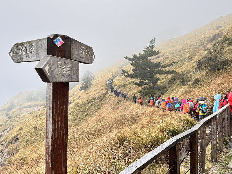
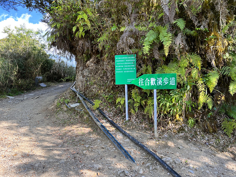
There are 10 Peaks of Hehuanshan, and the trailheads to those peaks are along Provincial Highway 14A 台14甲線.
You can connect those entrances on foot or have a pickup service drive you around.
Hehuanshan mountains are great to hike all year round. However, there are traffic controls during Taiwan
Alpine Rhododendron blossoms from April to June.

When winter weather is cold enough, it might snow at Hehuanshan, attracting thousands of tourists' snow
chasing.
8 Easy Peaks to Hike: Hiking Permits Not Required
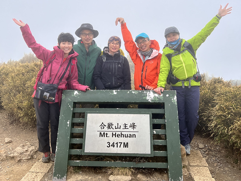
- Hehuanshan Main Peak 合歡山主峰, 3,417 meters (11,210.6 feet) above sea level, and is listed among 100 Peaks. There is a Class 3 Triangulation Stone on the top. Distance: a 3.6 km (2.2 miles) out-and-back trail.
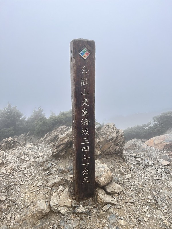
- Hehuanshan East Peak 合歡山東峰, 3,421 meters (10,554.4 feet) above sea level and is listed among 100 Peaks. Distance: a 2.1 km (1.3 miles) out-and-back trail.
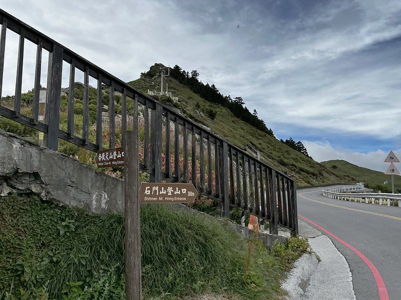
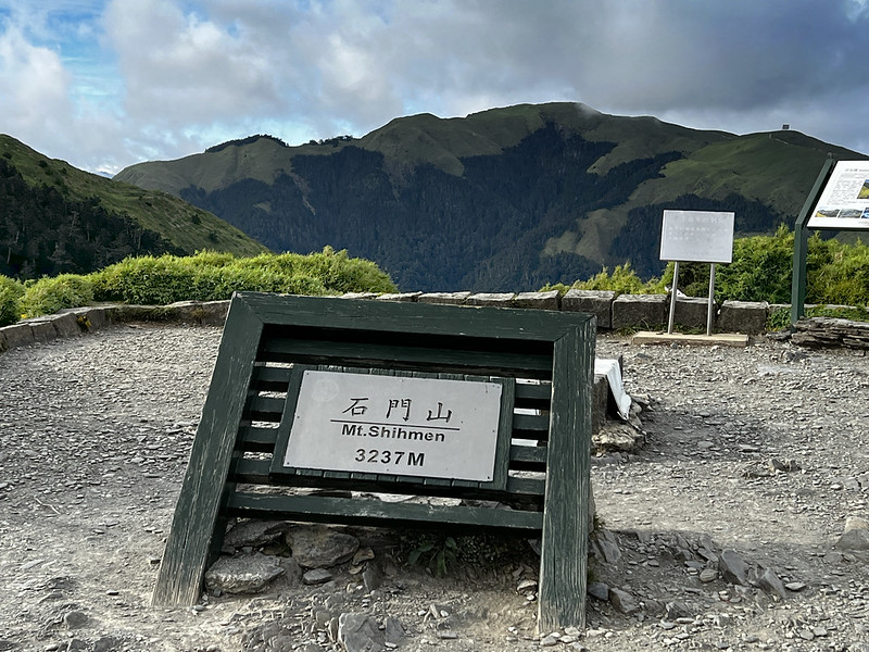
- Mt. Shimen 石門山, 3,237 meters (10,620 feet) above sea level and listed in 100 Peaks. There is a Class 3 Triangulation Stone on the top. Distance: a 1.6 km (1 mile) out-and-back trail.
- Mt. Shimen North Peak 石門山北峰, 3,275 meters (10,744.7 feet) above sea level. Distance: a 1.7 km (1.1 miles) out-and-back trail.
- Mt. Haha 哈哈山, 3,286 meters (10,780.8 feet) above sea level.
-
Mt. Nanhaha or Mt. South Haha 南哈哈山, 3,285 meters (10,777.5 feet) above sea level.
Mt. Shimen North Peak, Mt. Haha, and Mt. Nanhaha are on the same route, and Mt. Shimen North Peak is the farthest point on this route. The distance of this out-and-back route is 1.7 km (1.1 miles). -
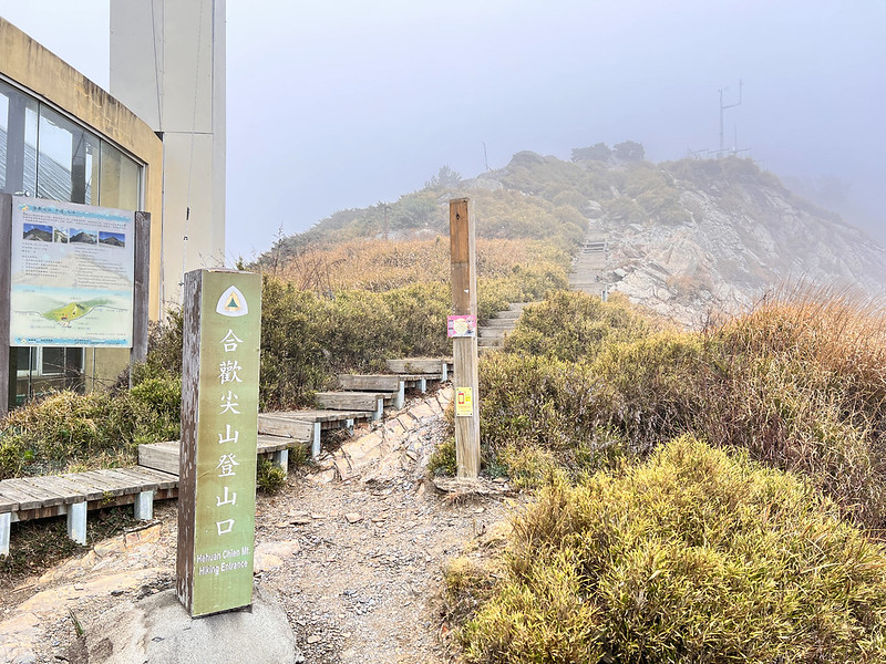
Mt. Hehuanjian 合歡尖山, 3,217 meters (10,554.4 feet) above sea level. Distance: a 0.8 km (0.5 miles)
out-and-back trail.
You can do Mt. Hehuanjian, Mt. Shimen, Mt. South Haha, Mt. Haha, and Mt. Shimen North Peak together. This out-and-back route is about 4.6 km (2.9 miles). - Hehuanshan South Peak 合歡山南峰, 3,070 meters (10,072 feet) above sea level. Distance: a 1 km (0.6 miles) out-and-back trail from Kunyang Parking Lot 昆陽停車場.

2 Challenging Peaks to Hike: Hiking Permits Not Required
- Hehuanshan North Peak 合歡山北峰, 3,422 meters (11,227 feet) above sea level. Listed in 100 Peaks. Distance: a 4.8km (3 miles) out-and-back trail.
- Hehuanshan West Peak 合歡山西峰, 3,145 meters (10,318.2 feet) above sea level. Listed in 100 Peaks. Distance: a 13.4km (8.3 miles) out-and-back trail. Hehuanshan North Peak is on this route if you hike to the West Peak.
There is a point-to-point trail to do Hehuanshan North Peak and West Peak; I will explain more later.
Another Small Trail to Enjoy: Hiking Permits Not Required
Xiao Qilai (Little Qilai) Trail 小奇萊步道. The highest point of this trail is 3,150 meters (10,334.6 feet)
above sea level. Distance: a 2.8km (1.7 miles) out-and-back- trail.
This trail is famous for its spectacular mountain views and Taiwan Alpine Rhododendron blossoms. This trail
also goes to Mt. Qilai Peaks, which requires hiking permits, gear, and being fit. If you only intend for a
wander, please stop here and return to the trailhead.
100 Peaks: Hehuanshan Mountains and A Guide with Public Transport and Parking Lots
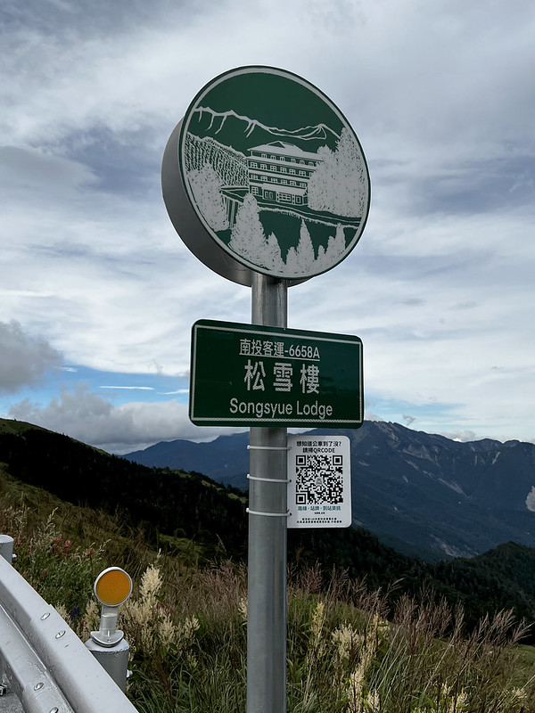
The closest choices are Songxue Lodge (or spelled as Songsyue Lodge or Song Syue Lodge) and Ski Hostel, run by
the Nantou Branch of Forestry Bureau 林務局南投林區管理處.
Stay at Songxue Lodge 松雪樓 or Ski Hostel 滑雪山莊
Songxue Lodge offers two types of rooms: suites for 2 people and 4 people. Ski Hostel offers shared rooms, and
it's NT$1,200 per person/night. The online booking is here (bilingual website.)

You can only book the rooms 30 days before the dates you wish to stay. The booking time is 8:00 am GPT+8:00.
You must refresh the web page if you book the room before 8:00 am.
Stay at Qingjing (Cingjing) Farm 清境農場
If you can't book a room at either Songxue Lodge or Ski Hostel, staying at Qingjing Farm can be an option. The
only problem is the distance from Qingjing to Hehuanshan is 20+ km.
Buses go to Hehuanshan from Qingjing Farm, but the earliest one leaves at 8:20 am and runs 3 times daily. So,
staying at Qingjing Farm is only recommended if you drive a car. Also, finding a parking lot can be difficult
during high seasons.
Update: Qingjing Farm and Hehuanshan parking lots start charging fees in March 2024, NT$50 per hour on
the weekdays, and NT$60 on the weekends. The maximum is NT$300 per day.
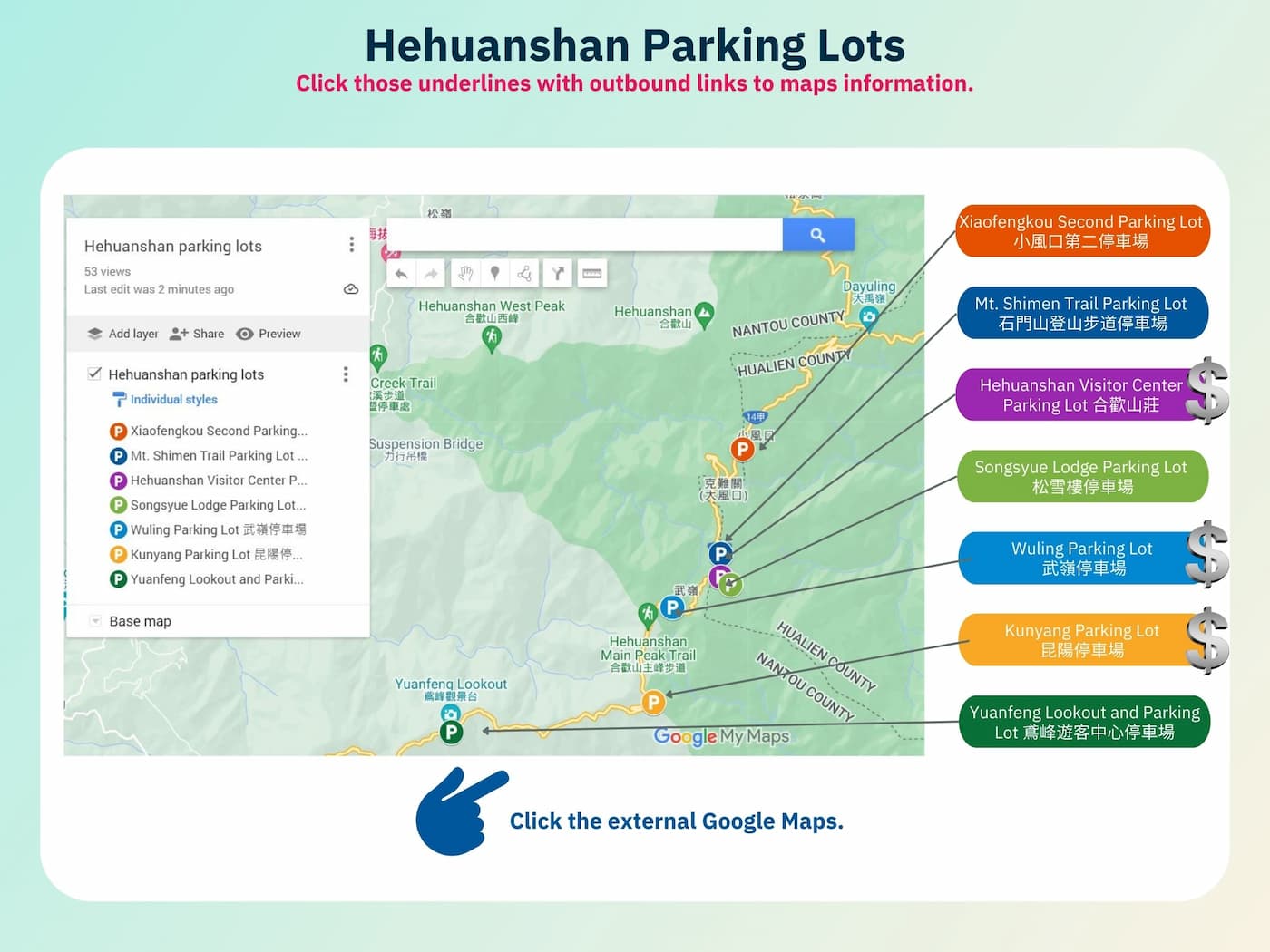
Guide for Hehuanshan Public Transport and Parking Lots
I made a guidebook and put English/Chinese in case you need to communicate with the drivers or people to help
you find your way. For only US$5, you can save hours of research. Purchase the bus
guide here or click the images below.
Map/GPX Data
I put 5 routes in this map collection, and you can arrange your itinerary that suits your logistics best.
Date of Hike: September 1, 202, March 15 and 16, 2023
Click Menu in the map to download, print, or share the map.
You can see more options after clicking the Play button.
Click to change the speed to meet your condition.
You can see more options after clicking the Play button.
Click
to change the speed to meet your condition.
The Easy Routes to Enjoy Hehuanshan

Those 8 mountains and Xiao Qilai Trail are relatively easy, as I mentioned. You follow the signs and bring GPX
(you can find them here), and you are ready.
Hehuanshan Main Peak
The trailhead to Hehuanshan Main Peak is close to Wuling 武嶺, 3,275 meters above sea level—they share the exact
English translations but are written with different Chinese characters.

Wuling is the highest point on Taiwan's highways and the saddle between Hehuanshan Main Peak and East Peak.
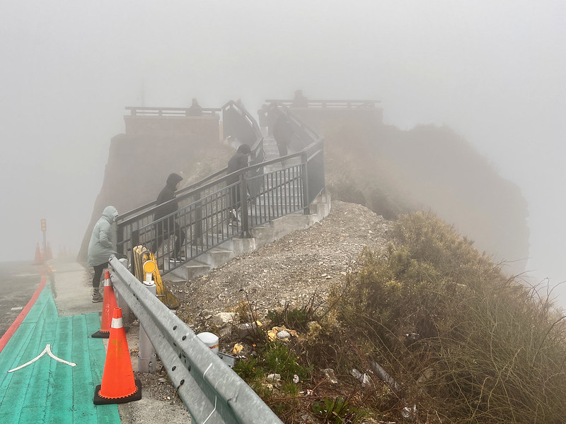
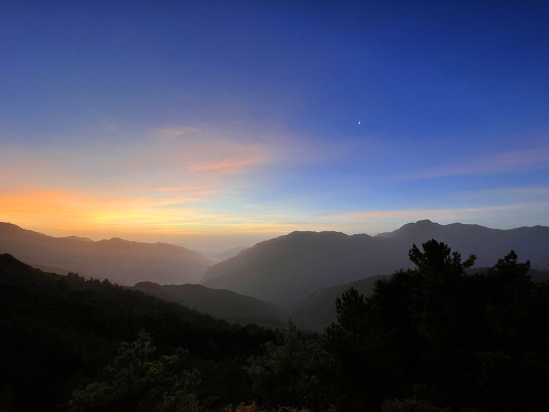
We started at Wuling Parking Lot. I went to the famous landmark Wuling Observation Deck. Unfortunately, it was
cloudy when I was there. This deck is a great spot to see the starry sky at night. You can find toilets here.
We walked along Provincial Highway 14A and reached 30.8 km. You will see a big gate telling you parking here is
not allowed. It takes around 30 minutes to reach Hehuanshan Main Peak. Then you take the same way back.


Hehuanshan Main Peak is listed in the 100 Peaks, also my 23rd 100 Peaks.
Hehuanshan East Peak
The trailhead is close to Songxue Lodge and well-marked. Just follow the endless steps.

I could see Ski Hostel from the trail, but it was too cloudy.
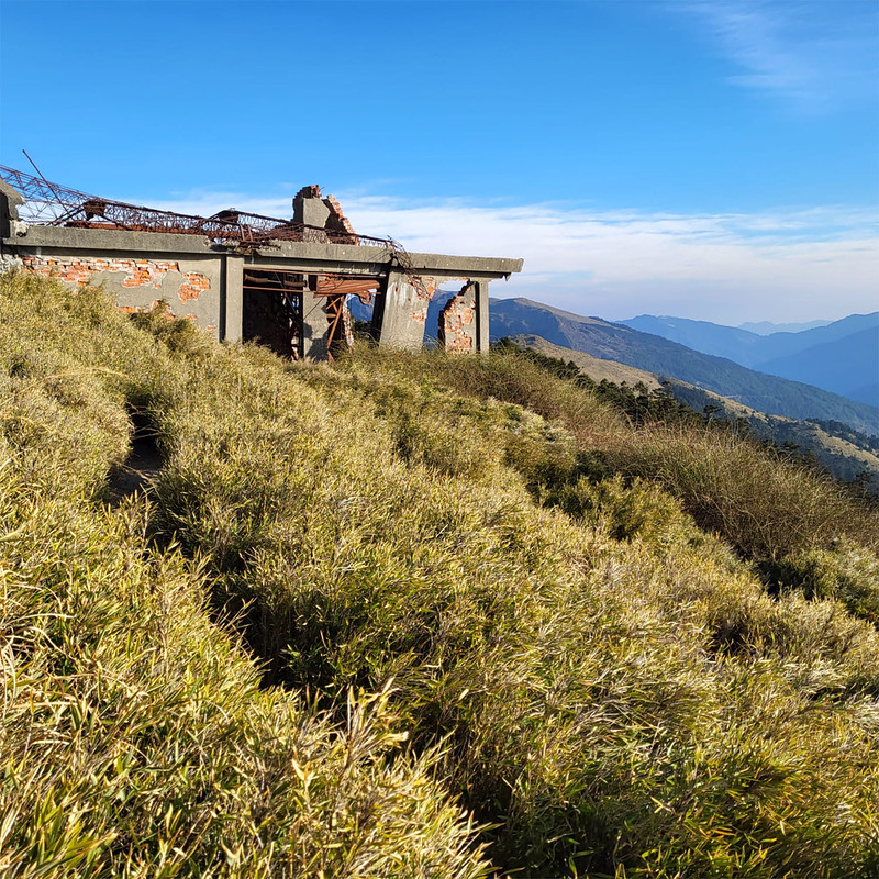
Then, I passed the old cable car station. For most people, imagining a tropical island like Taiwan once had a
ski resort can be challenging. However, due to the lack of visitors and climb change, the ski resort was gone,
and only the building was left.

I wasn't feeling ok when I did this hike. I saw stars, and I knew I got a mild high-altitude sickness.
Unfortunately, I wasn't the only one who felt ill. One of my poor hiking mates even threw up.

Unfortunately, I wasn't the only one who felt ill. One of my poor hiking mates even threw up. I am not new to
high mountains, and I just did the Jiaming Lake hike one month before my Hehuanshan hike. Yet, this could happen to
new or seasoned hikers.

It took me 80 minutes to reach Hehuanshan East Peaks, including several breaks. This is my 24th 100 Peaks. As
expected, I didn't see much at the peak. Hehuanshan East Peak is also listed as 100 Peaks.
After finishing the peak photo, I returned to Songxue Lodge as soon as possible. It took me 33 minutes to
complete this hike.
Hehuanshan South Peak
To do Hehuanshan South Peak, you must start from Kunyang Parking Lot. I did this hike in September 2022.

When I did this hike, I saw so many wildflowers on the trail, and I probably half of my time taking photos.

Mt. Shimen, the Easiest 100 Peaks to Climb
I didn't do Mt. Hehuanjian, but you can put this trail along with Mt. Shimen, Mt. Haha, and Mt. Simen North
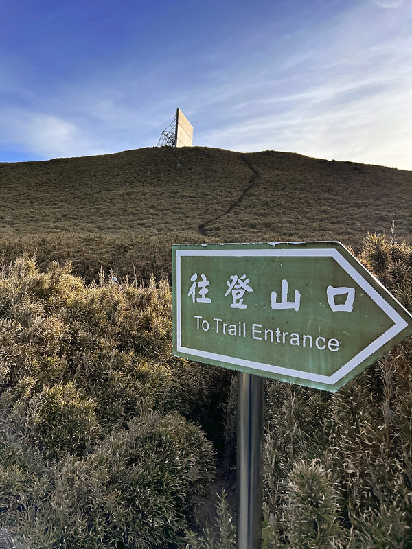
Peak. The trailhead is next to Hehuanshan Visitor Center/H2 Café. The other end connects to Mt. Shimen Trail
Parking Lot. From there, you can continue the hike to Mt. Shimen.
When speaking of the 100 Peaks in Taiwan, you might think it must be challenging to hike those mountains. Not at
all. Mt. Shimen is the easiest, less than 30 minutes from the trailhead (33.2 km at Provincial Highway 14A) to
the peak and back, and 10 times easier than the highest peak in Taipei City, Mt. Qixing.
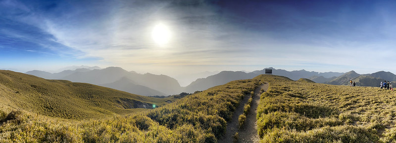
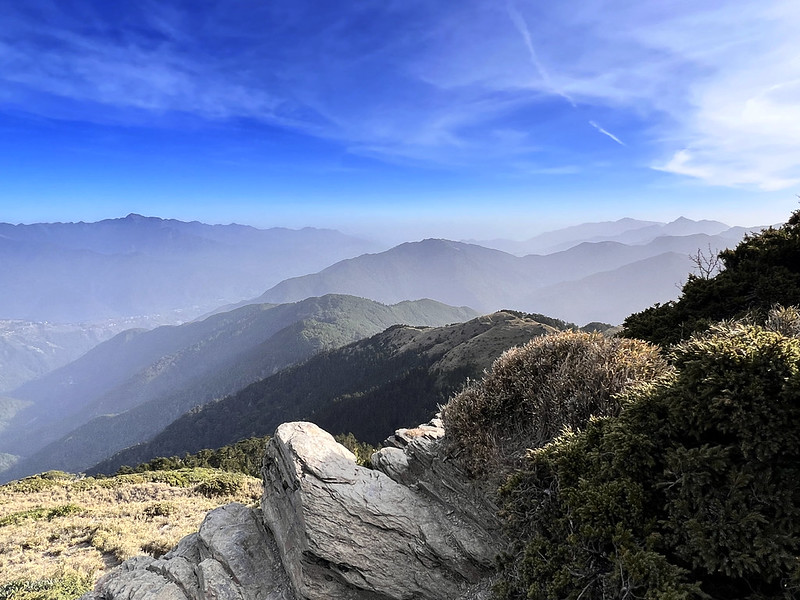
Yet, the view from the top is spectacular. You can see almost most of Hehuanshan mountains from there,
especially North Peak, with the landmark reflector nearby.
You might see the trail extended from Mt. Shimen. I suggest you take the same way back to the trailhead. That
section is more treacherous, with many junctions. Moreover, the Forestry Bureau often maintains the dwarf bamboo
and puts up signs asking tourists not to go inside. To avoid unnecessary troubles, take the same way back.
Mt. Haha and Mt. Shimen North Peak
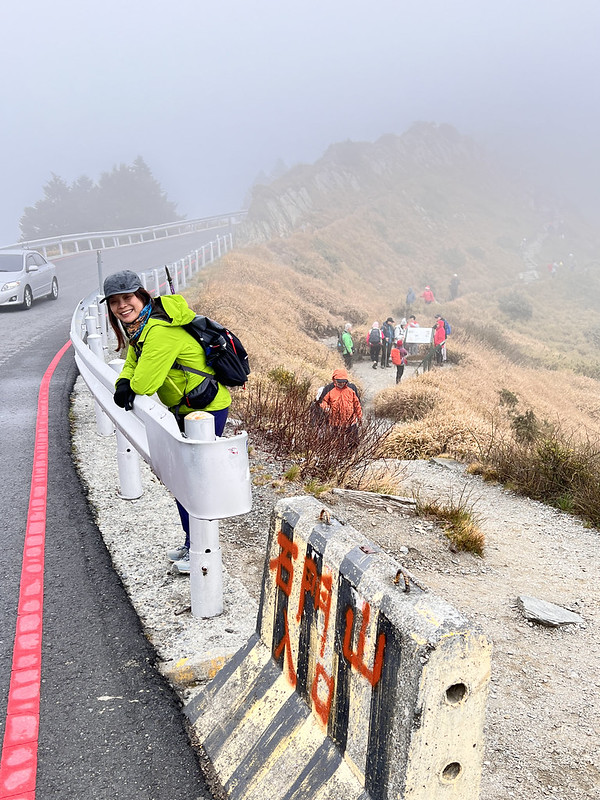
The trailhead to Mt. Shimen North Peak is called Kenangguan 克難關, aka Dafengkou 大風口 Big Wind Gap.
When I did this trail, it was almost 5 pm. It was windy, and I left my warm hat in the car, which was a bad
idea.

With the strong wind trying to take my body heat away, the spectacular mountain views also took my breath away.
From Mt. Shimen North Peak, I could see Mt. Baigu in the northwest.
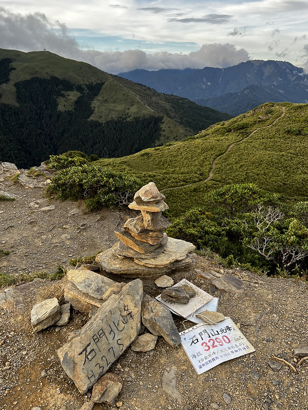
I reached Mt. Shimen North Peak in around 30 minutes. By now, the sun was setting. The setting sun cast an
orange hue on Mt. Qilai Main Peak and North Peak. Hehuanshan Main Peak and East Peak were shielded by the
shadows of other big mountains nearby.

When I returned to Provincial Highway 14A, the sky from the Mt. Baigu side had turned clouds into a vivid red,
with the blue sky unwilling to give in.
Then, the tip of Mt. Baigu was cradled by the clouds, with a layer of red and another layer of red building up.

The round trip to Mt. Shimen North Peak took me around 1 hour.
The More Challenging Route: Hehuanshan North Peak and West Peak
Distance: 13 km (8 miles)
Route type: out and back
Days/Hours Needed: 9-11 hours
Total Ascent/Descent: 1,427m/1,427m
Best Time to Go: All year round, but it can be very scorching hot when you hike on the exposed areas.
Permits: Not required
Difficulty Level:
Route type: out and back
Days/Hours Needed: 9-11 hours
Total Ascent/Descent: 1,427m/1,427m
Best Time to Go: All year round, but it can be very scorching hot when you hike on the exposed areas.
Permits: Not required
Difficulty Level:
I did this hike the day after my Hehuanshan Main Peak and East Peak hikes. Lucky for me, my high-altitude
sickness was relieved after a good sleep and me getting used to the high altitude.
What's even better was we were granted sunny weather. As usual, we got up around 3:30 am and left B&B around
4:30 am. We arrived at the trailhead around 5 am.

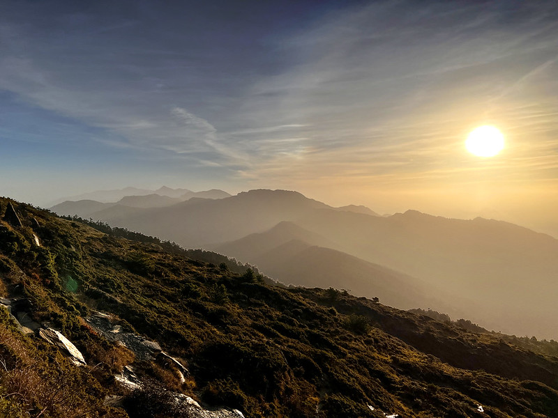
Stunning Sunrise
05:10 The orange hue was already glowing in the far east. We started our hike.
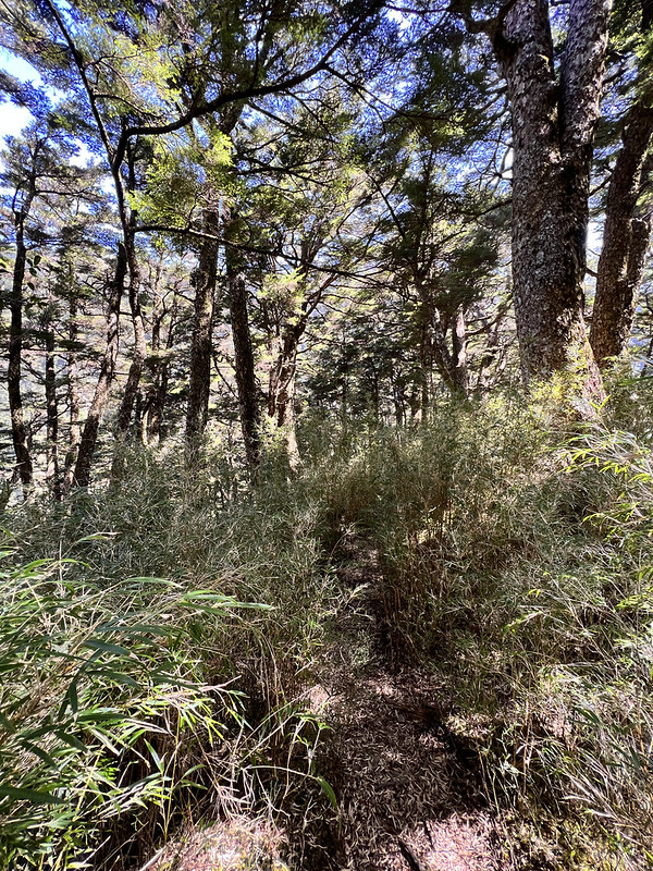
We went into several dwarf bamboo bushes. Our guide told us to wear rain pants because the morning dew might
dampen our clothes. It was so cold, and I even wore my down jacket inside my raincoat.
05:24 I passed the 0.2 km post and stopped because the sun was coming out. After
seeing the gorgeous sunrise, we mostly hike on the exposed trail.

06:05 I passed the 1 km post and saw Hehuanshan North Peak and hikers walking on
the ridge to West Peak.


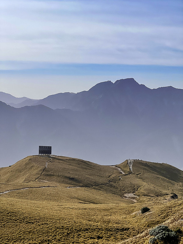
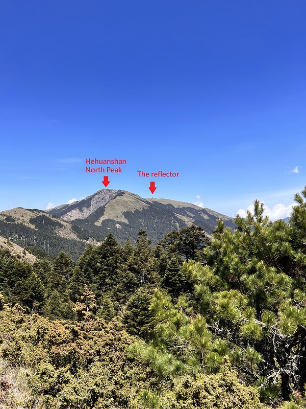
06:22 We passed the entrance to the famous landmark, the reflector, but we
didn't go inside.
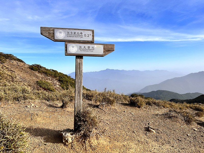
07:03 We reached the junction to Tianluan Pond 天巒池. This trail goes to Tianluan
Pond and Mt. Wu Fa Nai Wei 武法奈尾山.
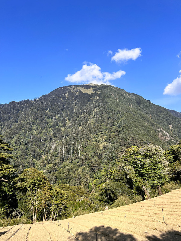
Mt. Zhongyangjian (3,705 meters) and the ridgeline from Mt. Bilu to Mt. Ju (Saw Mountains) peaks were clear.
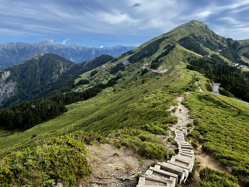
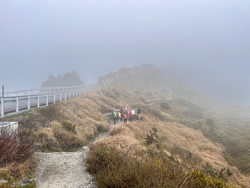
Hehuanshan Nor Peak with 360° view
07:09 I reached Hehuanshan North Peak, my 25th 100 Peaks. We were accompanied by
fantastic views all the way up to North Peak. The views at North Peak were even better because it was 360°
view.

I could see Xueshan, aka Snow Mountain, 3,886 meters, Wuling Farm, and Wuling Quadruple Mountains from here.
Since this is a popular trail, queueing for the peak photo is not surprising, but I preferred to take photos
with the Class 2 Triangulation, which was mostly ignored.

The reflector looked like a tiny box from here.
We stayed there for about 40 minutes; every minute was pure delight.
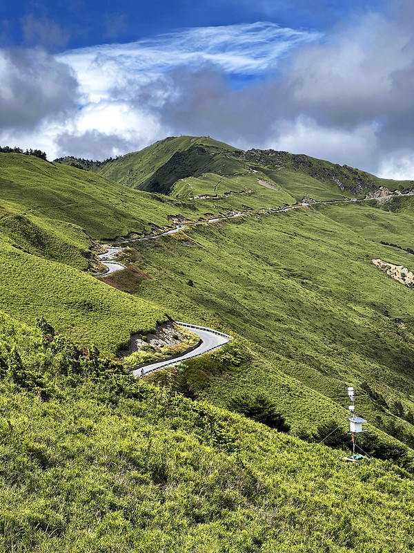
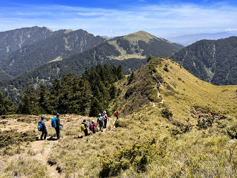
7 Ups And 8 Downs to Hehuanshan West Peak
07:48 It was time to embrace the ups and downs to Hehuanshan West Peak.
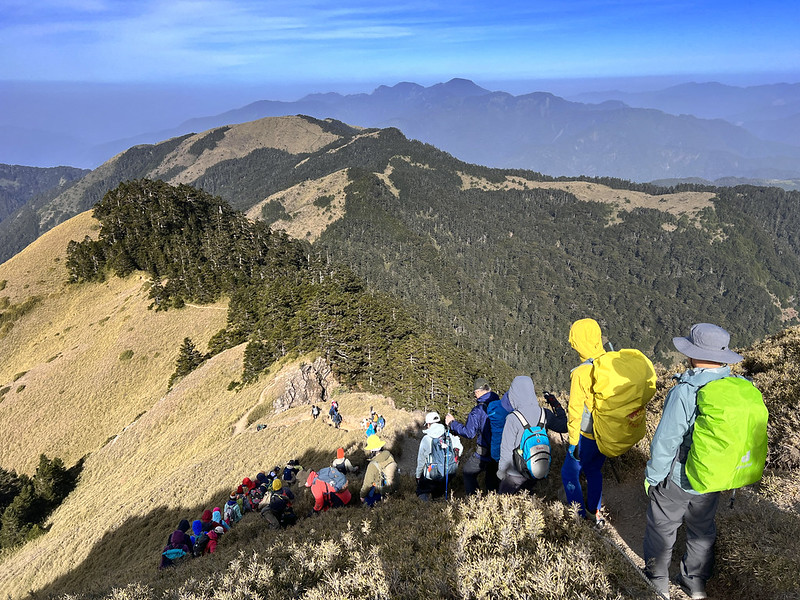
Before we started our hike, our guides told us that we would go through 7 ups and 8 downs 七上八下, literally
meaning 7 ups and 8 downs in Chinese. Here come those peaks. The mountains ahead of us were stunning, but
looking at all the peaks that awaited us was also disheartening.

From there, we hiked mainly on the ridgeline. I checked the map, and there are indeed 7 peaks before we reach
the junction to West Peak.
Surprisingly, the millage posts passed us quicker than I expected. It felt like a long time to see the next
mileage post when I did other trails.
08:40 We arrived at the 3.5 km post and took a short break. I finally removed my
down jacket because it was getting too hot, but I still put on my windbreaker.

09:13 I passed some ponds. Wild camping is not allowed here, but several places
are ideal for pitching a tent.

09:38 Reached the 5.1 km post. We took a break here, waiting for our hiking
mates to catch up. Here, we could see the famous Mt. Nenggao (3,262 meters), Hehuanshan Main Peak, East Peak,
North Peak, and Mt. Shimen North Peak.


Hehuanshan West Peak with Spectacular Views
10:20 We finally reached the junction, aka 3225 Peak (after passing the 5.7 km
post), to West Peak and Huagang Tribe. This place was huge and crowded.

The entrance to West Peak was in the forest. The signs said the distance from the junction to West Peak is 1 km
and 3.7 km to North Peak. Honestly, it felt like more than 1 km before I arrived at West Peak.


After the 20-minute break, we headed to the forest, and what was waiting for us was descending on the terrain
intertwined with tree roots.
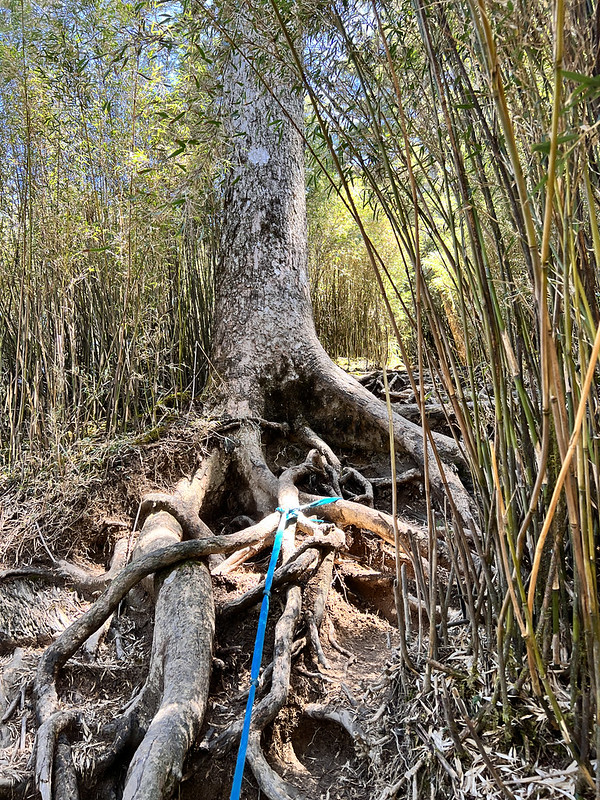
We reached the lowest point at 5.9 km and started climbing up.

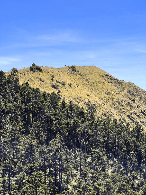
10:44 I went out of the forest and reached the 6.0 km post. After that, we hiked
on the ridgeline on an expansive grassland again.

The views were amazing!
Then I saw the trail disappear into a forest and reemerge to my left. I could see many hikers were there. So, I
figured that it was West Peak.

It looked so close to where I was, but it still took me another 20 minutes to arrive.
11:11 I finally reached Hehuanshan West Peak. While seeing a much longer queue
with hikers spending a much longer time taking peak photos, I decided to spend my precious time enjoying the
views at West Peak.


Jade Mountain was one of the mountains I saw here. So many beautiful mountains here to be recognized, and it was
exhausting my brain. I decided to sit down and quietly admire the views.

11:45 Bid farewell to the fantastic views and headed back to the junction. While
returning, many hikers were still coming to West Peak. If you can, please don't do this hike on the weekend.

12:24 I returned to the junction and waited for our hiking mates to arrive.
It took me 6 hours to reach Hehuanshan West Peak from the trailhead, including breaks.
The Most Challenging Route: Exit Hehuanshan West Peak from Huagang 華崗
Distance: 17.7 km (11 miles)
Route type: Point to point
Days/Hours Needed: 9-11 hours
Total Ascent/Descent: 1,014m/1,516m
Best Time to Go: All year round, but it can be very scorching hot when you hike on the exposed areas.
Permits: Not required
Difficulty Level:
Route type: Point to point
Days/Hours Needed: 9-11 hours
Total Ascent/Descent: 1,014m/1,516m
Best Time to Go: All year round, but it can be very scorching hot when you hike on the exposed areas.
Permits: Not required
Difficulty Level:
Extreme Descending
If you don't take the same way back, heading to Huagang Tribe is an option. However, expect the enormous
descending. The following is my hike heading to Huagang.
12:44 From the junction, we went through some small hills. I looked back to
where we were in the morning.

I'm not new to huge descending, but seeing this made my knees weak.
13:55 We went inside a forest, but the trail was steep. In addition, the trail
contained moisture and became slippery.
Yet, the trees are tall and magnificent. I finally heard water.
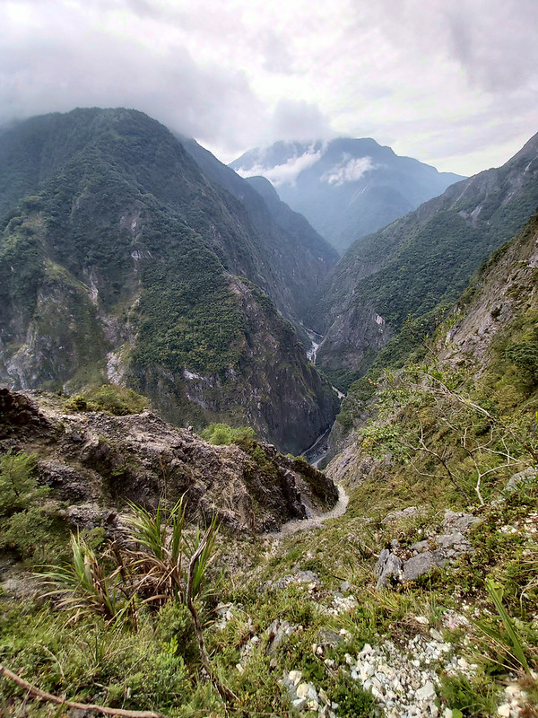
Beware of the Water When Crossing Hehuan Creek
14:21 I reached Hehuan Creek. Huge boulders and tall rock cliffs flanked this
river, and it looked so beautiful.
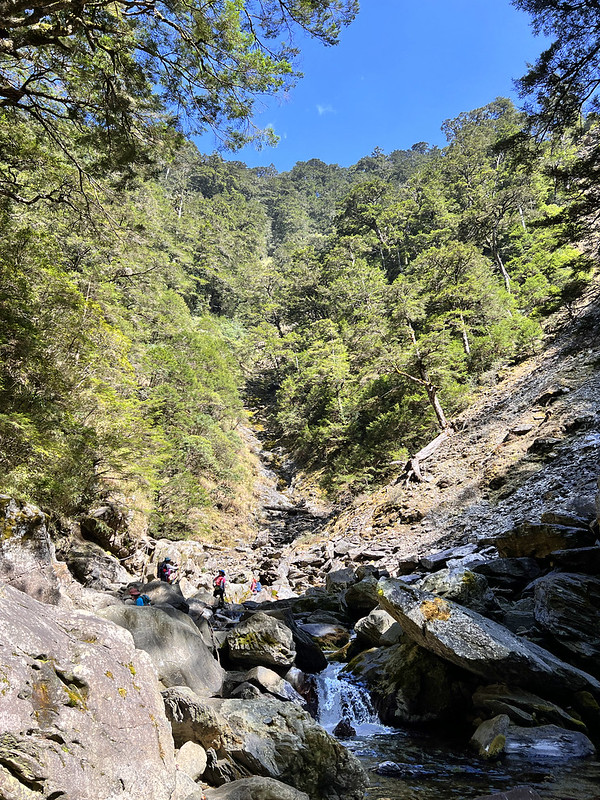
14:26 Walking on the giant boulders was easy till I reached a slope. Our guides,
Xiao Tsai and Da Mei, were there to give us a hand, literally.

Our guide, Mingshu, told me that the water in Hehuan Creek reached their knees when they did this hike before.
We didn't have enough rainfall in 2023, so we could cross the river with our hiking boots.
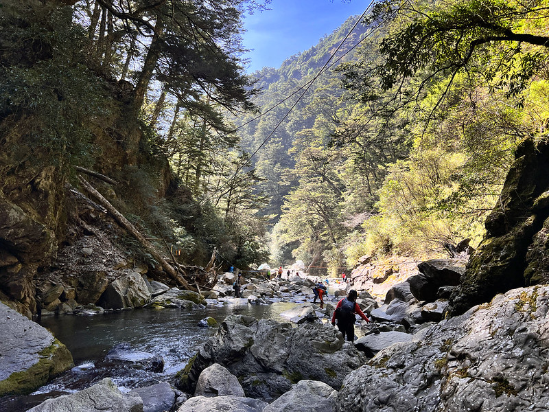
If you plan this hike and it rains before your departure, please reconsider changing your route.
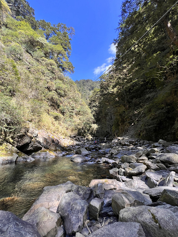
A Pleasant Surprise: Formosan Landlocked Salmon and Beautiful Hehuan Creek Trail
14:35 Soon, I reached the check dam, where my hiking mates had already taken a
break. They kindly point out a fish in the crystal-clear water. They were Foremosan Landlocked Salmon 櫻花鉤吻鮭, an
endangered species.
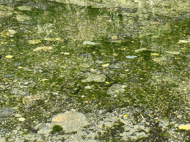
Soon, we started our hike on Hehuan Creek Trail. I looked at the creek again and saw this turquoise color.

This trail was flat, and we mostly went downhill. The trees and valley were beautiful.

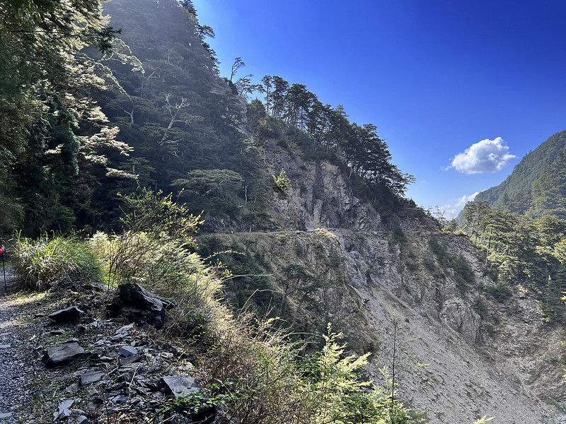
We also passed several landslides. Our guide later told me that they heard the large rocks falling after they
passed the landslide before.
If I weren't tired and desperate to finish this hike, I would enjoy Hehuan Creek Trail more.

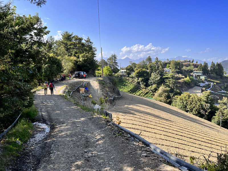
The trail led to a tree-tunnel-like path. It was wide, with water hoses on both sides.

15:48 I passed the trailhead of Hehuan Creek Trail and saw our van waiting.
Weather and High-Altitude Sickness: Being Easy Doesn't Mean You Won't Get It
I am lucky that I didn't suffer serious high-altitude sickness when hiking high mountains. However, I
experienced one on the way to Hehuanshan Main Peak and East Peak.
Ascend Too Fast, including the Car Ride
We stayed at a B&B near Wushe for one night, around 1,200 meters above sea level. Then our bus took us to
Wuling, 3,280 meters, within one hour the following day.
It was windy and cold when we did Hehuanshan Main and East Peak. Several of us felt some light headaches,
including myself. I took acetaminophen after I finished East Mountain.

One of our hiking mates even threw up. Lucky for me, I slept well, and I felt ok when doing Hehuanshan North
Peak and West Peak. However, the one who threw up wasn't so lucky. Some noisy hikers were chatting late, and he
could hear the noise. He was still miserable on Day 2.
Seasoned Hikers Aren't Exempt from Getting High-Altitude Sickness
Some people might say it's related to fitness and high mountain experience. The answer is no. High altitude
sickness can happen to anyone, new or seasoned hikers.
Our guide Damei told me that she had done the Jade Mountain hike more than 10 times and still suffered from
high-altitude sickness from her latest trip.
If you have a cold or are too tired and not feeling well before your high mountain hike, the chances of getting
high-altitude sickness might be higher.
One of our hiking guides even suffered Pulmonary edema when I did Mt. Dabajian in 2022.
The Only Way: Descend
Occasionally, we hear news about visitors suffering sickness at Hehuanshan and being rushed to the hospital.
Therefore, being an easy trail like Hehuanshan doesn't mean there is no risk.
If you suffer severe high-altitude sickness and it gets worse, the only way to save your life is to descend.
About Hehuanshan and the Only Ski Resort in Taiwan
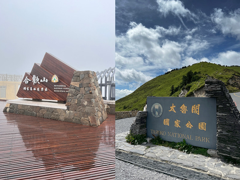
If you visit Taroko Gorge and continue to ride on the Central Cross-Island Highway, you will reach Dayulin 大禹嶺
at the junction, where Provincial Highway 14A joins. Provincial Highway 14A is the spur route of CCIH. This
highway is also how you get to Hehuanshan from Eastern Taiwan.

Located on the border of Ren'ai Village, Nantou County, and Xiulin Village, Hualien County, Hehuanshan is in the
north section of the Central Mountain Range in Taiwan and southwest of Taroko National Park.
Liwu River and its headwaters originate in the Hehuanshan area. In winter, the cold snaps and Northeast Monsoon
bring moist and low temperatures up to Hehuanshan.

Long story short, Hehuanshan slopes and Liwu River contributed to the ski resort at Hehuanshan in the 1950s and
1960s. The snow season at Hehuanshan back then could last up to 2 months. In February 1964, the snowfalls at
Hehuanshan reached 40cm (1.31 feet) deep, and the temperature was –5°°C (23°F).
Here's a Facebook page sharing the old photos of what the ski resort
at Hehuanshan looked like back in the 1950s, 1960s, and 1970s.
However, the ski resort didn't last long due to climate change. We still can see snow at Hehuanshan in winter
sometimes, but the snowfall can't compete with what it used to be. Now, we can only see the cable car station
building at Hehuanshan East Peak.
Certified as Dark Sky Park in 2019
In 2019, IDA (International Dark-Sky Association), an association to raise awareness of light pollution, certified Hehuanshan as a Dark Sky Park in 2019, one of
the 3 places in Asia. You can see the park at Yuanfeng 鳶峰. In fact, you can enjoy the starry sky at most places
in Hehuanshan as long as the weather is good.
