100 Peaks: Complete Guide of Wuling Quadruple Mountains - Stunning Views, Treacherous Terrains, and Scary Cliff Hike
Wuling Quadruple Mountains, aka Wuling Sixiu 武陵四秀, refers to Mt. Tao (Taoshan, aka Peach Mountain), Mt.
Chiyou, Mt. Pintian, and Mt. Kalahei at Shei-Pa National Park in central Taiwan. This hike is a popular 100
Peaks trail full of stunning views, scary cliff climbing, taxing long hiking, and more.
In this post, you will find out how to apply for permits, how to take public transport to the actual trailhead
without walking at Wuling Farm, and different routes to enjoy those spectacular high mountains in Taichung,
Taiwan.
Disclaimer:
All content is for inspiration only. Use Taiwan Hikes' suggestions at your own risk. We are not responsible for any losses, injuries, or damages.
All content is for inspiration only. Use Taiwan Hikes' suggestions at your own risk. We are not responsible for any losses, injuries, or damages.
Table of Contents:
- Trail Information: Different Routes Ranging from 4 days to One Day Hike
- How to Apply for Permits to Hike the Wuling Quadruple Mountains, Accommodation, and Catering Service
- How to Get There by Public Transport to Wuling Villa and Private Pickup Option
- Map/GPX Data and Different Routes
- My Hike Details of Wuling Quadruple Mountains Trail
- About the Wuling Quadruple Mountains, Wuling Farm, and Formosan Landlocked Salmon
- Related Posts
Trail Information: Different Routes Ranging from 3 days to One Day Hike
Trail Name: Wuling Quadruple Mountains Trail or Wuling Sixiu 武陵四秀. Si means 4,
and Xiu means Beauties in Chinese.
Distance: 29.2 km (18.1 miles.) We did around 44 km (23.4 miles.)
Route type: Loop + out and back
Days/Hours Needed: 1 to 3 days
Total Ascent/Descent: 2,777m/2,790m
Best Time to Go: All year round. Some sections and those peaks are exposed without shade. It's windy and cold at those peaks, too. So please do sun protection and stay warm when you hike.
Permits: Required. Please see How to Apply for Permits
Difficulty Level:
Peaks to Reach:
Distance: 29.2 km (18.1 miles.) We did around 44 km (23.4 miles.)
Route type: Loop + out and back
Days/Hours Needed: 1 to 3 days
Total Ascent/Descent: 2,777m/2,790m
Best Time to Go: All year round. Some sections and those peaks are exposed without shade. It's windy and cold at those peaks, too. So please do sun protection and stay warm when you hike.
Permits: Required. Please see How to Apply for Permits
Difficulty Level:
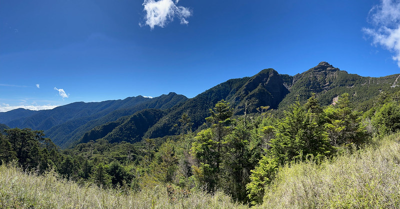
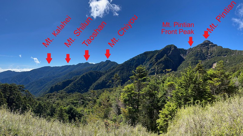
- Mt. Pintian 品田山, 3,524 meters (11,561.6 feet). Hikers must tackle the notorious Pintian V Cliff, before reaching Mt. Pintian. The views are breathtaking from the top.
- Mt. Chiyou 池有山, 3,303 meters (10,836.6 feet). There is a Class 3 Triangulation Stone on the top. The views are amazing, too.
- Mt. Tao, aka Tao Mountain or Taoshan, 桃山, 3,325 meters (10,908.8 feet). If I can only choose one of Wuling Quadruple Mountains to hike, Taoshan is the one. The views are spectacular.
- Mt. Kalahei 喀拉業山, 3,133 meters (10,278.8 feet). There is a Class 2 Triangulation Stone on the top. Nothing much to see from the peak, but the views are great before reaching Mt. Kalahei.
- Mt. Shilun 詩崙山, 3,194 meters (10,479 feet). Mt. Shilun used to be one of Wuling Quadruple Mountains, but later it was replaced by Mt. Pintian. No views there.
- Hikers need to apply for beds or a campsite in advance. At 3,175 meters, Xinda Cabin can accommodate 34 hikers.
- Xinda Campsite can accommodate around 6 or 7 tents to sleep up to 20 hikers.
- Water source: there are water tanks at the cabin, but hikers may need to go to the stream not far away to draw fresh water during drought seasons.
- Hikers can also find bio-toilets near the cabin.
- Phone reception is decent.
- Cost for a cabin bed or campsite: free.
- Hikers need to apply for beds or a campsite in advance, and now it's still first come, first serve, which is challenging to get a slot. At 3,725 meters, Taoshan Cabin is a small one that can only accommodate 19 hikers.
- The bio-toilets are behind the cabin, and this is also one of the best spots to see the sunset, just with the smell.
- The campsite can take up to 2 or 3 tents.
- The water source relies on the tank to collect rain.
- Phone reception is not stable.
- Cost for a cabin bed or campsite: free.
How to Apply for Permits to Hike Wuling Quadruple Mountains, Accommodation, and Catering Service
Send your application to Hike Smart Taiwan Service 臺灣登山申請一站式服務網.

Since "Hike Smart Taiwan Service" has been improved and made more straightforward, I have only included a
short video to help you understand how to use the website.
Please note that the Advanced Applications are only for hiking Xue Mountain (Xueshan) Trail and Daba Peaks (Mt. Dabajian)
Trail. There are no Advanced Applications preserved for Wuling Quadruple Mountains Trail.
You don't need to apply for Police Mountain Entry Permit (short for Police Permit)
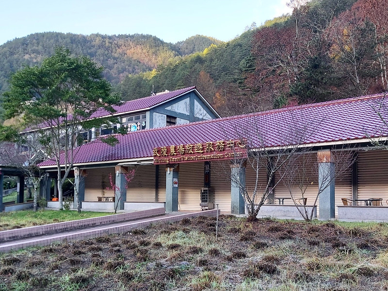
How to Get There by Public Transport to Wuling Villa and Private Pickup Option
How to get to Wuling Farm or the trailhead

From Lishan:
You can take Fongyuan Bus 865 and 866 from Lishan to Wuling Far. However, the timetable changed due to the
landslide and construction at the Central Cross-island Highway. It's too complicated for me, let alone those
who don't read Chinese. So, I'll say don't try this one unless you have no choice.
Where to Stay Before Your Hike:
You can stay at one of the hotels in Wuling Farm and walk to the trailhead. If you don't want to walk an extra
of 11 km (0.7 miles) to the trailhead, you can stay at Wuling Hostel near Wuling Farm and
hire their private pickup service to the Xueshan trailhead. Contact Mr. Huang WhatsApp +886 (0) 983328960 for
details.

Map/GPX Data and Different Routes
Date of Hike: Solo hike on August 22, 2021
Route map for Wuling Quadruple Mountains Updated by Anusha Lee on plotaroute.com
Click Menu in the map to download, print, or share the map.
You can see more options after clicking the Play button.
Click to change the speed to meet your condition.
You can see more options after clicking the Play button.
Click
to change the speed to meet your condition.
3-day Hike (the Most Popular Itinerary) to 4 Peaks:
Day 1: Your place ➔ Wuling Villa (2,086m) ➔ Wuling Suspension Bridge (1,894m) ➔
junction to Taoshan and Mt. Chiyou ➔ junction to Taoshan Waterfall and Mt. Chiyou Trail (skip Taoshan
Waterfall) ➔ junction to Mt. Chiyou Trail ➔ Sancha Campsite/Junction to Mt. Chiyou and Taoshan
(3,206m) ➔ the 2nd junction to Mt. Chiyou ➔ Mt. Chiyou (3,303m) ➔ back to junction ➔
Chiyou Famous Tree ➔ Xinda Cabin (3,172m)
Day 2: Xinda Cabin ➔ Mt. Pintian (3,524m) ➔ back to Xinda Cabin ➔ junction to Mt. Chiyou and Taoshan ➔ Taoshan Cabin (3,272m)
Day 3: Taoshan Cabin ➔ Taoshan (3,325m) ➔ Mt. Shilun (3,194m) ➔ Mt. Kalahei (3,133m) ➔ back to Mt. Shilun ➔ back to Taoshan ➔ junction to Taoshan Waterfall ➔ Wuling Suspension Bridge ➔ Wuling Villa
Pros: You don't need to take too many days off.
Cons:
Day 3 will be long and strenuous. If you feel ok, I suggest Taoshan (a 10-minute walk from Taoshan Cabin), Mt. Shilun, and Mt. Kalahei on Day 2.
If the weather is good on Day 3, you can get up early to catch the sunrise at Taoshan, get back to sleep, and get ready to go home.
Day 3 will be long and strenuous. If you feel ok, I suggest Taoshan (a 10-minute walk from Taoshan Cabin), Mt. Shilun, and Mt. Kalahei on Day 2.
If the weather is good on Day 3, you can get up early to catch the sunrise at Taoshan, get back to sleep, and get ready to go home.
2-Day Hike:
Day 1: Your place ➔ Wuling Villa (2,086m) ➔ Wuling Suspension Bridge (1,894m) ➔
junction to Taoshan and Mt. Chiyou ➔ junction to Taoshan Waterfall and Mt. Chiyou Trail (skip Taoshan
Waterfall) ➔ junction to Mt. Chiyou Trail ➔ Sancha Campsite/Junction to Mt. Chiyou and Taoshan
(3,206m) ➔ the 2nd junction to Mt. Chiyou ➔ Mt. Chiyou (3,303m) ➔ back to junction ➔
Chiyou Famous Tree ➔ Xinda Cabin (3,172m) ➔ Mt. Pintian (3,524m) ➔ back to Xinda Cabin
Day 2: Xinda Cabin ➔ junction to Mt. Chiyou and Taoshan ➔ Taoshan Cabin (3,272m) ➔ Taoshan (3,325m) ➔ Mt. Shilun (3,194m) ➔ Mt. Kalahei (3,133m) ➔ back to Mt. Shilun ➔ back to Taoshan ➔ junction to Taoshan Waterfall ➔ Wuling Suspension Bridge ➔ Wuling Villa
Day 2: Xinda Cabin ➔ junction to Mt. Chiyou and Taoshan ➔ Taoshan Cabin (3,272m) ➔ Taoshan (3,325m) ➔ Mt. Shilun (3,194m) ➔ Mt. Kalahei (3,133m) ➔ back to Mt. Shilun ➔ back to Taoshan ➔ junction to Taoshan Waterfall ➔ Wuling Suspension Bridge ➔ Wuling Villa
Pros: No need to apply for the hard-to-get Taoshan Cabin or carry a tent.
Cons:
Physically demanding.
Some hikers did Mt. Chiyou and Mt. Pintian on Day 1 and returned to Sancha Campsite (the junction to Mt. Chiyou and Taoshan) to stay there for one night. Then, they finish the rest on Day 2.
Not staying at Taoshan Cabin makes it easier to make this trip, but you will need to carry your sleeping bag and tent.
Or you can skip Mt. Shilun and Mt. Kalahei to make the hike even less strenuous.
1-Day Hike (Not for Everyone):
Do the 2-day-hike Route in 1 day.
Pros: super-efficient and hike light.
Cons:
You have to start hiking at 1 or 2 am.
Extremely physically demanding.
You have to start hiking at 1 or 2 am.
Extremely physically demanding.

Other Variations:
Some hikers separate those 4 mountains into 2 hikes: Chiyou + Pintian and Taoshan + Kalahei. If the
cliff climbing is too much, you can skip Mt. Pintian. Or you can only do Chiyou + Taoshan because the views
are spectacular at both peaks. Moreover, there's nothing much to see at Mt. Kalahei.
Some people do Taoshan only in one day. However, this itinerary is doable, and there is no need to do the
hike super early. The views at Mt. Taoshan are stunning.
My Hike Details of Wuling Quadruple Mountains Trail
Day 1: Beautiful Taoshan Waterfall
07:10 We met at North Exit 2 near Lion Travel's counter at Taipei Train Station
and left at 7:30.
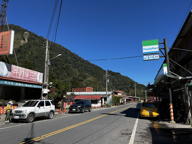
Our bus took 3 breaks to let us go to the toilets and stretch our legs. We stopped at Nanshan Village 南山村, the
popular stop for many hiking trails in Taiwan.
11:53 We arrived at Wuling Farm. Our bus had to drop passengers at several
hotels. Our guide Miss Lee was very friendly and helpful. She saw we were there for the hike and asked us
whether we wanted to get off at Wuling Villa. Of course, we did.
11:29 We got off at the parking lot near Wuling Villa. This ride saved us at
least a 5.3 km walk and energy. Wuling Farm is beautiful but carrying a 15 kg backpack is not fun.
12:45 Passed Wuling Villa.

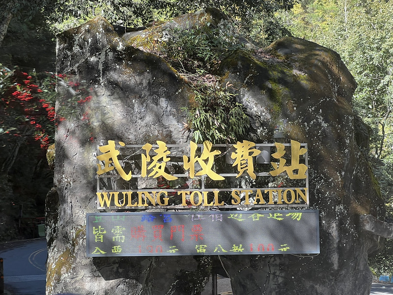
12:52 We passed the mailbox and submitted our documents in the box. Shei-Pa
National Park set up new QR codes for hikers to check in and out, but many hikers complained those were not
working properly.
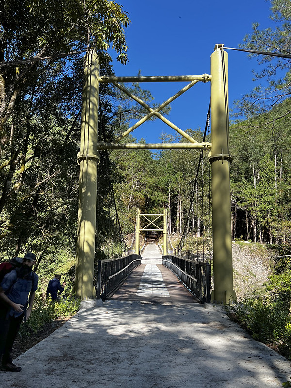
Soon, we passed Wuling Suspension Bridge.
13:12 We arrived at the junction to Taoshan Trail (we took this one on the way
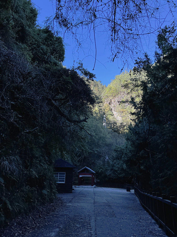
back) and the waterfall. We had a short lunch break here.

The trail from Wuling Villa to Taoshan Waterfall is open to everyone without hiking permits. The footpath is
accessible, but, however, ascending to Taoshan Waterfall might be too steep for some people. From here, it was a
zigzag trail all the way up to the waterfall.
14:22 We turned right to Taoshan Waterfall at the junction. There are toilets
near the waterfall.
14:58 We returned to the junction and turned left to Mt. Chiyou Trail. It was
steeper from here.

16:09 We reached 1.2 km and camped here. This place is big enough for two tents.
Day 2: Stunning Views at Mt. Chiyou and Embraced the Scary Climbing at Mt. Pintian
06:30 We started our second-day hike.
07:40 We passed 2 km on Chiyou Trail.
07:57 While scaling up, we saw Xueshan, aka Snow Mountain, or Mt. Sylvia. We even could
see the old Sanliujiu Cabin.

09:10 We reached Sancha Campsite at 3.5 km, aka the junction to Taoshan (right)
and Mt. Pintian (left). We took a short break here.
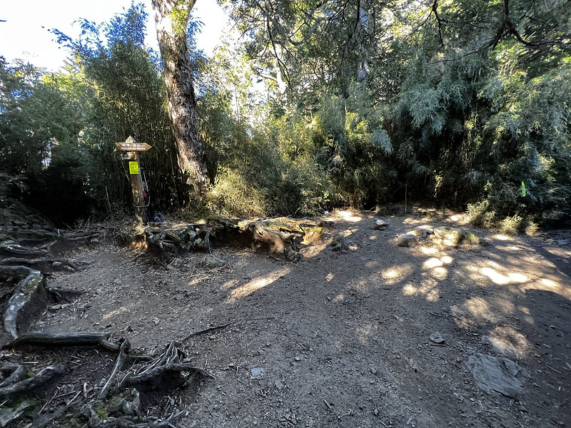
You will see many places called Sancha Campsite, like Black Water Pond, on the trails in Taiwan. Sancha means
junctions in Chinese, a good word to learn in Chinese.
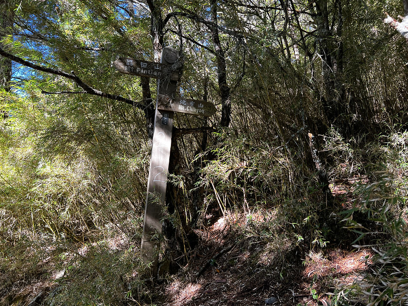
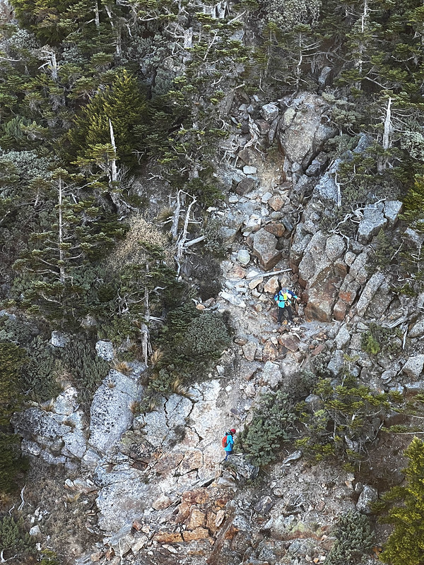
09:39 We arrived at the rock slope and saw a sign pointing the path to Mt.
Chiyou. There are two junctions to Mt. Chiyou, and this is the first. We took the next one.

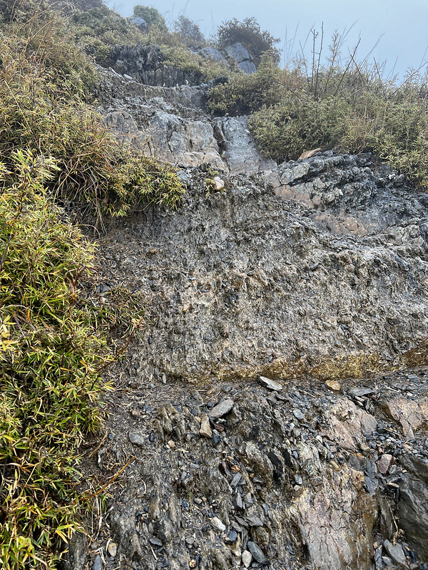
Those rock slopes look intimidating, but it's safe if you take time and be cautious. Unfortunately, sad
accidents still occur. A judge went missing and ended up dead around here in
September 2022.
09:47 We reached the second junction to Mt. Chiyou, and it was time to put down
our heavy backpacks.
10:06 We arrived at our first peak of the Wuling Quadruple Mountains! We were
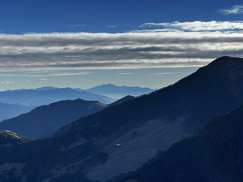
the only hikers there, and the views were amazing! All the major high mountains were in front of us: Xueshan,
Mt. Dabajian, Mt. Xiaobajian, Hehuanshan, and those I've done in the past!


From Mt. Chiyou, we saw Xinda Cabin and the winding trail to the notorious Mt. Pintian - still a long way to go.

10:58 We returned to the junction and picked up our backpacks.
11:14 We reached the Chiyou Famous Tree. It was cloudy when I saw this beautiful
tree for the first time in August 2022. Now it was sunny and looked so different. We took a 10-minute break to
enjoy this tree.

11:54 We passed the junction to Mt. Dabajian. I took this one to my second Mt.
Dabajian visit.

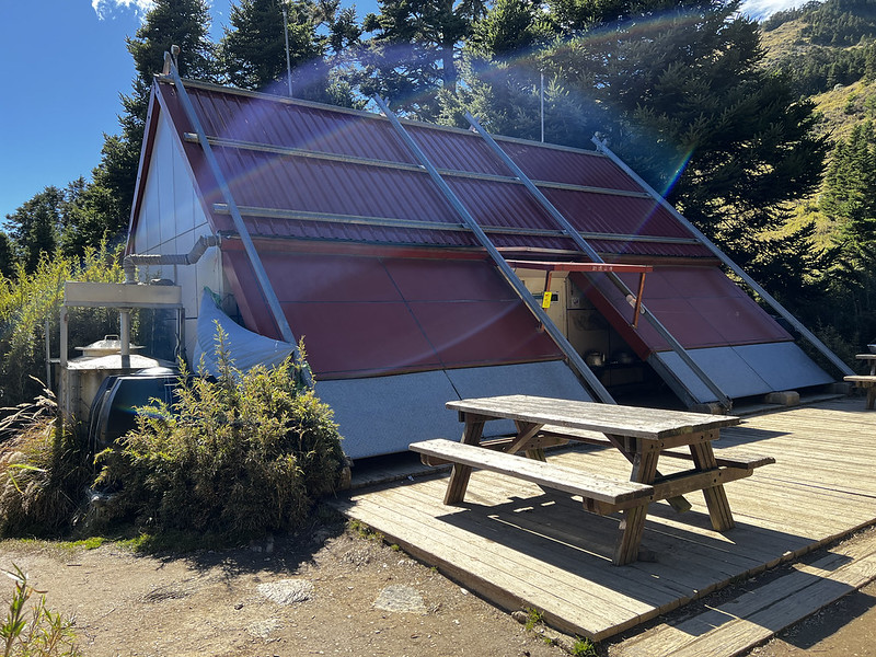
11:58 We arrived at Xinda Cabin! We took a 20-minute lunch break and packed the
essentials for Mt. Pintian.
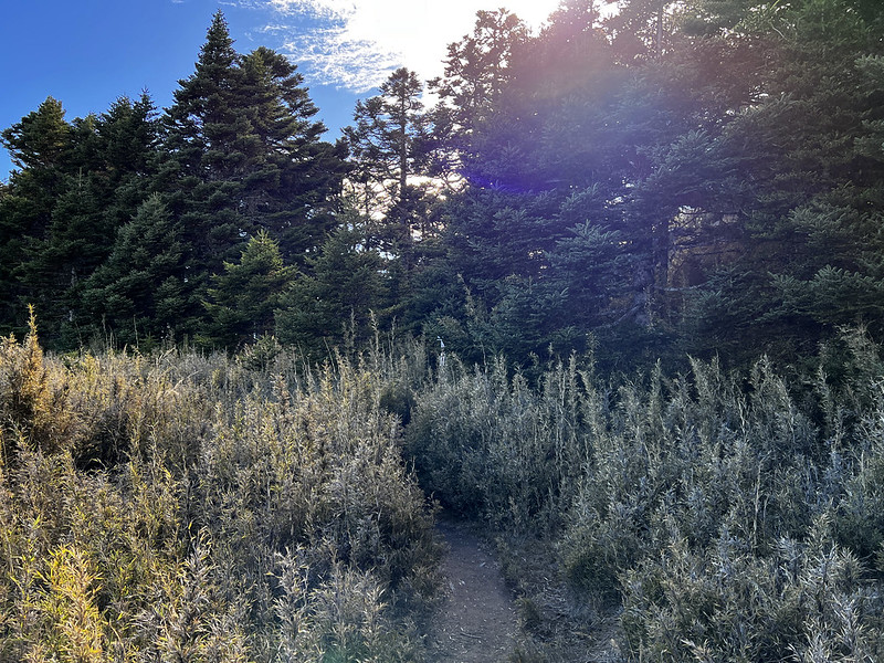
The trail to Mt. Pintian was steep, and the first section was exposed grassland. Then the path led us into the
woods.
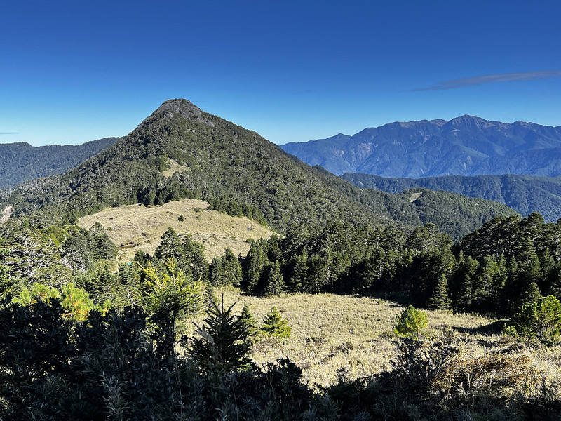
Before entering the woods, I looked back to see our trail. Mt. Chiyou looked like a pyramid, and the tents next
to Xinda Cabin were like blue dots from here. I couldn't believe we had come this far.
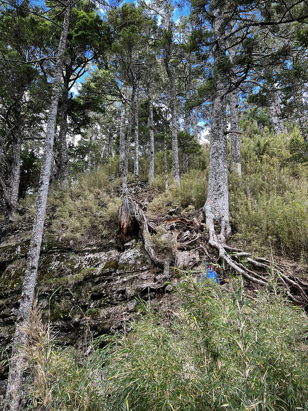
The woods were mixed with pine trees and dwarf bamboo. I saw the ridgeline of Mt. Dabajian and Mt. Xiaobajian
through the trees on my right.
14:14 We reached Mt. Pintian Front Peak, 3,445 meters. The views were striking,
with Mt. Dabajian on one side and the abyss-like valley on the other. I cursed myself for doing this.


There were ropes to grab, but seeing the cliff still made my heart stop. After all, this Pintian V Cliff has
claimed many lives.

It felt like a century before we reached the bottom of the Pintian V Cliff. The views were amazing there. After
catching our breath, we started climbing up.

After reaching the top, I looked back at Mt. Pintian Front Peak.

From here, the trail was easy compared to the cliff. Another 20 minutes passed, and we were closer to Mt.
Pintian.
15:24 Mt. Pintian, finally! The views were incredible here.

Some hikers said they saw Turtle Island in Yilan from here. We didn't see it because we were surrounded by
clouds. Not complaining.
16:24 We made it back to Mt. Pintian Front Peak safely.
17:07 We returned to our cabin before it got dark and called it a day.

Doing Mt. Pintian took longer than we expected. If you are uncomfortable with heights, prepare extra time for
this hike. Take it slow, and there is no need to rush. Safety first.
Hugged by the Clouds at Taoshan and A Long Way to Mt. Kalahei
We didn't get up super early, and we almost missed the sunrise. I only took a few photos, but unfortunately,
they are blurred.
06:40 We left Xinda Cabin.
07:25 We arrived at Chiyou Famous Tree. We spent longer here taking photos. This
tree is probably the most photogenic one I've ever seen on the trails in Taiwan.

07:46 We were back at Sancha Campsite/junction to Taoshan.
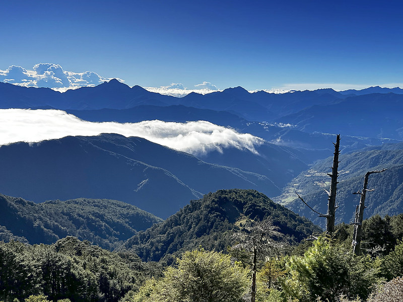
The sea of clouds was getting thicker. I was thrilled but also anxious that the good weather would be gone when
we reached Taoshan. Based on my experience, the good weather could be gone in one section in the high mountains.
Yet, I couldn't proceed any faster.

Unfortunately, we made a wrong turn near the junction. We saw ribbons on the trees, but we also saw a footpath.
We checked our map and decided to try the one without ribbons. A few minutes later, we turned back. So, if you
do the hike here, please follow the ribbons.
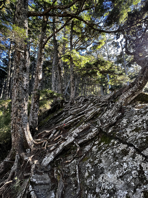
The Trail Terrains in Taiwan: Gap between Topographic Maps and Reality
According to our topographic map, the terrain looked flat. However, it's a different story when you set foot on
the trails in Taiwan.

The intertwined tree roots, the rocks, up and downs that are too small to be shown on the map, and other things
will drive you crazy when hiking. The gap between the topographic map and reality is what we saw on the way to
Taoshan, a rugged and jagged terrain.
That's why some tough trails are short but still labeled as challenging. Hiking 10 km (not 10 miles) can take
the whole day in Taiwan. That's why one of my favorite guides Xiao Tsai, doesn't put the mileage on his trips.
It means nothing sometimes.
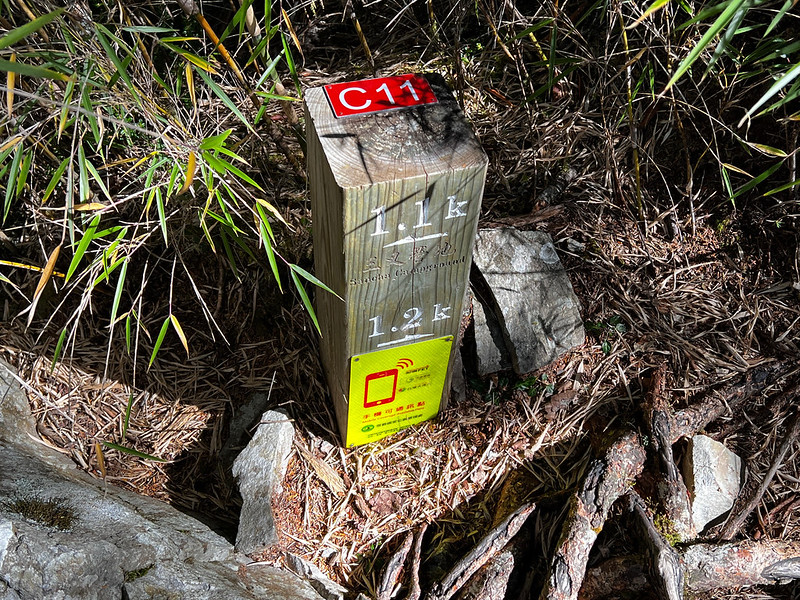
09:24 We finally reached the bottom of the valley and saw a post numbered C11.
It says 1.2 km to Taoshan - time to embrace ascending.
10:29 We arrived at Taoshan Cabin. We took a 20-minute break. Lucky for us, the
weather was still good.

We ate some food, took the essentials, and were ready for the rest of the Wuling Quadruple Mountains.
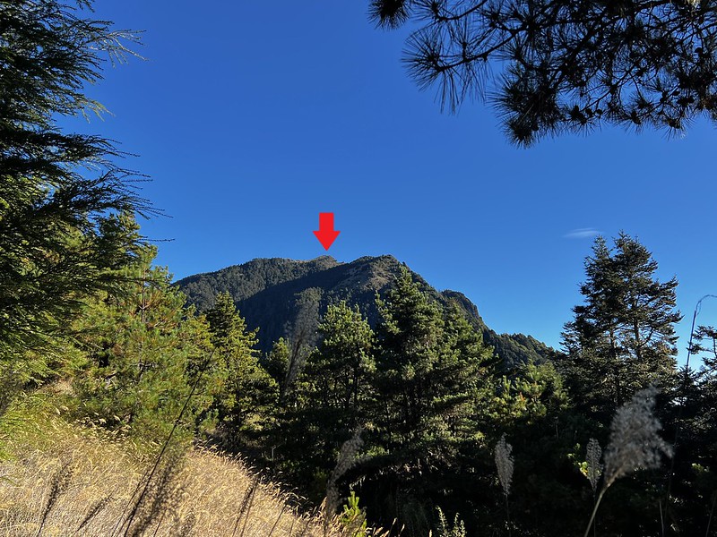
First, we saw a mountain with some gadgets on the top. Please don't be fooled by this one. The real Taoshan is
behind it.
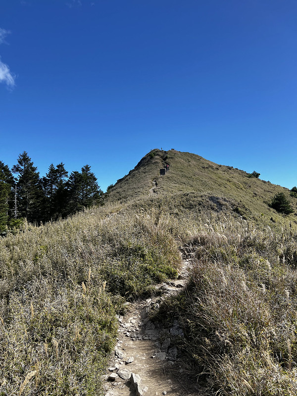
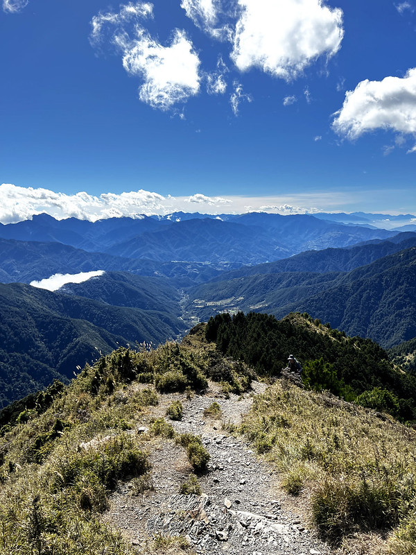
11:54 It took around 10 minutes to reach Taoshan from the cabin. The 360∘ views
at Taoshan were stunning! The most famous high mountains in Taiwan can be seen from here. The sea of clouds made
the views even 10 times better.


After having a good time at Taoshan, another deep valley awaited. The thought that we had to come back again was
disheartening, but we still had to go.

The hike from Taoshan to Mt. Shilun was mostly in the woods with intertwined tree roots and up and down.
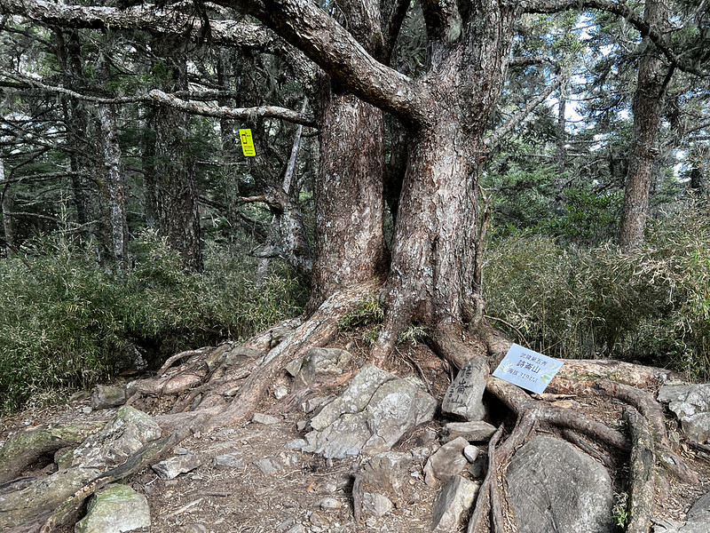
12:26 Arrived at Mt. Shilun, 3,194 meters. No views here.
We continued to Mt. Kalahei. After around 30 minutes, we exited the woods and saw an open area covered with
grass. The sea of clouds still kept us company.

13:34 We reached our last one of Wuling Quadruple Mountains, Mt. Kalahei, 3,133
meters. There was no view here because of the tall grass. However, the surroundings could be completely
different when the Japanese first set up the Class 3 Triangulation Stone 100+ years ago.

16:17 Eventually, we made it back to the last deep valley before Taoshan. I was
exhausted, hoping I could still catch the last glimpse of sunset at Taoshan.

The slope before Taoshan was disheartening. I stopped several times to catch my breath.
16:32 We were back in Taoshan and still had time to see the sunset.

However, the wind was too harsh to withstand, and not bringing my down jacket was a mistake.

16:48 Back to Taoshan Cabin. The sunset near the cabin was awesome, especially
on the Mt. Dabajian side.

We went to the toilets and were astonished by the more spectacular shades of vibrant colors from the sunset,
plus the smell.

Day 4: Visited Taoshan One More Time and Home
07:08 We left Taoshan Cabin, and it was gloomy and rainy, a big contrast to what
we had.

07:22 We were back to Taoshan for the third time because the trail to Wuling
Farm was next to the peak.
Most sections here are exposed, and we hiked on the rocky footpath. It would be scorching hot if the weather
were sunny. Lucky for us, it lightly drizzled, and we felt ok.
08:02 We passed the millage post, 3.6 km. Not long after we passed this post,
the vegetation changed, and we entered a forest mixed with grass.

08:50 We reached the junction pointing to Taoshan trailhead and water source
(Black Water Pond, 5.6 meters away from here.)

We went to check this area. This place will be ideal for camping.
The trail here was zigzag. The fatigue had long taken over us, and I had to summon our last strength to finish
this hike.
09:58 We reached a forest, and what surprised me was no tall grass beneath those
tall, beautiful trees. Instead, we could see the steep hill awaiting. If you start this hike from Taoshan
trailhead, this will be the slope you are going to climb.


10:40 We saw an old, abandoned house with many tourists taking photos. Here's
the starting point of Taoshan Trail, 0 km.

Although the sign said this was 0 km of Taoshan Trail, it was still around 1 km to Wuling Villa.
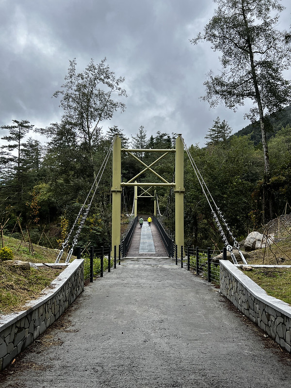
10:59 We crossed Wuling Suspension Bridge.
11:09 We were back at Wuling Villa. We finished the hike!
About Wuling Quadruple Mountains, Wuling Farm, and Formosan Landlocked Salmon
Wuling Quadruple Mountains
Mt. Pintian 品田山, 3,524 meters (11,561.6 feet). The views are incredible from the top. One of the
headwaters of the Tamsui River is from Mt. Pintian. When the weather is clear, hikers can see Yilan Plain,
Turtle Island, and even as south as Jade Mountain (Yushan).
The trail to Mt. Pintian involves scary climbing. Please cancel your hike to this mountain if the weather is
rainy, snowy, or wet. Many deadly accidents have occurred there, and it's easy to see why. This section is
called Pintian V Cliff, and you get an idea of where this name came from.

There is another cliff named after Pintian called Pintian Cliff. This cliff is worse than V cliff and is on the
way to Mt. Buxiulan 布秀蘭山 (3,452 meters/11,325.4 feet) from Mt. Pintian.
Mt. Chiyou 池有山, 3,303 meters (10,836.6 feet). There is a Class 3 Triangulation Stone on the top. The
views are amazing, too. The indigenous Atayal people call this mountain. Tamarappu.
I can't find what Tamarappu means. Chi means "ponds," and You means "have" in Chinese. Putting those two
characters together means there are ponds in this mountain. The ponds are near Xinda Cabin.
Mt. Tao, aka Tao Mountain/Taoshan/Peach Mountain, 桃山, 3,325 meters (10,908.8 feet). The contour of this
mountain looks like a peach, and that's how Tao Mountain got its name. Tao means peaches in Chinese. The views
are spectacular.
Taoshan is also the most popular among Wuling Quadruple Mountains. Many hikers do this mountain in one day. The
round trip is around 10 km (6.2 miles), which looks like nothing, but the elevation gain and loss of 2,800+
meters in one day had kicked many hikers' butts.
Mt. Kalahei 喀拉業山, 3,133 meters (10,278.8 feet), is located between Hsinchu County and Yilan County.
Unfortunately, the trees and grass are tall at the peak now - nothing much to see. But the views are great
before reaching Mt. Kalahei.
The north tip of the Xueshan Range starts from Bitoujiao/Bitou Cape, and Mt. Kalahei is the first peak over 3,000 meters,
counting from the northernmost point, Bitoujiao.
Wuling Farm and Formosan Landlocked Salmon 台灣櫻花鉤吻鮭
Wuling Farm, 1,750 meters above sea level, is one of the most popular tourist
attractions in Taiwan. It is famous for the spring blossoms and the fantastic views. You can read Foreigners in Taiwan's post for the details of Wuling
Farm.
For hikers like me, Wuling Farm is also the gate to many 100 Peaks, like Mt. Snow (Xueshan, 3,886 meters), Mt.
Pintian 品田山 (3,524 meters), Mt. Chiyou 池有山 (3,303 meters), Mt. Tao or Taoshan 桃山 (3,325 meters), Mt. Kalahei
喀拉業山 (3,133 meters) and more. Those 4 are also called Wuling-Quadruple or Wuling Quadruple Mountains 武陵四秀.
Even if you don't do 100 Peaks, Wuling Farm is a great place to explore
and relax. We were supposed to do another hike, but our guide decided to change the plan because the weather
wasn't good on that trail.

Cijiawan (or Qijiawan) Creek 七家灣溪 at Wuling Farm is also home and sanctuary for the critically endangered Formosan Lanklocked Salmon 櫻花鉤吻鮭.

I was lucky to see Formosan Landlocked Salmon when I did Hehuanshan hikes in April 2023.