Yangmingshan Series: Mt. Qixing - Explore the Highest Peak in Taipei City and Secret Spots
There are three trailheads to hike the highest peak, Mt. Qixing or Qixingshan, at Yangmingshan National Park.
You will find different routes to enjoy the stunning views at Mt. Qixing, and secret spots unknown to local
Taiwanese in this post. Plus, how to take public transport to enjoy Mt. Qixing Main Peak and more.

Important: the trail from Xiaoyoukeng and Mt. Qixing Main Peak reopens on January 7th, 2025. Please check
the Yangmingshan National Park's official Facebook Page for details.
Disclaimer:
All content is for inspiration only. Use Taiwan Hikes' suggestions at your own risk. We are not responsible for any losses, injuries, or damages.
All content is for inspiration only. Use Taiwan Hikes' suggestions at your own risk. We are not responsible for any losses, injuries, or damages.
Table of Contents:
About Mt. Qixing
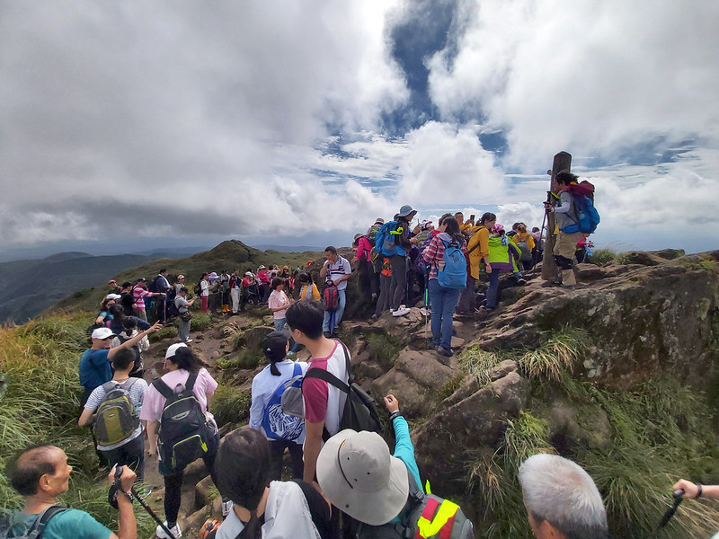
Mt. Qixing, 1,120 meters above sea level, is the highest peak in Taipei City. It's also listed as No. 2 on
Taiwan's Xiao Baiyue, Little 100 Peaks in Taiwan.

The Origin of the Name: Qixing (Or Also Spelled as Cising)
Qixing literally means Seven Stars in Chinese. It is said that the migrants from China sailed to Taipei from
the Tamsui River hundreds of years ago. When they looked up, they saw seven mountain peaks. Like the Big
Dipper or Plow, those peaks were also in the north, meaning seven stars in Chinese. So that's where the name
Qi Xing came from.
It is also said that the Qing government aligned the walls between the North
Gate and West Gate of Taipei with the peak of Mt. Qixing when they built Taipei.
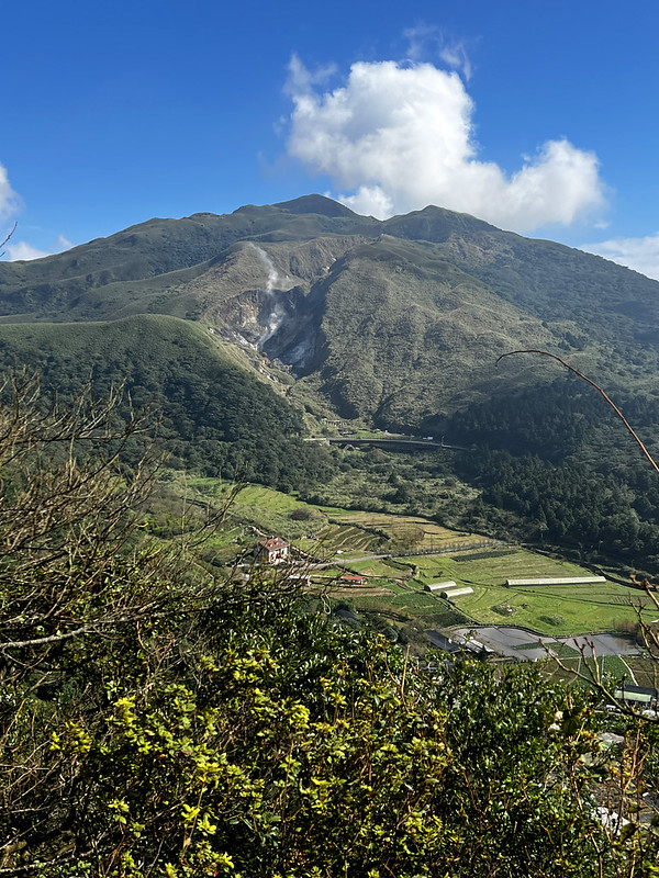
The Volcano Activities at Qixingshan
Before the last eruption of Mt. Qixing around 700,000 years ago, there was a crater on the top. After the
eruption, the crater was destroyed and got seven peaks left.

Mt. Shamao, 643 meters, is a dome-shaped mountain southwest of Mt. Qixing. It's the parasitic cone of Mt.
Qixing.
Sha 紗 is silk fabric, and Mao means hats. In ancient China, government officials wore Sha Mao 紗帽, silk hats.
You can click here to see what Sha Mao looks like.
Then you will understand how Mt. Shamao got this name.

Planning a permit-free hike by bus?
Skip the research. This guide covers 41 relaxing, permit-free trails in every Taiwan county — with trailhead maps and the exact public transport to reach each one. Everything you need to just show up and hike.
Get all 41 trails + maps →3 Trailheads to Mt. Qixing and Secret Spots
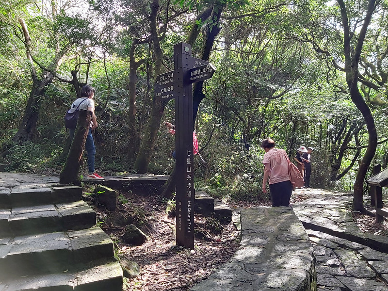
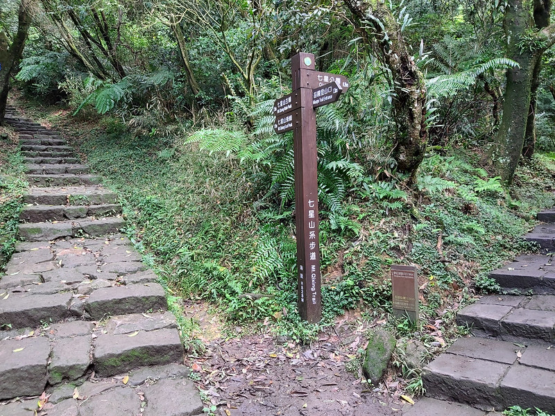
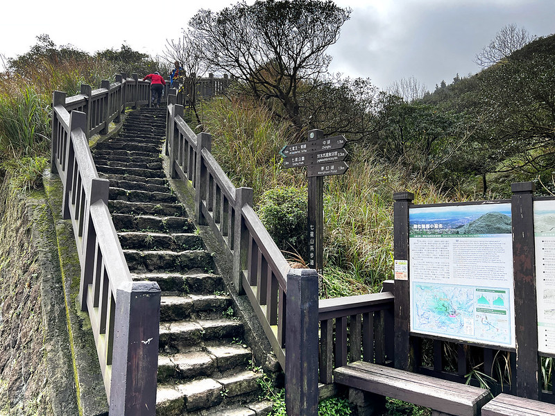
There are 3 trailheads to Mt. Qixing:
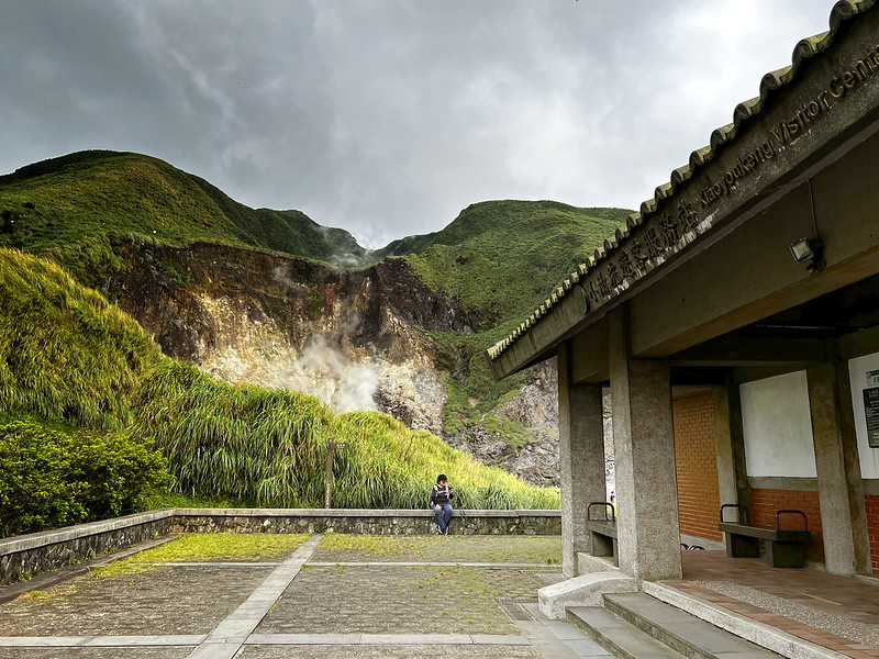
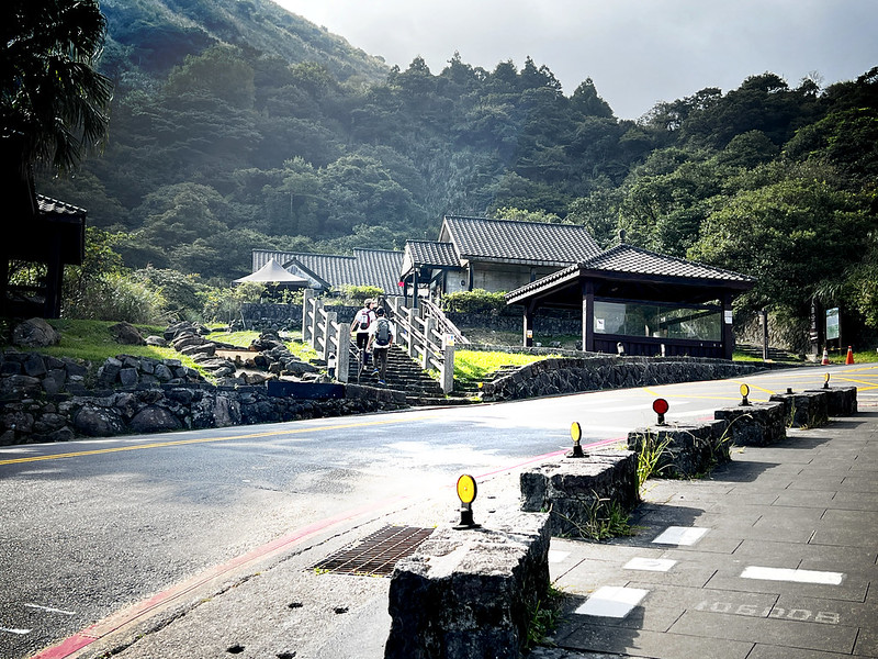
- Xiaoyoukeng Visitor Center 小油坑遊客中心
- Lengshuikeng Visitor Center 冷水坑遊客中心
- Miaopu trailhead 七星山苗圃登山口

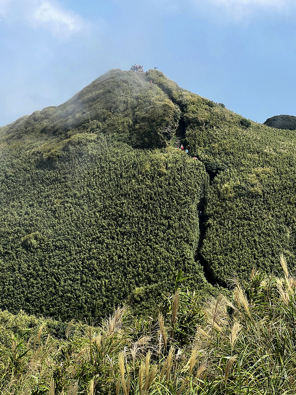
There are many routes to hike Mt. Qixing. For example, you can start from Xiaoyoukeng to Mt. Qixing Main Peak
and East Peak and exit from Lengshuikeng, or vice versa.
Or start from Miaopu and exit from Xiaoyoukeng or Lengshuikeng.
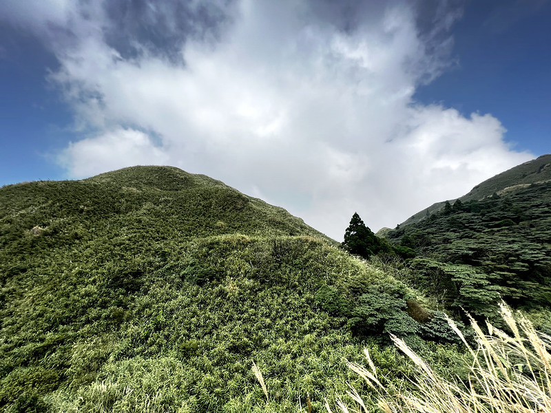
Secret Spots: Mt. Qingxing South Peak
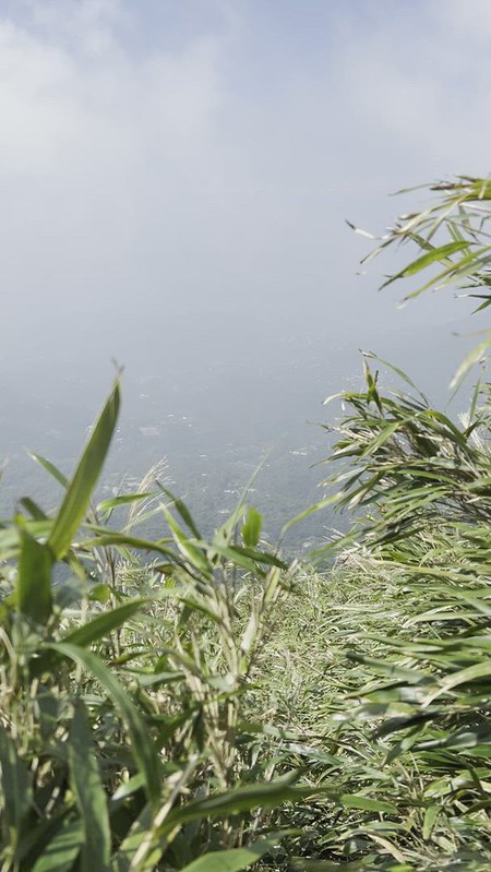
While scaling up to Mt. Qixing, you will see many dwarf bamboo tunnels on both sides. In addition, the
entrance to Mt. Dinosaur Kissing Stones and Mt. Ketagalan is close to Mt. Qixing.

For this route, I went to Mt. Qixing South Peak first. There are dwarf bamboo tunnels inside and they are
taller than I am, which can be confusing if you are unfamiliar with terrains like this.
You can return the same way back and continue to Mt. Qixing Main Peak. If you are adventurous, you can go
further to find Dinosaurs Kissing Stones and Mt. Ketagalan. Warning: steep slopes ahead.
Secret Spots: Dinosaurs Kissing Stones, Mountain God Temples, Mt. Ketagalan (from Ancient Culture or Even Aliens?)
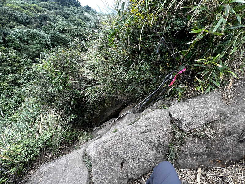
When I finished Mt. Qixing South Peak and continued further, my GPX map told me to descend. Soon I realized
that it was a huge descent. It was so steep that I thought about returning.

However, my curiosity overcame my doubt, so I went further. Warning: Please think twice if you are new
to Yangmingshan.
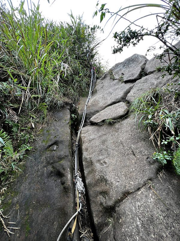
After constantly checking my GPX map, I saw a rock with ropes ahead of me. After I got home and did more
research, this should be Mt. Ketagalan. But I didn't take a full photo of the mountain.
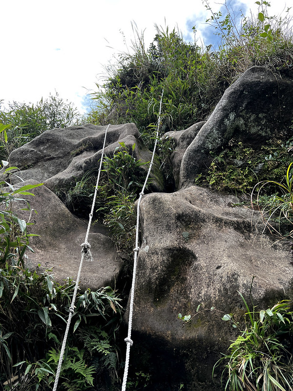
I thought the climbing was hard enough, but then I realized descending was even worse. It looked like a
vertical wall.
Some people said this was a sacred mountain for the indigenous people of Ketagalan. To worship gods, they
built those rocks (Mt. Ketagalan and Dinosaur Kissing Stones). Some resemble pyramids. However, there is no
archaeological evidence to prove this theory.
Some even said the aliens built those rocks or pyramids, and those were the radio towers.
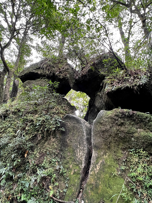
Finally, I was inside the forest again. There were several trails here, and I took several wrong turns before
reaching the right one.

I met other hikers, and they were kind to point out the direction for me. Finally, I found what I was looking
for.
I probably don't have a good imagination. Those rocks were unique, but I don't see how they resembled two
dinosaurs kissing each other. What do you think?
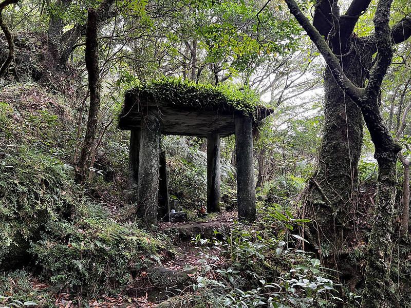
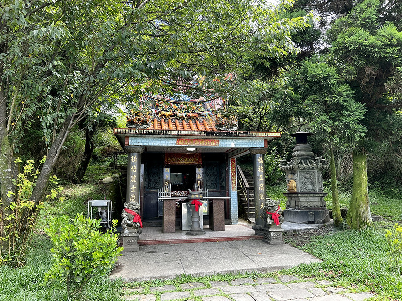
While finding my way to return to Mt. Qixing, I saw a small pavilion with a stele inside. There are two
Mountain God shrines, and this is one of them. They I didn't feel like looking for another one at that moment.
Those were built by Han people.
When I returned to the footpath to Mt. Qixing, I realized I could have taken this entrance
(25.169764,121.552275) to make my life easier. Well, now I know.

Note: The hunt for Mt. Qixing South Peak, Dinosaurs Kissing Rocks, and Mt. Ketagelan took me extra 2 hours and
15 minutes to finish.
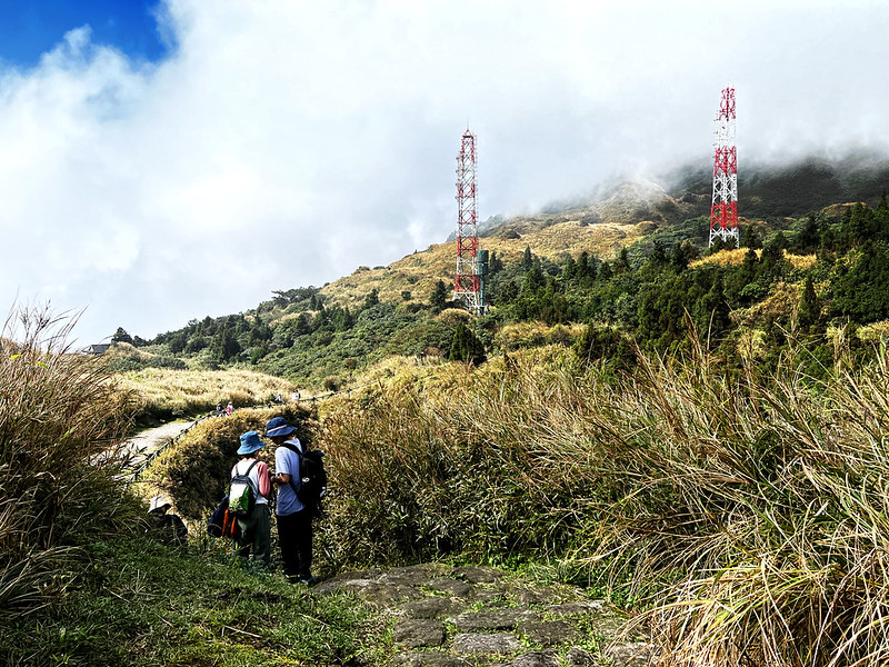
Secret Spots: Mt. Qixing North Peak
Mt. Qixing North Peak is close to the main peak. I tried to go there, but a bee scared me and made me abort my
plan. Although I learned this bee wasn't deadly, the memory of being stung by bees still lingers in my mind.
Maybe I'll try to find this peak again another day.
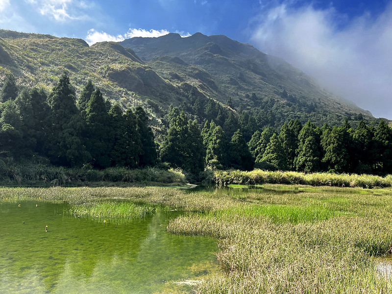
Secret Spots: Qixing Park and Menghuan Pond
If you prefer a relaxing wander at Yangmingshan, Qixing Park and Menghuan Pond (meaning Dream Lake in Chinese)
are for you. They are easy to locate, too.
When standing at the deck by Menghuan Pond, I told myself this would be a great spot to make ASMR videos.
As to Qixing Park, it isn't a secret, to be fair, but it's a pleasant place to take a break. There are toilets
at Qixing Park.

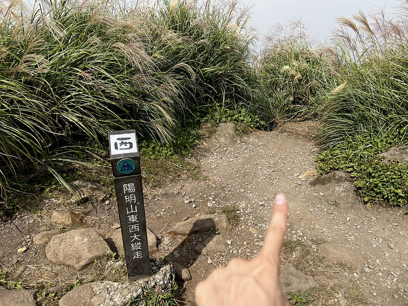
Yangmingshan East to West Thru-hike
You can even do a Yangmingshan East to West Thru-hike to visit all the peaks at Yangmingshan National Park.
But this is a story for another day.

Things to Keep in Mind to Have a Safe Trip
There are many signs on the major routes. Just follow the stone steps and the signs. If you are new to
Taiwan's trails, please don't take Mt. Qixing South Peak. If you try to find the south peak, you will be in
the dwarf bamboo woods, and finding your way out is difficult.

Please stay alert if you find yourself descending. You should be going up most of the time unless you take the
same route back.
Because feral buffaloes mostly wander at Qingtiangang, they have their own routes, which might lead nowhere.
Please stay on the major stone steps if you don't have a map or GPX.

Yangmingshan Weather
If you visit Yangmingshan in autumn or winter, please note that the temperature up there is at least
6.5℃ (11.7 ℉) degrees lower than in downtown Taipei City, plus the windchill.
The weather at Yangmingshan changes quickly. Sometimes clouds appear suddenly and cover the whole sky, even if
the weather forecast predicts good weather.
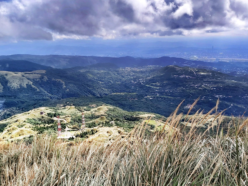
When you are close to Mt. Qixing Main Peak and East peak, there is little shade, and you are exposed to the
sun. There is no shade at all at Qingtiangang. Please be aware of the sun to prevent sunburn, even in winter.
Get up early to enjoy Yangmingshan if you can.
How to Get There by Public Transport
Taking public transport to Yangmingshan can be confusing. In addition, driving may not be an option because
there is daily traffic control.
There are 20+ buses to Yangmingshan, and we usually transfer to the attractions at least twice or thrice.
Maps/GPX Data and Itineraries
The stone steps can be wet and slippery. A few sections before reaching Mt. Qixing Main Peak are very steep.
Walking on those stone steps is taxing, but the views are worth it.

Maps/GPX Data
I put two routes I did before, one from Xiaoyoukeng and the other from Miaopu. My preference is to start with
Xiaoyoukeng because I like Xiaoyoukeng, and it's less steep.
Click Menu in the map to download, print, or share the map.
You can see more options after clicking the Play button.
Click to change the speed to meet your condition.
You can see more options after clicking the Play button.
Click
to change the speed to meet your condition.
Peaks to Reach:
- Mt. Qixing Main Peak 七星山主峰, 1,120 meters (3,674.5 feet) above sea level. The highest mountain in Taipei City. There is a Class 1 Triangulation Stone at the peak.
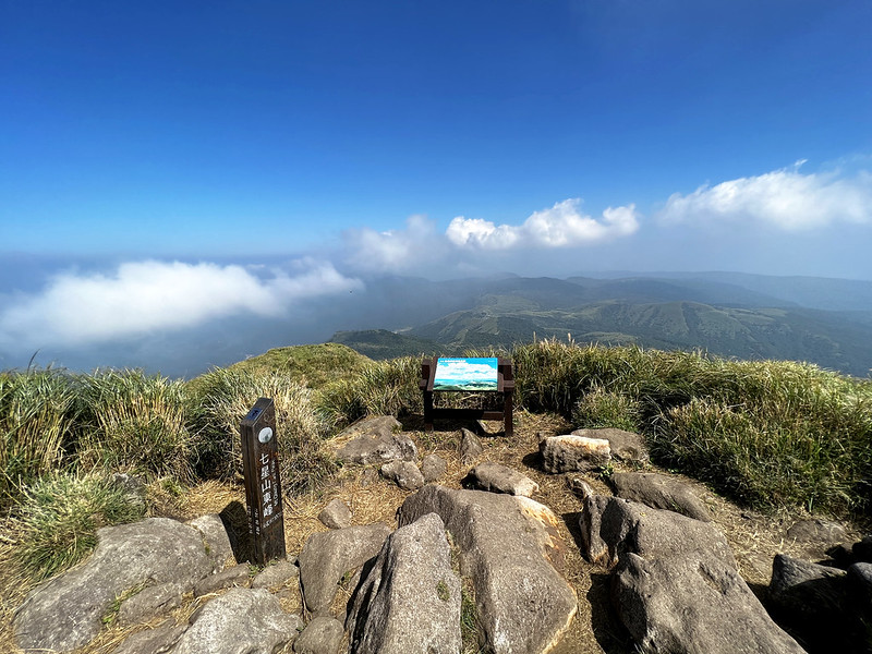
- Mt. Qixing East Peak 七星山東峰, 1,107 meters (3,631.9 feet) above sea level. There is a Class 3 Triangulation Stone at the peak.
- Mt. Qixing North Peak 七星山北峰, 1,063 meters (3,487.5 feet) above sea level.
- Mt. Qixing South Peak 七星山南峰, 1,088 meters (3,569.5 feet) above sea level.
- Mt. Ketagalan 凱達格蘭山 aka Qixing Zhui 七星錐, 1,048 meters (3,438.3 feet) above sea level.
- Mt. Xiaoyoukeng 小油坑山, 834 meters (2,736.2 feet) above sea level. The triangulation stone is inside the bamboo wood. Unfortunately, when I tried to find it again, I couldn't find it.
- Dinosaurs Kissing Rocks 恐龍接吻石. This place is not a peak, but it's fun to visit.
Loop Hike from Xiaoyoukeng to Mt. Qixing
Brief itinerary: Xiaoyoukeng (812m) ➔ Mt. Qixing Main Peak (1,220m) ➔ junction to Miaopu
(1,082m) ➔ Mt. Qixing East Peak (1,107m) ➔ radio station and the junction to Menghuan Pond
(Dream Lake) ➔ Menghuan Pond ➔ Pedestrian Trail ➔ Xiaoyoukeng
Distance: 4 km (2.5 miles)
Route type: Loop
Hours Needed: 2 to 5 hours
Permits: Not required
Difficulty Level:
Route type: Loop
Hours Needed: 2 to 5 hours
Permits: Not required
Difficulty Level:
You can go to Qixing Park 七星公園 at the junction to Menghuan Pond and return later.

You can also turn to Lengshuikeng and finish your hike. You can take bus S15 at Lengshuikeng.
You take a detour at a bamboo tunnel to the Dinosaurs Kissing Rocks and Mt. Ketagalan.

Hike from Miaopu to Mt. Qixing to Xiaoyoukeng, and Vice Versa
Brief itinerary: Miaopu (552m) ➔ junction to Mt. Qixing Main Peak and East Peak (1,082m)
➔ Mt. Qixing East Peak (1,107m) #10132; return to the junction ➔ Mt. Qixing Main Peak (1,120m)
➔ Xiaoyoukeng (812m)
Distance: 4 km (2.5 miles)
Route type: Point to point
Hours Needed: 3 to 5 hours
Permits: Not required
Difficulty Level:
Route type: Point to point
Hours Needed: 3 to 5 hours
Permits: Not required
Difficulty Level:
This hike is steeper because we start from 552 meters to 1,120 meters above sea level.
Hike from Miaopu to Lengshuikeng, and Vice Versa
Brief itinerary: Miaopu (552m) ➔ junction to Mt. Qixing Main Peak and East Peak (1,082m)
➔ Mt. Qixing Main Peak (1,120m) #10132; return to the junction ➔ Mt. Qixing East Peak
(1,107m)➔ radio station and the junction to Menghuan Pond (894m) ➔ Lengshuikeng (740m)
Distance: 4 km (2.5 miles)
Route type: Point to point
Hours Needed: 3 to 5 hours
Permits: Not required
Difficulty Level:
Route type: Point to point
Hours Needed: 3 to 5 hours
Permits: Not required
Difficulty Level:
You can turn to Menghuan Pond at the junction.

National Education Radio is close to the junction to Menghuan Pond.
Hike from Lengshuikeng to Mt. Qixing to Xiaoyoukeng, and Vice Versa
Brief itinerary: Lengshuikeng (740m) ➔ radio station and the junction to Menghua Pond ➔
Mt. Qixing East Peak (1,107m) ➔ Mt. Qixing Main Peak (1,120m) ➔ Xiaoyoukeng (812m)
Distance: 3.8 km (2.4 miles)
Route type: Point to point
Hours Needed: 2 to 5 hours
Permits: Not required
Difficulty Level:
Route type: Point to point
Hours Needed: 2 to 5 hours
Permits: Not required
Difficulty Level:
Longer Hike: One of the trailheads to Mt. Qixing and Exit at Qingtiangang and Vice Versa
Brief itinerary after Mt. Qixing Main Peak: Mt. Qixing Main Peak (1,120m) ➔ Mt. Qixing East Peak
(1,107m) ➔ radio station and the junction to Menghuan Pond ➔ Lengshuikeng (740m) ➔
Qingtiangang Visitor Center ➔ Qingtiangang Circular Trail (around 770m)
Distance: About 3.9 km (2.4 miles) from Mt. Qixing Main Peak to
Qingtiangang
Permits: Not required
Difficulty Level:
Permits: Not required
Difficulty Level:
Last but Not Least: Wildflowers
There are all kinds of flower blossoms at Yangmingshan National Park. But it's a great delight to see
wildflowers on the trails.


For more wildflowers I saw on the trails, please check out my Flowers on the Trails page.
There are so many routes to enjoy Mt. Qixing and connect those routes. What's your favorite route? Feel free
to share with me in the comment box below.