Yangmingshan Series: River Tracing Trail to Mt. Huangzui and Cuicui Valley and How to Apply for Permits
There are so many fantastic hiking trails at Yangmingshan National Park. This hike to Mt. Huangzui (aka
Huangzuishan) and Cuicui Valley is one of them. Unlike the traditional route, we traced Shanhuang Creek to
enjoy the beautiful streams in hot summer and went through Cuicui Valley to Mt. Huangzui. First, the volcano
crater near the peak reminded us of the history of Yangmingshan. Then, we ended the hike with the beautiful
sunset at Qingtiangang grassland.
Table of Contents:
Trail Information of Mt. Huangzui and Cuicui Valley and Feral Buffaloes
Trail Name: Hike from Shanghuangxi Parking Lot, via Cuicui Valley to Mt.
Huangzui 上磺溪溯翠翠谷上磺嘴山
Distance: 9.2 km (5.7 miles)
Route type: point to point
Days/Hours Needed: 8 to 9 hours
Total Ascent/Descent: 690 m / 323 m
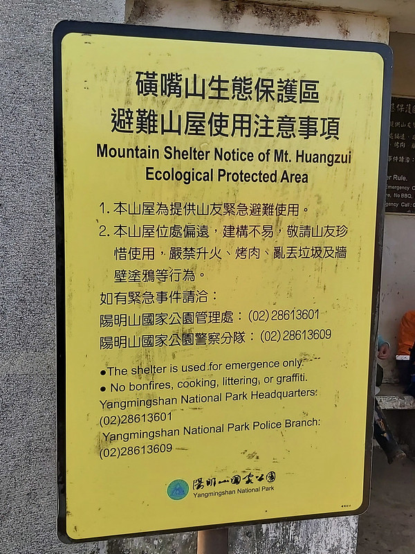
Best Time to Go: All year-round, but it can be scorching hot in summer. When you enter Cuicui Valley, there is not much shade. If it rains, DO NOT GO TO ANY RIVER.
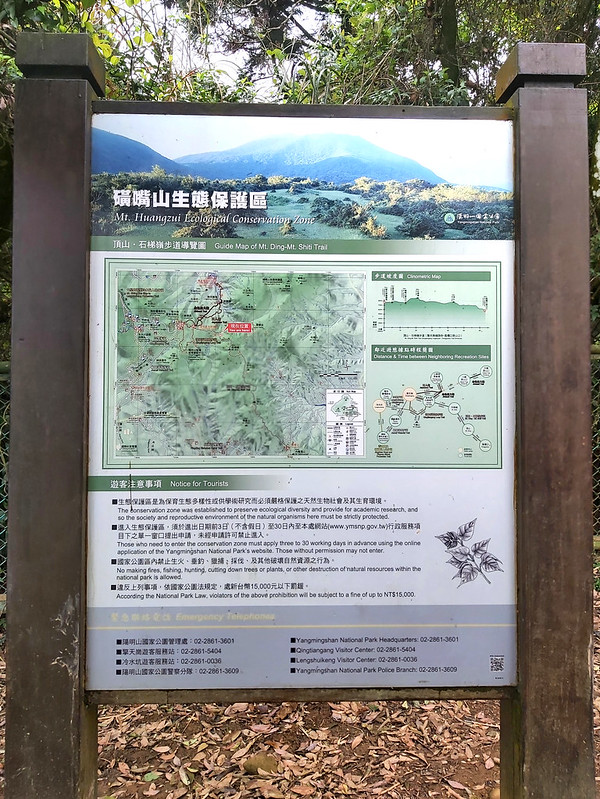
Permits: you need to apply for permits to enter Mt. Huangzui Ecological Protected Area 磺嘴山生態保護區. If you click the website, you'll see the bird-eye view of this area, which shows you the volcano crater. Please click How to Apply for Permits for details.
Difficulty Level:
Peaks to Reach:
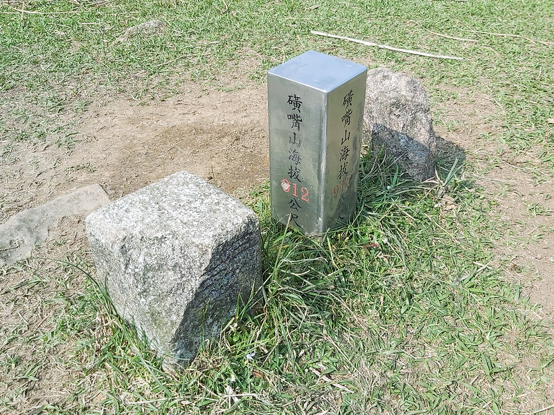
Mt. Huangzui 912 meters (2,992 feet). There is a Class 3 Triangulation Stone on the peak. Others:
Distance: 9.2 km (5.7 miles)
Route type: point to point
Days/Hours Needed: 8 to 9 hours
Total Ascent/Descent: 690 m / 323 m
Best Time to Go: All year-round, but it can be scorching hot in summer. When you enter Cuicui Valley, there is not much shade. If it rains, DO NOT GO TO ANY RIVER.
Permits: you need to apply for permits to enter Mt. Huangzui Ecological Protected Area 磺嘴山生態保護區. If you click the website, you'll see the bird-eye view of this area, which shows you the volcano crater. Please click How to Apply for Permits for details.
Difficulty Level:
Peaks to Reach:
Mt. Huangzui 912 meters (2,992 feet). There is a Class 3 Triangulation Stone on the peak. Others:
- If you take this route, it's better to prepare a pair of river tracing shoes or wear rain boots. In addition, a pair of gloves is a must. One of our hiking mates wore a helmet, which is a good idea.
- Cuicui Valley is the origin of Shanghuang Creek, but it has become a swamp now. So, it can be muddy and mushy to hike through the valley.
-
The trail from Cuicui Valley to Mt. Huangzui is exposed under the sun. Therefore, it's better to bring a
hat to cover your face and neck, especially in summer.
There is no shade from Cuicui Valley to Mt. Huangzui. -
Yangmingshan Feral Buffaloes and Their Tragic Deaths:
Many feral buffaloes are wandering around and grazing the grassland in Yangmingshan. They have become part of the beautiful landscapes. You can read their story here.Since 2020, 50 feral buffaloes have been found dead at Qingtiangang. After investigation, those buffaloes died from malnutrition. There have been buffalo attacks from time to time. Yangmingshan National Park Headquarters built fences to keep buffaloes from entering tourists' areas to solve the problems.And why did Yangmingshan Nation Park Headquarters build up fences? Because of us, the visitors. An old lady died from her injuries caused by a buffalo in 2018. It's sad to see the accidents like this happen, but we humans also have our responsibility.Qingtiangang is their home, and we are the guests. We should keep a safe distance from them to show some respect. We don't know when they will feel threatened and become aggressive, especially when cubs are around.
- Therefore, please stay away from those buffaloes for their own sake and your safety.
Personal Enjoyment
Things I Enjoy
- Yangmingshan is easy to access, and there are all kinds of trails with different difficulty levels. I will never get tired of those trails there.
- The first section of the trail we took was very relaxing. You don't have to apply for the permits to hike there.
- The river tracing is very exciting, although it can be slippery and dangerous sometimes. I had to cross several giant boulders, and my hiking mates could sense my fear. It's still fun.
- The views on Mt. Huangzui are beautiful. It is almost flat on the top of Mt. Huangzui. We stayed there for a bit longer, and I even took a nap.
- Seeing the sunset at Qingtiangang grassland is a great delight.

Things I Don't Enjoy
I enjoy this hike and will do it again via different routes. However, if I have to point out things I don't
like, they are the crowd and the public transport. There are always long queues at the bus stops near
MRT Jiantan Station and Yangmingshan Bus Terminal. Whether you drive or take the bus, it's easy to get stuck
in the traffic on the main road to Yangmingshan, Yangde Boulevard during the rush hour.

Map/GPX Data
Date of Hike: Group hike with Taiwan Mountain LOHAS Association on March 28, 2021
Route map for 2021-03-28- Huangzuishan And Cuicui Valley by Anusha Lee on plotaroute.com
Click Menu in the map to download, print, or share the map.
You can see more options after clicking the Play button.
Click to change the speed to meet your condition.
You can see more options after clicking the Play button.
Click
to change the speed to meet your condition.
How to Get There
Take Royal Bus 皇家客運 Royal Bus 1717 near Exit 8 of MRT Taipei Station and get off at Shanhuangxi Parking Lot.
About Mt. Huangzui, Lujiaokeng, and Menghuan Pond and How to Apply for Permits
There are three ecological protected areas 生態保護區 in Yangmingshan
National Park: Lujiaokeng 鹿角坑, Menghuan Pond 夢幻湖, and Mt. Huangzui 磺嘴山. Mt. Huangzui Ecological Protected Area is the biggest one among
those. Hikers and tourists must apply for park entry permits to enter.
Regulations of Entering Mt. Huangzui
There are two primary entrances to hiking Mt. Huangzui: one from Qingtiangang and the other from Lujueping. Here
are the regulations you need to know.
- You have to apply for permits 3 to 30 working days in advance. Those without permits will be subject to a fine of up to NT$3,000 (US$108, 95 Euros).
- Daily capacity of visitors: 8 groups. Each group is no bigger than 10 people. You can try to apply if you want to do a solo hike, but it's still up to Yangmingshan National Park to approve.
- Open hours: between 9:30 am and 4:00 pm. Visitors must enter and leave within this period. Visitors are not allowed to enter after 11 am.
- The group leaders must be over 20 years old and Taiwanese nationals. The group leaders are responsible for educating members about the national park's regulations. The leaders must submit the permission letters in the mailbox at the entrance gate at Qingtiangang.
- Children under 5 years old are not allowed to enter.
How to Apply for Permits to Enter Ecological Protected Areas at Yangmingshan National Park
-
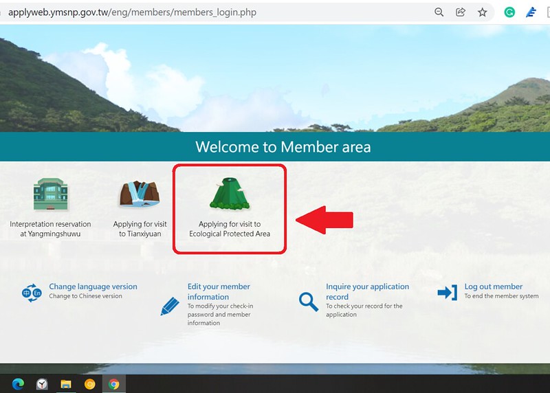
First, register as a member before applying.
Thank Taiwan Trails and Tales for emailing Yangmingshan National Parks back and forth. We know that this system is not available for people without Taiwanese ID now. It doesn't work for those with ARC, either. But it might be in 2022. Fingers crossed.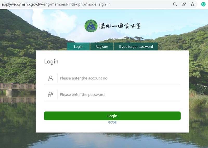
-
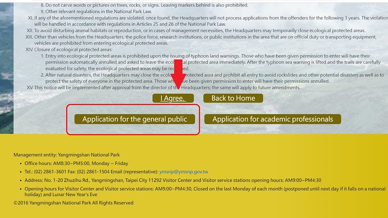
Click "Applying for a visit to Ecological Protected Area." Read and click "I agree" on the notice page.
-
Unless you are going to do academic research, click "Application for the general public."
-
You'll see Step 1 and select the date available to enter.

-
Step 2 is the general application for an entry permit.

-
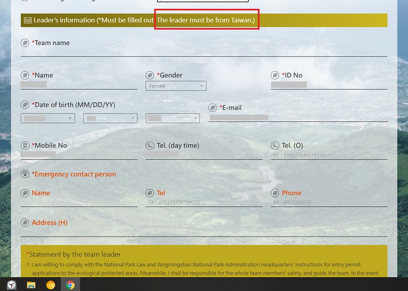
The group leaders must fill out the Team name, the leader's Emergency contact person, and that person's
contact information. Read "the statement by the team leader" and check the box. The group leader must be
Taiwanese.
-
You must upload the "Mountaineering Plan (hiking route)" if you don't take the routes suggested by
Yangmingshan National Park. See below for the route suggestions. You can download the template and modify
the content according to your plan.
Please note that Yansmingshan National Park has the right to reject your application if you choose unconventional routes.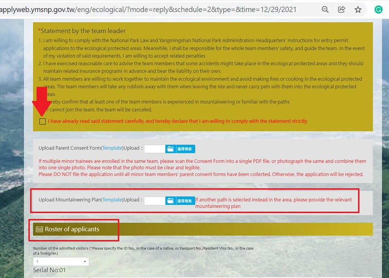
The NT$15,000 fine is reduced to NT$3,000 now. - If any of your group members are under 20, you must obtain their parent's consent form. You can also find the template on the website.
-
Then, fill out the members' names and other information in the form.

- Click "submit," and you are done.
You might be curious about this. If only Taiwanese could be the group leaders, why does Yangmingshan National
Park set up an English website for applications? I have no idea. I can only tell you that the user interface and
experience of many government websites in Taiwan are notorious. I'm sure many expats in Taiwan will agree with
me.
One thing that needs to address is visitors also need to apply for permits if they want to hike Mt. Xiaoguanyin 小觀音山. Mt. Xiaoguanyin or Xiaoguanyinshan is also
part of the Lujiaokeng area. It used to be under the military restriction area. Still, the military has eased it
and withdrew from it in the past few years. As a result, visitors must apply for permits now. You go to the
application page mentioned above to proceed with the process.
Route Suggestions to hike Mt. Huangzui
Yangmingshan National Park provides 4 routes for hikers. You can choose either from Qingtiangang's side or
Lukuping 鹿崛坪 side. If you do one of these routes, you don't have to submit your hiking route (Mountaineering
Plan).
The four routes provided by Yangmingshan National Park are:
- Qingtiangang to Mt. Huangzui (including Cuicui Valley) back to Qingtiangang
- Lukuping to Mt. Huangzui (including Cuicui Valley) back to Lukuping
- Qingtiangang to Mt. Huangzui (including Cuicui Valley) to Lukuping
- Lukuping to Mt. Huangzui (including Cuicui Valley) back to Qingtiangang
Please bring at least one paper copy of the list of the applicants with you. You'll find a mailbox at each
trailhead and submit your list in it.
You can also bring another copy or put it on your smartphone. Then, when you run into Yangmingshan National
Park staff, they might ask for your list.
Tragedies at Mt. Huangzui and Cuicui Valley
If you start your hike from Qingtiangang side to Mt. Huangzui, you will see a shelter at 1.5 km.
In 1975, three students from a prestigious university, National
Taiwan University, planned a long-distance hike in Yangmingshan during the New Year's Eve holidays.
Unfortunately, when they tried to reach Mt. Huangzui, the weather turned sour. The fog covered everything, and
they got lost on the ridge.
They got panicked and took a short cute to Cuicui Valley. The bad weather continued for days, and they tried two
days to find their way out. Unfortunately, the cold current hit, and they suffered from hypothermia and died.
After the tragedy, the government built a simple shelter with frames and a tarp. It collapsed quickly. Then,
Yangmingshan National Park was officially founded. The headquarters decided to rebuild the shelter to serve more
hikers. That is the structure we see today.
My Itinerary
Brief itinerary: Shanhuang Creek Parking Lot ➔ Stone Quarry ➔ Shanhuang Creek ➔
Cuicui Valley ➔ Mt. Huangzui ➔ Shelter ➔ Qingtiangang East Peak ➔ Qingtiangang bus
stop
GPS coordinates of the parking lot: 25.178288, 121.583119
GPS coordinates of trailhead: 25.176428, 121.584095
GPS coordinates of the parking lot: 25.178288, 121.583119
GPS coordinates of trailhead: 25.176428, 121.584095
07:00 Wait for Royal Bus 皇家客運 1717 near Exit 8 of MRT Taipei Station.
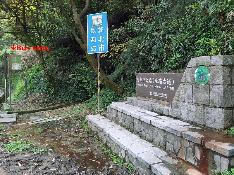
08:17 Arrived at Shan Huang Xi Bridge (Shanhuang Creek Bridge) 上磺溪橋. There's a
stone sign of the Jinbaoli Trail (Yulu Historical Trail). We went up to Shanhuang Creek parking lot and waited
for our other hiking mates to come.
I took some time to explore the surroundings. This place is very relaxing. It feels great even if you just sit
by the creek and enjoy nature.

09:00 Started our hike and walked on the irrigation canal. The water was crystal
clear here.

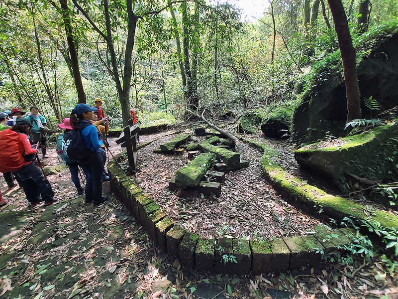
09:24 Arrived at Checheng 車埕 and Workers' Cookstove left from the old days.

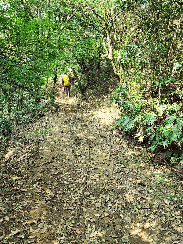
09:25 Turned to Japanese Trail 日人路. This part was relaxing. Sorry for the
blurred photo.

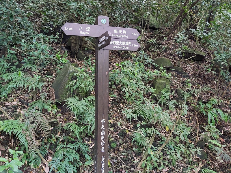
09:32 Reached the junction with a sign pointing to Payan 八煙 (2.4k), Qingtiangang
擎天崗 (2.4k), Jinbaoli Gate 金包里大路成門 (1.4k)
09:40 Reached Stone Quarry 打石場. We took a short break.
While taking a break, I saw a beautiful butterfly.

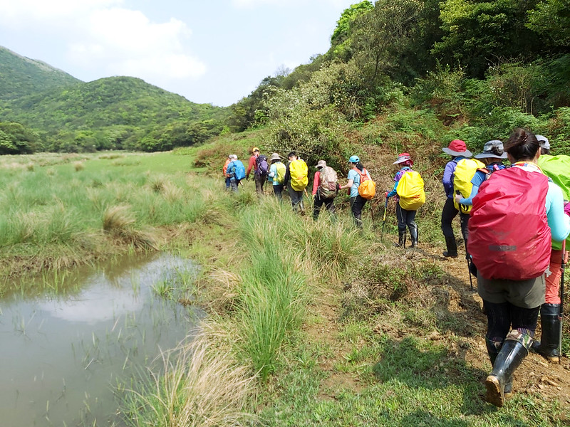
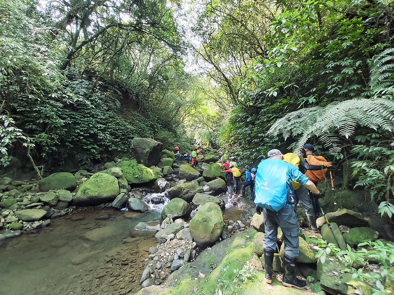
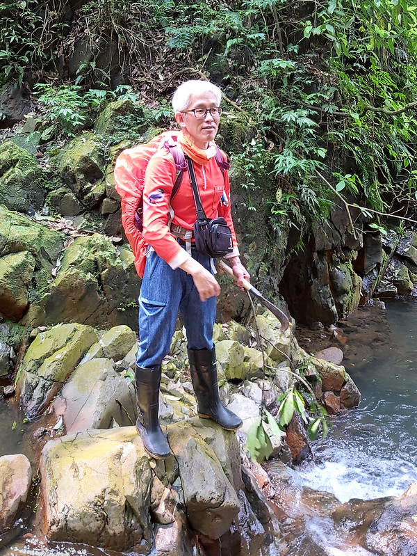
09:46 Entered Shanhuang Creek 上磺溪 and started river tracing. The easy hike was
over now. The terrain was the natural dirt path or intertwined with tree roots or rocks.
10:39 Took a short break and saw East-Chinese Many-flowered May-apple 八角蓮 and
the rare flowers. I didn't even see those if it wasn't Acer who pointed that out for us.

11:31 Reached a waterfall.
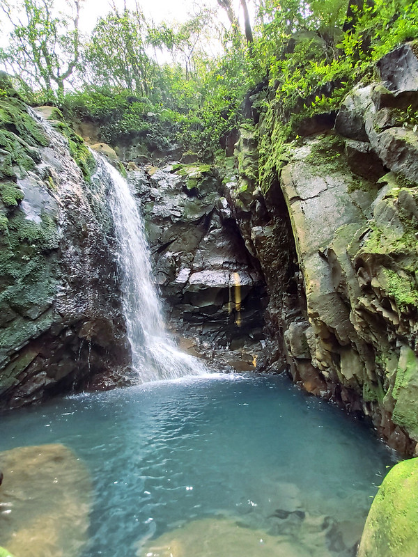
11:49 Went above the waterfall.

12:28 Took a 30-minute lunch break by the creek. According to our guide Acer's
plan, we were supposed to hike other peaks. But it always takes longer for a group of hikers. Yet, Acer is super
fit, and he can walk very fast. So, he decided to change the plan, so we took a shorter route to finish this
hike.

When we were taking a break, someone saw a snake. Acer went closer to check the snake. It was a Ptyas dhumnades 過山刀.
Found a #snake and it was still alive! Our guide said it was Ptyas dhumnades. pic.twitter.com/yXpZWfMWJ1
— Anusha Taiwan Hikes (@AnushaHiking) March 28, 2021
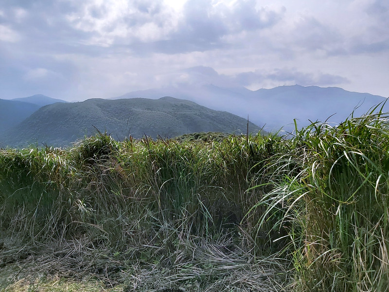
13:17 Reached Cuicui Valley 翠翠谷. We were surrounded by mountains, including Mt.
Huangzui (912 meters), Mt. Huangzui North Peak (893 meters), and Mt. Dajianhou 大尖後山 (885 meters).

I saw many Asian Mazus
通泉草, Taipei
Climbing Violet 台北堇菜.


13:45 Reached the junction to Cuicui Valley 翠翠谷, Mt. Huangzui Entrance (2.1k),
Mt. Huangzui (0.9k), Daping 大坪, Lukuping 鹿崛坪.

Saw rope on the trail. This rope is to help hikers find their way called Anti-lost Rope 防迷地線, literally meaning
trail rope to prevent getting lost. I just wrote a post about How to Stay Alive While Getting Lost on the Trails in Taiwan.
Yangmingshan National Park set up this rope. The whole Yangmingshan area is easily covered by fog. It isn't easy
to find the way out in the fog when this happens. Several tragedies were happening in the fog before.
Our guide Acer told us it's still easy to get lost here in good weather because the tall grass covers up the
trails.
I have to say I got tripped by the rope several times.
13:56 Reached a saddle and looked at Mt. Zhuzi Front Peak 竹子山前峰 (1,043 meters),
Mt. Zhuzi 竹子山 (1,094 meters), and Mt. Zhuzi North Peak 竹子山北峰 (1,074 meters).

14:08 Went uphill again.
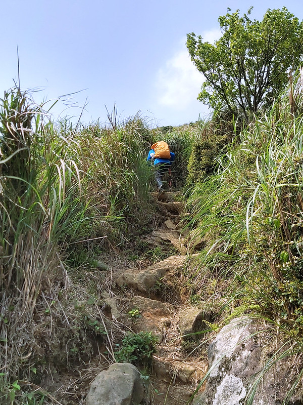
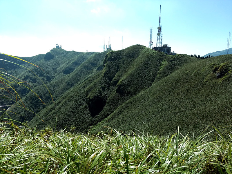
14:16 Reached the ridge. The terrain became very flat, and the grass is the
primary vegetation here.


14:22 Arrived at Mt. Huangzui. Acer took us to see the volcano crater, Mt.
Dajianhou, and Mt. Xiaoguanyin.


15:11 Left Mt. Huangzui and headed to the shelter.
15:43 Arrived at the shelter. The full name of the shelter is Mt. Huangzui
Ecological Protection Area Shelter.
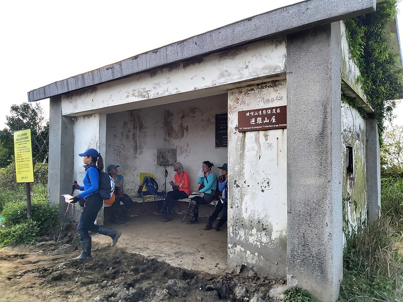
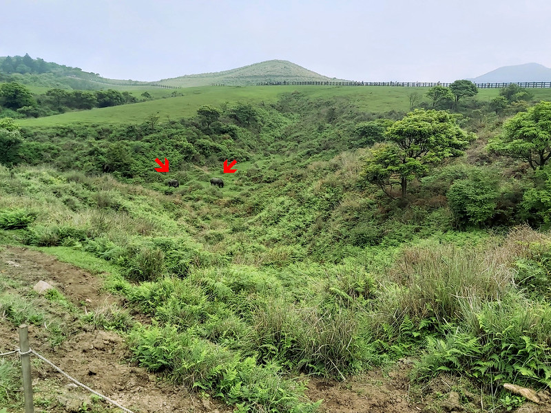
Acer is a volunteer at Yangmingshan National Park. He knows this place very well. He said buffaloes also take
this place as a shelter in winter. How did they find out? When they came here, the shelter was full of
buffaloes' droppings.
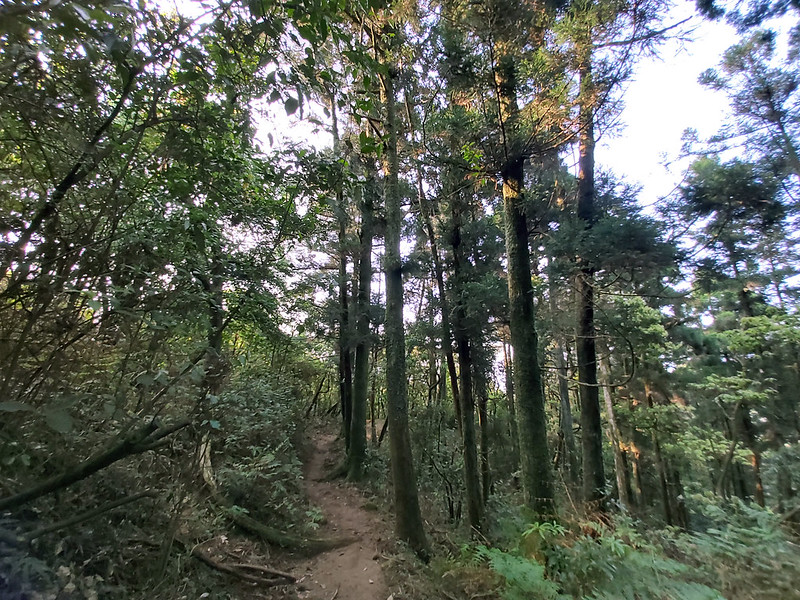
16:17 Entered Japanese Cedar woods.
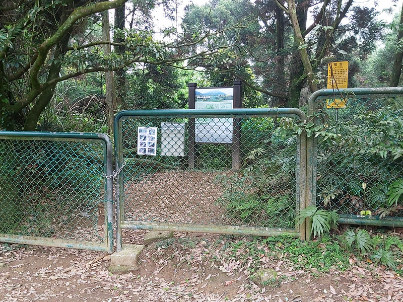
16:37 Left the gate of Mt. Huangzui Ecological Protection Area. Yangmingshan
National Park will give hikers a set of codes to open the gate when they leave this area. Don't worry. They will
change the code from time to time.
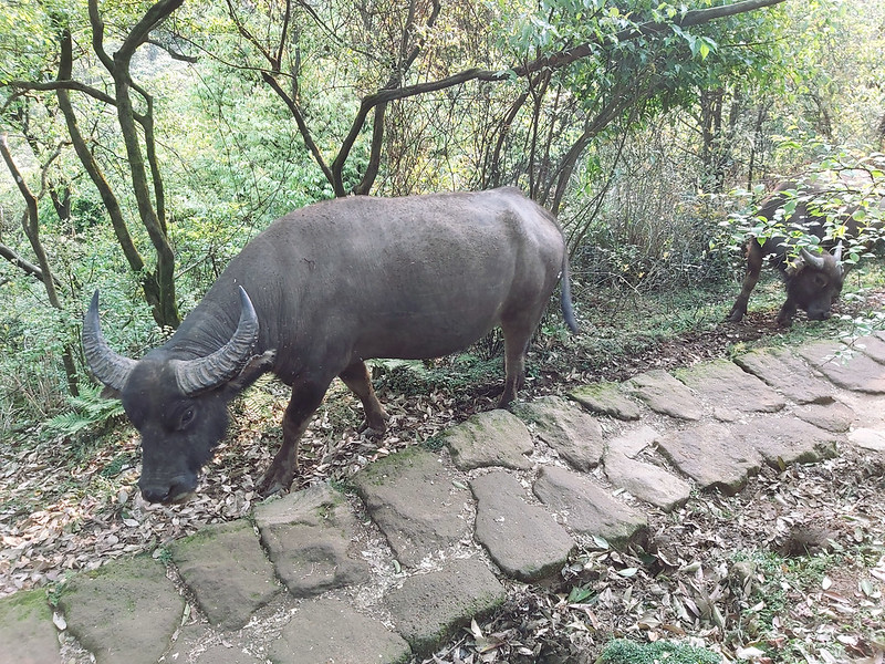
16:37 The encounter of feral water buffaloes.
#Buffalos coming. Humans scrambled to yeild. Probably only in #Yangmingshan #Taiwan. pic.twitter.com/NWgn1ag93d
— Anusha Taiwan Hikes (@AnushaHiking) March 28, 2021
I was scared to see those buffaloes here because we met at the narrow path, nowhere to dodge them. Please don't
get too close to them to take photos when you see them at Yangmingshan. Please stay away from them, especially
those with cubs.
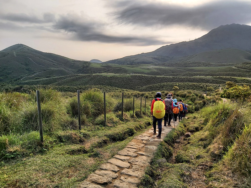
16:43 We reached Qingtiangang and tried to look for Qingtiangang East Peak, 783
meters. I wouldn't know there was a Qingtiangang East Peak if it wasn't Acer. It took us a few minutes to find
the geological survey stone 精密導線基石 hidden in the grass.

16:55 Passed Jinbaoli Historical Trail gate. We stopped here to look at the
smoke coming out of the sulfur craters near Mt. Dayoukeng 大油坑山.


Then, we headed to the bus stop at Qingtiangang and called it a day.