Yangmingshan Series: A Complete Guide of Trails at Yangmingshan National Park and Public Transport
Yangmingshan National Park is a gem for both visitors and locals. It is easily accessible within an hour by
bus from downtown Taipei City. Discover an array of popular trails in Yangmingshan, each offering different
difficulty levels. This guide provides essential information on how to reach the trailheads using public
transportation. Elevate your Taipei experience into an unforgettable adventure.
This ongoing project is a gateway to a multitude of hiking routes, ensuring there's always something new to
explore in Yangmingshan. Get ready to embark on an unforgettable journey, and stay tuned as we continuously
update the links below with new and exciting posts! Adventure awaits in Yangmingshan National Park - don't
miss this opportunity to explore its beauty and bounty!

Disclaimer:
All content is for inspiration only. Use Taiwan Hikes' suggestions at your own risk. We are not responsible for any losses, injuries, or damages.
All content is for inspiration only. Use Taiwan Hikes' suggestions at your own risk. We are not responsible for any losses, injuries, or damages.
Table of Contents:
- About Yangmingshan National Park and Active Volcano
- Exploring Yangmingshan: Public Transport Tips, Download, and Accommodation
- Things to See on the Trails at Yangmingshan
- Trail Systems and Popular Routes at Yangmingshan (Update Constantly)
- Essential Gear for Tackling Yangmingshan's Terrain
- Related Posts
About Yangmingshan National Park and Active Volcano
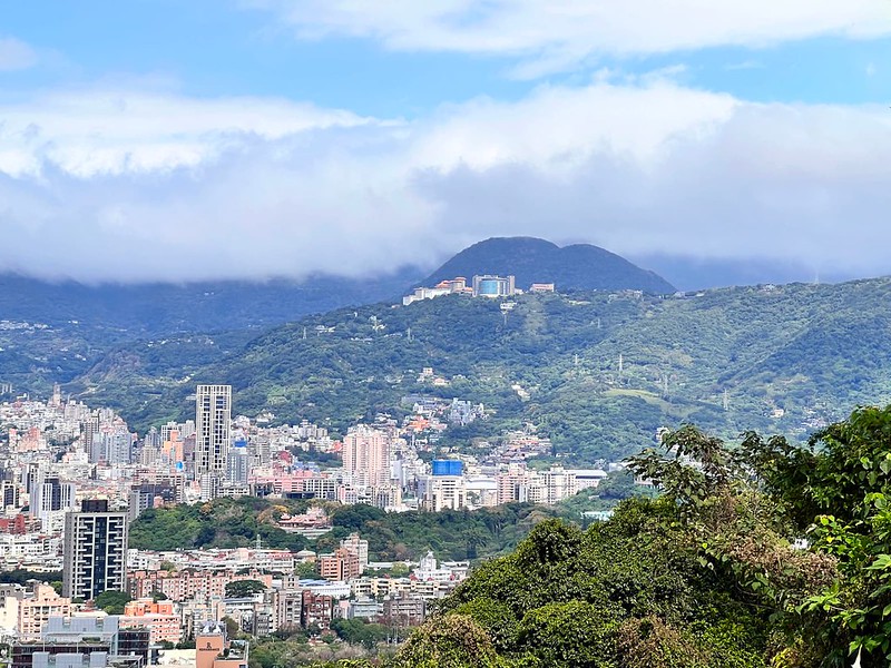
Yangmingshan National Park, located at the northern edge of Taipei Basin, is one of the nine national parks in
Taiwan. Yangmingshan is surrounded on the north by Mt. Zhuzi 竹子山, on the east by Mt. Huangzui 磺嘴山 and Mt.
Wuzhi 五指山, on the south by Mt. Shamao 紗帽山, and on the west by Mt. Honglu 烘爐山 and Mt. Miantian 面天山 (part of
Datun Volcano Group). Mt. Huangzui is the biggest volcano crater at Yangmingshan.
The area of Yangmingshan, 11,334 hectares (28,007 acres), covers many districts of Taipei City and New Taipei
City, and the altitude ranges from 200 to 1,120 meters above sea level. The highest mountain at Yangmingshan,
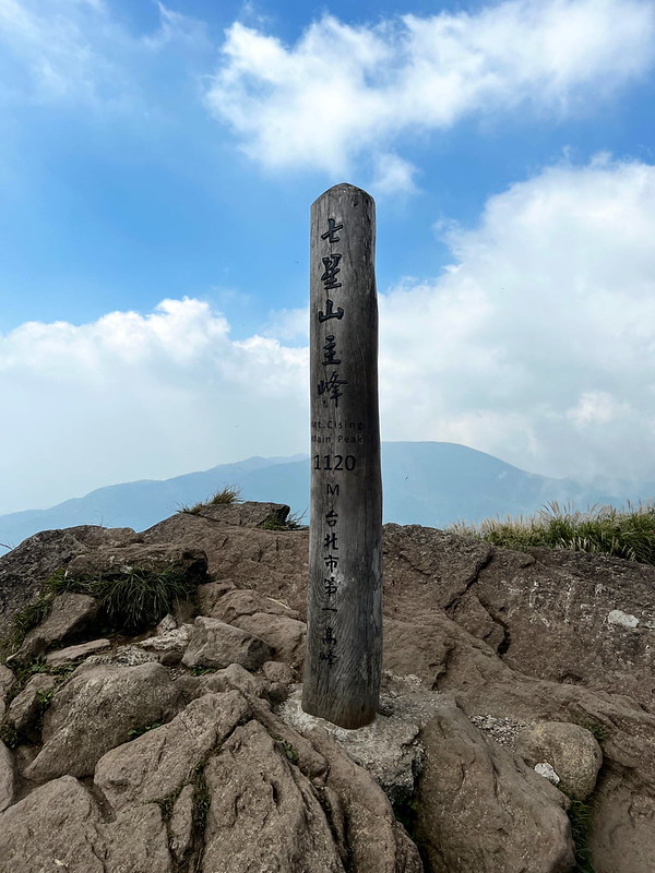
also in Taipei City, is Mt. Qixing 七星山, 1,120 meters above sea level.
In Chinese, Shan literally means mountain. Thus, Yangmingshan is Yangming Mountain. Actually, you will NOT
find any mountain at Yangmingshan National Park called Yangming Mountain. Yangmingshan, Caoshan 草山, or Grass
Mountain, is a general name that refers to Mt. Datun, Mt. Qixing, and Mt. Shamao.
However, there is a Caoshan or Grass Mountain near Mt.
Canguanliao 燦光寮山 in Ruifang 瑞芳.
Volcanic Activities at Yangmingshan:
Sitting on the Pacific Ring of Fire, experiencing constant earthquakes is a part of daily life for people who
call Taiwan home.
The landforms at Yangmingshan are shaped by the Datun Volcano Group 大屯火山群. According to
Yangmingshan National Park, Datun Volcano Group was most active between 800,000 and 600,000 years ago.
Frequent eruptions occurred at Mt. Ding Huo Qiao, aka Mt. Jhongfuzhih 丁火巧山 or 中幅子山 (471 meters), around 2.8 to
2.5 million years ago.
Mt. Zhuzi 竹子山, Mt. Qixing, Mt. Huangzui, and Mt. Xiaoguanyin 小觀音山 frequently erupted between 800,000 and
300,000 years ago.
Then, only Mt. Honglu and Mt. Miantian erupted frequently, and Mt. Shamao was formed. After that, Datun
Volcano Group became dormant.

It is said that the last eruption of Datun Volcano Group was 6,000 years ago.
A Dormant or Active Volcano?
So, is Datun Volcano Group an active or a dormant volcano? According to the latest study by Taiwan Volcano
Observatory, Datun is still an active volcano. You can read BBC: How Taipei discovered an active
volcano on its doorstep for details.
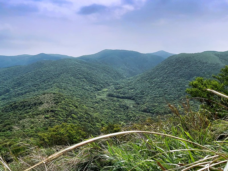
Yangmingshan Geologic Features and Landscapes
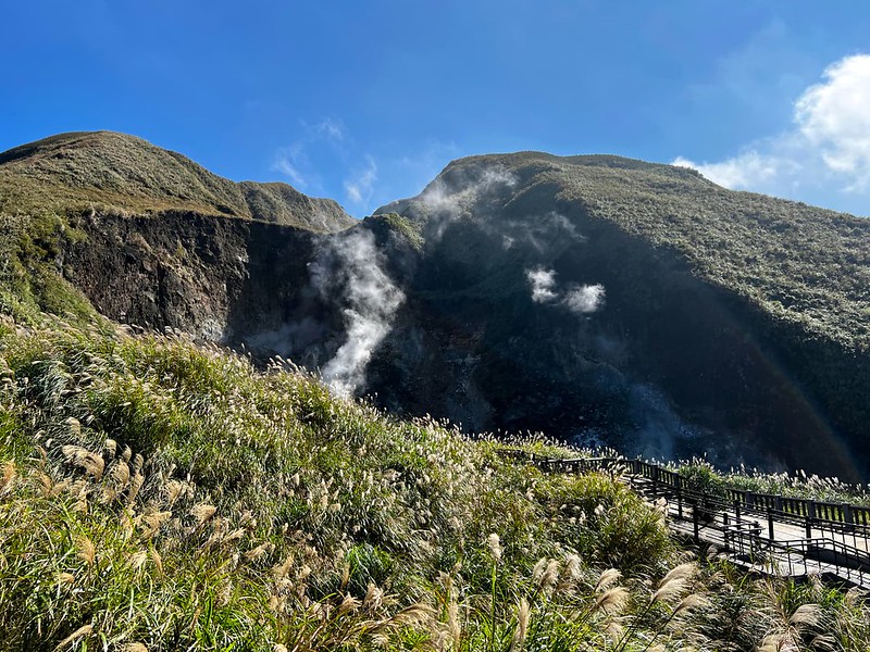
Therefore, it's not surprising that volcano eruptions have heavily influenced the spectacular landscapes and
terrains at Yangmingshan Nation Park in the past.
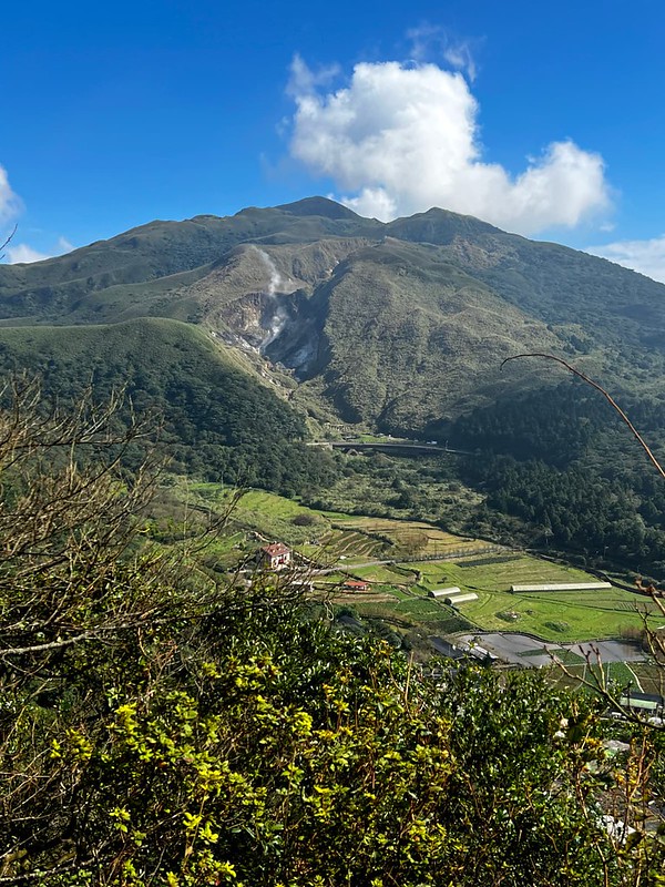
You will find crater at the top of Mt. Huangzui 磺嘴山, also the largest crater at Yangmingshan,
fumaroles spewing sulfur and steam at Xiaoyoukeng 小油坑,
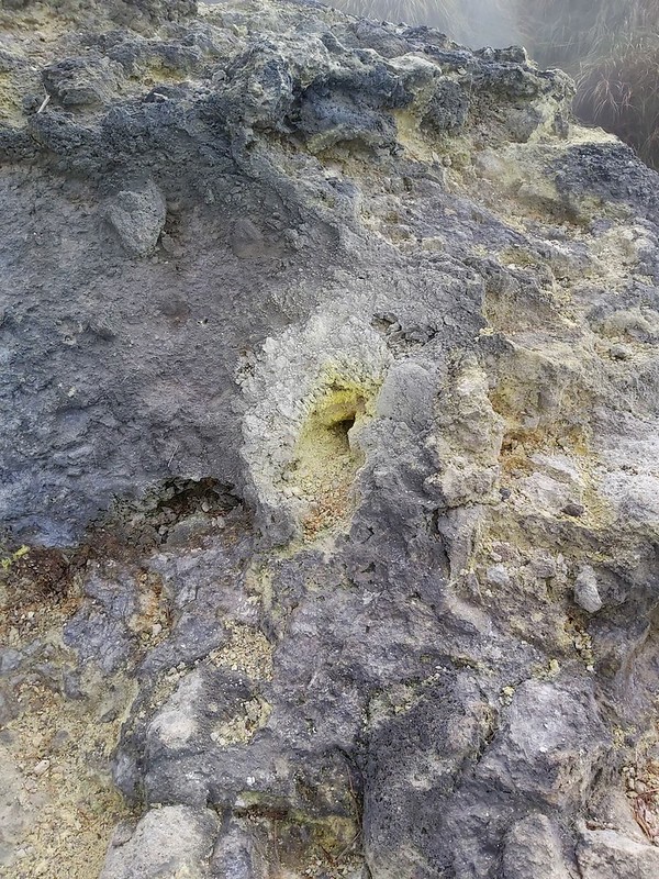
or dome-shaped Mt. Miantian and Mt. Shamao caused by the lava.

Brief History of Caishan or Mt. Grass, the Old Name of Yangmingshan
Politically, the history of Yangmingshan (used to be called Caoshan) can be traced back to the Kangxi Emperor
康熙皇帝 of the Qing Dynasty.
- Qing Dynasty: Many migrants from Fujian Province 福建 came to Caoshan to harvest sulfur and Dajing 大菁 (indigo made from Mayflower Glorybower). During that time, those were the most profitable materials in Taiwan.
- In 1923: the Japanese Crown Prince
Hirohito 裕仁太子 (later Emperor Hirohito 昭和天皇) set off on a 12-day trip to Taiwan. Many infrastructure
developments, including highway, electricity, hot spring facilities, Grass Mountain Chateau 草山行館 or Grass
Mountain Royal Residence, started since then, which laid the foundation of Yangmingshan.
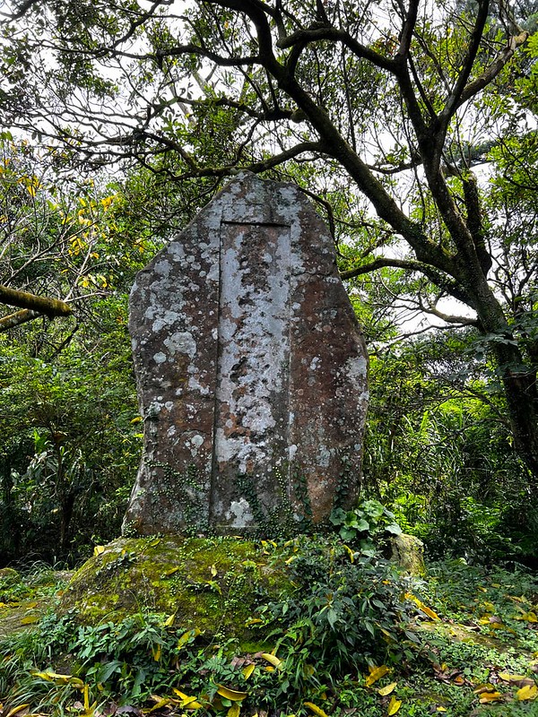
There is a steel, Crown Prince Memorial (Stele) 太子碑, on the trail to Mt. Xiangtian from Qingtian Temple 清天宮 in Beitou. The Beitou people set it up to commemorate Crown Prince Hirohito's visit to Taiwan. - In 1924: the Japanese government
started a 10-year project of forestation at Mt. Datun, which changed the flora at Yangmingshan. If you hike
on Mt. Din (Dinshan) 頂山 Trail, you will enter a forest of Japanese Cedar Trees from an open grassland. This
forest was the result of the forestation project. The Japanese government also established a ranch at Qingtiangang 擎天崗, raising buffaloes. During prime time, the number of buffaloes reached more than 1,000. With the decline of animal husbandry, the number of buffaloes sharply dropped. Most of them ended up feral buffaloes, breeding, roaming, and grazing freely at Qingtiangang.
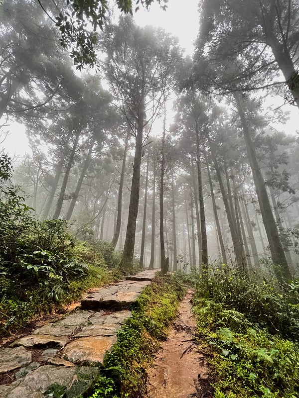
Japanese Cedar Trees on Shitilin Trail 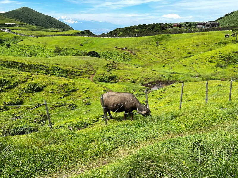
Feral buffaloes have become part of Yangmingshan, but please keep a distance from them for your own safety. - In 1935: the Japanese government started the idea of establishing Mt. Guanyin and Mt. Datun as Datun National Park. This was the first plan to transform Yangmingshan into a national park. The project was brought to a halt due to World War II.
- In 1949: Grass Mountain Chateau, the guest house of Taiwan Sugar Corporation to host the Japanese Crown Prince Hirohito, became the presidential residence of the then-president, Chiang Kai-shek 蔣介石.
- In 1950: Grass Mountain was officially renamed Yangmingshan.
- In 1985: Yangmingshan National Park was born.
Exploring Yangmingshan: Public Transport Tips, Download, and Accommodation
There is daily traffic control on Yangde
Boulevard, especially during blossom seasons. Therefore, taking public transport is recommended.
However, transferring to Yangmingshan can be a hassle, not to mention there are so many trailheads. It's
confusing for local Taiwanese hikers to understand, too.
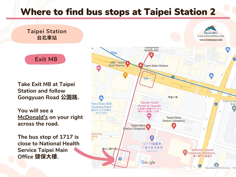
Bus 108 at Yangmingshan Stop is the main route to most trailheads. Here's an infographic of transferring buses
from 3 MRT stations to Yangmingshan Stop and the most popular attractions.


Planning a permit-free hike by bus?
Skip the research. This guide covers 41 relaxing, permit-free trails in every Taiwan county — with trailhead maps and the exact public transport to reach each one. Everything you need to just show up and hike.
Get all 41 trails + maps →Things to See on the Trails at Yangmingshan
There are so many amazing things to see at Yangmingshan. Here are some of them I saw on the trails over the
years:
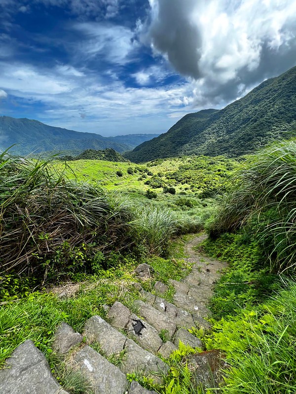
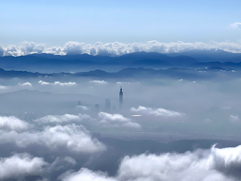
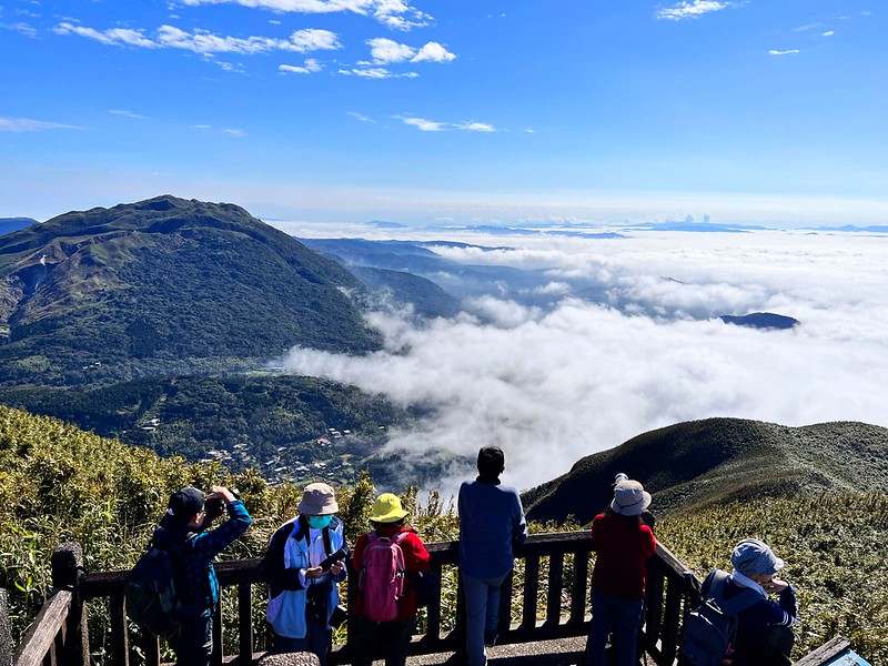
sunrise and sunset,
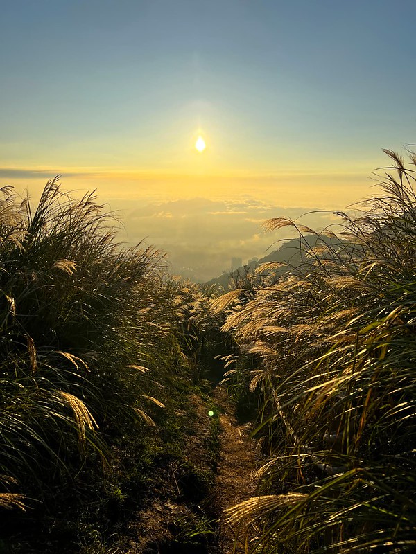
sea of clouds,
blossoms all year round,

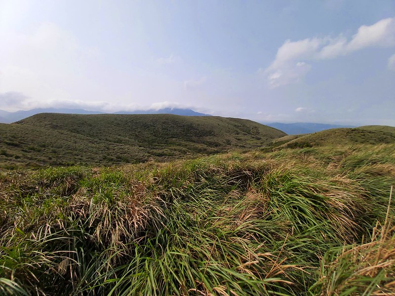
silver grass in autumn,

historical relics, old trails and more.

If the weather is cold enough, you can see snow, too. It snowed again on January 23, 2024.

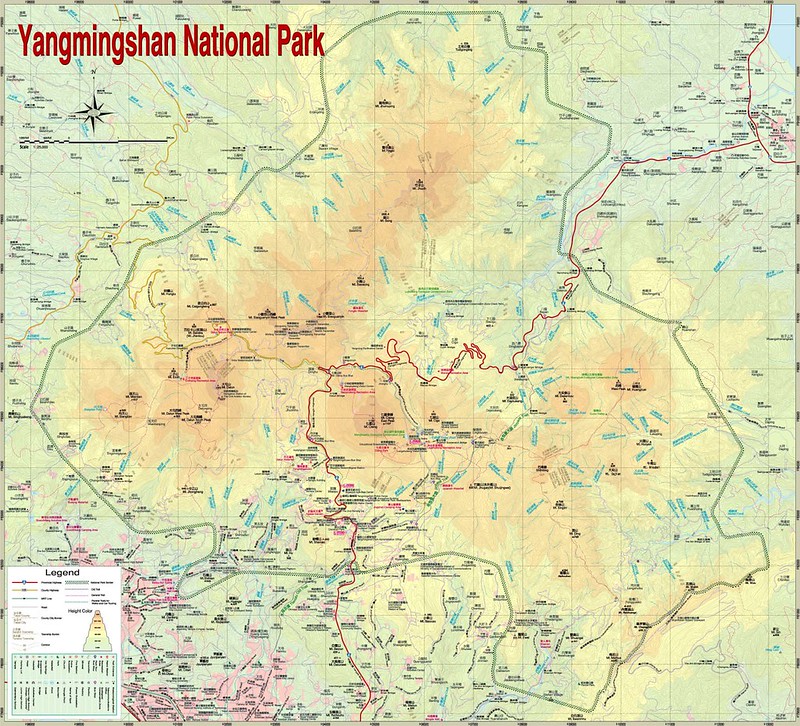
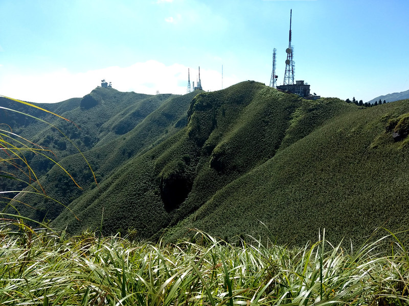
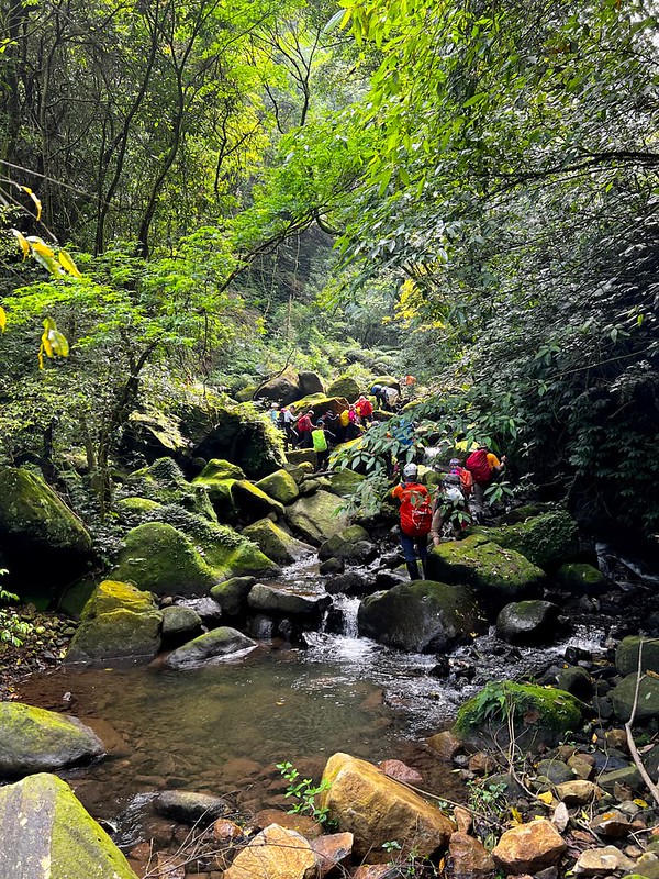
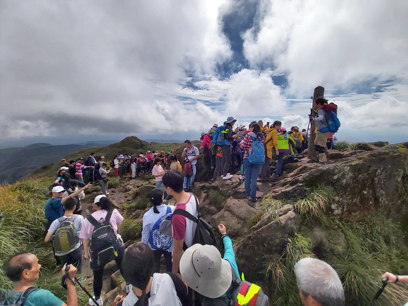
Trail Systems and Popular Routes at Yangmingshan
I made this list based on Yangmingshan National Park's website. There are 16
official trails at Yangmingshan, but the actual number is more than 16.
Local hiking groups develop many routes, and you can make your own routes, too. However, if you are new to
Yangmingshan, please stay on the footpaths.
I don't put all the routes here because those are easy to navigate by following the footpaths. You will see
the difficulty levels rating from 1 star as the easiest trail and 5 stars as the most difficult one.
I've done most of the trails here and will update the links when the posts are ready to publish.
Qixingshan (Mt. Qixing) Series
- Mt. Qixing Main Peak and East Peak Trail, Plus Dinosaur Kissing
Stone, Mt. Ketagalan 凱達格蘭山 (Qixing Zhui 七星錐), and Xiaoyoukeng 小油坑. Difficulty level:

- Tianmu Water Pipe Trail, Cuifeng Waterfall and Shamaoshan.
Difficulty level:

Datunshan (Mt. Datun) Series
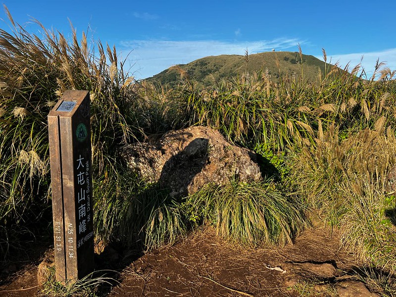
- Mt. Datun Main Peak, South Peak, West Peak to Qingtian Temple.
Difficulty level:

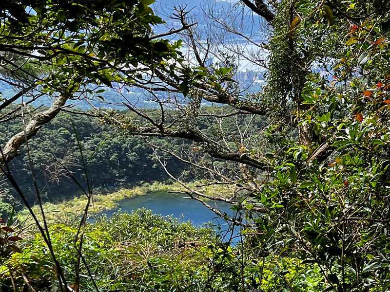
- Mt. Miantian, Mt. Xiangtian, and Xiangtian Crater Pool (or Pond)
向天池 Difficulty level:
Qingtiangang Series
- Jinbaoli Trail 金包里大路 (Yulu Historic Trail north section 魚路古道北段),
Japanese Trail 日人路 (finished the hike, post coming soon.) Difficulty level:
- Mt. Din (Dingshan) 頂山 to Mt. Shiti Trail 石梯嶺 (finished the hike,
post coming soon.) Difficulty level:

- Other Old Trails like Neishuangxi Old Trail 內雙溪古道 and Dutch Old Trail 荷蘭古道

Zhuzishan Series
Most areas of Zhuzishan or Mt. Zhuzi, Bamboo Mountain 竹子山 belong to the military, and hikers are not allowed
to enter.
- The Biggest Waterfall at Yngmingshan: Hike to Alibang Waterfall
阿里滂瀑布 from Qingshan Waterfall 青山瀑布 (finished the hike, post coming soon.) Difficulty level:

Thru Hikes or Long Distance Hike 縱走 in Chinese
- Yangmingshan East to West Thru-Hike, or Yangmingshan East–West
Vertical Traverse 陽明山東西大縱走 Difficulty level:
- Yangmingshan South to North Thru-Hike 陽明山南北大縱走
Ecological Protected Areas (Permits Required)
- Kujiaokeng Protected Area: Fenglin Waterfall 鹿角坑生態保護區: 楓林瀑布.
- Kujiaokeng Protected Area: Mt. Xiaoguanyin 鹿角坑生態保護區: 小觀音山 (Done this
hike before but plan to do it again.) Difficulty level:
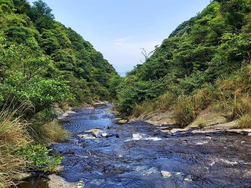
- Mt. Huangzui Protected Area 磺嘴山生態保護區: A Secret River
Tracing Trail to Mt. Huangzui and Cuicui Valley. Difficulty level:

Other More Challenging Routes
- Tam-Kee Crossing Trail (The Tam-Kee Crossing Track from YMS website): Tamsui to Keelung Trail East Section from Qingtiangang to Dawulun in Keelung 淡基橫斷古道東段(擎天崗-大武崙東都大樓)

Essential Gear for Tackling Yangmingshan's Terrain
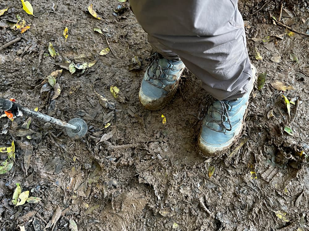
A Pair of Boots or Shoes with Good Frictions
Navigating Yangmingshan's stone steps or muddy trails demands footwear with unbeatable friction because they
are still slippery even when the weather is sunny. While the local hikers resort to rain
boots/gumboots/wellies for a grip, this is not for everyone.
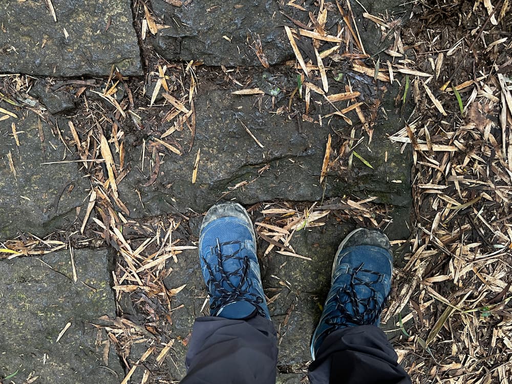
My favorite hiking boots are Scarpa hiking boots. They provide significant friction
against muddy trails and water resistance without compromising the comfortability. They fit my big, wide feet
well. These boots give me the confidence to tackle all the trails in Taiwan.
Trekking/Hiking Poles
Since 2017, I've relied on the exceptional performance of Komperdell trekking poles. These poles offer the perfect blend of durability and
lightweight design, all while being incredibly budget-friendly.