Yangmingshan Series: 4+ Routes to Enjoy Views and Sea of Clouds at Mt. Datun Multi-Peak Trail
Listed as one of Taiwan's most beautiful places by CNN in 2019, Datunshan, aka Mt. Datun, casts a magic spell
and attracts visitors to keep coming back. In this post, you will find out different routes about how and what
to enjoy this only active volcano at Yangmingshan National Park in Taiwan. Plus, the public transport guide
makes your hike much more effortless.
Mt. Datun, 1,092 meters (3,582.7 feet), the third highest peak in Taipei City, is also listed as the first
peak of 100 Minor Peaks (Xiao Bai Yue), the more accessible version of Taiwan's 100 Peaks.
The highest peak in Taipei City, Mt. Qixing, 1,120 meters (3,674.5 feet), is listed as No. 2.

Disclaimer:
All content is for inspiration only. Use Taiwan Hikes' suggestions at your own risk. We are not responsible for any losses, injuries, or damages.
All content is for inspiration only. Use Taiwan Hikes' suggestions at your own risk. We are not responsible for any losses, injuries, or damages.
Table of Contents:
About Mt. Datun Peaks and Active Volcano
Datunshan Volcanic Activities
The landforms at Yangmingshan are shaped by the Datun Volcano Group 大屯火山群. According to
Yangmingshan National Park, Datun Volcano Group was most active between 800,000 and 600,000 years ago.
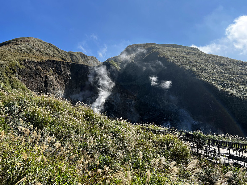
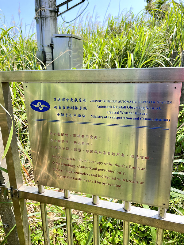
Frequent eruptions occurred at Mt. Ding Huo Qiao, aka Mt. Jhongfuzhih 丁火巧山 or 中幅子山 (471 meters), around 2.8 to
2.5 million years ago.
Mt. Zhuzi 竹子山, Mt. Qixing, Mt. Huangzui, and Mt. Xiaoguanyin 小觀音山 frequently erupted between 800,000 and
300,000 years ago.
Then, only Mt. Honglu and Mt. Miantian erupted frequently, and Mt. Shamao was formed. After that, Datun
Volcano Group became dormant.
It is said that the last eruption of Datun Volcano Group was 6,000 years ago.
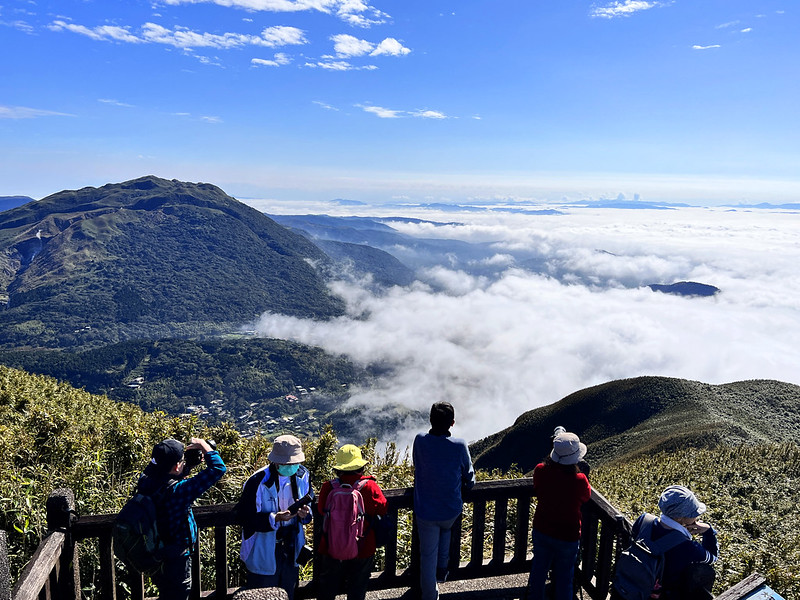
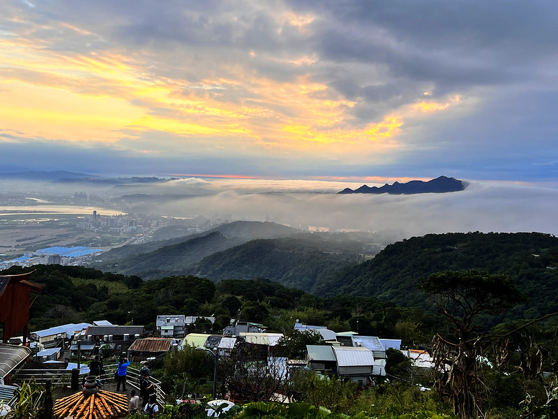
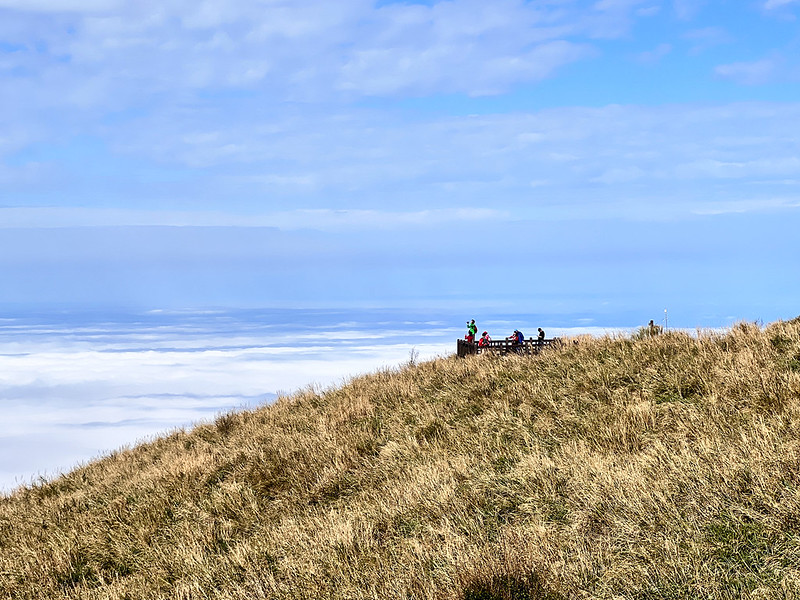
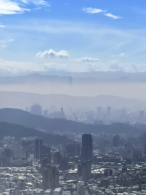
Sunrise, Sunset, and Sea of Clouds in Autumn and Winter
Other than the fantastic layers of mountains, there are different amazing views to enjoy from Mt. Datun, the
sunrise, sunset, and the sea of clouds.

You can enjoy the sunset at Mt. Datun Main Peak and the other two peaks, but hiking in the evening at Mt.
Datun West and South Peaks might be dangerous.

Another great spot to see the sunset is near Qingtian Temple, which is close to the bus stop.
The best time to see the sea of clouds at Mt. Datun is in autumn and winter. I highly recommend an app called
Yuan Hai Ren 雲海人, meaning Sea of Clouds Men in Chinese.
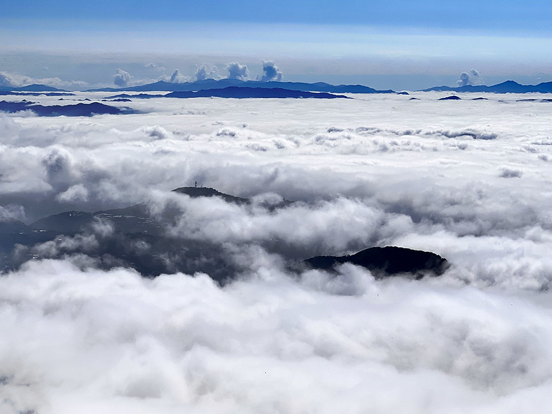
If you are curious about the accuracy of this app, I had the same doubt, too. When I was heading to Mt. Datun,
the weather was still cloudy at Yangmingshan Bus Stop. I wasn't sure I had made the right call to rush to Mt.
Datun. While those questions kept popping up in my head, I saw the clouds clear up and the blue sky.

This is the best sea of clouds I've ever seen at Mt. Datun.
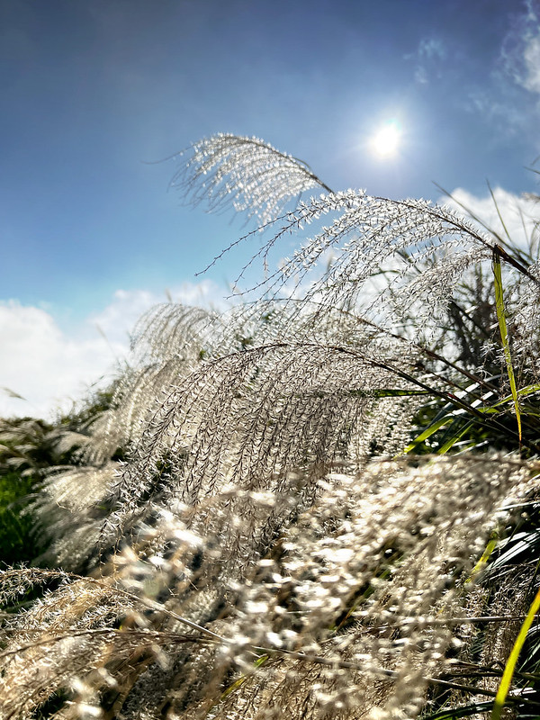
Silver Grass in Autumn
Mt. Datun is also a great spot to see the beautiful Silver Grass in autumn.
Peaks to Reach
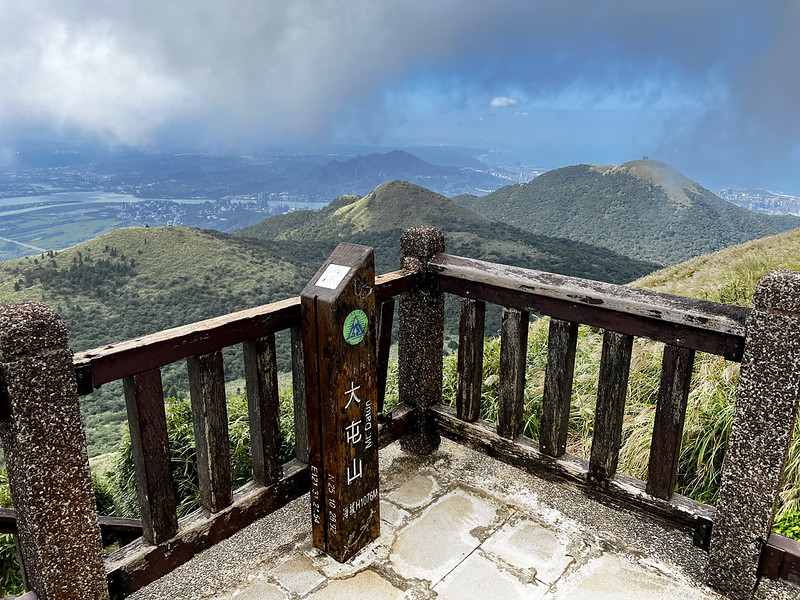
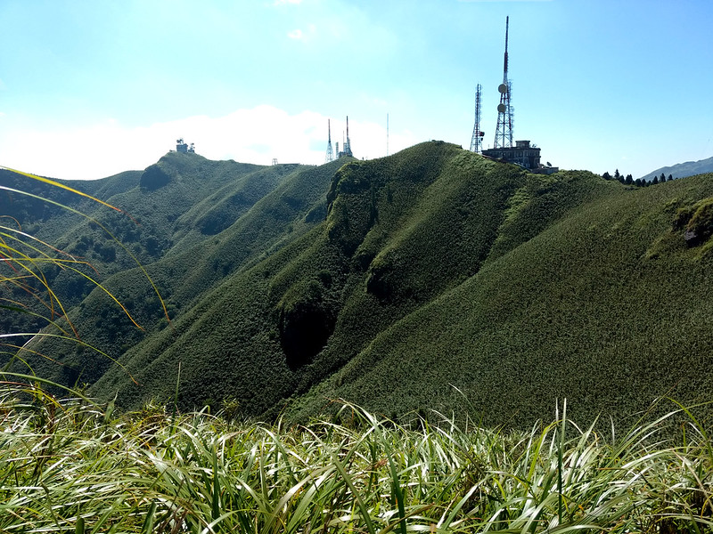
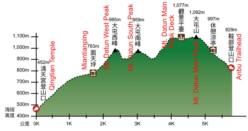
- Mt. Datun, 大屯山, 1,092 meters (3,582.7 feet). There are 3 triangulation stones at Mt. datun: a Class 2, a Class 3, and control point.The Class 3 Triangulation Stone is inside Datunshan Navaids Site ANWS CAA 大屯山助航台, but it's not open to the public. So, we take the post at the observation deck as the peak (1,077 m). Mt. Datun is also listed as No. 1 on Xiao Bai Yue or 100 Minor Peaks in Taiwan.
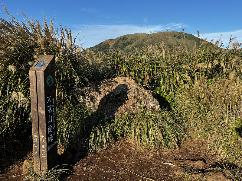
- Mt. Datun South Peak, 大屯山南峰, 957 meters (3,139.8 feet)
- Mt. Datun West Peak, 大屯山西峰, 982 meters (3,221.8 feet)
- Mt. Datun Southwest Peak, 大屯山西南峰, 863 meters (2,831.4 feet).
A Wild Boar Encounter near Mt. Datun Southwest Peak
It's evident that Mt. Datun Southwest Peak isn't popular because of the overgrown grass. After struggling with
the grass, Cris and I were very close to the peak.
Suddenly, the roar of a wild boar startled us. I saw it jump into the bush, and I stepped back at least 10
steps, which might be the fastest walking backward in my life.
Cris didn't see the wild boar but heard it and saw my freaking-out face. We stayed put for at least 5 minutes,
pondering whether to continue or give up. We even Googled what to do. Then Google said, RUN. So, we aborted
the plan to see this peak. Perhaps another day.
Later, we shared this encounter with Acer. Acer said he had met wild boars on the trails several times, and he
often continued his hike. Usually, they fear humans and will run away as soon as possible. But Acer often
carried a machete when doing hikes. So, it's still a good idea to run if you ask me.
How to Get There by Public Transport
There are 20+ buses to Yangmingshan, and we usually transfer to the attractions at least twice or thrice.
Therefore, I made a Yangmingshan public transport guide to make life easier. I try to make this guide handy
and easy to understand, so I only put the most popular trails and tourist attractions in this guide. You will
also find the maps of the bus stops at MRT Jiantan Station, MRT Beitou Station, and Taipei Station.
Map/GPX Data
The following map is from Anbu to Qingtian Temple. Trails at Yangmingshan are well-marked. You can follow the
steps and the signs to get to your destination.
This map is from MRT Zhongyi Station to Mt. Datun and exits at Anbu. Please note that this route is challenging
and steep, almost hiking from 0 meters to 1,077 meters, plus the ups and downs.
Click Menu in the map to download, print, or share the map.
You can see more options after clicking the Play button.
Click to change the speed to meet your condition.
You can see more options after clicking the Play button.
Click
to change the speed to meet your condition.
Planning a permit-free hike by bus?
Skip the research. This guide covers 41 relaxing, permit-free trails in every Taiwan county — with trailhead maps and the exact public transport to reach each one. Everything you need to just show up and hike.
Get all 41 trails + maps →4+ Routes to Do Mt. Datun Peaks from Easy to Difficult
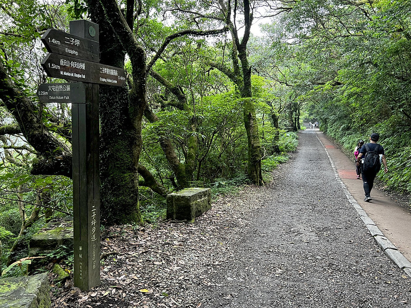
There are at least 4 trailheads to Mt. Datun: Anbu 鞍部, Erziping 二子坪, Qingtian Temple 清天宮, and MRT Zhongyi
Station 忠義捷運站. You can just do Mt. Datun Main Peak, or explore West Peak, South Peak and more.
The 4 routes to do Mt. Datun from the easiest to the most challenging one:
- From Anbu to Mt. Datun to Erziping, the Vice Versa
- From Anbu to Mt. Datun Main Peak, South Peak, West Peak to Erziping, and Vice Versa
- From Anbu to Mt. Datun to Qingtian Temple, and Vice Versa
- From MRT Zhongyi Station, via Datun Valley to Mt. Datun
From Anbu to Mt. Datun to Erziping, the Vice Versa
Brief itinerary: Anbu (829m) ➔ Mt. Datun observation deck near Datunshan Navaids Site ANWS CAA
大屯山助航台 (1,077m) ➔ Datunping (around 890m) ➔ Erziping (815m) ➔ Erziping Visitor Center
GPS coordinates of Anbu: 25.183161, 121.529198
GPS coordinates of Erziping Visitor Center: 25.186223, 121.525198
GPS coordinates of Erziping Visitor Center: 25.186223, 121.525198
Distance: 5.3 km (3.3 miles)
Route type: Point to point
Hours Needed: 1 to 2 hours
Best Time to Go: All year round, but it can be very hot in summer
Permits: Not required
Difficulty Level:
Route type: Point to point
Hours Needed: 1 to 2 hours
Best Time to Go: All year round, but it can be very hot in summer
Permits: Not required
Difficulty Level:
This might be the easiest way to enjoy Mt. Datun. Mt. Datun Observation Deck can even be reached by bike,
motorcycle, or car.
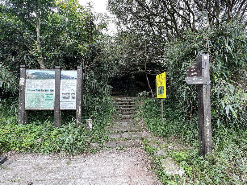
If you get off Bus 108 at Anbu stop, walk further, and you will see a parking lot. The trailhead to Mt. Datun is
on the left-hand side.
From there, we take the endless stone steps franked by dwarf bamboo.

When you take a break on the steps, remember to turn around to see the beautiful Mt. Xiaoguanyin 小觀音山. Mt.
Xiaoguanyin is a protected area, and hikers must apply for permits to take the hike.
Good morning from Datuanshan. #mountains #nature #Yangmingshan #Taiwan pic.twitter.com/XgjlCdEPjr
— Anusha - Taiwan Mountains (@AnushaHiking) January 22, 2023
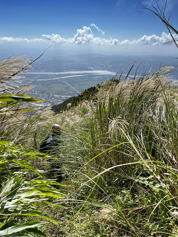
While taking the steps, you will see a junction. Remember to take a detour and stop at the deck near the road.
You will see the whole Tamsui 淡水 and Sanzhi 三芝 from here or the great clouds like cotton candy flowing.

The actual First-class Triangulation Stone is inside Datunshan Navaids Site. But, it's not allowed to go inside.
So, take the post at the observation deck as the peak. There is also a military base near this site.

The views are lovely here. If the timing is right, you'll see the incredible clouds and Mt. Datun South and West
Peak, Mt. Miantian 面天山, Mt. Xiantian 向天山, and Mt. Quanyin 觀音山 on the other side of Tamsui River.
After enjoying the views at Mt. Datun Observation Deck, you can return the same way. Or, you can take the super
steep steps all the way down to take on the south and west peak of Mt. Datun.

By the way, stoves and fires are not allowed at Yangmingshan National Park. So, I bring a thermal with
boiled water to enjoy my coffee.
From Anbu to Mt. Datun Main Peak, South Peak, West Peak to Erziping, and Vice Versa
Brief itinerary: Anbu (829m) ➔ Mt. Datun observation deck near 助航站 (1,077m) ➔ Datunping
(around 890m) ➔ Mt. Datun South Peak (959m) ➔ junction to Mt. Xiaotun ➔ Mt. Datun West Peak
(985m) ➔ Miantianping (junction/pavilion) and take Miantianshan Trail ➔ Erziping (815m) ➔
Erziping Visitor Center
GPS coordinates of Anbu: 25.183161, 121.529198
GPS coordinates of Erziping Visitor Center: 25.186223, 121.525198
GPS coordinates of Erziping Visitor Center: 25.186223, 121.525198
Distance: 7.1 km (4.4 miles)
Route type: Point to point
Hours Needed: 3 to 5 hours
Best Time to Go: All year round, but it can be very hot in summer.
Permits: Not required
Difficulty Level:
Route type: Point to point
Hours Needed: 3 to 5 hours
Best Time to Go: All year round, but it can be very hot in summer.
Permits: Not required
Difficulty Level:
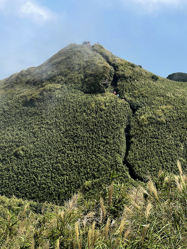
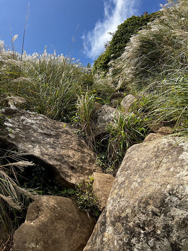
Hiking Mt. Datun South Peak and West Peak is more challenging. It involves mud, climbing, and steep slopes. As
you can see from this profile, the South and West Peaks are steep.
It's endless stone steps from Mt. Datun Observation Deck to Datunping. I once did those steps twice a day for
the training purpose. As you can guess, my legs weren't very happy about it.
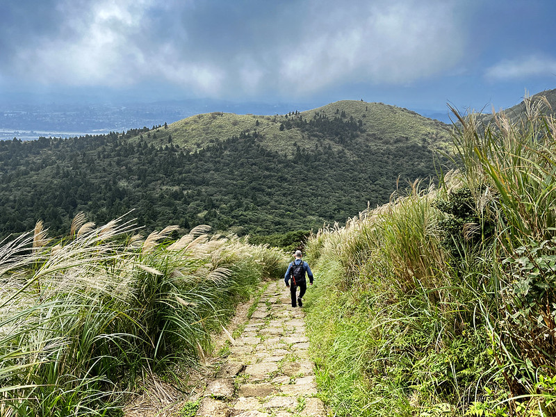
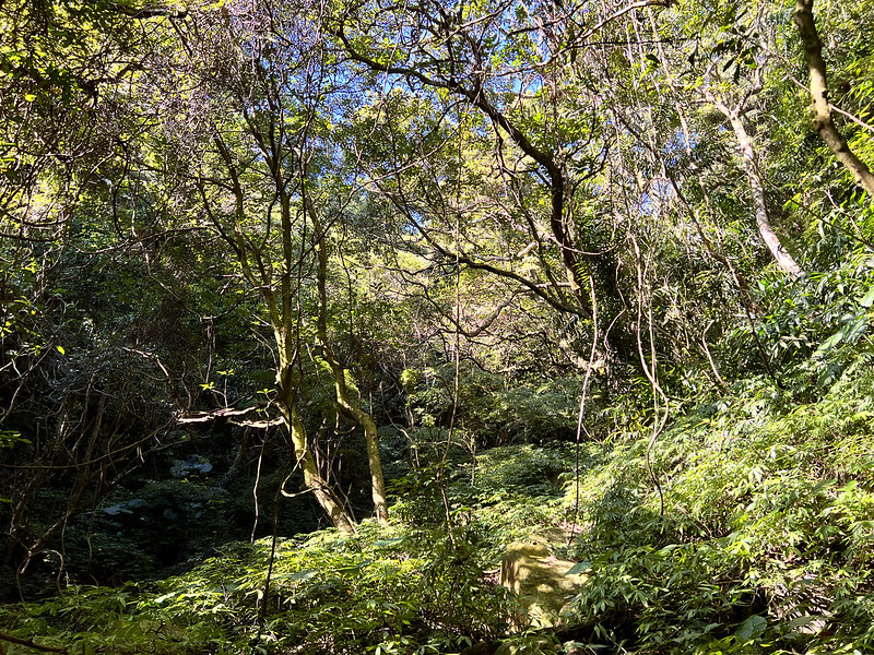
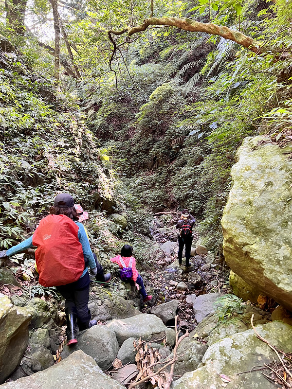
Datunping is the bottom of the valley. The footpath is replaced by the rough terrain from here.


After the slippery and muddy climbing, the hard work pays off. The views are awesome at Mt. Datun South Peak
unless you come on a gloomy day.
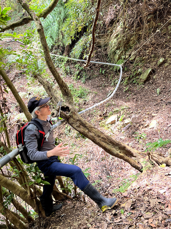
Heading to Mt. Datun West Peak, you will find another slope with ropes.

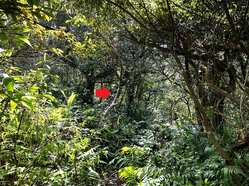
Then we entered the forests. Expect muddy slopes and be cautious when going down. And more muddy slopes with
ropes were waiting for us. If you hike here on the weekends, expect traffic jams while climbing up or
descending.
The views at Mt. Datun West Peak are equally rewarding for the hard work.

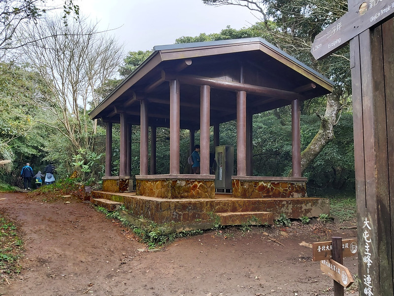
After descending from Mt. Datun West Peak, you will reach Miantianping. You can either head to Qingtian Temple
or go to Erziping.

The trail to Erziping is mostly stone steps, and it can be wet and slippery at some sections. I passed
Mingtianping Stone House after a small bridge. You can take a look around here.
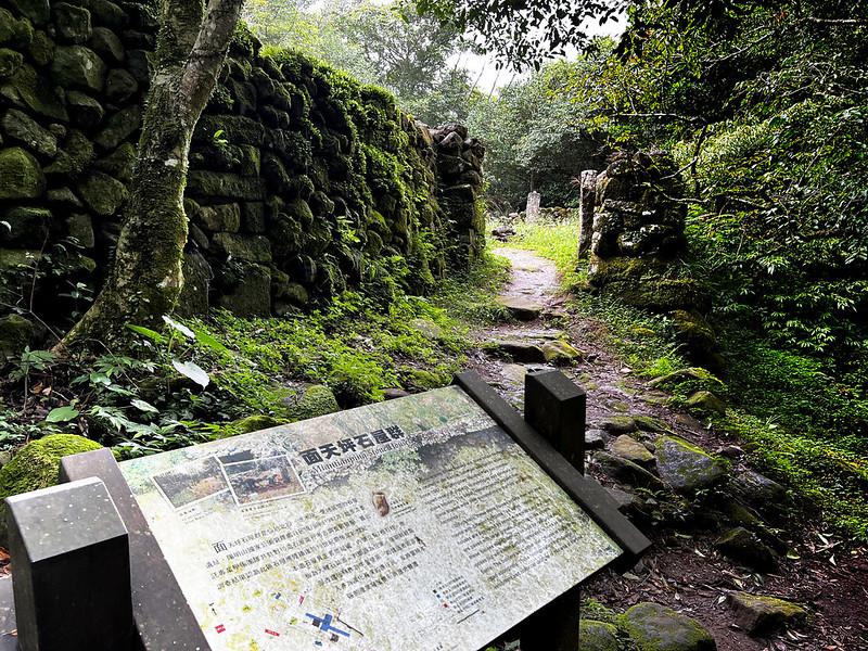
After the stone house, Erziping is near. There are two big ponds with different flowers in different seasons.
There are toliets here.
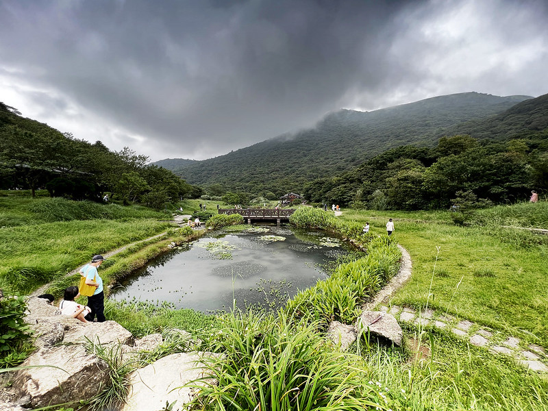
The distance between Erziping and Erziping Visitor Center is around 1.8 km (1.1 miles). The footpath here is
ideal for people of all ages.
The distance between Erziping and Erziping Visitor Center is around 1.8 km (1.1 miles).

From Anbu to Mt. Datun to Qingtian Temple, and Vice Versa
Brief itinerary: Anbu (829m) ➔ Mt. Datun observation deck (1,077m) ➔ Datunping (around
890m) ➔ Mt. Datun South Peak (959m) ➔ Datun West Peak (985m) ➔ Miantianping ➔
Qingtian Temple (452m)
GPS coordinates of Qingtian Temple: 25.160197, 121.501185
Distance: 5.8 km (3.6 miles)
Route type: Point to point
Hours Needed: 4 to 6 hours
Best Time to Go: All year round, but it can be very hot in summer.
Permits: Not required
Difficulty Level:
Route type: Point to point
Hours Needed: 4 to 6 hours
Best Time to Go: All year round, but it can be very hot in summer.
Permits: Not required
Difficulty Level:
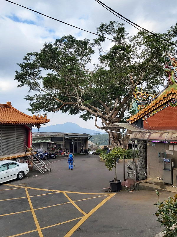
This is my favorite route to Mt. Datun because I only need to transfer one bus from MRT Beitou Station. After
getting off the bus, you will see an old banyan tree that beautifully frames the distinctive contour of Mt.
Quanyin.
The trailhead is right next to the temple. You can find water dispensers and toilets, too. Hikers can even use
the free water and brushes to scrub off the mud from the trail.
The trail is franked by bamboo woods and mostly covered by shade. Sometimes, the local farmers will sell their
produce on the trail.

You'll pass another small temple on the trail called Sansheng Temple 三聖宮, which is not open to the public.

After the temple, you will see the first junction. You can take a left if you want to go to Xiangtian Pond, Mt.
Xiangtian, and Mt. Miantian (post coming soon.) I'll write a post about this hike later.
Continue the trail ahead, and you will see another junction, which is Miantianping. A map and signpost point to
the directions to Mt. Datun West Peak and Erziping. Take a right to Mt. Datun West Peak.
As you might have read in the previous paragraphs, the terrain from Miantianping to Mt. Datun West Peak becomes
rougher, muddier, and steep. You can bring a pair of gloves to prevent rope burns. This section is constantly
muddy, even when the weather is dry.

After reaching another junction, you take the direction to Qingtian Temple. You might catch the sun setting from
Mt. Quanyin if you finish the hike late.

You will find Qingtian Temple, toilets, and a bus stop next to the old Banyan tree.

From MRT Zhongyi Station, via Datun Valley to Mt. Datun
Brief itinerary: MRT Zhongyi Station ➔ Mt. Zhongyi, aka Mt. Sha Lao Bie (233m) ➔ Xian Jui
Pond 仙掘池 ➔ Mt. Xiaopinding (386m) ➔ Qingtian Temple (452m) ➔ water hose trail ➔
Yongchunliao Creek ➔ Datun Valley trail ➔ Mt. Datun South Peak (957m) ➔ Datunping (890m)
➔ Mt. Datun Observation Deck (1,077m) ➔ Anbu
Distance: 13 km (8.1 miles)
Route type: Point to point
Hours Needed: 7 to 9 hours
Best Time to Go: All year round, but it can be very hot in summer.
Permits: Not required
Difficulty Level:
Route type: Point to point
Hours Needed: 7 to 9 hours
Best Time to Go: All year round, but it can be very hot in summer.
Permits: Not required
Difficulty Level:
This one, no doubt, is the most challenging route compared to the previous ones. Yet, there are more various
things to enjoy during the hike. I'll post about this hike later and only mention the highlights here.
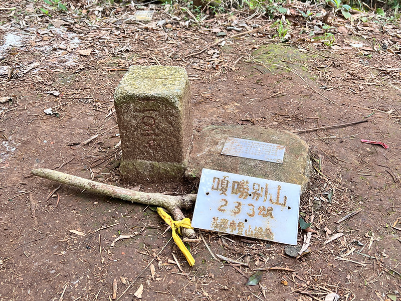
My friend, Acer, took us on this hike. This route takes us to Mt. Zhongyi, aka Mt. Sha Lao Bie, 233m. The
triangulation stone is in the woods, but the view near this mountain is excellent. The route also takes us to
cross some footpaths of Taipei Grand Hike Section 1.
We took a long break at Saci Temple 三慈宮. I highly recommend visiting this place because the view is stunning!
After another relaxing walk, we reached Qingtian Temple. Unlike the previous routes, Acer took us to the
sidehill trail, also called the water hose trail 水管路. Acer told us the residents here still don't have tap water
at home. So, they have to draw the water from the mountain with those long hoses.
We went down the Yongchunliao Creek Valley 永春寮溪谷, and it was slippery and treacherous. But the landscape here
was terrific. It's hard to imagine this place is so close to one of the most populated cities in Asia.
After getting down to the bottom of the route, it was time to go up, and we reached Datun Valley Trail. Then we
reached the junction to Mt. Datun South Peak. After that, Acer took us to other route, which is the story for
another day.

This route has many junctions, and some sections are physically demanding. Therefore, please prepare well when
doing this hike.
