Traditional Route to Angel's Teardrop: Jiaming Lake Trail and 100 Peaks - Mt. Sancha and Mt. Siangyang
Posted by: Anusha Lee
Published date: March 27, 2023
Last update: November 27, 2025
Jiaming Lake Trail (or Chiaming Lake), aka God's Lost Sapphire and Angel's Teardrop, is the second-highest
alpine lake in Haiduan Township, Taitung, Taiwan. The stunning views from the lake, Mt. Sancha, and Mt.
Siangyang (or Xiangyang Mountain) make this high mountain hike one of Taiwan's most popular 100 Peaks.
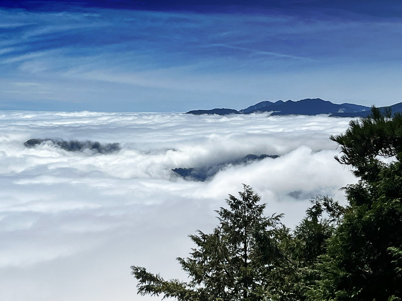
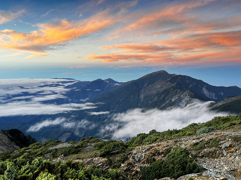
A much fuller Jiaming Lake after the typhoon. I did my third Jiaming Lake hike in 2025.
There are at least 2 routes to Jiaming Lake, the traditional out-and-back route and the Jiemaosi route. I've
done both. This post is the traditional route.
The Jiemaosi route to Jiaming Lake
Important: The railway and highway on Taiwan's east coast are prone to closure during typhoon season
due to landslides and heavy rains.
Disclaimer:
All content is for inspiration only. Use Taiwan Hikes' suggestions at your own risk. We are not responsible
for any losses, injuries, or damages.
Trail Information: Jiaming Lake Trail (Traditional Route)
Trail Name: Jiaming (Chiaming) Lake National Trail (Traditional Route) Distance: 26 km (16.3 miles) Route type: Out and back Days/Hours Needed: 1 to 4 days Total Ascent/Descent: 2,288m/2,288m Best Time to Go: All year round. Many sections are exposed without shade. It
can be windy on the ridges, too. Please do sun protection when you hike. Permits: Please see How to Apply for Permits for details. Difficulty Level: Peaks or Places to Reach:
Mt. Siangyang 向陽山, 3,603 meters (11,820.1 feet) above sea level.
There's a Class 3 Triangulation Stone on the peak. The views are incredible.
Mt. Siangyang North Peak 向陽山北峰, 3,435 meters (11,270 feet) above
sea level. It's a pointed rock at the top and near the place to see Guanshan Big Cliff.
Mt. Sancha 三叉山, 3,496 meters (11,469.9 feet) above sea level.
There's a Class 1 Triangulation Stone on the peak. The views are fantastic. In September 1945, after the
surrender of the Empire of Japan in World War II, an airplane carrying a war of prisoners crashed near Mt.
Sancha. More details later.
Jiaming Lake 嘉明湖, 3,310 meters (10,859.6 feet) above sea level.
Please note that try to arrive at Jiaming Lake before 10 am. Otherwise, the weather changes quickly, and
you probably won't see the blue Jiaming Lake.
Additional Information:
Camping is NOT allowed by Jiaming Lake.
Many sections are exposed to the sun. Please do sun protection.
It can still be cold in summer.
How to Apply for Permits to Hike Jiaming Lake: Multi-Day and Day Hikes
How to Apply for Cabins (Forest Service Accommodation) for the Jiaming
Lake Hike
Update: There is a glitch when you apply for permits on the old Jiaming Lake website. A notice of "Repeated
Dates" might pop up. Just ignore it. Go to your "Dashboard" and check your "Booking overview" to see if your
order is there. If it's there, pay attention to your SMS or emails and pay the payment before the
deadline.
How to Apply for A Mountain Entry Permit (Police Permit) to Hike
Jiaming Lake
Update: We now need to verify our email when applying for the police permit. If you still have trouble
getting the permit, just apply in person when you arrive at the police station near the Siangyang Forest
Recreation Area checkpoint.
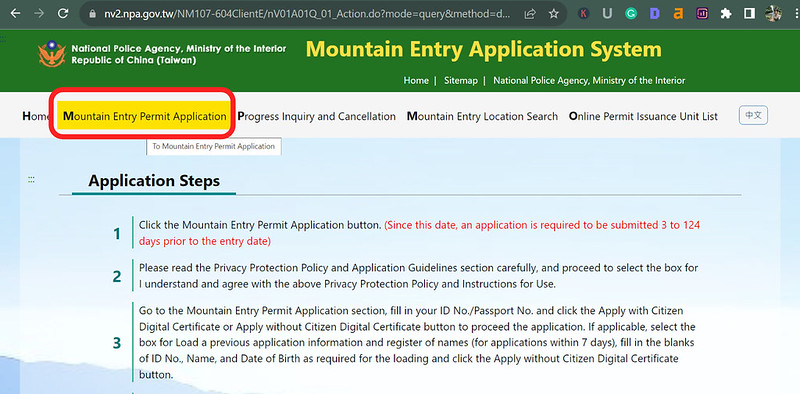
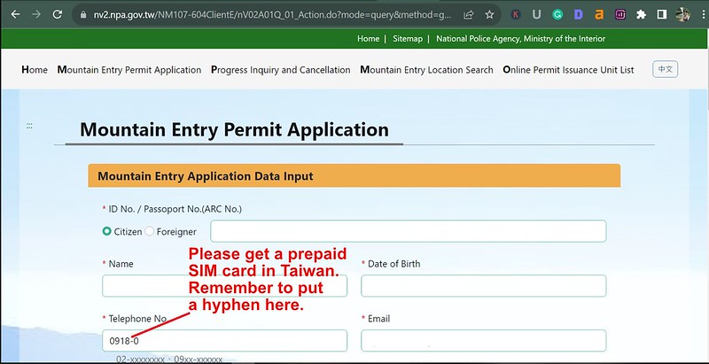
Click Mountain Entry Permit Application
Pur your personal information.
Put your Emergency Contact Person and the dates you want to hike.
This will pop up if your desired hiking dates are available to apply for a permit.
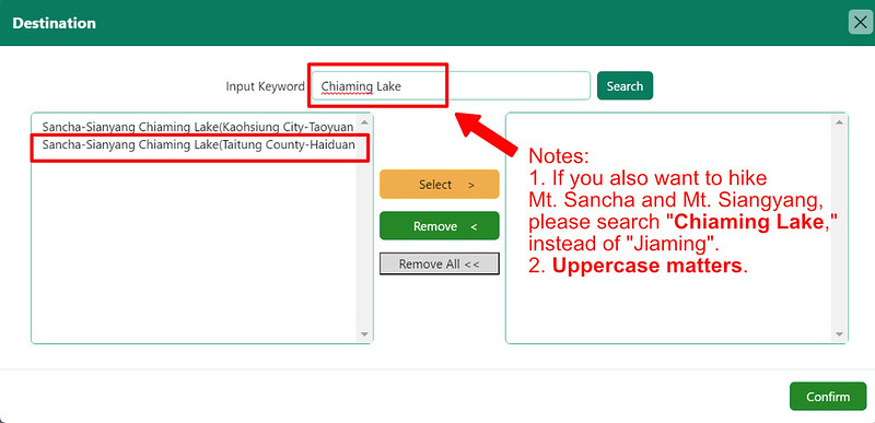
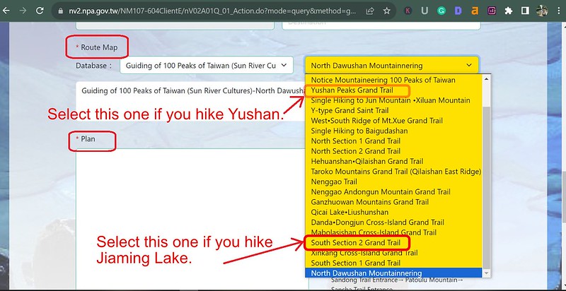
You will find both Jiaming and Chiaming Lake spellings on this database. If you also want to hike to Mt.
Sancha and Mt. Siangyang (most people do), please search for Chiaming with an uppercase C. Both refer
to the same lake but with different spellings. Welcome to the translation hell.
Search for the destination. The uppercase matters.
Although the Hike Smart Taiwan Service also sends out our application for the police permit (Mountain Entry
Permit), it's possible that it fails. This has happened to me several times. Here's a short video about how to
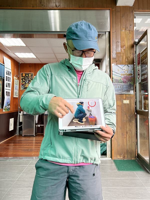
apply for a police permit.
If you are very fit and intend to hike the Jiaming Lake Trail in a single day, please read the official requirements first. The key points are:
Application time: The Online application is open from 30 days to 1
day before entering the mountain.
Hiking time: Due to frequent Formosan Black Bear activity, hikers
must start their hike between 3 a.m. and 5 p.m.
If hikers do not arrive at Jiaming Lake Cabin before 10 a.m. or at
Jiaming Lake before noon, they are advised to return the way they came for safety reasons.
A police permit is also required to hike the Jiaming Lake Trail in
one day.
Remember to check in at the Jiaming Lake Cabin when you do the hike in a day.
Water Source, Cabins, and Campsites to Stay
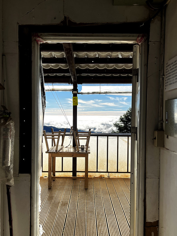
Siangyang Cabin 向陽山屋
Siangyang Cabin, 2,880 meters above sea level, is at 4.3 km and can accommodate 70 hikers. There is a small
stream close to the cabin. There's no campsite here. Hikers need to apply for their stay. Phone receptions are
good here.
Siangyang Cabin now provides a space for hikers who don't order catering, allowing them to cook
in the kitchen.
Bio-toilets at Siangyang Cabin
Jiaming Lake Cabin 嘉明湖山屋
Jiaming Lake Cabin is 3,380 meters above sea level at 8.4 km and can accommodate 70 hikers.
Jiaming Lake Cabin
The campsite can accommodate up to 6 people for each spot. This cabin has water tanks, which may not be enough
during drought. Hikers need to carry extra water at Siangyang Cabin.
Phone receptions are good here.
The campsite next to Jiaming Lake Cabin
Siangyang Campsite 向陽營地
This campsite is at Siangyang Forest Recreation Area, NOWHERE near Siangyang Cabin.
How to Get There (No Public Transport Available), Traffic Control, and Catering Service at the Cabins
The bad news is no public transport to Siangyang Forest Recreation Area. The only available public transport
is to take a train to Chishang or Guanshan.
No public transport to Siangyang Forest Recreation Area
The good news is that Jiaming Lake Trail is popular, and you might be able to share a hired van with other
hikers. Many B&Bs in Chishang or Guanshan take hikers, and you can ask the owners for help.
Some hikers rent scooters to Siangyang Forest Recreation Area. The driving/riding time is around 2 to 3 hours
on the winding road.
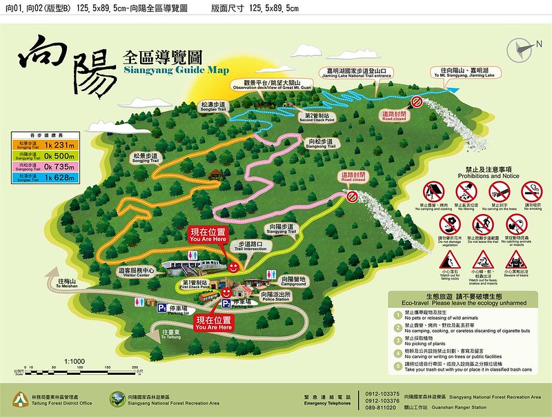
Map of Siangsang Forest Recreation Area
Southern Cross-island Highway (Tai 20 Highway)
Traffic Control
The Southern Cross-island Highway is constantly under construction due to typhoons and heavy rains. Therefore,
there is traffic control to ensure the safety of all parties. However, I can't find a specific website about
the traffic control time. If you decide to drive, you can check Guanshan Police Station's Facebook page or ask them for help.
View from Taiwan Provincial Highway 20
You can find parking lots at Siangyang Forest Recreation Area. When I was writing this post, Siangyang Forest
Recreation Area was closed for construction. The opening date is not announced yet. Hikers can only take
Songjing Trail and Songtao Trail to Jiaming Lake Trail.
On-site Catering Services for Meals and Sleeping
Bag Rentals
There are two catering companies at Siangyang and Jiaming Lake Cabin. They also provide porter service. You
can contact them for details.
Click Menu in the map to download, print, or share the map.
You can see more options after clicking the Play button. Click to change the speed to meet your condition.
There are several ways to do Jiaming Lake with the traditional route. When I was writing this post, I just did the Jiemaosi route.
For the traditional route, you can do it in 4, 3, and 2 days, or even in one day if you are super fit.
4-day Hike:
Day 1:
Your place ➔ Siangyang Forest Recreation Area ➔ Siangyang Cabin (2,855m)
Day 2:
Siangyang Cabin ➔ junction (3,488m) ➔ Mt. Siangyang (3,603m) ➔ junction ➔ Jiaming Lake
Cabin (3,380m)
Day 3:
Jiaming Lake Cabin ➔ Jiaming Lake ➔ Mt. Sancha (3,496m) ➔ Jiaming Lake Cabin ➔
Siangyang Cabin (or stay at Jiaming Lake Cabin)
Day 4:
Siangyang Cabin ➔ Siangyang Forest Recreation Area ➔ Home
Pros: This is the most relaxing route if you can have extra days off.
You can spend more time at Jiaming Lake.
Cons: Getting Jiaming Lake Cabin beds two days in a row might be challenging. So,
you can apply for Siangyang Cabin for Day 3 night.
3-day Hike
Day 1:
Your place ➔ Siangyang Forest Recreation Area (2,311m) ➔ Siangyang Cabin (2,855m)
Day 2:
Siangyang Cabin ➔ junction (3,488m) ➔ Jiaming Lake Cabin ➔ Jiaming Lake ➔ Mt. Sancha
(3,496m) ➔ Jiaming Lake Cabin (3,380m)
Day 3:
Jiaming Lake Cabin ➔ junction (3,488m) ➔ Mt. Siangyang (3,603m, sunrise) ➔ junction ➔
Siangyang Cabin ➔ Siangyang Forest Recreation ➔ Home
Pros: The chance to get a Jiaming Lake Cabin bed is higher, and you can
adjust the high altitude at Siangyang Cabin. You can see the sunrise at Mt. Siangyang.
Cons: You will miss the sunrise at Jiaming Lake for sure. You can see the
sunrise on the way to Jiaming Lake Cabin; the views are still stunning. Yet, it feels like you miss out on
something.
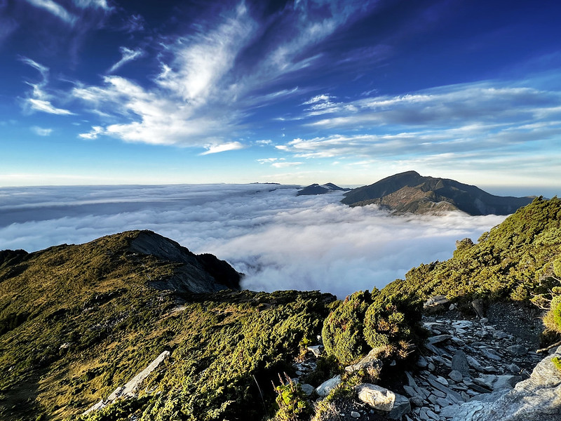
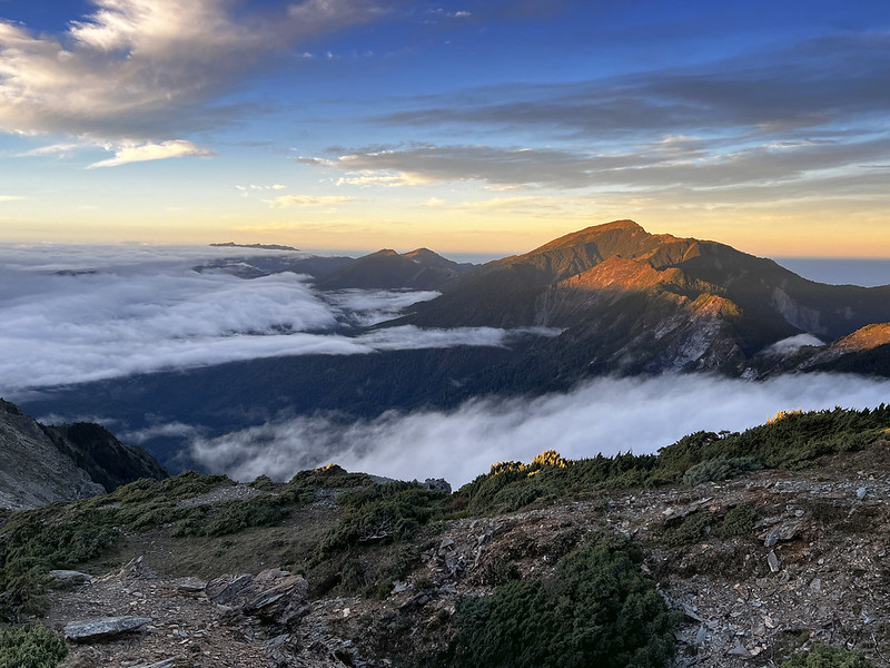
Beautiful clouds on the way to Jiaming Lake
3-day Hike (I Highly Recommend This Itinerary)
Day 0 (Transport Day):
Your place ➔ the B&B in Chishang or Guanshan in Taitung
Day 1:
Siangyang Forest Recreation Area (2,311m) ➔ Jiaming Lake Trailhead (2,659m) ➔ Siangyang Cabin
(2,855m) ➔ junction (3,488m) ➔ Mt. Siangyang (3,603m) ➔ junction ➔ Jiaming Lake Cabin
(3,380m)
Day 2:
Jiaming Lake Cabin ➔ Jiaming Lake ➔ Mt. Sancha (3,496m) ➔ Jiaming Lake Cabin (3,380m)
Day 3:
Jiaming Lake Cabin ➔ Mt. Siangyang (sunrise) ➔ Siangyang Cabin ➔ Siangyang Forest Recreation
➔ Home
Pros: You don't need to get up super early to see the sunrise at Jiaming
Lake like previous itinerary. You can see the sunrise at Mt. Siangyang.
Cons: You will miss the sunrise at Jiaming Lake for sure. You can see the
sunrise on the way to Jiaming Lake Cabin; the views are still stunning. Yet, it feels like you miss out on
something (or just me.)
Jiaming Lake Trail is more challenging than I thought.
2-day Hike
Day 1:
Your place ➔ Siangyang Forest Recreation Area (2,311m); Jiaming Lake Trailhead (2,659m) ➔ Siangyang
Cabin (2,855m) ➔ junction (3,488m) ➔ Mt. Siangyang (3,603m) ➔ junction ➔ Jiaming Lake
Cabin (3,380m)
Day 2:
Jiaming Lake Cabin ➔ Jiaming Lake (Sunrise) ➔ Mt. Sancha (3,496m) ➔ Jiaming Lake Cabin
➔ Siangyang Cabin ➔ Siangyang Forest Recreation ➔ Home
Pros: Time efficient.
Cons: Physically demanding, especially on Day 2.
1-day Hike (Only for Super Fit)
Day 0 (Transport Day):
Your place ➔ the B&B in Chishang or Guanshan in Taitung
Day 1:
Siangyang Forest Recreation Area (2,311m) ➔ Jiaming Lake Trailhead (2,659m) ➔ Siangyang Cabin
(2,855m) ➔ junction (3,488m) ➔ Mt. Siangyang (3,603m, optional) ➔ junction ➔ Jiaming
Lake Cabin (3,380m) ➔ Jiaming Lake (Sunrise) ➔ Mt. Sancha (3,496m) ➔ Jiaming Lake Cabin
➔ Siangyang Cabin ➔ Siangyang Forest Recreation ➔ Home
Pros: Time efficient.
Cons: Extremely physically demanding.
Trail profile from the map publisher, Sunriver Culture 上河文化.
My Itinerary: One Night at Siangyang Cabin and One Night at Jiaming Lake Campground
Day 1: A Short Hike to Siangyang Cabin and Sea of
Clouds
09:03 We left B&B around 7 am and arrived at Siangyang Forest Recreation
Area before 9 am. After submitting our police permits at the police station, we checked in at Siangyang Station.
Siangyang Station officer gave us a presentation about what to do and not to do, especially Formosan Black Bear,
and how to use the bio-toilet.
Some Taiwanese hikers obviously don't know how to poop properly.
Since Jiaming Lake Trail is popular, Forestry Bureau needs to maintain the trail constantly. Hikers are
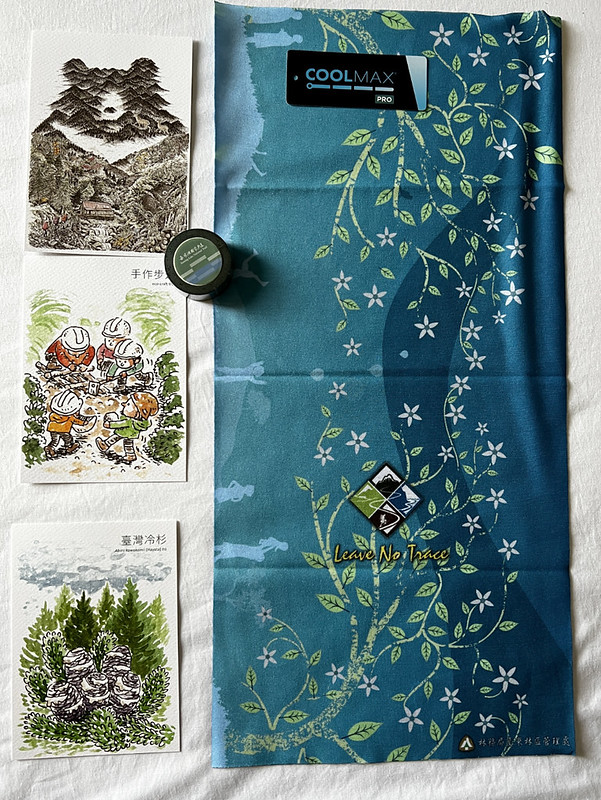
encouraged to carry an extra 1 kg of sand to help keep the trail, and they will be rewarded with cute postcards
and stickers when they return.
A scale is close to the checkpoint with marks.
If you want, carrying 5 kg of sand is also welcome. I carried an extra 5 kg because the scarf reward was so
cute. When I first did this hike, we dumped the sand at 3.8 km in October 2022. When I did this hike again in
March 2023, I saw several locations, and one was at 5.5 km.
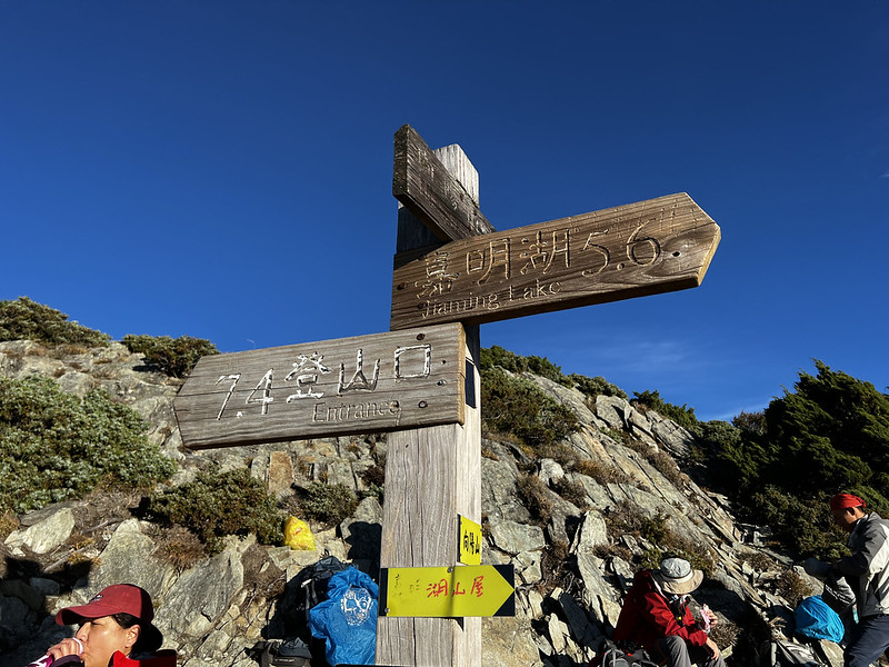
09:19 After everything was set, we headed to Siangyang Cabin. When you see this
sign, you can take either of them to Jiaming Lake Trail.
This one was closed when I did Jiaming Lake again in March 2023.
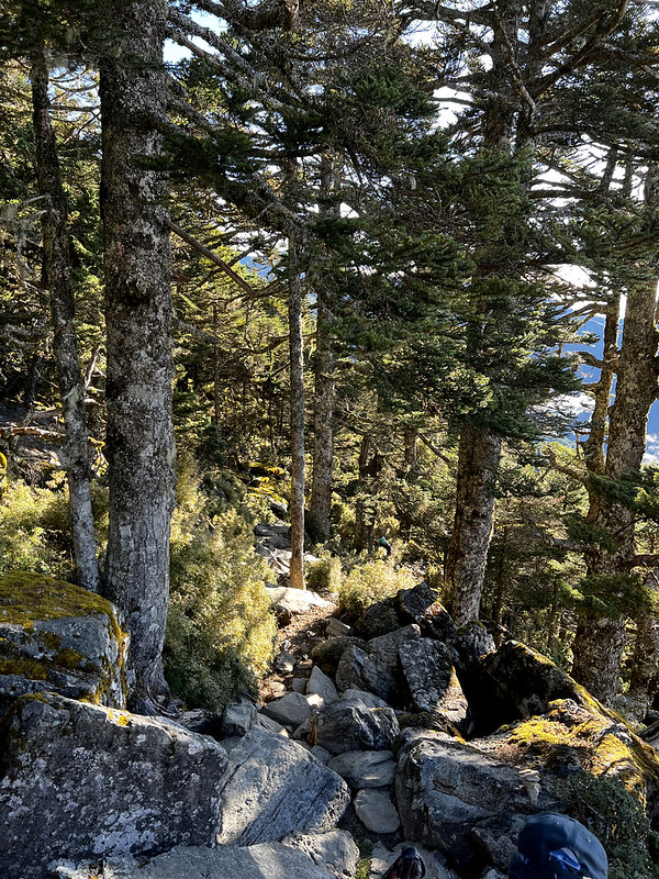
I might spend too much time taking photos. But the trees were beautiful, and I saw the beautiful sea of clouds
through the trees.
It was comfortable to walk on the pine needles.
10:20 Reached 1.5 km checkpoint. The Jiaming Lake Trail has clear markers
indicating elevations every 500 meters on one side, with GPS coordinates displayed on the other.
10:48 Arrived at 2.7 km trailhead. We saw many cars from rescue teams. Later, we
learned a hiker got injured on the trail.
11:52 We reached the designated area to place the extra sand at 3.8 km.
12:15 We reached Siangyang Cabin at 4.3 km and had lunch. This was our
destination for the first day.
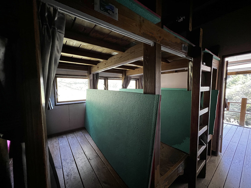
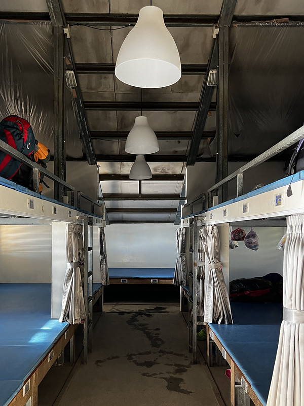
There is a creek next to Siangyang Cabin with plenty of water. Each bed inside this cabin is divided by curtains
for privacy. Bringing your sleeping pat is optional.
Siangyang Cabin provides curtains for each bed.
14:01 Honestly, I was bored by doing so little hiking on the first day. It was
my fault. After all, I didn't involve much in the planning for this hike because I was busy moving to a new
apartment.
I saw the incredible views through the trees on the trail, including Mt. Guan or Guanshan, 3,668m.
14:54 I reached Black Water Pond at 5.3 km. I followed the footpath inside, and
I wasn't disappointed.
Day 2: Stunning Sunrise at Somewhere and Wrong Timing
at Jiaming Lake
Unlike Day 1's short hike, we had a long day. We got up around 2 am, got breakfast, and packed our backpacks.
03:15 Left the cabin in the dark. The lack of proper sleep wore me out. I felt
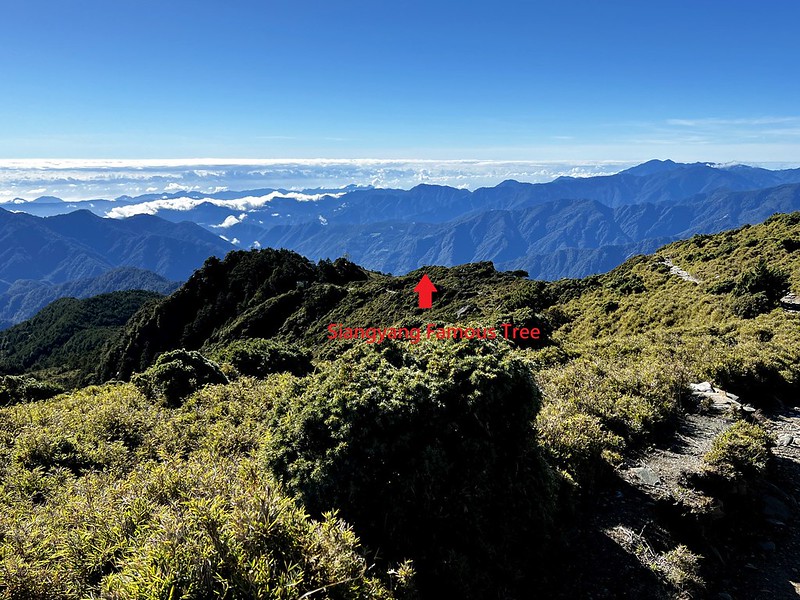
exhausted and had to drag my feet on the trail. We passed Siangyang Famous Tree 向陽名樹 at some point, but it was
too dark to see.
05:20 When we saw the sky getting brighter, we stopped somewhere near Guan Shan
Big Collapse Wall (said on the sign) 關山大崩壁 or Guanshan landslide at around 6.4 km, waiting for the sunrise.
Another name of the cliff used by the map publisher, Sun River Culture, is Siangyang landslide 向陽崩壁.
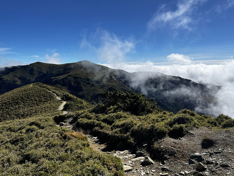
The sun and clouds displayed a splendid show for us, but I couldn't help but think how it would be to see this
by Jiaming Lake. Well, our itinerary sucked, but to be honest, this was stunning.
The warm orange hues helped me beat the morning cold.
We stayed here a little bit longer to enjoy the stunning views.
06:31 We reached the junction to Mt. Siangyang and Jiaming Lake Cabin. Many
hikers took a break here. So did we.
It is 5.6 km to go to Jiaming Lake from here.
The rock scrambles are after the giant boulder before reaching Jiaming Lake Cabin.
06:54 We reached the rock scrambles.
Those rock scrambles are steep.
Saw Jiaming Lake Cabin.
07:04 Jiaming Lake Cabin is at 8.4 km. We checked in with the cabin officer
first. He gave us a briefing about the amenities and things we needed to know. We applied for a campsite because
it was easier to get than beds at the cabin. Then, he asked us whether we wanted to stay inside the cabin
because empty beds were available. I said 'No' right away.
The officer let us take a look inside the cabin. Each bed isn't divided by curtains, but it looks decent.
One of the most popular mountain cabins in Taiwan.
And this view from the hallway was phenomenal.
The sea of clouds was right in front of the cabin.
08:10 Headed to Jiaming Lake with a light backpack.
We saw Jade Mountain (Mt. Jade, Mt. Yu or Yushan, 3,952 meters) at an empty sign. Someone used pebbles to
arrange the words Jade Mountain in Chinese. The clouds spilled over the mountain ridges flowing into the
valleys.
Jade Mountain with clouds spilling over the ridges.
Mt. Siangyang North Peak was near the sign, but I didn't go there. When I did this hike again in March 2023, I
still didn't go.
Mt. Siangyang North Peak near the sign.
Mt. Sancha looked close, but it was still another hour away.
The mountain in the center is Mt. Sancha. Still a long way to go from here.
09:00 Unfortunately, the good weather decided to go back to sleep. My heart sank
when seeing the blue sky on the Jiaming Lake side disappear.
The weather at Jiaming Lake changes quickly.
09:34 We reached the junction to Mt. Sancha. Either way will take you to Jiaming
Lake, and the distance is almost the same. We decided to go to Mt. Sancha first.
09:57 We arrived at Mt. Sancha, 3,496 meters, with a Class 1 Triangulation Stone
at the peak. The blue sky from the Jade Mountain side gave me hope, and I tried my best to hike to Jiaming Lake,
which was 20 minutes away.
While I was at Mt. Sancha, the weather in the north was still good.
When we descended from Mt. Sancha, the clouds took over the sky over the Jiaming Lake side.
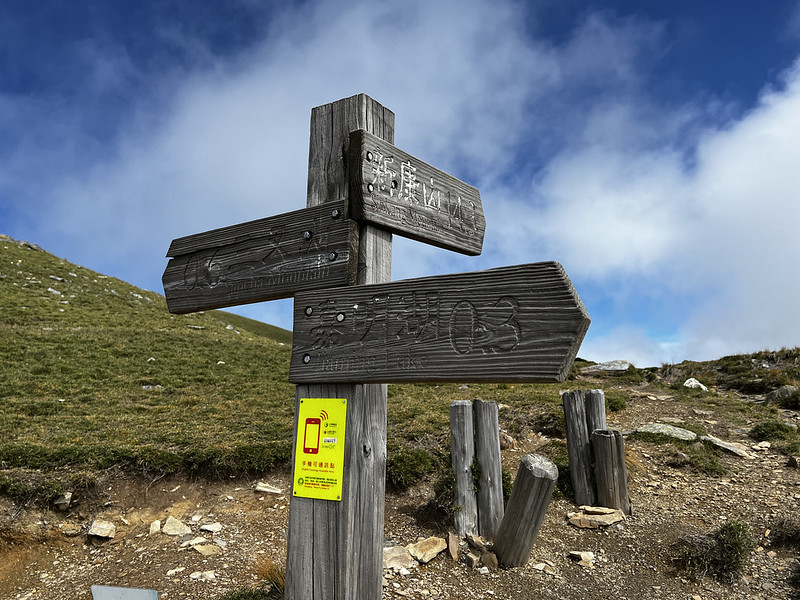
10:13 Passed the junction to Jiaming Lake close to the helipad and Mt. Sinkang
新康山 (3,338 meters), which was 14.3 km away from there.
The helipad near Jiaming Lake. The weather became foggy in the south.
Junction to Mt. Sinkang.
10:16 We arrived at Jiaming Lake at 13 km. I'm pretty sure the disappointment
was written all over my face. Well, at least I still could see the lake.
Jiaming Lake
We stayed here for 80 minutes, circling the lake and hoping the sky would be cleared up. But the fog above
Jiaming Lake was getting thicker. Finally, it was time to leave. Then, it started drizzling.
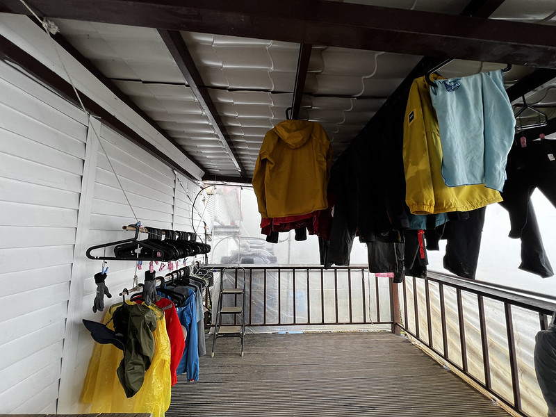
14:19 We returned to Jiaming Cabin, and I was already soaking wet.
It's good to have a space to dry raincoats at the cabin.
There are hangers for hikers to hang their wet clothes if you can find a spot for yours.
Day 3: Incredible Sunrise at Mt. Siangyang and Shadow
We left Jiaming Lake around 3:30 am after breakfast. When we left Jiaming Lake, the cook at the kitchen said the
sunrise at Jiaming Lake would be incredible, except that we were heading in the opposite direction.
04:34 Reached the junction of Mt. Siangyang.
05:06 We arrived at Mt. Siangyang, 3,603 meters, which was still early for
sunrise.
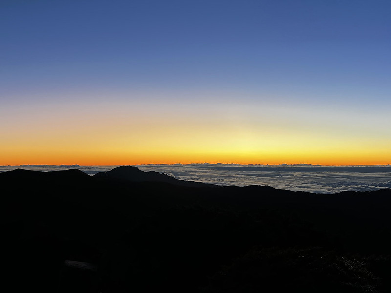
The sky started turning vivid blue mixed with an orange hue at 5:20 am. Hikers began showing up at Mt.
Siangyang, too. The sea of clouds in the distance was visible.
Waiting for the sunrise.
05:47 The orange hue cast a warm glow on Jade Mountain.
The sunrise at Jade Mountain must be stunning at that moment.
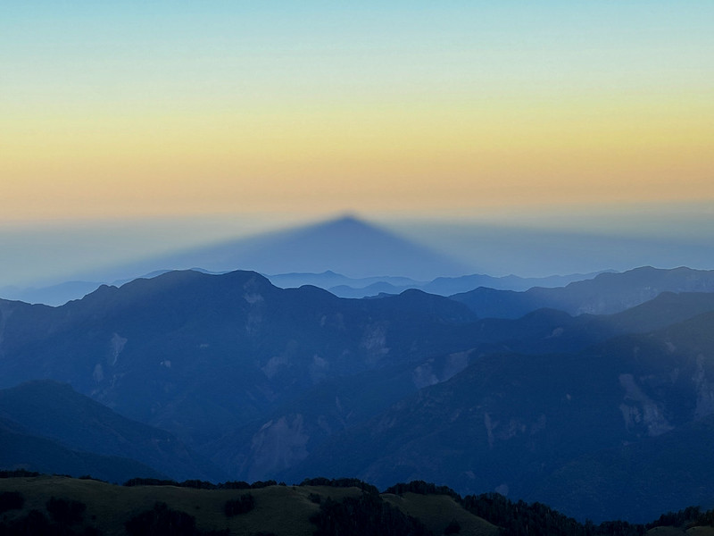
The 360∘ views at Mt. Siangyang were stunning. However, when I turned to the west side, I saw something I
couldn't comprehend at first. I couldn't figure what why there was a triangular shadow in the east.
This is my first time seeing the mountain's shadow in the air.
When the sun went higher, the shadow went lower. I realized that that was Mt. Siangyang's shadow. That was my
first time seeing a phenomenon like this.
We stayed there for 70 minutes, and the weather became bright and sunny.
My peak photo
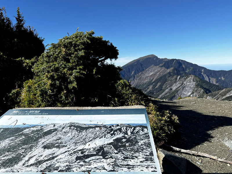
08:13 We were back at Guan Shan Big Collapse Wall. This English translation on
the sign was driving me crazy.
The sign says Guan Shan Big Collapse Wall.
The cliff was truly splendid.
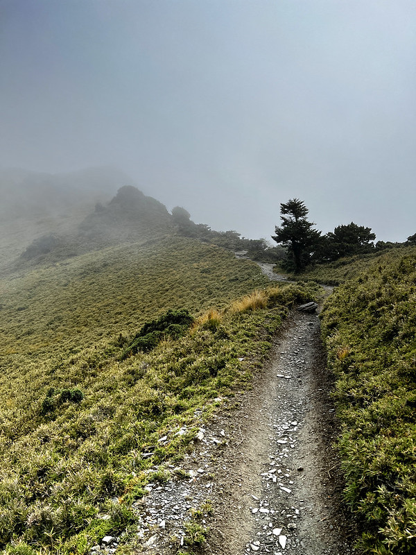
Looking at the trail ahead of us
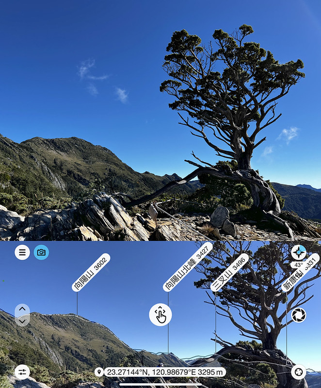
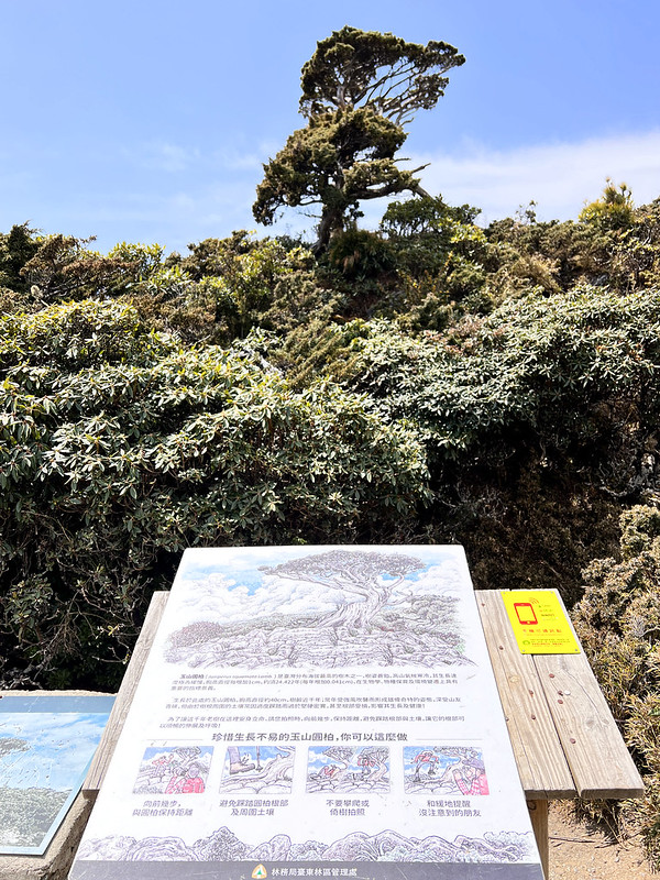
08:29 We finally saw the Siangyang Famous Tree. The sign there said it was
Juniperus Squamata 玉山圓柏. The common name is Yushan Sabina, which is common in high mountains in Taiwan. Its
distinct shape earns it the name of a famous tree. Many high mountain trails have their own famous trees.
Mt. Siangyang and her north peak and Mt. Sancha from Siangyang Famous Tree.
However, half of this tree collapsed years ago.
Juniperus Squamata 玉山圓柏
10:04 Arrived at Siangyang Cabin and took a 30-minute break.
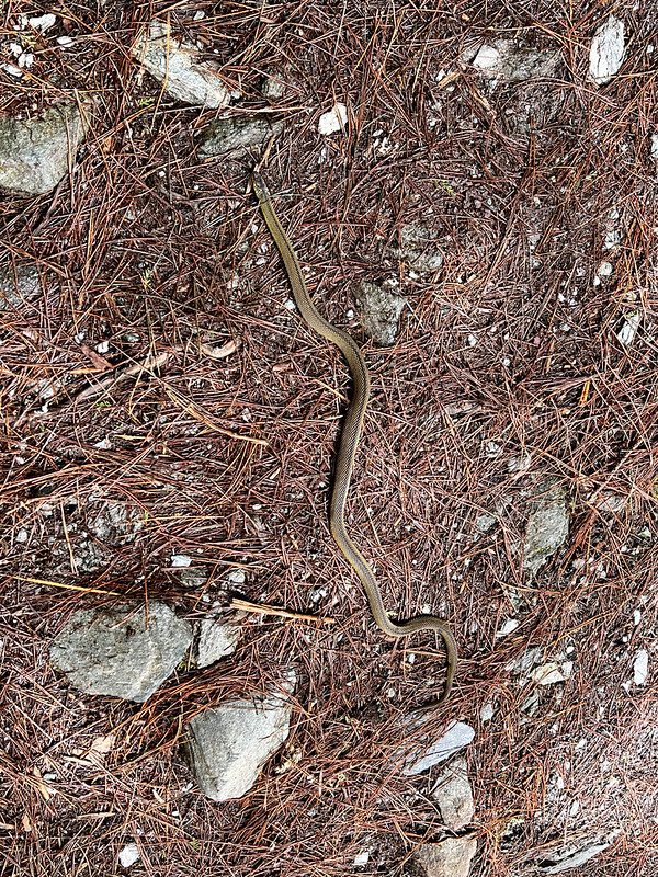
While returning to the trailhead, I saw a snake lying in the middle of the trail. I thought it was dead, and I
didn't want it to be smashed by hikers. So, I removed it aside, and it came back to life, which startled me. But
I guess the poor thing was terrified, too.
My rare snake sighting.
11:51 We returned to Siangyang Station and claimed our rewards for carrying
extra sand. This is my new scarf.
Happy to claim my reward for carrying an extra 5 kg.
About Jiaming Lake, Mt. Sancha, Mt. Siangyang, and A Plane Crash
About Jiaming Lake 嘉明湖
Jiaming Lake is the second-highest alpine lake in Taiwan, at 3,310 meters (10,859.6 feet). The highest one is
Cui Pond 翠池 (3,520 meters/11,548.5 feet) near Xueshan/Snow Mountain in Taiwan.
The widest length of Jiaming Lake is 120 meters, and the width is 80 meters, with an area of 1.9 hectares (4.7
acres) and a depth of 6 meters.
It is said Jiaming Lake is an impact meteor lake. When the sky is blue, the reflection on the lake looks like
sapphire. So, it is also called God's Lost Sapphire 上帝遺失在人間之藍寶石 or Angel's Teardrop 天使的眼淚. It's also called Egg
Pond because of its oval shape.
The indigenous Bunan people call Jiaming Lake Cidanuman Buan, meaning the moon's mirror.
100 Peaks: Mt. Sancha 三叉山 and the Airplane Crash
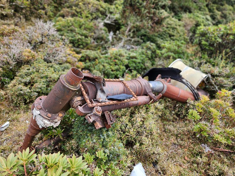
On September 10, 1945, after the surrender of the Empire of Japan in World War II, two airplanes flying from
Okinawa, Japan, to Manila, the Philippines, crashed in eastern Taiwan due to typhoons.
Our guide Xiao Tsai saw the plane crash debris near Mt. Sancha. Photo by Xiao Tsai.
One crashed in the sea, and the other crashed near Mt. Sancha, Taiwan. The one that crashed near Mt. Sancha
carried 25 people, including 11 American, 4 Dutch, and 5 Australian war of prisoners, and 5 cabin crews, and all
perished.
A Bunan hunter saw the plane down and reported it to the police. The government (still under Japanese rule then)
sent the first rescue team of 8 people on September 18 and a second team of 89 people on September 27 to search
for the victims.
Our guide Xiao Tsai saw the plane crash debris near Mt. Sancha. Photo by Xiao Tsai.
Unfortunately, a second typhoon hit on September 30 while the team was still in the high mountain. 26 members
died due to the harsh weather.
Mr. Bruce Liu has a detailed post about this tragedy. You
can find some English content about those victims and where they were buried in his post.
However, the remains of some rescuers were not totally recovered and got a proper burial. Guanshan Police Station Historical
Museum exhibits the wreckages retrieved from the crash. In addition, there's a stele to commemorate those
victims at Guanshan Waterfront Park.
LOHAS did a training near Mt. Sancha and visited the crash site in 2023. Guide Xiao Tsai was very kind to lend
me those photos he took.
100 Peaks: Mt. Siangyang 向陽山
Mt. Siangyang is the second-highest mountain in Taitung County. The most famous landscape near Mt. Siangyang is
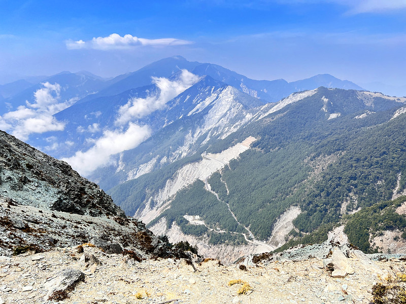
Guan Shan Big Collapse Wall (Guanshan Big Cliff) 關山大崩壁.
Mt. Siangyang (left) and her north peak (right). This is the ridgeline we hiked.
This expansive cliff is at 7km of the trail southwest of Mt. Siangyang. The gap between the top of the cliff and
the bottom is 800 meters (2,625 feet). The rocks constantly fall on this cliff.
Guan Shan Big Collapse Wall (Guanshan Big Cliff)
When the red hue of the sunset casts on Mt. Siangyang and makes it look like an extensive red leaf, Mt.
Siangyang is also called Mt. Hongye, Red Leaf Mountain.
Beautiful forest at Siangyang Forest Recreation Area
There are 4 trails in this recreation area: Songjing Trail (1.2 km long), Siangyang Trail (0.5 km long),
Siangsong Trail (0.7 km long), and Songtao Trail (1.6 km long).
If you don't hike Jiaming Lake, this park is great to visit. Those 4 trails are relaxing, and you will find an
observation deck on Songtao Trail to enjoy the incredible views.
You may not find garbage bins inside this area. That's because there are reports of Formosan Black Bears, aka
Taiwanese Black Bears/White-Throated Bears, digging out garbage bins. Therefore, those bins are either removed
or locked to protect this endemic species in Taiwan. The best solution is to bring the garbage with you.
Hikers who go to Jiaming Lake will have to take either A. Songjing + Songtao (2.8 km) or B. Siangyang +
Siangsong + Songtao (2.8 km) to the actual trailhead of Jiaming Lake. However, you can take a different route
and return to Siangyang Forest Recreation Area.
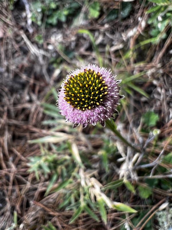
Cute little flowers I saw at Siangyang Forest Recreation Area.
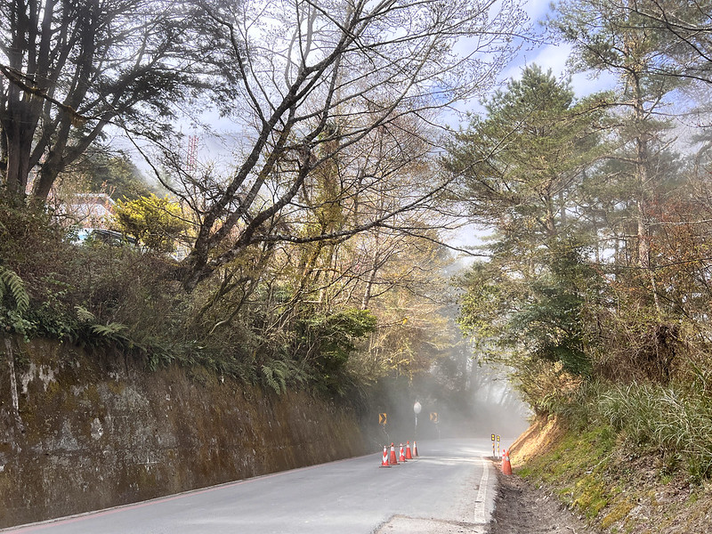
When I did my second Jiaming Lake, I saw clouds floating around this area.
Clouds and fogs floating around at Siangyang Forest Recreation Area


 to change the speed to meet your condition.