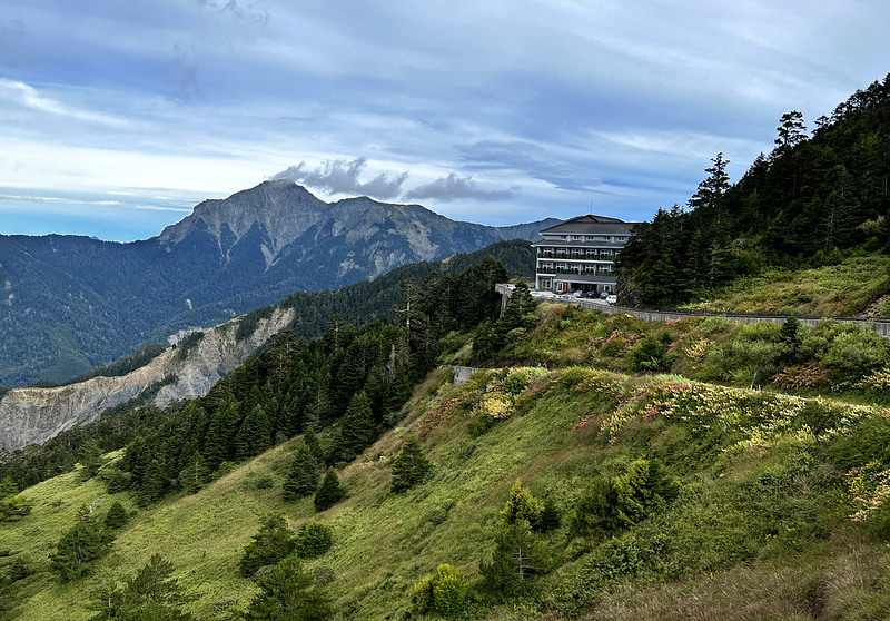
100 Peaks - the Majestic Mt. Bilu and Mt. Yangtou on the Central Cross-island Highway
Mt. Bilu (or Mt. Pilu) and Mt. Yangtou are famous for their stunning views but also notorious for their
treacherous steep terrains. Nicknamed as 2 of 'the Central Cross-island Highway 4 Spices' in Taiwan, we had to
carry an extra 5 liters of water and went through the hellish Saw Mountains.

Yet, we were rewarded with the stunning views of Hehuanshan mountains and Mt. Qilai North Peak and nearby
mountain ranges at the summit.

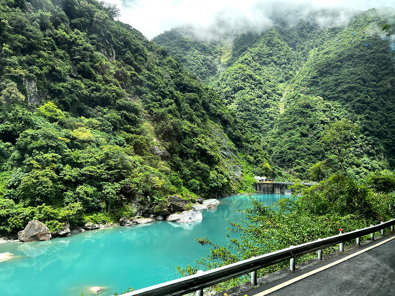
Our journey began in Dayuling (Dayu Ridge) and ended at the magnificent Taroko Gorge. The views we encountered
throughout this hike were breathtaking, making the challenging trek well worth the effort.
Disclaimer:
All content is for inspiration only. Use Taiwan Hikes' suggestions at your own risk. We are not responsible for any losses, injuries, or damages.
All content is for inspiration only. Use Taiwan Hikes' suggestions at your own risk. We are not responsible for any losses, injuries, or damages.
Table of Contents:
- Trail Information
- How to Get There and Map/GPX Data
- Day 1: Happy Hike to Mt. Maomu till Carrying an Extra 5L to Xiaowanmei Valley Campground
- Day 2: Spectacular Forest and Views on the Way to Mt. Bilu and the Saw Mountain Hell
- Day 3: Fantastic Mt. Yangtou Plus 1,000-Meter Descending
- About Central Cross-island Highway 4 Spices and Hehuan Traversing Historic Trail
- Related Posts
2026 Yushan Permit Application Guide
The hardest part of Yushan isn't the climb — it's the permit. My 2026 Yushan permit application guide walks you through the government site screen by screen, so you don't lose a date to a missed checkbox.
Trail Information
Trail Name: Mao Bi Yang (Mt. Maomu, Mt. Bilu, and Mt. Yangtou) or Mt. Bilu and
Mt. Yangtou Thru-hike 卯畢羊縱走
Distance: 17.7 km (11 miles)
Route type: Point to point
Days/Hours Needed: 3 days
Total Ascent/Descent: 1,775m/2,345m
Best Time to Go: All year round, but the Taroko National Park will check hikers' hiking experience or certificates during the snow season. Bring gear for hiking in the snow is a must.
Permits: Required Park Entry Permit. No Police Entry Permit is required. You can check here to apply for a standard permit.
Difficulty Level:
Peaks to Reach: We might have passed other peaks, but I was too tired to count.
- Mt. Maomu, aka Mt. Dayuling, 卯木山 (大禹嶺山), 2,819 meters (9,248.6 feet) above sea level. There is a Class 3 Triangulation Stone on the peak. You can see Hehuanshan near the peak.
- Mt. Bilu, 畢祿山, 3,371 meters (11,059.7 feet) above sea level. There is a Class 3 Triangulation Stone on the peak. 100 Peaks. Wonderful views at the peak.
- Mt. Bilu South Peak, 畢祿山南峰, 3,041 meters (9,977 feet).
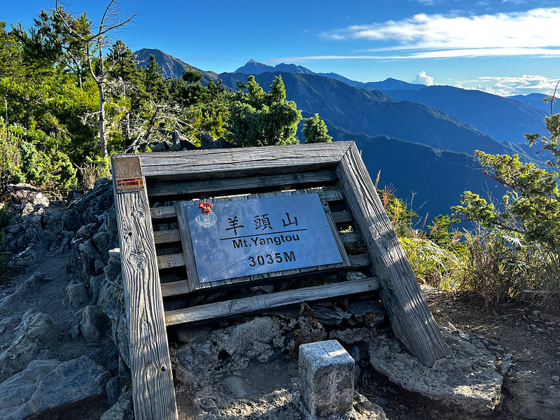
- Mt. 羊頭山/3035 meters (9,957.3 feet) above sea level. There is a Class 3 Triangulation Stone on the peak. 100 Peaks. Wonderful views at the peak.
- Mt. Ju First Peak or Saw Mountain First Peak, 鋸山一峰, 3,361 meters (11,026.9 feet).
- Mt. Ju Third Peak or Saw Mountain Third Peak, 鋸山三峰, 3,356 meters (11,010.4 feet). The views are fantastic.
- Mt. Ju Fifth Peak or Saw Mountain Fifth Peak, 鋸山五峰, 3,271 meters (10,731.6 feet). The views are great.
- Mt. Ju East Peak or Saw Mountain East Peak, 鋸山東峰, 3,060 meters (10,039.4 feet). No views.
How to Get There and Map/GPX Data
Take Hualien Bus 1141 at Hualien Train Station and get off at the Dayuling (Dayu Ridge) bus stop. This bus
runs only once every day at 5:10 am and arrives at Dayuling around 7:55 am.
You can take the same bus at Ci'en Tunnel stop back to Hualien Train Station after you finish your hike.
Please check the Hualien Bus timetable before you go.
Route map for Mt Bilu Yangtou And Maomu Updated by Anusha Lee on plotaroute.com
Click Menu in the map to download, print, or share the map.
You can see more options after clicking the Play button.
Click to change the speed to meet your condition.
You can see more options after clicking the Play button.
Click
to change the speed to meet your condition.
Day 1: Happy Hike to Mt. Maomu till Carrying an Extra 5L to Xiaowanmei Valley Campground
Day 1 Brief Itinerary: trailhead next to Hehuanshan Tunnel ➔ junction to Mt. Maomu ➔ Mt.
Maomu ➔ return to junction to Mt. Maomu ➔ junction to the water source (km, m) ➔jreturn to
unction ➔ Xiaowanmei Valley
GPS coordinates of the new trailhead: 24.180701, 121.309734
GPS coordinates of the new trailhead: 24.180701, 121.309734
05:20 I did this hike with LOHAS, and we stayed at a B B in Ren'ai
Township, Nantou County, before our hike. As usual, we left early for our hike.
While on the way to Dayuling (aka Dayu Ridge), we saw Wushe Reservoir (aka Wan'ta Reservoir and Bihu Reservoir)
霧社水庫.

07:15 We arrived trailhead. This took slightly longer because we had to return
to our B B to get my hiking mate's forgotten phone.
The new trailhead is right next to Hehuanshan Tunnel. You will find a parking lot and toilets here. The old one
was closed due to the landslides.

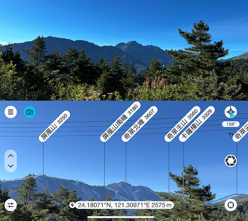
When we were prepping our backpacks, I saw Mt. Pingfeng 屏風山 (3,250 meters) and Mt. Qilai North Peak 奇萊北峰 (3,607
meters) from the trailhead.
07:30 We took the steps next to the building. Taroko National Park opened this
new trailhead in December 2021 to replace the old one because there are several collapsed areas at the old one
on 820 Forest Road (820 Logging Road written on the signs).

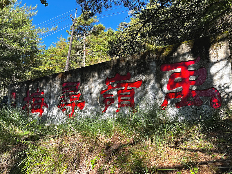
Passed Yu Ling Xun Mei stele 禹嶺尋梅, which means looking for plum flowers at Yu Ridge. I think Yu Ling here means
Dayuling.
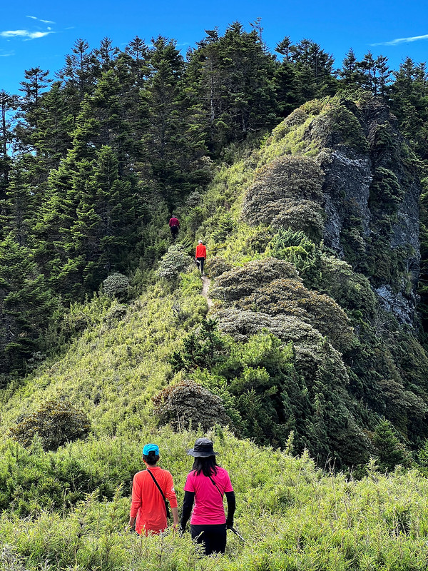
After some climbing, we reached 820 Forest Road and saw views before reaching the junction.

Old Fire Lookout Tower at Mt. Maomu
08:25 We reached the junction to Mt. Maomu. We left our backpacks here and
carried essentials to Maomu.


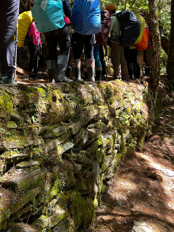
It took us 10 minutes to return to the junction and carry our backpacks. Then, we reached a retaining wall. Our
guide told us this was a bridge.
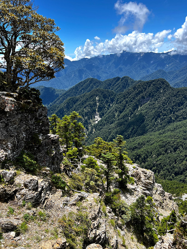
I passed a big, crooked tree on the cliff with beautiful mountains in the background.

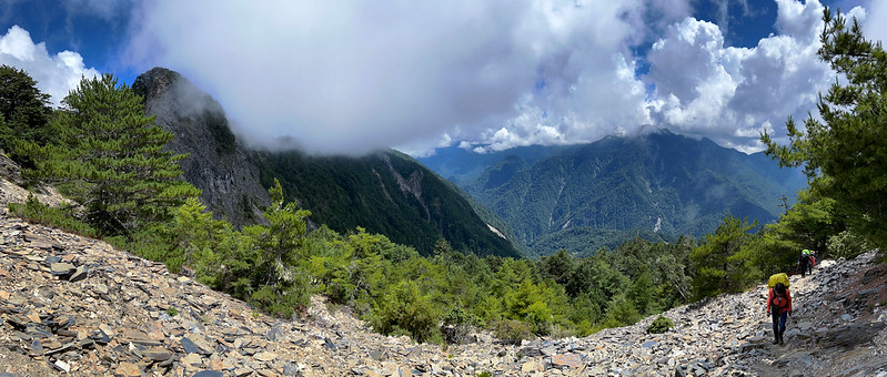
13:24 We passed a rock slope, and I stopped for a few minutes to enjoy the
wonderful view.
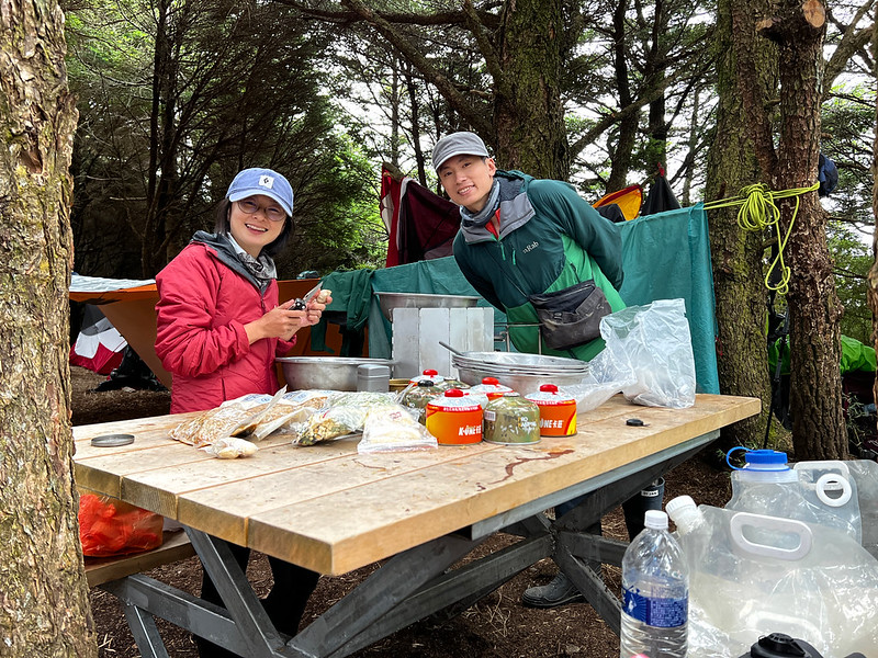
An Extra 5 Litter of Water
13:50 Finally, we reached the notorious junction; at least, it was notorious for
me. Why? It was time to go down 100 meters to the headwater of Bilu River 碧綠溪 in the valley and carry at least
5L of water, then climb another 100 meters with our backpacks plus the water to the campground.

Our guide, Xiao Tsai, asked us to carry 6 liters of water, 3 liters for cooking shared meals, and the rest for
our own water. But he let us get away with 5 if we didn't need that much for our own water. I carried 5L.
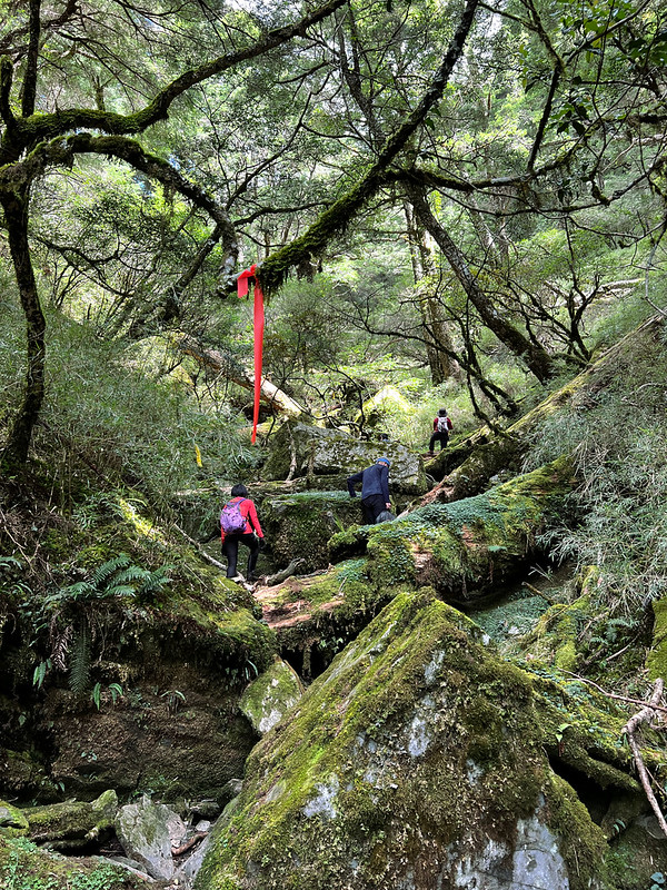
14:12 We reached the small creek and fetched our water.

The trip to the water source was treacherous and slippery enough. We walked on several giant boulders covered
with moss. I have to say this valley was beautiful.
14:42 After we returned to our backpacks, the last fight for Day 1 began. This
was my first time carrying a load of 18 or 19 kg, not to mention the steep hill.
The Little Perfect for That Day: Xiaowanmei Valley
15:10 After feeling like forever, we finally reached our campground, Xiaowanmei
Valley Campground. Xiaowanmei literally means 'little perfect' in Chinese.
This valley is enormous, and it is big enough for many tents. After I pitched my MSR tarp and mesh tent, I
explored this place.

Passing tents scattered in the valley, I reached the end of the east side. Clouds were rising from the valley,
and the sun was setting.
After having dinner and cleaning up, I went to the east side to explore again. The clouds had cleared up, and I
saw the layers of mountains from the east coast of Taiwan.

Day 2: Spectacular Forest and Views on the Way to Mt. Bilu and the Saw Mountain Hell
Day 2 Brief Itinerary: Xiaowanmei Valley ➔ Mt. Bilu South Peak ➔ junction to Mt. Bilu
➔ Mt. Bilu ➔ return to junction to Bilu ➔ Saw Mountain Peaks ➔ BiYang Famous Tree
➔ Judong Shelters
I woke up early and got dressed. It was difficult to leave my cozy sleeping bag to beat the cold. However, the
stunning view from the east side was calling.
I was glad I got up. This is what we saw.
I did Mt. Liwu during my Datong and Dali hike, and Qing Shui Da Shan or Big Qing Shui Mountain (2,408
meters) is also on my list.
I don't even dare to think about the rest of the mountains because most Hualien and Taitung mountains are
notoriously tricky. Our guide Xiao Tsai has warned me about those.

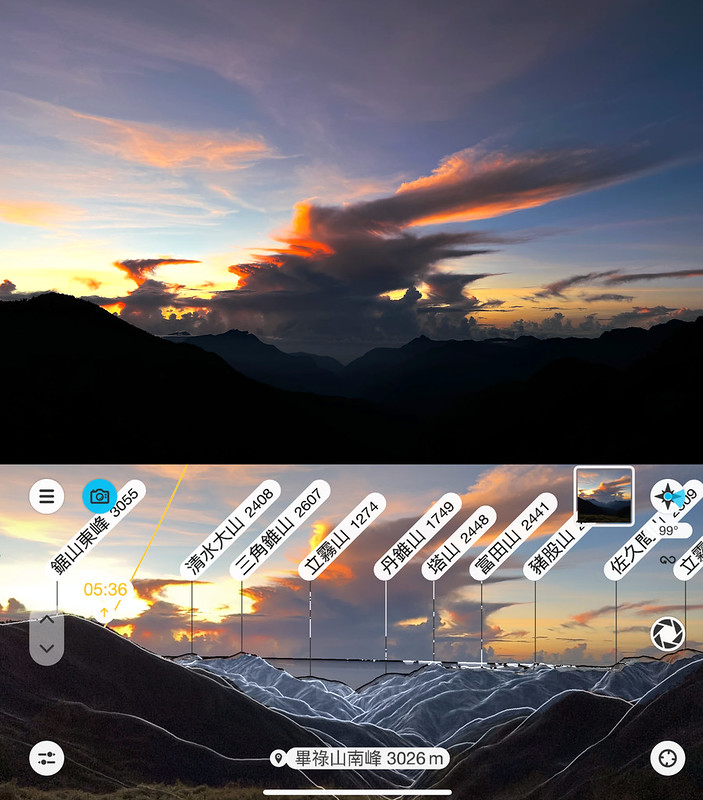
As to the mountain on the left in this photo, Saw Mountain East Peak 鋸山東峰 (3,055 meters in this photo), was on
our hike on Day 3.
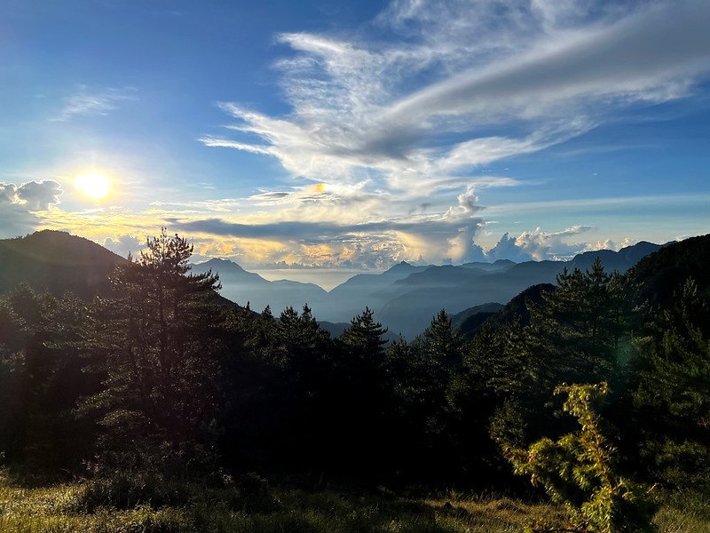
05:30 After enjoying the spectacular sunrise, we returned to our tents. The
weather was good last night, but our tents were soaked with dew. I think it was because we camped in the valley
where the moisture gathered. If you camp here, please prepare for that.
05:52 We started our Day 2 hike by taking the hill up next on the east side of
Xiaowanmei Valley.
While climbing uphill, I couldn't tear my eyes away from the stunning east side.
Soon, we reached a place where we could see Hehuanshan North Peak and Mt. Baigu (3,342 meters). Then, to our
delight, we saw the cloud waterfall and RAINBOW!
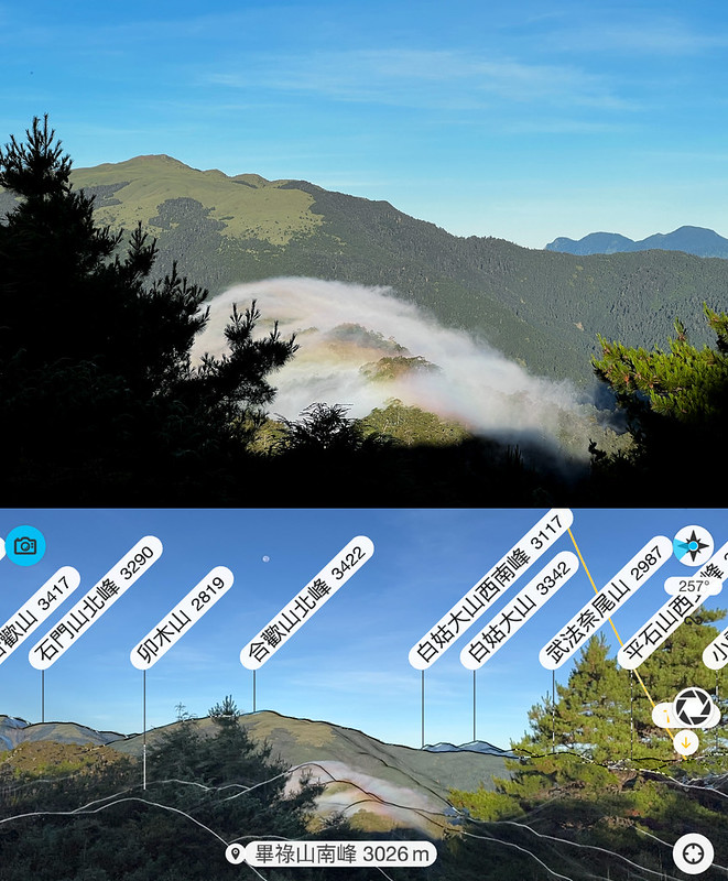
06:21 We reached Mt. Bilu South Peak, 3,029 meters. This one is not a 100 Peaks,
and the views were blocked by trees. Yet, I was still excited.

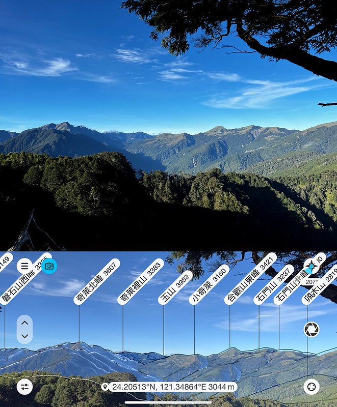
I passed another tree with a dramatic shape.

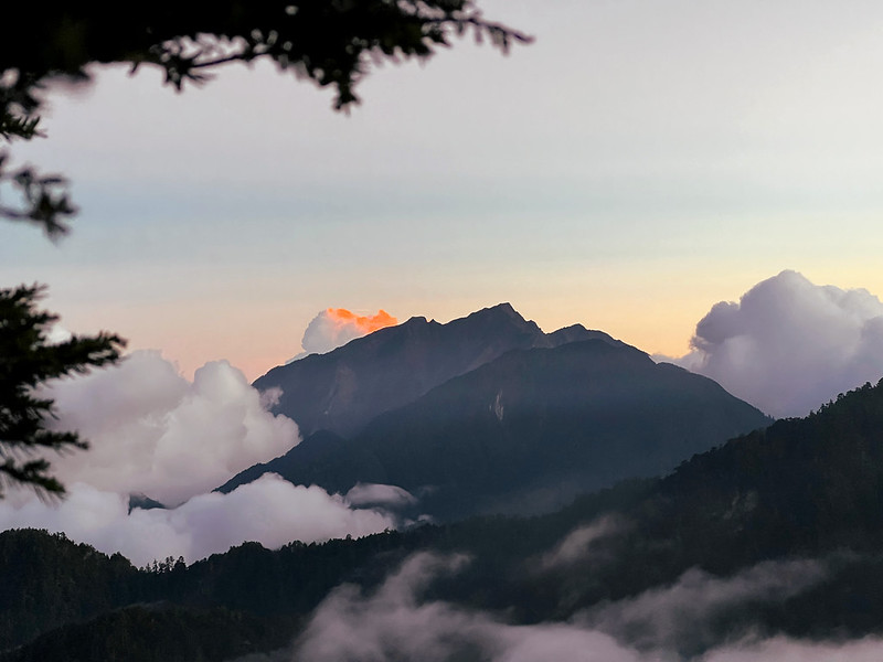
Behind the tree were the impressive layers of mountains, including Mt. Qilai North Peak (3,607 meters), Jade Mountain (3,952 meters),
and Mt. Maomu (2,819 meters), the one we had done on the previous day.
More beautiful mountains and clouds floating around.

Those stunning views made me forget about my heavy backpack for a moment. I still had an extra 3 liters of water
in my backpack.
08:25 We arrived at the junction to Mt. Bilu. We left our backpacks there and
only carried the essentials. From there, we mostly hiked on the ridgeline, which means we saw the stunning
mountain views again.
08:42 We passed the campground at the 0.1 km mark. It must be cold and windy to
camp here at night.

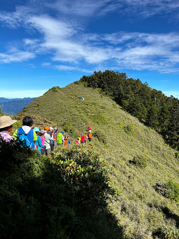
We hiked up and down several peaks, and I was fooled by each of them, thinking that was that one.

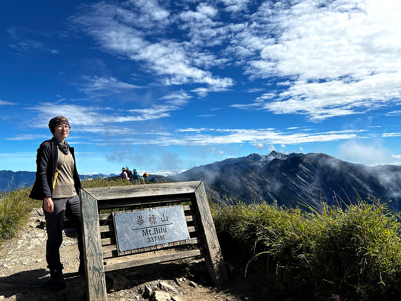
Finally, Mt. Bilu After Being Fooled
08:50 Finally, I reached the real Mt. Bilu. The weather was wonderful and
perfect to take timelapse videos.
When we returned to the junction, the ridgeline we had taken earlier looked impressive.


We found an excellent spot for taking photos. Mingshu demonstrated his signature pose.

Another five minutes passed after we were satisfied to unite with our backpacks.
Welcome to Saw Mountain Hell
09:52 We reached Saw Mountain First Peak (3,361 meters). This was the starting
point of the never-ending up and down to the 3.8km section of Saw Mountain Peaks. I was already the slowest
hiker in the group.
10:06 I saw the massive downhill around the 0.6 km post.

While catching my breath, I sent this photo and text messages to Ami from Taiwan Trails and Tales. Her reply was she would cry if she saw this. I'd already
cried inside.
The only comfort was the incredible Mt. Zhongyangjian in the distance.
Before I reached the junction, my hiking mates had already had their lunch break. We sat by the rope, telling
hikers not to take this way down. Xiao Tsai said to us that some hikers took the wrong way here and died.

This downhill was a dried creek all the way down to the valley. In November 2020, one female hiker went down the
creek and missed the junction where we had a lunch break. If you do this hike, please stay alert if you keep
going down. Please have a map or a GPX track on your phone.
11:00 Two guides, Mingshu and Youqing, kept me company, and we resumed our hike.
Now, we went uphill through the dwarf bamboo woods. I can't find any better words to describe this section than
hellish.

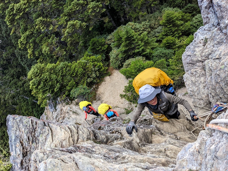
11:28 We stopped at an almost vertical cliff queueing. Our guides went up there
to assist each of us to go up.

While waiting for my turn, I looked at the surroundings and the wildflowers to keep my mind occupied.
Our guide Bo'yun took this photo for me. As you can guess, I enjoyed climbing this cliff with my 18kg backpack a
lot.
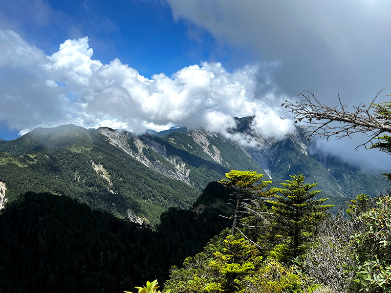
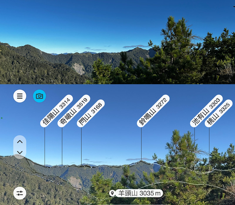
11:49 After climbing up the cliff, Saw Mountain Fifth Peak(3,271 meters) was in
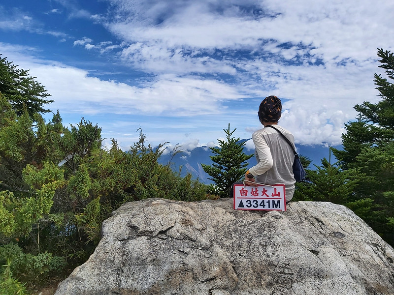
the bush. The views up there were great. Mt. Nanhu (3,742 meters), Mt. Lingming (3,272 meters), Taoshan (3,325 meters, post coming
soon), and Snow Mountain (3,886 meters) were among them.
The following was endless up and down in the forest. But those trees were magnificent.
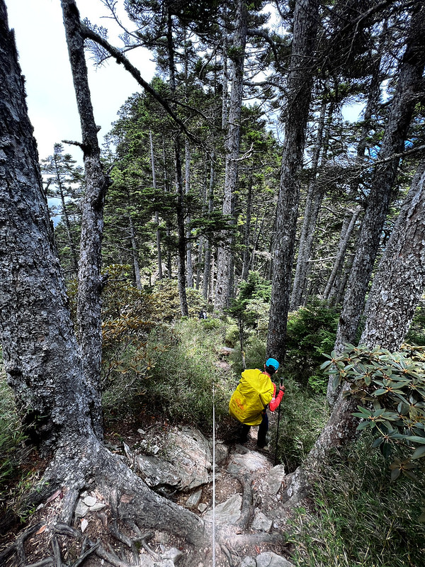
12:32 Reached Saw Mountain (3,356 meters).

BiYang Famous Tree 畢羊名樹
13:12 We reached BiYang Famous Tree 畢羊名樹 at 1.8 km. I still don't know what
species of BiYang Famous Tree is. It might be a pine tree. If you know, please leave a comment to let me know.
Thank you.


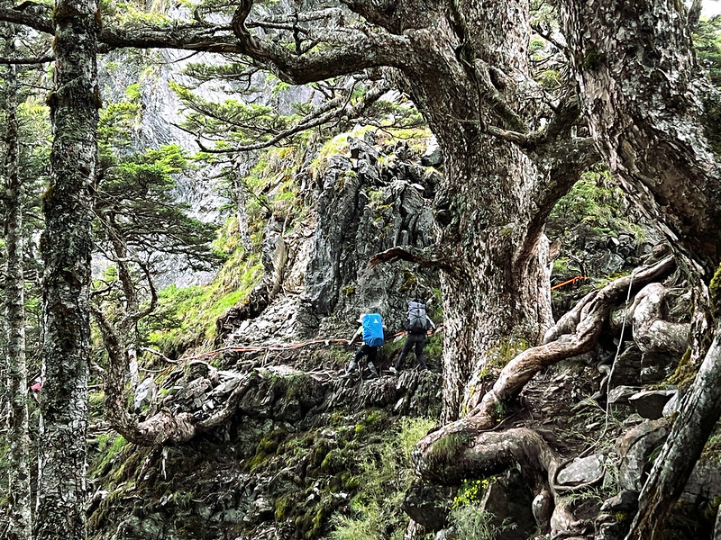
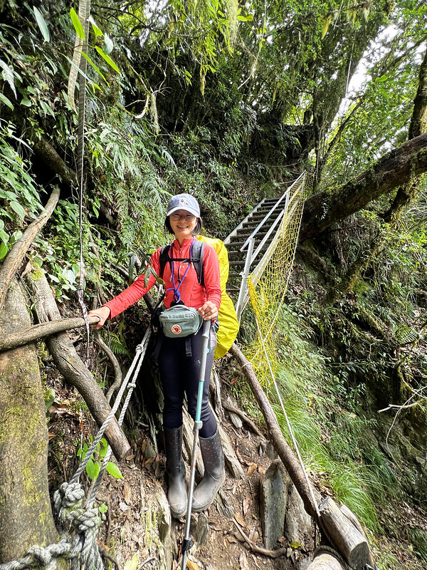
After BiYang Famous Tree, we had to pass a sidehill. This sidehill was no joke. We walked on the tree roots
intertwined on a cliff. Please proceed with caution.
14:39 Passed the 3.0km post. From here, we entered the trail section paved by
pine needles. Youqing kept me company here.
Saw Mountain, the hike is exactly like the teeth of the saw, up and down, up and down…

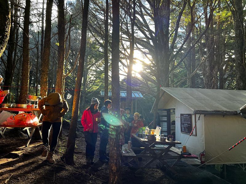
The Newly Built JuDong Shelters
14:47 We arrived at JuDong Shelters (Saw East Shelters) at 3.1 km. It took me a
little longer because I had to find a spot to relieve myself before reaching this shelter.
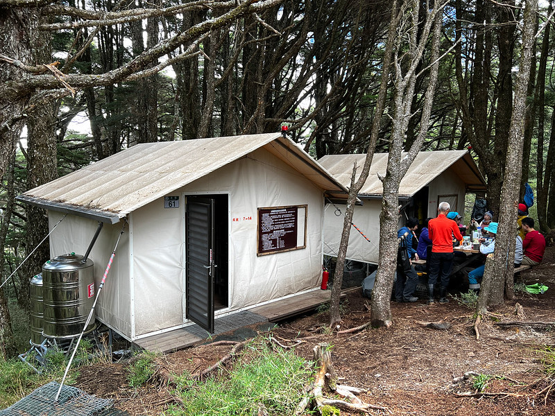
This shelter was finished in October 2021 and was open for application in January 2022. The materials used to
build those two shelters weighed 5.5 tons, and it took at least 220 shifts of porters to finish.
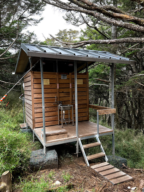
There are 2 shelters and 2 bio-degradable toilets here. Each shelter can accommodate up to 8 people. The beds
inside the shelters are foldable for an extra 8 people if needed. There are address plates for the shelters and
the toilet building.
Before reaching JuDong Shelters, our guide Xiao Tsai asked if anyone didn't want to stay at the shelter. One
male hiker and I raised our hands quickly. I'm not a fan of cabins unless I am the only person there. I like my
mesh tent and tarp.
While everyone was getting ready, I sat on a tree trunk, looking at this place. The evening sun cast light on
the woods and the shelters. It looked so relaxing.

There was no view around here because of the trees, but our guides managed to find a small footpath leading to
the slope. We went there to see the sun setting on Mt. Qilai North Peak.
If you come here to enjoy the sunset, please be cautious of discarded toilet paper scattering on the ground. I
don't understand why hikers didn't bother to take their trash with them. I'm so angry about this.
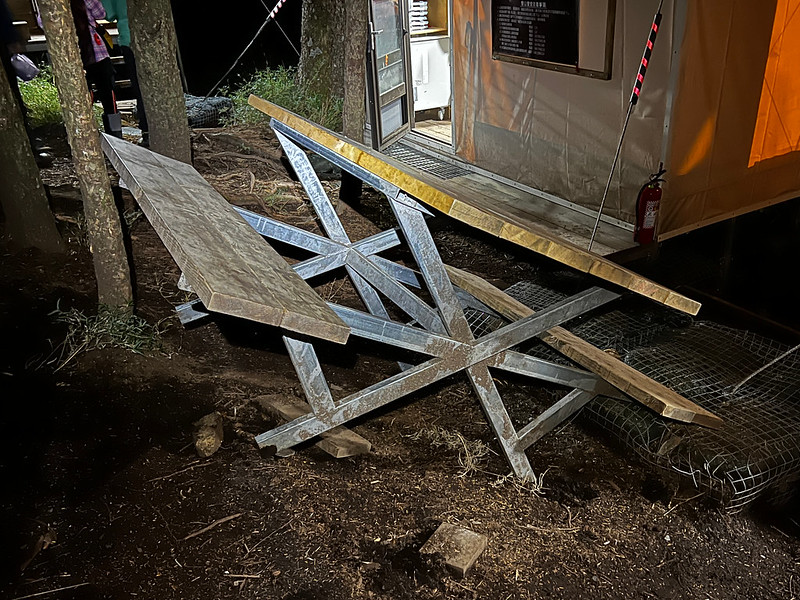
A Freak Accident
While most of us were sitting at the tables, something happened. Youqing and Bo'yun were prepping our dinner at
one table, and Mingshu was boiling water for us at another.
Suddenly, our hiking mates at Mingshu's table stood up, causing the table to tilt. The water Mingshu was boiling
spilled on him.
We were shocked and rushed to check on Mingshu. Luckily, Mingshu didn't get seriously burned, and we helped
clean up the mess.

Then, one of our hiking mates realized her leg was scraped by a rusty nail underneath the table chair and got a
massive wound. Now, we were worried. So, we took out our first aid kits to help clean up her wound.
The girl was extremely calm. She's a pharmacist and had her first aid kit and painkillers. Lucky for us, she was
doing ok, and everyone went back to the shelters to sleep. If this happened on Day 1, it would be more
complicated.
Day 3: Fantastic Mt. Yangtou Plus 1,000-Meter Descending
Day 3 Brief Itinerary: Judong Shelters ➔ Saw Mountain East Peak ➔ junction to Mt. Yangtou
➔ Mt. Yangtou ➔ return to junction ➔ Mt. Yangtou trailhead
GPS coordinates of Mt. Yangtou trailhead: 24.194060, 121.384576
GPS coordinates of Mt. Yangtou trailhead: 24.194060, 121.384576
05:13 We woke up around 4 am to have breakfast and got ready for Mt. Yangtou. We
left JuDong Shelters at 5:13 am.
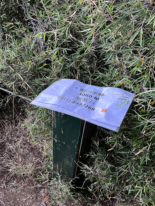
05:29 Reached Saw Mountain East Peak (3,060 meters). The height of this peak
shown on my PekFinder said 3,055 meters.
Beautiful Weather, Beautiful Views at Mt. Yangtou
05:42 We reached the junction to Mt. Yangtou at 3.8 km. The round trip from this
junction to Mt. Yangtou and back is about 2 hours.
05:42 Many hikers do Mt. Yangtou in one day, the out-and-back trail they take.
By doing this, they have to climb 3 km with an elevation gain of 1,010 meters before reaching this junction.

After a break and getting our essentials, we left our backpacks here and headed to Mt. Yangtou.
05:56 I Passed the 3.4 km post and saw a great view.
06:30 Arrived at Mt. Yangtou at the 4.1 km post. Some hikers will get up early
to see the sunrise. The sun was already up when we arrived, but the weather was terrific.
From Mt. Yangtou, I got a clear view of Mt. Lingming (3,272 meters) and Mt. Shuan (3,168 meters), the hike I did
just 2 weeks before Mt. Bilu and Mt. Yangtou.
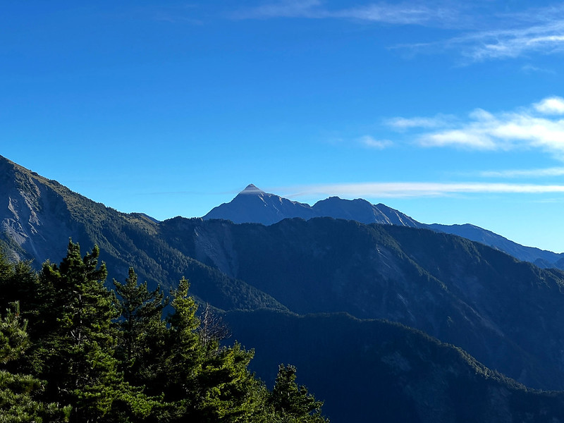
Then, clouds formed quickly around Mt. Zhongyangjian, which looked like Mt. Zhongyangjian was wearing a scarf.
Descending 1,000m or Ascending 1,000m If You Do Mt. Yangtou in One Day
From the junction, a 1,010 meter elevation loss was waiting for us.

After hiking for three days, I was tired and getting slower. Our guide Youqing kept me company and encouraged
me.
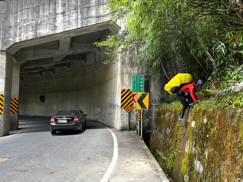
11:06 Finally, I saw our bus waiting for us near Ci'en Tunnel 慈恩隧道. Finally, we
walked over the top of the tunnel and climbed down the last ladder before calling it a day.
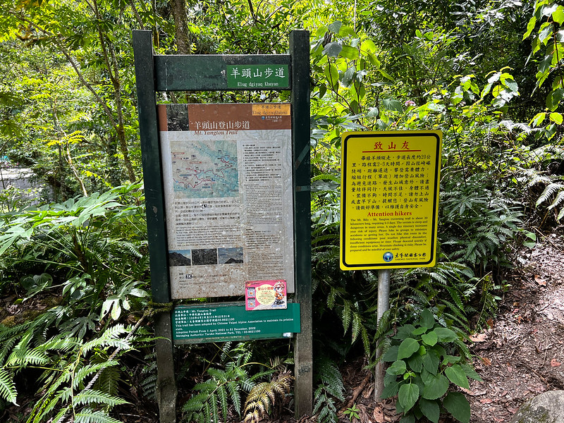
11:11 The trailhead to Mt. Yangtou is next to Ci'en Tunnel.
About Central Cross-island Highway 4 Spices and Hehuan Traversing Historic Trail
Mt. Maomu, Mt. Bilu, and Mt. Yangtou are in Ren'ai Township, Nantou County, and Xiulin Township, Hualien County.
Most hikers do Mt. Bilu and Mt. Yangtou, and some even do an out-and-back hike to Mt. Yangtou in one day.
Central Cross-island Highway 4 Spices 中橫四辣
There are several high mountains in the Central Cross-island Highway area. Among those 4 peaks are the toughest
ones: Mt. Pingfong 屏風山 (3,250 meters), Mt. Baigu 白姑大山 (3,341 meters), Mt. Bilu (3,371 meters), and Mt. Yangtou (3,035
meters), ranging from the most challenging to the (relatively) easiest one.
The trailheads of those mountains are at the Central Cross-island Highway, except Mt. Baigu. Before the 1999
Jiji Earthquake destroyed many sections of the Mt. Baigu trail, the trailhead of Mt. Baigu was at this highway.
Therefore, those four mountains are nicknamed the Central Cross-island Highway 4 Spices 中橫四辣 literally in
Chinese. If you have a better English translation idea for this nickname, please let me know.
The Hehuan Traversing Historic Trail and the Most Deadly Mountaineering Accident in Taiwan
The Hehuan Traversing Historic Trail was a 105 km long
trail between Wushe Village Ren'ai, Nantou, and Fushi Village of Xiulin, Hualien. The following map is from
Indigenous Peoples Cultural Development Center 原住民族文化發展中心. The Central Cross-island Highway 4 Spices are marked
in this map.

In 1910 during the Japanese Occupation, the Japanese government announced a 5-year project called Indigenous
People Management Project 五年理蕃計劃. The purpose of this project was to oppress the indigenous people, mostly
Atayal 泰雅族, Truku (Taroko) 太魯閣族, Sediq 賽德克族, and Saisiyat 賽夏族. (Reference: book 合歡越嶺道:太魯閣戰爭與天險之路.)
Those indigenous people lived on the lands with the vast camphor trees, the most valuable raw materials during
that time.
The Japanese government spent 2 years preparing Truku War 太魯閣戰爭, the biggest war in
Taiwan in the 20th century. One of the preparations was to explore this area for logistics. One of the
expedition teams was sent to Hehuanshan and Mt. Qilai North Peaks in March 1913. This team of 268 people reached
Hehuanshan Main Peak on March 21.
However, the weather turned sour. The cold snap and the northeast monsoon reinforced the strong wind. What made
matters worse was the narrow valley from Liwu River to Hehuanshan Main Peak, which pushed the wind to its
strongest when arriving at Hehuanshan Main Peak. Because of the unique terrain and weather, Hehuanshan used to
be the only skiing resort in tropical Taiwan in the 1960s and 1970s.
After the snowstorm passed on March 22, 1913, 89 people died of hypothermia or falling off cliffs, bodies
scattering on the slopes. Those deceased were indigenous porters. There were no casualties among the Japanese
members in this expedition. Nevertheless, this incident is also the deadliest disaster in Taiwan's
mountaineering history.
Taroko Trail was later rebuilt in 1933 and became Hehuan Traversing Historic Trail finished in 1935. The famous
Zhuilu Historic Trail was
also part of it, overseeing the majestic Taroko Gorge.

The First Highway That Connects the West to the East of Taiwan
In 1956, Taiwan started the Central Cross-island Highway construction. Many
sections of Hehuan Traversing Historic Trail merged into this highway. On May 9, 1960, Central Cross-island
Highway opened to traffic. This highway is 189.8 km (117.9 miles) and is also the first highway system
connecting the west to the east of Taiwan.
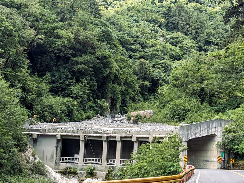
This highway route goes through the most rugged and unstable terrains. Typhoons, earthquakes, and heavy rains
also contribute to landslides and collapses. It is estimated that 212 people died during the construction.
To this day, many sections of the Central Cross-island Highway still collapse and are forced to close from time
to time when bad weather or earthquakes strike.
2026 Yushan Permit Application Guide
The hardest part of Yushan isn't the climb — it's the permit. My 2026 Yushan permit application guide walks you through the government site screen by screen, so you don't lose a date to a missed checkbox.