Mt. Shuan and Mt. Lingming: A 100 Peaks Trail Surrounded by Stunning High Mountains in Taiwan
If you are looking for relatively easy 100 Peaks in Taiwan and enjoy the magnificent Central Mountain Range,
the hike to Shuanshan (Mt. Shuan) and Lingming Shan (Mt. Lingming) might be for you. Moreover, it's easy to
apply for permits. The stunning views on the trail make this hike one of the most accessible 100 Peaks in
Taiwan.
Disclaimer:
All content is for inspiration only. Use Taiwan Hikes' suggestions at your own risk. We are not responsible for any losses, injuries, or damages.
All content is for inspiration only. Use Taiwan Hikes' suggestions at your own risk. We are not responsible for any losses, injuries, or damages.
Table of Contents:
- Trail Information
- Personal Enjoyment
- Map/GPX Data
- How to Get There
- Day 1: 730 Forest Road and Flooded Campground
- Day 2: Great Weather and Fantastic Ridgeline Views from Mt. Lingming
- Day 3: Even More Splendid Landscape on The Way to Mt. Shuan
- About Mt. Shuan, Mt. Lingming, and the North Section 2 of the Central Mountain Range
- Related Posts
Trail Information
Trail Name: Mt. Shuan and Mt. Lingming
Distance: 41 km (25.5 miles)
Route type: Out and back
Days/Hours Needed: 2 to 3 days
Total Ascent/Descent: 2,023 meters/2,041 meters
Best Time to Go: All year round.
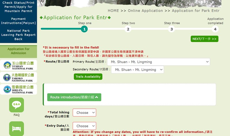
Permits: You only need to apply for Taroko National Park Permit. No Police Entry is required.
Difficulty Level:
Peaks to Reach:
Distance: 41 km (25.5 miles)
Route type: Out and back
Days/Hours Needed: 2 to 3 days
Total Ascent/Descent: 2,023 meters/2,041 meters
Best Time to Go: All year round.
Permits: You only need to apply for Taroko National Park Permit. No Police Entry is required.
Difficulty Level:
Peaks to Reach:
- Mt. Shuan, aka Shuanshan, 閂山, 3,272 meters (10,735 feet) above sea level. There is a Class 3 Triangulation Stone on the peak. The views are incredible. You can see Mt. Lingming from the peak.
- Mt. Lingming, aka Lingming Shan, 鈴鳴山, 3,168 meters (10,394 feet) above sea level. There is a Class 3 Triangulation Stone on the peak. The views are fantastic.
- Mt. Rendai, aka Rendai Shan 人待山, 3,114 meters (10,216 feet) above sea level. This one is not classified as a 100 Peaks. 360-degree views on the top, too.
- Mt. Rendai North Peak, aka Rendai Shan North Peak人待山北峰, 3,074meters (10,085 feet) above sea level. This one is not classified as a 100 Peaks. No views on the peak.
Personal Enjoyment
Things I Enjoy:
- The stunning views! The views on Mt. Shuan, Mt. Lingming, and Mt. Rendai are amazing! I did several hikers around this area in July and August 2022, and I was thrilled to see those peaks that I did and was going to visit. It feels surreal that I was on those peaks not long ago.
- There are some ups and downs while doing this hike, but the trail terrains are relatively easy to traverse.
- Walking on 730 Forest Road (730 林道) reminds me of Dalu Forest Road 大鹿林道 on the way to the trailhead of Dabajian Mountain, but less tedious. I saw many relics of the old road left behind.
- It's easy to apply for permits for this hike. There is a shelter at 25 km on 730 Forest Road, but it can be packed if many hikers visit here. You can find other campsites along 730 Forest Road.
Others:
- You can book on-site catering service for tents, sleeping bags, and meals.
- There is no water source near the shelter or other campsites. Before reaching the shelter, you can draw water at either 15 km or 24.2 km on 730 Forest Road. The water can be muddy, and you might need to bring a water filter.
- The shelter at 25 km is first come, first serve. If you hike on the weekend or holidays, there may not be enough room to take a spot there. So it's better to bring your tent just in case.
- Pack a light or small backpack because you only need to bring essential gear to Mt. Lingming and Mt. Shuan. You can leave your big one at the campground and the junction to Mt. Shuan.
- Stinging Nettle Biting Cats 咬人貓 are booming on 730 Forest Road. It's not fun to brush skin against them.
-
Be aware of tiny bugs at our campground. They are annoying. You can bring a head net.
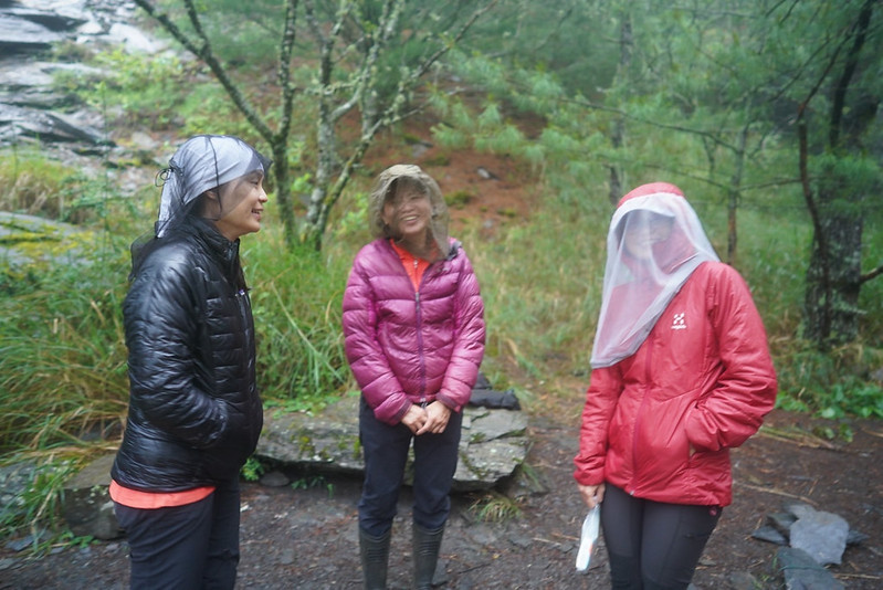
Our guides brought head nets. Photo by my hiking mate.
Map/GPX Data
Date of Hike: July 30 - August 1, 2022
Click Menu in the map to download, print, or share the map.
You can see more options after clicking the Play button.
Click to change the speed to meet your condition.
You can see more options after clicking the Play button.
Click
to change the speed to meet your condition.
How to Get There
There is no public transport to the trailhead. It's better to hire a driver to take you there. I don't recommend
you drive your car unless yours is a 4WD one. The road conditions suck, and your vehicle might be badly damaged.
One of our vans broke down because of this.
Take Bus and Hire A Pickup
If you plan to hire a van, you can take public transport to Huanxing 環興 bus stop at Huanshan Village or Sqoyaw
環山部落. This place is on Central Cross-Island Highway in Heping District, Taichung City 台中市和平區.
Kinbus has two buses going to Huanxing bus stop: 1751 from Yilan Transfer Station 宜蘭轉運站, and 1764 from Luodong Transfer Station 羅東轉運站.
It takes around 3 hours from both stops to the Huanxing bus stop. There is only one bus running in the morning
and noon for each route.
1751 bus fare: NT$303
1764 bus fare: NT$310
1751 bus fare: NT$303
1764 bus fare: NT$310
Take Bus and Hike An Extra 7.5 km to Trailhead
If you don't want to hire a pickup service, you can start your hike from Qingquan Bridge 清泉橋 and hike an extra
7.5 km on 730 Forest Road to the trailhead (GPX coordinates: 24.292274, 121.310437).
Then, take the 7.5 km back to Qingquan Bridge. You will find a bus stop also called Qingquan Bridge there.

Where to Stay
Most hikers stay at Wang Xiaoming B&B 光果農莊-王小明登山協助站.
This B&B is right next to Huanxing bus stop.

There are bunk beds with curtains for your privacy. But if you are tall, you might find the space too small.
Wang Xiaoming B&B also provides meals and pickup service to the trails nearby.

I stayed there before doing Mt. Pingyan and Mt. Duojiatun hikes). The bed and showers are ok. Because this is
also a farm, expect to see many flies. This one is the cheapest at Huanshan Village 環山部落. You can contact other
B&Bs here if you prefer regular beds.

Day 1: 730 Forest Road and Flooded Campground
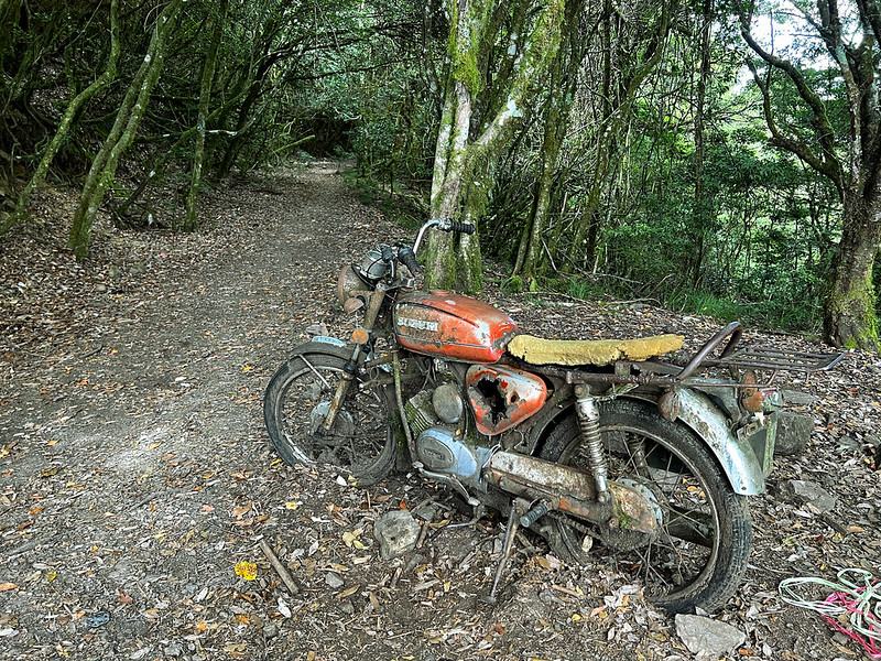
Day 1 brief itinerary: Trailhead at 11.7 km on 730 Forest Road ➔ Abandoned Suzuki motorbike at 16
km on 730 ➔ Shuanshan Gate at 18 km on 730 ➔ junction to Mt. Shuan at 23.2 km on 730 ➔
campground
GPS coordinates of 11.7 km at 730 Forest Road: 24.292274, 121.310437
GPS coordinates of 11.7 km at 730 Forest Road: 24.292274, 121.310437
I was planning to do this hike in October 2021, but things came up and I had to cancel it. Lucky for me, our
guide Kevin Wu 吳冠英 from LOHAS, had this hike again in July 2022. So, I finally made it.
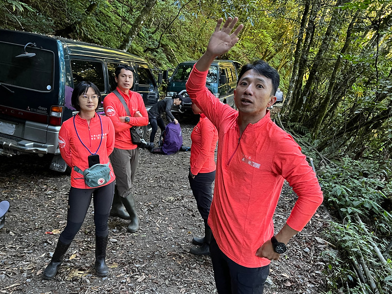
As usual, we got up early and headed to the trailhead around 6:50. If you have read my Mt. Jyunda hike, I mentioned
the rough 2-hour/32km ride from the entrance of Juynda Forest Road to the trailhead.
Well, this 730 Forest Road is a mini version of the Dalu one. Fortunately, getting to the trailhead on 730
Forest Road took one hour.
08:00 After getting ready, Kevin led us cross the gate with a warning sign.

Through the trees, the ridgeline of Wuling Quadruple Mountains Trail.

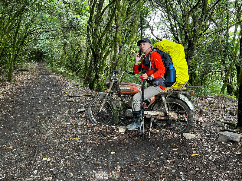
09:30 We reached the famous landmark, the abandoned motorbike. This bike might
have been left by one of the workers at the forest logging station decades ago. Now, it's become a popular photo
spot for hikers to take a break and take photos.
From here, the trail/730 Forest Road became relatively easy to hike. While walking on this forest road, many
things gave away this trail's previous identity as a transport passage, old signs, roadside blocks, etc.

10:26 After making a turn, we arrived at another famous landmark, Shuanshan Gate
or Mt. Shuan Gate 閂山之門. We took a one-hour lunch break.

It's a fallen humongous tree (I don't know what tree it is) that happened to rest on the side of the trail. It's
strong enough for hikers to sit on the trunk and take photos.

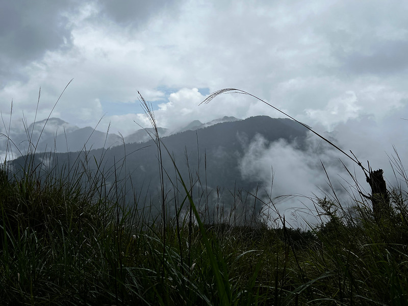
Around noon, the weather turned gray and started drizzling. If the weather was good, we could see the famous Mt.
Nanhu 3,742 meters and Mt. Zhongyanjian 3,705 meters through the trees. Then, we passed the junction to Mt.
Shuan at some point.
The drizzling had morphed into heavy rain by now. I only hoped Mother Nature would grant me good weather for the
next two days.
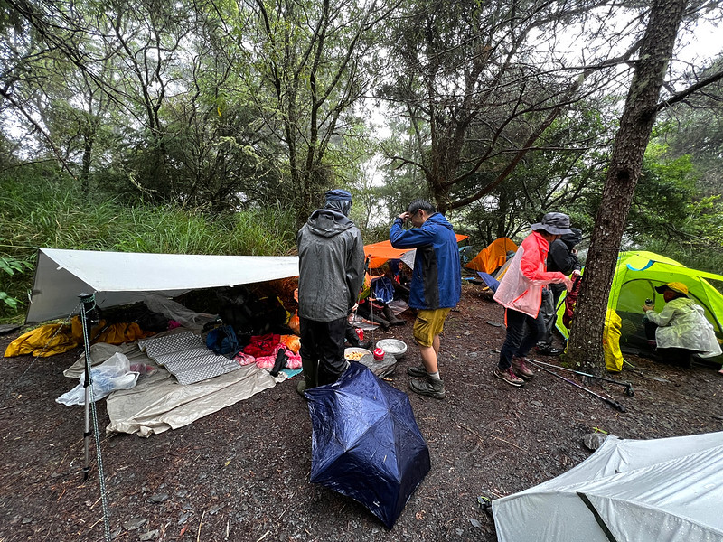
We were planning to camp near the water source at 24.2 km. We didn't expect to get spots at the shelter. So, we
found a place to pitch our tents.
Pitching a tent in the rain was hard for me. When I was still struggling in the rain, our guides had already set
up their tarp and started boiling water. They saw my struggle and asked me to sit under their tarp to have hot
drinks.

When everyone finished, we carried our water bags to fetch more water if the rainfall wasn't enough. We passed
several tents on the way to the water source.
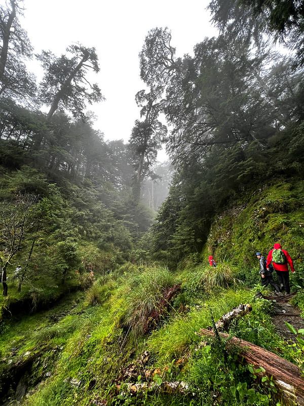
Then, we passed here. I thought this valley was beautiful.
Finally, we reached the water source, and there was already a long queue. First, we waited 20 minutes in the
rain because the water flow was smaller than household tap water. Then, when it was finally our turn, the flow
suddenly became a swift current accompanied by dirt.
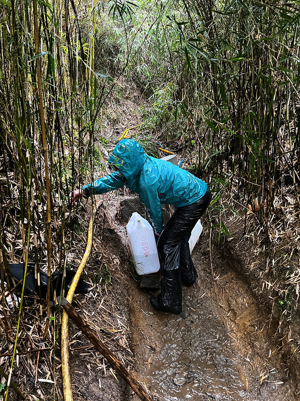
This is the water I drew. Luckily, we collected enough rain to cook meals.

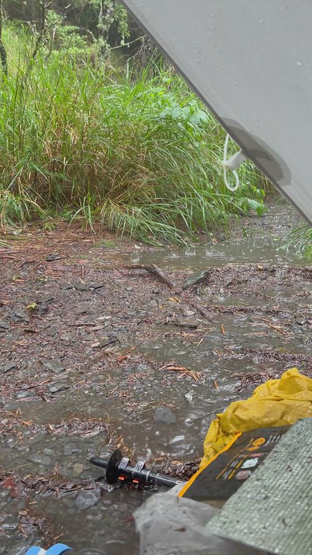
The Most Unforgettable Camping Experience
The heavy rain continued for a while after we sat inside the tarp. Everything was wet, including my groundsheet.
Not gonna lie, I felt miserable and upset.
While self-pitying and wondering how I could sleep, our guide, Boyun, casually said: it's part of life; stay dry
as much as possible. He was right. I survived the rain and even got a decent sleep.
Later, I keep thinking about that moment. This rain has enriched my hiking experience and made me a little bit
stronger mentally.
Day 2: Great Weather and Fantastic Ridgeline Views from Mt. Lingming
Day 2 brief itinerary: Campground ➔ shelter at 25 km on 730 and a junction ➔ Mt. Rendai
North Peak ➔ Mt. Rendai ➔ Mt. Lingming ➔ Take the same trail back to our campground
05:05 We carried the essentials and started our hike.
05:43 We reached the shelter at 25 km on 730 Forest Road. Hikers don't need to
apply for this shelter. It's first come, first serve.

It has 8 rooms and can accommodate around 25 hikers. The outdoor space is big enough to pitch 4 tents. If you
want to stay here, it's better to come early. Expect rats to have a party at night.

After the shelter, we reached a junction. We took the way up because of a collapsed section.

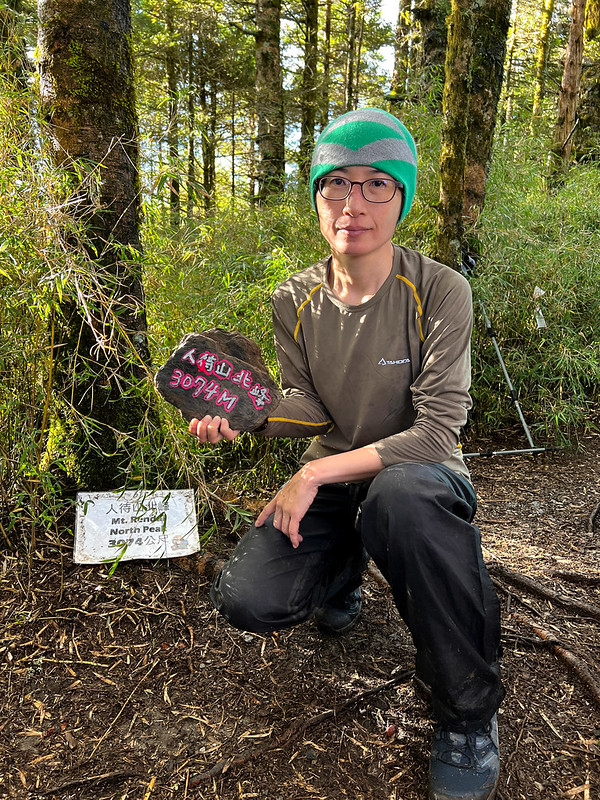
06:54 After going through the thick bamboo woods, we arrived at Mt. Rendai North
Peak. This peak was covered by tall trees without views. We took a short break and resumed our hike.
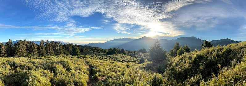
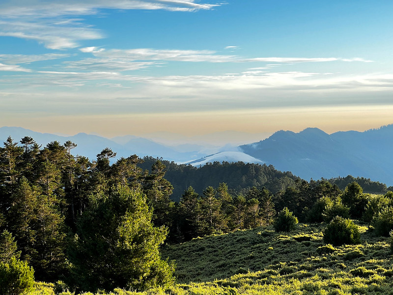
Striking Ridgeline Views
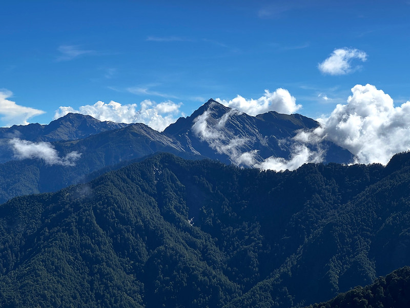
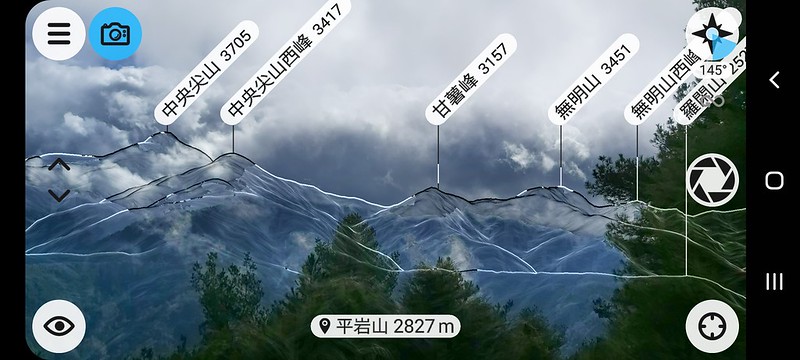
07:29 We reached Mt. Rendai, 3,110 meters. The views here were amazing! I saw
the famous Mt. Qilai North Peak (3,607 meters, aka Black Qilai), Zigzag Peaks 鋸齒連峰, Mt. Bilu (3,371 meters), and
Mt. Baigu (3,342 meters).
When looking at Mt. Bilu 畢祿山 (3,371 meters) and Zigzag Peaks 鋸齒連峰, I was scared because I was going to do that
trail two weeks after Mt. Shuan and Mt. Lingming. Going up and down with a heavy backpack on the trail like that
is fun.

Aside from those mountains, many major 100 Peaks can be seen here, too. For example, Mt. Hehuan East Peak and
North Peak, Mt. Qilai South
Peak, Mt. Pingfeng, Mt. Nanhu, Mt. Zhongyangjian, etc.

I don't know why Mt. Rendai isn't labeled as 100 Peaks.
With great delight, we headed to our goal for that day, Mt. Lingming, and dived into the bamboo woods. After
doing 100 Peaks for a while, you will get used to the bamboo woods mixed with the tall trees from the frigid
zone in Taiwan.

Remember to protect your eyes when passing through those bamboo woods.
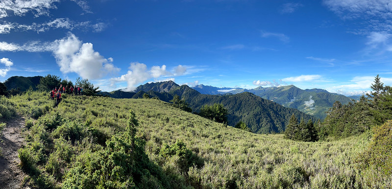
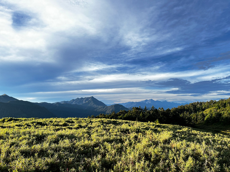
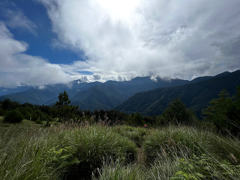
Mt. Lingming Surrounded by Vast Grassland and Spectacular Scenery
08:33 After we exited the bamboo woods, the view opened up, and the landscape
changed. A vast grassland expanded on the sides of the ridgelines, and Mt. Lingming was so close. Almost.

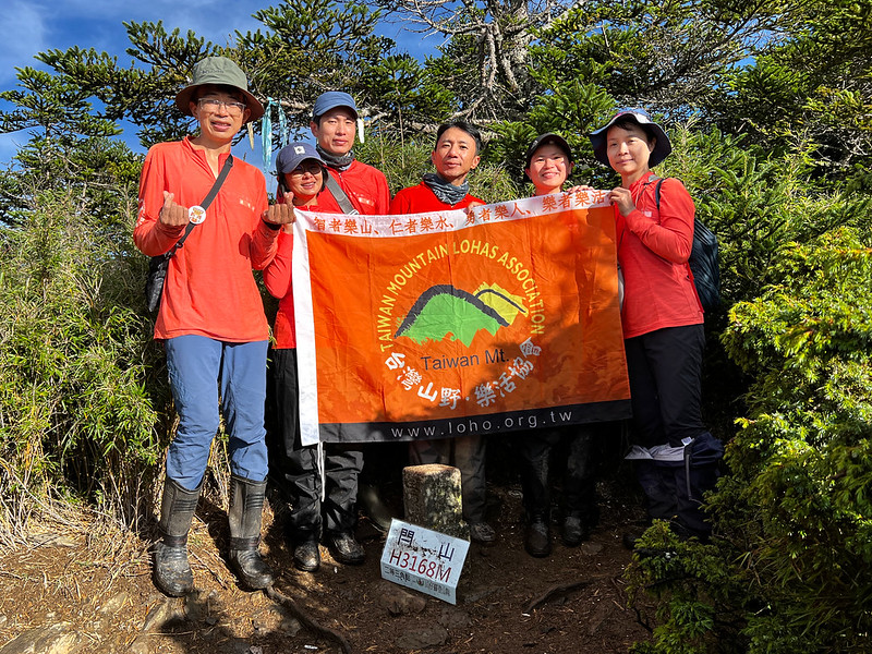
08:49 Finally, we reached Mt. Lingming. Lucky for us, it wasn't too crowded at
the peak. We stayed there, taking as many photos as we wanted.

Then, it was about time to say goodbye. We took the same way back.

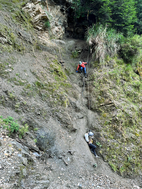
When we reached the junction to the collapsed slope, Minshu and Damei decided to take the shortcut, and they let
me tag along.
I don't recommend you take this route if you are not okay with heights. My power died, so I didn't take photos
here. I slipped when descending from the slope, and Damei took this photo for me.
A Reminder of the High Mountain Weather in Taiwan
By the time we returned to our tents, it was raining again. It's hard to imagine we had the best morning
weather. But this is the high mountain in Taiwan. So prepare rain gear and keep your gear dry inside your
backpack as much as possible.
Day 3: Even More Splendid Landscape on The Way to Mt. Shuan
Day 3 brief itinerary: Campground ➔ the junction to Mt. Shuan at 23.2 km on 730 ➔ Mt. Shuan
➔ return to the junction ➔ Shuanshan Gate at 18 km on 730 ➔ abandoned motorbike at 16 km on
730 ➔ trailhead at 11.7 km on 730
The rain stopped in the middle of the night, and I left my tent to enjoy the starry sky.

04:40 We left our campground and took the same way back. Soon, the sky in the
east started to brighten up.
05:00 We reached the junction of Mt. Shuan. Although the weather was slightly
better than the previous night, our tents still got wet. We placed our tents on the trees, hoping the rising sun
would remove some moisture.
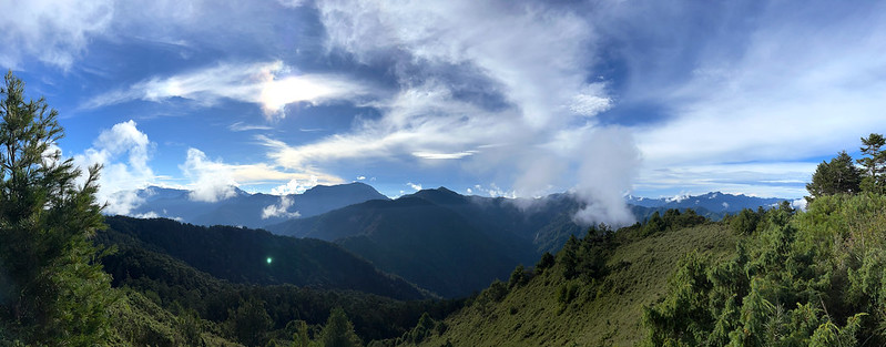
Incredible Sunrise from Mt. Zhongyangjian and Mt. Nanhu
05:40 When we reached a massive grassland, the sky was getting brighter. Kevin
let us stay here to enjoy the sunrise.
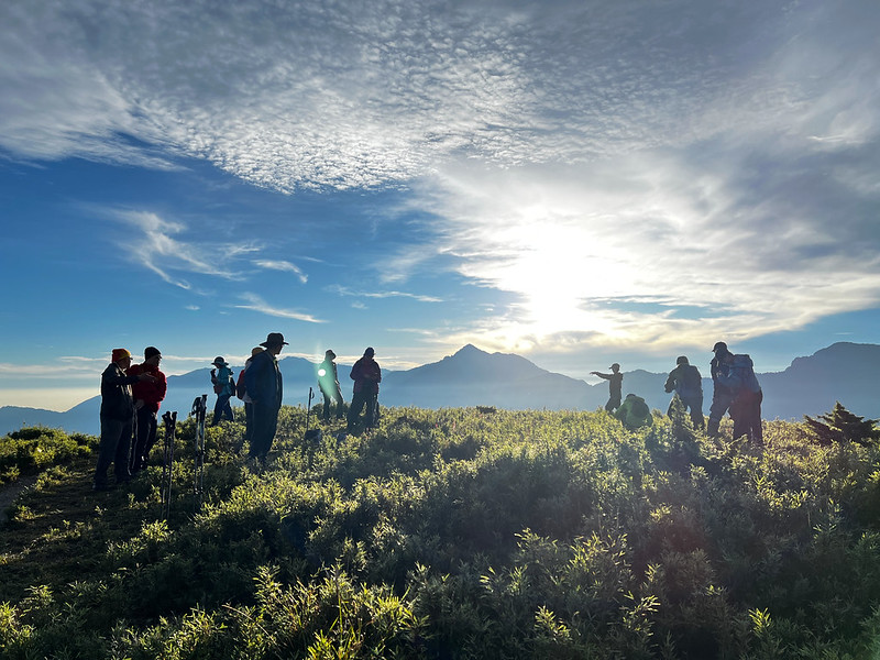
On my right, the second-highest mountain in Taiwan, Mt. Snow/Mt. Sylvia and three famous Wuling Quadruple
Mountains (Mt. Pingtian, Mt. Chiyou, and Taoshan) were there, too.
We stayed there for 30 minutes and resumed our hike to Mt. Shuan.
06:58 We reached Mt. Shuan. The space at the peak of Mt. Shuan was small, but
the views were equally stunning.
We stayed at Mt. Shuan for 20 minutes and returned. Within 30 minutes, the weather went from sunny with clouds
to gloomy. We were lucky to see the fantastic views on the way to Mt. Shuan.
09:05 We were back at the junction. We packed our tents that were still wet, and
took 730 Forest Road back.
10:20 We were back at Mt. Shuan Gate.
11:00 We arrived at the abandoned motorbike again.
One of Our Vans Broke Down
Our hired vans waited near the trailhead, and the bumpy ride awaited us. Suddenly the van before mine stopped,
and I saw the driver bent down to check something.
Later, we were told that the van's axle was broken, and the driver had just had major maintenance. So if you
want to do this hike, please either hike an extra 15 km (round trip) or hire a van. Don't drive your own car.

About Jinmingzhen Road
You will see a junction to Jinmingzhen Road 金明真路 and Mt. Shuan near the shelter. It is 2.3 km shorter than the
one we took, but it's more treacherous. If you still want to take this shortcut, please stay safe and have a map
or GPS with you.
Last but Not Least: Wildflowers
I found many beautiful wild flowers on this trail.

For more wildflowers I saw on the trails, please check out my Flowers on the Trails page.
I hope you enjoy this post. Would you like to do Shuanshan and Mt. Lingming hike? Feel free to let me know in
the comments below.
About Mt. Shuan, Mt. Lingming, and the North Section 2 of the Central Mountain Range
Central Mountain Range divides Taiwan into the east and the west. It starts from Su'ao Yilan and ends in
Hengchun in Pingdong, with a length of 340 km.
The Central Mountain Range is also the home of 69 100 Peaks in Taiwan. The southernmost 100 Peaks, Mt. Beidawu,
also belongs to the Central Mountain Range.

It's not easy to hike 69 of the 100 Peaks at the Central Mountain Range in one go. So, the hiking community in
Taiwan divides those peaks into 6 sections: North Section 1, North Section 2, North Section 3, South Section 1,
South Section 2, and South Section 3.
Mt. Shuan and Mt. Lingming
Mt. Shuan and Mt. Lingming are part of the North Section 2 of the Central Mountain Range hike and are located at
Taroko National Park. North Section 2 route is a famous and challenging 100 Peaks hike in Taiwan.

However, it's relatively easy if you only do Mt. Shuan and Mt. Lingming. Most hikers do this hike in 3 days, and
some do it in 2 days. Some even do Mt. Shuan in one day.
North Section 2 of the Central Mountain Range
There are four 100 peaks on this route. Other than Mt. Shuan and Mt. Lingming, the other two peaks are Mt.
Ganzhu or Ganzhu Peak (or Ganshu Feng) 甘薯峰 (3,158 meters/10,361 feet) and Mt. Wuming 無明山 (3,451 meters/11,322
feet).

Ganzhu means yam/sweet potato in Chinese. That's why you will see hikers put a yam on the triangulation stone at
Mt. Ganzhu.
Section 2 is a loop hike, 50.9 km/31.6 miles, and it takes around 5 to 6 days to do this route.
While hiking to Mt. Wuming, hikers need to overcome the infamous Wuming Cliff 無明斷崖 and Guimenguan Cliff 鬼門關斷崖.
Guimengguan means ghost gate in Chinese. It's a metaphor for a dangerous place. So you can imagine how
challenging and scary they can be.