Mt. Pingyan and Mt. Duojiatun: A Firebreak Hike Hugged by Mt. Snow and Central Mountain Range
Ping-Duo Hike refers to the trail from Mt. Pingyan to Mt. Duojiatun, which isn't far from the famous Wuling
Farm in Taichung. What's so special about this hike is you get to hike between two famous mountain ranges in
Taiwan: The Xueshan and the Central Mountain Range, with stunning views. The endless hills and pine needles on
the trail make this trip even more memorable. If you want to experience the spectacular high mountain trails
within one day, this hike is for you.

Table of Contents:
Trail Information
Trail Name: Mt. Pingyan 平岩山 and Mt. Duojiatun 多加屯山 Trail, short name for
Ping-Duo Trail 平多縱走
Distance: 16.7 km (10.4 miles)
Route type: Point to point
Days/Hours Needed: At least 11 hours. It's better to stay at the B&B near the trailhead so you can start your hike early in the morning.
Ascent/Descent: 934m/1,198m
Best Time to Go: All year round
Permits: Not required. Difficulty Level:
Peaks to Reach:
- Mt. Pingyan 平岩山, 2,827 meters (9,275 feet). There is a Class 2 Triangulation Stone on the peak.
- Mt. Duojiatun Front Peak, 多加屯山前峰, 2,723 meters (8,933.7 feet).
- Mt. Duojiatun, 多加屯山, 2,795 meters (9,170 feet). There is a Class 3 Triangulation Stone. We didn't get to Mt. Duojiatun this time.
- Mt. Shengguan, 勝光山, 2,285 meters (7,496.7 feet). There was a triangulation stone, but it is missing now.
Personal Enjoyment
Things I Enjoy:
- Like the ROMA hike I did in 2019, I love this trail! The views are amazing.
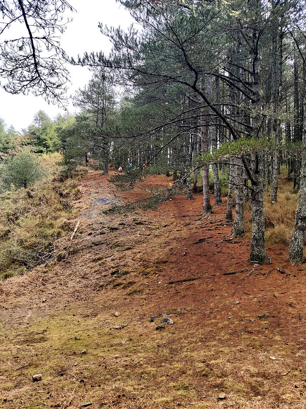
- After “swimming” through the bamboo woods, the wide firebreak is waiting for you. This section is covered with pine needles, and it's so comfortable to walk on them. However, the steepness of this firebreak can still bite your butt and spice up your hike.
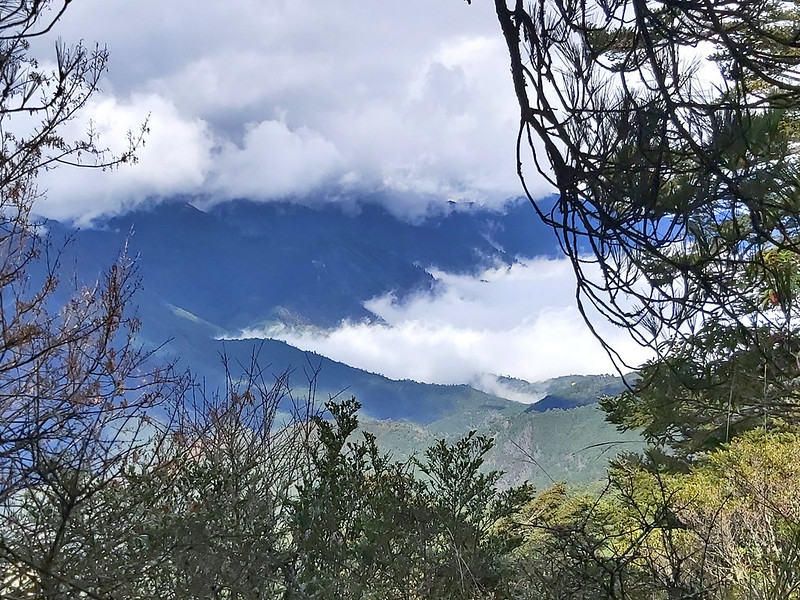
- The sights of two stunning mountain ranges in Taiwan, the Xueshan (Mt. Snow) Range and the Central Mountain Range, the endless the sea of clouds, and terrains covered with pine needles make this hike even more memorable.
- If you are looking for challenging hikes, the 1,000m+ ascend and descend will also spice up your enjoyment, not to mention the swimming section through the bamboo woods before reaching the firebreak.
Map/GPX Data
Date of Hike: Group hike with THMA 新北市山岳協會 on January 8, 2022
Route map for 2022-01-08 Pingyan Mountain And Doujiatun Mountain by Anusha Lee on plotaroute.com
Click Menu in the map to download, print or share the map.
You can see more options after clicking Play button.
Click to change the speed to meet your condition.
You can see more options after clicking Play button.
Click
to change the speed to meet your condition.
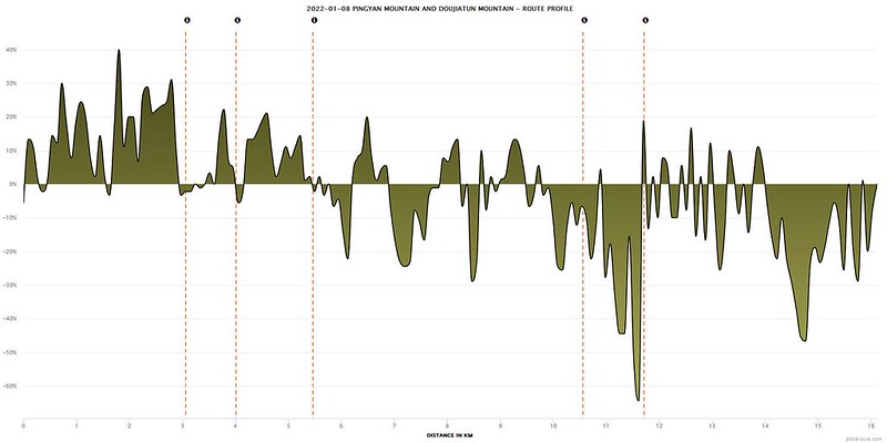
Note: According to our guides, who did this hike again in March, the route is changed due to landslides at 6.1k on
710 Forest Road. So, if you do this hike, you need to take a detour. Please see this map for details.
How to Get There and B&B to Stay
If you have enough people in your group, the easiest way is to hire a van to take you to the trailhead and pick
you up after you finish.
If you want to drive and park your car near the trailhead, the distance between point A and point B is about 7
km, which takes around 2 hours to walk back to your vehicle.
Public Transport
If you don't drive, you can still take buses. However, the bus schedule is limited and almost impossible to
catch the bus after you finish your hike. If you can have extra days to do this hike, you can stay at one of the
B&B one day before and after your hike.
Option 1: take Kingbus 國光號 1764 (Luodong - Lishan 羅東 - 梨山) at Luodong Transfer Station 羅東轉運站 in Yilan at 7:00 or 12:00. Get off at Yuli Store
Stop 豫立商行站. The one-way ticket is around NT$310.
Option 2: take Kingbus 國光號 1751 (Yilan – Lishan 宜蘭 - 梨山) at Yilan Transfer Station at 7:30 or 12:40. Get off at Yuli Store Stop 豫立商行站. The
one-way ticket is around NT$290.
B&B to Stay
Some hikers say some B&B near the trailhead also offers pick-up services. You can contact them for details.

About Qalang Sqoyaw, Mt. Pingyan and Mt. Duojiatunn
Huanshan Tribe (Qalang Sqoyaw) 環山部落
This trail starts at Huanshan Tribe, aka Sqoyaw. Sqoyaw Tribe is the biggest settlement among the indigenous Atayal people in
Lishan 梨山.
The tribe is located in the village (between 1,600 and 1,800 meters above sea level), surrounded by mountains
above 3,000 meters. That's why it's also called Huanshan Tribe. Huanshan means being surrounded by mountains.
This place used to be the only entrance to do Mt. Snow hike many years ago.
Mt. Pingyan 平岩山
Mt. Pingyan (2,827 meters) is in Heping District, Taichung City 台中市和平區, and
belongs to the Central Mountain Range. Hikers can see Xueshan Mountain Range while ascending.
When reaching the peak of Mt. Pingyan, hikers can enjoy the incredible views of Mt. Nanhua, Zhongyanjian
Mountain, and other 100 Peaks. Therefore, Mt. Pingyan is also called the observation deck of 100 Peaks 百岳觀景台.
Mt. Duojiatun 多加屯山
Mt. Duojiatun is located between the border of the Heping District of Taichung and Datong Village of Yilan. This
mountain belongs to the Central Mountain Range, and the peak extends from Mt. Nanhu. The trail is also mostly
covered with pine needles.

For hikers who want to hike Mt. Nanhu or North Section One 北一段, Mt. Duojiatun is the first peak
to take on. It's a shame that we didn't get to Mt. Duojiatun, but we reached Mt. Duojiatun Front Peak (aka
Northwest Peak). The sight of Mt. Snow and the other 100 Peaks from the front peak is fantastic.

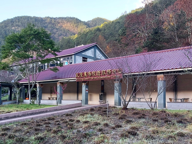
A Brief Visit of Wuling Farm: The Gate to Mt. Snow and Other 100 Peaks
Wuling Farm, 1,750 meters above sea level, is one of the most popular tourist
attractions in Taiwan. It is famous for the spring blossoms and the fantastic views. You can read Foreigners in Taiwan's post for the details of Wuling
Farm.
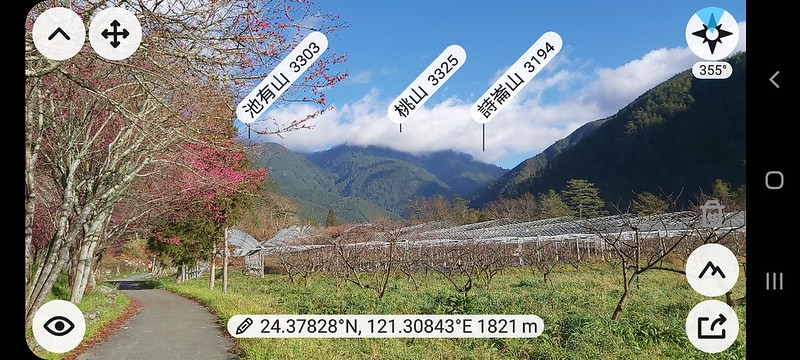
For hikers like me, Wuling Farm is also the gate to many 100 Peaks, like Mt. Snow (Xueshan, 3,886 meters), Mt.
Pintian 品田山 (3,524 meters), Mt. Chiyou 池有山 (3,303 meters), Mt. Tao or Taoshan 桃山 (3,325 meters), Mt. Kalaye 喀拉業山
(3,133 meters) and more. Those 4 are also called Wuling-Quadruple or Wuling Quadruple Mountains 武陵四秀.
Tourists can also see other 100 peaks, like Mt. Shuan 閂山 (3,168 meters) and Mt. Lingming 鈴鳴山 (3,272 meters).
Even if you don't do 100 Peaks, Wuling Farm is a great place to explore
and relax. We were supposed to do another hike, but our guide decided to change the plan because the weather
wasn't good on that trail.

Cijiawan (or Qijiawan) Creek 七家灣溪 at Wuling Farm is also home and sanctuary for the critically endangered Formosan Lanklocked Salmon 櫻花鉤吻鮭.

We spent the whole morning wandering around at Wuling Farm. It was freezing cold when we got there in January.

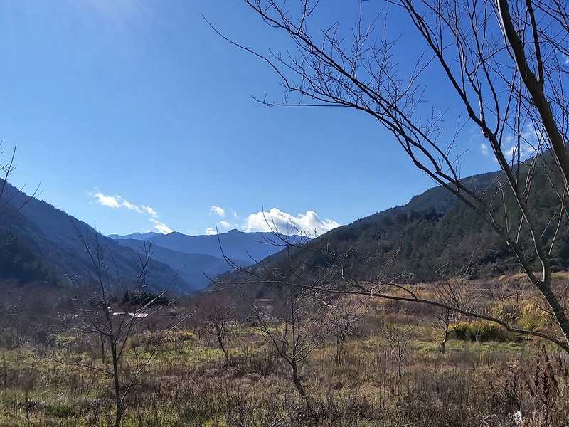
Drastic Weather Change in Yilan
For people who are not familiar with the weather in Taiwan, Yilan (eastern Taiwan) claims to be the wettest
place on this small island, and it rains constantly. The weather was sunny and beautiful when we were at Wuling
Farm in central Taiwan. But we witnessed a drastic change once we entered the border of Yilan. I am glad to have
this video as proof.
My Itinerary
Brief itinerary: Trailhead near the farm ➔ Pingyan Pond ➔ Mt. Pingyan ➔ Doujiatun
Shelter ➔ Mt. Doujiatun Front Peak ➔ Mt. Shengguan ➔ Trailhead near Changliang Bridge 張良橋
➔
GPS coordinates of the trailhead near the farm: 24.338443, 121.319100
GPS coordinates of the trailhead near the farm: 24.338443, 121.319100
We arrived at B&B on the previous day. My Matsu friend Jeffery Chang 張建舫 and I joined TSMA's trip
to do this hike.
05:00 Got up and got ready for the hike.
06:00 Headed to the trailhead. Our guides told us to wear the rain paints
because we had to go through bamboo woods, and morning dews would cover us.
06:31 Arrived at the trailhead. Our guide suggested we put on our rain pants
because we had to went through bamboo woods before reaching the firebreak. The morning dews on the bamboos would
make our pants soaking wet.
06:39 Ready to hike.
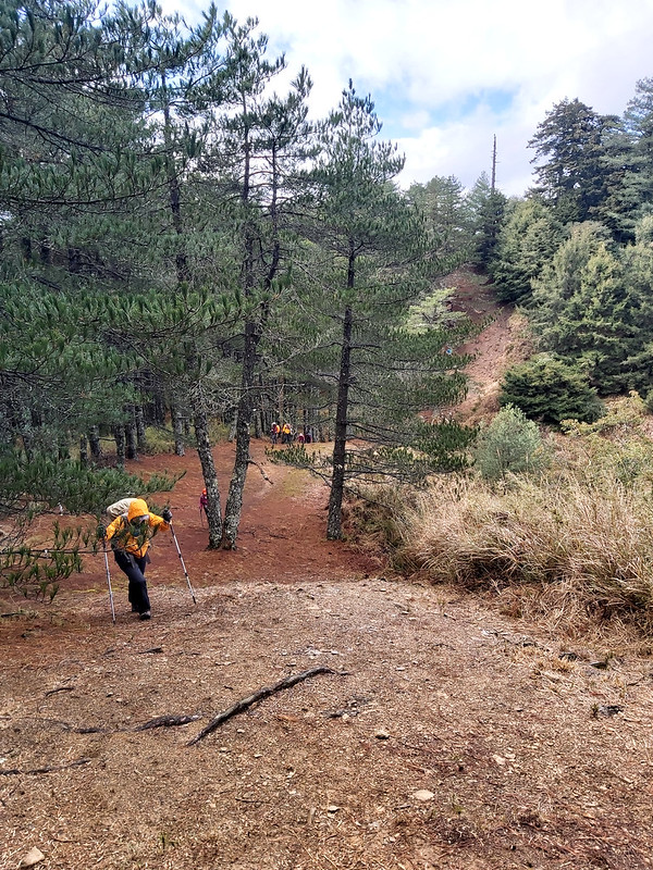
07:11 While climbing the steep slopes, we got a glimpse Xueshan through the
trees.

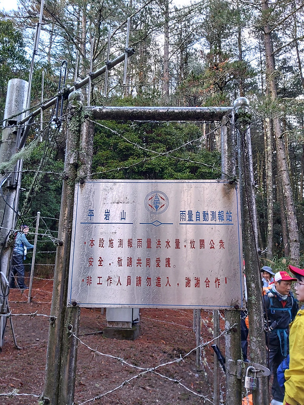
07:24 Arrived at Pingyan Rain Measurement Station 平岩山雨量自動測報站 and took a
20-minute break.
Then, we entered the dense bamboo woods 箭竹林. That was why our guides suggested us to put on our rain pants.


08:12 We stopped at a tree with small fruit with ruby colors. Some parts of the
trunk were stripped of barks. Our guide said this was done by the animals.

Other than bamboo woods, we were also surrouned by tall pine trees.

08:56 We arrived at Pingyan Pond and took a long break.

Pingyan Pond was quite large, and I thought this might be a decent place to camp.

And group photos. This photo was taken by our hiking mate.
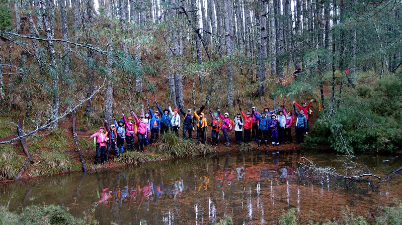
We took many photos here. If you come here, don't miss the woods near the pond.
The light made a gracious displace within the woods, and the lights were amazing.

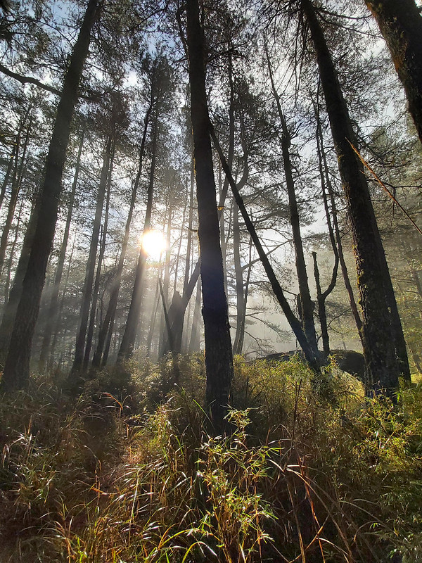
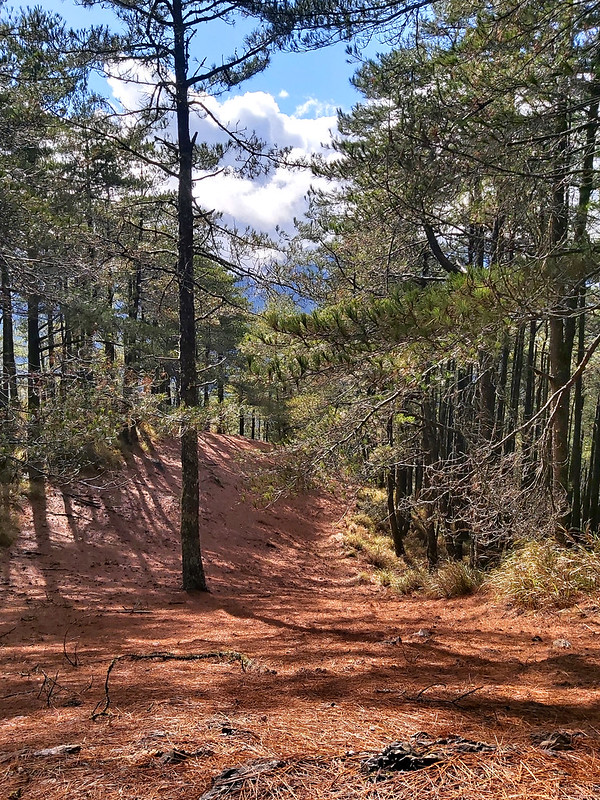
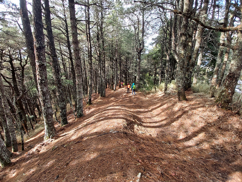
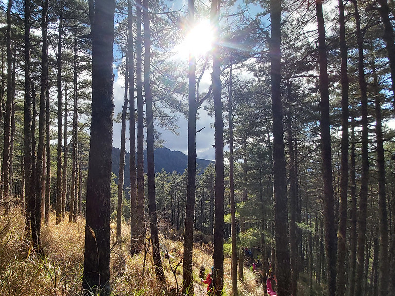
09:43 Reached the firebreak ridge — no more bamboo woods from here.
This ridge was so broad that our guide was joking that it was big enough to drive here if you could get your car
there.

The ridge was totally covered by pine needles and surrounded by tall pine trees. I thought it would be much
easier to hike here. I was wrong.
10:13 There were some openings on the sides of the ridge. I used my PickFinder
app to check out what mountains I was looking at.

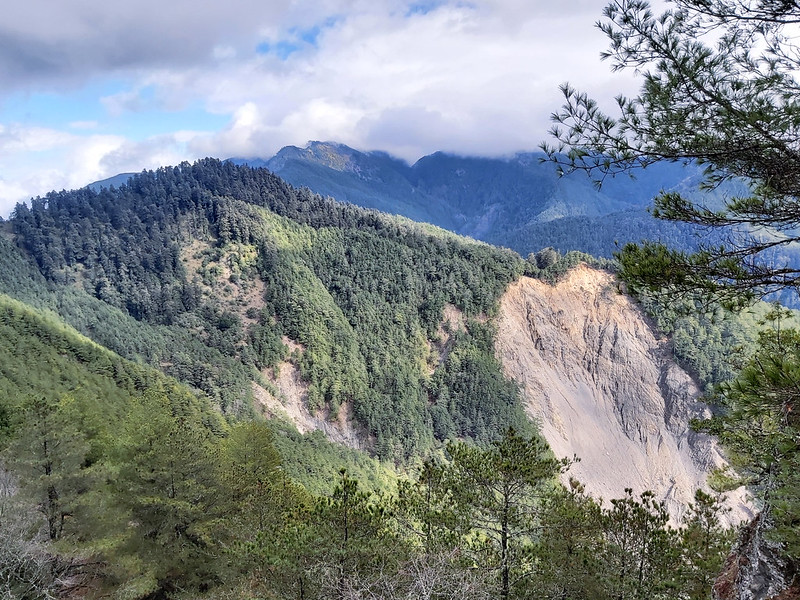
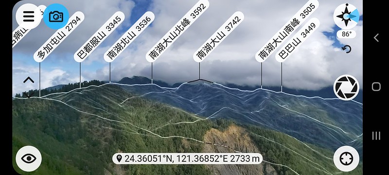
I saw Mt. Soucheng (2,420m), Mt. Baigu (3,342m), Mt. Qilai South Peak (3,357m), and more. I was very excited to see I've done some of those
peaks.

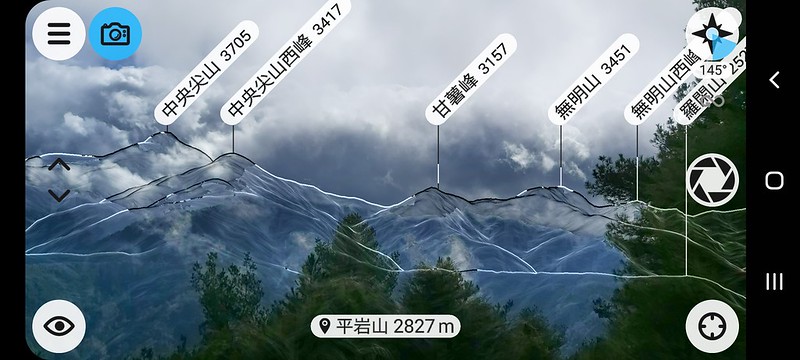
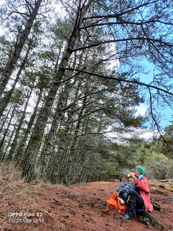
10:40 Reached Mt. Pingyan, 2,827m. We took a 40-minute lunch break here.
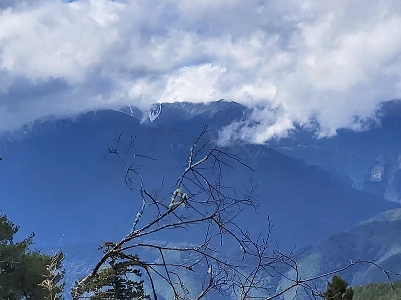
Zhongyangjian, 3,705m, was right in front of us. Although the magnificent peak was covered by heavy clouds, I
was still very excited to see this beautiful mountain.

Here's a photo of Zhongyangjian taken on my ROMA hike. You can recognize the distinctive pointed peak.

Other than Zhongyangjian, I also see Mt. Ganshu 甘藷山 (3,157m), Mt. Wumin 無明山 (3,451m), and other high mountains.
They all belong to the Central Mountain Range and are labeled 100 Peaks.
I shot a timelapse video while having my lunch.
11:29 After we resumed our hike, I saw a pine tree with dark bark that looked
like being burnt.

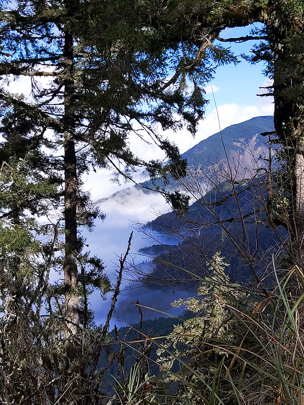
Soon, we saw the sea of clouds from a distance. I'll never get tired of seeing this.

11:56 Reached a very steep descending slope. It was slippery, too. So, we took
our time to descend.

12:48 Mt. Nanhu, 3,742m, was clear to see on our right side, almost.
12:52 We passed a rugged slope.

13:29 We passed a shelter that was transformed from a utility storage room.
Seeing this means we had arrived at Mt. Duojiantun Front Peak, 2,711m.

Mt. Snow range was right in front of us. We took a long break here, waiting for our rest hiking mates to catch
up.

Xueshan and Beilingjiao 北稜角 (3,882 m) were still snow-capped when we were there. Belingjiao is above 3,000
meters, but it is not listed as 100 Peaks.

While staying there to admire the stunning Xueshan, our guides decided that we would skip Mt. Duojiatun Main
Peak. It would take another 2 hours from the main peak back to here. We still had a long way to go before
reaching the trailhead.
From here, we hiked on 710 Forest Road 710林道.
14:00 We saw more clouds on the way down and stopped to take more photos.
14:13 Passed the junction to Yuleng Cabin 雲稜山屋. Yuleng Cabin is 2,616 meters
above sea level and is located at Taroko National Park. It's the must-pass stop to hike Mt. Nanhu 南湖大山 (3,742m)
and Zhongyangjian Mountain 中央尖山 (3,705m).
The signs at this junction say 3.8 km to Yuleng Cabin and 1.1 km to the trailhead of Mt. Nanhu.

14:16 I saw Mt. Pingyan through the trees. We'd been hiking so far.
14:58 Passed the sign of Taroko National Park. The sign says you will enter
Taroko National Park after hiking 2.5km further from this point. We took a break here.

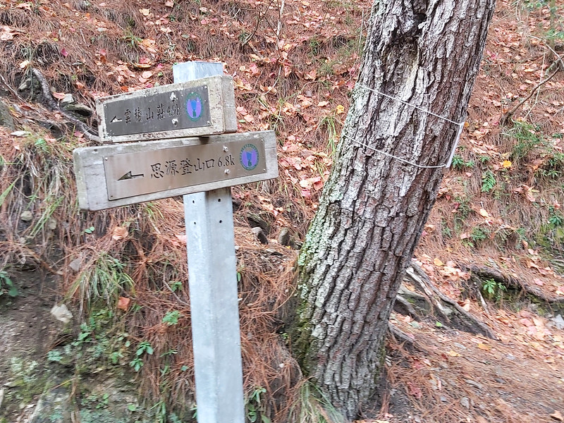
I also saw other signs saying 6.8k to Siyuan Trailhead 思源登山口 and 4.9 km to Yuleng Cabin. So, it took us 45
minutes to hike 1.1 km at this section.
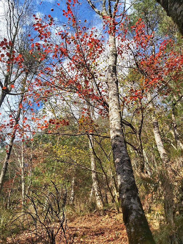
15:32 Resumed the hike. We started seeing red maple trees.
16:08 Passed the signs saying 6.9k to Yuleng Cabin, 2.3k to Shengguan, and 4.8k
to Siyuan Trailhead. It took us 50 minutes to hike 2km at this section.

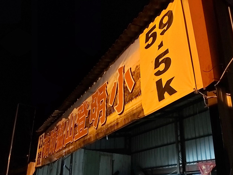
I did a point-to-point hike with a short name for ROMA, and one of the trailheads is Shengguan.
16:19 We arrived at Mt. Shengguan 勝光山 2,285m. Our guide said the triangulation
stone was removed but found by other hikers. So, the hikers put it back, but it got stolen again. It still
baffled me why people want to remove or steal the triangulations stones. Those things were made of granite, and
they were heavy.

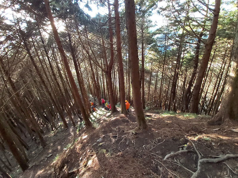
This section was so steep that I couldn't imagine what it would be like if I would take on this all the way up
to Mt. Nanhu someday.
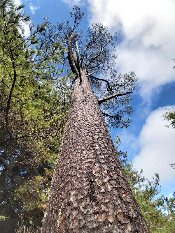
16:52 I reached the trailhead and saw this beautiful tree

17:04 We arrived at the trailhead near Changlian Bridge and called it a day.
