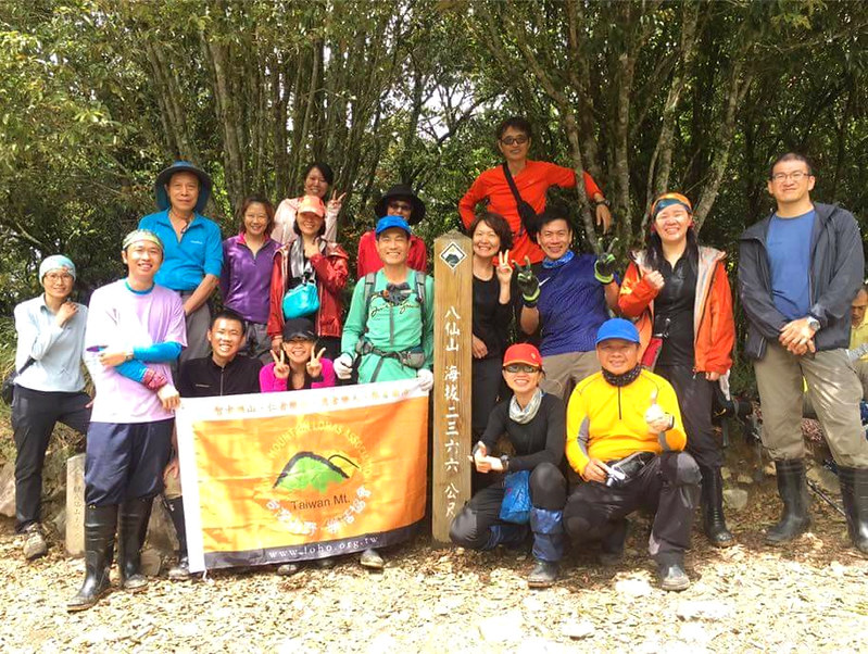
Puli 6 Beauties Part 1: Big Mt. Souchengda, Mt. Guandao, Mt. Wujeyue, and Mt. Hengping
Those trails are not far from the famous Sun Moon Lake in central Taiwan, Puli. Yet, they are very
challenging. The thick bamboo woods and treacherous terrain will make you question your sanity. I can assure
you that I don't plan to do this hike again in the future. If you are looking for an exceptional hiking
experience in Taiwan, this one is for you.


Table of Contents:
- About Big Mt. Soucheng, Mt. Guandao, Old Mt. Wujeyue, and Mt. Hengping
- How to Get There
- Peaks to Reach
- Follow Your Favorite Hiking Guides Wherever They Take You To Hike
- Day 1: Swimming in the Bamboo Woods before Reaching The Peaks
- Day 2: An Easy and Happy Hike according to Xiao Tsai, But Ended with Huge Slopes and Bee Attacks
- Thoughts about this Hike
- Map and Itinerary
- Recommended Blogs and Resources
- Related Posts on Taiwan Hikes
About Big Mt. Soucheng, Mt. Guandao, Old Mt. Wujeyue, and Mt. Hengping
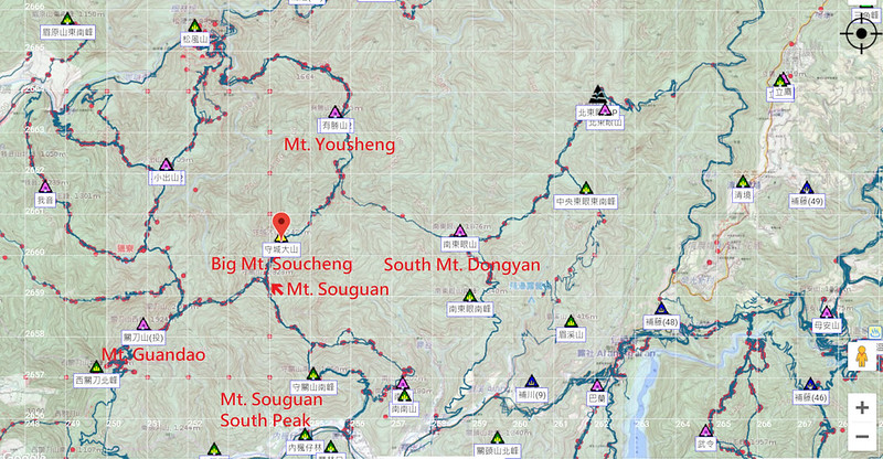
Puli Six Beauties 埔里六秀 refer to Big Mt. Soucheng 守城大山 (Souchengda Mountain),
Mt. Guandao 關刀山, Old Mt. Wujeyue 舊武界越山, Mt. Hengping 橫屏山, Mt. Yousheng 有勝山 and South Mt. Dongyan 南東眼山, and
they are labeled as Mid-elevation Mountain Trails in Taiwan. Those six mountains are located in very remote
areas of Puli and most of them except for Mt. Yousheng can only be accessed by driving or hiring a car.
After I hiked those mountains, I understand why those aren't as popular as Guguan Seven Heros 谷關七雄, which are
also located in central Taiwan. The drastic ascending slopes accompanied with endless bamboo woods, and other
challenges make hikers think twice before doing Puli Six Beauties.
But those are great for hikers who want to challenge themselves and take on the difficult terrains and also
enjoy the process of the hiking, not just for the veiews.
How to Get There
There is no public transport. You have to drive or hire a care to get to the trailhead.
Peaks to Reach
We hiked more than 4 peaks of Puli Six Beauties, and I put those 4 in green.
The following is lised according to the order we reached them.
Day 1:
Mt. Guandao West Peak: 關刀山西峰, 1,924 meters (6,312 feet). No views.
Mt. Guandao: 關刀山, 2,017 meters (6,617 feet). No views.
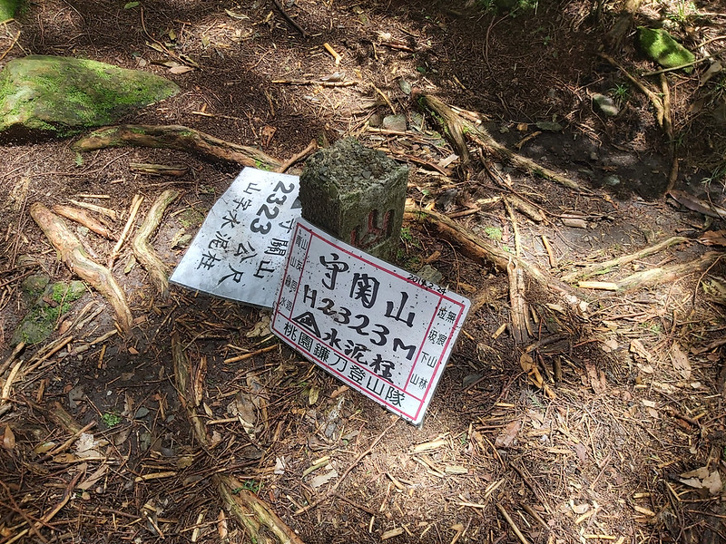
Mt. Souguan: 守關山, 2,323 meters (7,621 feet). No views.
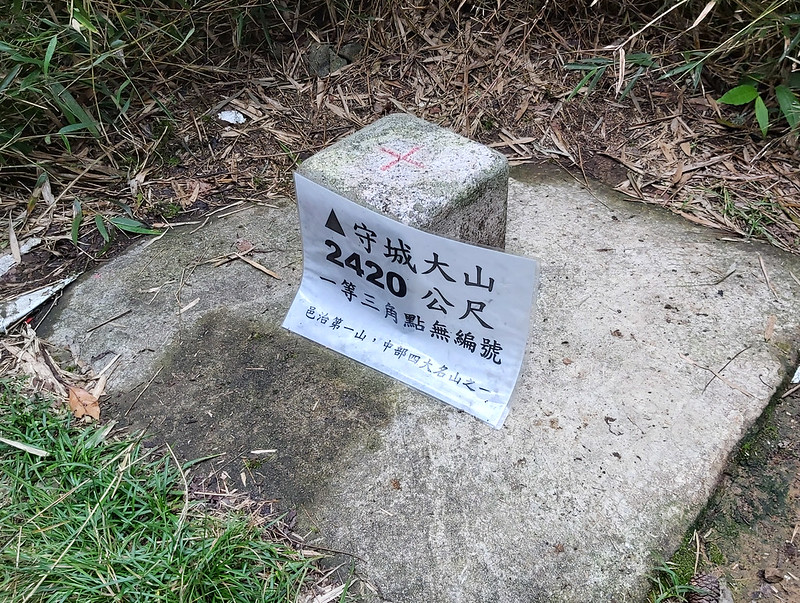
Big Mt. Soucheng: 守城大山, 2,420 meters (7,940 feet). There are endless bamboo woods to swim through before reaching the peak. A great trail to enjoy being poked in the eyes by sharp and bouncy bamboos. No views on the peak. Big Mt. Soucheng is also one of Four Famous Mountains 中部四大名山 in Central Taiwan.
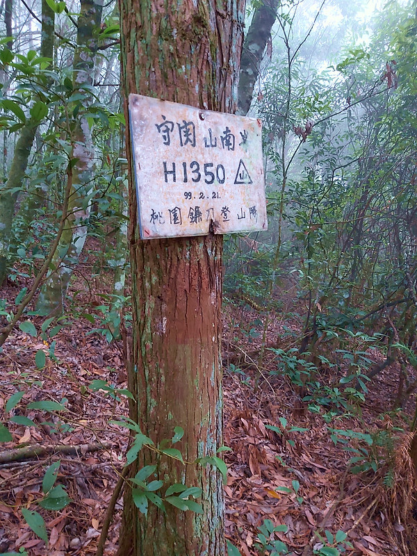
Mt. Souguan South Peak: 守關山南峰, 1,360 meters (4,461 feet). No views.
Day 2:
Mt. Hengping: 橫屏山, 1,508 meters (4,947 feet). No views.
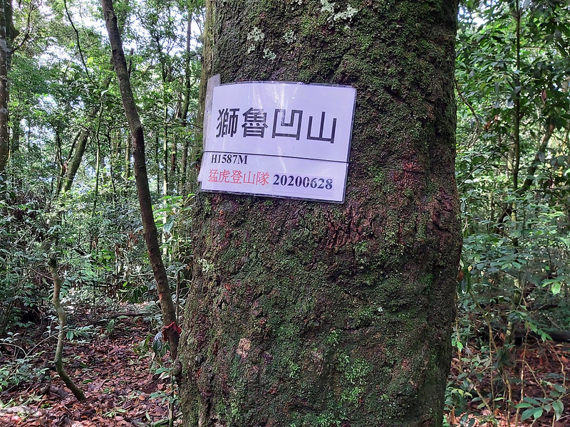
Mt. Shiluao: 獅魯凹山, 1,587 meters (5,207 feet). No views.
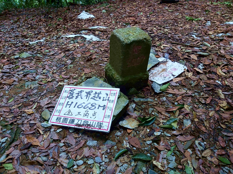
Old Mt. Wujeyue: 舊武界越山, 1,668 meters (5,472 feet). No views.
Mt. Guandao West Peak: 關刀山西峰, 1,924 meters (6,312 feet). No views.
Mt. Guandao: 關刀山, 2,017 meters (6,617 feet). No views.
Mt. Souguan: 守關山, 2,323 meters (7,621 feet). No views.
Big Mt. Soucheng: 守城大山, 2,420 meters (7,940 feet). There are endless bamboo woods to swim through before reaching the peak. A great trail to enjoy being poked in the eyes by sharp and bouncy bamboos. No views on the peak. Big Mt. Soucheng is also one of Four Famous Mountains 中部四大名山 in Central Taiwan.
Mt. Souguan South Peak: 守關山南峰, 1,360 meters (4,461 feet). No views.
Day 2:
Mt. Hengping: 橫屏山, 1,508 meters (4,947 feet). No views.
Mt. Shiluao: 獅魯凹山, 1,587 meters (5,207 feet). No views.
Old Mt. Wujeyue: 舊武界越山, 1,668 meters (5,472 feet). No views.
Follow Your Favorite Hiking Guides Wherever They Take You To Hike
After doing group hikes in Taiwan for a while, you will have a list of favorite guides and you will sign up
their trips no matter where they are going. This is one of them. Xiao Tsai 小蔡 is one of my favorite guides
from LOHAS, and his trips are quite challenging. If you want to upgrade your hiking
experience, Xiao Tsai's trips are definitely worth to consider. But please bear in mind that most of his trips
are quite tough. It's better to get prepared before you sign up.
Another benefit to hike with a group is you get to hike in remote places if you don't drive. Even if you have
a car, the roads of most of those places are too bumpy to drive anyway. That's why I still hike with groups.
You can also check out my other hikes with Xiao Tsai:
Tefuye Old Trail,
Mt. Data, the highest peak in Alishan, and
100 Peaks, 100km Feet: Mt. Liushun and Qicai Lake.
Tefuye Old Trail,
Mt. Data, the highest peak in Alishan, and
100 Peaks, 100km Feet: Mt. Liushun and Qicai Lake.
Day 1: Swimming in the Bamboo Woods before Reaching The Peaks
Distance: 16.7 km (10 miles)
Brief itinerary: Mt. Guandao Trailhead (Height 460 meters) ➔ Mt. Guandao (Height 2,017 meters) ➔ Mt. Souguan (Height 2,323 meters) ➔ Big Mt. Soucheng (Height 2,420 meters) ➔ Mt. Souguan ➔ Mt. Souguan South Peak (Height 1,360 meters) ➔ trailhead (Height 648 meters)
GPS coordinates of the trailhead: 24.01886, 121.008909
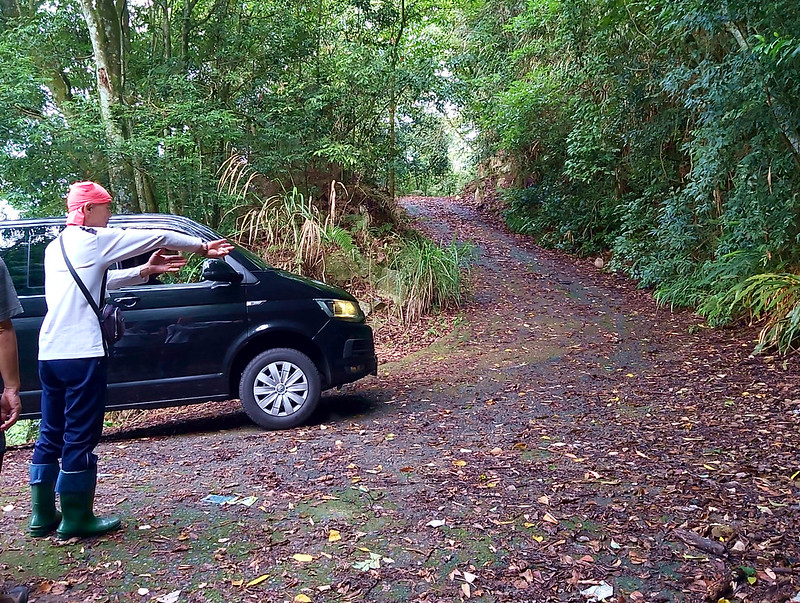
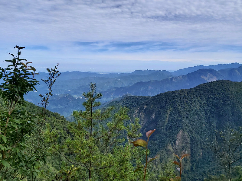
After more than one-hour bumpy ride, we got off at a slope and headed to the trailhead, which was in a grassy
area. The trail conditions were okay at first. Most of this section were on the ridge, which allowed us to see
the stunning mountain views.
Looking at Sun Moon Lake from the Distance
When we reached a small, exposed section of the trail, our guide told us to turn to the southwest. It took me
a while to see what she wanted us to see because the surrounding mountains were too eye catching to see the
distant targets. Then I looked further, and I saw a small unregular shaped of blue. It was Sun Moon Lake. The town we saw here was Puli. We were
in the north of Puli.


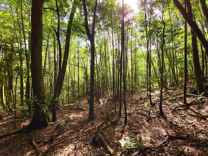
The Nightmare of Swimming in the Bamboo Woods
After enjoying the spectacular mountain views, we continued to hike. The trail terrain became rough. We
reached a junction and took the left one. It took a few minutes to get to a small peak, Mt. Guandao West Peak,
and we got back to the junction and headed to Mt. Guandao.

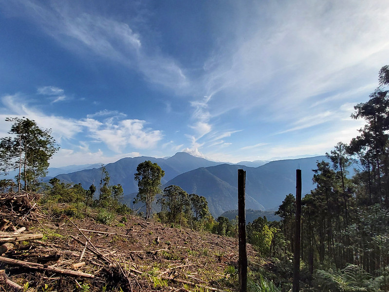
After that, we enjoyed a small section of relatively flat and not too difficult terrain, and reached an
exposed ridge again. The views around us were amazing, the layers of mountains on both sides of the ridge were
spectacular. We stopped here for a while to admire the amazing views.
We humans were not the only ones who walked on this ridge. There were some unknown animal poos here.

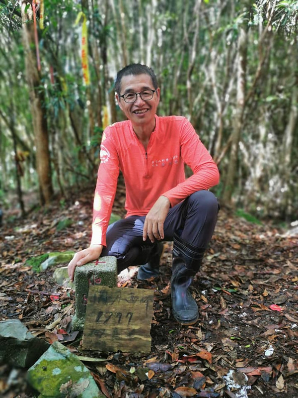
About 20 minutes after the animal poo encounter, we arrived at Mt. Guandao. There were some old, abandoned
houses and this place was filled with garbage.


After the we resumed our hike, it was a downhill after Mt. Guandao, and then we reached the saddle with height
around 1,850 meters (6,070 feet). From the saddle, it was all the way up again to Mt. Souguan.
After Mt. Souguan, we went downhill to a saddle again, with the height around 2,250 meters (7,382 feet), and
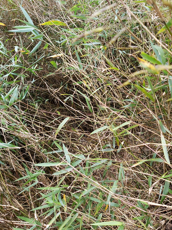
then we went uphill again. But this time, things became more complicated, because the trail was covered by the
bamboo woods. Bamboo woods are common on the trails in Taiwan. You will still have to deal with them on high
mountains like 100 Peaks.

But what made the bamboo woods here so unique was they were so dense and bended that they became endless
tunnels and you had to either crawl or almost sat on the trail to get through them. I had a similar experience
with bended bamboo woods when I hiked ROMA Hike and I had to crawled on the trail covered by ice.

If you are not familiar with trails like this, it might be difficult for you to see the trails underneath the
bamboo woods. Remember to protect your eyes when you have to pass through them.
It took me almost 90 minutes from Mt. Souguan to Big Mt. Soucheng 守城大山. If we continued this trail, we could
reach Mt. Yousheng 有勝山, but that would be our second trip to finish Puli Six Beauties.
Reaching the peak didn't make me feel excited, because I was tired with a heavy heart by just thinking about
swimming in the bamboo woods, again.
Ended with 1,500m Descending to Call It A Day
After we got back to Mt. Souguan again, which was also a junction, we took the other trail. From there, it was
all the way down, and the elevation loss was around 1,500 meters. We passed Mt. Souguan South Peak 守關山南峰, but
we didn't stay there long because we just wanted to finish this hike.
Within 20 minutes, I arrived at the end of the trail and could finally finish my Day One hike.
Day 2: An Easy and Happy Hike according to Xiao Tsai, But Ended with Huge Slopes and Bee Attacks
Distance: 10 km (6.2 miles) (roughly)
Brief itinerary: Mt. Hengping Trailhead (Height 1,456 meters) ➔ Mt. Hengping (Height 1,508 meters) ➔ Mt. Shiluao (Height 1,587 meters) ➔ Old Mt. Wujeyue (Height 1,668 meters) ➔ trailhead (Height 701 meters)
GPS coordinates of the trailhead: 23.948455, 121.012634
Brief itinerary: Mt. Hengping Trailhead (Height 1,456 meters) ➔ Mt. Hengping (Height 1,508 meters) ➔ Mt. Shiluao (Height 1,587 meters) ➔ Old Mt. Wujeyue (Height 1,668 meters) ➔ trailhead (Height 701 meters)
GPS coordinates of the trailhead: 23.948455, 121.012634
When we got back to the temple we stayed, Xiao Tsai told us that the next day's hike would be an easy and
happy one, 輕鬆快樂行. If you have known Xiao Tsai for a while, you definitely won't buy that. It doesn't mean he
was lying. It was indeed easy and happy if you have his hiking experience and physical fitness.
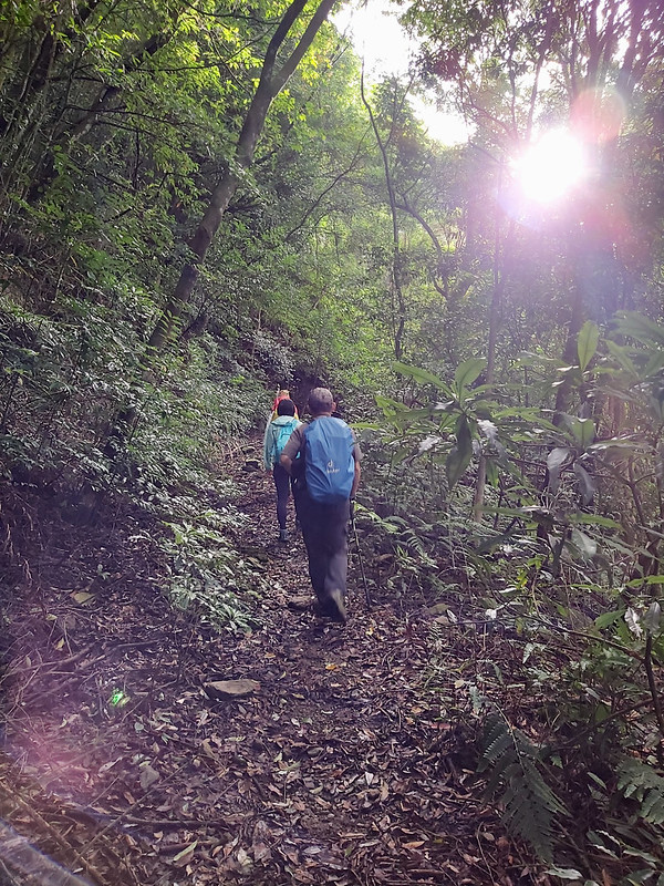
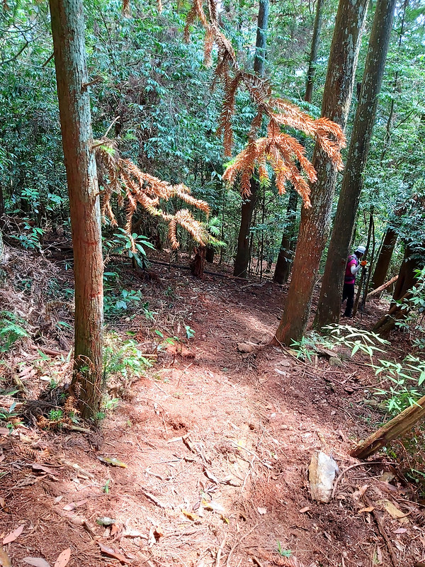
As usual, we started early. It took us a while to reach the trailhead. We got off at a beautiful bamboo woods,
the tall and beautiful ones, not those that gave us a hard time when trying to reach the peak on our Day One.
However, the path was slippery, and our drivers kept warning everyone to be careful. I guess I was still
sleepy, and I didn't pay enough attention, so I slipped. Luckily, it didn't do damage to my body, except for
my ego.

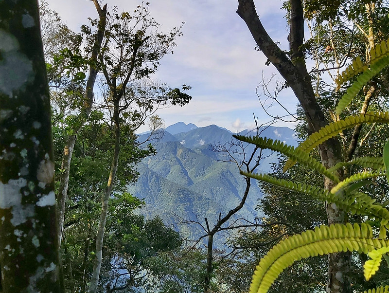
After we passed the bamboo woods, we were on a section of trail without any shade. When the curved trail led
us to turn to a different direction, the view in front of us opened up and the layers of mountains were in
front of us.

Xiao Tsai stopped and pointed to the highest one with a flat top saying that was Mt. Soucheng, the mountain we
hiked yesterday. When you are in the woods, it's difficult to know the mountain outlines on the trails. But
when I get a chance to see them from a distance, it always amazes me to know how beautiful those mountains
are, and I can't believe I hiked to the peak on the previous day.
We continued our hike, and it didn't take long for us to reach a junction. Xiao Tsai told us that was our
first peak, Mt. Hengping 橫屏山. We got there within a few minutes. Okay, that was really easy. I started to
believe Day 2 hike was going to be easy and happy, almost.

Before we got back to the junction, Xiao Tsai pointed to the woods again. He wanted us to look for the
mountains with M-shaped peaks, and he said the taller one on the left was Mt. Zhimao 治茆山, 2,909 meters (9,544
feet), and the one on the right was Mt. Zhimao South Peak 治茆山南峰, 2,863 meters (9,393 feet). Those two are
called Zhimao Twin Towers 治茆雙塔 and can be spotted from Sun Moon Lake.
We continued our hike, and then Xiao Tsai told us to stop and yield our way. It turned out there was a trail
running race on the same day. I always admire those trail runners, because it's not easy to hike uphill or
downhill, not to mention running.

Beautiful Taiwan Rhododendron Trees
We were not in a hurry like those trail runners and I really wanted to enjoy those Taiwan Rhododendron Trees
台灣杜鵑. Although it wasn't in the right season to see the beautiful blossoms in April and May, it was still
pleasant those amazing trees. If you are confused with the difference between rhododendron and azaleas like
me, I found this article if you want to know more about them.

Before long, we reached a junction and also our second peak Mt. Shiluao 獅魯凹山, 1,587 meters (5,207 feet). There
was no view since this was in the woods. We parted our way with those trail runners because they turned to the
other trail from here.

The Trail Wasn't Easy Anymore
When I thought hike on Day 2 was relatively easy, we turned to a long rugged sidehill. After my scary close call in July 2018, I developed a fear
when hiking on the rugged sidehill. I could feel the fear crawling under my skin. I was very happy when we
finished this section on the sidehills, and I was hoping there would be no more sidehills on this hike.

After a while, we were back to the ridge and the view in front of us opened up again, and we could see the
layers of mountains in the distance. One thing about this trail was there was no view on the peaks, but you
got to see the spectacular mountains when walking on the ridges.

Massive Descending and We Disturbed the BEES... Didn't End Well
We had an early lunch at 10:50 am and headed to Old Mt. Wujeyue 舊武界越山. Before reaching Old Mt. Wujeyue, I was
exhausted. I knew that I shouldn't believe what Xiao Tsai said about an easy happy hike. As to the peak, it
was not a surprise that there was no view, so we took some photos and left quickly.
After some rest, we turned to the massive slope in front of us. It was an open area without many bushes under
those tall huge trees, but this also made the trail difficult to find. When you hike on this kind of terrain,
you have to pay extra attation to find the right path.
The surface was covered by leaves and you could just go ahead to descend. It may sound easy, but it was a
different story to go downhill. It felt like you could get tripped at any time and roll downhill like a log.

After I managed to get to the bottom of the slope, I turned back to check on my hiking mates. Almost everyone
half walked, half ran to get down. While we were trying to get down from another scary sidehill, I heard
buzzing sound around my head. Uh oh... I didn't have a good feeling about this.

Then I heard Xiao Tsai, who was the last guide to guard us at that time, urged us to hike as fast as we could.
I didn't know what happened, but I knew something went wrong. We were still on the scary sidehill, and it was
difficult to descend fast while maintaining your balance.

Finally, we reached a relatively flat surface, and it turned out one of our hiking mates got stung by bees
several times on his head. We were really worried that he might be allergic to bee stings, but it was still a
long way to exit the trail. Xiao Tsai used his radio to ask other guides who had reached to the place with
phone signals to call for an ambulance. We kept company with our poor hiking mate and checked on him
constantly. He said he felt dizzy and weak but was still able to hike on his own, which was a good sign.
Because our hiking mate was feeling weak, we didn't hike fast, especially on some rough slopes. It took us
more than one hour to exit the trail. By the time we reached the trailhead, an ambulance was already there.
Later, I know our hiking mate was doing okay. We were very grateful for that.
Thoughts about This Hike: Definitely Not Again
There are two kinds NO (please check out the "Never Again Hikes" feature on Blog page) when I am asked whether I will hike some trails once
more. The first one is I-might-change-my-mind-later kind of NO, and the other is DEFINITELY NO. Without a
doubt, this is the latter one, because of the sea of bamboo woods, the huge descending, the rough terrains, no
views on the peaks, etc., etc.
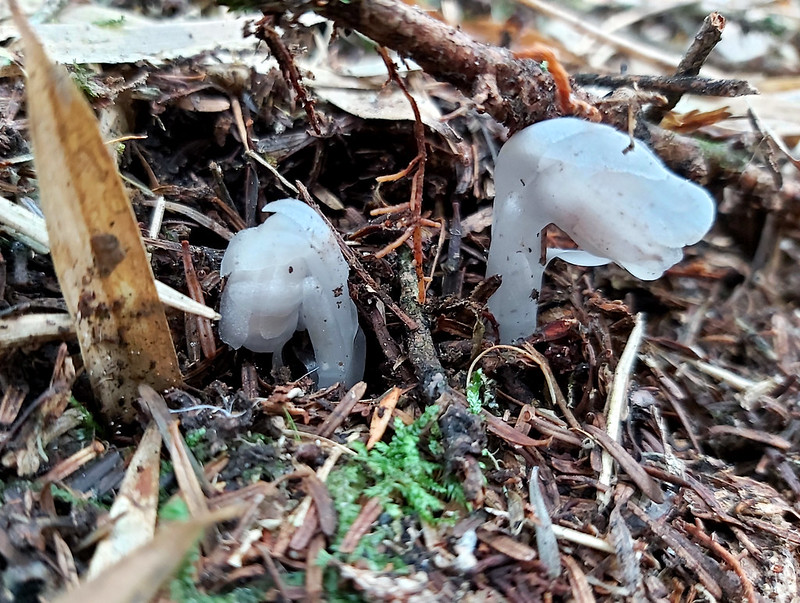
But I can give you some reasons for you to go. Some hikers report seeing Falseindianpipe or Indian Pipe near Mt. Guandao. I
wasn't lucky enough to see them there. I only found Falseindianpipe on Mt. Baigu.
Another legit reason is if you want to enhance your hiking experience to take on more challenging hikes in the
future, this is the trail for you. Moreover, the views on the sides of the trails are really great. If you
embrace the challenges, this hike will be like what Xiao Tsai has said, an easy, happy one.
Have you been to Sun Moon Lake? Are you also looking for mountains to hike in near the lake? If so, this hike
might be for you. Please be well-prepared and ready to take on the challenges. Please leave comments below and
subscribe to newsletters for more amazing trails in Taiwan.
Map and Itinerary
Click Menu in the map to download, print or share the map.
Click to change the speed to meet
your condition.
to change the speed to meet
your condition.
Note:
My GPS tracks may not be totally accurate and are for reference only.
Click
to change the speed to meet
your condition.Note:
My GPS tracks may not be totally accurate and are for reference only.
Day 1: Based on my hike on July 4, 2020
06:30
Left the temple we stayed
06:40
Got off cars and walked toward to the trailhead
06:53
Reached the real trailhead
07:40
Reached the ridge and saw Sun Moon Lake
08:26
Arrived at a junction to Mt. Guandao and its west peak
08:29
Reached Mt. Guandao West Peak
09:00
Reached the second exposed ridge
09:19
Arrived at Mt. Guandao and took a break
11:55
Reached the bamboo woods
12:40
Arrived at Mt. Souguan
14:16
Arrived at Big Mt. Soucheng
15:23
Back to Mt. Souguan
17:19
Reached Mt. Souguan South Peak
17:32
Exited from another trailhead
Total time:
9 hours 2 minutes, including breaks
Day 2: Based on my hike on July 5, 2020
06:48
Arrived at the trailhead (I forgot to record when we left the
temple)
07:33
Reached the junction to Mt. Hengping
07:38
Reached Mt. Hengping
08:09
Reached Taiwan Rhododendron Trees
08:23
Arrived at Mt. Shiluao
10:50
Took a lunch break for 40 minutes
12:53
Reached Old Mt. Wujeyue
14:16
Reached scary massive slope and prepared to descend
14:45
Hiking mate got stung by bees around this time
16:16
Exited the trail
Total time:
9 hours 28 minutes, including breaks