Climbing Mt. Data: The Sacred Mountain of the Tsao People in Alishan
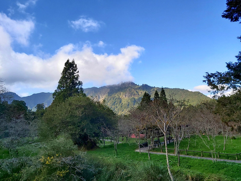
The Tashan Trail in Alishan offers a stunning journey through lush forests, iconic giant trees, and
breathtaking views of the Alishan Range. Starting from the entrance of the Alishan National Forest Recreation
Area, this well-maintained trail is perfect for hikers seeking a serene yet adventurous experience.
For those looking to explore further, you can extend your hike to Xiaoliyuan, Duigaoyue, and Zhushan, each
offering unique sceneries and landscapes. Whether you are drawn to the trail's beauty or its connections to
Alishan's famous sunrise views, this is a great place to immerse yourself in nature.

Trail Closed:
The Tashan (Mt. Data) Trail will undergo renovations starting July 1, 2026. As a result, the trail will be closed after this date. Additionally, the trailhead for the Mianyue Line on the Tashan side will also be closed. It is anticipated that the trail may reopen in June 2027.
The Tashan (Mt. Data) Trail will undergo renovations starting July 1, 2026. As a result, the trail will be closed after this date. Additionally, the trailhead for the Mianyue Line on the Tashan side will also be closed. It is anticipated that the trail may reopen in June 2027.
Table of Contents:
Trail Information: Tashan Trail 塔山步道 and Extended Hike to Duigaoyue 對高岳 and Mt. Xiaoliyuan 小笠原山
Trail Name: Tashan Trail 塔山步道
Distance: 7.5 km (4.6 miles) from Zhaoping Station. If you start from the toll booth of Alishan National Forest Recreation Area, the total distance is 11.5 km (7.1 miles).
Route type: Out and back
Days/Hours Needed: 3-5 hours
Total Ascent/Descent: 400m/400m
Best Time to Go: All seasons. Check the Forestry Agency's website to see if the trail is open.
Permits: Not required
Difficulty Level:
Trail Name: Tashan Trail, Duigaoyue, and Mt. Xiaoliyuan 大塔山、對高岳、小笠原山
Distance: 12.2 km (7.6 miles)
Route type: Point to point
Days/Hours Needed: 5-7 hours
Total Ascent/Descent: 1,061m/770 m
Best Time to Go: All seasons. Check the Forestry Agency's website to see if the trail is open.
Permits: Not required
Difficulty Level:
Distance: 12.2 km (7.6 miles)
Route type: Point to point
Days/Hours Needed: 5-7 hours
Total Ascent/Descent: 1,061m/770 m
Best Time to Go: All seasons. Check the Forestry Agency's website to see if the trail is open.
Permits: Not required
Difficulty Level:
Peaks or Places to Reach
- Mt. Data 大塔山, 2,663 meters (8,737 feet), is the sacred mountain of Taiwanese indigenous Cou People. Hikers reach the observation deck nearby. Mt. Data is also the highest in the Alishan Range, listed in Xiao Baiyue (Minor 100 Peaks) in Taiwan.
- Mt. Duigaoyue 對高岳, 2,444 meters (8,018 feet). No views.
- Mt. Zhu or Zhushan 祝山, 2,430 meters (7,972 feet). You can also take Alishan Railway Zhushan Line to see the sunrise.
- Mt. Xiaoliyuan: 小笠原山 Mt. Xiaoliyuan, 2,488 meters (8,162 feet). There's an observation deck on Mt. Xiaoliyuan, one of the best spots to see the sunrise and Mt. Yu Range.
Maps/GPX and Public Transport to Alishan
From Zhaoping Station to Mt. Data and back
Route map for Mt. Data by Anusha Lee on plotaroute.com
Zhushan to Mt. Xiaoliyuan, Duigaoyue, and Datashan
Route map for Datashan-DuiGaoYue-XiaoLiYuan by Anusha Lee on plotaroute.com
Click Menu in the map to download, print, or share the map.
You can see more options after clicking the Play button.
Click to change the speed to meet your condition.
You can see more options after clicking the Play button.
Click
to change the speed to meet your condition.
Public Transport
- Take Alishan Route A (7329、7329A) from Chiayi High-speed Raiway Station.
- Take Alishan Route B (7322C or 7322D) from Chiayi Train Station.
- Take Kuokuang Bus 1835 from Taipei Bus Station.
- Take Sun Moon Lake Alishan Route (Bus 6739).

2026 Alishan Itinerary Guide
The hardest part of Alishan isn't the hiking — it's getting there and sorting things out. My 2026 Alishan itinerary guide maps out the whole trip by bus — 1, 2 & 3 days — in English. It's just $5, and it saves you hours of piecing together scattered, half-outdated posts.
Details of Tashan Trail and Other Extended Trails - Duigaoyue and Mt. Xiaoliyuan
From Zhaoping Station to Mt. Data
Brief itinerary: Zhaoping Station ➔ Tashan Trail entrance ➔ Junction/wood platform to
Mianyue Line and Mt. Data at 2 km ➔ Mt. Data lookout ➔ Back to the junction to Mianyue Line and
Mt. Data ➔ Zhaoping Station
If you are not in a hurry, you can walk from the toll booth of the Alishan National Forest Recreation Area to
Zhaoping Station, enjoying the forest.

If you take the train to Zhaoping Station, turn right after leaving.

Follow the signs, and you will find the entrance to Tashan Trail.


The distance between the entrance to the junction/deck to Mianyue Line and Mt. Data is 2 km, and it takes less
than 1 hour to reach.

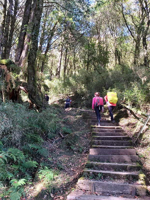
The hike becomes steeper once you reach this deck because of the steps. I first hiked to Mt. Data in December
2019, and I was lucky to have good weather at the peak.


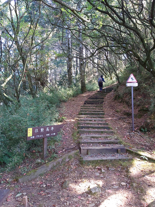
An Extra Hike to the No. 13 Bridge on the Mianyue Line
After you return to the junction/deck at 2 km, you can hike to see the Mianyue Line.

You can stop at the first half-open tunnel to see the Alishan National Forest Recreation Area from the other
side.


The furthest distance is the No. 13 bridge. You need a permit to hike into the Taiwan Pleione Nature Reserve or
face a hefty fine of up to NT$150,000 (around €4,380, USD 4,627).

See the details about the Mianyue Line

Extended Trails: From Duigaoyue, Mt. Xiaoliyuan, to Mt. Data
In 2019, I took this route that began at the Xiaoliyuan Lookout, with the stunning Yushan Mountains beside us.

We passed the famous Zhushan Lookout, a popular spot for witnessing the sunrise over Yushan. Since this location
attracts many visitors in the early morning, be prepared to see a crowd of eager heads awaiting the sun's first
rays.

Afterward, we continued onto the Duigaoyue Trail, which offered a pleasant hike to Duigaoyue Pavilion.
Although there wasn't much to see at the pavilion itself, the views along the way were fantastic.


Finally, we followed the footpath along the railway, which led us to Tashan Trail and the junction/wood platform
located 2 kilometers before reaching Mt. Data.

About Mt. Data (Tashan) and Mt. Xiaota
Mt. Data, also known as Tashan, is the highest peak in the Alishan Mountain Range. It, along with the nearby Mt.
Xiaota (Little Tower Mountain), is considered sacred by the indigenous Tsou (Cou) people, who have lived in the
Alishan region for generations.
According to the beliefs of the Tsao people, Tashan is a realm belonging to the Gods, which is why they regard
it as a sacred site. They believe that the spirits of good people ascend to Tashan after death, while the
spirits of those who were not good go to Mt. Xiaota.

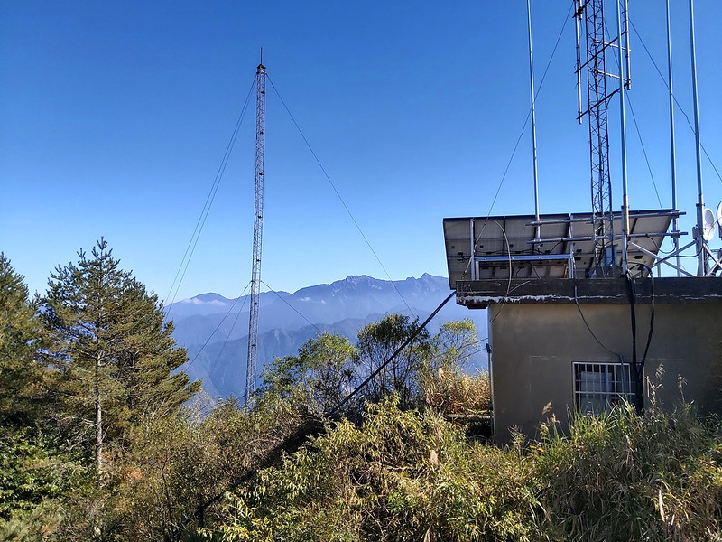
In the past, the Ministry of National Defense in Taiwan established a transmitter station at the peak of Mt.
Data for rescue operations and stationed guards there. A trail was constructed to facilitate the maintenance and
supply of materials for the station.
After the station was decommissioned in July 1998, the area gradually returned to nature. However, in 2002, the
Forestry Bureau decided to transform the site into a hiking trail, making it accessible to the public.

2026 Alishan Itinerary Guide
The hardest part of Alishan isn't the hiking — it's getting there and sorting things out. My 2026 Alishan itinerary guide maps out the whole trip by bus — 1, 2 & 3 days — in English. It's just $5, and it saves you hours of piecing together scattered, half-outdated posts.