San-Yuan Hike: A Pleasant Tung Blossom Trail between Sanyi and Tongluo in Miaoli
This is one of the best hiking trails between Sanyi and Tongluo in Miaoli, Taiwan. This ridgeline hike is
great to enjoy Tung Tree blossoms in spring, and you can also see Snow Mountain on the ridge.
To do this hike, you can take an early train from Taipei and take a short walk to the trailhead. Or, you can
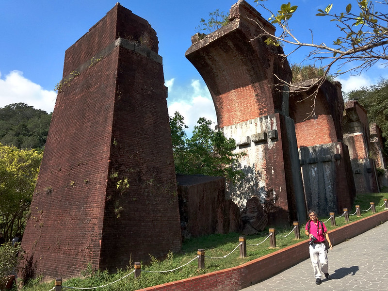
stay at a hotel in Miaoli and enjoy other attractions like Longten Broken Bridge and Huoyanshan after your
hike.


Table of Contents:
- About San-Yuan Hike, Sanyi and Tongluo Townships
- How to Get There
- Peaks and Places to Reach
- A Pleasant and Easy Ridgeline Hike to Enjoy Mountain and Township Views
- Bonuses from Both Trips: Cherry Trees Trail in Yuanli and Beautiful Sunset on Mt. Hutou in Tongxiao
- Thoughts about This Hike: A Trail Worth Doing Again
- Map and Itinerary
- Recommended Blogs and Resources
- Related Posts on Taiwan Hikes
About San-Yuan Hike, Sanyi and Tongluo Townships
This is a ridgeline hike starting from Sanyi to Tongluo via Mt. Sanjiao, Mt. Changkeng, Mt. Shuangfeng, Mt.
Shuangfeng North Peak, and ending with Mt. Yuantun. To make it easier to remember, hikers take the first word
of the first and last mountains and call it San-Yuan Hike.
Sanyi and Tongluo
60% of people in Miaoli and 15% of the total population in Taiwan are Hakka people or Hakka Han 客家, literally meaning Guest Families in Chinese. Hakka
Han are a Chinese subgroup and came from southern China provinces.
Hakka people have their own language, distinct culture, architecture and foods. In Sanyi and Tongluo, 94% of
the population in each township is Hakka people. If you have been to Taipei and take MRT, you must have heard
of Hakka language because the voice announcements in the trains include Mandarin, Taiwanese, Hakka and
English.
Sanyi is famous for the wood sculpture making because of many
camphor trees in the old days. There are 4 townships in Taiwan certified as “Slow City” by Cittaslow, and Sanyi is one of them. Actually, Miaoli has two townships listed,
and the other one is Nanzhuang.
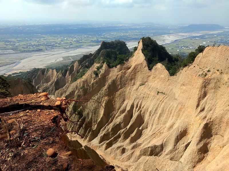
There are several tourist attractions in Sanyi, and some of the famous ones are Longten Broken Bridge 龍騰斷橋 and Mt. Huoyan or Huoyanshan 火炎山.

Mt. Huoyan is famous for the spectacular landscape that consists of
conglomerate and sandstone layers, and later was designated as a Nature Reserve Area. There's a hiking trail
to Mt. Huoyan, but there are several accidents near the
cliffs because of the fragile geological structure. Please DO NOT get too close to the cliffs when you are
trying to take photos.
Like Sanyi, Tongluo is a famous Hakka town, and there are many delicious Hakka restaurants in Tongluo. Mt.
Shuangfeng is located within the border of Tongluo and also the highest mountain in the township. If you want
to know more about Hakka history, you can visit of Hakka Yard 客家大院 when you get there.

San-Yuan Hike: A Relaxing Ridgeline Trail
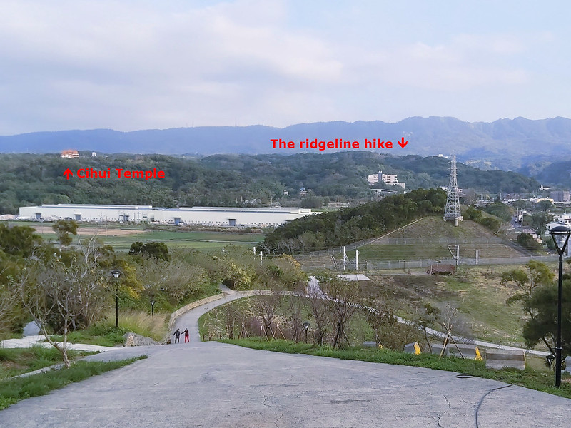
You can also start from the Tongluo side, and the trail is much easier than the Sanyi side. Just follow the
steps and you'll reach Mt. Yuantun 員屯山. The other trailhead near Mt. Yuantun is from the back of Hakka Yard 客家大院, but this one was closed when I went there.
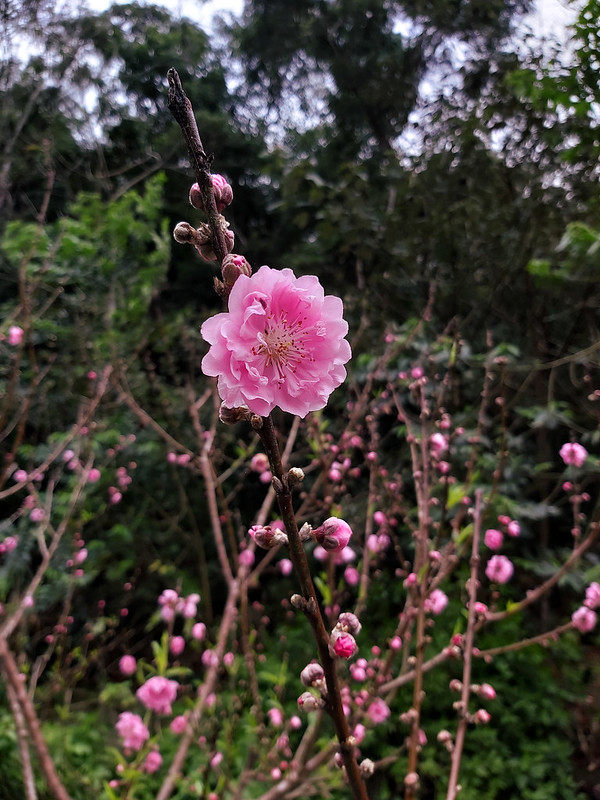
If you enjoy tung blossoms, you can't miss this trail in April and May. San-Yuan Trail is one of the popular places to see the snow-like blossoms in Miaoli.

Other than tung blossoms, you can see the second highest mountain, Mt. Xue Main Peak (aka Mt. Snow, Mt.
Sylvia), height 3,886 meters, in Taiwan from the ridges. This trail terrain isn't too rugged or complicated.
Occasionally you'll have to walk through some narrow ridges before reaching Mt. Shuangfeng. It's a
point-to-point hike and both sides can be accessed by train.

Mt. Shuangfeng is listed as one of Miaoli Eight Scenes 苗栗八景. During Japanese Occupation, it was said the shape
of Mt. Shuangfeng looked like Mt. Fuji. Therefore, it was also called Miaoli's Mt. Juji. I didn't get to see
the shape of Mt. Shuangfeng from the distance, so I can't comment whether it really looks like Mt. Fuji.
You don't have to go through the whole trail. The new friends I made on my second trip were planning to turn
back after reaching Mt. Sanjiao, which can be done within 30 minutes from Lantern Earth God Temple.
How to Get There
You can take Local Train and get off at Sanyi or Tongluo Train Station. If
you want to drive a car or ride your scooter to either train station, you can park there and take the train
back to your car or scooter. It takes only 7 minutes from Sanyi to Tongluo or Tongluo to Sanyi by train, but 5
hours on the ridgeline on foot.
This is probably one of the very few point-to-point hikes that can be done without the need to arrange
pickup transport.
Peaks and Places to Reach
Lantern Earth God Temple: 燈籠福德祠, height 336 meters (1,102 feet). This is also
the entrance of Mt. Sanjiao behind the parking lot. One of the big trees behind this temple is camphor tree
大樟公 and is said to be over 100 years old. You can also find toilets there.
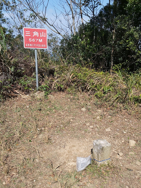
Mt. Sanjiao: 三角山, height 567 meters (1,860 feet). There's a Class 3 Triangulation Stone, not much to see on the peak.
Mt. Changkeng aka Mt. Sanjiao North Peak: 長坑山 or 三角山北峰, height 560 meters (1,837 feet). You can see Provincial Highway 13 台13線 and Tongluo Science Park 銅鑼科學園區 from there.
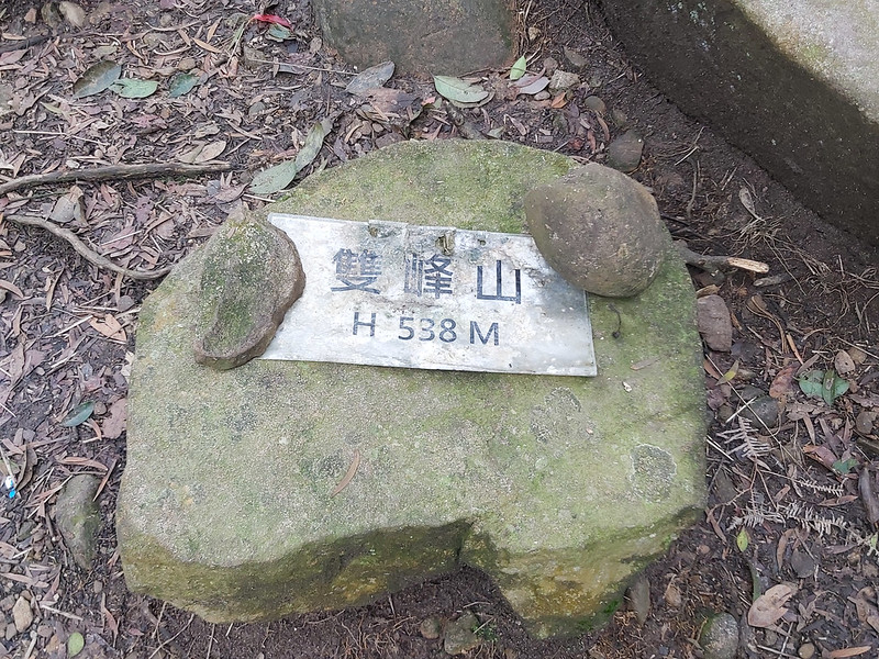
Mt. Shuangfeng: 雙峰山, height 538 meters (1,765 feet), the highest mountain in Tongluo.
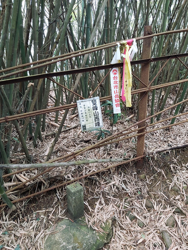
Mt. Shuangfeng West Peak: 雙峰山西峰, height 538 meters (1,765 feet). You won't see this peak, unless you turn to Cihui Temple at the junction. No views here.
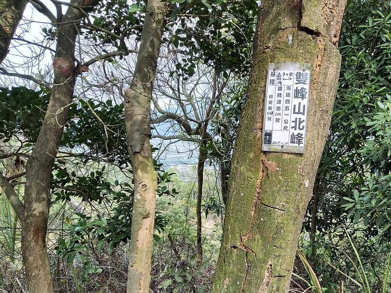
Mt. Shuangfeng North Peak: 雙峰山北峰, height 450 meters (1,476 feet).
Mt. Yuantun: 員屯山, height 339 meters (1,112 feet). There is a Class 3 Triangulation Stone.
Mt. Sanjiao: 三角山, height 567 meters (1,860 feet). There's a Class 3 Triangulation Stone, not much to see on the peak.
Mt. Changkeng aka Mt. Sanjiao North Peak: 長坑山 or 三角山北峰, height 560 meters (1,837 feet). You can see Provincial Highway 13 台13線 and Tongluo Science Park 銅鑼科學園區 from there.
Mt. Shuangfeng: 雙峰山, height 538 meters (1,765 feet), the highest mountain in Tongluo.
Mt. Shuangfeng West Peak: 雙峰山西峰, height 538 meters (1,765 feet). You won't see this peak, unless you turn to Cihui Temple at the junction. No views here.
Mt. Shuangfeng North Peak: 雙峰山北峰, height 450 meters (1,476 feet).
Mt. Yuantun: 員屯山, height 339 meters (1,112 feet). There is a Class 3 Triangulation Stone.
A Pleasant and Easy Ridgeline Hike to Enjoy Mountain and Township Views
Distance: 12.2 km (7.6 miles), including the distance from the other trailhead to Tongluo Train
Station, 2.2 km (1.4 miles).
Brief itinerary: Sanyi Train Station (Height 266 meters) ➔ Mt. Sanjiao entrance (Height around 336 meters) ➔ Mt. Sanjiao (Height 567 meters) ➔ Mt. Changkeng (Height 560 meters) ➔ Mt. Shuangfeng (Height 538 meters) ➔ Mt. Shuangfeng North Peak (Height 450 meters) ➔ Mt. Tungyuan (Height 339 meters) ➔ Tongluo Train Station (Height 185 meters)
GPS coordinates of parking lot near Mt. Sanjiao: 24.421786, 120.779057
GPS coordinates of the trailhead near Tongluo Train Station: 24.473855, 120.796251
Before We Start: Same Trail on Different Times and Seeing Different Things
On my first hike in February 2020, my friends and I started from Sanyi Train Station, reached Mt. Sanjiao, Mt.
Changkeng, and Mt. Shuangfeng, and then we took the turn to Cihui Temple at a junction to have a lunch break.
From there, I forgot to turn back to the junction, took a wrong turn and we ended up getting off the trail. We
had to walk back to Sanyi Train Station and one of our friends drove us around to see the tourist attractions
nearby. That's how I got the photos of the ridgeline from the distance.
On my second hike in October 2020, I met a couple and we started hiking together after Mt. Changkeng and had
lunch near Mt. Shuangfeng. For some unknown reason, I passed the transmission tower next to Mt. Shuangfeng but
missed the triangulation stone. I didn't see the junction to Cihui Temple, either.

This is a point-to-point hike and can be done in 5 hours. I started from Sanyi Train Station for my both
attempts. It took me one hour from my place to Taipei Train Station, and 2 hours and 44 minutes to Sanyi Train
Station from Taipei. It had been raining a lot in northern Taiwan in 2020, and it was no exception when I left
home in New Teipei City on both mornings. When the train arrived at Sanyi, I was excited to see the sunny blue
sky.

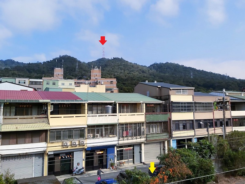
As usual, having a map or GPX track with you is a must, especially when you need to get to the trailhead from
Sanyi Train Station. There were many marks on the way to the trailhead, but they were all in Chinese. I turned
right after leaving the train station and saw a big sign pointing to Mt. Sanjiao next to an underpass on my
right. So, I turned right again.
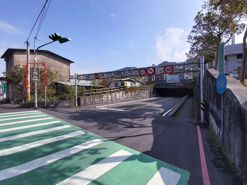
You'll have to make several turns before reaching the trailhead of Mt. Sanjiao, but, lucky for hikers, there
are many signs and a map telling us where to turn.
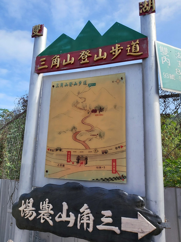
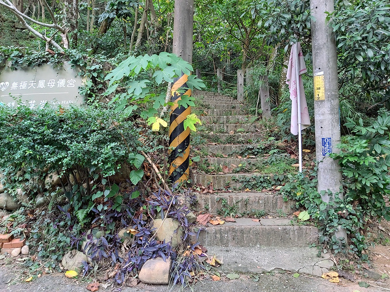
After 10+ minutes, I arrived a parking lot and the trailhead.

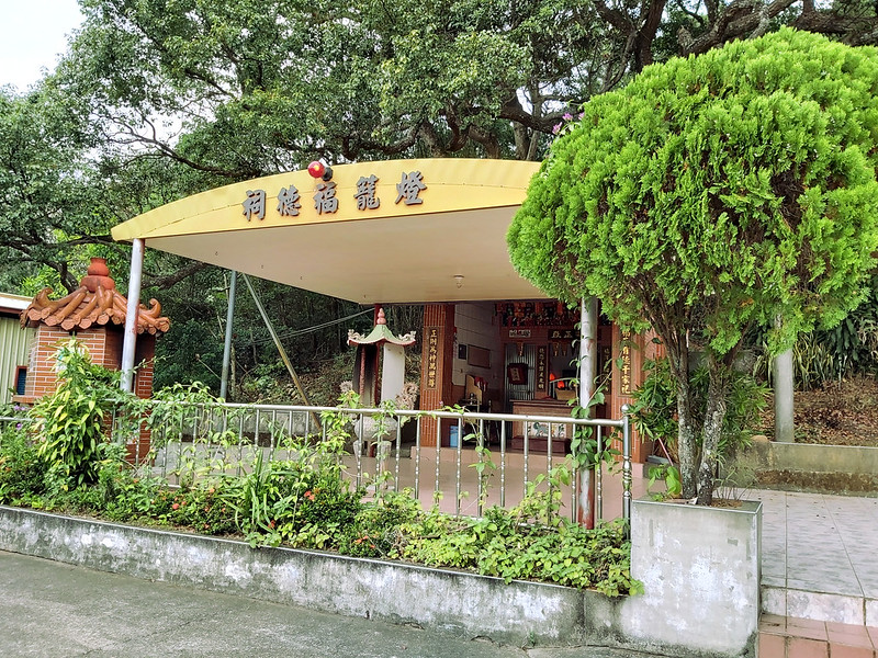
Start with An Earth God Temple with A Cute Name and Quicky to Mt. Sanjiao
There was an earth god temple above the parking lot, called Denglong Earth God Temple 燈籠福德祠, or Lantern Earth
God Temple. I didn't see this on my first hike. I'm thankful that my new friends took me there and they also
pointed the toilet to me. There were two big trees that were over 100 years old behind the temple. You can go
there to take a look before your hike.

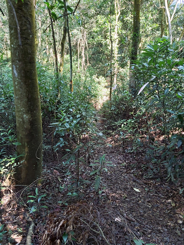
Very soon I reached the first junction on this trail and I turned right.

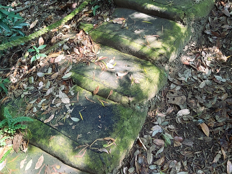
The trail was obvious to recognize with steps, and some of the steps were made of sandbags, which could be
very slippery if those got wet.
I just followed them and stopped once in a while to see the views.
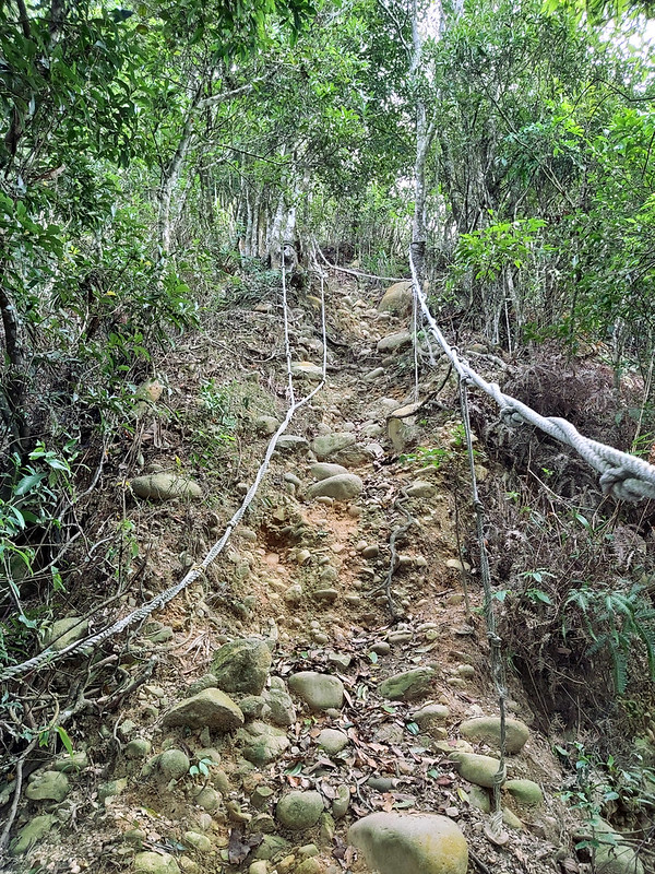
Then I reached a very steep slope with ropes to help hikers getting up or down. I'd say this was the steepest
slope on this hike, but it just took a few minutes to finish it.
Following the trail, I saw a huge transmission tower painted with tung flowers on my left and I continued.

After making a turn and passing a pavilion, I reached the first peak, Mt. Sanjiao. There was a relatively big
space on this peak, but not much view so I quickly left.
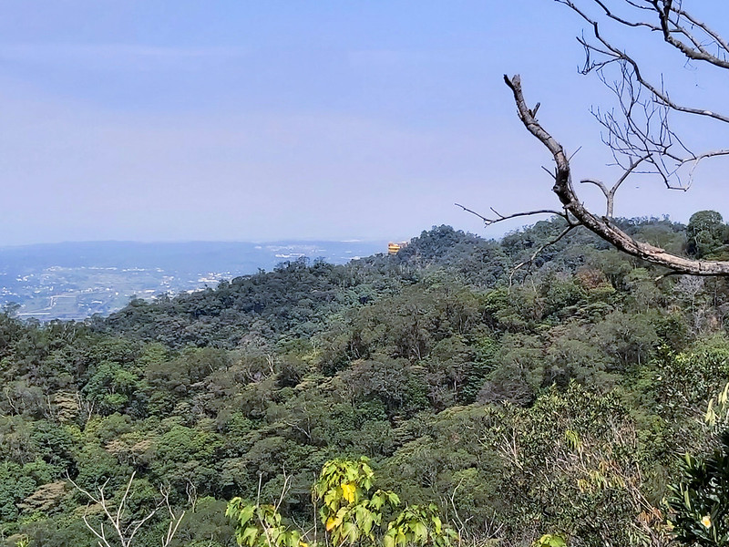
Mt. Xue Range Kept Me Company to Mt. Changkeng
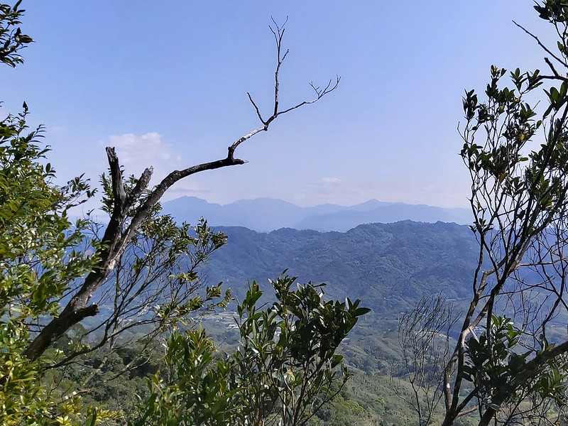
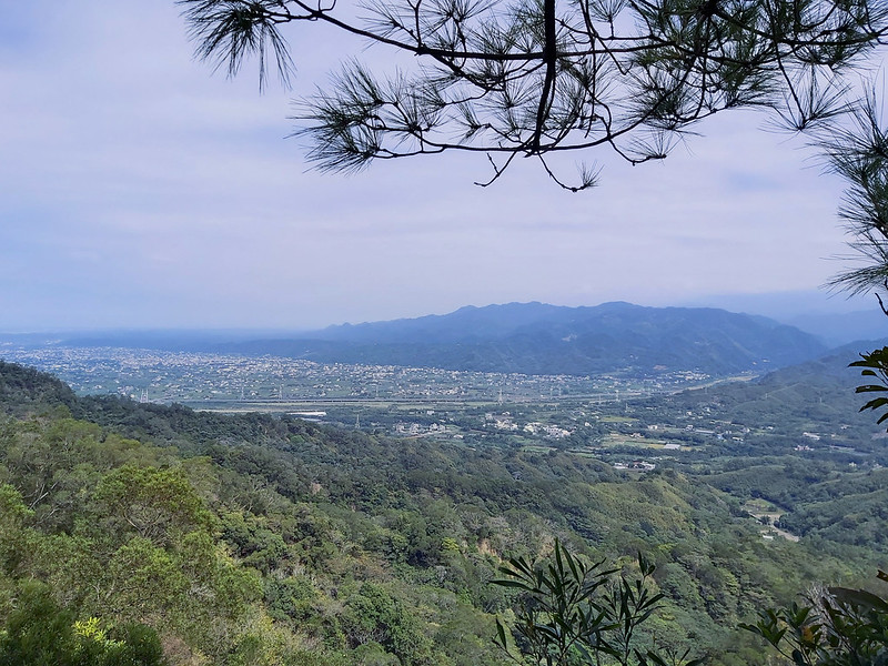
From there, I started to hike on the ridges. On my right, I could see layers of mountains. Those are sections
of the famous Mt. Xue Range 雪山山脈, and this range goes all the way to the easternmost Taiwan, Sandiaojiao 三貂角.
The ridgeline hike was up and down and up and down, but there weren't many huge ascending and descending.
My new couple friends and I I reached Mt. Sanjiao about the same time, and we ran into each other again on
this trail. Then we struck up conversations. Their Plan A was to hike to Mt. Sanjiao, enjoy their time there
and go home. After having a conversation with me, they decided to join me to do this point-to-point hike
together.
Sometimes, there were several narrow ridges to pass through, and some small steep slopes to climb up. Other
than those, this hike wasn't difficult at all.

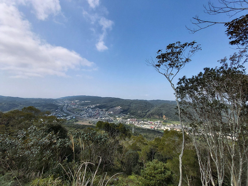
Very soon, I reached Mt. Changkeng, aka Mt. Sanjiao North Peak. There was an opening on the west side of this
ridgeline, and I could see Tongluo in the distance.

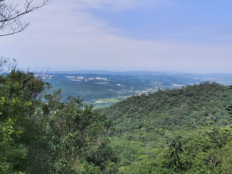
I could see Cihui Temple from the trail, too.
To Mt. Shuangfeng, Supposedly
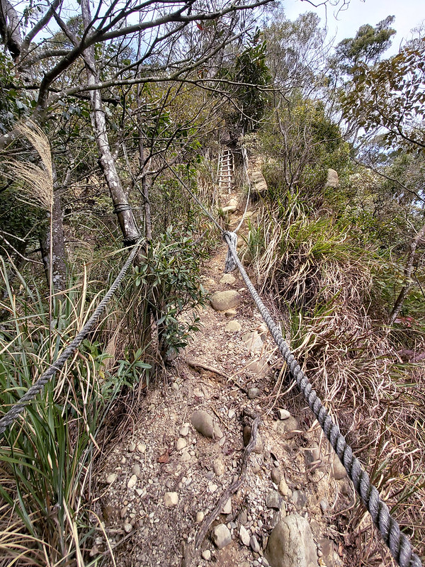
After hiking for about one hour, there was a slope with a flimsy looking ladder hanging on a steep slope. It
looked a little bit scary, but it wasn't too bad.
Then I passed another transmission tower, where Mt. Shuangfeng was.
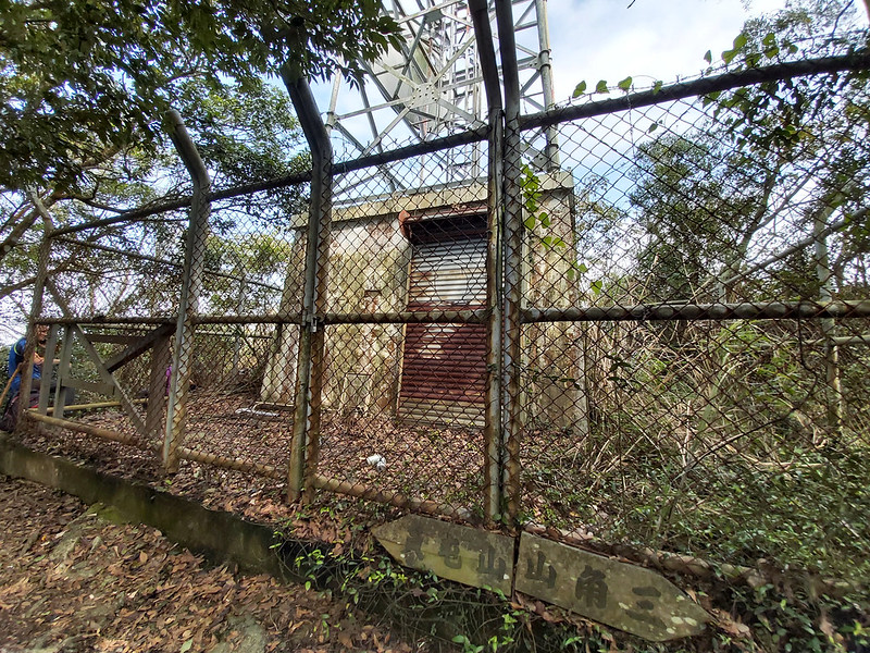
But for some unknown reason, I didn't see the sign and Class 3 Triangulation Stone. At least, I got to see it
on my first hike.
On my first hike on February 8, 2020, my friends and I reached Mt. Shuangfeng right after climbing the flimsy
ladder and saw a junction, one to Cihui Temple and the other to Shuangfeng Road.
On the way to Cihui Temple, we saw Mt. Shuangfeng West Peak. Nothing much to see here.
We went to Cihui Temple to have lunch and totally forgot about returning to the junction. As a result, my
first hike ended with Mt. Shuangfeng, and we had to walk back to Sanyi Train Station to get my friend's car.
It took us around 70 minutes from Cihui Temple to Sanyi Train Station.

The people at the temple are very friendly, but it's better to let them know your intention polietly. They let
us cook lunch and use the toilet inside the temple. If you want to have lunch here and continue your hike
later, remember to return to the junction.

On my second hike, my new friends and I saw a small platform like cliff with a beautiful view, and we decided
to have a lunch break to enjoy the scenery together.
However, I didn't see Mt. Shuangfeng on my second hike, nor did I see the junction. I check other hikers'
blogs and it seems the local government set up new signs. This is still a mystery to me and can only be solved
by a third attempt.
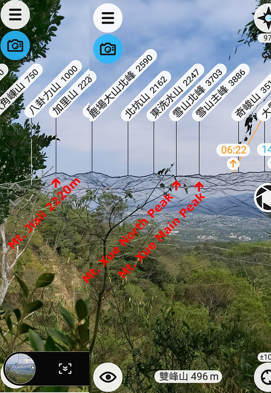
Although I missed Mt. Shuangfeng on my second try, I got to use my PeakFinder app to see where Mt. Xue Main
Peak was after passing Mt. Shuangfeng. I accidentally turned off my phone's rotation function, so I have to an
app to make a collage of those screenshots.
Mt. Yuantun North Peak and Finally, Mt. Yuantun
After lunch break on my second hike, my friends and I continued. The trail terrain became much milder, and we
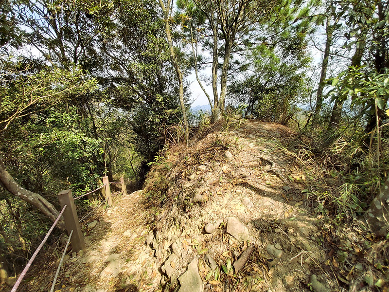
arrived at Mt. Shuangfeng North Peak within a few minutes.
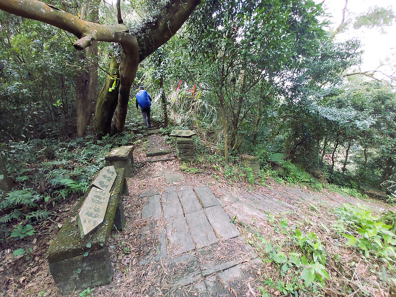
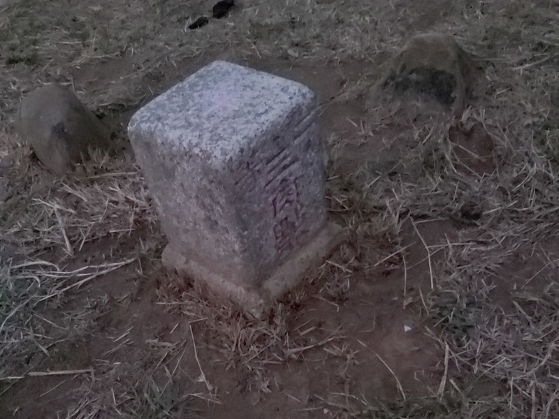
The trail was well maintained, and I saw several stones carving with numbers and millages like this one.

Looing through the trees, I still could get glimpses of mountains and the highway.

Then, we reached our last peak on this trail, Mt. Yuantun. There wasn't much to see here, either. So, we
continued our hike.

After Mt. Yuantun, we passed a hexagon pavilion within 2 minutes. From there, we hiked mostly on steps.

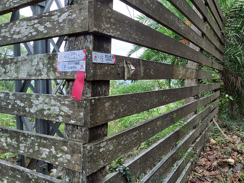
We passed a fence with a relay staion in the middle. There were three signs on the fence, the one on the right
pointing to Hakka Yard, one pointing to Mt. Yuantun, and the third one pointing to Tongluo Train Station. We
headed to the direction of Tongluo Train Station.
Within a few minutes, we exited the trail, and my new friends arranged a pickup for us to do more sightseeing
before getting back to Sanyi Train Station.
The distance from the trailhead to Tongluo Train Station is 2.2 km (1.4 miles) if you walk on Taiwan County
Highway 119 and pass Tongluo Fire-cracker Vine Flower Park 銅鑼炮仗花海公園. The blossom season of Fire-cracker Vine is in February and March, which is
about the time of cherry blossoms.
Bonuses from Both Trips: Cherry Trees Trail in Yuanli and Beautiful Sunset on Mt. Hutou in Tongxiao
Although I didn't get to finish the whole hike on my first trip, we drove to nearby attractions to see Cherry
Trees Trail in Yuanli Township and got to see the ridgeline we hiked earlier.
We saw Taiwan High Speed Railway trains passed by, too.

As to my second trip, my new friends were so warm and friendly. In fact, most Taiwanese hikers are very
friendly and willing to help hikers in need. My new friends arranged a pickup, and their friend, Mt. Lee, took
us to his cabin to have snacks and Chinese tea. Mr. Lee was a retiree, but he had a very busy and colorful
life. He let us visit his cabin located in remote Miaoli, and it was such a great getaway to enjoy the country
life.

Later, my new friends took me to Mt. Hutou Trail 虎頭山步道 and enjoyed
sunset on Mt. Hutou 虎頭山, in Tongxiao 通宵. This is probably the shortest hiking trail I've ever been, only 600
meters round trip. Hutou literally means tiger's head in Chinese.
The height of Mt. Hutou is only 93 meters (305 feet), more like a small hill, but you can see the panoramic
view of whole area.

There is one Class 2 Triangulation Stone and a Class 3 one, but I only saw the class 2 one. There was a Tongxiao Shrine 通宵神社, but it was already closed when we got there.
By the way, there are 5 mountains with the name of Hutou in Taiwan, and the
locations of the other four are: Guishan District of Taoyuan City, Puli Township of Nantou
County, Kenting (Checheng Township) of Pingtung County, and Tuisui Township of Hualien County.
The one in Kenting is actually called Mt. Dinghutou 頂虎頭山. Ding means top in Chinese.
Later, my friends took me to Tongxiao Train Station and ended this wonderful day.
Thoughts about This Hike: A Trail Worth Doing Again
Although this trail is far from Taipei, I will love to do this hike again. It's so relaxing to hike on the
ridges and see the mountain and city views from both sides, and very easy to get to both trailheads by train.

It will be much easier to get there by driving or riding a scooter if you want to visit other attractions
after this hike. There are several ways to do this hike, too. I can start from the Tongluo side and hike to
Mt. Shuangfeng and return to Tongluo.

The other way to enjoy this hike is to start from the Sanyi side, and also hike to Mt. Shuangfeng and return.
Then I will put Mt. Houyan or Longteng Broken Bridge on my itinerary.
Have you been to this trail? What do you think about this hike? Feel free to let me know if you have any
questions or comments below. Sign up for the Taiwan Hikes newsletter for more trails in Taiwan.
Map and Itinerary
Group Hike or Solo Hike: Solo hike
Date of Hike: October 25, 2020
Date of Hike: October 25, 2020
Based on my hike on October 25, 2020
09:48
Left Sanyi Train Station
09:49
Turned at underpass with the sign pointing to Mt. Sanjiao
09:53
Saw the map and entered the tunnel
10:02
Turned to a parking lot and saw the entrance of steps with a map
of Mt. Sanjiao, Mt. Shuangfeng, and Tung Flower Trail
10:10
Saw a junction and turned to the right
10:28
Reached the steep slope with ropes
10:35
Passed the transmission tower
10:39
Reached Mt. Sanjiao and started hiking on the ridge
11:32
Reached Mt. Chengkeng, aka Mt. Sanjiao North Peak
12:02
Reached the wooden ladders
12:05
Passed the transmission tower where Mt. Shuangfeng was
12:31
Found a great spot with wonderful views for lunch. If I didn't
miss Mt. Shuangfeng, it would be about time to reach it. It would also be about time to see the junction
to Cihui Temple.
13:31
Resumed the hike
13:34
Reached Mt. Shuangfeng North Peak
14:14
Saw a stone with "0K 495M"
14:16
Reached Mt. Tunyuan
14:18
Passed a hexagon pavilion
14:27
Passed the fence with signs pointing to Hakka Yard and Tongluo
Train Station
14:31
Exit the trail
Total time:
4 hours 43 minutes, including long breaks