Mt. Wulai to Mt. Datong: A Trail to See Exotic Wild Orchids and Beautiful Woods in an Indigenous Village near Taipei
Most people's first impression of Wulai in Taiwan is the hot springs. Yet, there are many amazing hiking
trails and wild orchids near Wulai to explore. This post is about the hike between Mt. Datong and Mt. Wulai.
If you do this trail in spring, you can also enjoy the stunning Tung Tree Blossoms, May Snow, in Taiwan.


Table of Contents:
About Wulai and Mt. Datong
Wulai 烏來, or Ulay in Atayal, meaning water is hot, is
the home of indigenous tribe, Atayal, in New Taipei City, Taiwan. Wulai is also the largest but the least
populated district in New Taipei City. Compared Wulai's population density, 20/km², to Yuanhe District's 永和區 30,000/km². Wulai is a popular
tourist attraction, but also a hiker's heaven. However, the devastating aftermath brought by
Typhoon Soudelor in 2015 made Wulai suffer for a long
time.
Typhoon Soudelor brought floods in Yilan and Wulai. It produced vast amount of 422 mm (16.61 inches), within 6 hours in Wulai. The intensity of Soudelor also
triggered landslide in the mountains, and the impact lasted for years, which also made me think twice to hike
here.
How to Get There
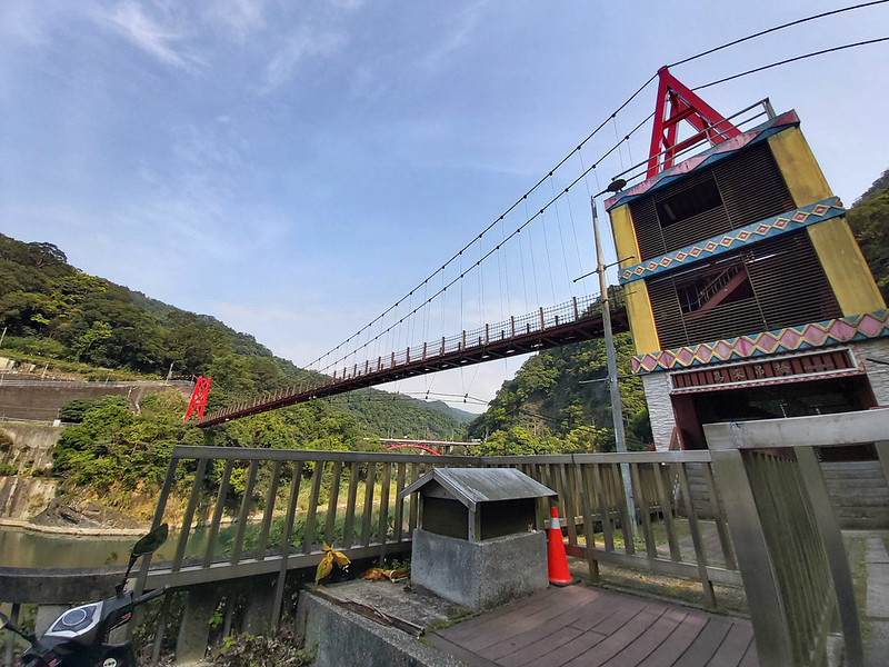
Take Bus 849 at MRT Xingdian Station. If you want to start
your hike from Miaoxin Temple 妙心寺, get off at the last stop, Wulai Terminal 烏來總站.
If you want to visit Wulai Old Street right after your hike without taking the bus back to Wulai Terminal, you
get off at Zhongzhi Stop 忠治站 and walk slightly uphill for around 45 minutes to Mt. Datong Trail 大桶山登山步道.
Please note that it might be more difficult later if you start from this trailhead.
Peaks to Reach
Mt. Wulai Front Peak: 烏來山前峰, 789 meters (2,588 feet)
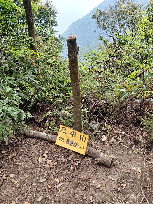
Mt. Wulai: 烏來山, 820 meters (2,690 feet)
Mt. Datong: 大桶山, 916 meters (3,005 feet), Class 3 Triangulation Stone, no view
Mt. Datong East Peak: 大桶山東峰, 910 meters (2,985 feet), no view
There's a short name for this trail called Wutong Trail, from Mt. Wulai and Mt. Datong.
Mt. Wulai: 烏來山, 820 meters (2,690 feet)
Mt. Datong: 大桶山, 916 meters (3,005 feet), Class 3 Triangulation Stone, no view
Mt. Datong East Peak: 大桶山東峰, 910 meters (2,985 feet), no view
There's a short name for this trail called Wutong Trail, from Mt. Wulai and Mt. Datong.
A Steep Beginning to Mt. Wulai Front Peak and Mt. Wulai
GPS coordinates of the trailhead from Miaoxin Temple 妙心寺: 24.8658207,121.5520373
GPS coordinates of the trailhead from Zhongzhi 忠治, the entrance of Mt. Datong Trail 大桶山登山步道: 24.8903745,121.558496
GPS coordinates of the trailhead from Zhongzhi 忠治, the entrance of Mt. Datong Trail 大桶山登山步道: 24.8903745,121.558496
My Plan B Became Plan A Because of the Virus
My Plan A for my birthday was to hike Mt. Jiali 加里山, because I was hoping I
could find Taiwan Pleione (or Pleione formosana Hayata) 台灣一葉蘭 and Indian Pipe 水晶蘭.
However, the outbreak of Covid-19 messed up many things and I wasn't sure it was okay to travel there in
April. So, I decided to pick up a trail that required me to travel less by public transport. Then, I came
across this trail, which also gave me one of the most pleasant surprises.
This is a point-to-point trail, and you can start from either trailhead. I started this hike from the steeper
one, which was very close to Wulai Old Street 烏來老街. The other one was near Zhongzhi Village 忠治部落.

You have to look for the trailhead on your left carefully, because I missed it at first and walked all the way
into Miaoxin Temple, while my GPS watch showed that I was further away from the trailhead.

A Steep Beginning to Wake You Up
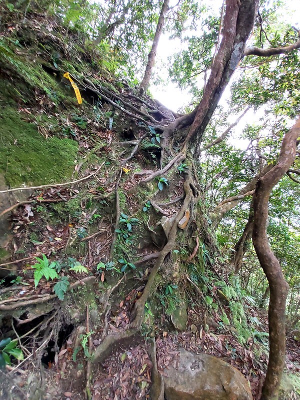
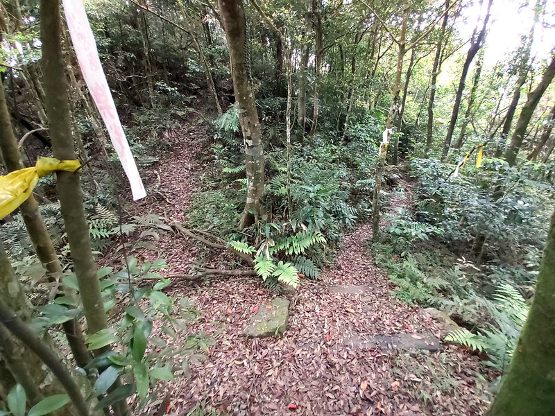
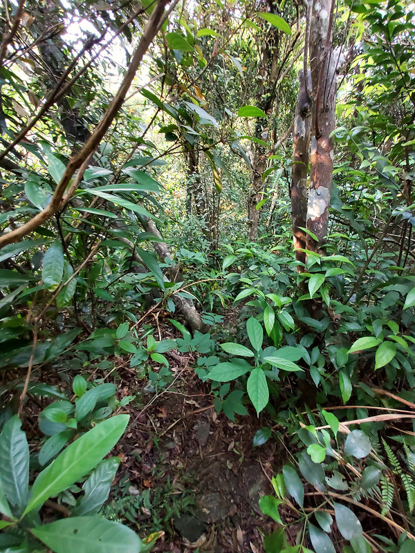
The trail terrains were typical in Taiwan: soil intertwined with tree roots and rocks, but it wasn't difficult
to navigate. There were also many plastic ribbons tied on the trees to help me follow the trail, and I saw
steps leading up to a huge water tank on my right. I continued to hike, and the trail quickly it went uphill.
While I was working hard to climb up, I saw Wulai and River Nanshi through the trees.

The more I went, the steeper the trail became. Some slopes were almost vertical, but it wasn't too hard to get
myself up because there were many strong tree roots for me to grab.
Auntie, You Are Really Good 阿姨好厲害
To my delight, there weren't many hikers on the trail. The first people I met were the residents living in
Wulai, a guy and two teenage boys doing a short hike. When the guy learned that I went solo, he turned to the
boys and said: "Auntie (which is me) was really good 阿姨好厲害".

When I do solo hikes and meet other hikers on the trails, I usually get either one of the following two
reactions. The first one is ‘You are good', and the other is ‘you shouldn't hike by yourself'. Lucky me
because I encountered both comments on that day. In Taiwan, it's not popular or even encouraged to do solo
hikes, because people think you can't get help if accidents happen, not to mention females doing solo hikes.
To be honest, I'm not special at all. I just want to enjoy the trail by myself.
After saying goodbye to them, I continued my hike. it was quiet on the trail and I had to stop several times
to catch my breath. There weren't many junctions on this trail, so I didn't have to spend much time to
navigate. Then, I reached my first peak on the trail, Mt. Wulai Front Peak 烏來山前峰, 789 meters (2,588 feet).

There wasn't much to see from Mt. Wulai Front Peak, so I didn't spend much time there. Within 20 minutes, I
reached my second peak, Mt. Wulai 烏來山, 820 meters (2,690 feet). Like Mt. Wulai Front Peak, there wasn't much
to see, and it was cloudy on that day. So, I left quickly.
A Surprised Detour to Enjoy the View
After 20 minutes, I saw a junction. The trail on my left went up to somewhere and the other one went downhill.
For some unknown reasons, I was curious about the one going up, even though I knew I should turn right. So, I
decided to take the uphill one to explore a little bit. I could always get back to the trail if that wasn't
the right one.

Then, I saw a pile of big rocks pointing to the sky. The trail to those rocks was sounded by two trees and
became very narrow and I had to leave my backpack there to get through them.
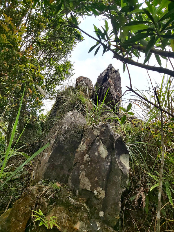
When I reached those rock and climbed up there, the view was amazing. During that time, I didn't have an app
called PeakFinder. I had no idea what mountains I was looking at, which was a shame. I
think I could have gotten a better view if I dared to climb on the top of those rocks. But I decided not to.
This is one of the things I enjoy a lot when doing solo hikes: discovering hidden gems like this. Of course, I
have done research as thorough as I can before the hike, but I can always find pleasant surprises on the
trails. And this wasn't the only surprise I got on that day.
A Beautiful Treasure to Make My Day
It was almost noon when I left the rock and got back to the trail. I wasn't hungry yet, so I continued my
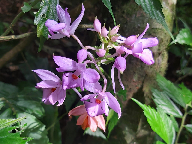
hike. Suddenly, I saw something white out of the corner of my right eye, and I stopped to take a closer look.
It turned out to be three white little flowers with vertical red strips on the flower paddles. Those were the
cutest flowers I'd ever seen!
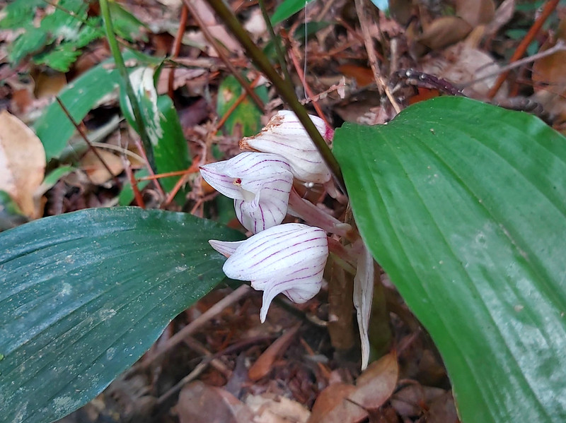
During that time, I had no idea what those lovely flowers were. I got a feeling that they were some kind of
orchids. I kneeled down immediately and took as many photos as I wanted. Those flowers were Striped Jug Flower Orchid 一葉鍾馗蘭, 一葉罈花蘭. I didn't
expect to see such beautiful flowers on that day, and I was so happy that I could stay there for more than 10
minutes just taking photos of them. If I hiked with a group, I probably could stay there for a few minutes.
What a wonderful surprise.

After I was satisfied, I decided to take a lunch break. Before lunch, I heard people's voice ahead of me. I
wasn't in a hurry and I wasn't keen to meet other hikers, either. I took my time and started brewing coffee.

The trail terrain became more friendly here, and it wasn't as steep as the previous parts of the trail. More
timber posts saying Mt. Datong Trail 大桶山步道 could be seen on the trail. You can see GPS coordinates of your
current location written on those posts.

Reached the Highest Peak: Mt. Datong
Then, I reached Mt. Datong 大桶山, 916 meters (3,005 feet). There wasn't much to see around here, but this was
the highest peak on the trail. This was also easy to recognize, because Central Weather Bureau set up a small
station to collect precipitation data, but I didn't take photos of this station.

There is a famous river called River Tonghou 桶后溪 near here, and it means the river behind Tong in Chinese.
Here, Tong means Mt. Datong, meaning bucket in Chinese. The shape of Mt. Datong looks like an upside-down
bucket, and that's how this mountain got this name.
There are many beautiful trails near Tonghou River, and I got to hike two of them: Tonghou River Source to Mt. Hongludi and Tonghou Traversing Trail.

Taiwan Trails and Tales also has a
great post about her hike along with Tonghou River to Mt. Hongludi.
Here at the peak of Mt. Datong, I finally caught up with the hikers who were ahead of me, one male and two
females. We had some chat, and I got lectured by the male hiker saying that I shouldn't be hiking alone. Yes,
you either get “You are good” or “You shouldn't hike alone” on the trails when you do solo hikes in Taiwan.
Jungle to Forest: the Views under the Woods Open Up
The trail terrains and vegetation were very different after Mt. Datong. They went from a lush dense jungle to
the forest mixed with many tall straight Japanese Cedar Trees when I reached the junction to Mt. Datong East
Peak 大桶山東峰, 910 meters (2,985 feet).

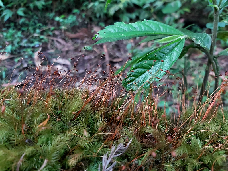
Not much view to see here, either, but those tall straight Japanese Cedar Trees were delightful to enjoy.
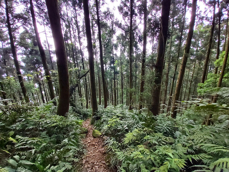
I also saw beautiful mosses close to the sign of Mt. Datong East Peak.
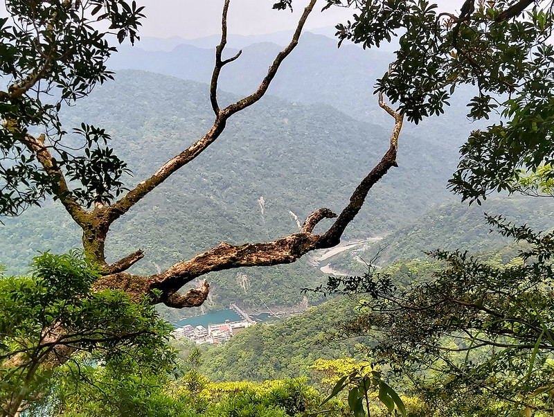
From here, the trail was mainly wooden steps, and I also got a glimpse of the view between the trees to see
Wulai valley.
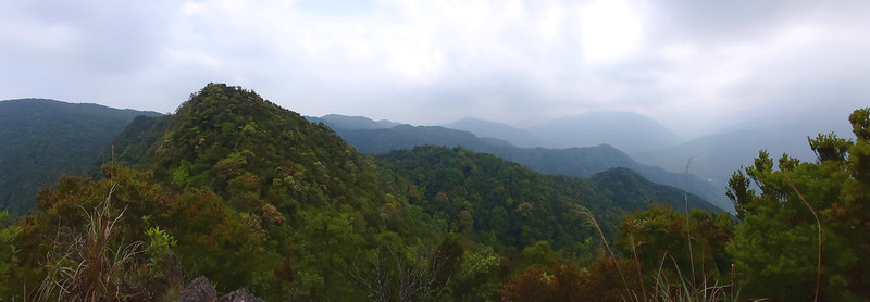
Witness the Geological Formation on the Ridge
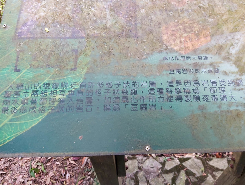
Those wooden steps led me up to a ridge again. There were many big and almost square rocks on the ridge. Those
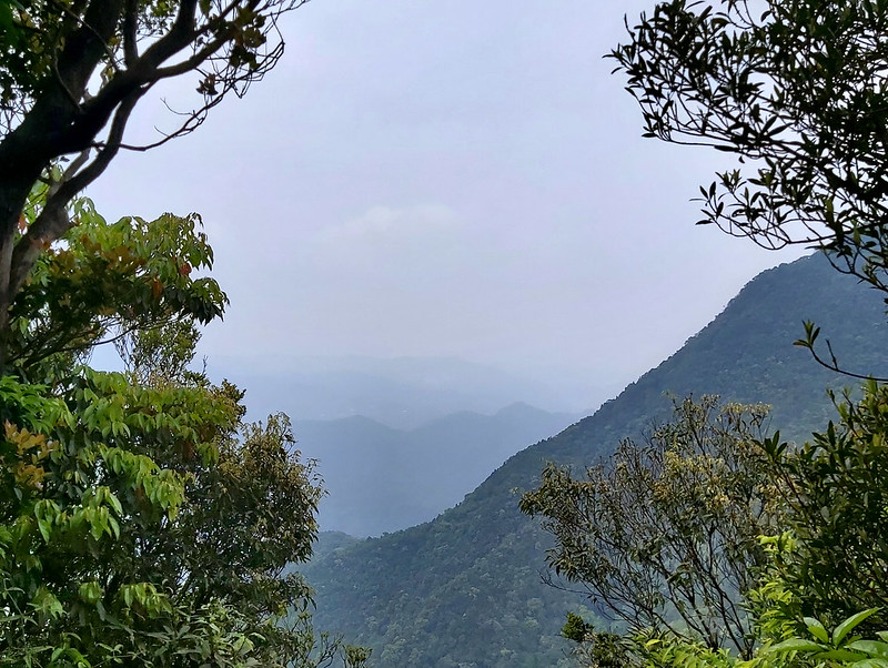
rocks were the wonder made by the nature, a unique geological formation called Chessboard Rock 豆腐岩. If the
weather is great, you can see Feitsui Reservoir on the east and Mt. Badaoer 拔刀爾山 on the west.

According to the sign, those rock layers were squeezed and creased by the plate movements (not sure it's the
right way to describe it in English). When it rained, the water expanded the creases on the rock, and made the
rock layers look like chessboards over a long period of time.
Although it was cloudy on that day, I still could see some views on my left among the trees. I continued my
hike and saw a junction, and I took the left trail, and those wooden steps showed up again.
Then, I saw Mt. Sikanshui 四崁水山 written on the timber post, and it didn't take long before I reached the
junction to Mt. Sikanshui.

Aborted the Last Peak but still Got Popsicles after 4 Months
The trail condition to Mt. Sikanshui wasn't as good as the previous one, and I had to go downhill here and
climb back later. You could tell that not many people hiked this trail for a while. My original plan was to
reach Mt. Sikanshui and turn back. But I was already tired and really didn't want to climb uphill again. So, I
decided to abort my plan to this peak and got back to Mt. Datong Trail.
Later, I was told that you can just leave the trail after Mt. Sikanshui and get to
Kueishan Power Plant 桂山發電廠 to enjoy cheap but delicious popsicles. Well, I did
get one popsicle from a different hike after 4 months.
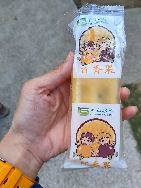
Kueishan isn't the only power plant that sells popsicles in Taiwan, and you must be wondering why power plants
sell popsicles. When Kueishan Power Plant was under construction in 1940s, Taipower Company needed tons of ice
to cool down the concrete to build the dam. So, they bought many ice making machines to produce the ice.
After the dam was finished, Taipower decided to keep those machines and hired people to make ice for their
employees, and sold those popsicles at the employee canteens. Later, those popsicles become very popular,
because they still maintain the old Taiwanese flavors and are really cheap, NT 10 for each. If you are
curious, Kueishan Power Plant was also the first hydroelectric power plant in Taiwan.
Back to the Wooden Steps and Time to Eat My Birthday Cupcake
When I got back to Mt. Datong Trail, the wooden steps were back. The heights of steps were not even, which is
common on the trails in Taiwan. I decided to take off one of my rainboots as the reference to show you those
annoying uneven steps.

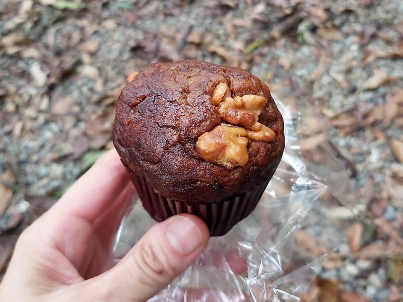
After a while, I felt hungry and I finally got to eat my birthday cake. I definitely have to do solo hikes on
my birthdays after this.
April Snow in Taiwan: Tung Blossoms in Spring
While getting closer to the other side of the trailhead, I saw many white flowers lying on the trail. If you
get to visit Taiwan in April or May, please don't forget to check out Tung tree blossoms. They are very easy
to recognize. You can also check out
the
Hakka Tung Blossom Festival to see whether the flowers are ready at those areas where you intend to
visit.

Sometimes, I feel bad to put my feet on those delicate beautiful white flowers.

It didn't take long for me to reach the trailhead. There was a sign saying Mt. Datong Trail with two Atayal
statues guarding the gate.
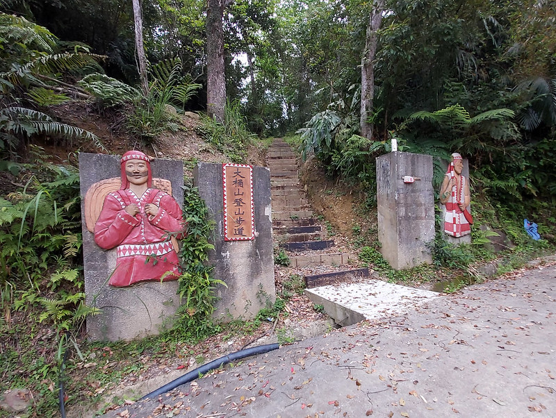
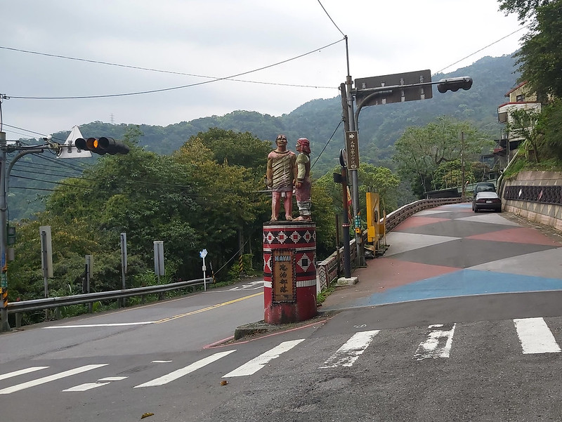
This trailhead was very close to an Atayal village called Zhongzhi Village 忠治部落. There was a bus stop close to
the entrance of Zhongzhi Village on Xingwu Road. When I got back to Xingwu Road, I was lucky that I didn't
have to wait long for my bus to come and call it a day.
One more thing. As you know the weather is very humid in Taiwan, it's not a surprise that there are many
leeches on the trails. I accidentally brought one home.

Thoughts about This Hike: A Trail for Wild Orchid Fans
This is a pleasant trail to hike and not too difficult to finish. There are some steep slopes to boost your
adrenaline if you start from Miaoxin Temple side, but they are manageable.
Later, I realize that you can find many exotic wild orchids in Wulai almost all year round, not just
Striped Jug Flower
Orchid in spring. This hiker, Max Kuo, spends a lot of time looking
for wild orchids on the trails and he founds many in Wulai. After reading his posts, I feel tempted to look
for those amazing wild orchids on the trails in Wulai.
There are also many other
interesting things to do in Wulai. If you want to visit Wulai Old Street, you
can start your hike from Zhongzhi Village, end your hike at Miaoxin Temple, and go to Wulai Old Street within
a few minutes.

Or just take bus at Zhongzhi Stop to Wulai after you hike from Miaoxin Temple if you don't want to spend 45
minutes trying to find the trailhead in Zhongzhi Village from the bus stop. It's pity that
Wulai Public Hot Spring is long gone,
but you still can enjoy it at the hotel.
I highly recommend this trail for those who want to experience the nature and culture within one day.
Have you been to Wulai and done hot springs? What do you think about those trails nearby? Please leave
comments below. Don't forget to subscribe to newsletters to know more about the exciting trails in Taiwan.
Map and Itinerary
Group Hike or Solo Hike: Solo hike
Date of Hike: April 18, 2020
Date of Hike: April 18, 2020
Click Menu in the map to download, print or share the map.
Click to change the speed to meet
your condition.
to change the speed to meet
your condition.
Click
to change the speed to meet
your condition.Based on my hike on April 18, 2020
08:27
Arrived at Wulai, took photos, and headed to Miaoxin
Temple
08:36
Found the trailhead
08:57
Saw a junction and took the right
09:51
Took a rest
10:21
Reached a ridge
11:14
Reached Mt. Wulai Front Peak and took photos
11:33
Reached Mt. Wulai
11:54
Saw a junction and checked out the left one to see the
rock
11:58
Reached the rock and took photos of the amazing views
12:11
Saw Striped Jug Flower Orchid and took photos for about 10
minutes
12:30
Took a lunch break for about 30 minutes
13:30
Reached Mt. Datong, and met other hikers
13:48
Continued the hike and noticed the change of the
vegetation
13:57
Passed the big sign of Mt. Datong Hiking Trail and reached Mt.
Datong East Peak within a few minutes
14:06
Took the left at the junction
14:21
Encountered the first section of wooden steps
14:37
Climbed up the ridgeline and saw the sign about the chessboard
rock formation
14:42
Took the left trail at the junction
15:00
Saw the sign of Mt. Sikanshui on a timber post
15:05
Reached the junction to Mt. Sikanshui, headed to the trail, but
gave up around 5 minutes later and turned back
15:25
Saw wooden steps
15:31
Saw the sign of 0.7K/2.3K Saint Jiuxuan Temple 九玄聖宮 on a timber
post
15:40
Saw sign of Zhongzhi Police Statin 忠治派出所 and chairs. Took a rest
to eat my cupcake
15:55
Saw Tung tree blosoms and took photos
15:59
Exited the trail through the gate of Mt. Datong Hiking
Trail
16:29
Reached Zhongzhi Village
16:33
Reached Xingwu Road Section 5 and arrived at the bus stop
Total time:
8 hours 6 minutes, including breaks