Tonghou Traversing Trail: Discover the True Beauty of Rivers in Taipei
Tonghou Traversing Trail is a must-do hike to experience the true beauty of rivers near Taipei. The trail is
in remote Wulai, but the reward of driving there is worth it. The rich vegetation and Tonghou River also make
this place a great campsite to enjoy the wilderness in Taiwan.


Table of Contents:
- About Tonghou Traversing Trail and the North Section of Mt. Xue (Snow Mountain)
- How to Get There
- Peaks to Reach
- Anything to Do with Tonghou Is Great and This One Is No Exception
- Thoughts about this Hike: Have to Visit Again
- Now, Let's Talk about the Translations
- Map and Itinerary
- Recommended Blogs and Resources
- Related Posts on Taiwan Hikes
About Tonghou Traversing Trail and the North Section of Mt. Xue (Snow Mountain)
According to a famous Taiwanese hiker, prolific author and YouTuber, Tony Huang : “You won't know how beautiful the rivers in Taipei are, unless
you visit Tonghou 不至桶后,不知台北溪流之美”. After doing Tonghou Traversing Trail myself, I can say his statement is
totally fair. I'm not new to Tonghou River, but I'm still amazed by her striking beauty every
time I come into her presence.

One of the Famous Indigenous Historic Trails
When we talk about Tonghou Traversing Trail, it's necessary to mention the three famous indigenous historic
trails used by Atayal People for hunting and commuting in the old days: Happen Traversing Trail 哈盆越嶺古道, Fuba Traversing Historic Trail 福巴越嶺古道, and Tonghou Traversing Trail 桶后越嶺古道. There is no public transport
to get to those trailheads, and you have to apply for permits to hike on Fuba Traversing
Trail.
Tonghou Traversing Trail is a very short and easy trail between Wulai in New Taipei City and Yilan, but worth
to spend time either sitting by the river quietly to enjoy the tranquility or strolling in the woods. Tonghou
in Chinese means behind the bucket, and the bucket here refers to Mt. Datong. So, this trail is literally located behind Mt.
Datong. During Japanese occupation, the Japanese government rebuilt this trail to transport logs.

Lanyang Five Famous Mountains 蘭陽五大名山
There are five mountains in Yilan and are labeled as Lanyang Five Famous Mountains 蘭陽五大名山:
Mt. Sanjiaolun: 三角崙山, 1,028 meters (3,373 feet). I hiked Mt. Sanjiaolun
before, but I don't remember much about this trip. I'll need to do it again.
Mt. Yinziling: 鶯子嶺山, 943 meters (3,094 feet)
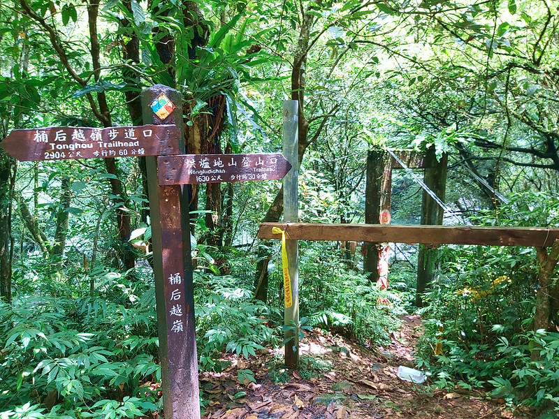
Mt. Hongludi: 烘爐地山, 1,166 meters (3,497 feet). You can read my Tonghou River Source Hike to know more about the details.
Mt. Dajiaoxi: 大礁溪山, 1,161 meters (3,809 feet)
Mt. Ayu: 阿玉山, 1,420 meters (4,659 feet)
Mt. Yinziling: 鶯子嶺山, 943 meters (3,094 feet)
Mt. Hongludi: 烘爐地山, 1,166 meters (3,497 feet). You can read my Tonghou River Source Hike to know more about the details.
Mt. Dajiaoxi: 大礁溪山, 1,161 meters (3,809 feet)
Mt. Ayu: 阿玉山, 1,420 meters (4,659 feet)

The North Section of Mt. Xue 雪山尾稜
If you zoom out the Google Maps here, you'll see those mountains I mark on the map almost align from the
northeast Taiwan to Mt. Xue (Mt. Sylvia on Google Maps). This is because those mountains are part of Mt. Xue Range 雪山山脈.
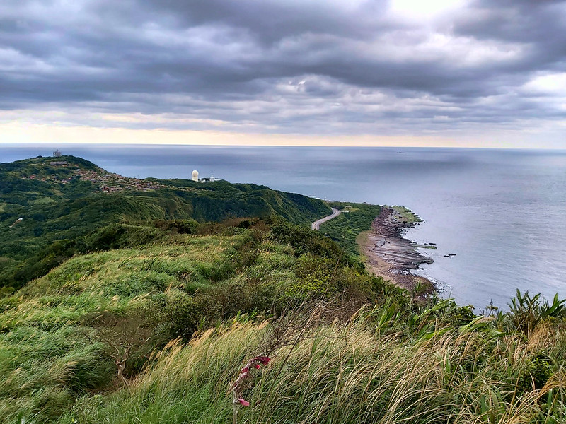
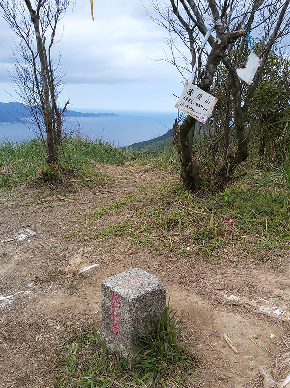
The mountain close to the easternmost tip of Taiwan, Sandiaojiao Lighthouse 三貂角燈塔, is Mt. Longlong 隆隆山 with height
of 433 meters (1,420 feet), and there is a popular trail called the North Section of Mt. Xue 雪山尾稜. If you
want, you can start from Mt. Longlong, those Lanyang Five Famous Mountains, and all the way to Mt. Xue.
This is a short post, and this hike only scratched the surface of Tonghou River area. There are so many trails
that are connected to Tonghou Traversing Trail, but we only hiked a little bit due to the group hike schedule.
I hope someday I can come back here to hike more.
I joined Dudu's trip to this trail. This is my third trip in this area. You can check
out my trips to Mt. Datong
大桶山 and Tonghou River Source to learn more about beautiful Tonghou River
region.

Before you go, please remember to check the trail condition in case the trail is closed.
How to Get There
There's no public transport to get there. You have to drive or hire a car.
Peaks to Reach
There are no specific peaks to reach on this trail if you just want to enjoy the woods and the river. However,
if you plan to hike Mt. Dajiaoxi and Mt. Xiaojiaoxi, or even Mt. Hongludi, the following is the information of
those three mountains.
Mt. Dajiaoxi: 大礁溪山, height 1,161 meters (3,809 feet). If you want to hike Mt.
Dajiaoxi, you need to apply for permit.
Mt. Xiaojiaoxi: 小礁溪山, height 1,147 meters (3,763 feet)
Mt. Hongludi: 烘爐地山, height 1,166 meters (3,825 feet). There is a Class One Triangulation Stone, and you can see the 360° view on the peak.
Mt. Xiaojiaoxi: 小礁溪山, height 1,147 meters (3,763 feet)
Mt. Hongludi: 烘爐地山, height 1,166 meters (3,825 feet). There is a Class One Triangulation Stone, and you can see the 360° view on the peak.
Anything to Do with Tonghou Is Great and This One Is No Exception
Distance: 9.1 km (5.7 miles)
GPS coordinates of the trailhead: 24.836228, 121.647824
GPS coordinates of the trailhead: 24.836228, 121.647824
A Bumpy Long Ride to the Beautiful Trailhead
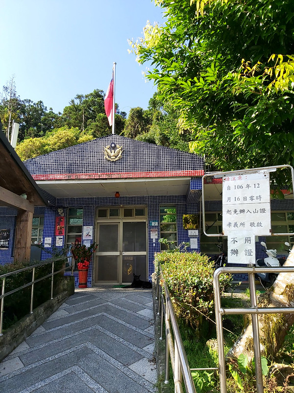
We left Banqiao at 7am and arrived at Xiaoyi Police Station 孝義派出所 around 8 to take a toilet break. Before
December 16, 2017, hikers had to apply for permits to hike here. Now, hikers can go whenever they want as long
as the trail is open.
From Xiaoyi Police Station, it took us another hour to the trailhead. There were many cars heading to the same
direction because Tonghou Traversing Trail was finally open to the public after being closed for a long time
due to damages brought by Typhoon Soudelor in 2015.
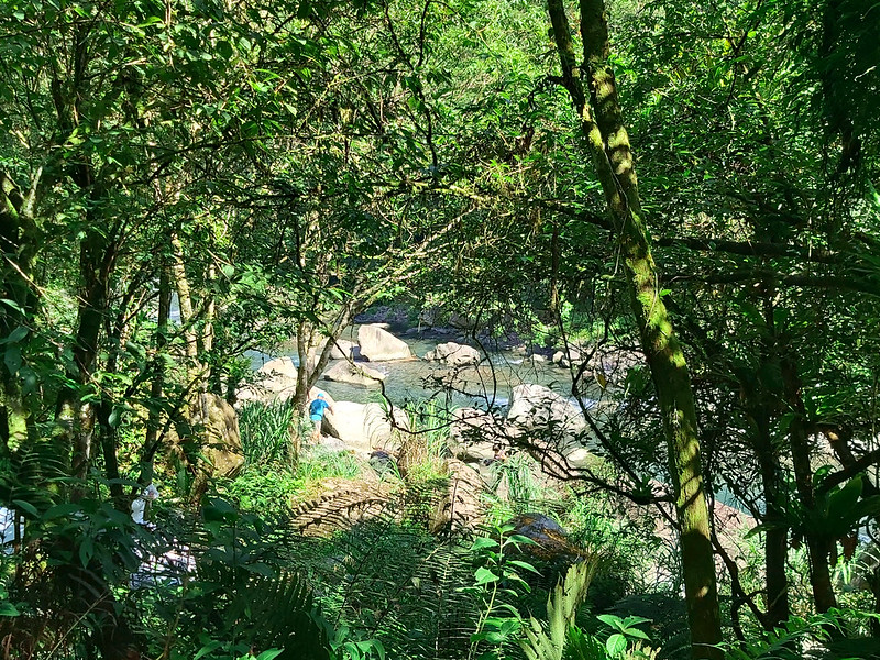
Although the road condition was very bumpy, we got a wonderful sunny weather. After we got off the cars and
ready for the hike, Tonghou River let us take a peek through the trees first.
Then, our guide took a brief stop at the old suspension bridge and gave us a short introduction about this
trail. I wanted to take a closer look at the old bridge, but we had to get going.

Junctions to Mt. Dajiaoxi and Mt. Xiaojiaoxi
This trail was well marked. Within a few minutes, we reached the junction to Mt. Dajiaoxi. As I mentioned
before, this mountain was one of Lanyang Five Famous Mountains. I made a mental note of doing research about
this mountain later.
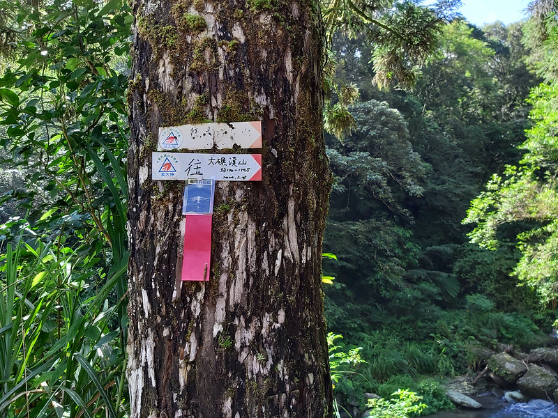
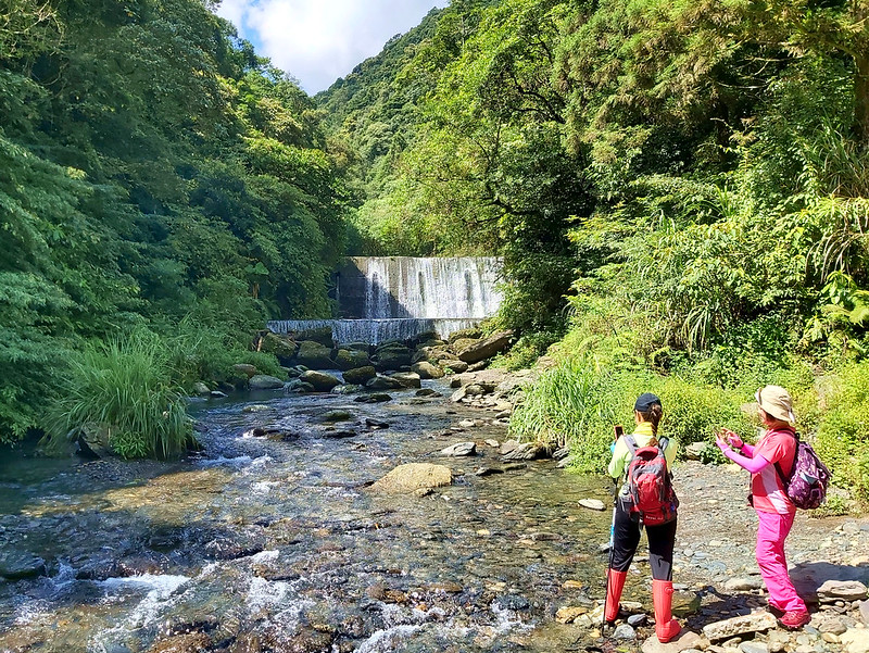
While continuing the hike, we passed a sand dam.
Soon I saw the junction and the trail to Mt. Xiaojiaoxi. This one and the one to Mt. Dajiaoxi are connected.
So, you can enter either one and make a loop hike and get back to Tonghou Traversing Trail later. After doing
some research, hikers said the views on those peaks were great, and I've put this on my list of trails to hike
in the future.
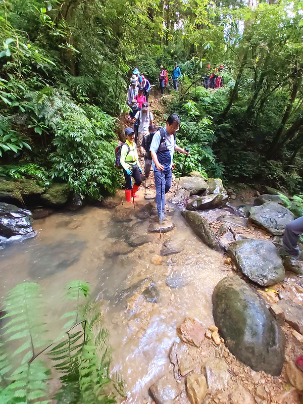
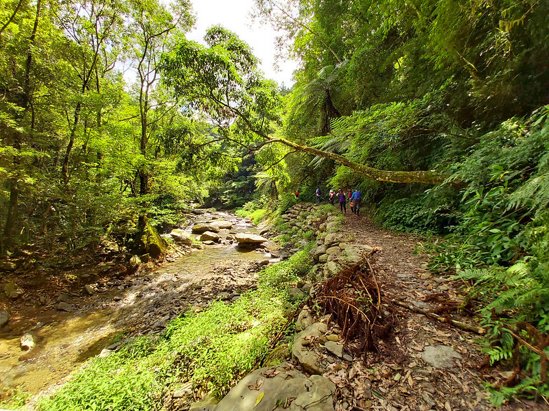
Lush Jungles along the Winding River
We hiked along the beautiful Tonghou River for a while and then turned to a sidehill. You can take the trail
by the river if you want. But our guides just wanted us to be safe.

Most of the sidehill were paved by big pebbles as steps. To be honest, it wasn't easy to hike on those
man-made trails because those pebbles got loose easily, which made each step unstable.

After a while, those pebbles were either pushed out of position by hikers or washed away by rain. I complained
a lot about the lousy user experience on the trails in Taiwan, but I have to say this wasn't the worst.
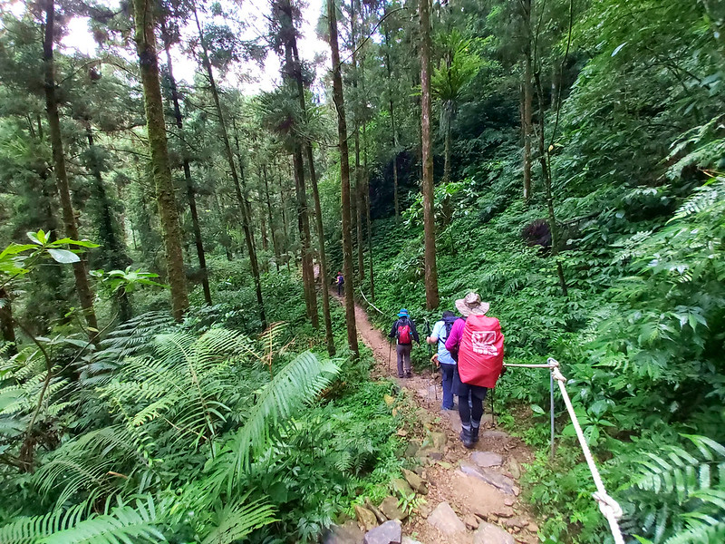
Aside from the steps, the woods here were amazing. The tall trees mixed with the jungles, and sometimes we had
to cross small streams.
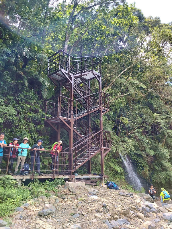
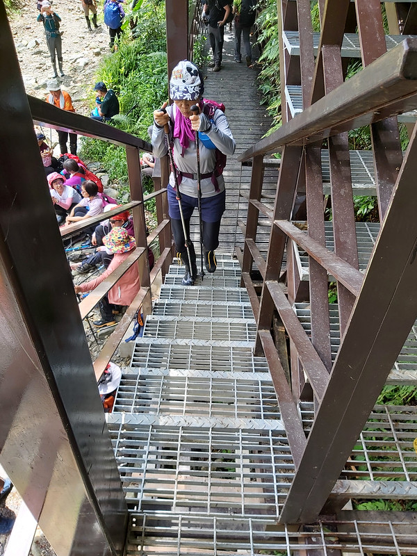
The end of this sidehill was a 3-story steel staircase, a very narrow one, so narrow that your shoulders will
bump into other hiker's when trying to walk on the stairs at the same time. Then, we were back to the
beautiful Tonghou River. We took a break here again waiting for our hiking mates to catch up.
When we were there, it was in mid-summer. Many people were having fun in the water to escape the heat.
Standing there watching them, I was so tempted to take off my heavy rainboots and join them, but I had to
follow our group's schedule.

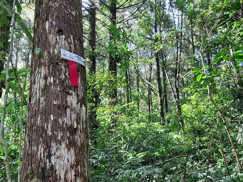
Had Lunch near the Junction to Mt. Houludi
From here, the trail was very flat, and it was very relaxing to stroll on the trail listening to the water
flowing by.

After passing the junction to Mt. Hongludi, we continued to hike. Then we reached to the river
again, our guide told us to have a lunch break by the river around 11:30.
This was a great spot to have lunch and take a break. Some of our hiking mates started swimming in the river.

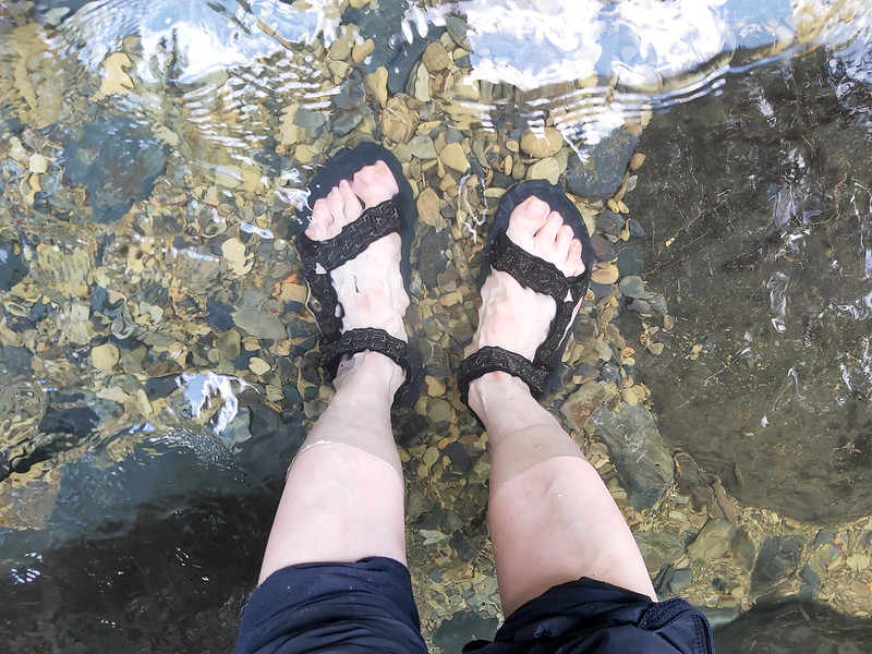
I found a quiet spot, took off my rainboots and changed to my sandals. When my feet finally touched the cold
water, it was so soothing and relaxing. It felt like I could just stand there forever.
Hate to Say Goodbye
We stayed there for about one hour and had to get back to our cars. I felt sad because I hadn't enjoyed
enough, especially when we had such a wonderful weather. One of the benefits to hike with a group is you don't
have to worry about the transportation, but the drawback is you can't change the schedule.
We followed the same trail back, and I couldn't help but admire Tonghou River again. Tonghou River had been
very kind to unveil her beauty to us and allowed us to get close to her.

When we were on the way to our cars, we saw a guy trying to remove some plants from the fallen trees. It
turned out those plants were orchids, and he was trying to save those precious plants to a safer place so they
could grow properly. I was so moved by his dedication.

When we reached our cars, I saw many tents camping on the campsite. I also ran into some guides I know from LOHAS,
and they told me they were also camping there for one night. What a great idea to enjoy Tonghou River.

When our cars reached Xiaoyi Police Statin again, it started to rain. We were really lucky.
Thoughts about this Hike: Have to Visit Again
I can tell you that this is definitely a trail I'd love to visit again and again. It's pity that my trip to
Tonghou Traversing Trail was so short, but this also gave me some ideas for my future hikes. Those are several
ways to enjoy this trail.

1. Do a loop hike including Mt. Dajiaoxi and Mt. Xiaojiaoxi and get back to Tonghou Traversing Trail to the
junction to Mt. Houludi. Then, take the trail along Tonghou River back to the parking lot. Please note that
the loop of Mt. Dajiaoxi and Mt. Xiaojiaoxi will be more challenging than Tonghou Traversing Trail.
2. Do point-to-point hike from the trailhead to Mt. Houludi. You'll have to hire a car to send you to the
trailhead and pick you up at the other.

3. Camping by Tonghou River and just relaxing.
If you get a chance to hike this trail, please stay by the river longer if possible. You won't regret it.
Now, Let's Talk about the Translations
The translations from the websites made by Taiwan governments are notoriously messy, which not only drives
international visitors crazy but also makes my brain hurt when I'm trying to write posts. As a local Taiwanese
who reads both Chinese and English, I can imagine the desperation non-Chinese speakers have to go through when
seeing those translations.
While trying to figure out the translations of Yueling 越嶺, I came across this issue again. Thus, I've decided
to write something to explain the possible versions of translations you can find about the names of the
trails, mountains, locations, streets, etc. And I definitely need a drink for this.
Thanks to the help from Twitter friends, Yueling 越嶺 means mountains/ridges traversing or traversal. I've found
at least 4+ versions of 越嶺 from just ONE government website:
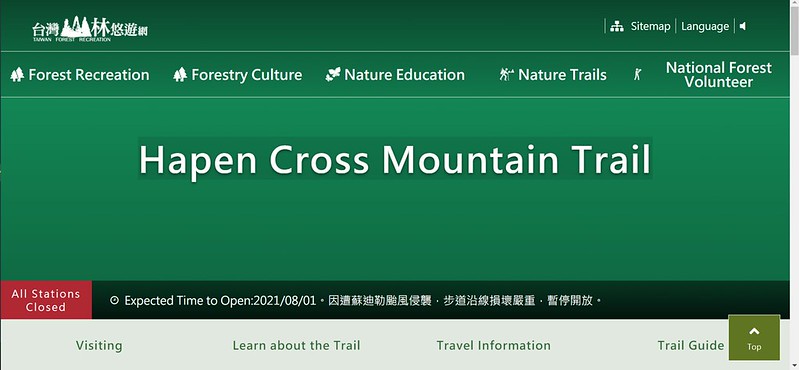
Cross Mountain, example: Hapen Cross Mountain Trail 哈盆越嶺古道. Please note that this trail
will not open to the public until August 1, 2021.
Mountain-crossing, example, Fubayueling Historic Trail 福巴越嶺古道. However, the content says
The Fuba Mountain-crossing Trail. Sometimes you will see Bafuyueling Historic Trail 巴福越嶺古道. They all refer to
the same trail, but each starts from different trailhead.


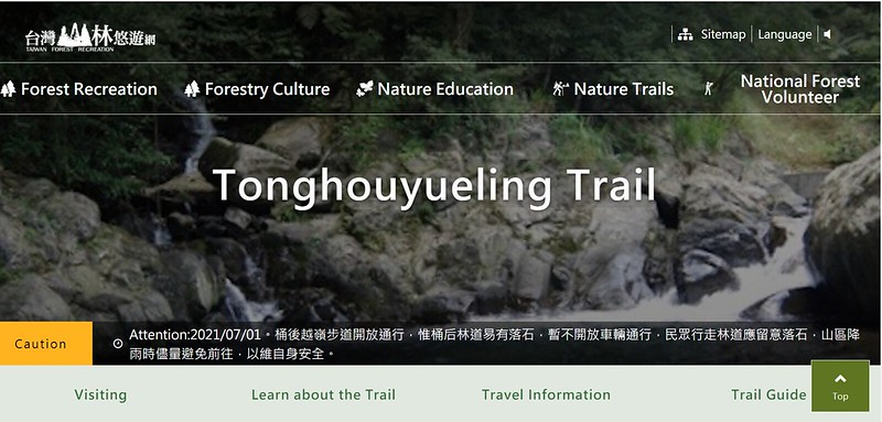
Yueling, example: Tonghuoyueling Trail 桶后越嶺古道, which is literally translated
the pronunciation from Chinese. Not sure those who don't speak Chinese can understand what yueling means.
Cross-Ridge, example: Nenggao Cross-Ridge Historical Trail 能高越嶺古道.


So… I hope you survive after reading so many versions of translations. Our government's websites have a big
issue of being consistent. I might have made mistakes like this on my website. To make the trail name easier
to understand, I decide to use “traversing” to make it easier to understand.
Have you been to Tonghou River? What do you think about this trail? Please leave comments below. Don't forget
to subscribe to newsletters to know more about the exciting trails in Taiwan.
Map and Itinerary
Group Hike or Solo Hike: Group hike with Dudu
Date of Hike: July 11, 2020
Date of Hike: July 11, 2020
Click Menu in the map to download, print or share the map.
Click to change the speed to meet
your condition.
to change the speed to meet
your condition.
Note:
My GPS track may not be totally accurate and is for reference only.
Click
to change the speed to meet
your condition.Note:
My GPS track may not be totally accurate and is for reference only.
Based on my hike on February 23, 2020
08:17
Arrived at Xiaoyi Police Station
09:13
Arrived at the trailhead
09:15
Reached the old suspension bridge
09:28
Passed 0.5k mark
09:31
Passed the entrance to Mt. Dajiaoxi
09:35
Passed the entrance to Mt. Xiaojiaoxi
10:23
Reached the steel staircase and took a break
10:44
Reached a bridge
10:52
Arrived at the junction to Mt. Hongludi
10:54
Saw 3k mark
11:32
Passed the junction to Mt. Hongludi and had an one-hour lunch
break
13:21
Back to the steel staircase and took a break
14:39
Back to the trailhead and our cars
Total time:
6 hours 22 minutes, including long breaks