Yangmingshan Series: Miantian Mountain, Xiangtian Mountain, and Xiangtian Crater Pool
You might have seen Mt. Miantian (Miantianshan) and Mt. Xiangtian (Xiangtianshan) in Taipei without knowing
it. Those dome-shaped mountains are part of the Datun Volcano Group, and the trail to those mountains is a
moderate climb that takes about 4 hours.
The trails are well-marked and easy to follow. Once you reach the summit, you'll be rewarded with breathtaking
views of Taipei and Northwestern Taiwan. Mt. Miantian and Mt. Xiangtian are also part of Datun Volcano Group.
You might see Fairy Shrimps at Xiangtian Crater Pool if you come at the right time.

Disclaimer:
All content is for inspiration only. Use Taiwan Hikes' suggestions at your own risk. We are not responsible for any losses, injuries, or damages.
All content is for inspiration only. Use Taiwan Hikes' suggestions at your own risk. We are not responsible for any losses, injuries, or damages.
Table of Contents:
Trail Information
Trail Name: Mt. Miantian, Mt. Xiangtian, and Xiangtian Pool Loop Hike
Distance: 8 km (5 miles)
Route type: Loop
Days/Hours Needed: Needed: 3-5 hours (whether you do a loop hike or a point-to-point hike from Qingtian temple to Erziping)
Total Ascent/Descent: 642m/642m
Best Time to Go: All year round, but it can be scorching in summer
Permits: Not required
Difficulty Level:
Peaks and Places to Reach:
- Mt. Miantian 面天山, 977 meters (3,205 feet) above sea level.
- Mt. Xiangtian 向天山, 949 meters (3,113.5 feet) above sea level.
- Xiangtian Crater Pool 向天池, 840 meters (2,756 feet) above sea level.
- Some sections are exposed to the direct sun. Please prepare sun protection to prevent sunburn.
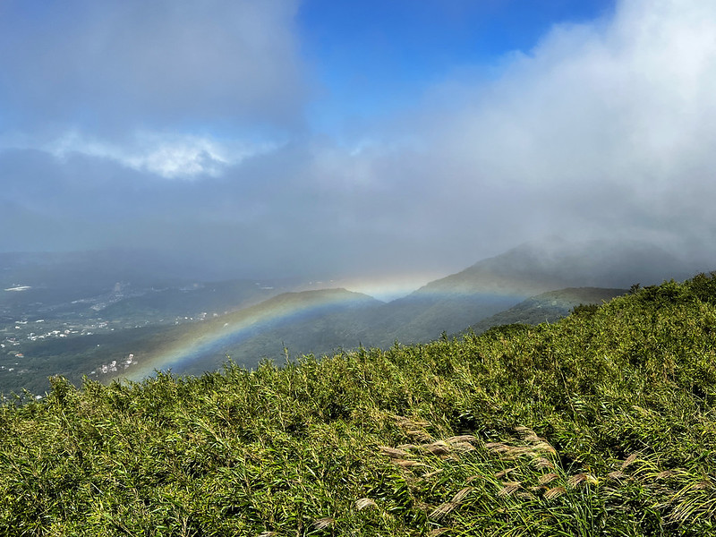
- The weather changes fast at Yangmingshan even though the weather forecast says it might be sunny. If you want to see the beautiful views at Mt. Miantian, arriving there before 10 or 11 am is better. I've done this trail several times and encountered clouds and drizzles 5 out of 10.
- The stone steps are slippery, no matter if it's sunny or rainy. Please put on a pair of shoe soles with better friction.


Trailheads, How to Extend to Other Mountains and Trails, and Map/GPX Data
As part of the Mt. Datun
Trails, you will find many junctions that extend your hike to other places at Yangmingshan. If you
prepare a whole day to explore, wandering around is OK.

However, if you only intend to do a half-day hike, please stick to your plan. Having a map or GPX track in
your phone app is advised.
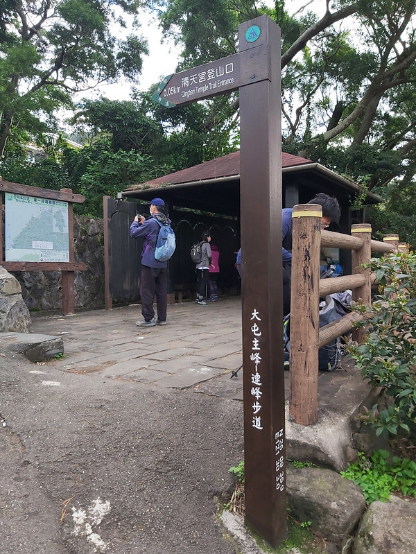
From Qingtian Temple Trailhead
Take bus S6 小6 at MRT Beitou Station, and get off at the last stop, Qingtian Temple. This route is my favorite
trailhead because I only need one bus from the MRT station.

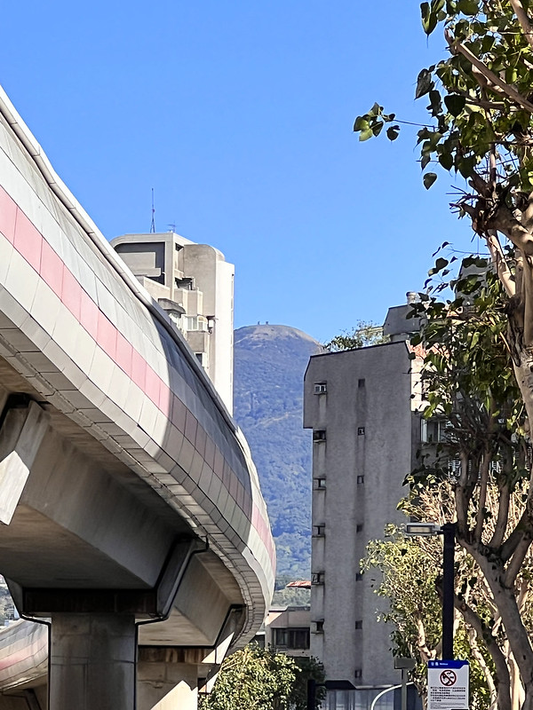
From Erziping Visitor Center
Take bus 108 at Yangmingshan Stop and get off at the Erziping stop. Here's an illustration of how to take
buses at different MRT stations to the Yangmingshan stop.
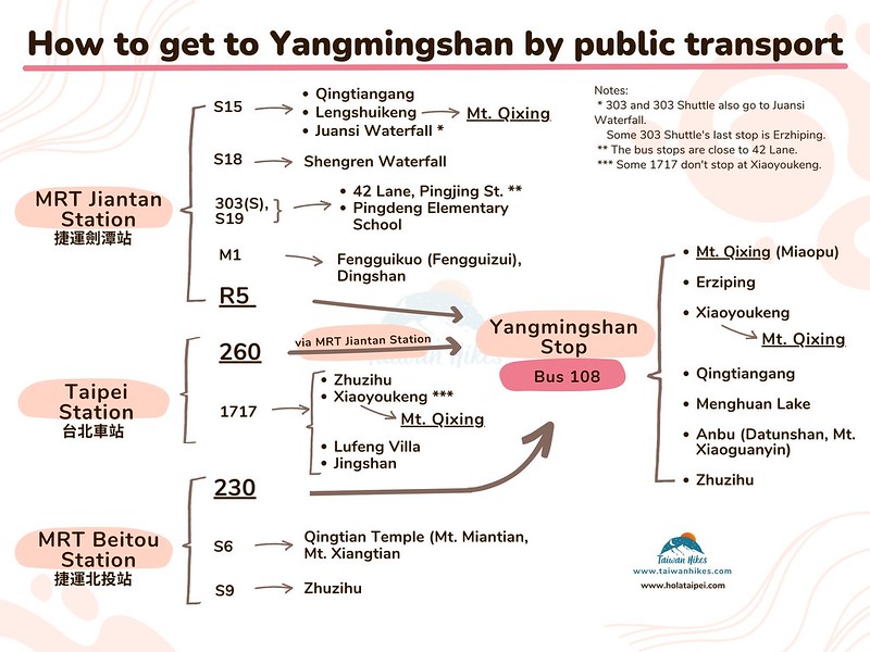
From Xingfuliao Trailhead
Take Bus F101 Pingding 坪頂 and get off at No. 15 Xingfuliao stop. Here is the map of Xingfuliao Trail 興福寮登山步道. It's steeper to hike from here, too.
Extend to Mt. Datun West Peak, South Peak and Main Peak
This is a part of Yangmingshan East to West Thru-Hike (post coming soon) and the second section of Taipei Grand Trail. You can extend this hike to Mt. Datun West Peak and South
Peak at Mingtianping 面天坪. You will find a pavilion with signs here.

Click Menu in the map to download, print, or share the map.
You can see more options after clicking the Play button.
Click to change the speed to meet your condition.
You can see more options after clicking the Play button.
Click
to change the speed to meet your condition.
Planning a permit-free hike by bus?
Skip the research. This guide covers 41 relaxing, permit-free trails in every Taiwan county — with trailhead maps and the exact public transport to reach each one. Everything you need to just show up and hike.
Get all 41 trails + maps →Itineraries and What to See
I can't remember how many times I've done this hike. My favorite route is the loop hike at Qingtian Temple
because I only need to transfer 1 bus from MRT Beitou Station. (放北投車站的google maps) Yet, this hike can be
flexible if you want to explore more.
Brief itinerary: Qingtian Temple (452 m) ➔ junction to Xiangtian Pool ➔ Crown Prince
Memorial ➔ Xiangtian Pool (840 m) ➔ Mt. Xiangtian (949 m) ➔ saddle (900 m) ➔ Mt.
Miantian (977 m) ➔ Miantianping (783 m) ➔ Qingtian Temple
Starting from Qingtian Temple
After getting off bus S6, an enormous Banyan tree sits in front of the Qingtian Temple. The toilets are next to
the bus stop, and a water dispenser is on the side of the temple if you need them.

The view is excellent underneath the Banyan Tree.

There's a pavilion, and you will find a map of the Taipei Grand Trail. Qingtian Temple is also the starting
point of the Taipei Grand Trail.

Just follow the stone steps, and soon you will enter sections flanked by beautiful bamboo woods.

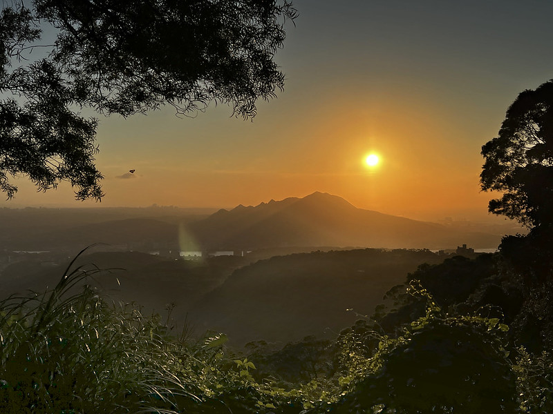
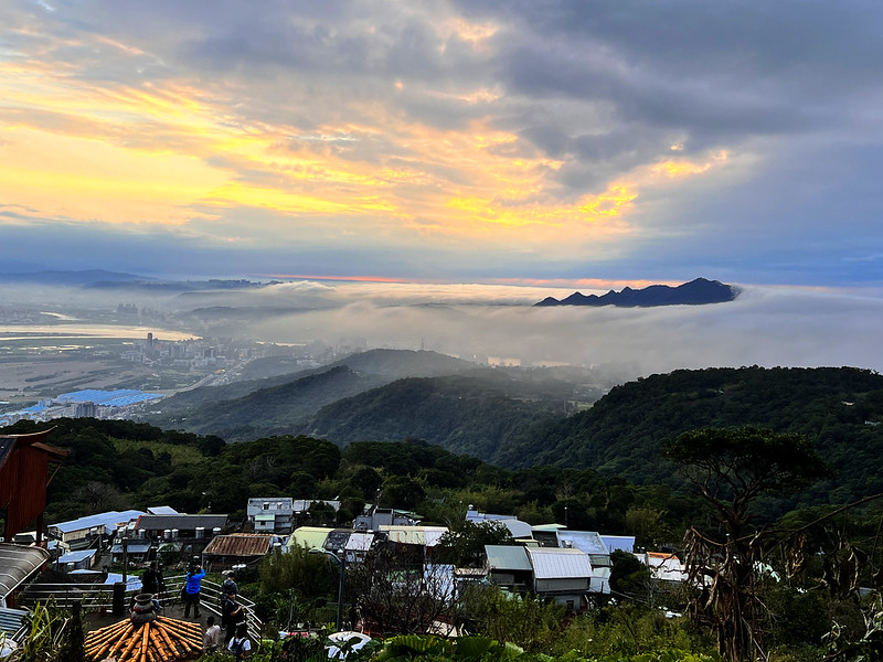
You will pass some openings with Mt. Guanyin in the distance. If you take the same way back, here is one of the
spots to see the beautiful sunset.
If you come here on the weekends, farmers who live nearby sell their produce and fruits, primarily tankan
oranges. This area is famous for tankan orange farms. They are just too heavy to carry all the way.
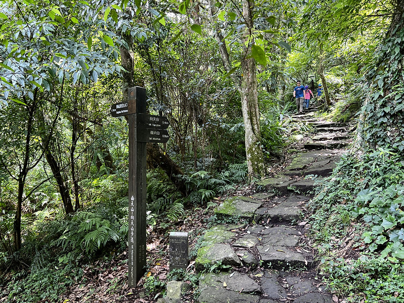
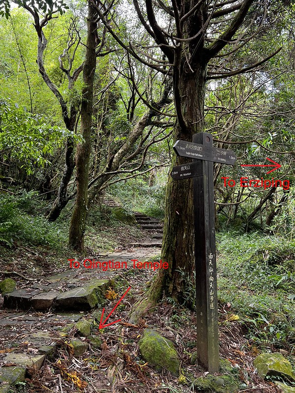
After you pass Sansheng Temple 三聖宮, the junction to Xiangtian Pool is not far away.

Taking either one is fine if you only want to do a loop hike and return to Qingtian Temple. I turned left here.

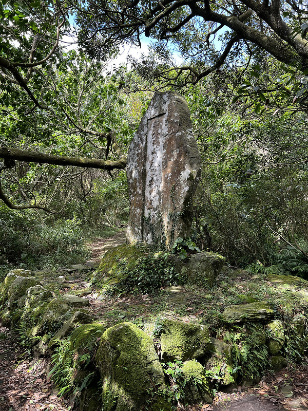
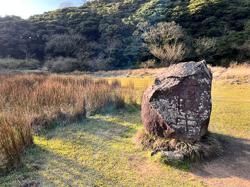
Crown Prince Memorial (Stele) 裕仁皇太子殿下行啟紀念碑 or 太子碑 and Junction
If you take the left trail to Xiangtian Pool and Mt. Miantian, you will soon reach the Japanese Crown Prince
Memorial for Prince Hirohito.

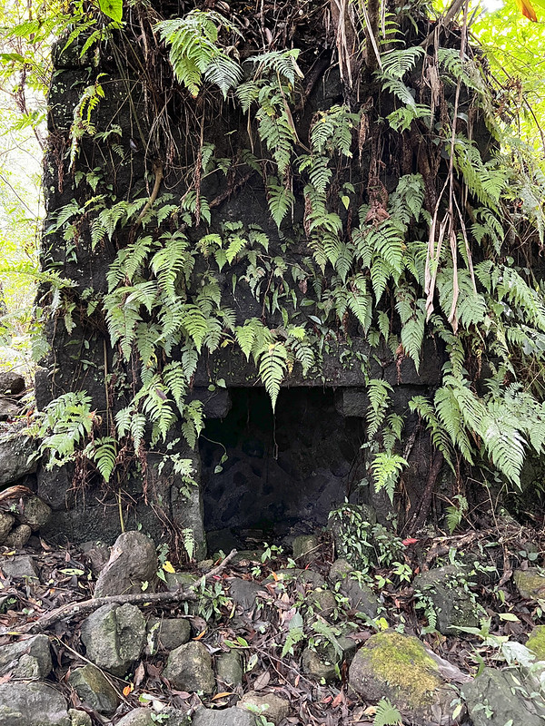
If you detour and follow the footpath (not the stone one) on the right into the woods, you will find a
foundation and chimney. This house was built in the 1920s when the Japanese government implemented forestation.
The wooden structure was long gone, and only the foundation and the chimney were left.

After the memorial, the trail from here is mostly flat till you reach Xiangtian Pool.
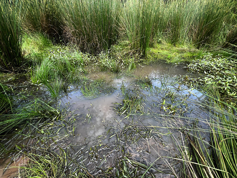
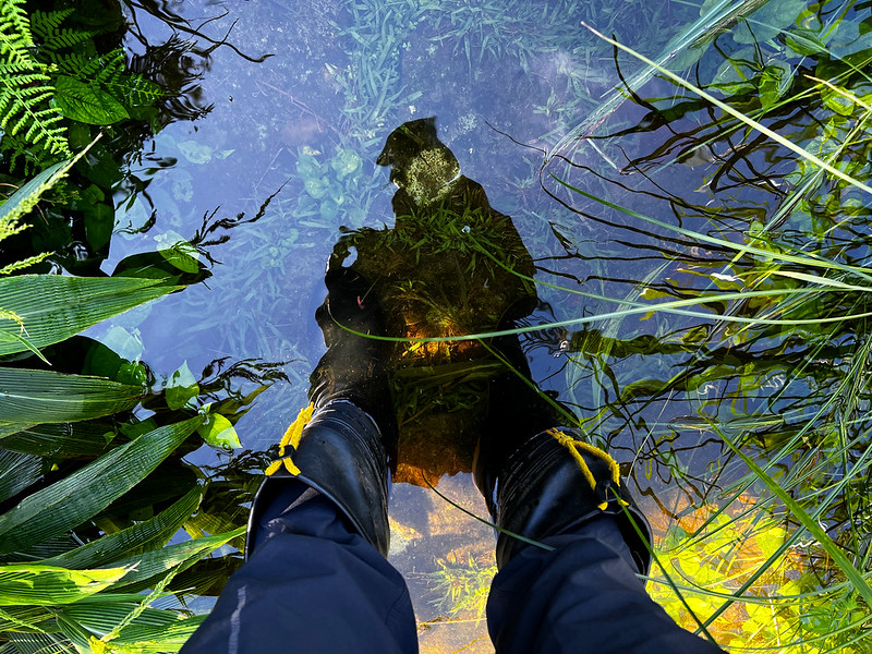
Drained and Full Xiangtian Crater Pool with Fairy Shrimps
Xiangtian Pool was formed from a crater and became a vernal or ephemeral pool. If it hasn't rained for a long
time, you only see grassland here.

Yet, the rainfall at Qingtiangang from October 15 to 17, 2022, has reached 1.835 meters or 6 feet within 3 days.
Qingtiangang is not far from Mt. Miantian and Xiangtian Pool.
I took those photos on October 21, 2022, when the weather was good after the downpour. I've never seen Xiangtian
Pool this full, which made it visible even from a distance. However, the water was too full to see any Fairy
Shrimp.

Yet, when I revisited Xiangtian Pool on January 22, 2023, the water had drained already.
Fairy Shrimps or Xiangtian Shrimps are another reason I came here. You can check out About to see what they are.
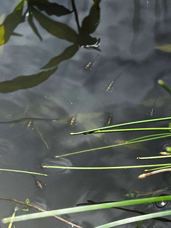
I came here several times after the rain, trying to get a glimpse of those larvae. Their body length is between
0.75 mm (0.03 inch) to 1.5mm (0.06 inch), which is difficult for my smartphone to pick them up.
If you want to see those tiny creatures, come here after typhoons and extensive rainfall when it's safe to hike
to increase your chance.
Mt. Xiangtian and Saddle
After Xiangtian Pool, the trail ascends again. The steps are steep, from 840 meters to 946 meters (about twice
the height of the Empire State Building), Mt. Xiangtian.

On the Mt. Xiangtian side, it's covered by tall grass. After I went to the saddle, the vegetation on the Mt.
Miantian side was replaced by broadleaf forests due to the leeward and windward of the northeast monsoon.
I'm not an expert in meteorology or botany, but I can tell you the wind is strong on the Mt. Xiangtian side.
Sometimes, it could be so strong that I could barely keep myself steady on the trail.
A #timelapse near Mt Miantian 面天山 from yesterday's hike.
— Anusha - Taiwan Mountains (@AnushaHiking) October 22, 2022
Silver grass is ready now.#Yangmingshan #nature #Taiwan pic.twitter.com/ie7GAR9tmF
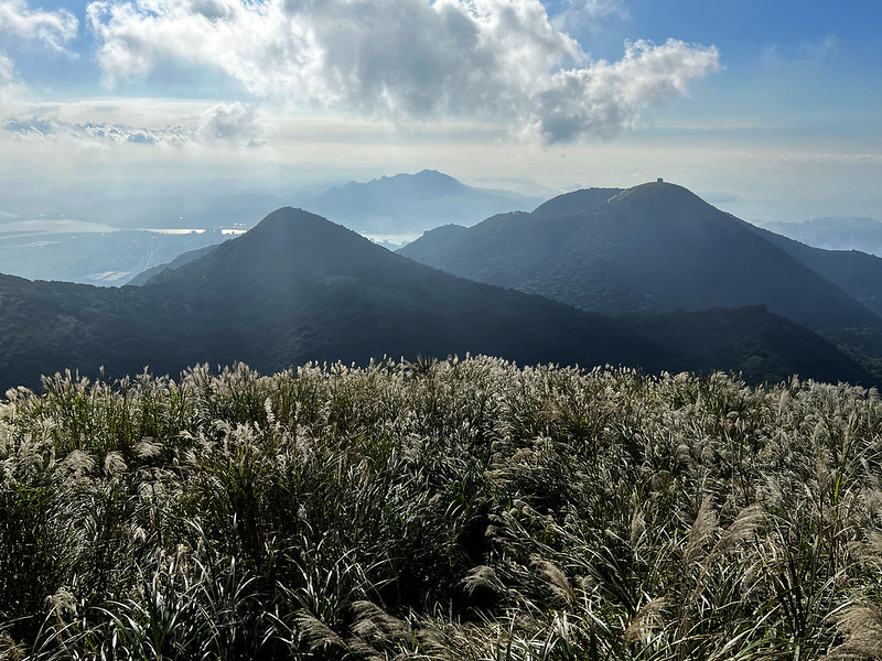
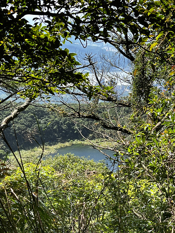
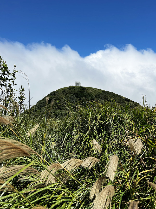
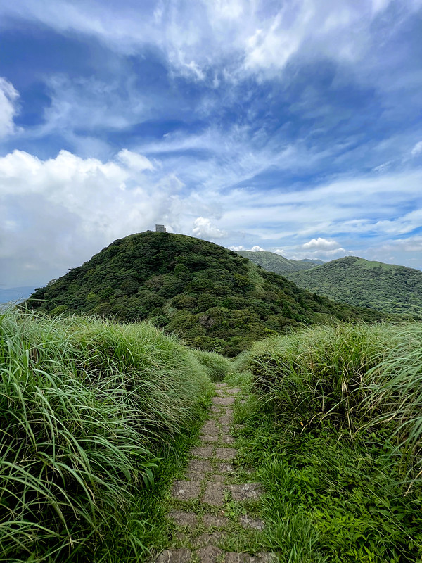
Different Vegetation and Mt. Miantian
The section from the saddle is shaded by the trees till you reach the top. The distinctive landmarks of 2 radio
reflectors appear. They are huge.

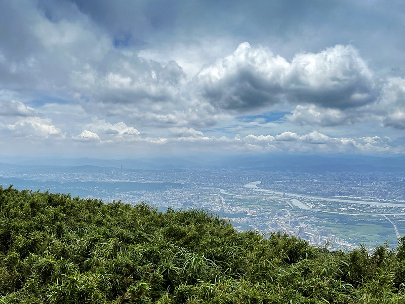
There is a deck near the reflectors and the views are great: from Sanzhi 三芝 to Taipei 101.
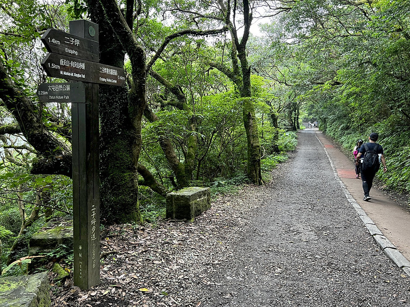
Junction to Erziping and Qingtian Temple - Option 1: If You Turn to Erziping
If you want to end this hike at Erziping Visitor Center to take the bus, this is the junction you should turn
to.
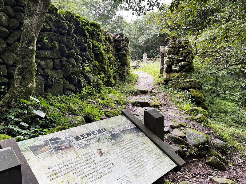
Soon, you will reach a wooden bridge with some stone house relics here. According to Yangmingshan National
Park's research, those houses were built in the late 19th century.

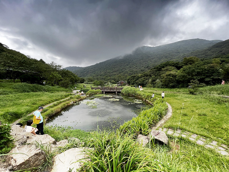
The trail is easy to hike after reaching Erziping. Erziping is an enormous valley marked with 3 ponds. You will
find different flowers during different seasons. There are toilets here.
Erziping is the end of Mt. Miantian Trail, and the section between Erziping and Erziping Visitor Center is
Erziping Trail. This section is also great for all ages.

Some sections of the Erziping Trail have two sets of footpaths. One is wheelchair friendly.
Please note that Erziping is different from where you can take the bus. The bus stop is at Erziping Visitor
Center, 1.8 km from Erziping. You can borrow a wheelchair at the visitor center if you need one.

If I do this route, I will start from Erziping and end the hike at Qingtian because the returning bus to MRT
Station is more accessible.

Option 2 - If You Return to Qingtian Temple and Possible Sunset
If you take this route, you will see another junction with a pavilion, Miantianping Pavilion 面天坪, which leads
you to Mt. Datun West Peak and South Peak. This pavilion is also the starting point of the second section of the
Taipei Grand Trail.

Then, you will return to the junction to Qingtian Temple.
You might see the beautiful sunset on the way back to Qingtian Temple.
About Fairy Shrimps, Mt. Miantian, Mt. Xiangtian, and Xiangtian Crater Pool
What are Fairy Shrimps? Are they really shrimps?
Those are not shrimps, and their scientific name is Branchinella kugenumaensis 鵠沼枝額蟲. The body length of
those creatures is between 0.75mm to 1.5mm.

They are also called Fairy Shrimps 仙女蝦 or Xiangtian Shrimps 向天蝦. They were named Xiangtian Shrimps because they
were only discovered here in Taiwan. It is said they can be found on Kinmen Islands and Orchid Island.
According to the Yangmingshan National Park's research, when the water here is full, the eggs of the Fairy
Shrimps hatch within 24 hours. When the eggs hatch, those larvae must lay their eggs before the water drains to
ensure they can hibernate in the dirt, waiting for the next rainfall to prosper.
About Mt. Miantian, Mt. Xiangtian, and Xiangtian Pool
Both mountains are the parasitic cones of Mt. Datun and were formed about 400,000 years ago. They are typical
volcanic domes.
Xiangtian Pool is one of the iconic craters at the Yangmingshan National Park. The biggest crater at the
Yangmingshan National Park is Mt. Huangzui (Huangzuishan).

Xiangtian Pool is a vernal pool or ephemeral pool. We can see the water when it is filled up with heavy rain.

About Crown Prince Memorial (Stele)
During the Japanese Occupation, Crown Prince Hirohito, later Emperor Shōwa, visited Taiwan in 1923. People in
Beitou donated money to build this stele to commemorate his visit. However, this stele was sabotaged and
engulfed by nature after World War II. Later, Yangmingshan National Park cleaned up this place and let this page
of history emerge.