Sanxia Loop Hike: Mt. Jinminzi, Mt. Shilang, Mt. Saikuokeng and Mt. Neijinmin. Plus, Couhe Rock Formations
Mt. Jinminzi trail is in Sanxia, Taiwan, and very close to the famous Manyueyuan National Forest 滿月圓國家森林遊樂區 and Wuliaojian 五寮尖. This is a trail with rock
walls, amazing views on the peaks, and stunning bamboo woods. If you come in the right seasons, you can also
get a glimpse of exotic wildflowers only in Taiwan mountains. For those who enjoy waters, the unique rock
formations, Couhe Shi Ba Dong Tian (Couhe Rock Formations) 湊合十八洞天, on Dabao River are very close to here, too.
Table of Contents:
Trail Information of Mt. Jinminzi, Mt. Shilang, Mt. Saikuokeng and Mt. Neijinmin
Trail Name: Mt. Jinminzi, Mt. Shilang, Mt. Saikuokeng and Mt. Neijinmin
Distance: 8.4 km (5.2 miles) from the parking lot; I did 11.6 km (7.2 miles) from the bus stop and Couhe Rock Formations.
Route type: Loop
Days/Hours Needed: Day hike near Taipei, 6 - 7 hours
Total Ascent/Descent: 789 m / 800 m
Best Time to Go: All year round, but it can be very hot in summer
Permits: Not required
Difficulty Level:
Peaks to Reach:
Mt. Jinmizi 金敏子山 aka Mt. Baishihu 白石鵠山, height 630 meters (2,067 feet) Mt. Shilang 詩朗山 aka Mt. Xilun 西崙山, height 667 meters (2,188 feet) Mt. Saikuokeng 塞口坑山, height 755 meters (2,477 feet) Mt. Neijinmin 內金敏山 aka Mt. Dabao 大豹山, height 594 meters (1,949 feet) Others: Most of the trail is shaded. You'll need a pair of gloves to grab the ropes. The trail terrain was dry when I was there, but it can be muddy when it rains.
Personal Enjoyment
Things I Enjoy
- The views on Mt. Jinminzi and Mt. Saikuokeng are great. You can see one of the three famous rock mountains in Taipei, Wulaojian from both peaks.
- Other than those two peaks, the two lookouts are worth making a detour. If the weather is good, you can see Mt. Wushifen and even Mt. Qixing, the highest mountain in Taipei City.
- There are several amazing rock walls on the trail. Those walls are huge.
- If you come to the right seasons, you might see beautiful wildflowers from the trail. For example, native Striate Acanthephippium 一葉罈花蘭 and Indian Pipe 水晶蘭 in spring, native Fairy Lily 艷紅鹿子百合 (or Lilium speciosum Thunb. var. gloriosoides Baker) and White Crane Orchid 白鶴蘭 in summer. I saw Japanese Ophiorrhiza 蛇根草 when I did the hike in January.
- I took some time to visit Couhe Shi Ba Dong Tian (Couhe Rock Formations) on Dabao River (meaning Big Leppard) along County Way 114 (北114). The unique rock formations cut by the stream, Couhe Shi Ba Dong Tian (Couhe Rock Formations), are impressive. It would be great to enjoy the water in summer. But due to way too many drownings on Dabao River, the entrance to the creek is closed by the local government. According to a news report in 2003, Dabao River once claimed 13 lives in one day.
Thing I Don't Enjoy
- If you don't drive, the transportation can be a problem. Getting to the bus stop near the trail is easy by taking Bus 807. Returning is a different matter. I missed the bus leaving Manyueyuan Parking Lot at 15:15. I had to wait for the next one (also the last one) at 18:10.
- You can skip Mt. Neijinmin because there isn't much to see. Besides, the trail is blocked by the landlord. Luckily, it is a short round trip from the road barricade to the peak.
- Some hikers report that there are many biting midges (Forcipomyia taiwana) in summer. Please prepare repellent if you do this hike in summer.
Map/GPX Data
Date of Hike: Solo hike on January 24, 2021
Route map for Mt. Jinminzi In Sanxia by Anusha Lee on plotaroute.com
Click Menu in the map to download, print or share the map.
You can see more options after clicking Play button.
Click to change the speed to meet your condition.
You can see more options after clicking Play button.
Click
to change the speed to meet your condition.
How to Get There
By Car
If you drive, here is the GPS coordinates.
By Public Transport
If you don't drive, you will have to transfer several buses to the trailhead. There are also other buses to
take, but I personally think those near MRT stations are easier.
From different MRT stations to Sanxia Old Street Stop:
From MRT Yongning Station Exit 4 永寧捷運站 to Sanxia 1 Bus Terminal: Take Bus 916.
From MRT Banqiao Station 板橋捷運站 to Sanxia 1 Bus Terminal: You need to go to the stop next to Banqiao Wanping Park 萬坪公園 and take Bus 910.
From MRT Yongning Station Exit 4 永寧捷運站 to Sanxia 1 Bus Terminal: Take Bus 916.
From MRT Banqiao Station 板橋捷運站 to Sanxia 1 Bus Terminal: You need to go to the stop next to Banqiao Wanping Park 萬坪公園 and take Bus 910.
From Sanxia 1 Bus Terminal to the trailhead near Jinmin Stop 金敏站: Take Bus 807 at Sanxia 1 Bus Terminal. Please check here for the timetable.

History about Jinmin: A Wiped-out Village and A Coal Mine
During the Japanese Occupation, there were 8 coal mines in Sanxia. One of them was in Jinmin Village near this
trail called Jinmin Coal Mine 金敏煤礦. This mine started producing coal
in 1946 and ceased its production in 1985. The total production of coal reached 105.9 million metric tons.
We still can see the old buildings and houses left from the coal mining's heyday. Chajiao Elementary School at
Jinmin was founded in 1941 to accommodate those miners' children.
I saw this old bridge before reaching the trailhead. Some hikers say this bridge is from the coal mine, but I'm
not sure. It looks nostalgic and adds something extra for this hike.

From Qing Dynasty to Japanese Occupation, many Atayal people lived along the Dabao River, and the old name for
this area was called Ncaq. Ncaq means ghost silver grass. Later, the Japanese government let Han people enter
Atayal's land to produce camphor in 1900. In June 1900, camphor workers raped Atayal women, which led Atayal
people's fight against the Japanese government.
To reign the Atayal people, the Japanese government started ruthless plans to control the indigenous people.
Without a doubt, several clashes broke out, and one of them was Ncaq Incident or Dabao Incident, which caused casualties
among the Atayal, Han and Japanese. After this incident, Ncaq Village was almost wiped out or forced to
relocate.
In November 2011, Wanshan Shrine 萬善堂 was built to collect those deceased
indigenous and Han people. There are many Wanshan Shrines in Taiwan, and those were built to commemorate the
deceased who was Joe/Jane Doe or didn't have families or offspring to worship them. Usually, those temples or
shrines are spookier than those that worship gods.
In the mid-1930s, the Japanese government built a monument Dabao Loyal Spirits Monument 大豹忠魂碑 near Wanshan Shrine to commemorate those
Japanese soldiers who died during the clashes.
You can see a famous Taiwanese hiker Tony Huang's video to see Dabao Loyal Spirits Monument.
Professor/Director Kao Jun-Honn 高俊宏 spent 4 years investigating and interviewing those descendants of
those Atayal people and made a documentary, llyong Topa 拉流斗霸 to preserve this sad
history.
My Itinerary
Brief itinerary: Trailhead ➔ Lookout #1 ➔ Lookout #2 ➔ Mt. Jinminzi ➔ Mt.
Shilang ➔ Mt. Saikuokeng ➔ Mt. Neijinmin ➔ trailhead
GPS coordinates of parking lot: 24.867000, 121.383895
GPS coordinates of trailhead: 24.865537, 121.382991
GPS coordinates of parking lot: 24.867000, 121.383895
GPS coordinates of trailhead: 24.865537, 121.382991
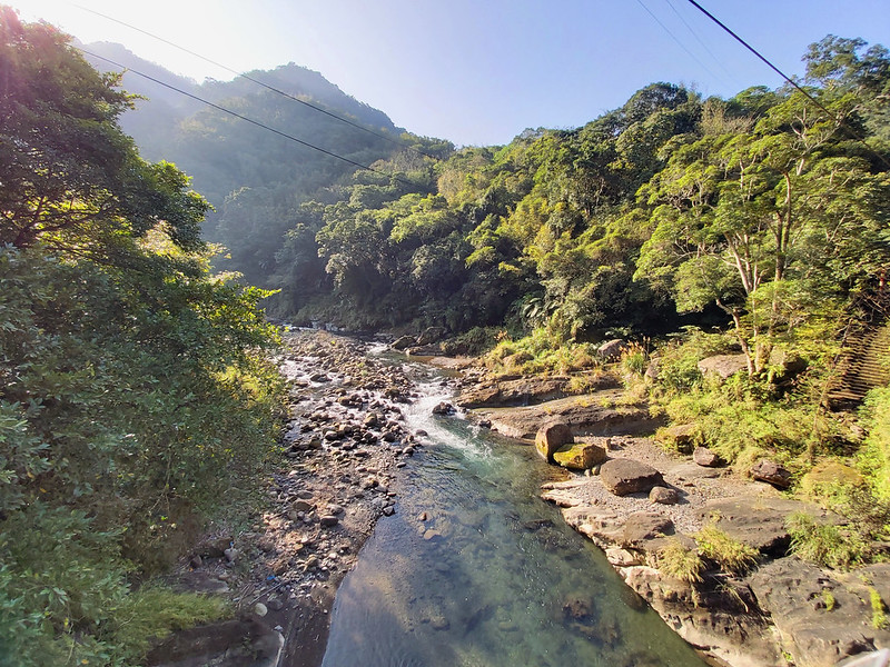
08:59 Arrived at Jinmin Bus Stop next to Dabao River. When I got off the bus, I
took some photos of the river on Jinmin Bridge before heading to the trailhead. The morning sun made the river
look so incredible.
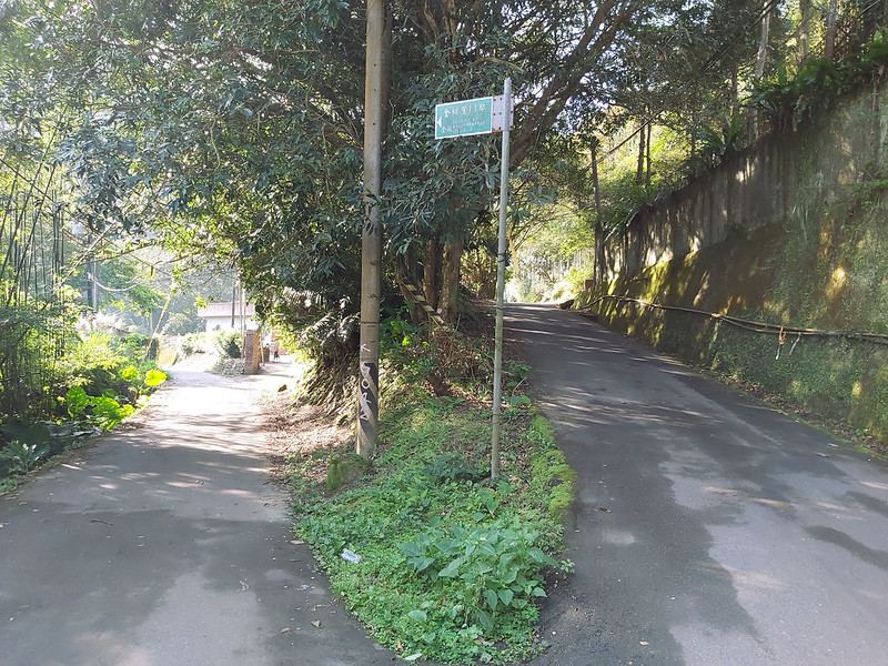
09:03 Crossed Jinmin Bridge 金敏橋.

09:12 Passed the junction of 金圳里11鄰. I took the right and went up.
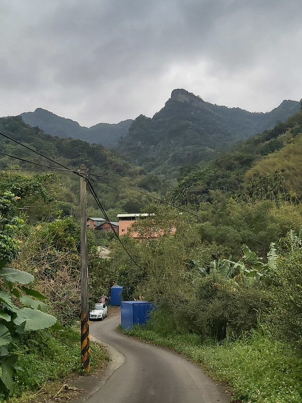
09:16 Saw the ridgeline I was going to hike from the bridge.
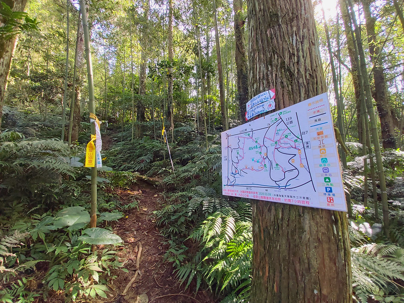
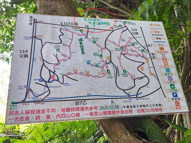
09:21 Reached the map made by Blue Sky Team 藍天隊. There is a parking lot. You can
also find toilets provided by a kind local resident.

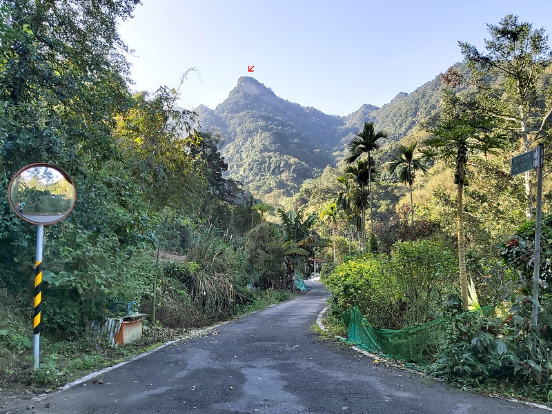
09:24 I saw the distinct shape of Mt. Jinminzi near the parking lot. You can see
the barren surface underneath the peak, and those are the magnificent rock walls.
09:35 Crossed a small bridge. Someone put a sign pointing to the trailhead.
Before reaching this bridge, I made several wrong turns in this small village, which made me turn back to the
map near the parking lot. If you do this hike, you can follow the ribbons tied on the trees by other hiking
groups.
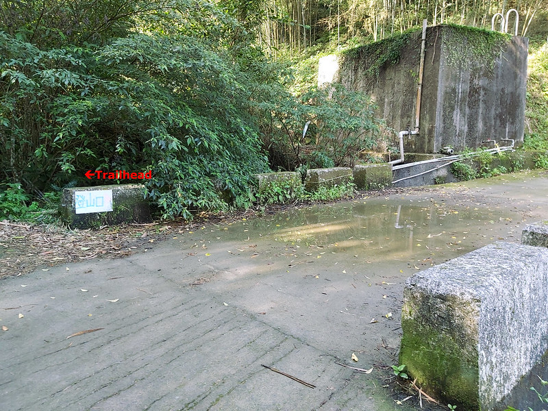
09:38 After walking on the winding road, I reached the real trailhead.

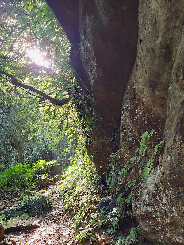
09:57 Went up the stairs and saw the rock wall #1.
10:13 Saw Japanese Ophiorrhiza 蛇根草.

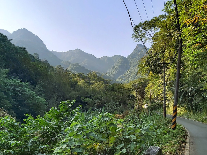
10:18 While climbing up the steep slope, I turned to see the beautiful mountains
in the distance.

10:21 Reached a slope with ropes. This slope will be very slippery if it rains.

10:25 Reached the rock wall #2. Rock wall #2 is much bigger than #1 and
continues all the way up.

10:35 I saw incense bowls on a stone altar but those were gone when I went there
again on April 30, 2022.

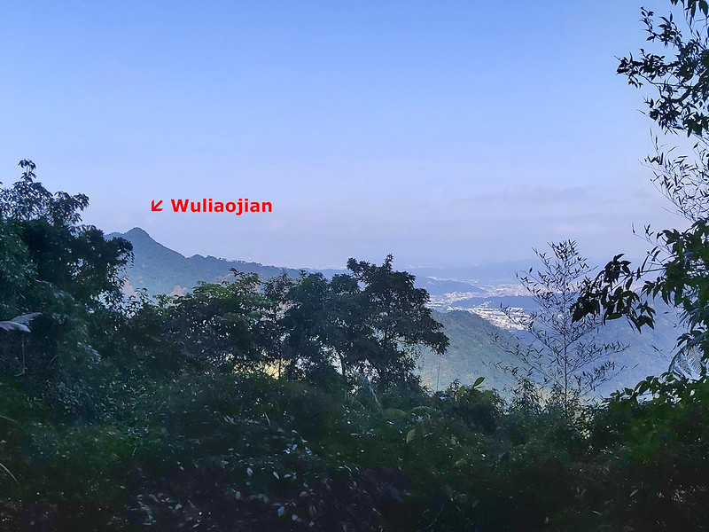
10:40 Saw Wuliaojian 五寮尖 and Mt. Yuan 鳶山 from the trail.
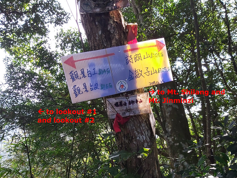
10:43 Passed the junction with the sign pointing to the directions to lookout
#1, lookout #2, Mt. Shilang and M. Jinminzhi. The sign said it takes 4 minutes to reach the lookout #1 and 6
minutes to the lookout #2.
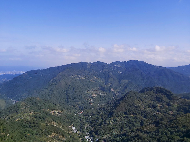
10:47 Reached lookout #1. Views were amazing. I spent some time to take photos.
Please don't go over the rope hanging up there. This is a cliff ahead.

10:50 Reached lookout #2. The trail to lookout #1 and #2 is a parallel trail to
Mt. Jinminzi. So, I had to return to the junction to my next peak. After I was done with photo taking, I took
the same way back.
11:09 Back to the junction with the sign. Went into the bamboo woods to the next
peak.
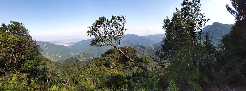
11:14 Reached Mt. Jinminzi and took a short break. Mt. Jinminzi isn't far from
the junction. The views were great. This is also a good location to have a lunch break.

11:24 Saw Wuliaojian, Mt. Yuan, Mt. Dadong 大棟山, and Mt. Guanyin 觀音山 from Mt.
Jinminzi.
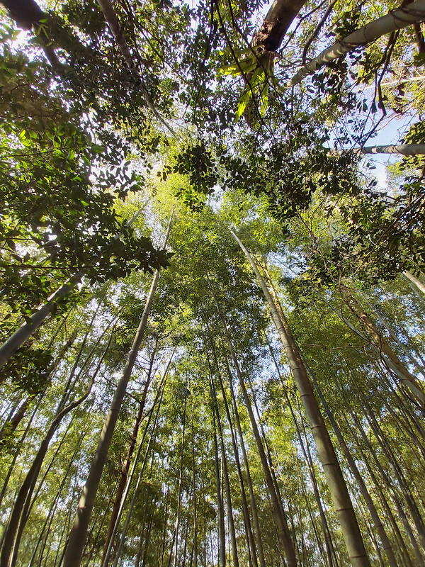
11:36 Back to the junction again. Headed into another bamboo woods. I met three
hikers here, and they told me they came here for the bamboo woods. After we parted ways, I saw they enjoy their
lunch. The bamboo woods is indeed a great place to relax.
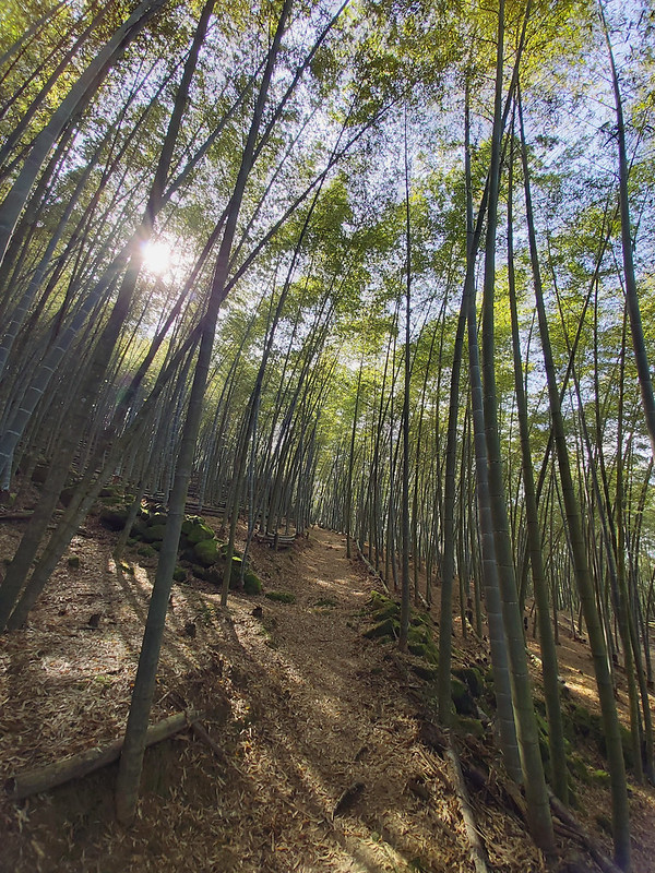
11:48 Reached Mt. Shilang located in the bamboo woods. No views. I was a little
bit hungry, but I was looking for a more pleasant place to have lunch.

12:05 Found a spacious area inside among the trees and had a 40-minute lunch
break. There was a small opening to let me enjoy some view with my lunch and coffee.

13:06 Reached the junction with a map pointing to Mt. Saikuokeng and Mt.
Neijinmin.
13:20 Reached Mt. Saikuokeng. I could see Wuliaojian, Sanxia, Mt. Wushifen 五十分山,
Mt. Yuan, and almost Mt. Qixing 七星山. Looking at Wuliaojian made me want to do this hike someday.

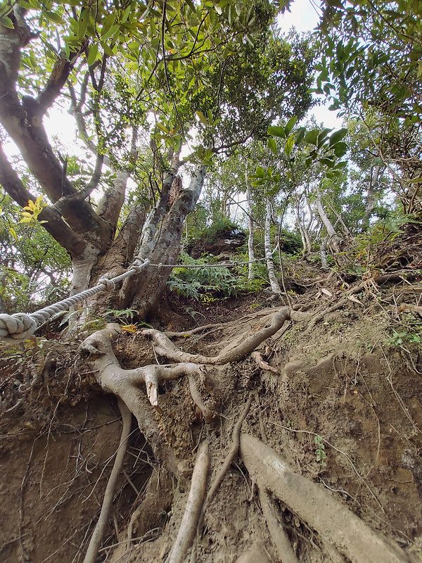
13:39 After Mt. Saikuokeng, I reached a steep slope intertwined with tree roots.
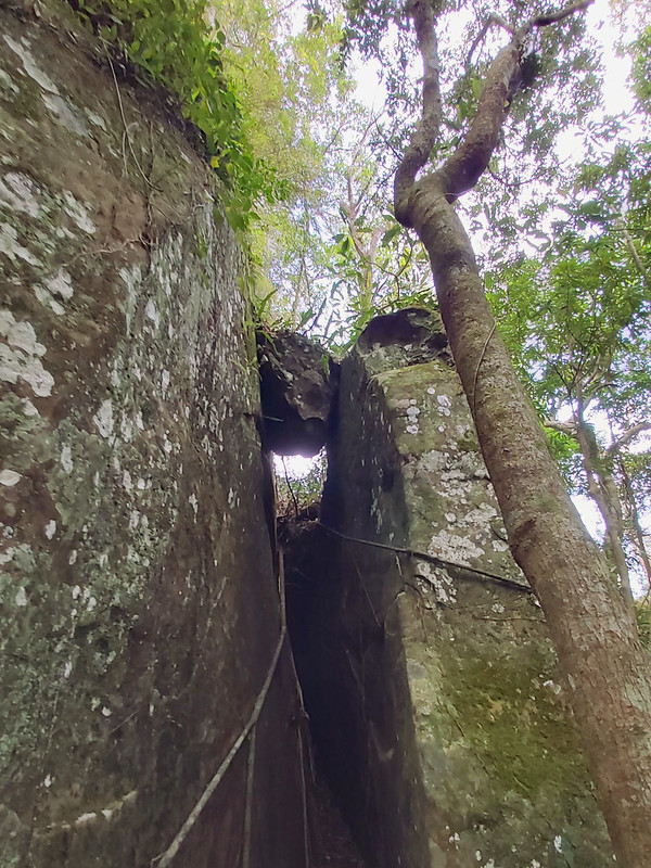
13:49 Descended a narrow passage between rocks.

13:55 Passed the boulder between two cliffs that reminds me of Kjerag in Norway.

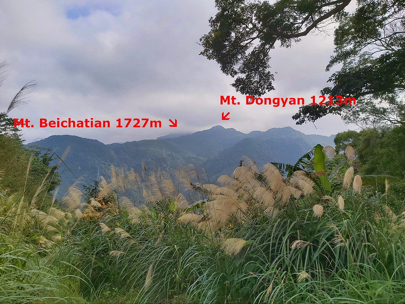
14:41 Reached the junction to Mt. Neijinmin that was barricaded by the landlord.
From the junction, I could also see Mt. Dongyan 東眼山, Mt. Beichatian 北插天山, Mt. Zhulu 逐鹿, and Mt. Kabao 卡保山.
There was also a warning saying “Do Not Enter. Private Property.” But it also says it's for reference only. The
sign did make me think twice before entering.
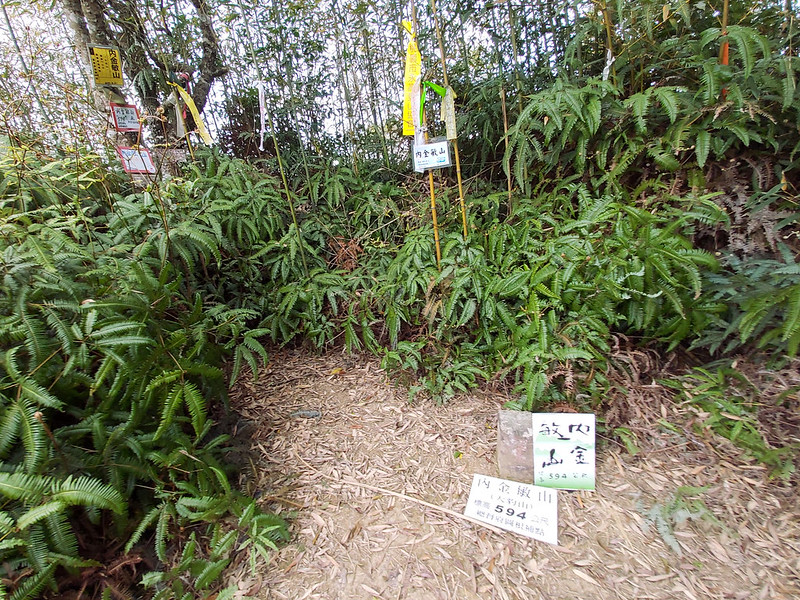
14:47 Reached Mt. Neijinmin, aka Mt. Dabao 大豹山. No views. You can skip this one.
Luckily, it didn't take long from the barricade to this peak. After this peak, I wasn't feeling well. So, I
didn't take many photos. I missed a junction somewhere and ended up leaving the dirt trail.
15:59 I got back to the parking lot after making a wrong turn again. without
other options, I followed the road trying to get to the bus stop. Missing the shorter route led to my getting
back to the bus stop late.
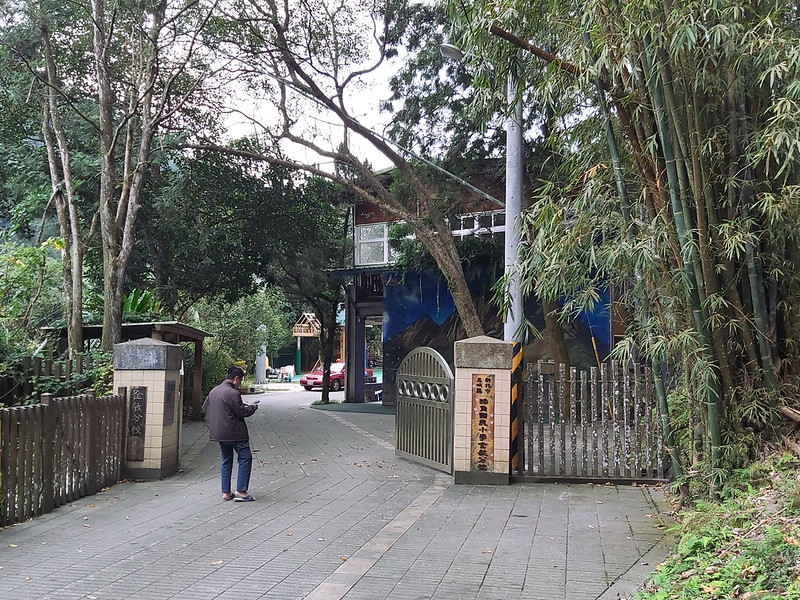
16:12 Passed a super cute elementary school, Chajiao Elementary School at Jinmin
插角國小金敏分校. Most elementary schools in remote areas of Taiwan are very small, but they have more characters than
their counterparts in big cities. Seeing this school made me feel better.
16:17 I finally reached Dabao River. I missed the bus leaving Manyueyuan at
15:15. If I didn't take the wrong turns, I might have had caught that bus.
16:28 With extra time on my hands, I decided to take a long walk and explore
Couhe Shi Ba Dong Tian (Couhe Rock Formations). I didn't go down to the river. I just took photos as many as I
could before it got too dark. Then, it was a long wait for Bus 807 to come.
