Wuliaojian: A Heart-Pounding Hike with Stunning Views and How to Get There by Bus
Posted by: Anusha Lee
Published date: May 29, 2022
Last update: January 29, 2025
Wuliaojian (Wuliao Peak or Wu Liao Jian) is one of Taiwan's most thrilling hikes for those not afraid of
heights. With rock climbing, knife-edge ridges, and a steep 30-m descent, it's an adrenaline-packed adventure
with stunning mountain views.
Disclaimer:
All content is for inspiration only. Use Taiwan Hikes' suggestions at your own risk. We are not responsible
for any losses, injuries, or damages.
Trail Name: Wuliaojian Mountain 五寮尖 Distance: 5 km (3.1 miles) Route type: Loop. You can do the bigger loop hikes, but I think most people
come here for the exciting knife ridge hike. Days/Hours Needed: 4-6 hours. I heard some seasoned hikers can do this loop
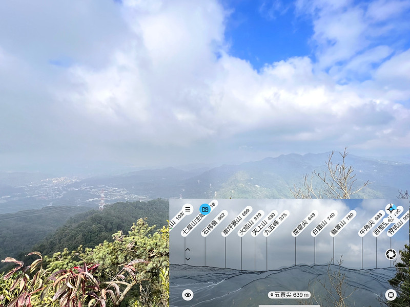
hike in 2 hours. Total Ascent/Descent: 789m/798m Best Time to Go: All year-round, but it can be very hot in summer Permits: Not required Difficulty Level: Peaks to Reach:
Mt. Wuliaojian 五寮尖, 639 meters (1,768 feet) above sea level if you
decide to go that far.
Gear to Bring:
Prepare a pair of gloves to prevent rope burns when you grab the
ropes to do the 30-meter descending.
Wear a helmet if possible. I wore a helmet, but I was also the
only one on that day.
It can be scorching hot on the knife ridges. Please do sun
protection when you go. I felt the heat on the ridges when doing it in winter.
Warnings before you go:
This trail isn't for people who are NOT OKEY with height.
This hike is a total body workout. Please make sure you are fit
enough to do it.
Please don't do this hike when it rains.
Please ensure the ropes are sturdy enough before grabbing them at
Qiao Bi Xiong Feng. The ropes broke, and a hiker fell off the cliff before. Some people lost their footing
and fell to their death.
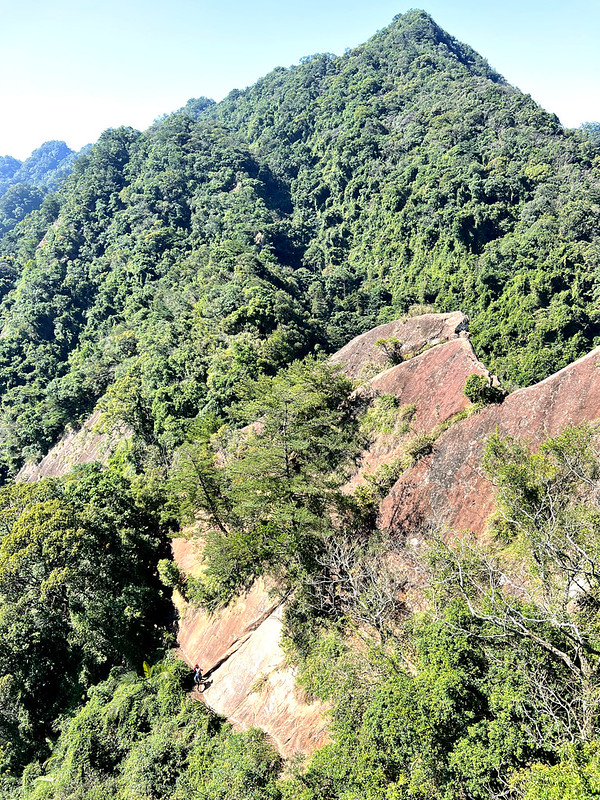
Qiao Bi Xiong Feng and Duli Rock
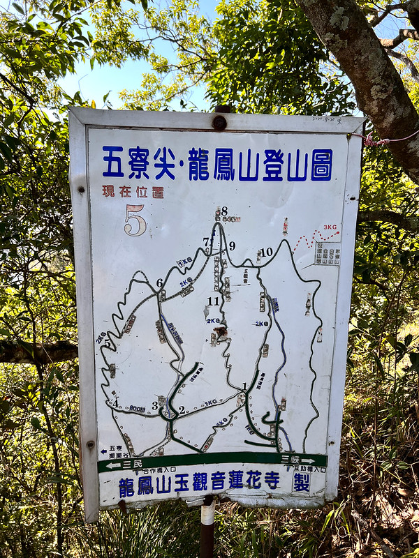
Map/GPX Data
This hike has big and small loops. You choose the one that best suits your preferences and the bus schedule.
Click Menu in the map to download, print, or share the map.
You can see more options after clicking the Play button. Click to change the speed to meet your condition.
How to the Wuliaojian Trailhead by Bus
Your location ⇒ Sanxia Elementary School (Sanying Public Sports Center) 三峽國小 (三鶯國民運動中心) or Sanxia
One Stop 三峽一站 ⇒ Hezuo Bridge Stop 合作橋站 / Wuliaojian Trailhead
Brief itinerary: Trailhead near Hezuo Bridge ➔ Map No. 4 ➔ Wind eroded notches ➔
knife ridges ➔ Map No. 5 ➔ Qiao Bi Xiong Feng (the 30-meter descending) ➔ Duli Rock
➔ Map No. 6 ➔ Map No. 7 and Bishop wood ➔ Mt. Wuliaojian ➔ Map. No. 8 ➔ Map
No. 9 ➔ back to Map No. 7 ➔ Shop ➔ Map No. 2 ➔ Yongda Coal Mines ➔ trailhead
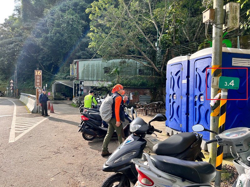
near Hezuo Bridge GPS coordinates of trailhead near Hezuo Bridge: 24.884272,121.376952, 3.4 marker at Dapu
Road.
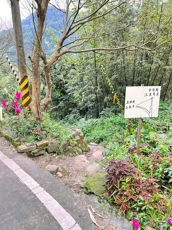
08:44 Arrived at the trailhead next to Hezuo Bridge/Yuli Shop 玉里商店.
08:50 Took the steps and started hiking.
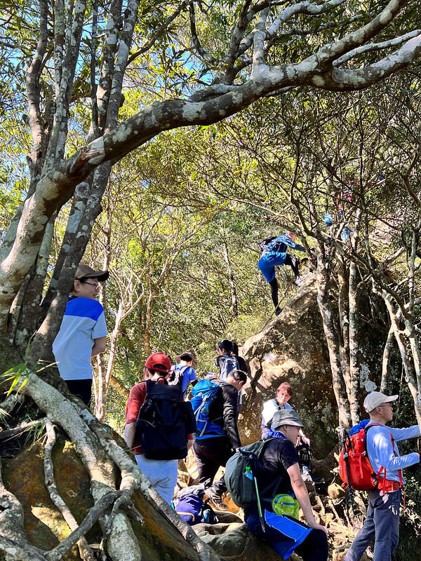
A lot of climbing after the steps.
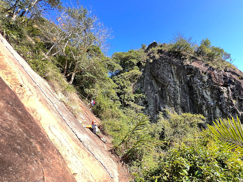
Small Rock Climbing to Warm Up
09:33 Reached a ridge with ropes. While climbing the ridge, I saw words painted
on the rock: Watch out for your head 小心頭.
10:11 Reached a junction with a map. According to the handwritten texts on the
map, this is No. 4.
You can find the first-aid kit underneath the map.
We saw some great views through the trees.
More climbing.
We took a break waiting for the crowds to finish.
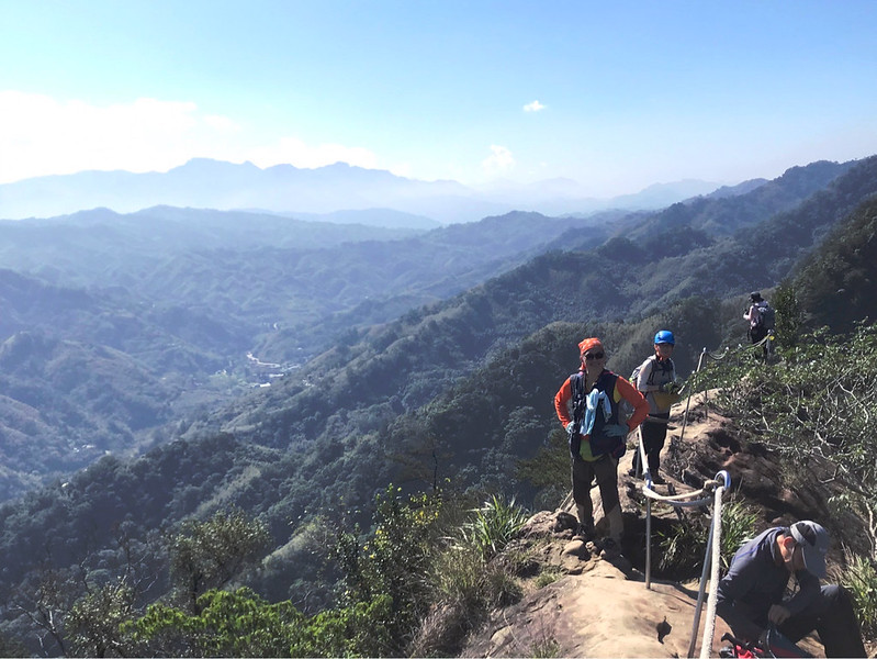
10:55 Then we reached the first ridge.
My friend, Mr. Chang
Great weather and spectacular mountains
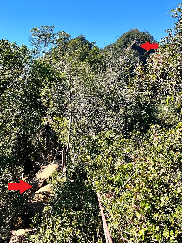
I could see more knife ridges from the trail.
The knife ridge in the distance pointed by the red arrow made my knees weak.
There were several notches under the rocks. According to our map, those notches were 風蝕洞, literally meaning
wind-eroded notches. I can't find the official English names for those.
I did some research, and those notches were oceanic crusts pushed upwards during orogeny over the millions of
years. So they should be called Sea caves or littoral caves. But please correct me if I'm wrong. I'm not a
geology expert.
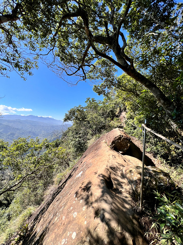
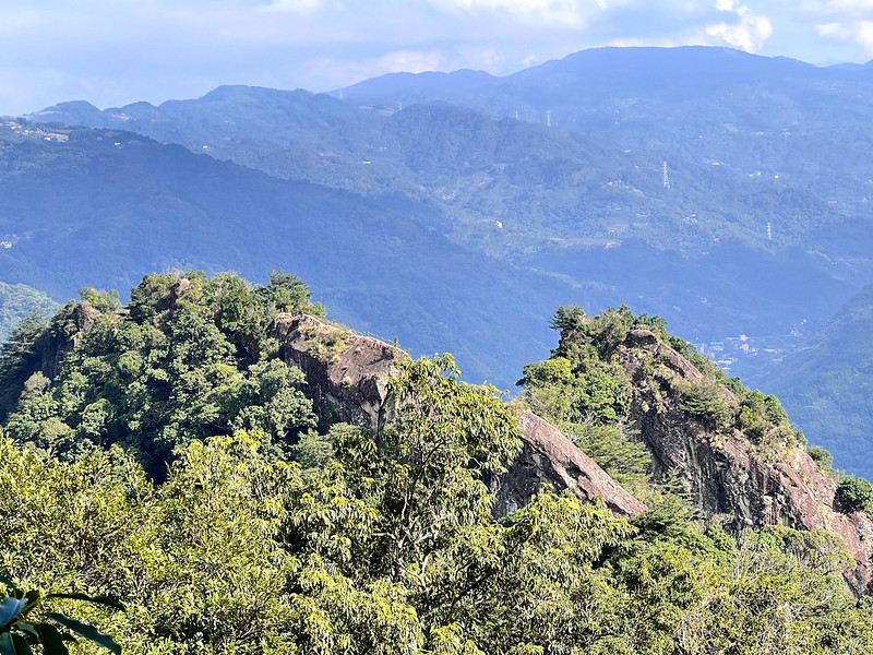
The First Taste of Knife Ridges
11:15 Then here came the knife ridges.
We were fortunate to have gorgeous weather, and the views were taking my breath away.
I could see the distinctive peaks of Mt. Jinminzi and Mt. Saikuokeng nearby, and the layers of mountains in Sanxia and
the other side.
My friend asked me to turn around so he could take photos of me. I was scared but managed to pull myself
together.
Photo by Day-Ruey Liu 劉代瑞
Lucky for us, we didn't come here on the weekend, but there were many people on the ridge already. I can't
imagine how packed it will be on the weekends.
11:21 Reached No. 5 spot.
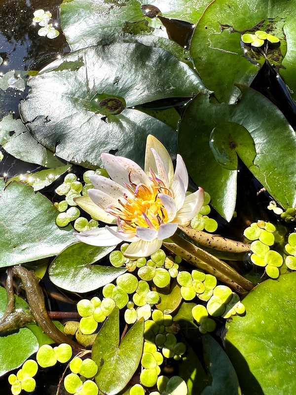
Beautiful Water Lily Pond on the Ridge
11:27 Passed the cute small water lily pond on the rock ridge. I saw several
small ponds on the knife ridges and was amazed by how they ended up here.
More ridges before Qiao Bi Xiong Feng
11:35 Saw a handwritten map about what to expect, Qiao Bi Xiong Feng 峭壁雄峰,
meaning steep slopes/cliffs. Duli Feng or Duli Rock 獨立峰 means a single protruding peak or rock.
According to the handwritten map, there were three ropes to descend. To be honest, it was difficult for me to
comprehend what we would face at that moment.
We also took a lunch break near the map.
You can take a detour to avoid the ridges for those who don't like climbing knife ridges or heights.
Last Chance to Avoid the Cliff
For those who are here to take on the ridges, you continue. I thought we had passed the worse section and had no
idea what awaited us. I did homework before I came, but those things didn't click until I faced them myself.
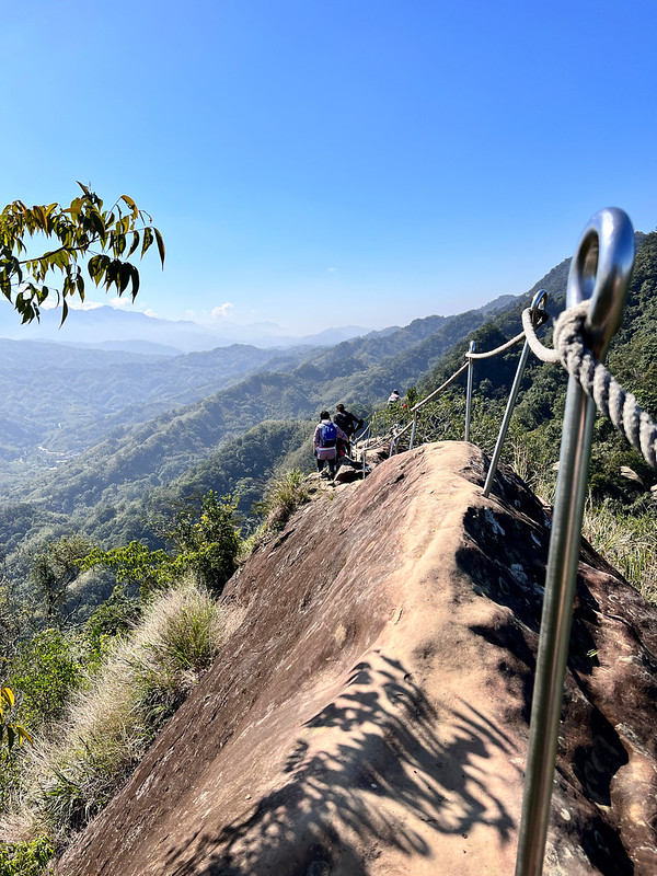
12:19 Back on the knife ridge again. We had to climb up several rocky slopes to
reach the ridge. But no worries. You'll see many ropes to grab so you can balance yourself while scaling up.
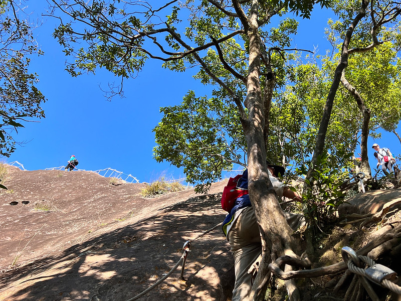
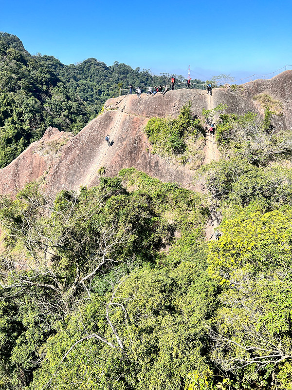
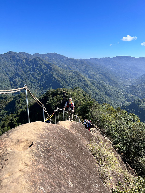
Qiao Bi Xiong Feng and the 30-meter Descent
I saw Duli Feng (Duli Rock) and several people at the top.
Soon, I reached the devil, Qiao Bi Xiong Feng, the famous/infamous knife ridge. This time, it wasn't to walk on
the narrow ridge, but to descend, a 30-meter descent, about the height of a 10-story building.
I thought the previous narrow ridge crossing was scary enough. This one is even ten times scarier.
Photo by Day-Ruey Liu 劉代瑞
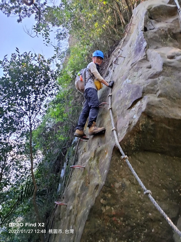
12:23 My turn to do the 30-meter vertical descending. This photo was what I saw
when I was trying to lower myself on the cliff.
My turn...
Needless to say, I started to question my sanity and why I said I would join my friends' hike in the first
place. I'm not okay with height...
Looking at the cliff from Duli Rock
Lucky for us, we did this hike on the weekday, and each of us didn't queue on the knife ridge long. Wuliaojian Warriors or volunteers only showed up to help
people on the weekends.
12:30 It felt like forever for my foot to touch the solid ground in one piece. I
didn't embarrass myself, either. Then, I looked up to see what it was like from a different perspective.
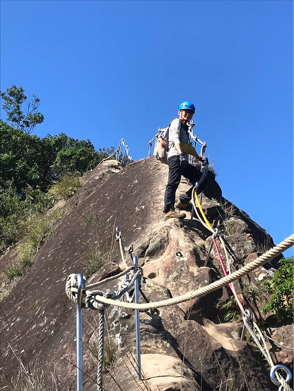
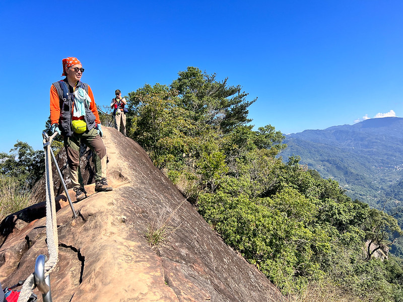
Duli Rock with More Fantastic Views
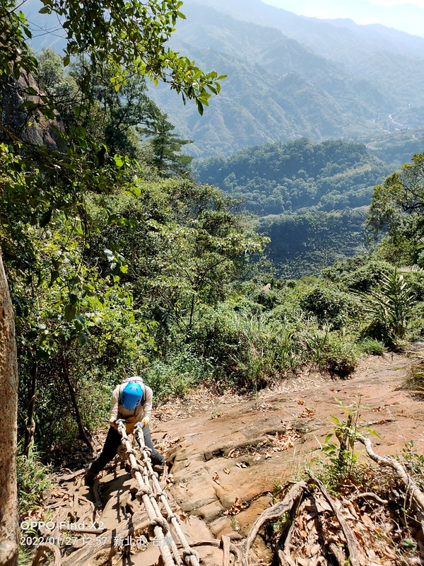
After catching my breath in the saddle, I continued to take on Duli Rock.
Ready to tackle Duli Rock
Compared to the previous exciting descending, climbing Duli Rock seemed relatively easy.
Photo by Jeffery Chang 張建舫
12:40 Climbing up wasn't difficult but walking on the top of this rock did make
my heart skip a beat. I felt like Jack and Rose standing on the deck of Titanic, except that I was alone.
Those are the video clips shot by my friend Mt. Liu and I from the ridge to Duli Rock.
Then, I turned to look at the vertical slope we had just descended. To this day, I am still amazed by myself
that I did this hike.
12:59 We had to get down another rock slope.
Photo by Jeffery Chang 張建舫
I took photos of my friend. You can see Duli Rock and the deck-like top on the top right.
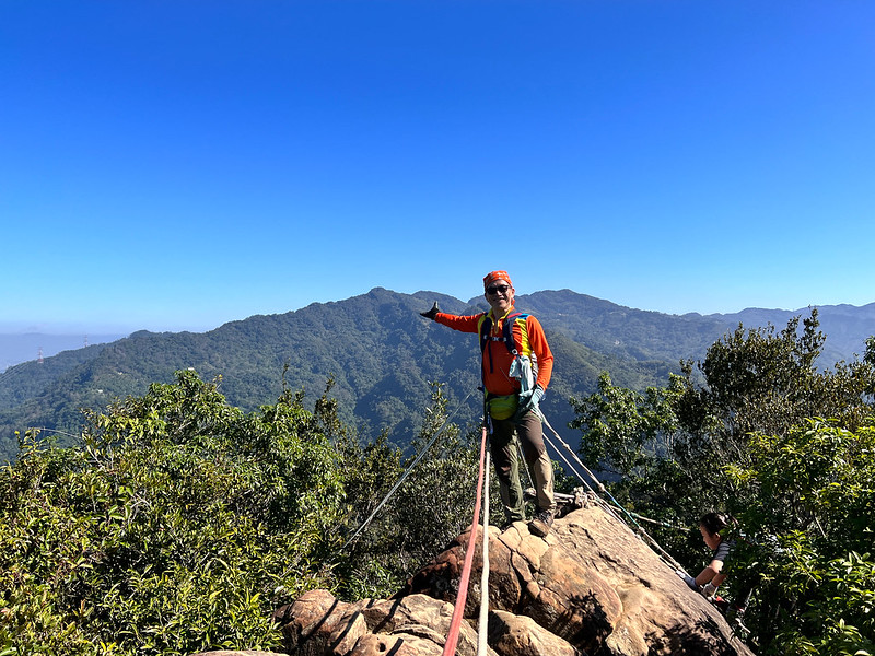
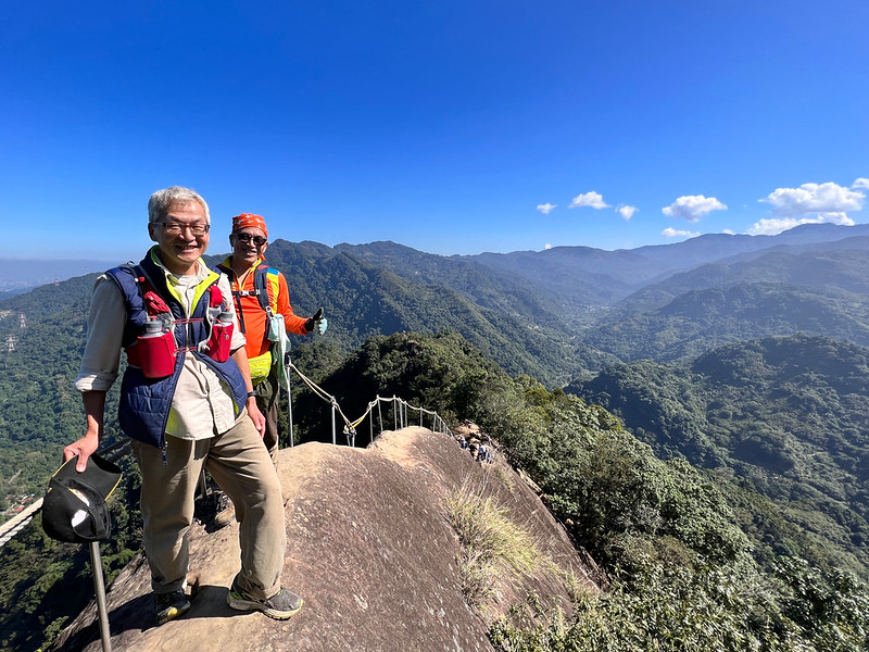
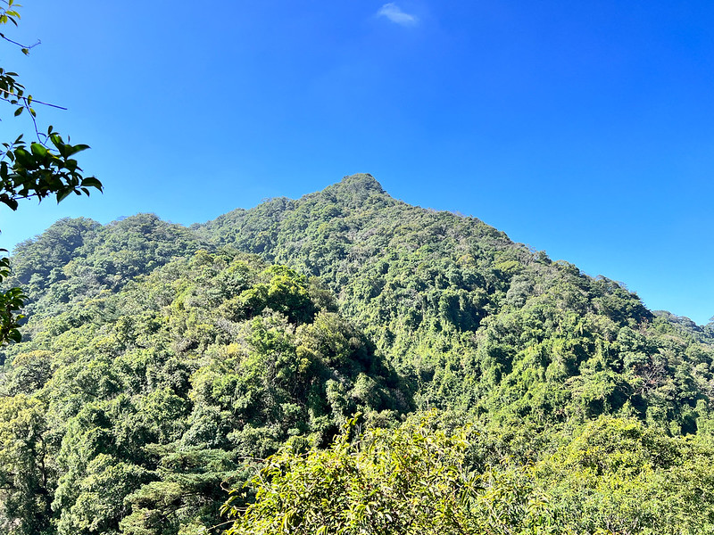
While continuing, I saw a mountain ahead, and this peak was our next destination, the real Wuliaojian Mountain.
Wuliaojian Mountain, 639 meters (1,768 feet)
On the way to Wuliaojian Mountain, it was endless ups and downs, like the contour of a closed fist.
13:03 We reached No. 6, the junction to Hezuo Bridge Longshanyang (Longshan
Rock) and Huzhu Bridge. If you are aiming for fun rock climbing, you can return to the trailhead from here.
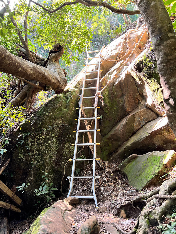
13:42 Reached a ladder. It looked sketchy to me, but I made it.
Old Bishop Wood and Mt. Wuliaojian
14:03 Reached a junction with a map and No. 7 spot. You can also return to the
trailhead from here.
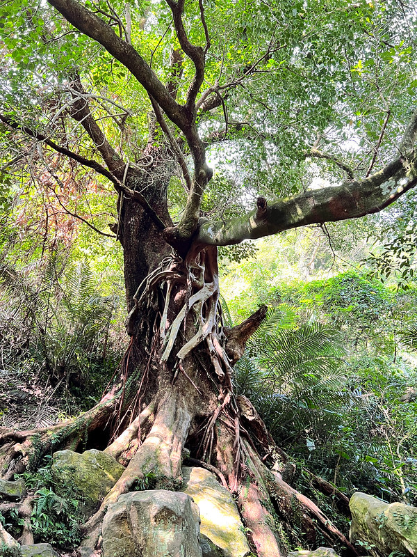
There is a giant Bischofia javanica, or Bishop Wood, near the junction. It is said that this Bishop Wood is over
100 years old.
Bishop Wood 茄苳
We took a right at the junction. If you do a small loop hike like us, taking either one is fine because you will
be back to No. 7.
14:25 Arrived at Mt. Wuliaojian, 639 meters. When we reached the peak, many
people were taking endless photos there.
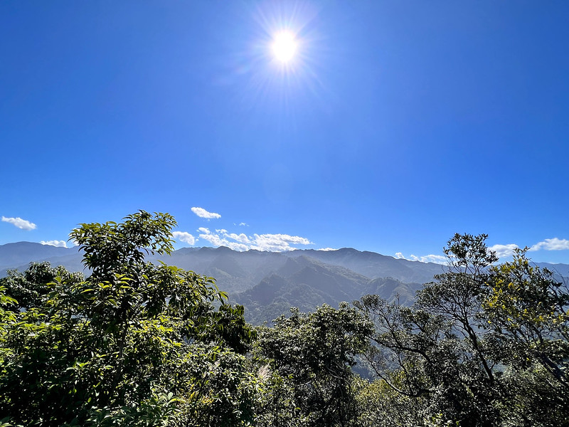
Some hikers say we can see Taipei 101 if the weather is good. Unfortunately, when we got there, the weather
turned gloomy. We couldn't see much because of the clouds. So we didn't stay long and left quickly.
14:35 We reached No. 8. We intended to take the bigger loop, but my friend's
ankle didn't feel okay, and we were getting slower. So, we took the smaller one.
If the weather is good, we can see as far as Mt. Qixing in Taipei City.
14:39 Reached No. 9 and the junction to Longshan Rock. You can turn here to take
an even bigger loop here.
14:56 We were back to No. 7 and the massive Bishop Wood. We took the trail that
went downhill.
The terrain here was more slippery than in the previous sections. After a while, we walked along with a small
stream.
15:48 We reached a junction saying 50 meters ahead before going to the
industrial road.
15:54 We arrived at a small shop called Wuliaojian Shop 五寮尖山休息站, aka No. 82
Zuntou 圳頭82號. You can get cold drinks here. From here, we reached the paved industrial road.
Yongda Coal Mines
16:07 I saw the map with the No. 2 spot and a tunnel. I wonder if this tunnel
was from the coal mines.
A tunnel near the map of No. 2
16:13 I reached a junction with a handwritten map. The map said the right one
would take me back to Huzhu Bridge and Yuli Shop faster. So, of course, I took this one. From here, I walked on
the steps and a footpath again.
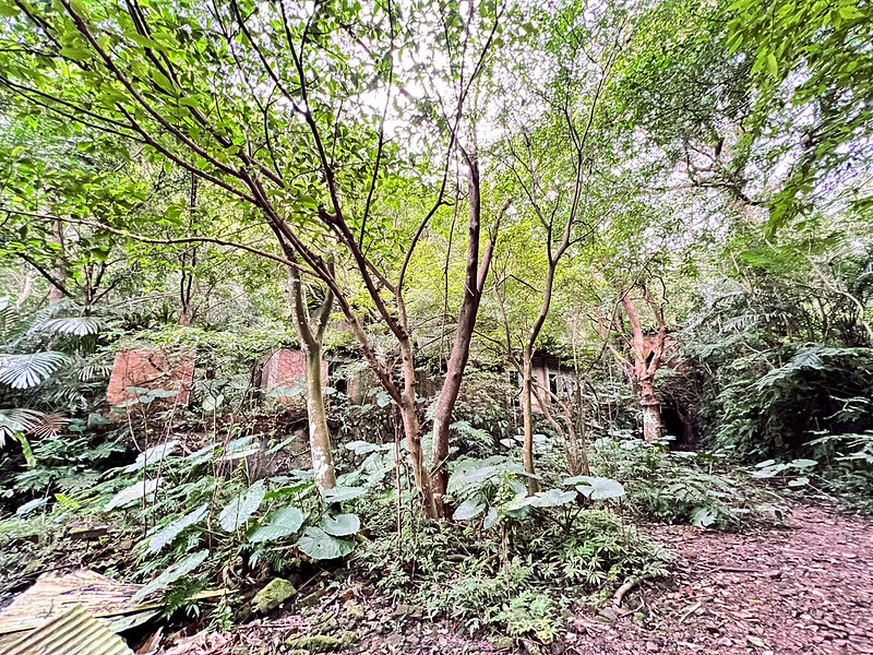
It was a little bit slippery but manageable. Soon, I saw some noteworthy buildings. Those were the relics left
from Yongda Coal Mine 永達煤礦遺址. Those old buildings were beautiful!
If you only want to see these relics, you can click here to see the map of Yongda Coal
Mines.
16:19 We arrived at the trailhead, Yuli Shop, and finished this hike.
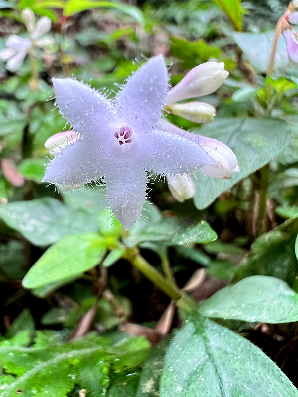
Last but Not Least: Wildflowers
Other than the water lilies I saw on the knife ridges, and I also saw other beautiful wildflowers.
Please check out my Flowers on the Trails page for more wildflowers I saw on the trails.
About Wuliaojian and Yongda Coal Mines 永達煤礦遺址
Mt. Wuliaojian
Wuliaojian Mountain, aka Cou He Mountain 湊和山, Fengjijian 鳳髻尖, or Jiulong Mountain, is in Sanxia, New Taipei
City. Wuliaojian, Mt. Bijia 筆架山, and Huangdidian 皇帝殿 is named as one of the three rock climbing slopes/ridges in
northern Taiwan.
The mountain's contour looks like a closed fist, with up and down ridges. The name of Wuliao came from the
Quangxu Emperor of the Qing Dynasty, when Liu Mingchuan 劉銘傳, the then governor of Taiwan, built five huts to
contain the Indigenous people.
The contour of Mt. Wuliaojian looks like a closed fist.
Wu means five, Liao means huts, and Jian means sharp steep slopes or peaks. That's how Wuliaojian got its name.
Yongda Coal Mines
On our way to the trailhead back to Cuohe Bridge, we passed several huge buildings in the woods. During the
Japanese Occupation, eight coal mines were operating in Sanxia. I found some relics when doing the Mt. Jinminzi trail.
The one near Wuliaojian is Yongda Coal Mine. During its prime time in the 1950s and 1960s, more than 3,000
miners worked here. It stopped operation in 1983.
Now, Yongda Coal Mine has become one of the popular locations for photographers to peruse fireflies in summer.

 to change the speed to meet your condition.