Kulu Forest Road, Mt. Dayuan and Dayuan Elementary School: The Less Known Logging History near Taipingshan
This is a hike on Kulu Forest Road to visit Mt. Dayuan and Dayuan Elementary School, but it can be extended to
the famous Cueifong Lake (1,840 meters) in Taipingshan. Underneath the seemingly lush forest and splendid
landscape, many stories are untold, intentionally or unintentionally.
We did an out-and-back route to the school for the children of staff from the long-forgotten Dayuan Logging
Station, trying to imagine the hardship they had to endure during that time.
Along with the station, there is also an old forest road that isn't recognized much by the government's
Forestry Bureau.

Table of Contents:
Trail Information
Trail Name: Kulu Forest Road, Pingyuan Forest Road to Dayuan Elementary School
and Mt. Dayuan
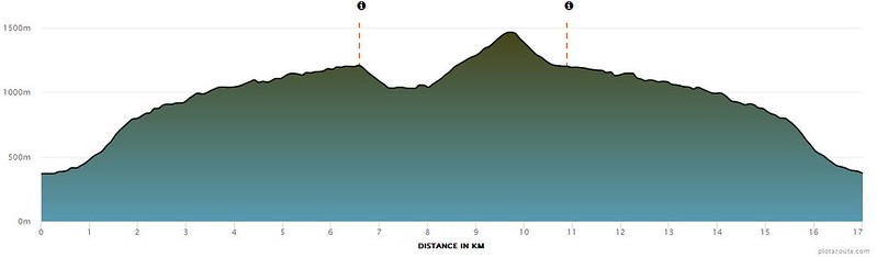
Distance: 17 km (10.6 miles)
Route Type: Out and back
Days/Hours Needed: 9-11 hours
Total Ascent/Descent: 1,416 m/ 1,416m
Best Time to Go: All year-round, but it can be hot and humid in summer.
Permits: Not required
Phone Reception: Almost none on the trail
Water Resource: A small creek near the trailhead
Difficulty Level:
Peaks and Places to Reach:
- Mt. Dayuan (Dayuanshan) 大元山, 1,489 meter (4,885 feet) above sea level
- Dayuan Elementary School 大元國小, 1,045 meters (3,428 feet) above sea level
- Bring a pair of sandals, or take off your hiking boots because there's a small creek to cross near the trailhead.
- Wear a helmet if you want to get inside the old classrooms at Dayuan Elementary School. After getting inside them myself, I didn't feel safe. If I revisit this place, I will stay away from them.
- It's possible to do wild camping by the old outpost. You'll find the creek nearby to draw water.
- I was told that you could drive and park your car near the trailhead, saving 2.5 km of walking. But I'm not sure the gate will remain unlocked when you want to leave.
- If you want to hike from Hanxi to Cueifong Lake, you can go to Nanao North River and camp on the dry riverbed.
Personal Enjoyment
Things I Enjoy:
- The old school and the history behind this place.
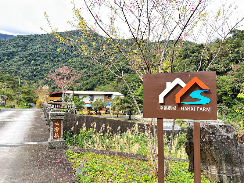
- Hanxi is a small and quiet indigenous village. The suspension bridge is gorgeous. After a tour of Hanxi, I returned to Hanxi Farm and sat by Fanshekeng River. It was so relaxing, and I will return to camp by the river.
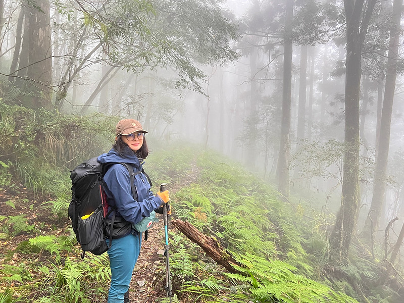
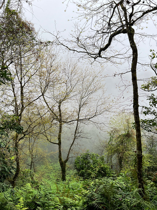
- The whole hike is enjoyable. Although the precious old trees are long gone, the forest is still stunning, especially when it's covered with fog.
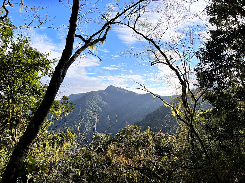
- There isn't much to see on the peaks, but we got glimpses of Nanao North River and Mt. Fanshekeng in between trees. Those are awesome.
Map/GPX Data
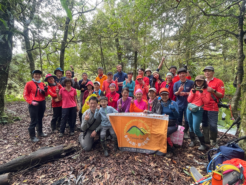
Date of Hike: Group hike with LOHAS on February 13, 2022
Route map for 20220213-古魯林道-大元國小-大元山 by Anusha Lee on plotaroute.com
Click Menu in the map to download, print, or share the map.
You can see more options after clicking the Play button.
Click to change the speed to meet your condition.
You can see more options after clicking the Play button.
Click
to change the speed to meet your condition.
How to Get There
If you are from Taipei, you can take a bus or train to Luodong Transfer Station, and take Bus 1795 at Luodong Transfer Station. Get off at the last stop next
to Hanxi Police Station.

Stay at Hanxi Village for one day so you can head to the trailhead early the next morning.

I thought it would take us much longer to finish this hike. So, I was going to book another night to stay in
Hanxi. We finished the hike at 16:40, leaving us plenty of time to get to the bus stop and catch the last bus at
19:05.

My Itinerary
I arrived at Hanxi Village one day before our hike. If you have plenty of time, I highly recommend a short visit
to Hanxi Village.
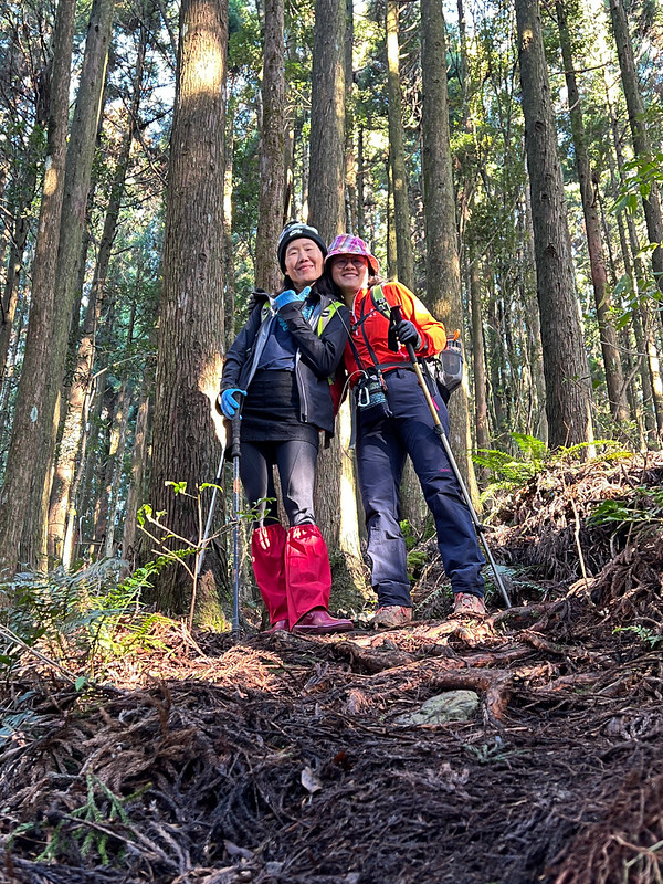
I did this hike with the two doctors I met from Mt. Dahun and Mt. Beidelaman.
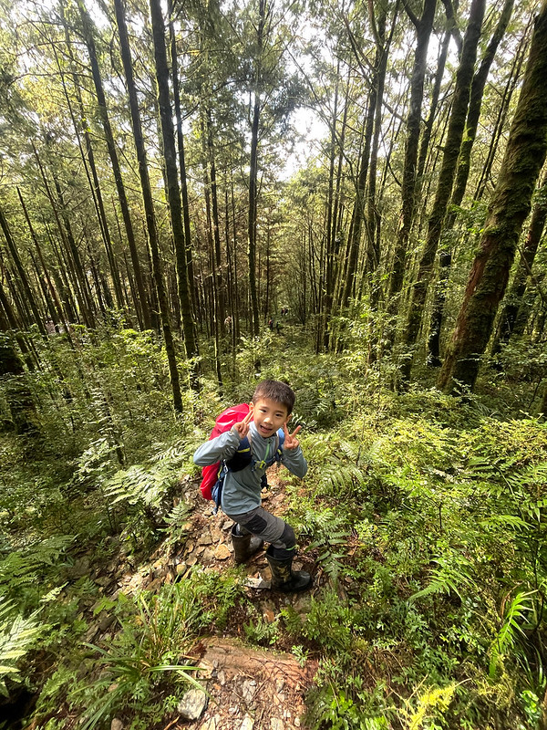
Our youngest hiking mate, the most adorable one I've ever met, who did Hunters Trail and Mt. Jyunda with me, also took this hike with his father. He was so
adorable and fearless. Unfortunately, I always forgot to ask his name.

Our hiking guides told us we could drive past the gate, saving us at least 20 minutes of walking. If you decide
to drive to the old checkpoint, please make sure the gate is still open when you return.

Brief itinerary: Hanxi Farm ➔ the old checkpoint ➔ the crossroad saddle ➔ Junction
➔ Dayuan Elementary School ➔ junction ➔ Mt. Dayuan ➔ junction ➔ the crossroad
saddle ➔ the old checkpoint
GPS coordinates of the old outpost: 24.578052, 121.675795
GPS coordinates of the old outpost: 24.578052, 121.675795
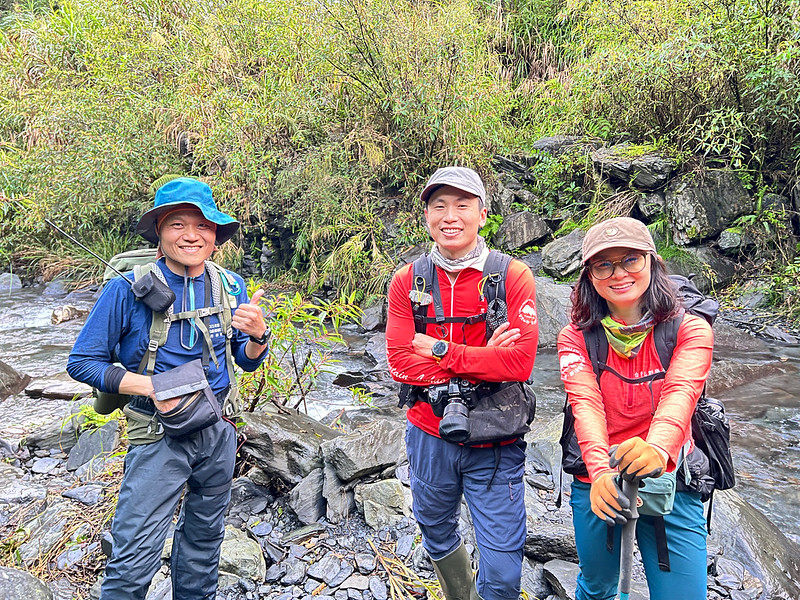
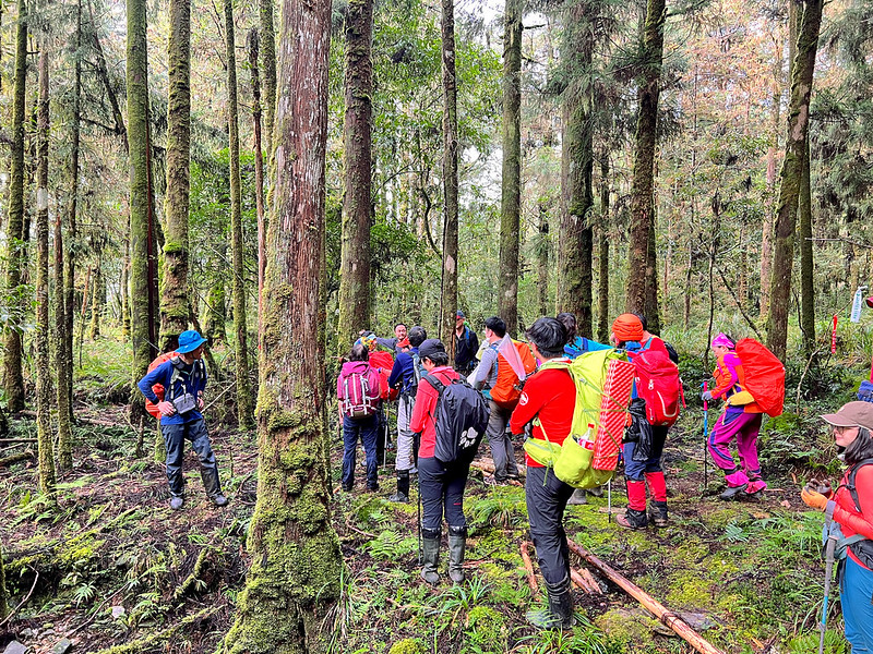
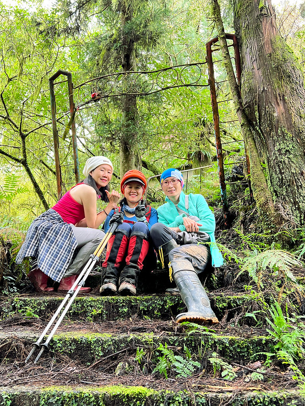
06:06 We arrived at the old checkpoint. We prepared our gear, and our guide,
Julya Lu, explained our hike and things to pay attention to.

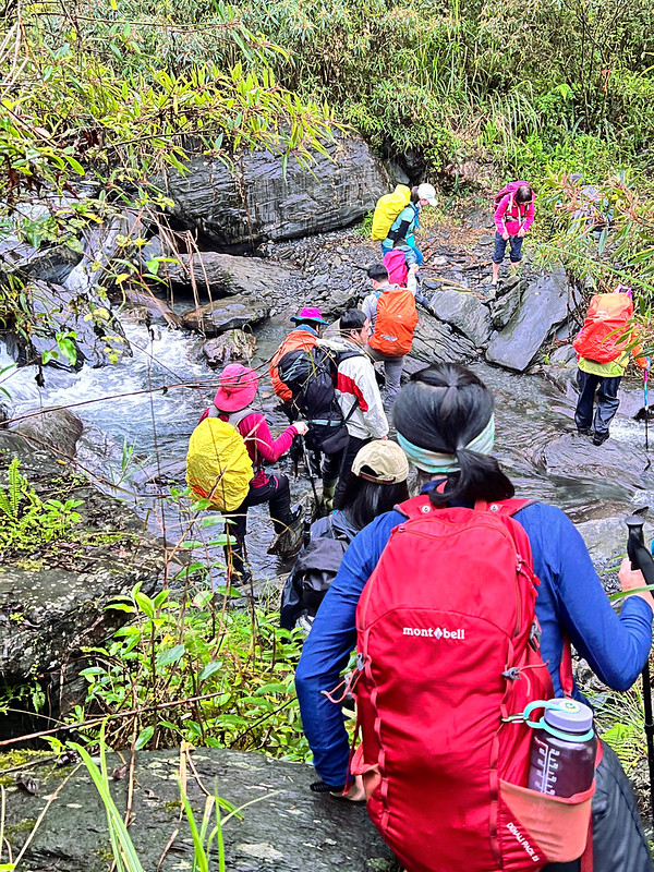
06:25 Headed to the trailhead hidden in the grass.

06:34 Reached a small creek. It had been raining for months in Yilan. So, the
water was high. Most hikers took off their hiking boots and rain boots. I decided to wear mine because I was
lazy.
Sometimes, you must do what you got to do. I slipped into the creek, and the water spilled inside my left boot.
I had to bear the consequence for the rest of the day.
The Crossroad Saddle That Separated Kulu and Pingyuan Forest Road
08:03 We reached a junction, aka the crossroad saddle 十字鞍部. Julya took some time
to tell us some history about Kulu Forest Road.
During the Japanese Occupation, the old road went down from the saddle to the Nanaobei River or Nanao North
River.
Before reaching the river, there was an old suspension bridge and an outpost after crossing the river.
When Dayuanshan Logging Station was operating, trucks took the road by the river. It is said some tourists even
rode motorcycles by the river in the 70s and 80s.
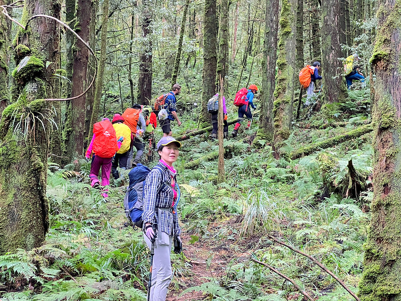
After the junction, we turned right and continued. By now, the sky was blue, and Mt. Fanshekeng was accompanying
us to our destination.
My champ, our youngest hiker, crossed the tree on the side slope at ease.

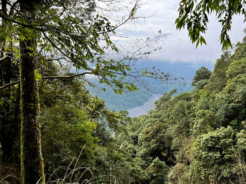
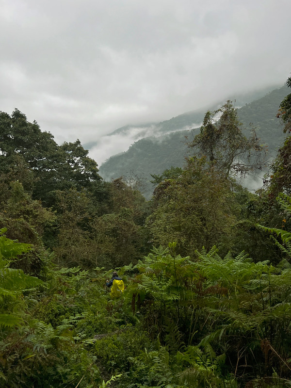
08:39 We saw a vast riverbed with a winding river. It was Nanao North River.
Nanao North River and Nanao South River merge in Nanao County, Yilan, and go to the Pacific Ocean.
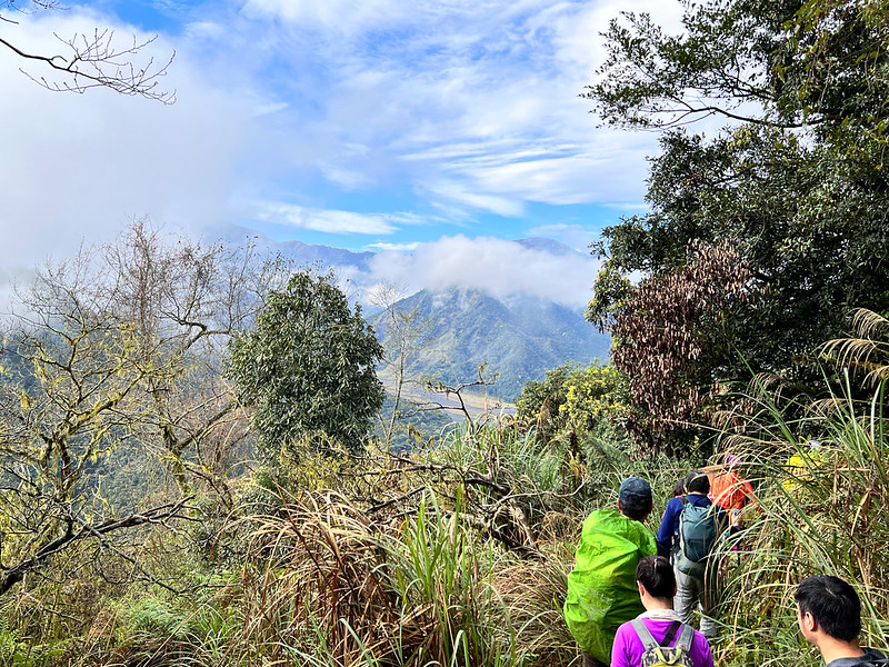
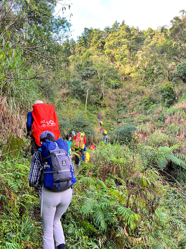
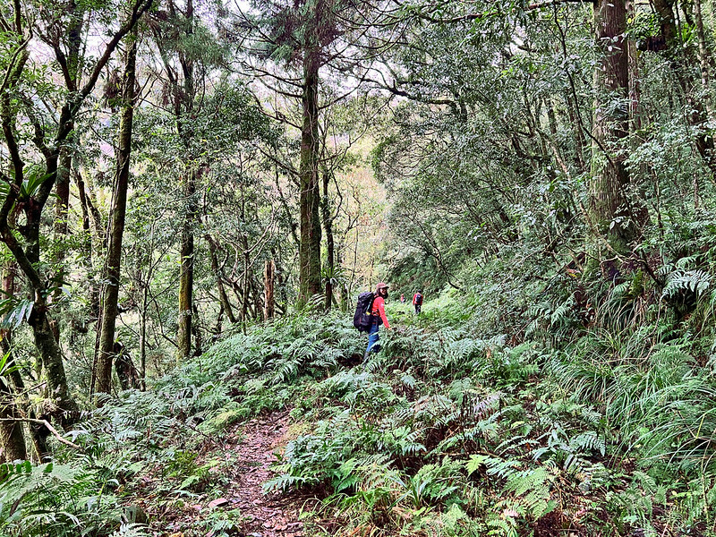
After reaching this point, the terrain became relatively flat. I started inspecting the trees and the landscape
around us. From now on, we were on Pingyuan Forest Road.

09:38 After hiking for around one hour, I saw Nanao North River through the
trees again.

Junction to Dayuan Elementary School and Mt. Dayuan
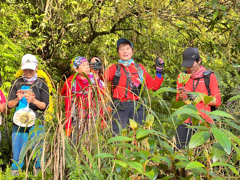
09:59 We reached the junction of Mt. Dayuan and Dayuan Elementary School. Juylia
told us we would head to the school first because it would rain in the afternoon according to the weather
forecast. She hoped we could spend more time at the school.
It was a long steep slope from the junction surrounded by tall Japanese Cedar Trees. Juylia took a super cute
photo of my champ here. His father agrees to let me put his photos.
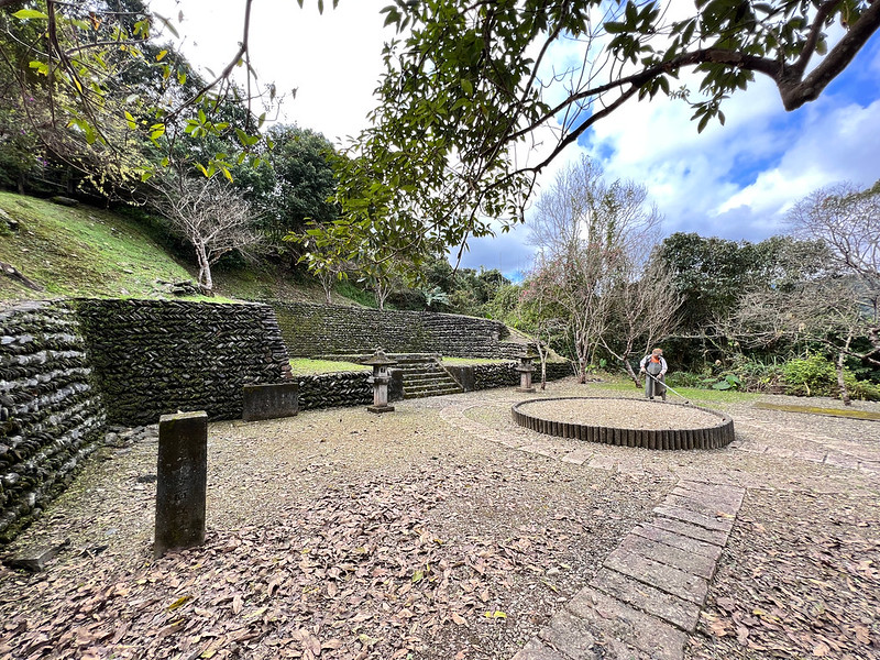
Dayuan Elementary School
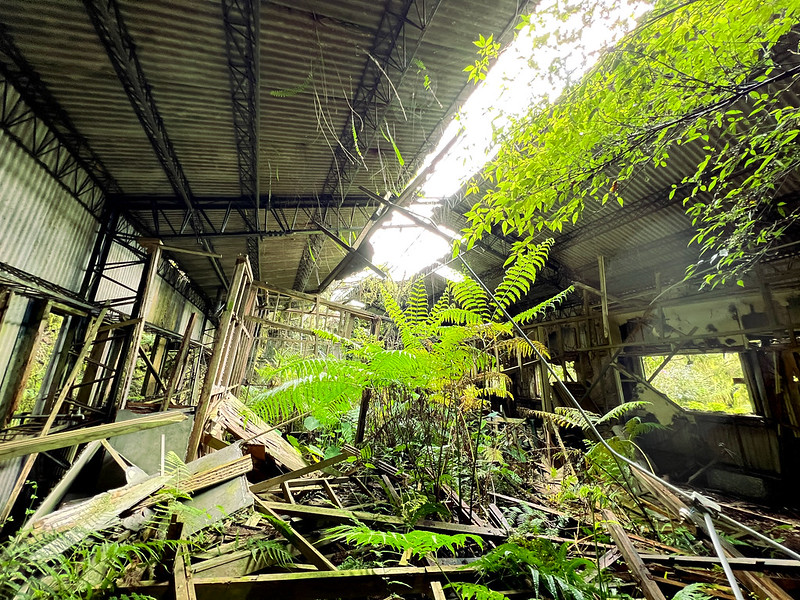
10:14 Reached the steps, which indicated the school was close.

Within a few minutes, we arrived at Dayuan Elementary School. This school was dissolved in 1973, almost 50 years
ago. Sadly, the logging equipment and other things that could help us understand the past were also looted,
along with the precious trees.

The sign on the school gate was almost gone, only "學" school dreadfully hanging on it.
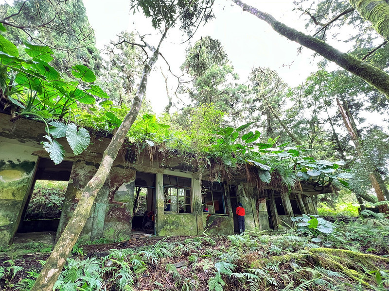
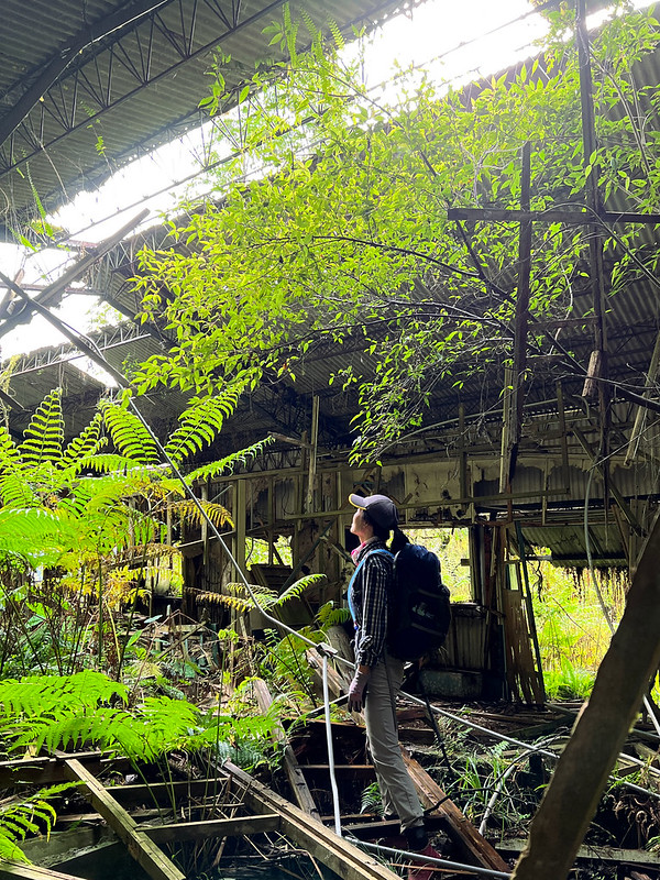
We went inside the classrooms. Honestly, I was concerned because I wasn't sure when the roofs would collapse.

The doctor and I checked out the school buildings together.
11:44 We spent around 90 minutes at Dayuan Elementary School and headed back to
the junction of Mt. Dayuan.
Most trees we saw here were Japanese cedar trees. Most of the Japanese cedar trees in Taiwan were planted later.
I wonder what the virgin forests looked like before they were gone.

Steep Ascending to Mt. Dayuan
12:52 We arrived at the junction. I decided to take the essentials and left my
backpack at the intersection. Our guides told us it would be a steep hike all the way up to Mt. Dayuan. They
weren't lying.

There were endless steep slopes, and we took the zigzag trail up slowly.
12:43 Finally, we reached our destination, Mt. Dayuan, 1,489 meters.
Unfortunately, there was no view at the peak. So, we didn't spend too much time here.

13:20 We returned to the junction and took our backpacks. By now, the sky had
turned grim.

Although this is an out-and-back trail, the trees looked different on the way back. The mist gave the landscape
a mysterious atmosphere.


13:25 We got back to the crossroad saddle.
16:42 We were back to the stream near the trailhead.

16:40 We arrived at the old checkpoint and were ready to go home.

Last but Not Least: Wildflowers
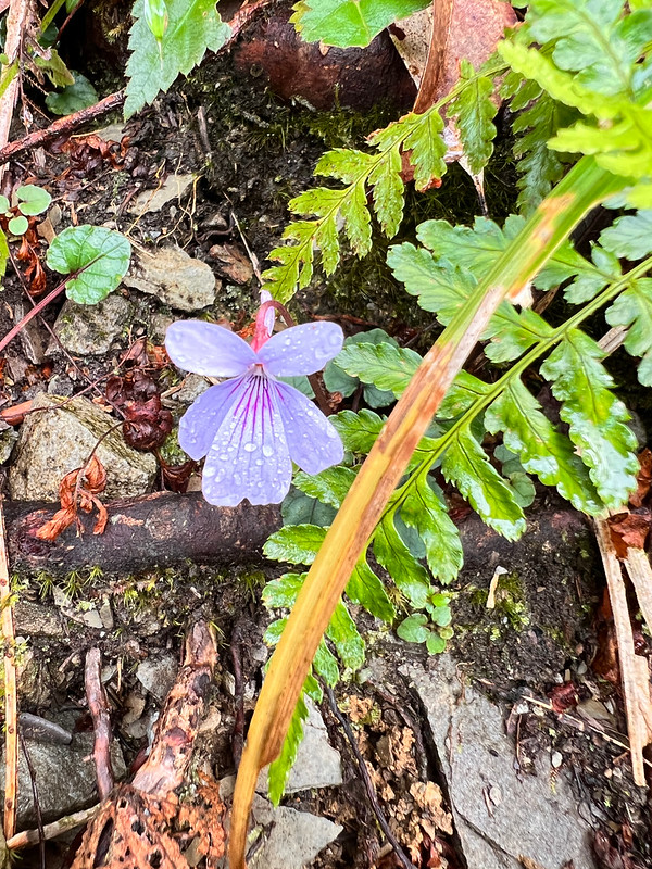


For more wildflowers I saw on the trails, please check out my Flowers on the Trails page.
About Dayuanshan Logging Station and Dayuan Elementary School
I want to thank Mt. Chen Dongyuan 陳東元先生 for giving me his permission to use his content and write
about Dayuanshan's history.
Mt. Chen is a famous artist. He grew up at Dayuanshan Logging Station and Cueifong Lake. Now he dedicates his
time to letting the world know the history behind Dayuanshan Logging Station and Dayuan Elementary School.
The following content was from Mt. Chen's website, Dayuanshan Cueifong Lake 大元山翠峰湖. Mt.
Chen collects many precious old photos and data about Dayuanshan Logging Station. He also lets us glimpse the
hardship those small children had to endure to go to school.
Please spend some time checking out his website to see those precious old photos.
A Brief History of Dayuanshan (Mt. Dayuan) Logging Station
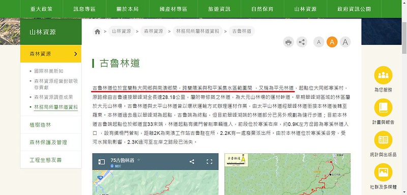
Kulu Forest Road was built to transport logs from Dayuanshan. It started in Hanxi Village and went all the way
to Cueifong Lake. The total length of this road is 28 km (17.4 miles). According to Forestry Bureau, the
following track is Kulu Forest Road and overlapped with the track we did.
The area started from Dayuanshan. Gradually, the logging extended to Mt. Wangyang 望洋山 near Cueifong Lake.

There were four timber railway lines to transport logs:
- Dayuanshan line (aka Sigongli line) 大元線 (四公里線): 7.86 km
- Cueifong line 翠峰線: 15 km
- Qingfong line 晴峰線: 15.1 km
- Bizi line 埤仔線: 4 km. This line has become Taiwan Beech Trail under Taipingshan National Forest Recreation Area.
And five cableways to help transport the logs.
A Brief Timeline of Dayuanshan Logging Station:
1938
The Japanese government assigned Taipingshan forestry to The Taiwan Development Co., Ltd. 臺灣拓殖株式會社 (臺拓).
The Japanese government assigned Taipingshan forestry to The Taiwan Development Co., Ltd. 臺灣拓殖株式會社 (臺拓).
1946
After Japan surrendered and the Republic of China claimed Taiwan back, the Forestry Administration Division under Taiwan Provincial Government took over the old Taipingshan Logging Station.
After Japan surrendered and the Republic of China claimed Taiwan back, the Forestry Administration Division under Taiwan Provincial Government took over the old Taipingshan Logging Station.
Old Taipingshang Branch Logging Station, New Taipingshan Branch Logging Station, Dayuanshan Branch Logging
Station, and Taroko Branch Logging Station were under the Forestry Administration Division.
1952
The large-scale logging unfolded at Dayuanshan Branch Logging Station.
The large-scale logging unfolded at Dayuanshan Branch Logging Station.
1954
Dayuan Branch under Hanxi Elementary School was established. Ms. Lee Youquan 李有權 was appointed as the headmaster.
Dayuan Branch under Hanxi Elementary School was established. Ms. Lee Youquan 李有權 was appointed as the headmaster.
1956
Dayuan Branch School was upgraded to Dayuan Elementary School.
Dayuan Branch School was upgraded to Dayuan Elementary School.
1959
Chainsaws replaced hacksaws to harvest lumber, drastically increasing log production.
Chainsaws replaced hacksaws to harvest lumber, drastically increasing log production.
Luodong branch office merged with Taipingshan Logging Station and was reorganized to the Lanyang division. As a
result, Tapingshan Logging Station and Dayuanshan Logging Station were under the Lanyang division.
1960
All the forestry administration offices were reorganized and renamed the Forestry Bureau 林務局. Dayuanshan Logging Station 大元山林場, Jialuo Logging Station (the Old Taipingshan Branch) 加羅山林場, and Taipingshan Logging Station (the New Taipingshan Branch) 太平山林場 were under Lanyang Forestry District Office.
All the forestry administration offices were reorganized and renamed the Forestry Bureau 林務局. Dayuanshan Logging Station 大元山林場, Jialuo Logging Station (the Old Taipingshan Branch) 加羅山林場, and Taipingshan Logging Station (the New Taipingshan Branch) 太平山林場 were under Lanyang Forestry District Office.
Since then, Dayuanshan Logging Station had increased the logging volume. The amount of lumber produced at
Dayuanshan was way more than Taipingshan. Dayuanshan and Taipingshan shared a crucial position in contributing
to Taiwan's economy.
1967
The headmaster, Ms. Lee Youquan, was promoted and transferred.
The headmaster, Ms. Lee Youquan, was promoted and transferred.
1973
Dayuan Elementary School was dissolved and renamed the Dayuan Branch School of Hanxi Elementary School.
Dayuan Elementary School was dissolved and renamed the Dayuan Branch School of Hanxi Elementary School.
Qingfong line was merged with the Sanxing line 三星線 from Taipingshan Logging Station at Zhong Xing Gang 中興崗.
Unfortunately, merging those two lines also paved the road for Dayuanshan Logging Station to be closed.
1974
Dayuanshan Logging Station was dissolved, and the offices at Sigongli were transferred to Kulu.
Dayuanshan Logging Station was dissolved, and the offices at Sigongli were transferred to Kulu.
The trees and forests at Dayuanshan were classified as "wastage" and outsourced to the private sector. According
to Mr. Chen, this led to exploitation, and many precious trees were wiped out. No record was left to know how
many forests had been harvested ever since.
1975 - 1977
Luodong Forest District Office dismantled the railway tracks, cableways, and other equipment at Dayuanshan Logging Station.
Luodong Forest District Office dismantled the railway tracks, cableways, and other equipment at Dayuanshan Logging Station.
Pingyuan Forest Road 平元林道 was built (Note 1). Pingyuan Forest Road was classified as a regular forest road, and
six-wheelers could ride on it. While Kulu Forest Road was more treacherous, only heavy vehicles like
ten-wheelers could handle it.
According to Mr. Chen's research, more virgin forests were harvested after this forest road was built.
Unfortunately, the logging also led to several landslides along with Nanao North River.
Both Pingyuan and Kulu Forest Road exited the forests at Kulu, passed Hanxi, and reached Luodong.
1979
Dayuanshan Logging Station was delisted.
Dayuanshan Logging Station was delisted.
2007
Mt. Chen started collecting photos and stories from Dayuan Elementary School alumni.
Mt. Chen started collecting photos and stories from Dayuan Elementary School alumni.
2008
The yearbook of Dayuan Elementary School was published.
The yearbook of Dayuan Elementary School was published.
2016
The first headmaster of Dayuan Elementary School, Ms. Lee Youquan, passed away.
The first headmaster of Dayuan Elementary School, Ms. Lee Youquan, passed away.
Note 1:
If you check Forestry Bureau's website, it says Kulu Forest Road, also named Pingyuan Forest Road. I find this confusing. According to Mr. Chen's map, those are two different roads.
If you check Forestry Bureau's website, it says Kulu Forest Road, also named Pingyuan Forest Road. I find this confusing. According to Mr. Chen's map, those are two different roads.
I also found a blogger's post, Pingyuan Forest Road (Cueifong Scenic Road)
在山腰間環繞的公路─平元林道(翠峰景觀道路), Pingyuan Forest Road is a different one. So I wonder whether part of the old
Pingyuan Forest Road was merged with the old railway near Cueifong Lake and transformed into Cueifong Scenic Road.
The Estimated Log Volume Harvested at Dayuanshan Logging Station
During the prime time, the log volume at Dayuanshan Logging Station reached 80,000 cubic meters per year, the
most extensive production of all the logging stations in Taiwan.

By the time Dayuanshan Logging Station was dissolved, the annual production at Dayuanshan was 20,000 cubic
meters, while Taipingshan had 15,000 cubic meters.

According to Mr. Chen's research, the estimated log volume harvested
from Dayuanshan Logging Station might have reached 160 million cubic meters from 1947 to 1974.
What is the idea of 160 million cubic meters of logs? The weight of one cubic meter of hardwoods ranges from 700 to 1,000+ kg, and the weight of one cubic meter of
softwoods ranges from 600 to 1,000 kg, depending on the species, moisture content, etc.
So, it's possible that 160 trillion kilograms of precious forests (if those left behind are excluded) was gone
within three decades.
Plight and Grit: Life in Dayuan Elementary School
The logging station's employees and their families are mostly scattered in such an expansive area near Cueifong
Lake. During the prime time, there were at least 500 families. With other single ones and staffers, the number
of residents in Dayuan Logging Station was over 2,000 people.

An elementary school was built to give the employees' children a better education. However, it took at least one
day for those school kids to take the cableway and walk from their homes to school.
Therefore, 80% of students were required to stay in the dormitory. It wasn't easy for kids to leave their
parents at such a young age.

Because most employees weren't paid well, they couldn't afford good meals for their children at the dorm, not to
mention the freezing winters. According to Mt. Chen, most school children suffered from malnutrition. The
headmaster, Ms. Lee Youquan, worked very hard to improve the children's food.
From 1954 when the school was built to 1973 when it was dissolved, close to 300 students graduated from Dayuan
Elementary School, and 80+ teachers served there.

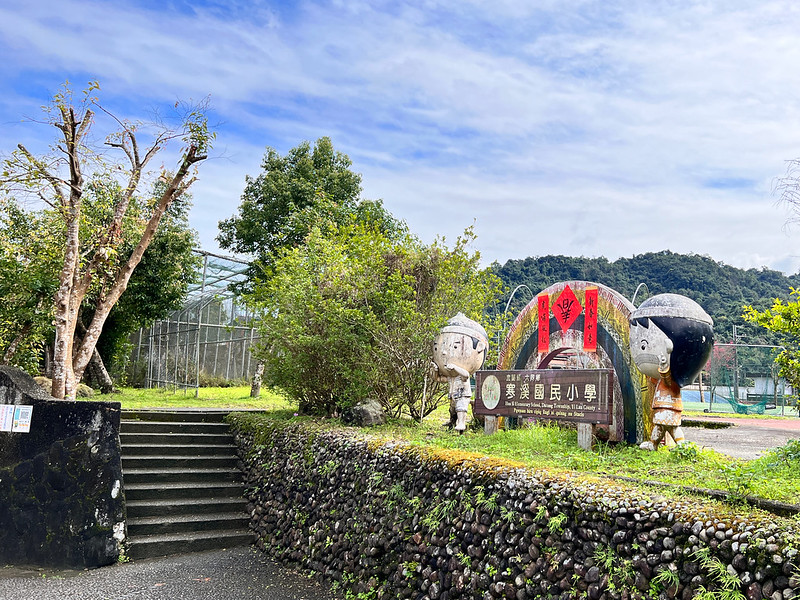
About Hanxi Village
Hanxi Village is located in Datong County, Yilan, an indigenous Atayal village. Hang means freezing cold in
Chinese, and Xi means creek. Hanxi is a tributary of the Fanshekeng River. As you can guess, the water in Hanxi
is freezing cold at least many decades ago.
Hanxi Suspension Bridge
After getting off and walking a little further, I saw a suspension bridge with bright colors and distinct
patterns above the broad riverbed. Hanxi Suspension Bridge is the longest suspension bridge made of steel cables
in Yilan, and the main span is 324 meters.

Most of the residents of Hanxi Village are the indigenous Atayal people, and the rhombic patterns on the bridge
represent the eyes of their ancestors' spirits.

Another place worth visiting is Hanxi Shrine, even though there's nothing much left. It
took me a while to find the steps leading to it.
The entrance is in the back of Hanxi Elementary School. I went inside this small school to take a look. You'll
see the Atayal people's designs everywhere inside this petit school. Hanxi Elementary School was built in 1914,
over 100 years ago.
After walking around without finding where the shrine was, I gave up and headed to a beef noodle restaurant to
have my lunch. Then I saw it.
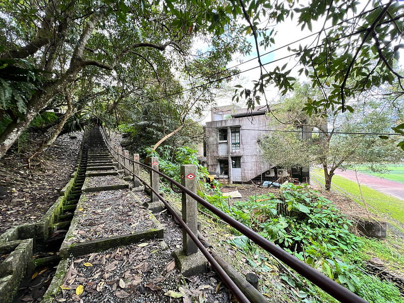
Those steps were what I was looking for. So I ditched my plan to have lunch and took the steps up. Within a few
minutes, I saw the shrine.
The main structure of the shrine is long gone, only some stone lantern posts left.
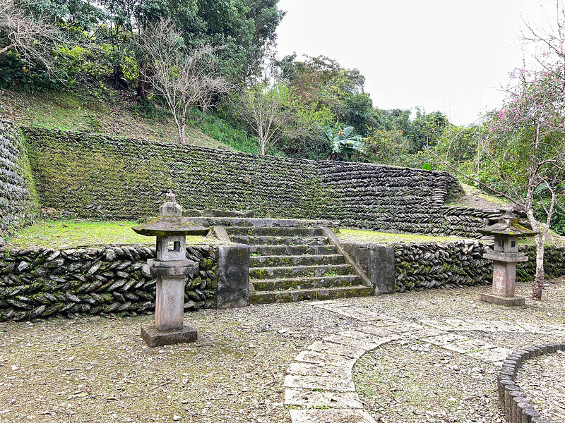
After the Japanese government returned Taiwan to the then KMT government, many old buildings that represented
the Japanese were destroyed.
I had a simple lunch at a local restaurant. The restaurant owner told me that it took only two hours for them to
reach Cueifong Lake from Hanxi decades ago.
Hanxi Farm and Fanshekeng River
I wandered around Hanxi Village for a while and headed back to Hanxi Farm, the place where I stayed for
the night.
My friend and I stayed in the room, but there were plenty of camping spots. I'd love to come back in the summer
to enjoy the river.
The farm owner's daughter followed me around, so I took her hand and sat by the river. It was in mid-February,
and the water looked cold.
Yet, Fanshekeng River still cast her spell on me. I took off my shoes and dipped my feet in the icy water,
expecting the chill to seep into my bone. However, the cool currents soothed my feet, which had been walking all
day.
