Mt. Dahun and Mt. Lidong: Dancing Lights, Cedar Trees, and A Bloodshed Past
The trail from Mt. Danun to Mt. Lidong in Hsinchu Taiwan, is a hike with history and stunning scenery. The
tranquility in the Japanese Cedar trees, the blood and tears hidden inside Lidong Mountain Fort, and the
mountains silently witnessing everything make this hike even more special.

This post is the first part of my two-day hike, but you can arrange this as a one-day hike.
Table of Contents:
Trail Information
Trail Name: Mt. Dahun and Mt. Lidong Trail 大混山, 李棟山
Distance: 10.6 km (6.6 miles)
Route type: Out and back
Days/Hours Needed: 7-10 hours
Total Ascent/Descent: 789m/798m
Best Time to Go: All year round, but it can be very hot in summer
Permits: Not required
Difficulty Level:
Peaks to Reach:
Distance: 10.6 km (6.6 miles)
Route type: Out and back
Days/Hours Needed: 7-10 hours
Total Ascent/Descent: 789m/798m
Best Time to Go: All year round, but it can be very hot in summer
Permits: Not required
Difficulty Level:
Peaks to Reach:
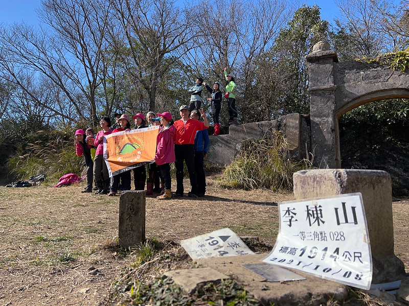
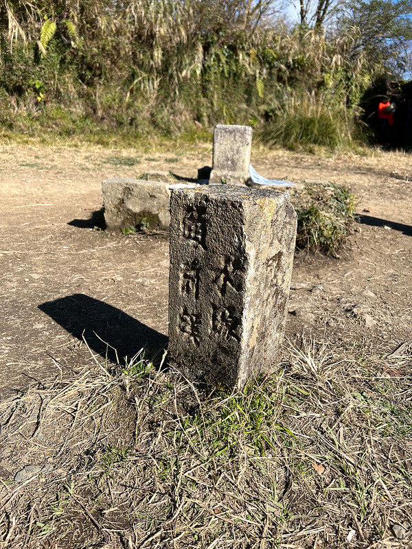
- Mt. Lidong 李崠山 (李棟山), 1,914 meters (6,280 feet) above sea level. There is a Class 1 Triangulation Stone on the peak. Mt. Lidong Fort is also on the peak. Although it's a Class 1 mountain, there's nothing much to see because trees surround it.
- Mt. Dahun 大混山, 1,541 meters (5,056 feet) above sea level. There is a Class 3 Triangulation Stone on the peak. Not much to see on the peak, either.
Personal Enjoyment
Things I Enjoy:
- I liked this trail already, even before we started our hike. Although the weather was gray when we arrived at Linkong Corridor, the views were still great. I could see the layers of mountains and the villages in the valley. Some tourists come here just for the stunning landscape without hiking.
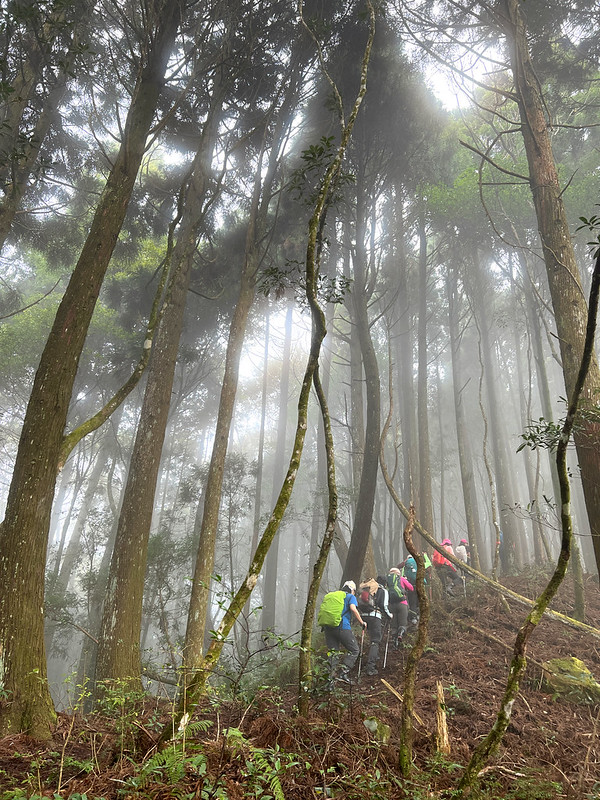
- If you go hiking regularly, this trail isn't too tricky, and the trail is in good condition. There are several steep slopes in the Japanese Cedar forest, but the mystic woods and fog floating in the trees will be a great distraction to make you in awe.
- It is said that we can see Mt. Dabajian (link, 3,492 meters), Xueshan (3,886 meters), Holy Ridge, and Mt. Nanhu (3,742 meters) from Lidong Mountain Fort. I didn't get to see those fantastic 100 Peaks, but it's a unique experience to reach a peak with such a vast space. There are also many stories behind this fort.
Map/GPX Data
Route map for 2022-01-08 Pingyan Mountain And Doujiatun Mountain by Anusha Lee on plotaroute.com
Click Menu in the map to download, print or share the map.
You can see more options after clicking Play button.
Click to change the speed to meet your condition.
You can see more options after clicking Play button.
Click
to change the speed to meet your condition.
How to Get There
There is no public transport to get close to the trailhead. You'll need to hire a car or ride a scooter to do
this hike.
My Itinerary
Brief itinerary: Linkong Corridor (1,220m) ➔ Mt. Dahun (1,541m) ➔ Mt. Lidong (1,914m)
➔ Linkong Corridor
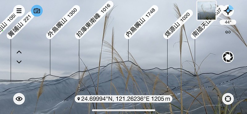
GPS coordinates of: 24.698008, 121.263489
GPS coordinates of: 24.698008, 121.263489
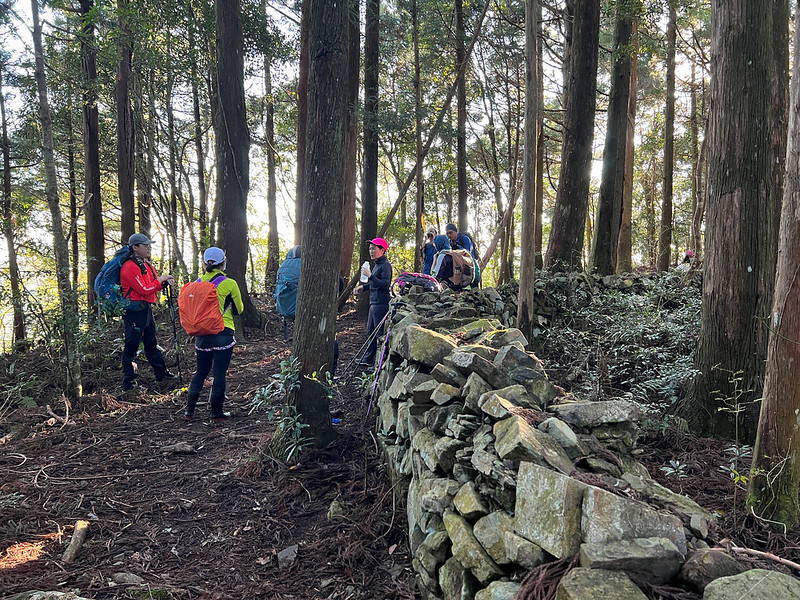
This hike was led by our two fabulous guides, VP He 何復忠 and Amy Chen 陳素惠. They shared a great deal of knowledge
of the history of Lidong Mountain Fort and the defense line.
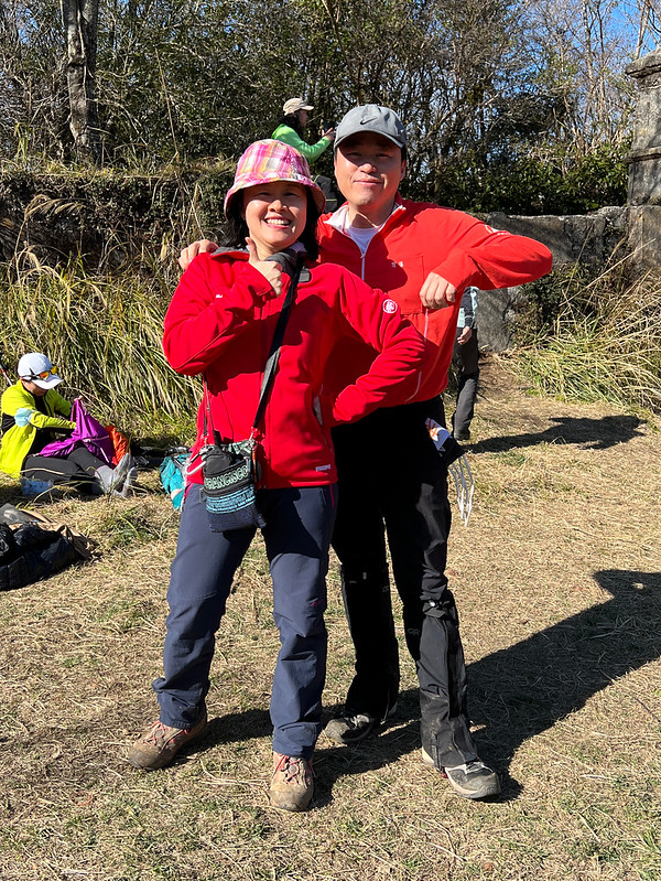
Moreover, Amy is also a dentist and speaks fluent English. In fact, we had two doctors on this hike. How
cool is that to hike with two doctors on the trail?
07:00 Left Taipei Train Station.
09:49 Arrived at Linkong Corridor and prepared for the hike.

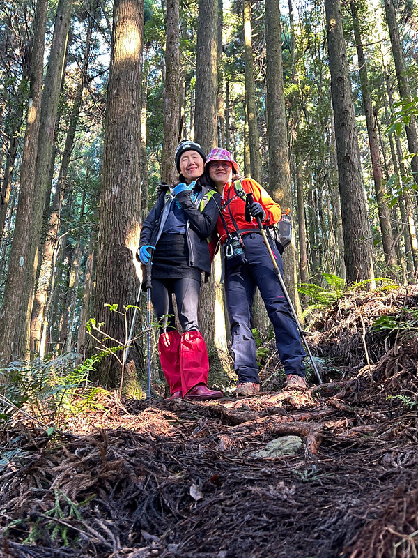
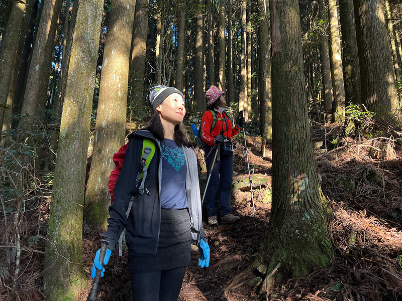
10:07 Started hiking. Soon, we went through the tall, beautiful bamboo woods.

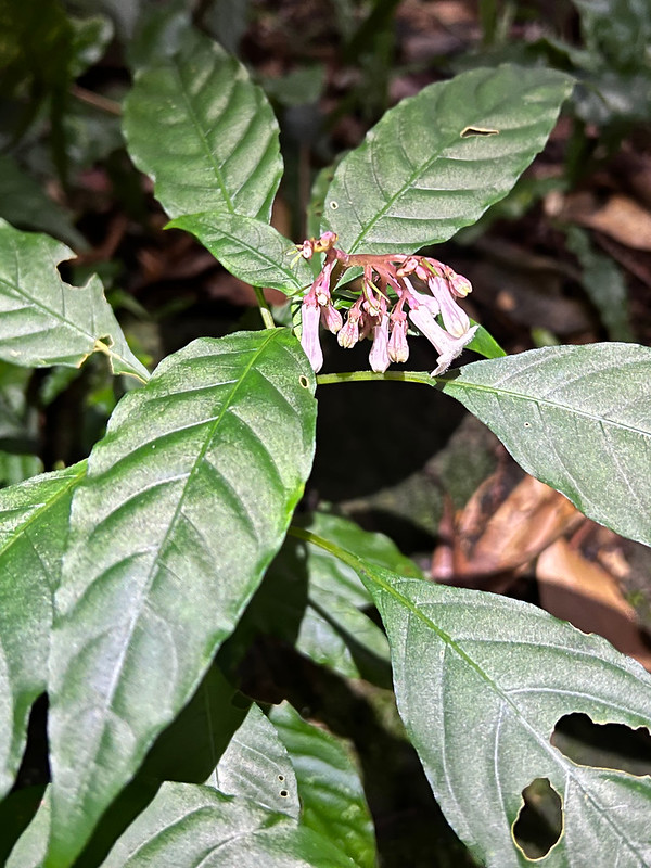
I saw Japanese Ophiorrhiza 蛇根草 near the trailhead. There were many of them around here. You can see my Flowers on the Trails
page to see the details.

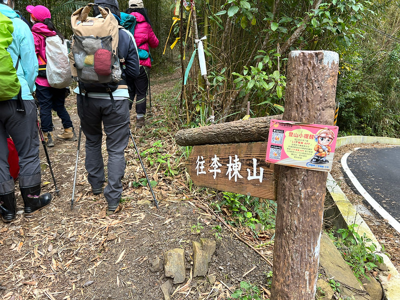
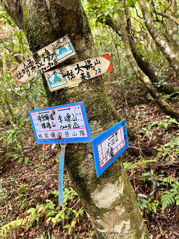
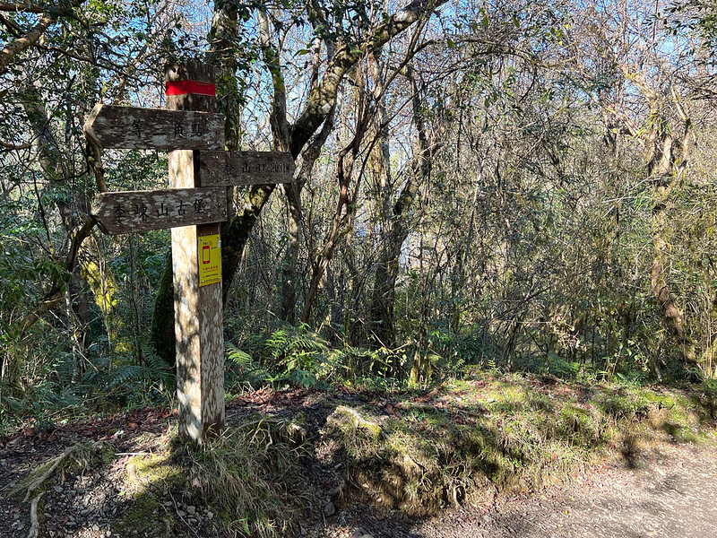
11:03 Arrived at the junction to Mt. Dahun/Mt. Lidong (大混山/李棟山), and to Mt.
Niulankeng/Mt. Daoshia (牛攔坑山/道下山).

11:11 Arrived at another junction to Mt. Dahun and Mt. Lidong. We headed to Mt.
Dahun first.
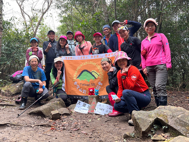
11:15 We reached our first peak, Mt. Dahun, 1,541 meters (5,056 feet). No views
on this peak. We took a break here.
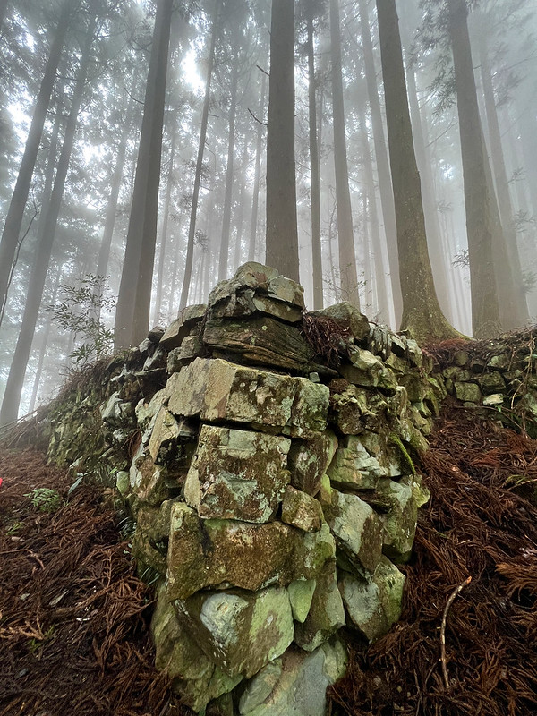
11:36 We saw the embankment of the first border guard detachment. Our guide, VP,
explained the history during the Japanese Occupation of Taiwan.
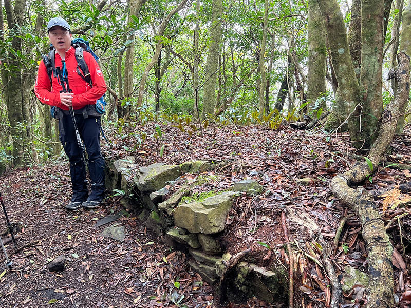
The weather was still gloomy, but the fog made this place look like a fairyland.
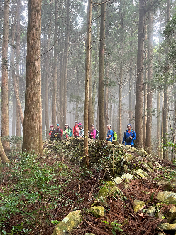
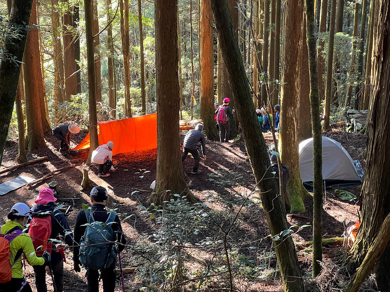
12:27 We arrived at Bawu Outpost 八五駐在所. Bawu Outpost was very spacious, and the
embankments were much larger. We took a break here. I've lost count of how many of those embankments I'd seen on
this trail.

12:58 I thought the rest of the day would be foggy and gloomy, but I started
seeing sunlight seeping through the trees.
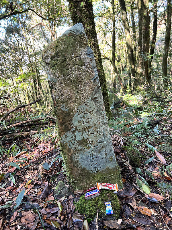
13:17 Our guide VP stopped near the junction and pointed out a stone post. It
turned out to be a grave of a Japanese patrol officer who lost his life during conflicts with the Indigenous
people, the Grave of Watanabe 渡邊要之墓. Our hiking mates put some snacks as the offering.

13:47 Reached Lidong Fort/Mt. Lidong 1,914 meters (6,280 feet). There is a Class
A Triangulation Stone on the peak.

This fort is enormous and can be reached via another trailhead. The distance from the trailhead to Lidong Fort
is only 2km, and it's an easy hike. But I've never been there, nor Lidong Mansion.
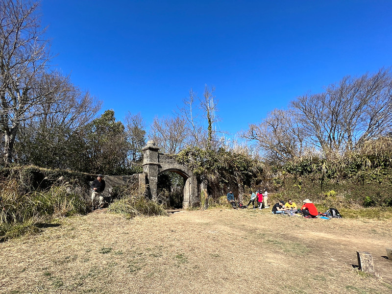
We took a lunch break at Lidong Fort. The sky had become crystal clear with a beautiful blue shade by now,
making it hard to believe it was dusky when we started the hike.
I checked out the corners of this fort and saw several embrasures on the walls.

14:38 We resumed the hike and took the same route back to the trailhead.
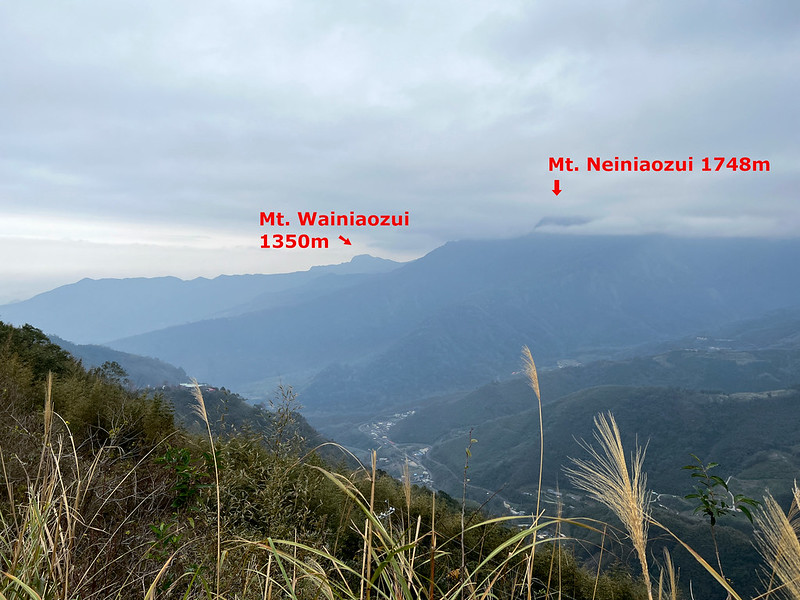
15:36 While the weather was getting better, I could see mountains in the
distance through the trees. With the help of an app, PeakFinder, I saw Mt. Neiniaozui 內鳥嘴山 (Post coming soon),
the mountain we were going to visit the next day.

Soon, we were back to the Japanese Cedar forests and Bawu Outpost.
Now, there were several tents pitched up by a group of hikers at Bawu Outpost. I wonder where they found the
water. Or they carried all the way up, but I didn't ask.

15:45 We were back to the long embankment. I saw some broken pieces of ceramics
and bottles left from the old days.
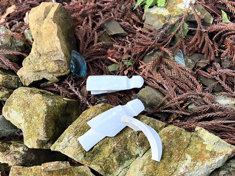
Those things are also common on the trails if you hike to Syakaro Historic Trail and Zhuilu Old Trail, where the Japanese Occupation had greatly influenced.

16:35 Back to the junction to Lingkong Corridor, Mt. Lidong, and Mt. Dahun.
17:15 The sun started setting. The sunlight was dancing in the woods and playing
magic with the trees and leaves.
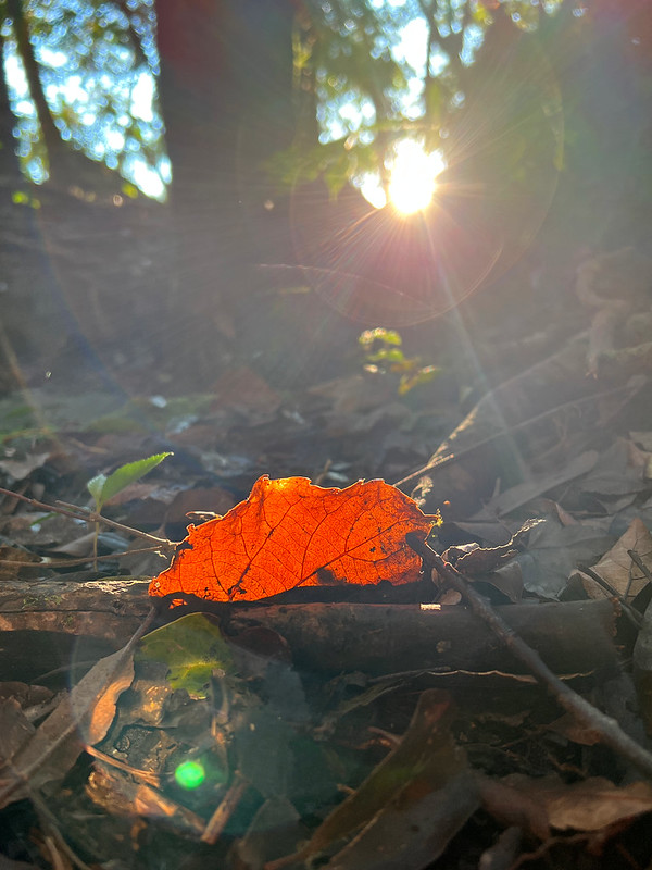
While I was grumbling silently about the lost opportunity of seeing gorgeous sunset, shrieks suddenly erupted
from my hiking mates ahead of me. It took me a few seconds to make out what they talked about.

It turned out that Mother Nature decided to give us one of the most significant rewards, and this was what we
saw through the trees.

17:49 We arrived at the trailhead. Our hired vans were already there waiting to
send us to the B&B.

About Mt. Lidong and Lidong Mountain Fort
Mt. Lidong used to be the transport hub for the indigenous Atayal people. Atayal people called this place
Tapung, meaning a place with accumulating snow. In Taiwan, Mt. Lidong is listed as Xiao Beiyue 小百岳, Little 100
Peaks.
There are 2 trailheads to Mt. Lidong. An army veteran built a house near one of the trailheads (not the one we
took), and this place became famous among hikers. Here's the old photo of the fort entrance.
During the Japanese Occupation, the Japanese Government built a defense line of frontier guard 隘勇線 to contain 26
Atayal tribes around here.
In 1910, the Japanese Government built Lidong Mountain Fort as a command post to deploy cannons to reinforce
their control over the local Indigenous people.
The fort was about 28 meters in length and 22 meters in width. The walls had embrasures with baroque
architecture style, which was very new.

There was a stone banner on the entrance of the fort carved with 慎守其一, meaning carefully guarding the only one.
Unfortunately, the stone banner is missing. You can click here to see what the old banner looks like.
In March 2003, Hsinchu County Government listed Lidong Mountain Fort as a county historic site and named it
Tapung Fort. But the public still calls it Lidong Mountain Fort.
The Defense Line of Frontier Guard between Mt. Dahun and Mt. Lidong 隘勇線
While hiking in the woods, you'll see some old embankments. Those were from the defense line built between Mt.
Dahun and Mt. Lidong by the Japanese Government.

It is said that the Japanese Government built 5 frontier police guard detachments (or border guard detachments)
along this defense line. You can click here to see the locations of those old
detachments.
Linkong Corridor 凌空廊道
Meiyuan Connecting Road 煤源聯絡道 is the main road between Naluo 那羅 and Meiyuan 煤源 in Jianshi Township 尖石鄉.
To promote tourism, Jianshi Township selected the highest point on this connecting road and set up Linkong
Corridor in 2015. This place has great views and easy access.
Last but not Least...
If you are interested in Taiwan's old photos and history, you can check out Taiwan Memory Exhibition: A Project of
Online Curation for details.
More links about Mt. Lidong and the history: Institute of Taiwan History, Academia Sinica, , 蕃社坑水力發電所, Tapung(Lidonsan) Castle. I'd like to thank our guide,
VP, for sending me those links.