Grand Taipei and Taipei 101 Views from Xiao Baiyue Mt. Dadong in Huilong Shulin
The trail to Mt. Dadong (one of the Xiao Baiyue in Taiwan), Mt. Datong, and Mt. Sanjiaopuding is a popular
hike in Northern Taiwan. You can hike all the way to Yingge or Sanjia Train Station, too. This trail is easy,
and you will see the panoramic views of Taipei Basin, Taipei 101, Mt. Qixing, and layers of mountains. For
those who love sunrise, you can't miss this hike, either.
Please note that I've done this hike at least 6 times in different seasons. That's why there's an
inconsistency of weather conditions in those photos. The exciting thing is I always can find something new on
this trail.
Table of Contents:
Trail Information
Trail Name: Mt. Dadong, Mt. Datong, Qinglong Ridge, and Mt.
Sanjiaopuding
Distance: 13.9 km (8.6 miles)
Route type: Out and back
Days/Hours Needed: 7 - 8 hours
Total Ascent/Descent: 554m/555m
Best Time to Go: All year round, but it can be very hot in summer
Permits: Not required
Difficulty Level:
Peaks to Reach:
Distance: 13.9 km (8.6 miles)
Route type: Out and back
Days/Hours Needed: 7 - 8 hours
Total Ascent/Descent: 554m/555m
Best Time to Go: All year round, but it can be very hot in summer
Permits: Not required
Difficulty Level:
Peaks to Reach:
- Mt. Sanfu 三福山, 233 meters (764 feet) above sea level.
- Mt. Sanjiaopuding 三角埔頂山, 285 meters (935 feet) above sea level.
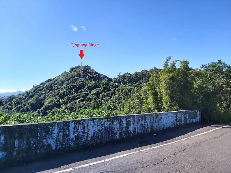
- Qinglonglin or Qinglong Ridge 青龍嶺, 256 meters (840 feet) above sea level.
- Mt. Dadong 大棟山, or 405 Highland 405高地, 405 meters (1,329 feet) above sea level, is located among Quishan of Taoyuan County, Shulin, Shanjia, and Yingge of New Taipei City. It's also the highest point on Linkou Mesa 林口台地. There is a Class 1 Triangulation Stone on the top. The views here are beautiful. You can see as far as Taipei 101 and Mt. Keelung. This is also a great spot to see Taipei Basin at night.

Personal Enjoyment
Things I Enjoy:
- The views on the trails are wonderful. My personal favorite is the saddle before Mt. Sanjiaopuding.
- There are several trailheads and different routes to enjoy this hike. You can hike to Mt. Datong and exit from there. You can also hike all the way to Sanjia or Yingge Railway Station and take the train back.
- You can extend this hike to Shanjia Railway Station or Yingge Railway Station.
-
The silver grass in autumn is phenomenal.
- Mt. Dadong is also famous for enjoying the stunning sunrise or Taipei City at night. My favorite spots to see the sunrises are Mt. Sanfu and Mt. Sanjiaopuding.
Thing I Don't Enjoy:
- Many concrete steps before reaching Mt. Sanfu. Too many.
- It can be very crowded on the trail.
- The hike is mixed with footpaths and roads. There might be many cars and scooters on the roads.
- It will be scorching hot in summer. I almost threw up when I hiked near noon in August.
Map/GPX Data
Date of Hike: Solo hike on August 22, 2021
Route map for Mt. Dadong, Mt. Sanjiaopuding And Mt. Sanfu by Anusha Lee on plotaroute.com
Click Menu in the map to download, print or share the map.
You can see more options after clicking Play button.
Click to change the speed to meet your condition.
You can see more options after clicking Play button.
Click
to change the speed to meet your condition.
How to Get There
Take MRT and get off at MRT Huilong Station. Take Exit 2 to the trailhead on foot.
About Mt. Dadong, Mt. Datong, and Other Peaks:
This hike is also a section of Taipei Skyline Trail. In addition, there
are several tourist attractions along this hike, and you can arrange your routes to visit those places.

About Arms Park, aka New Taipei City Military Cemetery:
If you start from the Huilong side, you will go through the steep steps before reaching New Taipei City Military Cemetery (Arms Park) 新北武器公園. You will find many old
fighter aircraft and tanks on both sides of the steps and more next to the shrine.
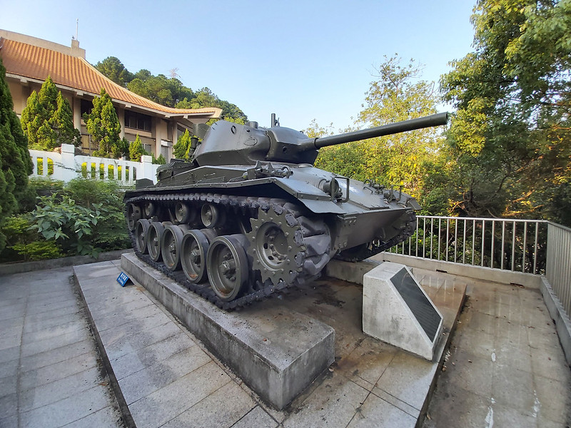
With the help of the Ministry of National Defense of Taiwan, New Taipei City displayed weaponry to make this
cemetery more accessible (less creepy, I guess) to the public.

About Mt. Dadong:
Mt. Dadong, aka 405 Highland 405 高地, is in Shulin District, New Taipei City.
There's a Class 1 Triangulation Stone and one of Xiao Baiyue (aka Little 100 Peaks) 小百岳 in Taiwan.

As you can guess, the height of Mt. Dadong is 405 meters (1,329 feet) above sea level. This peak can be accessed
on foot, by bicycle, scooter, or car. With the stunning grand view of Taipei and Taoyuan, this is a popular
place near Taipei City.
You will never get bored with Mt. Dadong Hiking Trail because there are many trailheads and routes you can do
here.

You can do out-and-back, point-to-point, or loop routes. You can even start at a different trailhead if you do
the point-to-point route.
About Shanjia Railway Station:
We can also do this hike from Huilong and end at Shanjia Railway Station 山佳火車站.
Shanjia Railway Station was built in 1901 and is a municipal heritage of New Taipei City now. So, if you end
your hike here, don't forget to check out this well-preserved train station and nearby park.

My Itinerary
Confessions to Make:
I've been to Mt. Dadong before, but I didn't know one of the trails was so close to my place. This trail is
close to my place, and I have lived here for more than 8 years when I wrote this post.
One of the reasons this trail was under my radar was the karaoke singing shops and trucks. Yes, there are trucks
loaded with karaoke machines to satisfy customers from everywhere. The terrible singing lingering all over the
hills just put me off.

I never thought of coming here again until we had a semi-lockdown in mid-May 2021. After doing the hike, I was
shocked by the time I'd wasted not exploring here more. Most importantly, I didn't hear too much karaoke singing
from here.
So, within 5 months, I did this trail 6 times. I wanted to do it all the way to Yingge and get to Mt.
Sanjiaopuding to see the sunrise. Someday.
Brief itinerary: Trailhead (New Taipei City Military Cemetery) ➔ Mt. Sanfu ➔ Mt.
Sanjiaopuding ➔ Shulin Rainfall Radar Station ➔ Qinglonglin ➔ Mt. Chengyuan ➔ Mt.
Qiutan ➔ Mt. Dadong
GPS coordinates of New Taipei City Military Cemetery: 25.013536, 121.409535
GPS coordinates of New Taipei City Military Cemetery: 25.013536, 121.409535
06:32 Arrived at Taiwan Cooperative Bank 合作金庫 at Zhongyi Street 忠義街. I did this
hike from my place. If you come from other locations, you can get to this bank from Exit 2 of MRT Huilong
Station. The distance is around 700 meters (0.44 miles).

06:36 Reached New Taipei City Military Cemetery and started taking the steps.
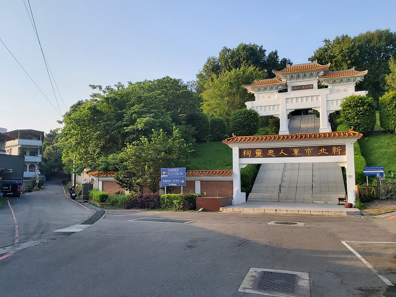
06:41 Reached Arms Park and took some photos here. Took the steps close to the
park.

06:50 Reached the signs of Datong Mountain Hiking Trail and New Taipei City
Military Cemetery.

06:52 Reached the junction to Lane 2 of Zhongyi Street 忠義街2巷. There's a
trailhead at this lane, which has become my favorite entrance to do this hike later.

This section is called Duofu Trail 多福步道, and it's made of concrete steps. You can also access Arms Park from
Duofu Trail.

07:00 Reached the junction to Guangming Industry Road 光明產業道路. I took a small
break to enjoy the views here. This is a popular spot for local people to hang out or do their morning exercise
routines. You can also ride a scooter from the military cemetery via Guangming Industry Road to here.


After this junction, I saw a funny hack to fix the broken handrail.

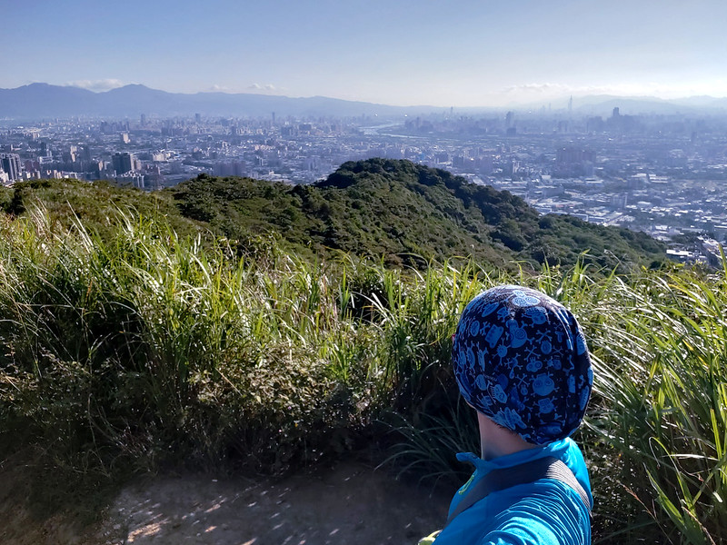
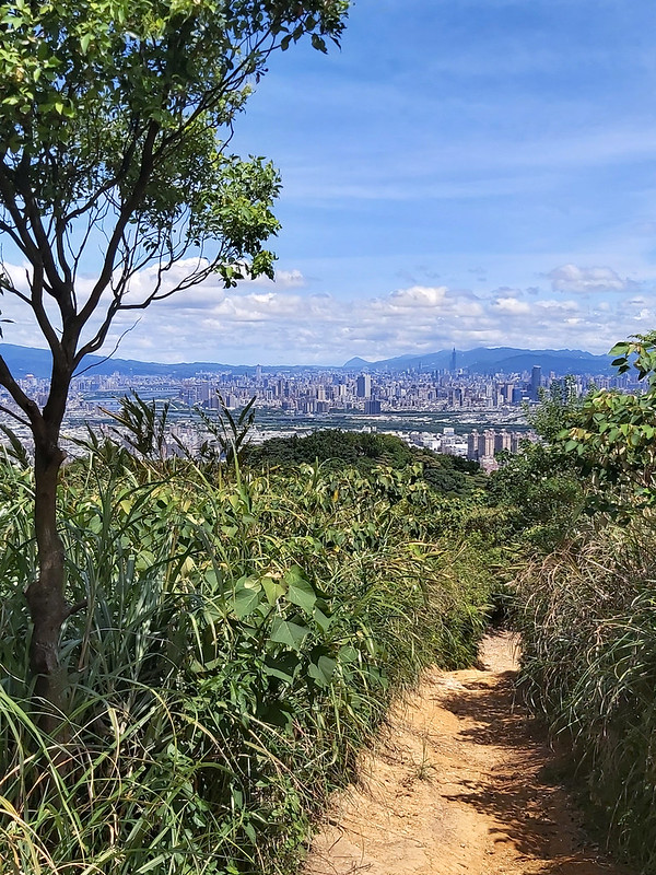
07:24 Reached the pavilion at Mt. Sanfu. This is a great spot to see many things
here.


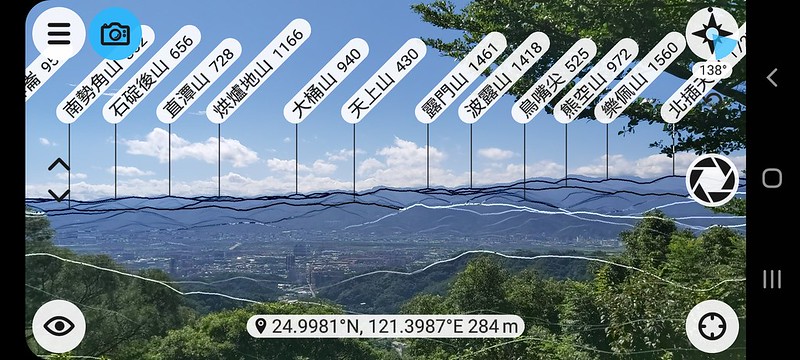
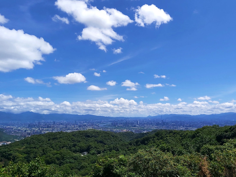
On the east side, I could see the whole Taipei Basin surrounded by Mt. Guanyin 觀音山, Mt. Datun 大屯山, Mt. Qixing 七星山 (the highest mountain in
Taipei City), and mountains in Nangang 南港. You can even see Mt. Keelung.
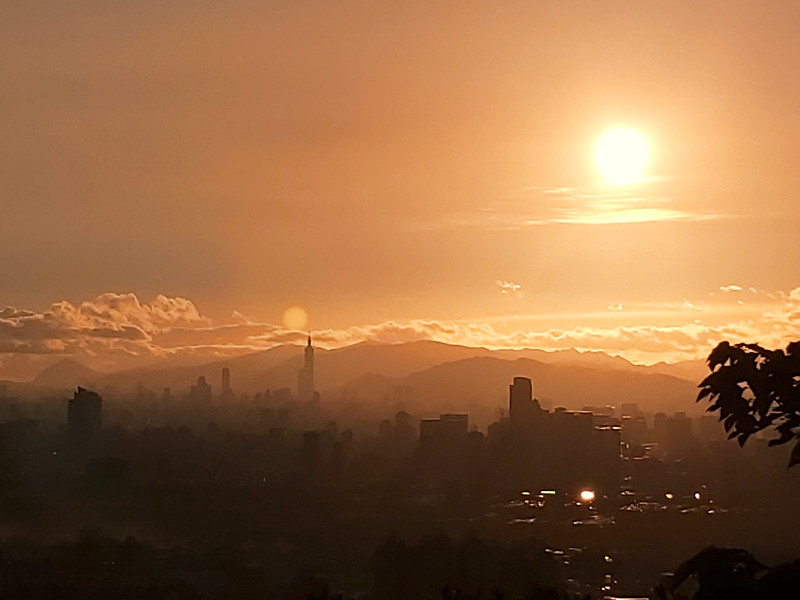
Of course, the tallest landmark in Taiwan, Taipei 101. Taipei 101 was the tallest building in
the world between 2004 and 2009.

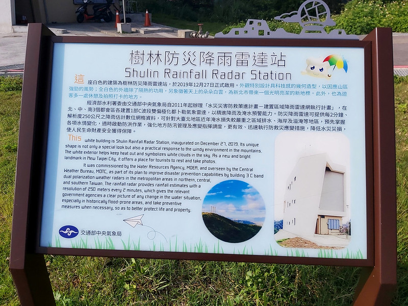
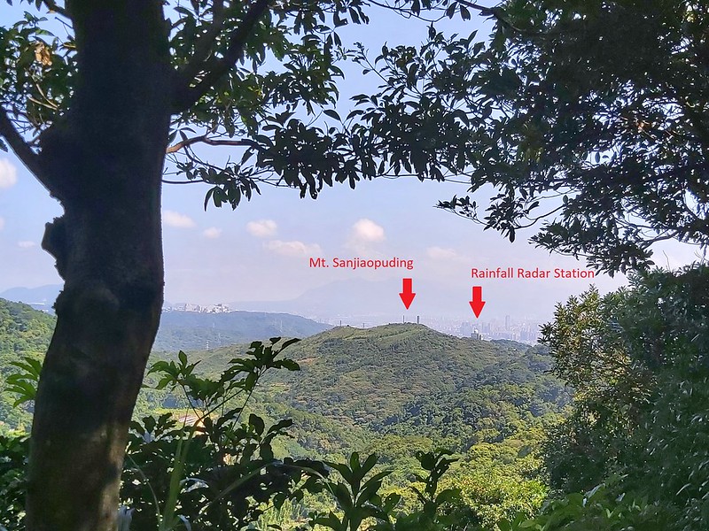
You will see more if you turn to the other side. On the southwest side through the trees, I saw Shulin Rainfall
Radar Station.

07:40 I left Mt. Sanfu and headed to Mt. Sanjiaopuding. While I was heading to
my next peak, the view on the south side opened up, which allowed me to see layers of mountains all the way from
Sanxia to Wulai. I've done done several hikes in Sanxia and Wulai.

Something worth Mentioning:
There is a shortcut from another much less known trailhead. Someone sprayed words on the pavement warning people
not to take this trail because it's private land.

I saw this shortcut on the map, and this section ended at Zhongshan Park 中山公園, very close to my place. On my 5th
hike here, I couldn't resist my curiosity and took this detour. This section was steeper with slightly overgrown
grass. Yet, it was still manageable.

When I descended from the slope, I saw a wide path, too nicely done to be a trail. I saw a guy ahead of me, so I
walked up to him and started a conversation. He was surprised to see me and then told me that the landlord had
closed the original trailhead. He offered to take me to an alternative trailhead used by the locals. I'm very
grateful for that.
The alternative trailhead was surrounded by small farmland. Although my curiosity has been satisfied, I won't
recommend you take this trailhead, even though this could save me at least 40 minutes to Mt. Sanjiaopuding.
Now back to my hike.
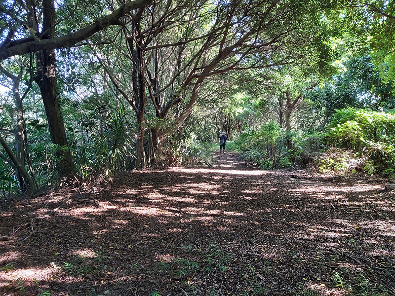
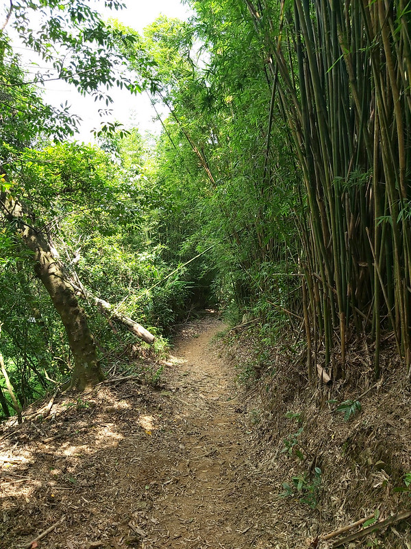
07:56 I reached a junction with a handwritten map attached to a tree. I followed
the map's instructions and headed to the dirt path. This dirt path could be muddy and slippery if it rains.

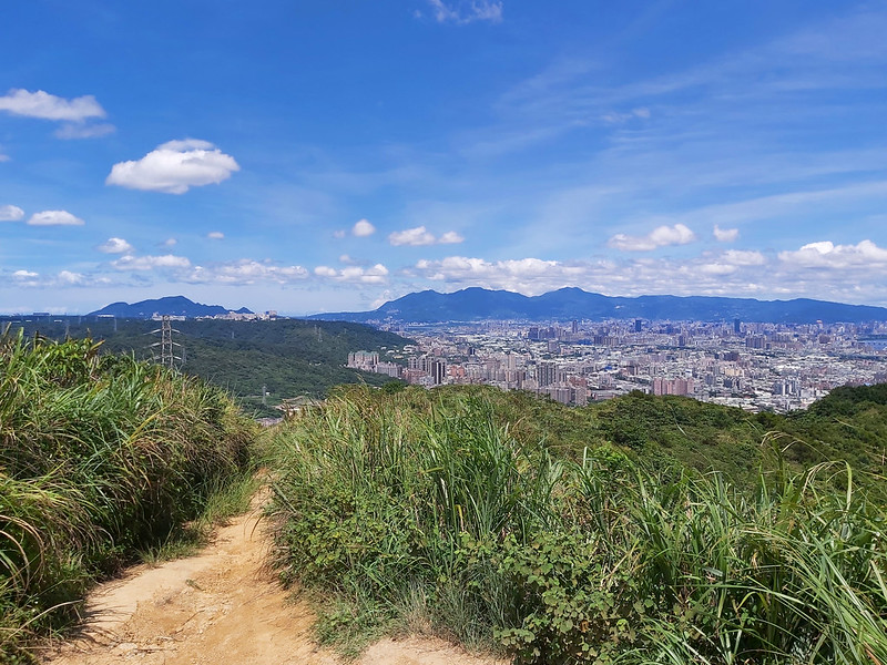
Before reaching Mt. Sanjiaopuding, there's an open area. This is my favorite place to admire the whole Taipei
view. This spot is even better than Mt. Sanfu. I plan to come here to see the sunrise someday.
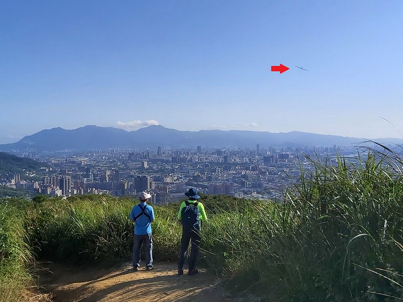
I ran into a guy enjoying his remote-controlled plane. I've seen him several times.
This might be a great place to see the fireworks on Taipei 101, but I am not a fan of fireworks after having
cats.
08:01 I reached Mt. Sanjiaopuding. There's a Class 3 Triangulation Stone under
the trees.

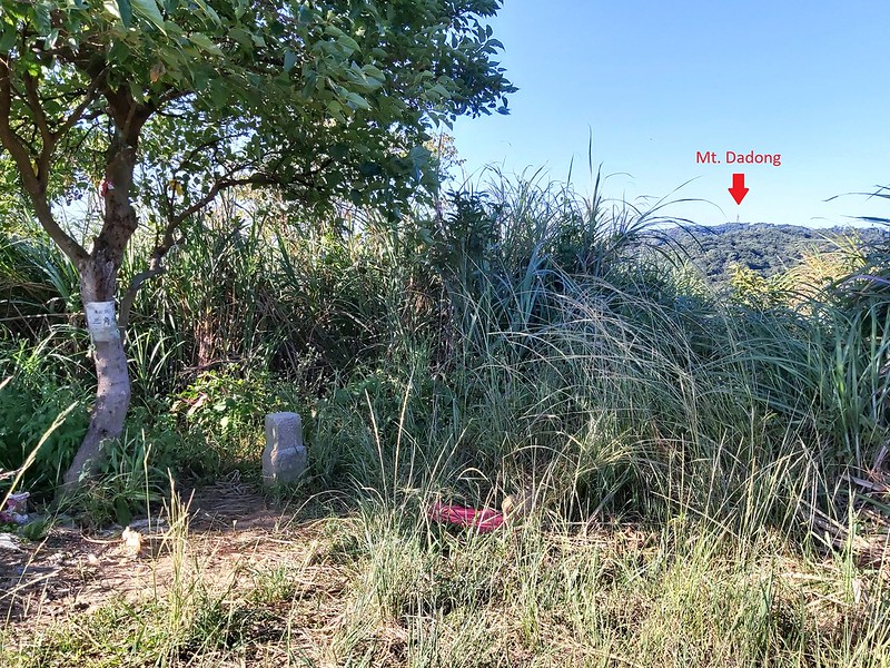
If you move to the north a few feet, you can see the radio tower on Mt. Dadong.
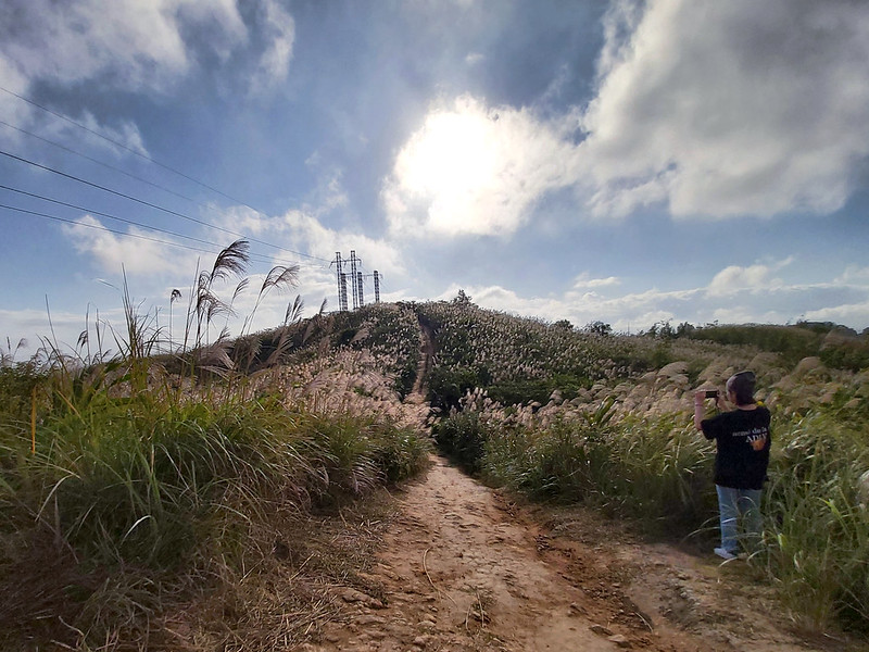
In late November or early December, the silver grass blossoms are stunning. I've lived in this place for more
than 8 years. I don't understand why I had missed this incredible trail in the past.

More silver grass under the sun. It was windy when I filmed those videos.
Silver grass time-lapse. pic.twitter.com/pssgH2GfZm
— Anusha Taiwan Hikes (@AnushaHiking) December 11, 2021
After Mt. Sanjiaopuding, you have two options. The first one is to get back to the junction with the handwritten
map and take the paved road to Qinglonglin.
However, I highly recommend the second one. If you step back a little bit on the trail to Mt. Sanjiaopuding, you
will see a small trail entrance.
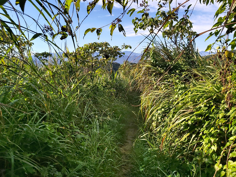
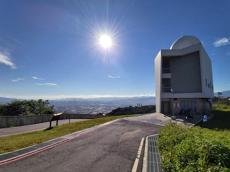
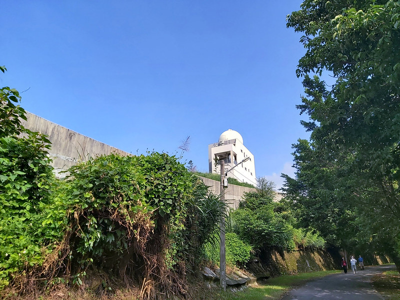
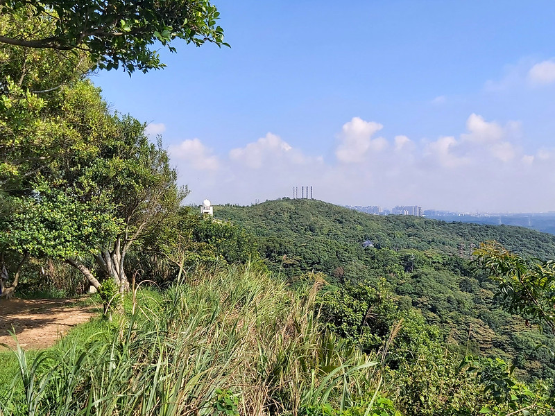
After exiting from the tall grass, you will soon see a white dome building, Shulin Rainfall Radar Station.
The views here are great. This is also a popular spot for cyclists to take a break and enjoy the view. I met a
cyclist from the Philippines, and we talked about the trail for a while.
If you return to the junction with the handwritten map, you still can take the minor road up to see the radar
station. It's just I think taking the small trail is easier.
08:27 After the radar station, I followed the road. There were more cars and
people here. Then, I saw an observation deck and decided to take a look.

Since this deck faced the same direction as the radar station, the views were the same. I saw maps of Datong
Mountain Trail Guide at a junction.
08:38 I reached a junction. The entrance to Qinglonglin is on the left up to the
hill. If you want to skip this peak, you can take the road and reach the market next to Qingde Temple 青德宮.

08:45 Reached Qinglonglin. This side was also facing Taipei Basin.

Shulin Rainfall Radar Station looked far from here.
08:50 Arrived at the market. You can find toilets here.

If you follow the steps going down, you will walk on Qinglonglin Hiking Trail and reach Mt. Datong. This trail
is popular among the locals as you can see.

08:57 I took the road and reached one of the two entrances to Mt. Dadong.
Another one was not far away from here.

08:59 I Saw a sign saying 480m/10 minutes to Qinglonglin, 2420m/60 minutes to
Mt. Dadong, 400m/1 minute to Guangming Forest Road.

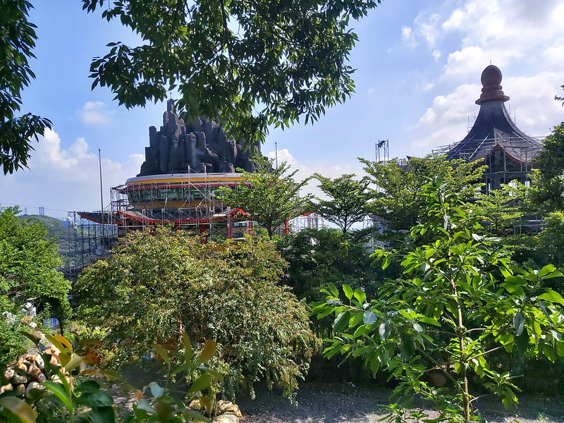
09:03 Passed a cemetery and a vast temple, Ling Shan Sheng Di Bei Ling Temple
靈山聖地北靈宮.
There are several detours here, but they all lead to the same destination, Mt. Dadong. I took this photo while
looking at the mountains from Wulai and Sanxia near a pavilion.
09:46 Arrived at Mt. Chengyuan 鎮遠山. I saw Shulin Radar Rainfall Station and Mt.
Sanjiaopuding through the trees.
10:02 Passed the sign to Donghe Street 東和街 500m.

10:17 Arrived at Mt. Qiutan 秋壇山. Nothing much to see here, and I even couldn't
make out it was a peak without the stone.

10:19 Arrived at the junction to Keebei Trail to Guangong Ridge 關公嶺基北步道, 1100m.
The rest trail was relatively flat from now.

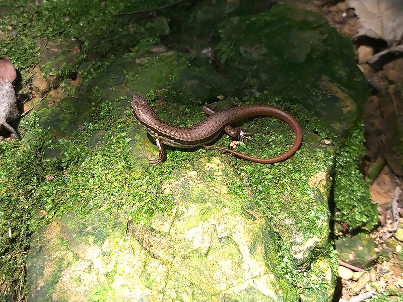
10:35 The weather was scorching hot when I did this hike in August. I stopped at
a place to catch my breath. While taking a break, I saw a beautiful skink 石龍子 bathing under the sun.
10:39 Reached Mt. Dadong, aka Highland 405 (it says Height 405 Triangulation
Point on the map). There is a Class 1 Triangulation Stone.

Besides the footpath, there is also a road for cars and scooters. This is also a popular destination for
cyclists.

If the weather is good, you can see as far as Mt. Keelung and Taipei 101 from here.
After reaching Mt. Dadong, you can take the same trail back to MRT Huilong Station...
Or Exit from Keebei Trail:
There are many trails around Mt. Dadong, and they are relatively easy to hike. I didn't take the same way back
or go to Yingge as I planned for my first hike. Instead, I took Keebei Trail to Guanggong Ridge.
The trail condition was easy to manage. Before I exited the woods, I passed a small hut and got lost here a
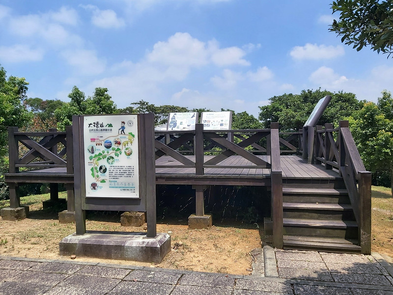
little bit.
When I exited the woods, I reached a road and saw a platform ahead. The views on the platform were great, but it
was too hot.
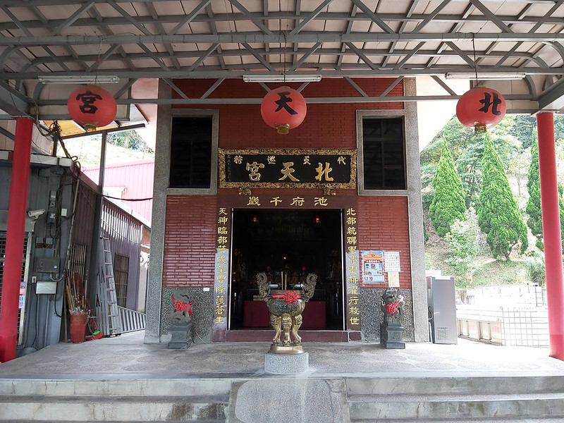
I followed the road and reached the steps. The rest was just walking on the steps, and I saw a big temple,
Beitian Temple, 北天宮.
Then, I continued to walk till I reached the bus stop. You need to know about the bus schedule here is it might
take another 2 hours for the next one to come if you miss it. I wasn't feeling well from the heat, and I got a
taxi and called it a day.
Or Hike All the Way to Yingge:
You can do this hike from Huilong to Yingge. I was planning to do this, but things and other plans always came
up. But I did do a minimal walk when I went to Yingge.

You can also do this hike from Yingge. The trailhead from the Yingge side is close to Yingge Train Station.
Yingge is famous for ceramics, and you can visit Yingge Old Street after your hike.
I hiked to Mt. Yinggeshi to see the beautiful sky during sunset.

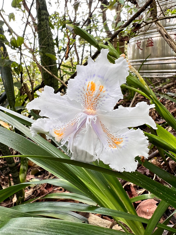
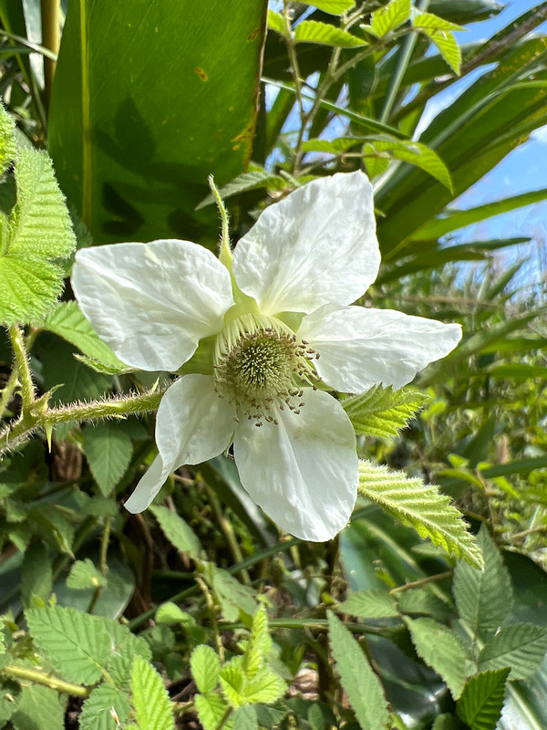
Some Wildflowers I found on This Hike
For more wildflowers I found on the trails, please visit Wildflowers on the Trails in Taiwan.