Tonghou River and Mt. Hongludi Hike: The Best Stream Trail to Escape Summer Heat in Taiwan
Tonghou River hike is my favorite place to visit in summer. You first hike to the most famous mountain in
Yilan, Mt. Hongludi, to enjoy the stunning views of eastern Taiwan. Then, you descend to Tonghou River,
sitting by the water to relax. If you want both epic mountains and a relaxing river, this hike is for you.


Table of Contents:
- About Tonghou River, Mt. Hongludi, and A Black Hawk Down
- How to Get There
- Peaks and Places to Reach
- Mt. Hongludi: 360° View of Yilan Plain and Mountains
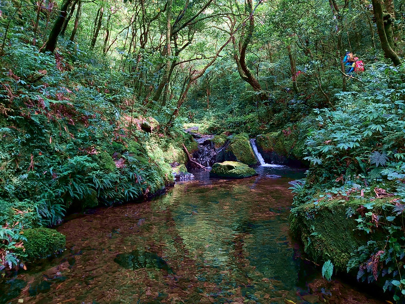
- Tonghou River: A Relaxing Beautiful Place to Go in Summer, Plus My Accident
- The Highlight of Tonghou River: I Finally Enjoyed the River
- Thoughts about This Hike: The Best Hike to Do with People Who Are Important to You
- Map and Itinerary
- Recommended Blogs and Resources
- Related Posts on Taiwan Hikes
About Tonghou River, Mt. Hongludi, and A Black Hawk Down
Tonghou River 桶後溪 is the largest branch of Nanshi River 南勢溪, and its river source
is from Mt. Hongludi 烘爐地山 with the height of 1,166 meters (3,825 feet), which is located in between the border
of Wulai, New Taipei City, and Jiaoxi, Yilan. Mt. Hongludi was also on our itinerary on this hike.
There is a historical trail called Tonghouyueling Trail (it actually means
Tonghou Crossing Historical Trail) 桶後越嶺古道, and this trail used to be one of the three Atayal people's
trails. Tong Hou in Chinese means behind the bucket. The bucket here refers to Mt. Datong, and I hiked Mt. Datong in April 2020.

The trailhead of Tonghouyueling Trail is in a very remote part of Wulai. I hiked there in July 2020 after it was open to the public, and the car ride to get to the trailhead
takes much longer than the time to finish the trail. Please note that this trail was closed in January 2021 due to some collapsed sections
of the trail.
Year 2020 was truly a difficult year. On January 2nd, one Black Hawk helicopter carrying several high-ranking
military officers suddenly crashed in the mountainous district of Wulai in New Taipei City. Of the 13
passengers and crew on board, 8 lost their lives, sadly including the Chief of the
General Staff Shen Yi-ming 沈一鳴. In order to rescue the passengers and retrieve the wreckage, the
military built several new dirt roads near the one to Tonghou River.

How to Get There
There is no public transport to get to the trailhead. You have to drive or hire a car to get there.
Peaks and Places to Reach
Mt. Hongludi: 烘爐地山, height 1,166 meters (3,825 feet). There is a Class One
Triangulation Stone, and you can see the 360° view on the peak.
Tonghou River: 桶後(后)溪. Tonghou River is the biggest tributary of Nanshi River 南勢溪 and her river basin covers the northeast Wulai in New Taipei
City. In Chinese, “tong” means bucket 桶, and “hou” means in the back or behind 後. This river flows behind Mt. Datong 大桶山 Tonghou River
originates from Mt. Hongludi.
Nanshi River: 南勢溪. Nanshi River originates from Songluo Lake 松羅湖, and the length of Nanshi River is 45 km (28 miles). Nanshi River is
also the major water source for northern Taiwan.
Mt. Hongludi: 360° View of Yilan Plain and Mountains
GPS coordinates of the trailhead: 24.8301892, 121.700955
It's near Wei-Shui Chiang Memorial Cemetery 蔣渭水之丘 and Yinghua Cemetery 櫻花陵園.
It's near Wei-Shui Chiang Memorial Cemetery 蔣渭水之丘 and Yinghua Cemetery 櫻花陵園.

I hiked this trail on July 21st, 2018 and I had a very scary accident which could end up ugly. Lucky for me,
I'm still here. After that, I have a new fear towards certain kind of trail terrains like sidehills and
heights. I'm glad that it didn't stop me from hiking and I always wanted to get back to Tonghou River to do it
properly. This post mainly focuses on my second hike, but I will put some photos from my first one.
I joined Dudu for this hike. As usual, we left Banqiao at 7:00 am and arrived at the parking lot near Wei-Shui
Chiang Memorial Cemetery around 9 am. We went to Wei-Shui Chiang Memorial Cemetery to take some photos and
returned to the dirt road.

New Dirt Trails to the Helicopter Crash Site
Because of the helicopter accident, the government dug new dirt roads to transport the helicopter remains.
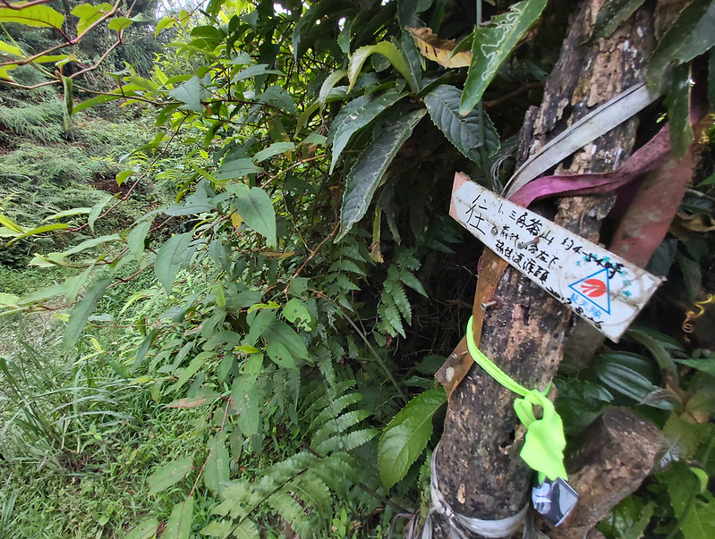
When we arrived at the real trailhead, which was also a junction of trails going to different mountains.
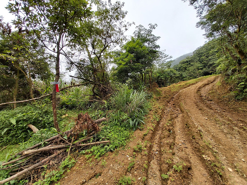
There were also many new signs telling you which trail will take you to which mountains. We waited here for a
while for the rest of our group to catch up. I actually can't remember what it was like when I first hiked
here in 2018.

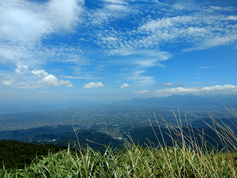
Wonderful View on Mt. Hongludi
It took us around 20 minutes from the real trailhead to the junction of two trails: the one going up to Mt.
Hongludi and the one going to Mt. Sanjiaolun 三角崙山. Part of the trail to Mt. Sanjiaolun was also overlapped
with the loop trail we were going to take later. Mt. Sanjiaolun is close to Marian Cabin Trail and you can
read Taiwan Trails and Tales' post for more
details.
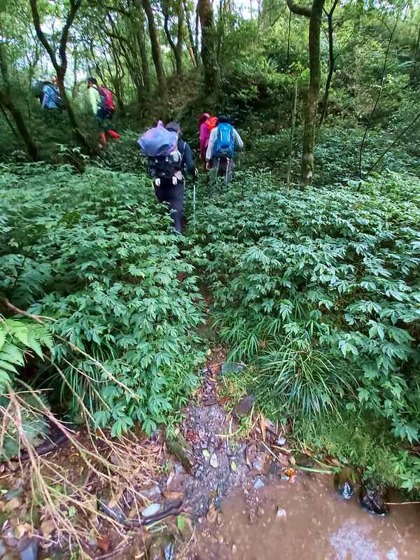
Our first peak to reach was Mt. Hongludi. We took the left trail that went all the way up. It was steep and
the weather was hot but cloudy. The grass on both sides of the trail was taller than most of us, and it was
like swimming in the grass when we were trying to get to Mt. Hongludi with hight of 1,166 meters (3,825 feet),
the highest point of our hike.

There was a Class 1 Triangulation Stone on the peak of Mt. Hongludi, but we couldn't see much because it was
cloudy.

But no worries, because I got better photos when I first hiked there in 2018. You could see Lanyang Plain (or
Yilan Plain) in the distance.

After everyone had taken enough photos, we went downhill. It was steep when we went up, and it was also steep
when we tried to descend. If it was raining, it would be very slippery to hike here.

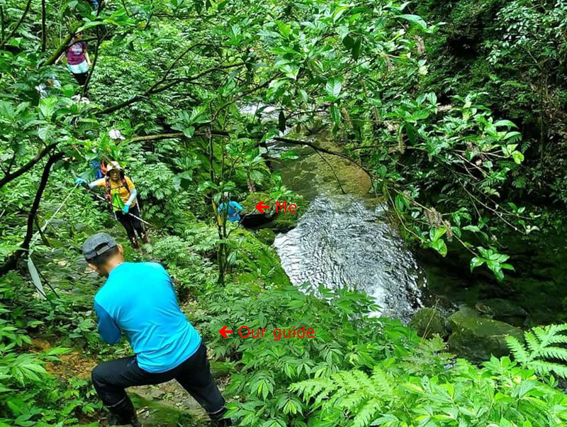
Tonghou River: A Relaxing Beautiful Place to Go in Summer. Plus My Accident
We stopped at a junction waiting for the rest of our hiking mates to catch up. I checked the signs at this
junction and there were three trails: one was where we came from, the second one went to Mt. Gupaoliao 姑婆寮山,
and the third went to Mt. Sanjiaolun.

Although I've been here before, I couldn't recall much about this junction and the woods from here. We walked
a little bit in the woods and then Tonghou River showed up. It was as beautiful as I could remember, and my
memory of that day also emerged. The fear was getting stronger and I had to let other hikers to go first.

How Did My Accident Happen
On July 21, 2018, I joined
Densanler 登山樂 to hike this trail. When we arrived at this slope, I was busy with
taking photos of the river. I remember I didn't stop to put my phone in my fanny bag, which was a mistake.
Then, when I was on the slope, I was too confident to make sure I had grabbed the rope on the slope properly
before moving my feet forward. Before I knew it, I found myself losing my footing. When I slipped, the only
thing I could do was trying to grab anything frantically, but I got nothing. At that moment, I said to myself:
ok, that's it. I stopped struggling and waiting for the end to come.
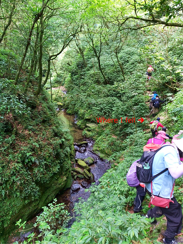
What happened next was I landed on the riverbank on my left side so hard that the air was squeezed out of my
lungs. It also hurt so much that I even couldn't scream or breathe. I could hear other hikers behind me
screaming in horror and yelling: she's not moving, she's not moving. I murmured to myself thinking of course I
wasn't moving. It hurt too much.
After lying on the cold riverbank for a while, I felt the air came back to my lungs and I unbuckled the chest
and hip belts of my backpack to release myself. I slowly stood up, checking myself to see whether I broke
anything. Surprisingly, I was feeling ok. I didn't think I break my bones or hit my head. Then, something
caught my attention, the river.
I Survived and Took the Most Beautiful Photo on this Hike
While I was checking myself, it was difficult not to look at the beautiful Tonghou River and I wanted to take
photos of what I saw. I hesitated for one second but still took out my phone (it wasn't broken, either), and
snapped this shot.

Our guide and other hikers got down to help me. Our guide asked me how I was doing, and I told him that I was
doing okay, hurt, of course, but okay. He told me that he was worried sick when other hikers told him someone
fell and thought he was going to call 112 for help. He also said I fell off 5 or 6 meters, which was about 2
floors. After making sure I was okay, he asked a male hiker to keep me company, and I finished the rest of the
hike.
By the time, I got back to Taipei and checked myself in at the emergency room of the hospital near my place,
it was already 9 pm. The doctor said it's been 10 hours and he thought I was doing fine.
Made it Home in One Piece and Got Only Nasty Bruises. Warning: Graphic Image
When I got home and took a shower, this was what I saw, and I didn't even have any big scrape.
It seems I bumped against the slope hard on the back of my right thigh, but I couldn't remember what was going
on before I landed. The more I thought about the accident, the scarier scenoriors popped up. I even didn't
break my gear. I was extremely lucky.

When I reflected what happened later, I think I made several mistakes. The biggest one is I was too confident.
I didn't make sure I was secured before I made the next move and I wanted to pass the slope as soon as I
could. After this accident, I have a fear when passing the sidehill, but I learn to go with the fear as much
as I can. My back still feels weird sometimes. So, stay humble, be cautious, and there's no need to be in a
rush on the trails. Those are the lessons I learn from this accident.
The Highlight of Tonghou River: I Finally Enjoyed the River
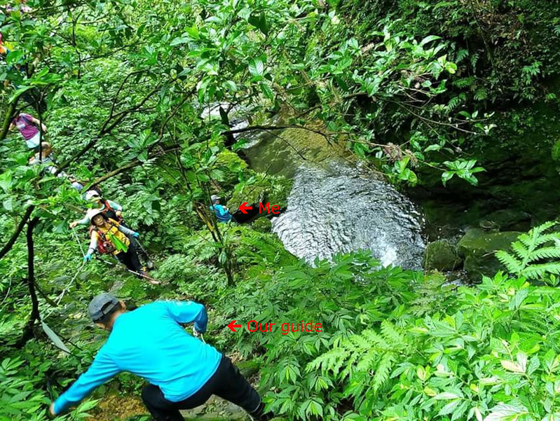
Back to my second hike, when it was my turn to pass the slope, the memory came back, which wasn't a surprise.
But this time I made sure I had grabbed the rope tightly and put my feet steadily before I moved. Within a few
minutes, I crossed the slope and reached to a wider trail section. It was not too bad. How come I didn't do it
properly two years ago?

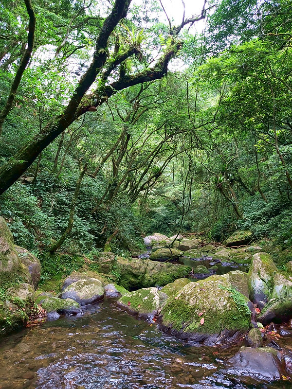
Now, I made it safe on my second attempt, and I could truly enjoy this river. There were schools of fish and
shrimps in the river. It was so relaxing to watch the water and the trees around us. Our guides even carried
home-made iced boba to let us enjoy in a hot summer day like this.
The Beauty of Tonghou River
I wore rainboots for this hike, but I forgot to bring a pair of sandals with me.

I stood in the river looking around, thinking it would be wonderful to visit here every summer or stay here
much longer. But we still had to get back to our bus. I reluctantly pack my backpack and continued the hike.
The Woods Turned into A Mystic World
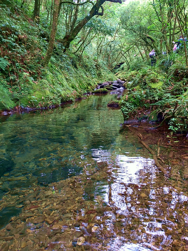
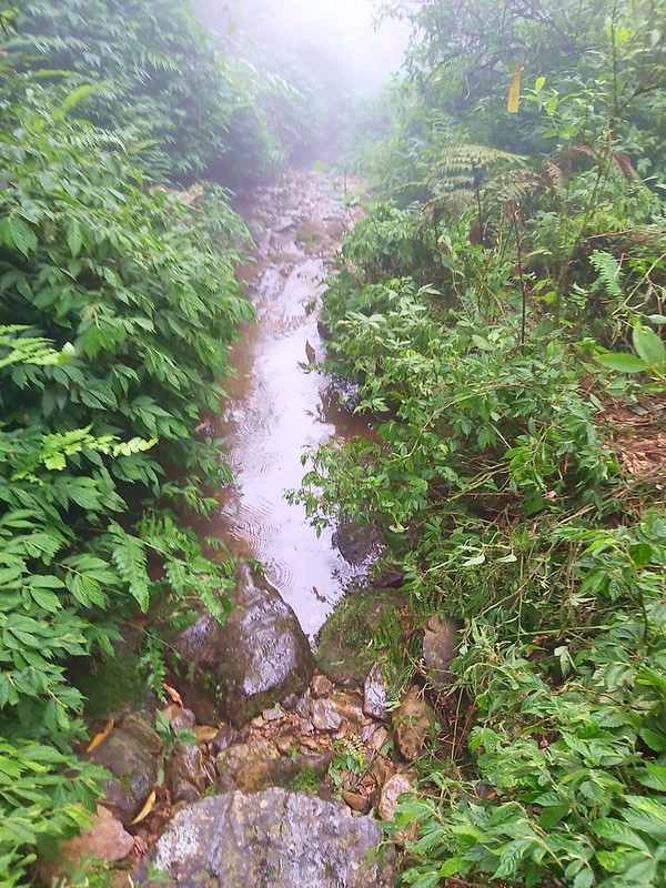
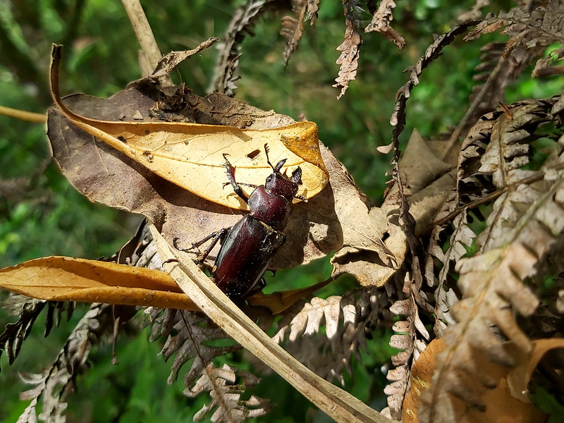
Although we couldn't stay here long, the rest of the hike was wonderful. The clean water and the vibrant
jungle landscape made Tonglou River source hike even better.

I took many photos along the river, trying to make up what I lost from my previous hike.

Then we turned to a small hill and the trail went up. Our guides told us that we were getting closer to the
river source.
Suddenly, Tonglou River decided to give us a different vibe and we were surrounded by mist.
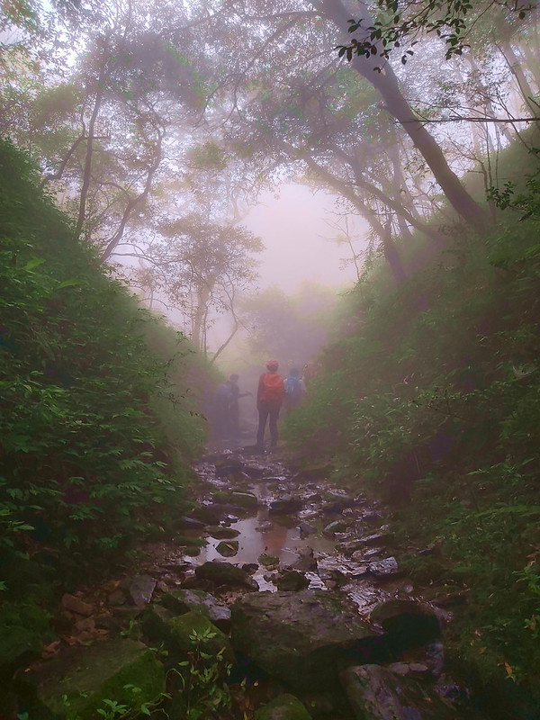
Just following the water, we reached the end of the river. I was in awe to see this tiny pool of water was the
beginning of raging rivers, the oceans, the life and everything.
A Bonus: Partial Solar Eclipse
We made a loop back to the junction before going to Mt. Hongludi, and took the same trail back to the parking
lot around 4 pm. While waiting for our bus to arrive, the sky was suddenly getting dark, which was weird. It
was too early for sunset to come, but we remembered why.
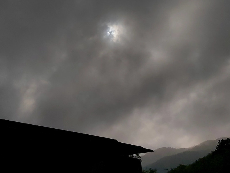
There was a good reason for it. We had
a solar eclipse on that day. Many people in Taipei
could see the total eclipse, but I was happy enough to see the partial one and called it a day. After all, I
got to finish this hike safely, so the partial solar eclipse was a bonus.
Thoughts about This Hike: The Best Hike to Do with People Who Are Important to You
There are so many hiking trails in Taiwan, and I don't think I can get to do 1/10 of them in my lifetime.
However, among so many trails, there are still some that make me want to come back again and again, and this
is one of them.
In my humble opinion, Tonghou River source hike is ideal to hike to do in summer with people who are special
to you, like your partners or your close friends, etc., if they also enjoy hiking. Imagine sitting quietly
with people you care by Tonghou River and watching the water going into the deep woods, forget about the heat
and other things, and just enjoy the pure moments. It's definitely a great getaway to refresh yourself.
However, due to the lack of public transport, it's better to arrange your own transportation to get there,
either driving a car or renting one or a scooter in Jiaoxi or Yilan.
If you are in Taiwan, how do you cope with the summer heat? What do you think about this trail? Please leave
comments below. Don't forget to subscribe to newsletters to know more about the exciting trails in Taiwan.
Map and Itinerary
Group Hike or Solo Hike: Group hike with Dudu
Date of Hike: June 21, 2020
Date of Hike: June 21, 2020
Click Menu in the map to download, print or share the map.
Click to change the speed to meet
your condition.
to change the speed to meet
your condition.
Note:
My GPS track may not be totally accurate and is for reference only.
Click
to change the speed to meet
your condition.Note:
My GPS track may not be totally accurate and is for reference only.
Based on my hike on June 21, 2020
07:00
Left Banqiao
08:47
Arrived at Wei-Shui Chiang Memorial Cemetery
09:06
Reached the real trailhead and waited up other hikers
09:40
Resumed the hike
09:59
Reached the junction to Mt. Sanjiaolun and Mt. Hongludi
10:20
Reached the junction to Mt. Houludi and the new dirt trail to the
crash site
10:40
Resumed the hike
10:49
Arrived at the peak of Mt. Hongludi and took a 10-minute
break
11:49
Arrived at the junction to Mt. Gupaoliao and Tonghou River and
took another 10-minute break
12:03
Reached the slope where I fell in 2018
12:15
Arrived at the river and had a lunch break
13:30
Resumed the hike and walked along the river
14:41
Clumbed up a small hill
14:47
Reached the end of Tonghou River
15:07
Back the junction with trails to Mt. Hongludi and Mt.
Sanjialun
15:35
Exited the trail and went to the parking lot to waited for our
bus
16:08
Saw the partial eclipse
Total time:
7 hours 38 minutes, including long breaks