Stone Lion Mountain, Stone Elephant Mountain, and 100-year-old Sticky Rice Bridge in Keelung
Mt. Shishi (aka Stone Lion Mountain) and Mt. Shixiang (aka Stone Elephant Mountain) are famous for their
relaxing hike and stunning views in Keelung. First, you will cross the unique 100-year-old sticky rice bridge
when you start. Below the bridge, there are impressive rock formations in the Malingkeng River. Then, to spice
things up, you can hike further to Mt. Kangkou to enjoy the almost steep climbing and incredible mountain
landscape in northern Taiwan.
This trail is also a great example that you can't tell what the trail terrains in Taiwan look like by the
topography maps. From the map, this trail is easy, and those peaks aren't tall at all. However, the
up-and-down hills will kick your butt.

Table of Contents:
Trail Information of Mt. Shishi, Mt. Shixiang, and Others
Trail Name: Mt. Shishi 石獅山, Mt. Shixiang 石象山, Mt. Zhongbu 中埔山, and Mt. Gangkou
港口山 Trail
Distance: 10.5 km (6.54 miles)
Route type: Return trail
Days/Hours Needed: 7 to 8 hours
Total Ascent/Descent: 246 m/259 m
Best Time to Go: All year-round, but it can be scorching in summer
Permits: Not required
Difficulty Level:
Peaks to Reach:
Distance: 10.5 km (6.54 miles)
Route type: Return trail
Days/Hours Needed: 7 to 8 hours
Total Ascent/Descent: 246 m/259 m
Best Time to Go: All year-round, but it can be scorching in summer
Permits: Not required
Difficulty Level:
Peaks to Reach:
- Mt. Shishi (Stone Lion Mountain) 石獅山: 160 meters (525 feet). The views on the peak are delightful. You can see the three bridges, Formosa Highway and the mountains.
- Mt. Shixiang (Stone Elephant Mountain) 石象山: 135 meters (443 feet). Nothing much to see.
- Mt. Zhongbu 中埔山: 170 meters (558 feet). This peak is hidden in the trees.
- Mt. Zhongbu East Peak 中埔山東峰: 165 meters (541 feet). There's nothing much to see on this peak. However, if you follow the trail on the east, the landscape will open up, and you get to see some views.
- Mt. Gangkou 港口山: 193 meters (633 feet). There are two triangulation stones on the peak. You can see Mt. Keelung, Mt. Canguanliao, Mt. Teapot, and other mountains in Ruifang.
- Most sections of this trail are covered by trees and shaded. But when I was doing this hike in September, it was hot like summer. My smartphone was overheated and wouldn't let me take any photos on the peaks. Like other trails in Taiwan, the weather can be sweltering and humid when you go in summer.
- If you want to do Mt. Gangkou, please bring a pair of gloves with you. You'll need to do some climbing when trying to get to the peak.
- There's a Fuyang Eco Park 富陽自然生態公園, which is only 5 minutes from MRT Linguang Station in Taipei City. If you visit here, you will find Mt. Zhongbu and Mt. Zhongbu East Park near this park, too.
Personal Enjoyment
Things I Enjoy
- The views! The views I saw on Mt. Shishi and Mt. Gangkou are amazing! I got to see views from the Keelung side on Mt. Shishi and the Ruifang side on Mt. Gangkou. Seeing Mt. Keelung, Mt. Canguanliao, and Mt. Teapot from different places always makes me excited.
- The century-old sticky rice bridge, Maxi Sticky Rice Bridge. There are several old rice bridges in Taiwan. I'm thrilled to see this one.
-
The potholes in the riverbed of Malingkeng River. Other than Maokong potholes, there are more in upstream of
Keelung River. I'm amazed by how the swirled motions of the water can cause such a mind-blowing landscape in
the river.

- The flexibility to adjust the route to hike. You don't have to do all the peaks as I did. You can only visit Mt. Shishi and Mt. Shixiang and return to the sticky rice bridge.
- This hike can be relaxing and easy, too. If I get a chance to do this hike again, here's how I will do it. First, I will take some time to enjoy Maxi Sticky Rice Bridge and the potholes in the Malingkeng River. Then, I will take the more accessible trailhead on Dacheng Street to Mt. Shishi if the other trailhead is still covered by overgrown grass. After that, I might visit Yeshan Recreational Medicinal Herb Farm if it is open.
-
Qidu markets. I visited the Qidu Market after my previous hike in Qidu. You will find many cheap but
delicious local foods there. Before Level 3 was issued, I had a sandwich with fried bread, 七堵家傳營養三明治. I will say it tastes ok, but it's
cheap, NT$35 (US$1.26, 1.06 Euros) for one, and NT$100 (US$3.6, 3.02 Euros) for 3. It's not bad to have a
quick bite after a day hike.
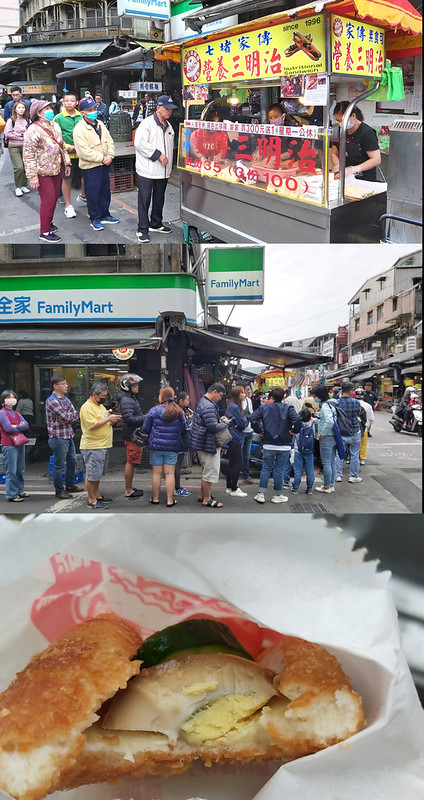
Although the queue looked long, we only waited around 10 minutes to get our sandwiches.
The Things I Don't Enjoy
- As I mentioned in my previous posts, many wonderful volunteers help clean up the hiking trails in Taiwan. Without their help, traversing on the terrains will be more challenging. My hike on this one is an example.
- In mid-May 2021, Taiwan entered Level Three, the semi-lockdown due to Covid-19 outbreaks. All non-essential activities almost stopped. Then, nature claimed the mountains back. The trail to Mt. Shishi and Mt. Shixiang was no exception.
- It was predictable that the grass and trees would be overgrown. Yet, the volume still caught me off guard. I found a hiker's post who did the hike one week before Level Three, and it is a sharp contrast to the things I saw 4 months later.
- It's too hot to hike in summer.
I'm not sure the trail was cleaned up by the time I wrote this post. So, if you want to do this hike, please
prepare extra time to hike and proper clothing.
Map/GPX Data
Date of Hike: Solo hike on September 19, 2021
Route map for Shishi And Shixiang Mountain In Keelung by Anusha Lee on plotaroute.com
Click Menu in the map to download, print or share the map.
You can see more options after clicking Play button.
Click to change the speed to meet your condition.
You can see more options after clicking Play button.
Click
to change the speed to meet your condition.
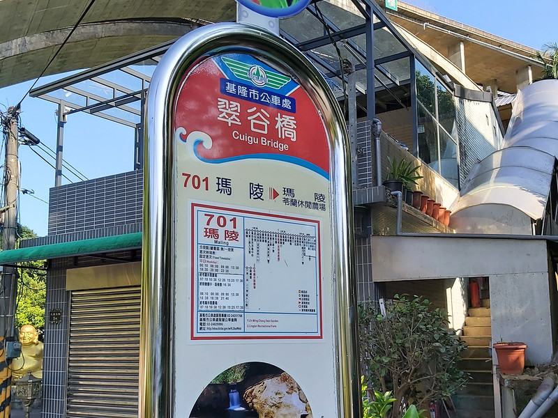
How to Get There
Take Keelung Bus 701 to Maling at the bus stop in front of Qidu Post Office. You can take the train to Qidu Train Station and walk to the
post office.
About Mt. Shishi, Mt. Shixiang, Sticky Rice Bridge, River Potholes, and More
After doing a trial in Qidu a while ago, I heard the zealous bus driver sharing this trail, Mt. Shishi and Mt.
Shixiang, with several passengers in the bus. The bus driver said this trail was straightforward and relaxing,
and the views were superb. He was almost right.
Mt. Shishi and Mt. Shixiang
You can guess how those names came from their Chinese names, Stone Lion Mountain and Stone Elephant Mountain. I
couldn't relate to the lion and the elephant when I was there. What do you think?
Please don't confuse Stone Elephant Mountain with Elephant Mountain in Taipei City.
If you take the easier trailhead, you will see a sign with a brief history about Mt. Shishi.
According to the sign, a couple, Mr. and Mts. Lee, built a house on the hill to avoid the shelling in wartime.
After they passed away, rumors said they got devoured by the stone lion. Therefore, nobody dared to move into
their house or go into the mountain.
Until one day, a thunder struck right into the stone lion's face, which ended up a huge boulder. The locals
believed the man-eating lion was struck to death. Therefore, the locals lived peacefully.
There was no hiking trail to Mt. Shishi. So, in 2003, the village chief, Mt. Su, took a group of volunteers to
clean up the track.
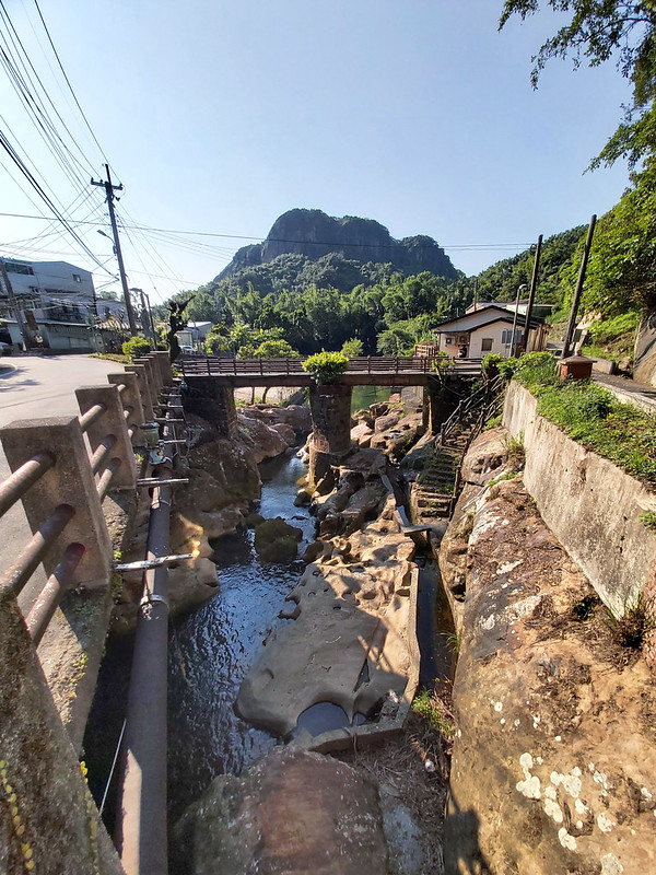
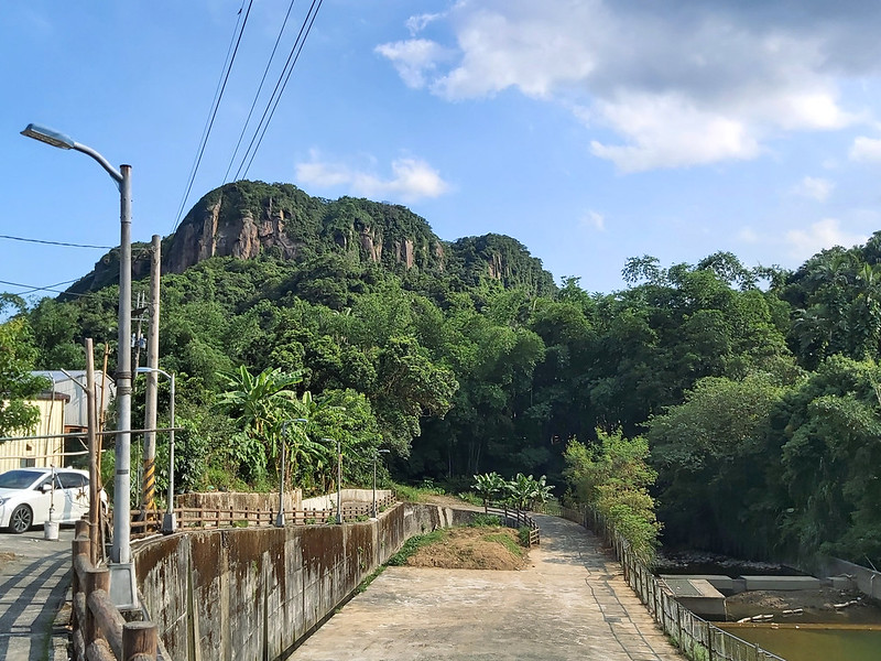
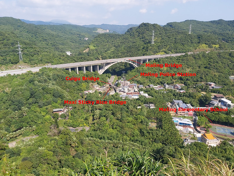
3 Brides: Maxi Sticky Rice Bridge, Cuigu Bridge, and Maling Bridge
The most special one is Maxi Sticky Rice Bridge. It is said that this bridge is over 100 years old, but I can't
find the exact year when it was built. As you can guess from its name, the villagers in the old days took
glutinous rice mixed with red lime, brown sugar, and other materials to hold the stone blocks together.

Why did they use the sticky rice to hold the bridge? Because life at that time was harsh, and the villagers
didn't have money to buy proper materials to build the bridge.
Years went by, and the sticky rice bridge became a landmark. The local government has rebuilt the pavement on
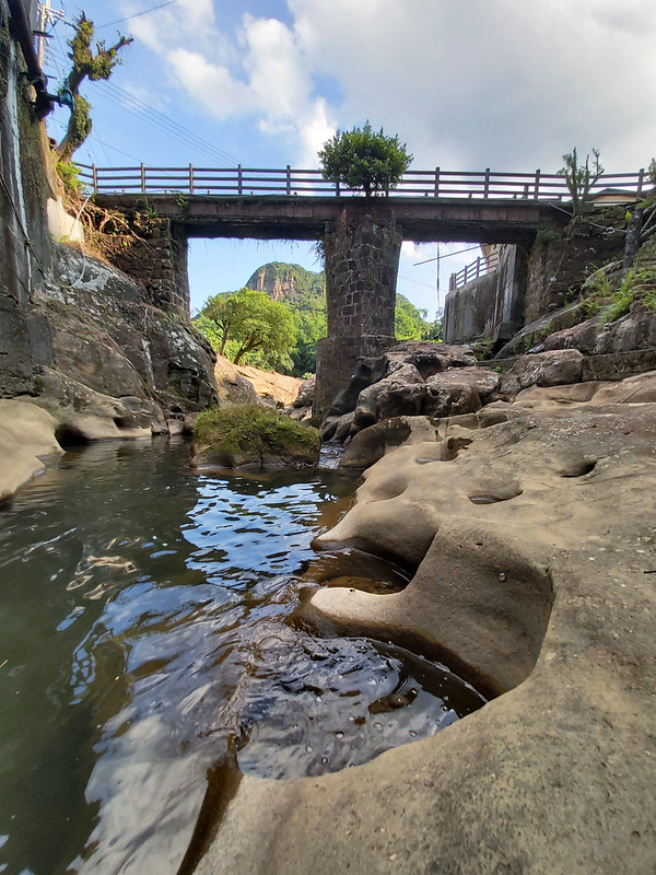
the top. Luckily, we still can see the hexagonal pier standing in the Malingkeng River along with the potholes.
The remarkable thing is the hexagonal pier withstands numerous typhoons and is still standing strong.
Next to Malingkeng is Wudu Canal 五堵圳, built for irrigation purposes. This canal is relatively short. There is a
sign to commemorate this way of life in the old days.
Cuigu Bridge, literally meaning emerald valley bridge, is above Malingkeng River and connects two villages on
both sides.

Maling Bridge is the landmark bridge of National Freeway
3 國道三號 (aka Formosa Freeway) in this area. It's 60 meters above the ground and connects two hills like a
rainbow. The length of the northbound highway is 445 meters, and the southbound is 345 meters.
You can see those bridges from Mt. Shishi.
Malingkeng River and Potholes in the Riverbed 瑪陵坑溪及壺穴
Another thing worth paying a visit to is the potholes in the river. Potholes here are the "smooth, bowl-shaped
or cylindrical hollow, generally deeper than wide, found carved into the rocky bed of a watercourse" according
to Wikipedia. You will find many of them on upstream of the Keelung River. The most
famous one is Dahua Potholes 大華壺穴, scattering on the section of Keelung River between Dahua Train Station and
Sandiaoling Train Station.
My Itinerary
Brief itinerary: Trailhead ➔ Mt. Shish ➔ Mt. Shixiang ➔ Mt. Zhongbu ➔ Mt.
Zhongbu East Peak ➔ Mt. Zhongbu ➔ Mt. Gangkou ➔ Mt. Zhongbu ➔ Dacheng Street
➔ trailhead
GPS coordinates of the trailhead I took: 25.108738, 121.687600
GPS coordinates of another trailhead: 25.107330, 121.686527
GPS coordinates of the trailhead I took: 25.108738, 121.687600
GPS coordinates of another trailhead: 25.107330, 121.686527
08:00 Took Keelung Bus 701 at Qidu Post Office Stop.
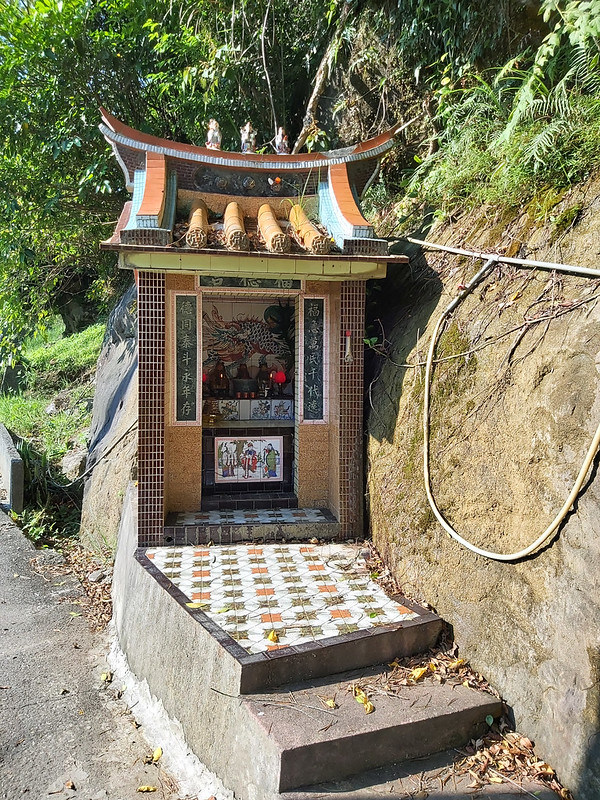
08:12 Got off at Cuigu Bridge Stop. I spend some time taking photos of the small
Fude Temple (the earth god temple), Maxi Sticky Rice Bridge, and the unique potholes in the river. There was
another Fude Temple nearby, but I didn't go there.
08:25 Went across the sticky rice bridge to start my hike.

08:29 I saw a roadblock, but my GPS told me to take this way. I later know this
is Yeshan Recreational Medicinal Herb Farm.
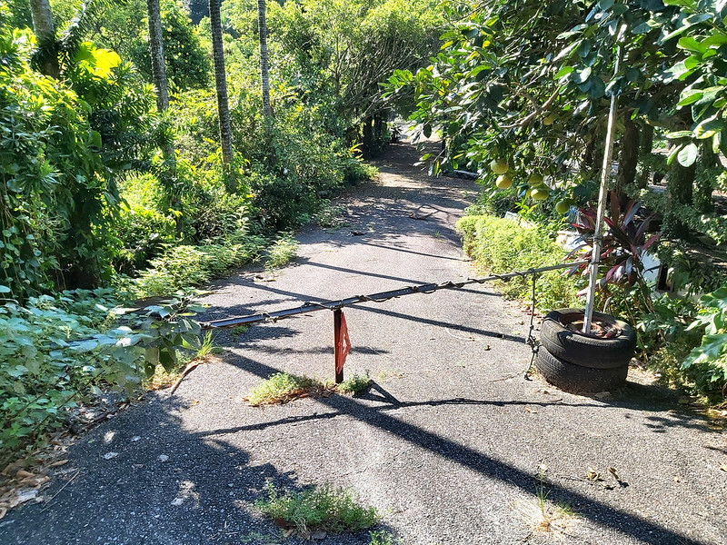
According to the Keelung Government travel website, the master of this farm has collected 1,700 kinds of medical
herbs over the past 4 decades from 5 continents. So, if you are interested in herbs, this might be the place for
you to visit.

While finding the trailhead, I saw a beautiful small pond.

08:34 Went through the gate and found the trailhead. I met a hiker when I was
trying to go through the gate. He was surprised to see me and thought I had got lost. He offered to take me to
another trailhead and hike with me. I declined. I really wanted to do the hike by myself.


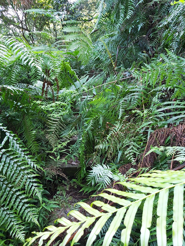
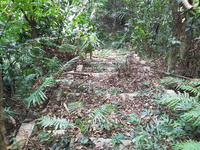
After the hiker left, I took the narrow steps going up. Those steps were almost covered by overgrown grass and
plants. The Level 3 semi-lockdown in Taiwan did make it more challenging to hike. The overgrown grass made me
nearly miss a step. Please proceed with caution. You can see what the trail was like right before Level 3.
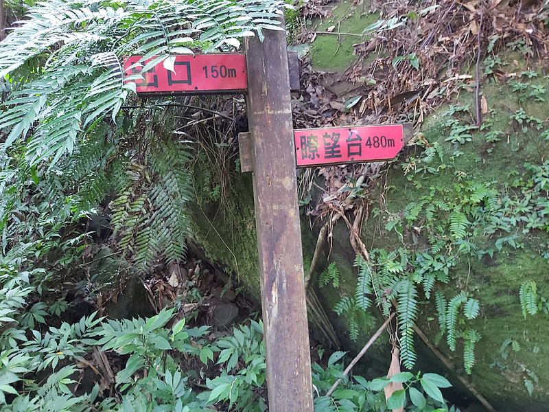
08:40 Saw a sigh saying to the Exit 150 m and Lookout 480 m.
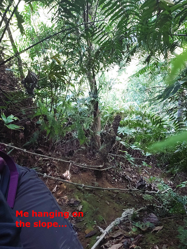
08:49 Reached a slope with ropes.

08:53 Saw signs to Yeshan Recreational Medical Herb Farm (pointing to the left)
and Mt. Shishi (pointing to the right).
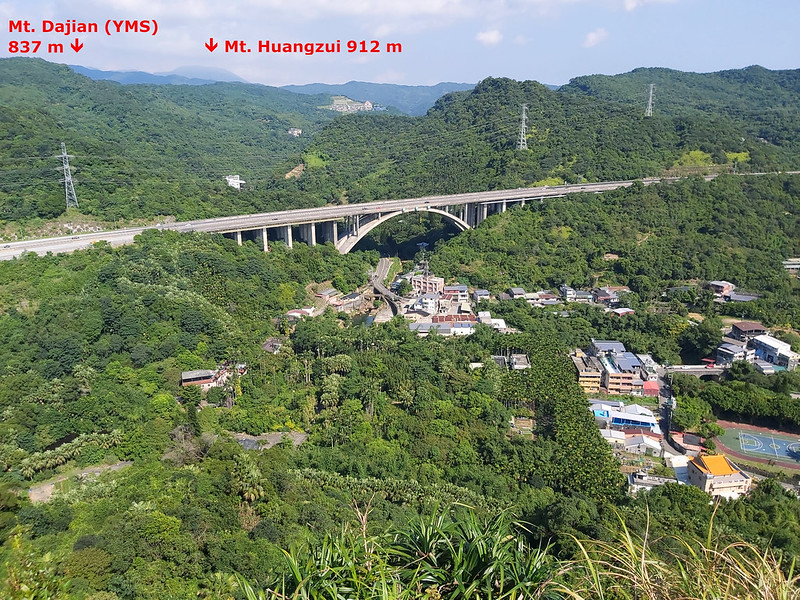
09:00 Reached Mt. Shishi. The views were fantastic. I could see the rice bridge
and the river. I could also see Mt. Huangzui 磺嘴山 (912
meters/2,992 feet) and Malingjian (aka Maling Peak) 瑪陵尖. Mt. Huangzui is the ecological protected area at
Yangmingshan National Park.


09:34 Got to the junction with a sign saying to Lookout 350 m. I am not sure the
lookout here meant Mt. Shishi, but I guess it was.

09:34 I also saw shortcut on the map pointing to Mt. Shixiang, but it looked
more challenging. So, I took the longer route.

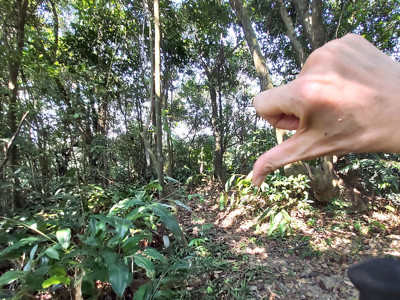
I saw some tiny, cute flowers on the trail, so I stayed here for a while to take photos of them. Unfortunately,
my smartphone couldn't take close-up images. Those are blurred.


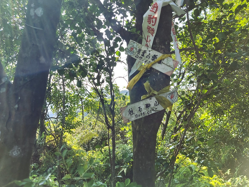
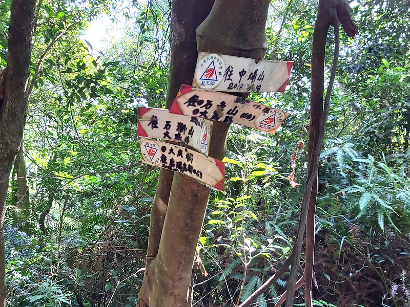
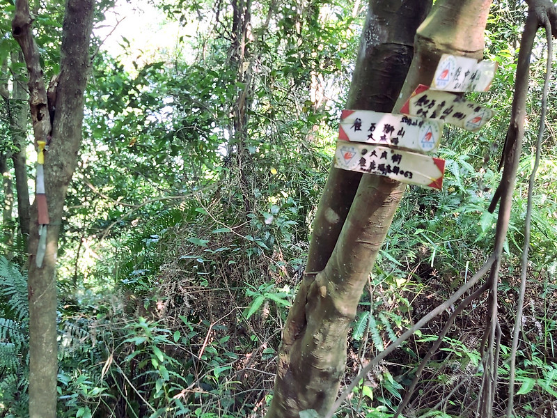
09:51 Saw hand-written signs to Mt. Zhongbu, Mt. Shixiang, Mt. Shishi, and
Dacheng Street.
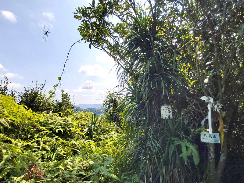
10:00 Arrived at Mt. Shixiang. There wasn't much to see here, so I quickly left.
While returning, I took a wrong turn, and it took me a while to get back to my track.
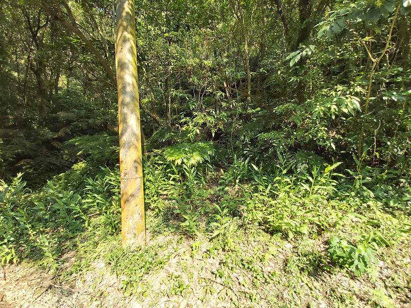
10:22 I could see Mt. Zhongbu and the power tower from the trail.
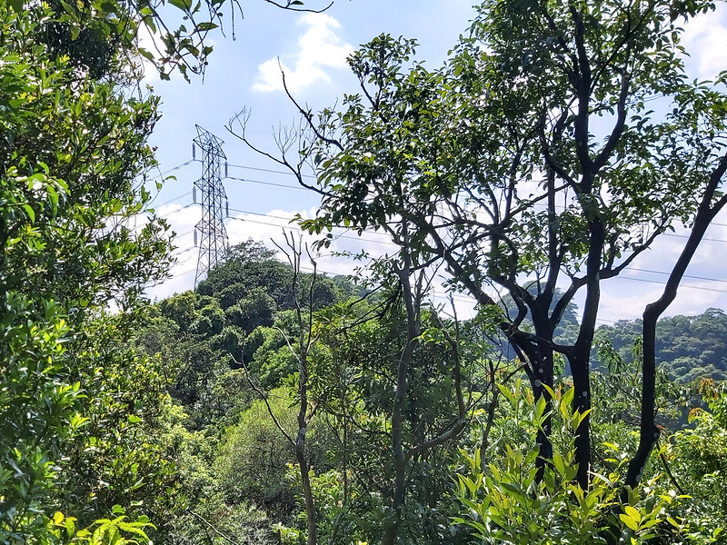
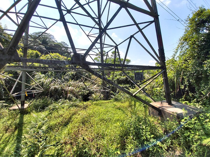
10:28 Passed a power tower 026. I became acquainted with this one on that day.
10:33 I saw Malingjian again.

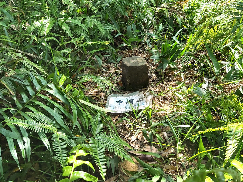
10:50 Reached Mt. Zhongbu for the first time. I became acquainted with Mt.
Zhongbu on that day, too.

When I was standing at the junction, thinking whether I should go to Mt. Gangkou, I heard several cries from
some animal. So, I told myself perhaps I should skip that one. Well, not really.
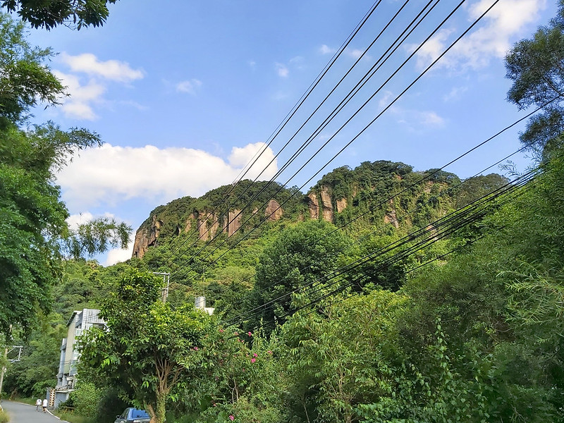
I continued my hike to Mt. Zhongbu East Peak. Several hikers mentioned the magnificent cliff walls. Naturally, I
wanted to see them.
11:32 Reached Mt. Zhongbu East Peak. There wasn't much space to stay on the
peak, but I was hungry and tired. The overgrown grass and heat made this hike much harder than I anticipated.
So, I decided to hide under the shade to have my lunch.

After lunch, I tried the trail toward the east near the peak again. The path led me downhill with an open view.
The views here were much better than the east peak, but there wasn't much place to sit. I couldn't find the
cliff walls, either. Feeling tired, I returned to the trail where I was.

12:17 I passed Mt. Zhongbu for the 2nd time. Standing at the junction, I changed
my mind and explored Mt. Gangkou.
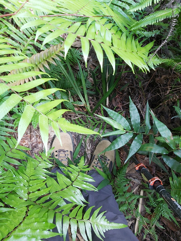
The trail conditions were much worse. This section was supposed to be easy because of the steps. Yet, the
semi-lockdown let nature take back her control. Those steps were almost covered by ferns and grass, which took
me extra time to go.
12:25 Reached a saddle with signs pointing to Mt. Gangkou and Mt. XiShiWaiLiao
西勢外寮山.

What was waiting for me was a very steep slope, almost vertical, or at least I thought so. I managed to take
photos of myself struggling on the slope.
12:33 Reached Mt. Gangkou. The climbing was hard, but, lucky for me, it was a
short one. Seeing those views on the peak made the effort pay off. There was ample space to see the whole
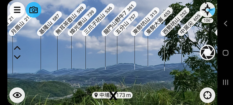
mountains in Jiufen, Mt. Keelung, Mt. Teapot, Mt. Canguanliao, and more.
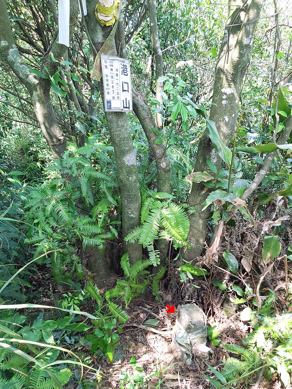

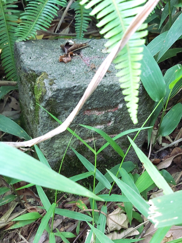
There were 2 stones on the peak of Mt. Gangkou.
After I was satisfied, I got down the slope. Going down was much worse than climbing up. After reaching the
saddle, I was so exhausted that I had to take a long break. Too tired to take photos here.
13:15 Passed Mt. Zhongbu for the 3rd time. I think we had become good friends
now.

14:13 Arrived at the power tower 026 again. My map said a junction near the
tower, and I was hoping to leave the trail soon. However, I couldn't find the junction. I kept coming back and
forth trying to find it, but I still didn't find it.
After several attempts, I was so tired that I decided to take the same way back. This tower became my second
good friend on that day. I wasted at least 10 minutes here.
14:39 I was back to the junction of Mt. Zhongbu, Mt. Shixiang, Mt. Shishi, and
Dacheng Street. When seeing Dacheng Street, I immediately took this direction. Within 20 minutes, I left the
trail and back to Dacheng Road.
14:47 While walking on the street, more people and cars were coming. Then, I
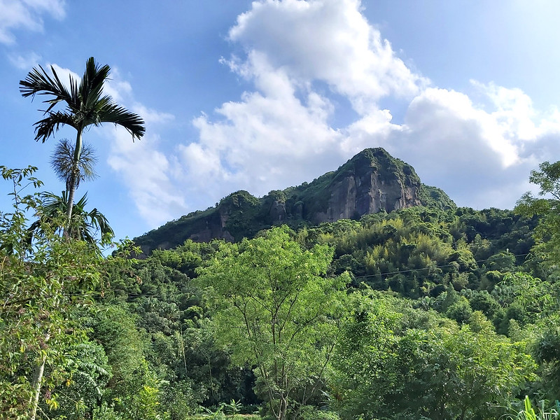
finally saw the cliff walls I was looking for when I was at Mt. Zhongbu East Peak. They seemed so magnificent
from a distance. But I don't think I will be back there anytime soon.
14:50 I passed a trailhead with a sign saying this was to Mt. Shishi. I realized
this was the easier trailhead mentioned by the hiker I met in the morning.

14:53 I passed the trailhead I took in the morning. I thought about going
through Yeshan Recreational Medicinal Herb Farm again, but I changed my mind and continued to walk on the road
back to the sticky rice bridge. Bypassing the farm took me at least 15 minutes instead of 5.
15:12 Back to Maxi Sticky Rice Bridge. The next bus came at least one hour
later. I took this time to see the potholes in the river and called it a day.