Mt. Xiangtianhu, Mt. Guantiangao and More: A Beautiful Ridgeline Hike in Nanzhuang
Mt. Xiangtianhu and Mt. Guantiangao are two of the famous mountains in Nanzhuang Miaoli, central Taiwan.
You'll hike through beautiful cedar tree forests and walk on the ridgeline. If you still have time after the
hike, you can visit the lovely Xiangtian Lake for more.


Disclaimer:
All content is for inspiration only. Use Taiwan Hikes' suggestions at your own risk. We are not responsible for any losses, injuries, or damages.
All content is for inspiration only. Use Taiwan Hikes' suggestions at your own risk. We are not responsible for any losses, injuries, or damages.
Table of Contents:
- About Mt. Xiangtianhu, Mt. Guantiangao, and Xiangtian Lake, plus Mt. Jiali
- How to Get There
- Peaks and Places to Reach
- Daping Trailhead to Mt. Jiali and Mt. Daping
- Hiking on the Ridge to Mt. Nandagui
- Mt. Xiangtianhu with Beautiful Forest and Wild Orchids
- Mt. Guangtiangao and Misty Xiangtian Lake
- Thoughts about this Hike and Other Routes to Enjoy Mt. Jiali
- Map and Itinerary
- Recommended Blogs and Resources
- Related Posts on Taiwan Hikes
About Mt. Xiangtianhu, Mt. Guantiangao, and Xiangtian Lake, plus Mt. Jiali
Those mountains and trails are located in Nanzhuang, a Hakka town or Hakka Han 客家 in a central county, Miaoli, of Taiwan. Nanzhuang is
also certified as “Slow City” by Cittaslow, along with other three townships, Sanyi in
Miaoli, Fonglin in Hualien, and Dalin in Chiayi.
A Popular Hike nearby: Mt. Jiali
There are several hiking routes here, and the most famous one is Mt. Jiali. Mt. Jiali, 2,220 meters (7,283 feet), is one of three major
mountains that are 2,000 meters above the sea level on Jiali Mountain Range, which is 180 km long and located
on the west of Xue Mountain Range.
Mt. Jiali is also listed as one of Mid-elevation Mountain Trails 中級山 in Taiwan. There's a Class 1
Triangulation Stone on the peak. The views on Mt. Jiali are spectacular. If the weather is good, you can see
Mt. Dabajian, and Holy Ridge, although I didn't get to see the
views when I was there in 2017.
However, doing Mt. Jiali isn't for everyone. It's a challenging hike and there will be an elevation gain of
900 meters within 3.2 Km (2 miles) near the peak of Mt. Jiali. Some sections even require rock-climbing
skills.
There are 2 trailheads to hike Mt. Jiali: Luchang 鹿場 and Daping 大坪 Trailhead. There are also other mountains
nearby.
Mt. Xiangtianhu and Mt. Guangtiangao
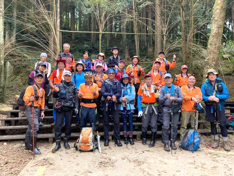
I did this trail with Xizhi Mountaineering Association 汐止山岳. We started from Daping
Trailhead but didn't go to Mt. Jiali. Instead, we turned north at the junction to Mt. Jiali, and headed to Mt.
Daping, Mt. Xiangtianhu, and Mt. Guangtiangao for our point-to-point hike.
If you want to do a loop hike, please check out Taiwan Trails and Tales' post.
Mt. Xiangtianhu and Mt. Guangtiangao used to be the hunting ground and logging forest for indigenous Saisiyat people 賽夏族. Now, this area is
forest compartment of Forestry Bureau. Hikers can find numbered markers on the trails.
Xiangtian Lake and Pas-ta'ai
Saisiyat people called Xiangtian Lake “Raremewan”, meaning the place with plants that were used to make dyes.
I don't know what those plants are, but I think you might be able to find out at SaySiyat Museum 賽夏族民俗文物館 by Xiangtian Lake if you get a chance to visit it.
Hakka people called this lake Yangtian Lake 仰天湖. Yang Tian literally
means looking up at the sky.
賽夏族民俗文物館 SaySiyat Museum is very kind for giving me permission to use their
images here.
Important: Please note that the symbol you saw on the image of SaySiyat Museum is the most common patterns woven on Saisiyat people's clothes for generations
that can be traced back tohundreds of years ago. This is nothing to do with the infamous symbol in history.
In Saisiyat culture, worshiping the little black spirits (or
dwarf spirits) 矮靈 plays an important part in their lives. A famous ceremony called Pas-ta'ai (Dwarf
Spirit Ceremony) 矮靈祭 (賽夏族巴斯達隘祭典) is hold between the first harvest and the following full moon in Lunar Month
10. Saisiyat people hold regular Pas-ta'ai event every two years, and major big event every ten years. The
ceremony usually lasts one month.
Before Covid-19, there were shuttle buses taking tourists to witness this ceremony. But I'm not sure whether
the ceremony will be open to the public in the future.
Spy Plane Wreckage
In May 1978, a spy plane, U-6A Beaver, crashed in the mountain near Xiangtian Lake. During that time, Saisiyat
people helped the military to recuse the two pilots. Unfortunately, one died and the other got seriously
injured. It was difficult to retrieve the wreckage, and the plane rested there for more than 40 years. The
location was later discovered by hikers and this trail had become a tourist attraction. You can click here to see the plane wreckage.
In August 2020, the military finally retrieved the wreckage and donated a model of U-6A Beaver
to thank the local people's efforts to recuse the pilots. The model now is located at the SaySiyat Museum and
calls there forever home.
How to Get There
I'll recommend you do a loop hike from Xiangtian Lake and take Miaoli Bus 5824 to the lake from Nanzhuang Bus Station. Bus 5824 runs only 3 times per day. Therefore, I'll
suggest you stay in Nanzhuang for one day and catch the earliest bus to Xiangtian Lake to enjoy the loop hike.
Nanzhuang is a fun place to visit. You can check out this page to see more details about the tourist attractions in
Nanzhuang.
Peaks to Reach
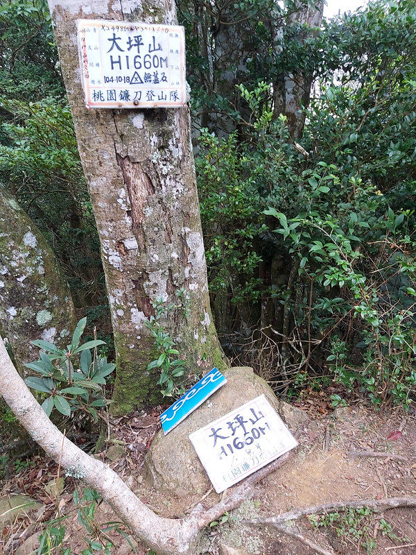
Mt. Daping: 大坪山, 1,660 meters (5,446 feet)
Mt. Nandagui: 南大龜山, 1,330 meters (4,363 feet). There is a forest triangulation stone carved with a Chinese character, mountain 山.
Mt. Xiangtianhu: 向天湖山, 1,225 meters (4,019 feet). There is a forest triangulation stone carved with a Chinese character, mountain 山. There is not much view on the top. Hu literally means "lake" in Chinese.
Mt. Guangtiangao: 光天高山, 1,123 meters (3,684 feet). This belongs to Mt. Jiali Mountain Range.
Xiangtian Lake: 向天湖, 750 meters (2,461 feet).
Daping Trailhead to Mt. Jiali and Mt. Daping
Distance: 11 km (6.8 miles)
Brief itinerary: Daping Trailhead (height 1,342 meters) ➔ Junction to Mt. Jiali and Mt. Daping (height 1,622 meters) ➔ Mt. Daping (height 1,660 meters) ➔ Mt. Nandagui (height 1,330 meters) ➔ Mt. Xiangtianhu (height 1,225 meters) ➔ Guangtiangao (height 1,123 meters) ➔ Xiangtian Lake (height 780 meters)
GPS coordinates of Daping Trailhead: 24.523515, 120.999822
I've been wanting to do a loop hike to Mt. Xiangtianhu, Mt. Guantiangao and Mt. Sanjiaohu like what Taiwan Trails and Tales did for a long time. When I saw Xizhi Mountaineering Association had this trip, I signed up without
hesitation.
We left Xizhi at 6:30 on February 27, and it took us around 3 hours to the parking lot of Daping Trailhead on
Daping Forest Road 大坪林道. This was my second time to visit this trailhead. I did a loop hike to Mt. Jiali in
July 2017 and started from here. Usually, it's very crowded on Daping Trailhead because Mt. Jiali is very
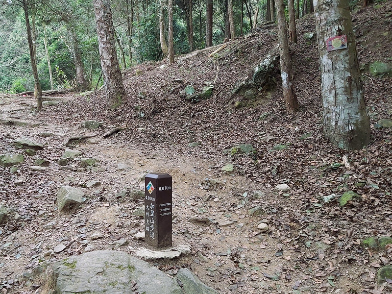
popular among hikers. Lucky for us, we didn't see many people when we got there.
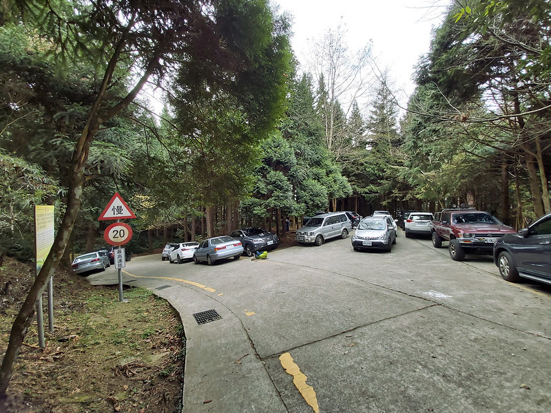
You can see the trailhead was well maintained and there were GPS coordinates on the millage post.
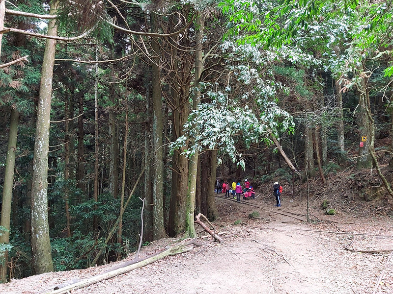
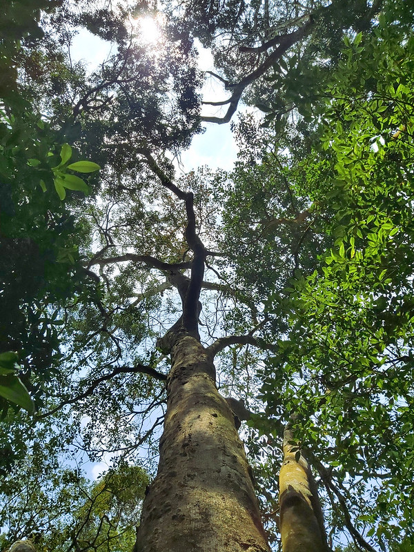
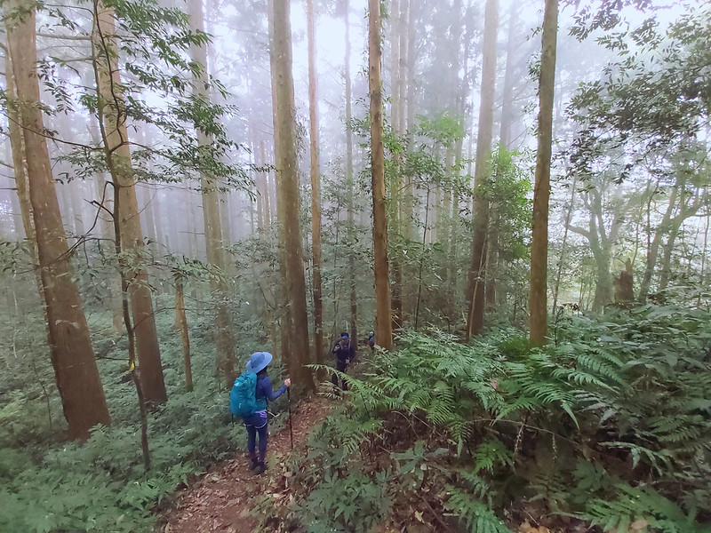
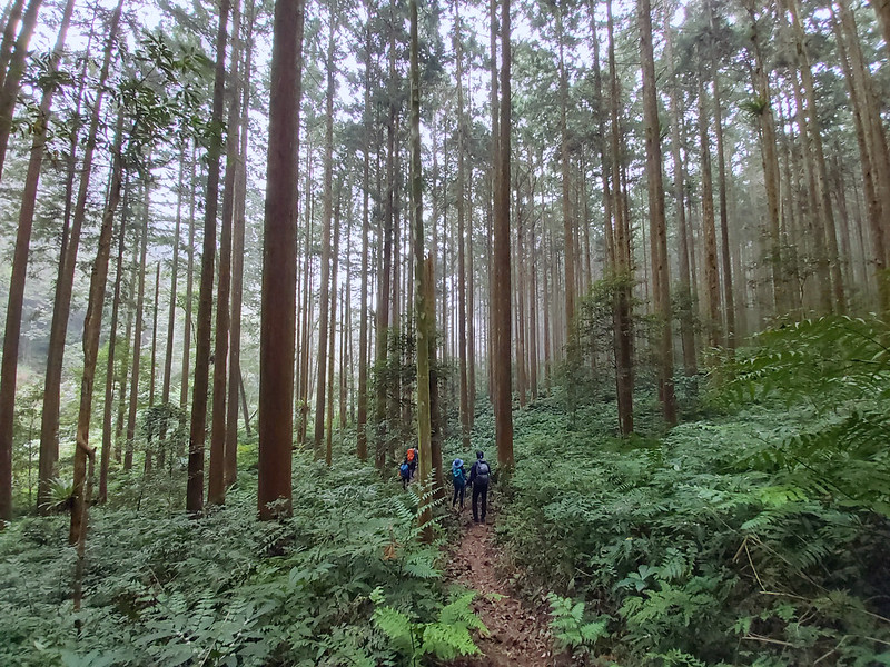
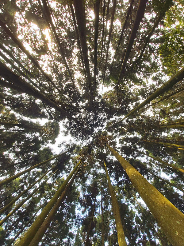
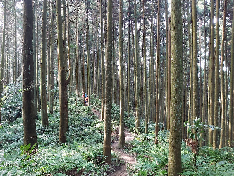
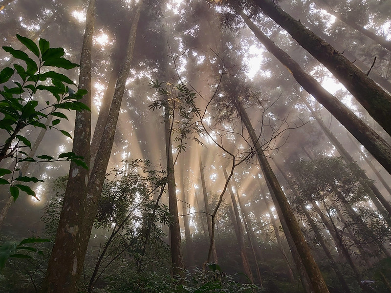
The first thing we saw after starting the hike was the beautiful Japanese Cedar trees. Some people say those
trees were the results of failed forestation. I'm no expert but I have to say those trees were beautiful and
it was relaxing to hike underneath them.
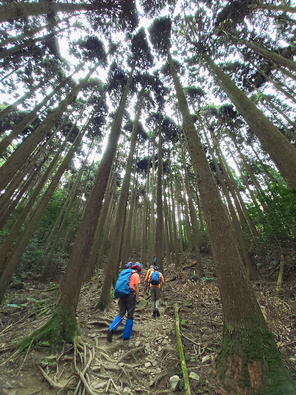
The first 0.5 Km was a little bit steep, but the Japanese Cedar trees were beautiful enough to distract us. We
just followed the plank steps all the way to the rest point at 0.5 Km.
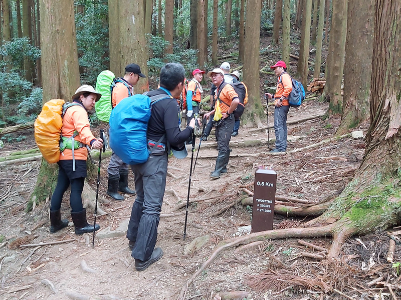
After taking a short break, there was no more plank steps and we hiked on the dirt trail, which was what I
preferred.
The Junction to Mt. Jiali and Relics Left behind by Commercial Logging
When we reached 0.9 Km, there was a junction. One of the signs pointed to "Refuge Hut 救難小屋 2.7 Km". If you
want to hike Mt. Jiali, you will need to take this one.

We took a break here, and I followed other hikers to the Mt. Jiali direction to take a look. Within 2 minutes,
I reached a big open area with some old machinery on my right and railway on my left.

The railway was the log-cart railway used to transport trees when commercial logging was still popular in the
old days.
There was a water faucet at the junction in case you need some.

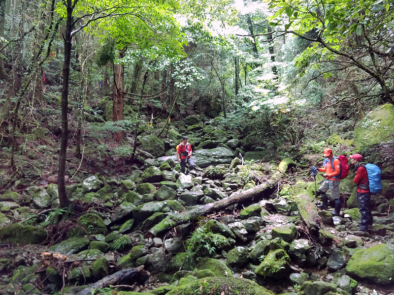
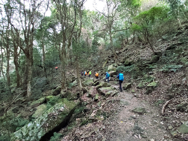
After the rest of our hiking mates had arrived, we turned left to continue our hike. Steep slopes and rugged
terrain awaited us. From here, we mostly hiked on the ridgeline.
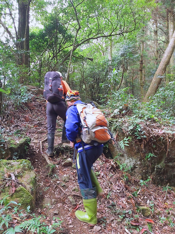
Steep Ridgeline Climbing to Mt. Daping
Although this section was steep and the weather was not on our side, I still enjoyed hiking on the ridge a
lot. I slowed down once in a while to see the mountains on my right when heading north.

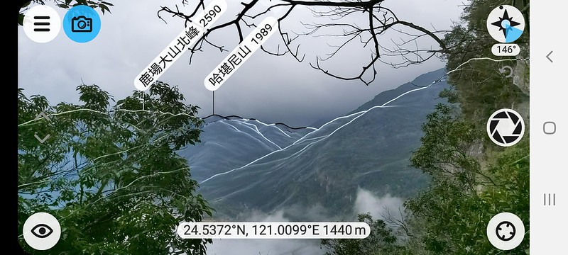
Through the trees and clouds, I could see Mt. Hakanni 哈堪尼山 1,989 meters (6,526 feet), which was also on my To-hike list.
Some hikers will do a loop hike from Mt. Hakanni to Mt. Jiali.
Lucky for us, we soon arrived at Mt. Daping. There wasn't much to see on the peak and it was cloudy. So, we
quickly left for our next peak.
Hiking on the Ridge to Mt. Nandagui
After Mt. Daping, the trail became relatively flat and easy to hike. Japanese Cedar trees were replaced by the
common jungle landscape on the trails in Taiwan.
Occasionally, the clouds opened up a little and gave away mountain views from the distance.
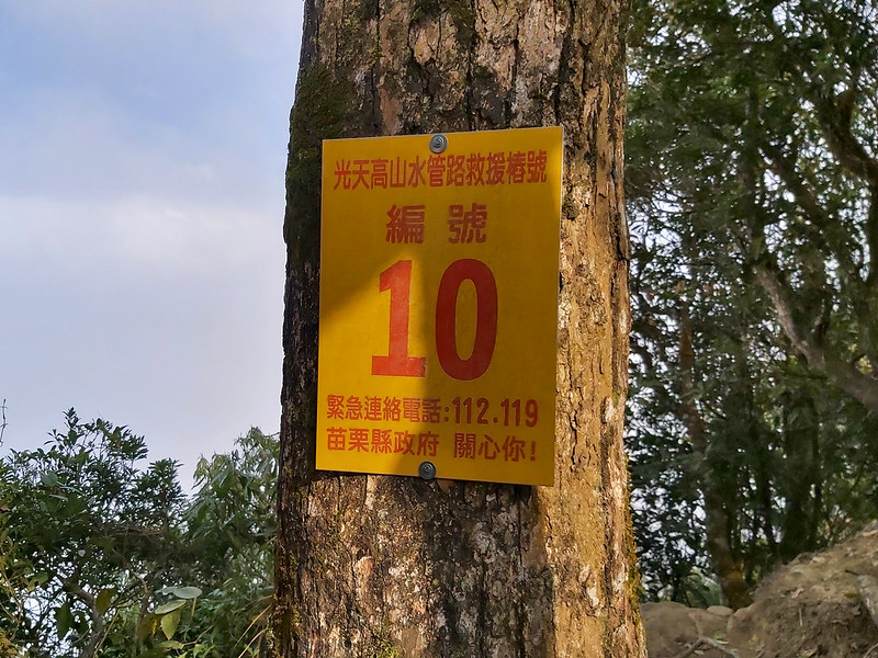
After a while, I started seeing numbered markers or I started paying attention to them. When we arrived at Mt.
Nandagui, the marker was No. 10, but the Chinese on the sign referred to Mt. Nandagui Rescue Marker No. 10.
You'll find the ordered markers of Mt. Guangtiangao and other mountains if you do a loop hike to Mt.
Xiangtianhu, Mt. Guangtiangao and Mt. Sanjiaohu. For those who don't read Chinese, those markers at least let
you know you are on the trails. Having a GPS track is a must.

The space was quite big on Mt. Nandagui with a little view. But again, we could only see clouds. Time to move
on.
Mt. Xiangtianhu with Beautiful Forest and Wild Orchids
After Mt. Nandagui, we left the ridge and were surrounded by Japanese Cedar trees again. The cloudy weather
and mist made this forest look mysterious.
After a while, we saw a huge boulder landing in the middle of the forest. The boulder was also home for many
ferns.

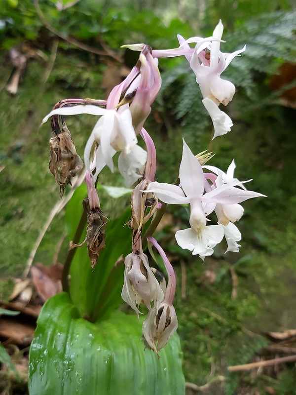
For some unknown reason, we stopped near the boulder waiting for a long time. Then, something white popped up
out of the corner of my eye, and to my delight, I found wild orchids.
After doing some research, I think those are Calanthe elliptica Hayata 闊葉根節蘭 or 翹距根節蘭, which is very common on the humid
mountains between 1,500 to 2,500 meters above the sea level. It was pity that some of those delicate flowers
were withering when I saw them, but the rest were still gorgeous. But if it's not Calanthe elliptica Hayata,
please also let me know. Thank you in advance.
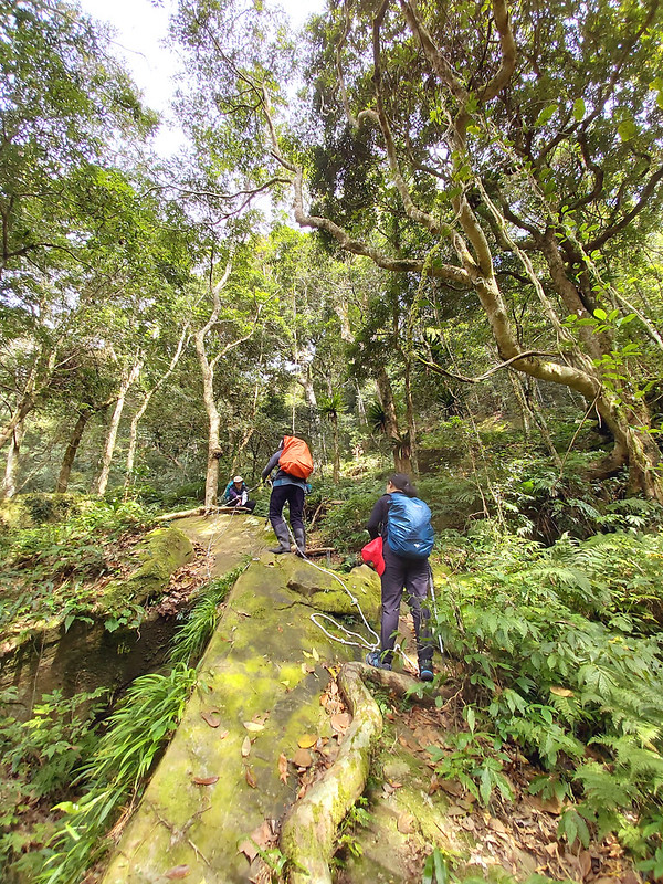
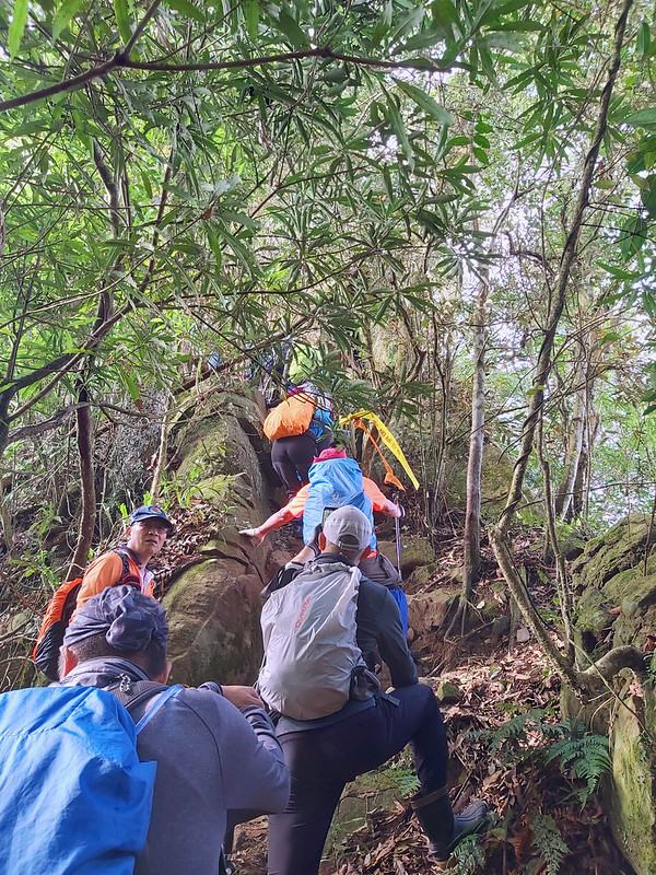
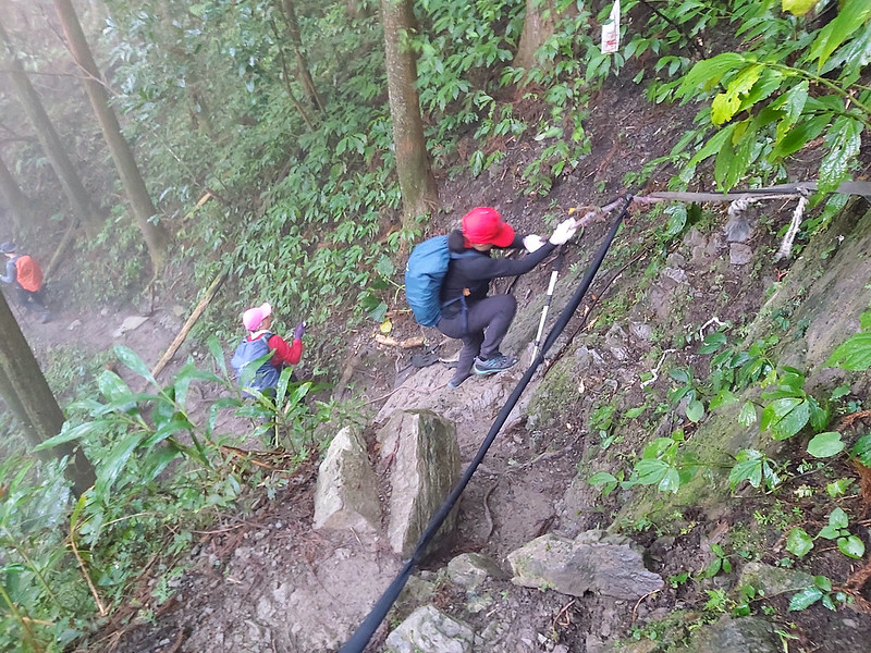
After we started moving, there was a big rock slope waiting for us and it looked very slippery. We grabbed the
ropes set up by enthusiastic hikers and went uphill one by one.
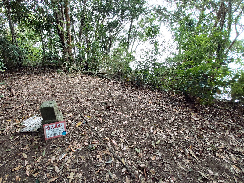
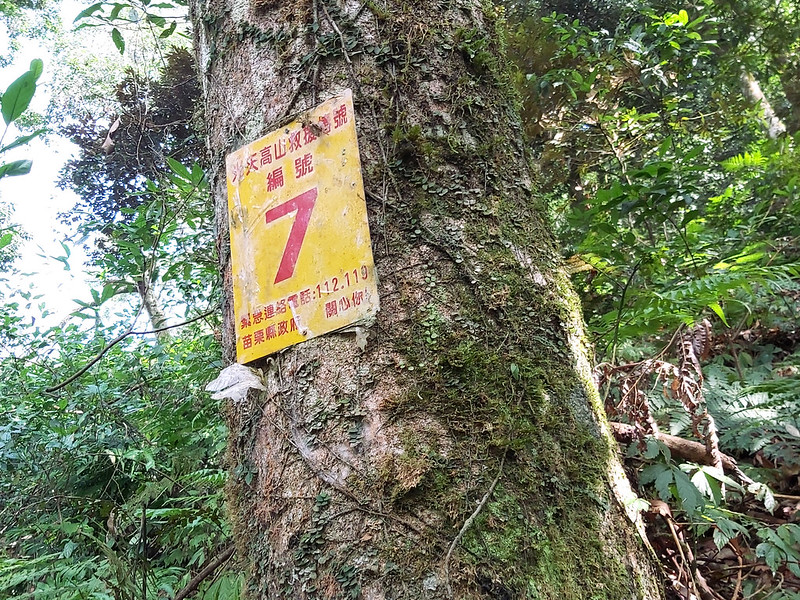
Then, I saw No. 7 marker. Please note that this marker belonged to Mt. Guangtiangao, not the previous Mt.
Nandagui.
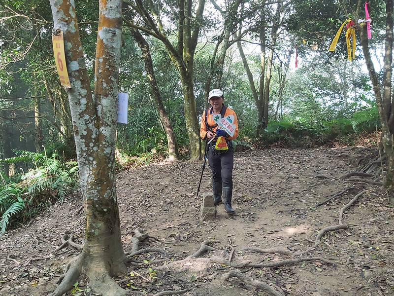
When we saw No. 6 marker, we also arrived at Mt. Xiangtianhu. There is a big space here but not much to see,
either.
Mt. Guangtiangao and Misty Xiangtian Lake
After leaving Mt. Xiangtianhu, we passed a junction which would lead you to Mt. Sanjiaohu, but that wasn't on
our itinerary on that day.

Then we were embraced by tall, slender Japanese Cedar trees again. It was around 3 pm, and the clouds cleared
up slightly and let us see the mist and light mingle together.
Moreover, this section was mostly downhill, which made the hiking even more relaxing. The only downside was it
was very slippery. Our hiking mates, including myself, involuntarily practiced gliding skills on the trail.
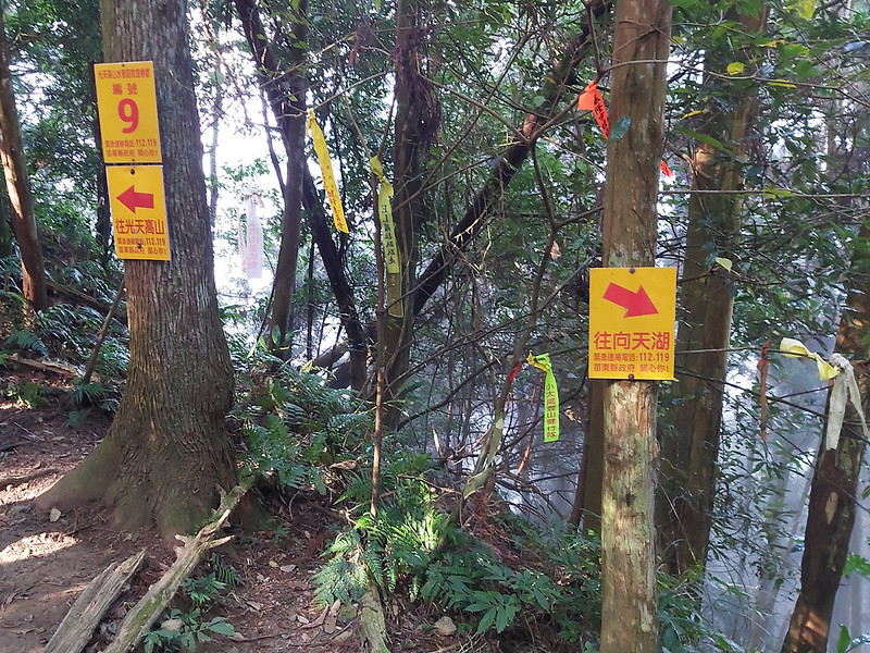
Then, we reached a junction with No. 9 marker and a sign pointing to Xiangtian Lake.
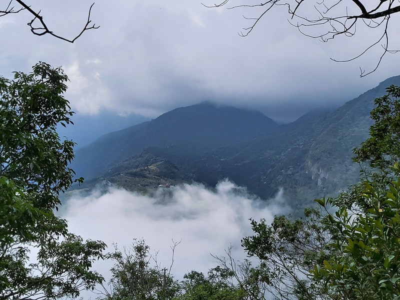
We were back on the ridge again. I passed an opening on the ridge, but it was still cloudy. Soon, the relaxing
strolling in the forests was replaced by steep rocky slopes before we reached Mt. Guangtiangao.
After some huffing and puffing, we passed No. 10 marker (this marker was not the same one at Mt. Nandagui) and
finally arrived at our last peak on that day, Mt. Guangtiangao.

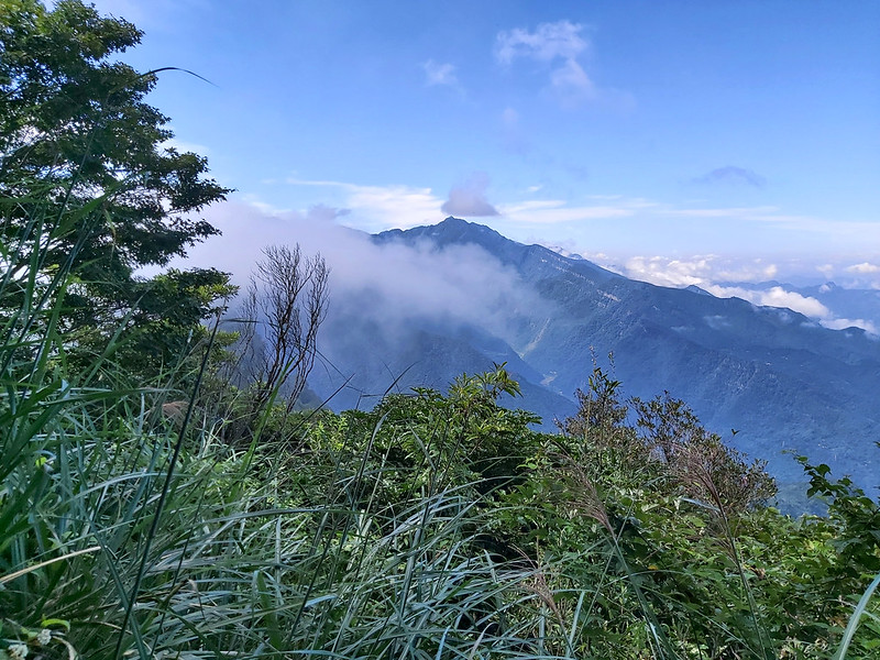
We couldn't see much from the peak, so I checked out my PeakFinder app to see what those surrounding mountains
were if the weather was good.

My PeakFinder app told me that I could expect to see Mt. Egongji 鵝公髻山 1,579 meters (5,180 feet) and even Mt.
Qixing Main Peak 1,118 meters (3,668 feet), the highest peak in Taipei City. As usual, there is always a gap
between the expectation and reality, and I guess this could be an incentive for me to visit this place again
in the future.

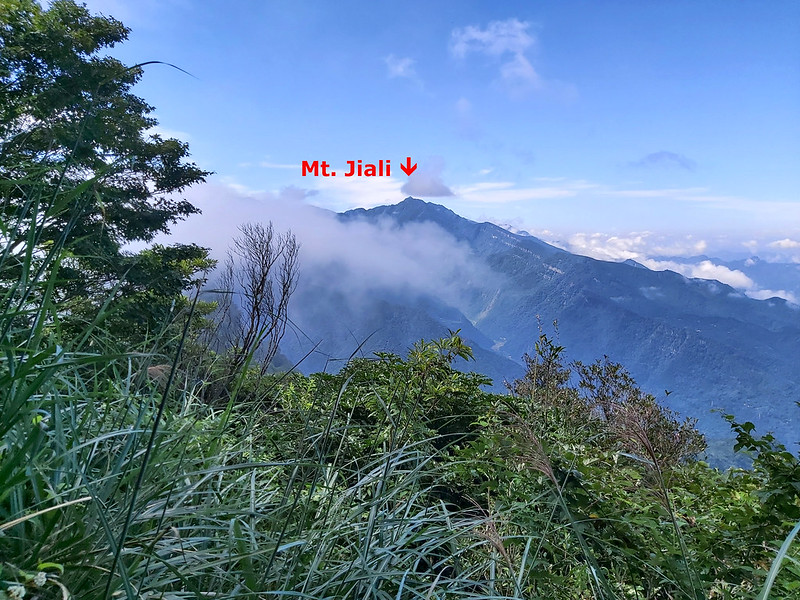
This is the view of Mt. Jiali from Mt. Ergonji (post coming soon), a hike I did in September 2020.
After everyone had finished taking photos, we headed back to the junction and turned to the trail to Xiangtian
Lake. From there, it was a steep, slippery descending.
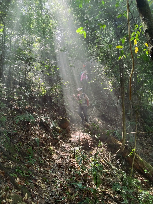
I guess the mountain spirits took pity on us and decided to reward us something else to remember from this
hike. This was what we saw on the way to Xiangtian Lake.
Everyone was very excited to see the beams of light dancing with the tall cedar trees and we stopped several
times to take photos of the amazing views.

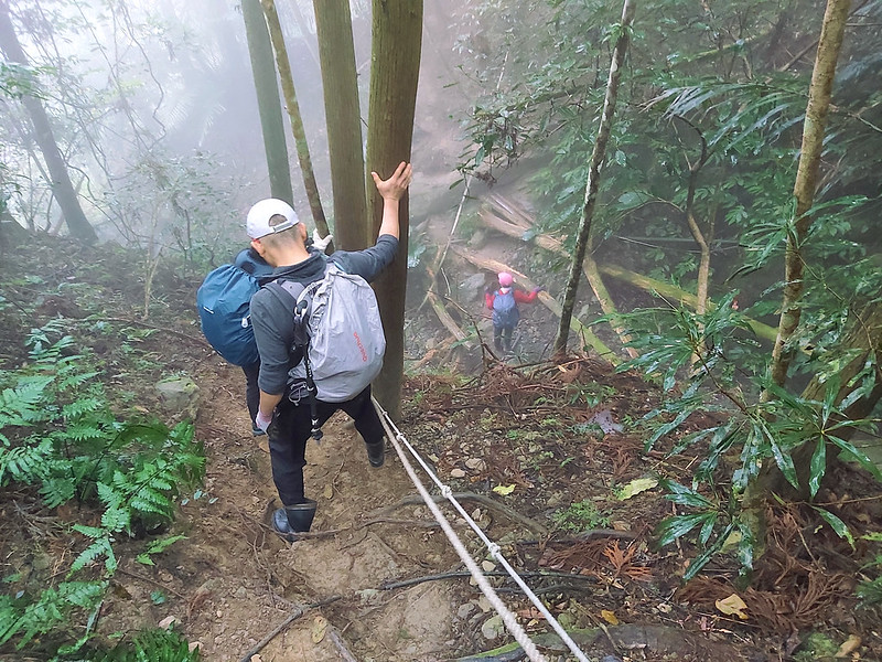
The happy hour ended soon, because we had to pay attention to the rocky, slippery trail again. I would say
this section might be the most dangerous part of this hike. We descended the steep slope one by one, grabbing
the rope as tightly as we could.
While we were trying to go downhill, the fog in the forests became thicker and our hope to see the beautiful
Xiangtian Lake also became dimmer.

By the time we reached the trailhead of Mt. Guangtiangao, the fog was so thick that we couldn't see very far.

When we walked on a regular road, I didn't know we were circling the lake until I saw those feathered friends
either resting on the lake bank or swimming ashore.

We were disappointed by the fog that covered the whole Xiangtian Lake, but this also gave me another reason to
do this hike again. Soon, we reached the parking lot (not the one we started in the morning) and our hired
buses were already there waiting for us.

Thoughts about this Hike and Other Routes to Enjoy Mt. Jiali
As I mentioned earlier, there are so many routes to enjoy mountains in Nanzhuang, either loop hikes or
point-to-point hikes. This hiker has mentioned several routes if
you are curious.

I also had a great time hiking with Xizhi Mountaineering Association.

It's for sure that I will hike Mt. Jiali again, and those are the routes I'd like to do in the future, if I'm
fit enough.
- Doing a loop hike to Mt. Jiali and Dujuanlin 杜鵑嶺 2,125
meters (6,972 feet) from Daping Trailhead. The distance of this loop hike is 12 Km (7.5 miles), but
this one is a difficult one. It will take about 9 hours to finish it.
You can also do this hike from Luchang Trailhead.
If you do this hike between March and May, you might be able to see one of the most beautiful orchids in Taiwan, Pleione formosana 台灣一葉蘭. - Doing a loop hike from Mt. Hakanni 哈堪尼山 to Mt. Jiali. This is also a very challenging hike. The distance is 11 Km (6.8 miles), and hikers have to descend to a creek after reaching the peak of Mt. Hakanni, and ascend to Mt. Jiali again.
- Doing a point-to-point hike from Taian Hotspring 泰安溫泉 via Mt. Hu (Tiger Mountain) to Mt. Jiali. The distance for this hike is 13 Km (8.1 miles), and there are many bamboo woods from Tiger Mountain to Mt. Jiali. It takes at least 10 hours to finish, also a very challenging hike. But if you can only do an out-and-back hike from Taian Hotspring to Tiger Mountain, and the total distance is 8 Km (5 miles).
If you want to do more challenging hike here, I highly recommend you stay in Nanzhuang or Taian at least one
night and start your hike in the early morning. Although there are many markers on those trails, having a GPX
track in your smartphone or a map is a must, whether you read Chinese or not.
Another thing is Mt. Jiali is very popular among hikers in Taiwan, expect many cars at the parking lots and
hikers on the trails and the peak of Mt. Jiali.

Have you been to Nanzhuang or Miaoli? What do you think about this hike? Please leave comments below. Don't
forget to subscribe to newsletters to know more about the exciting trails in Taiwan.
Map and Itinerary
Group Hike or Solo Hike: Solo hike
Date of Hike: February 27, 2021
Date of Hike: February 27, 2021
Route map for Mt Xiangtianhu Mt Guangtiangao by Anusha Lee on plotaroute.com
Click Menu in the map to download, print or share the map.
Click to change the speed to meet your
condition.
to change the speed to meet your
condition.
Note:
My GPS track is for reference only.
Click
to change the speed to meet your
condition.Note:
My GPS track is for reference only.
Based on my hike on February 27, 2021
09:24
Arrived at the parking lot near the observation deck of Daping
Trailhead
09:36
Reached Daping Trailhead
09:58
Passed 0.5 Km mark
10:12
Reached to junction to Mt. Jiali, visited the old log-cart railway
and took a long break
10:24
Resumed the hike and took the north trail at the junction
10:42
Arrived at Mt. Daping
11:35
Took a 50-minute lunch break
13:09
Arrived at the junction to Mt. Xiangtianhu and Mt. Guantiangao
13:11
Arrived at Mt. Nandagui with No. 10 marker nearby and took a
break
14:13
Passed No. 7 marker
14:42
Arrived at Mt. Xiangtianhu with No. 6 marker
15:21
Passed the junction with No. 9 marker to Mt. Guangtiangao and
Xiangtian Lake
15:30
Arrived at Mt. Guangtiangao with No. 10 marker
15:38
Returned to No. 9 marker and took the trail to Xiangtian Lake
15:55
Descended the steep rock slope
16:47
Arrived at the trailhead to Mt. Guangtiangao
16:54
Saw the map of Xiangtian Lake and walked on the Cherry Trail
17:02
Got a glimpse of Xiangtian Lake
17:10
Arrived at the parking lot near SaySiyat Museum and called it a
dal
Total time:
8 hours 34 minutes, including breaks
Recommended Blogs and Resources:
Chinese only:
Hiking Biji: Mt. Xiangtianhu Trail in Nanzhuang 南庄向天湖山步道
Mt. Daping, Mt. Nandagui and Mt. Xiangtianhu from Daping Forest Road 大坪林道登大坪山連走南大龜山、向天湖山
Mt. Xiangtianhu, Mt. Nandagui and Mt. Daping in Nanzhuang 南庄向天湖山,南大龜山與大坪山
Hiking Biji: A Point-to-point Hike from Mt. Xiangtianhu to Mt. Jiali 向天湖加里山連稜縱走
5 Routes to do Mt. Jiali in 1 Day 加里山一日單攻|5種路線走法|交通資訊|懶人包