100 Peaks: Mt. Jyunda – An Easy High Elevation Hike to Embrance Yushan Mountain Range
Mt. Jyunda is one of the easiest 100 Peaks or 100 Mountains hikes in Taiwan. It's a short ridgeline hike,
only 7.4 km, but the views are stunning. You can see the highest mountain, Yushan, aka Mt. Jade or Mt. Yu,
and the famous Alishan from there.


Disclaimer:
All content is for inspiration only. Use Taiwan Hikes' suggestions at your own risk. We are not responsible for any losses, injuries, or damages.
All content is for inspiration only. Use Taiwan Hikes' suggestions at your own risk. We are not responsible for any losses, injuries, or damages.
Table of Contents:
- About Mt. Jyunda and Mt. Wangxiang Forest Station
- How to Get There
- Peaks and Places to Reach
- A Bumpy Ride to the Checkpoint
- Mt. Wangxiang and Beautiful Flowers
- Magnificent Yushan and Alishan Mountain Ranges on the Way to Mt. Jyunda North Peak
- A Glimpse of Stunning Views on Mt. Jyunda
- Thoughts about this Hike: I WANT TO DO THIS HIKE AGAIN!
- Map and Itinerary
- Recommended Blogs and Resources
- Related Posts on Taiwan Hikes
About Mt. Jyunda and Mt. Wangxiang Forest Station 望鄉山林場
When it comes to doing 100 Peaks hike in Taiwan, most people probably would think of Mt. Yu or Jade Mountain.
But in fact, it's getting more difficult to do Mt. Yu because of its popularity. If you want to have other
easier options but still want to enjoy the view, hiking Mt. Jyunda is for you.

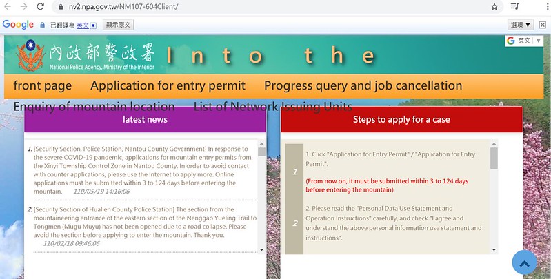
You need to apply for Entry Permits to hike Mt. Jyunda at least 3 days
before your hike. When you use Google Translate on the page, it shows "Junda Mountain (Nantou
County-Xinyi Township)" instead of Jyunda. You need to get printouts of your permits from your email and the
list of people of your group. You don't need a park permit for this hike.
Speaking of Mt. Jyunda or Mt. Junda 郡大山, the first thing most hikers said is that the ride to the trailhead is
more challenging than hiking itself, which is totally true. To start your hike, you must go through 32 Km of
Jyunda Forest road, and take the same way back.
However, please don't let the bumpy ride put you off, unless you have a big problem with car sickness. This
ridgeline hike is short and sweet (relatively) and you will be rewarded with the most stunning views you can
wish for, if the weather is good.
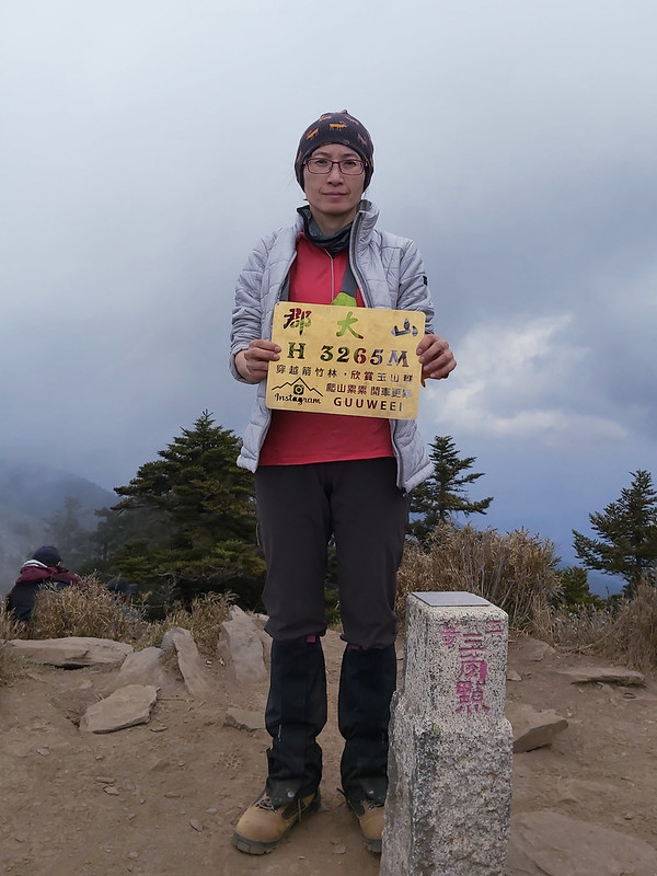
You'll hike three peaks that are over 3,000 meters, but only Mt. Jyunda is listed as 100 Peaks, Baiyue 百岳 in Taiwan. There is a Class 2 Triangulation Stone on the
peak of Mt. Jyunda.
According to the post by Sunriver Culture, the name of Mt. Jyunda
came from one of the tribes of indigenous Bunun people, Jyunda Tribe 郡大社. There were two groups of Bunun
people living by Jyunda River 郡大溪 and Luanda River 巒大溪: Jyun Group and Luan Group. Jyunda Tribe belonged to
Jyun Group, and Mt. Jyun was located on the west of Jyun Group. Therefore, the less known name of Mt. Jyunda
is Mt. Xijyunda. Xi means ‘the west' in Chinese.
When you hike this trail, you'll go to Mt. Wangxiang first. As I mention on my previous post about my hike to
Hunters Trail, the name of Mt. Wangxiang came from a Japanese soldier. During
Japanese Occupation, a homesick Japanese soldier called this place Bukiu, meaning missing home in Japanese.
Later, Wangxiang, literally meaning missing home in Chinese, became the official name.
There was a forest station around Mt. Jyunda, but it was named after Mt. Wangxiang called Mt. Wangxiang Forest
Station. When hiking on the ridge to Mt. Jyunda, you won't see many big trees left, only some pines and bamboo
woods.
How to Get There
It's better to stay at Wangxiang Village for one night, like what I did for Hunters Trail. You will have to transfer several buses to get there if you don't
drive.
From Taichung to Shueili Nantou
Please check All Day Bus 總達客運 for those buses from Taichung to Shuili 水里: 6333, 6333A, 6333B,
and 6322. Bus 6333B will stop at High Speed Rail Taichung Station, too.
From Shuili Train Station to Wangxiang Village
Take Yuanlin Bus 員林客運 6733 and get off at Tongfu Junior High School 同富國中.
Or take the Dongpu Route of Taiwan Tourist Shuttle 台灣好行 東埔線,
get off at Tongfu Junior High School 同富國中.
From Bus Stop to the Trailhead
After getting off at Tongfu Junior High School stop, please use navigation in the Google Maps by checking the
coordinates of the trailhead of Hunters Trail: 23.602417, 120.885642.
Please note that there will be less bus schedules or regulations due to Covid-19 pandemic. Check with the
bus companies before you go.
Peaks and Places to Reach
Checkpoint of Wangxiang Branch Station of Shuili Ranger Station of Forestry Bureau
: 林務局水里工作站望鄉分站. This checkpoint is at 23 Km on Jyunda Forest Road, and opens between 8 am and 5 pm.
Hikers have to submit their permits here before continuing their trip. You can take a break to stretch out
your legs before taking the even bumpier ride to the trailhead.
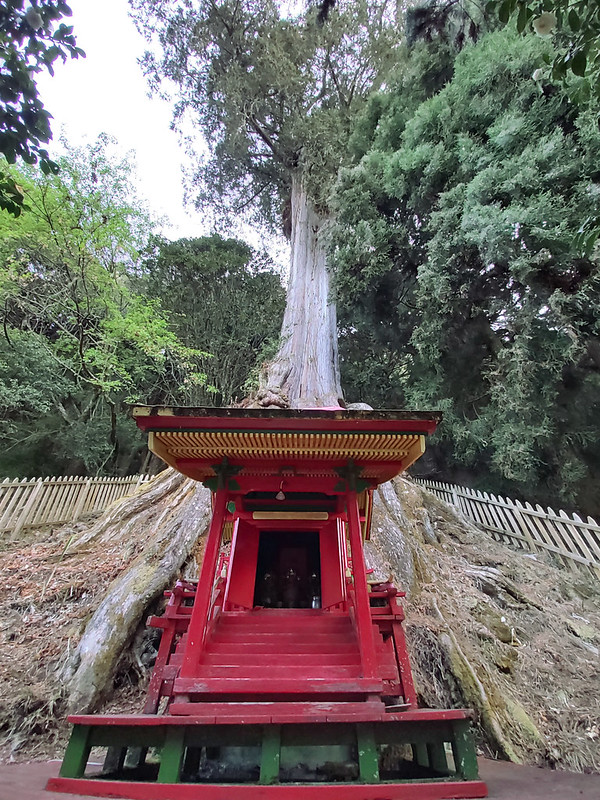
1,200+ years old Taiwan Red Cypress: 紅檜神木. If you get off at the checkpoint, don't forget to check out this huge tree, which is obvious to recognize with an earth god temple underneath it. It is said the height of this cypress is 35 meters above the ground and circumference is 13 meters.
Mt. Wangxiang: 望鄉山, 3,007 meters (9,865 feet), but it is 3,018 meters according to Sunriver Culture, a prestigious cartography company in Taiwan. Mt. Wangxiang is not listed as one of 100 Peaks.
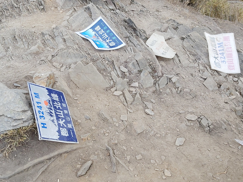
Mt. Jyunda North Peak: 郡大山北峰, 3,241 meters (10,633 feet), but it is 3,252 meters according to Sunriver Culture. Mt. Jyunda North Peak is not listed as one of 100 Peaks.
Mt. Jyunda: 郡大山, 3,265 meters (10,712 feet), but it is 3,278 meters according to Sunriver Culture. There is a Class 2 Triangulation Stone on the peak. The views on the peak are great.
1,200+ years old Taiwan Red Cypress: 紅檜神木. If you get off at the checkpoint, don't forget to check out this huge tree, which is obvious to recognize with an earth god temple underneath it. It is said the height of this cypress is 35 meters above the ground and circumference is 13 meters.
Mt. Wangxiang: 望鄉山, 3,007 meters (9,865 feet), but it is 3,018 meters according to Sunriver Culture, a prestigious cartography company in Taiwan. Mt. Wangxiang is not listed as one of 100 Peaks.
Mt. Jyunda North Peak: 郡大山北峰, 3,241 meters (10,633 feet), but it is 3,252 meters according to Sunriver Culture. Mt. Jyunda North Peak is not listed as one of 100 Peaks.
Mt. Jyunda: 郡大山, 3,265 meters (10,712 feet), but it is 3,278 meters according to Sunriver Culture. There is a Class 2 Triangulation Stone on the peak. The views on the peak are great.
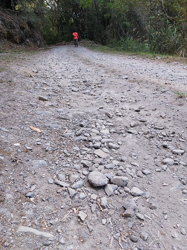
A Bumpy Ride to the Checkpoint
Distance: 7.4 km (4.6 miles)
Brief itinerary: Trailhead of Mt. Jyunda (Height 2,865 meters) ➔ Mt. Wangxiang (Height 3,007 meters) ➔ Mt. Jyunda North Peak (Height 3,241 meters) ➔ Mt. Jyunda (Height 3,265 meters) ➔ Mt. Jyunda North Peak ➔ Mt. Wangxiang ➔ Trailhead of Mt. Jyunda
GPS coordinates of trailhead at 32 km: 23.596145, 120.946991
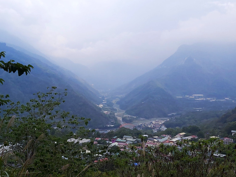
This hike was done the day after my Hunters Trail. We stayed at Wangxiang Village for one night after hiking Hunters
Trail and got up early for our Mt. Jyunda hike. This was what I saw from our B&B on that morning.

Some Warnings before You Go
Before doing this trip, I'd heard so many hikers saying that taking the ride to the trailhead is more
challenging than the hike itself. After doing this hike, I can guarantee you that it's totally true. If you
suffer from car sickness, you might need to take some medicine just in case.
It's highly recommended to call the local pickup service to take you to the trailhead. I don't think you want
to drive your own car on this road condition. However, I'm not sure those services are licensed or registered
cabs and there is some risk involved if you take this service. Just a warning before you go.

If those haven't put you off, you will be rewarded with the amazing views of Yushan Mountain Range on the
premise of decent weather.
Embrace the Jolty Ride
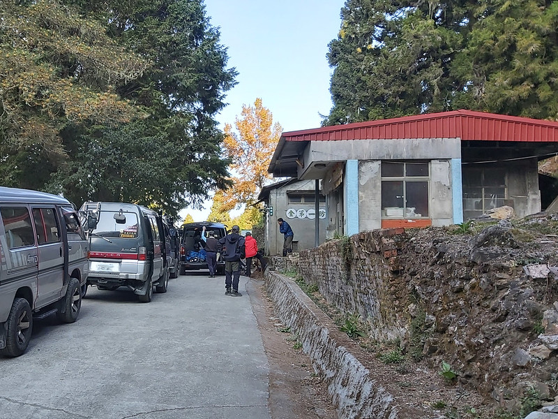
It took us less than 2 hours from the entrance (0 Km) of Jyunda Forest Road to the trailhead at 32 Km, but we
had to get off at the Forestry Bureau's checkpoint at 23 Km to submit our documents. If you need to relieve
yourself, you need to find a place. The toilets at the checkpoint weren't open for hikers.
When you get off at the checkpoint to stretch your legs, don't forget to take a look at the 1,200+ years old
Taiwan Red Cypress 紅檜神木. There is an earth god temple underneath it. It is said the height of this cypress is
35 meters above the ground and circumference is 13 meters.
After the checkpoint, the road condition became worse. To be honest, it wasn't too bad when we went up to the
checkpoint, because our drivers drove relatively slow when going uphill. Driving downhill was a different
story, because it seems those drivers were more eager to go home than we exhausted and stinky hikers. (Or it
was because our terrible body odor drove him crazy?) I felt like a sack of potatoes being tossed in the back
seat and I couldn't find any seatbelt in the car.
Mt. Wangxiang and Beautiful Flowers
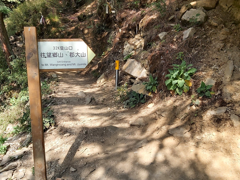
After you survive the fun ride and reach the trailhead of Mt. Jyunda, you will see a big sign written in
Chinese and English and a millage post in reflective yellow color sleeve. You'll see those posts a lot on this
trail.
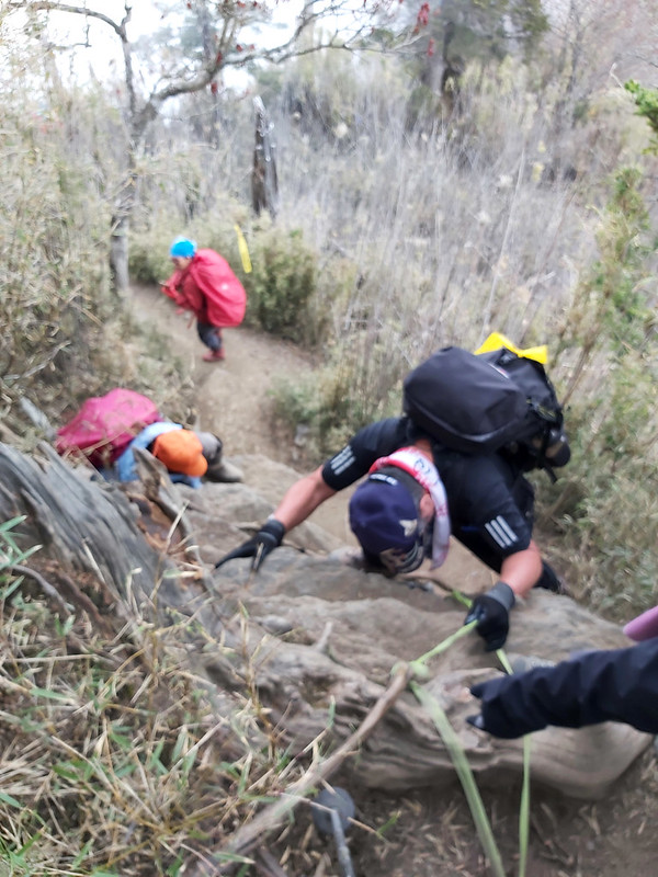
There was a steep slope to kickstart our hike. Since this was an easy hike, I could see many hikers scaling up
underneath those bare tree branches. I started huffing and puffing just within a few minutes. Our youngest
hiker, a cute second grader, still could have conversation with his father without losing a beat.

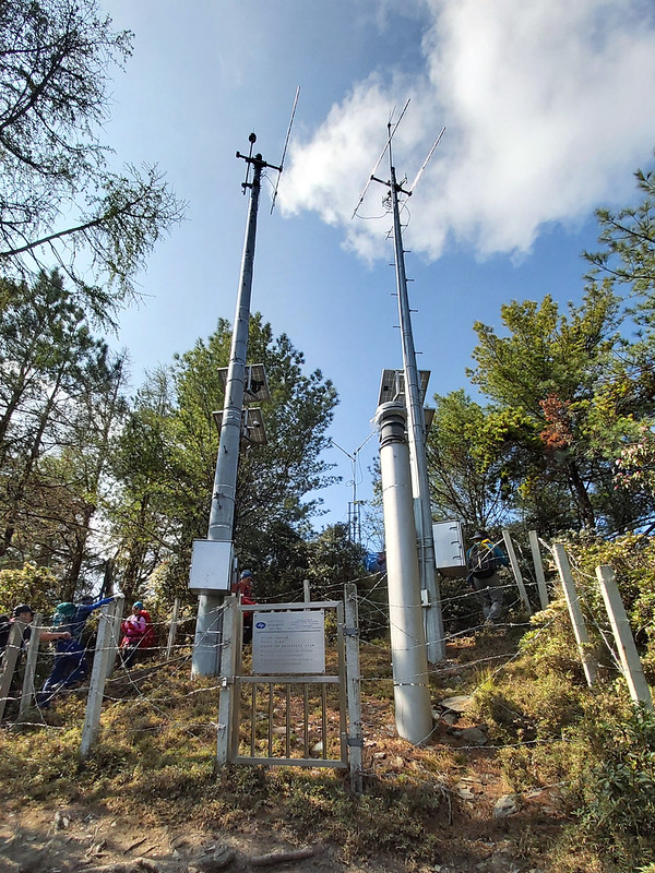
After going through a bamboo tunnel, we passed a Rainfall Observing Station built by Central Weather Bureau in
Taiwan.
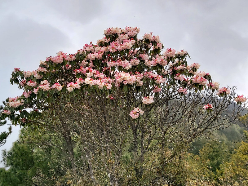
While passing the station, I saw many bell-shaped white flowers dangling on the bush branches. Those were Taiwan Pieris 台灣馬醉木. April and May are their blossom
seasons, and we were right on time.
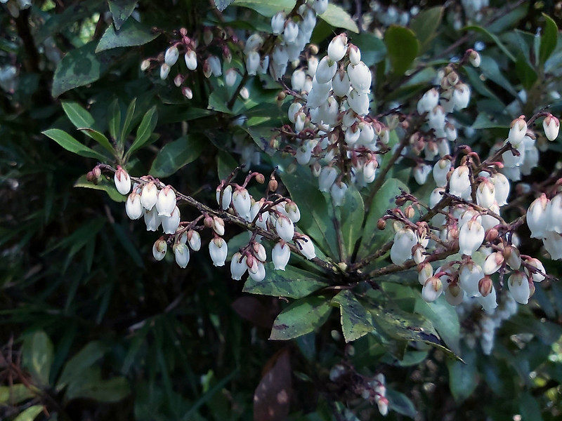
In Chinese, Taiwan Mǎ Zuì Mù 台灣馬醉木 literally means horses got drunk. 馬 means horses, 醉 means drunk or wasted,
and 木 means trees. This is because the stems and leaves of Taiwan Pieris are poisonous. Horses will get drunk
and pass out if they eat the leaves. It is said some indigenous people will use the stems and leaves to make
pesticide.

Other than Taiwan Pieris, there were more blossoms on higher trees nearby, and those were Taiwan Alpine Rhododendron 森氏杜鵑.
You'll find the trails on high-altitude mountains are packed with hikers in spring because they just want to
witness the exotic beauty of Taiwan Aline Rhododendron along with the magnificent mountains. I felt so lucky.

After those happy encounters, we arrived at our first peak, Mt. Wangxiang (or Wangsiang). There was a little
view on the peak, but we were looking forward to the epic views later. So, we quickly left.

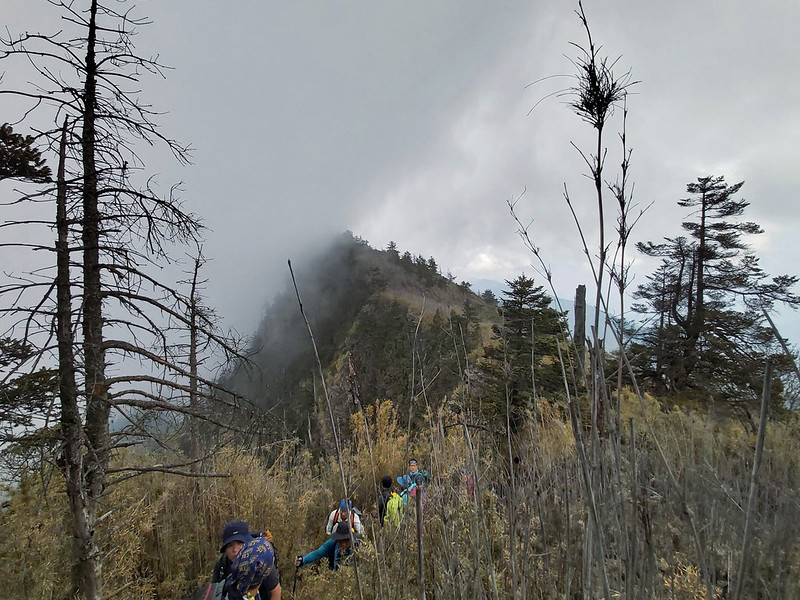
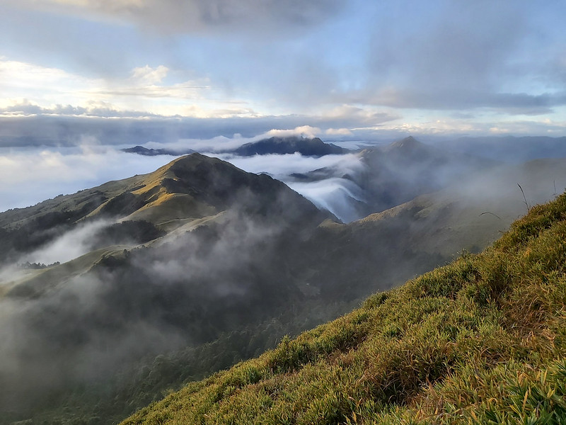
Magnificent Yushan and Alishan Mountain Ranges on the Way to Mt. Jyunda North Peak
After Mt. Wangxiang, we soon reached the ridge. Once we got there, the whole space just opened up, and I saw
Mt. Yu Main Peak, North Peak and West Peak were barely touched by the fluffy clouds. The ridgeline of Mt. Yu
was presented in front of our eyes.

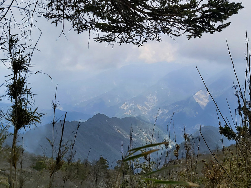
Other than Yushan Mountain Range, Mt. Qiong 1,846 meters, where I was there less than 24 hours before this hike,
Mt. Song, Mt. Data
2,663 meters and other mountains of Alishan Mountain Range were also on the other side. It always makes
me feel surreal that I could see the peaks I reached on my previous hikes from different locations.

Although seeing those amazing mountain ranges was very thrilling, this trail wasn't that easy as I anticipated
earlier. It was endlessly up and down. I could see the hills in front of me while panting like a dog in hot
summer.
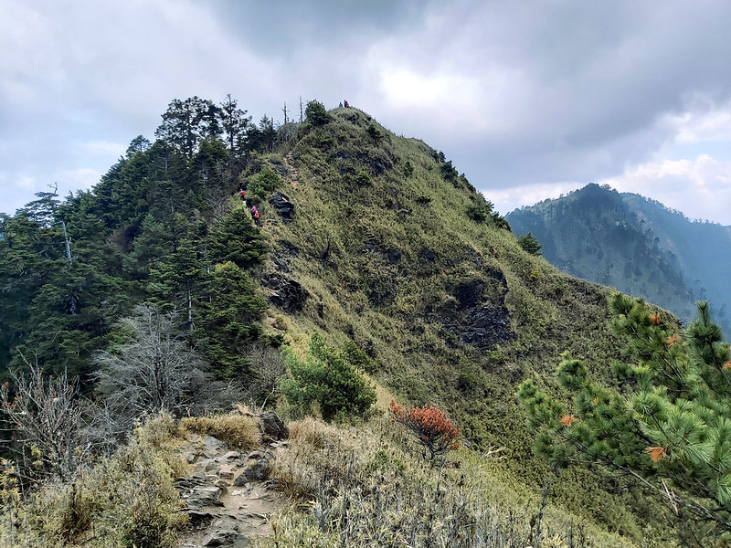
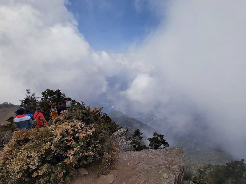
Suddenly, I heard some noises and a small queue formed by hikers. It turned out they found the perfect spot to
take the epic photos. I later realized that this was also a famous IG spot.
This rock reminded me of Trolltunga in Norway. I think it is a
Mini Me of Trolltunga.

I don't like queueing, but I have to say the views from there were truly stunning. Besides, I wasn't sure I
dared to sit on the rock posing for photos.


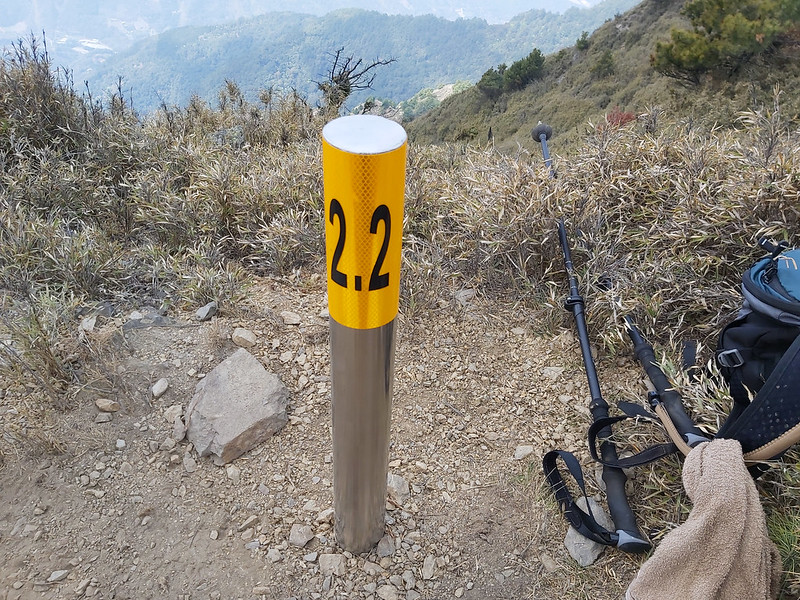
I continued my hike and I saw the bright yellow post with 2.0 Km mark, indicating that Mt. Jyunda North Peak
wasn't far away. Mt. Jyunda North Peak was at 2.2 Km. Although it wasn't listed as one of 100 Peaks in Taiwan,
the views were great.
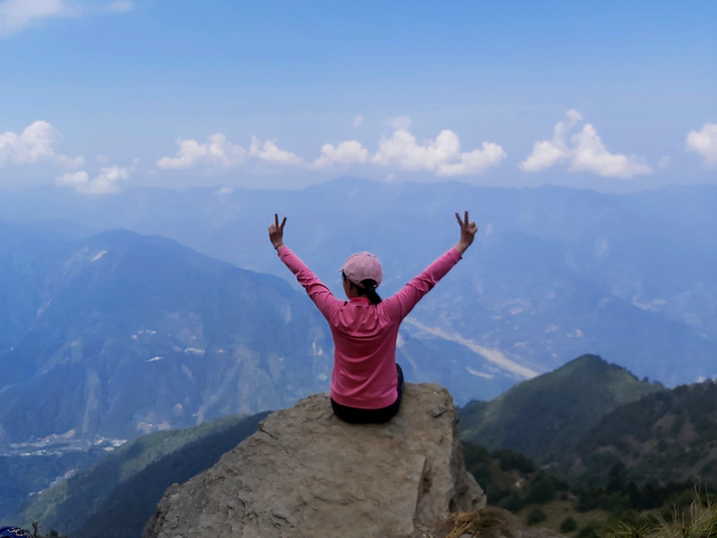
A Glimpse of Stunning Views on Mt. Jyunda
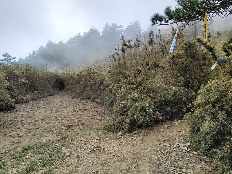
Soon, we entered the bamboo woods again. Those bamboos were much taller than the previous sections, but that
wasn't the worst I've been through. If you want to hike in Taiwan, this kind of bamboo woods is shorter,
smaller and thicker than Moso bamboos, and is common on the trails. They can be a pain in the neck to traverse
and can also become weapons to poke your eyes.
When I passed the 3.0 Km post, the clouds ahead of me became thicker and darker. I was praying that I could
hike as soon as I could to catch the last glimpse of views on the peak of Mt. Jyunda.
By the time I arrived at Mt. Jyunda after passing 3.6 Km post, I did catch the last glimpse of clear views
through the clouds. Then the thick clouds took over the sky right before I was trying to take a second photo
and turned it into totally white.
We stayed there for about one hour to have lunch. While sitting there, we saw more and more hikers coming up.
Our guides decided we should leave sooner, so other hikers could have space to rest.

On the way back to the trailhead, the partial blue sky on the side of Yushan Mountain Range was already
replaced by heavy gray clouds. I felt very lucky that I still could see the epic views on the way up to Mt.
Jyunda.
Then, I turned my focus on the plants and trees around me. I saw more Taiwan Pieris and Taiwan Alpine
Rhododendron on both sides of the trail. I stopped several times to take photos and sneaked some breaks.

I often see white, purple or pink wildflowers on the trails in Taiwan, but not that many yellow ones. To my
great delight, I saw Yushan Barberry 玉山小蘗, an endemic alpine shrub that is mostly found in Yushan and
Central Mountain Ranges.

You can also click here to see my wildflower collection on the trails.

When I still immersed myself with the happiness of having done another 100 Peaks hike and seeing so many
wildflowers on this trail, one stray bamboo branch decided to bring me back to the reality and casually grazed
my right eyeball. Luckily, it didn't cause too much damage. I still could see the trail ahead of me and finish
the hike.
The Final Jolty Ride
I was very happy to see the trailhead when I finished the hike, but I totally forgot there was still another
challenge awaiting: taking the ride on Juynda Forest Road. I'm very lucky that I don't suffer any motion
sickness, but this one is beyond words.
Our driver drove like he was being chased by Godzilla, which made our heads almost bump into the car ceiling.
I didn't suffer headache on the trail, but my head hurt like crazy when I was sitting in the car. I wasn't
alone. My fellow hikers and I started whining, counting the millage signs along the road and hoping the
suffering would end soon. I've have never been so happy when we finally got off the car.
It took us around 2 hours from 0K of Jyunda Forest Road to 32K of the trailhead, and it took 1.5 hours on the
way back.
Thoughts about This Hike: : I WANT TO DO THIS HIKE AGAIN!
I can tell you that many trails near Taipei are way more difficult than this one, and this one is totally
doable by yourself.

There are still some rocky slopes to climb, but those are manageable. The trail can be very muddy if it rains.
There was a drought in Taiwan in Spring of 2021, so the trail was very dusty when we were there.
I'll suggest you do this hike along with Hunters Trail and stay at Wangxiang Village for one night. You'll need to stay
near Mt. Jyunda anyway, so just get this chance to enjoy Wangxiang Village and Hunters Trail altogether.

When you arrive at Wangxiang, you can walk to the trailhead of Hunters Trail.

Moreover, please avoid going there on the weekend and plan your hike one week before you go.
If you don't drive, please follow the instructions of How to Get
There.
If you drive, I will suggest you park your car at Wangxiang Village and hire the car ride service to the
trailhead. The fee is NT5,000 for round trip when I wrote this post, and it can take up to 7 hikers.
Some hikers will put another 100 Peaks, Mt. Xiluanda 西巒大山 3,081 meters, with Mt. Jyunda together. I thought
about doing this, but our guide Mingxhu told me that this will be very exhausting, and you might not be able
to enjoy the hike. I think he is right. I want to take my time to enjoy the scenery. But if you are very fit
and you want to take on the challenge, feel free to do those mountains in one trip and you can check out this post for reference.
Overall, this hike is easy and short with the epic mountain views. I know the first choice for international
tourists to go hiking in Taiwan is Mt. Yu, but there are many other great alternatives like Mt. Qilai South Peak and
Mt. Nanhua and Mt. Jyunda, which can grant you equal satisfaction without going through too much hassle.
I highly recommend this hike.
Have you been to this trail? What do you think about this hike? Feel free to let me know if you have any
questions or comments below. Sign up for the Taiwan Hikes newsletter for more trails in Taiwan.
Map and Itinerary
Based on my hike on April 11, 2021
05:39
Breakfast
06:25
Arrived at 0K of Jyunda Forest Road and embraced the bumpy
ride
07:34
Arrived at the checkpoint, 23K of Jyunda Forest Road
08:30
Arrived at 32K, the trailhead to Mt. Jyunda and got off
cars
09:05
Reached the Rainfall Observing Station of Weather Bureau
09:09
Arrived at 0.5K, Mt. Wangxiang
09:23
Passed 1.0K post
09:47
Passed 1.5K post
10:24
Passed 2.0K post
10:30
Arrived at 2.2K, Mt. Jyunda North Peak
11:03
Passed 3.0K post
11:26
Arrived at 3.6K, Mt. Jyunda, and had a 1-hour lunch break
12:46
Back to 3.0K post
13:07
Back to 2.2K post of Mt. Jyunda North Peak
13:38
Back to 1.5K post
14:08
Passed Mt. Wangxiang
14:28
Back to 0K, the trailhead
16:00
Finished the terrible ride and back to 0K of Jyunda Forest
Road
Total time:
6 hours 2 minutes, close to 5 hours, including breaks