100 Peaks Mt. Baigu: Tackling Taiwan's Challenging 'Four Spices' Trail on the Central Cross-island Highway
Journey through the wild heart of Taiwan on Mt. Baigu or Baigu Mountain, a gem among the 'Four Spices' of the
Central Cross-island Highway. This hike is not for the faint-hearted, featuring treacherous rock scrambles and
untamed landscapes. It's a paradise for those seeking a challenging adventure amidst breathtaking scenery,
offering an unforgettable experience.

Disclaimer:
All content is for inspiration only. Use Taiwan Hikes' suggestions at your own risk. We are not responsible for any losses, injuries, or damages.
Taiwan Hikes may include affiliate links. When you purchase through these links, you support our ability to continue providing FREE content — at no additional cost to you.
Table of Contents:
Exploring Taiwan? Save Time with the Ultimate 2026 Hiking Guide! Discover the top hikes in every city and
county across Taiwan—all accessible by public transport (bus links available). We've spent 35+ hours
researching the best trails and transit options, so you can skip the hassle and start your adventure! Permit
free!

Trail Information
Trail Name: Mt. Baigu or Baigu Mountain 白姑大山
Distance: 18 km (11.25 miles)
Route type: Out-and-back
Days/Hours Needed: 1 to 3 days
Total Ascent/Descent: 2,317m/2,317m
Best Time to Go: All seasons, but winter is also the snow season. Bring gear for hiking in the snow is a must.
Permits: Not required
Difficulty Level:
Distance: 18 km (11.25 miles)
Route type: Out-and-back
Days/Hours Needed: 1 to 3 days
Total Ascent/Descent: 2,317m/2,317m
Best Time to Go: All seasons, but winter is also the snow season. Bring gear for hiking in the snow is a must.
Permits: Not required
Difficulty Level:
Peaks or Places to Reach
- Mt. Sanzhui 三錐山 2,570 meters (8,431 feet). No views.
- Mt. Baigu Southeast Peak 白姑大山東南峰, 3,035 meters (9,957 feet), but not listed as 100 Peaks.
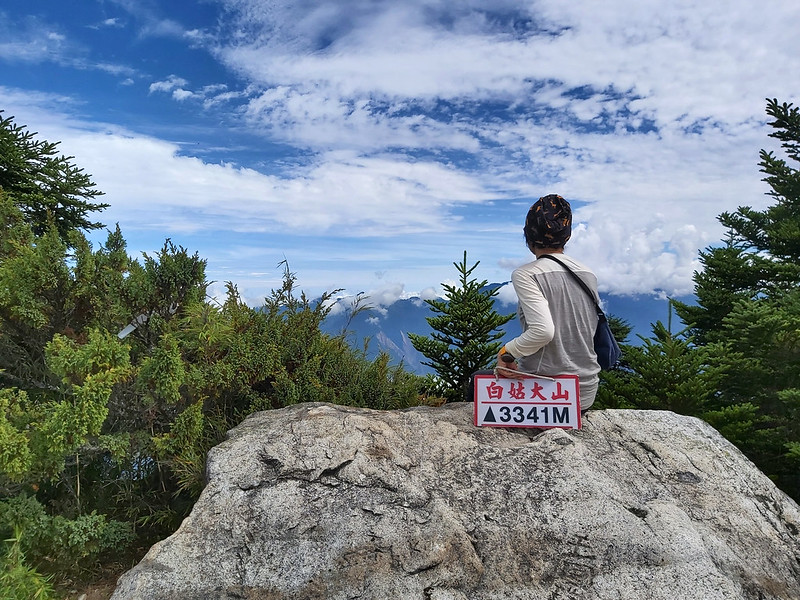
- Mt. Baigu 白姑大山 3,341 meters (10,961 feet) There is a Class 1 Triangulation Stone on the peak. Views are great if the weather is good.
Additional Information:
- Siyan Pond Campsite 司宴池: Most hikers will pitch their tents there because of the ponds nearby for drinking water. The water comes from rain, so those ponds are also called ponds from the sky 看天池, meaning that the water depends on precipitation. If you want to do your own business, please go to the other side and stay away from the water.
- A small cloth and a water filter are must-have gear for this hike.
No Transport to the Trailhead and Map/GPX Data
No Public Transport to the Trailhead
The trailhead is very close to the Last Farmhouse 最後農家 near Hongxiang Hotspring 紅香溫泉. There's no public
transport to get there. You have to drive or hire a car. Please note that it's better to drive or hire a
4-wheele drive car because of the steepness of the off road to the Last Farmhouse.
GPX to Download
Click Menu in the map to download, print, or share the map.
You can see more options after clicking the Play button.
Click to change the speed to meet your condition.
You can see more options after clicking the Play button.
Click
to change the speed to meet your condition.
Your support empowers Taiwan Hikes to create more FREE content, making your hiking adventures in Taiwan even
more enjoyable. Click "Buy Me A Coffee" or use our affiliate links to support.
My Baigu Mountain Hike: So Many Rock Scrambles
Day 1: based on my hike on July 24, 2020
05:25
Left hotel
07:00
Arrived at the Last Farmhouse and get gear ready
07:19
Arrived at the trailhead
07:48
Reached the fence and turned to the steep slope on the left
10:07
Reached Mt. Sanzhui
11:49
Reached Hunter Campsite and took a break
12:33
Reached our campsite near Siyan Ponds and started pitching
tents
13:20
Headed to Siyan Ponds to fetch water
13:35
Arrived at Siyan Ponds
Total time:
5 hours 33 minutes, including long breaks
(from the Last Farmhouse to our campsite)
(from the Last Farmhouse to our campsite)
Distance: 5.6 km (3.5 miles)
Brief itinerary: Last Farmhouse (Height 1,970 meters) ➔ Mt. Sanzhui (Height 2,570 meters) ➔ Siyan Pond (Height 2,881 meters)
GPS coordinates of the Last Farmhouse: 24.18036, 121.17024
Brief itinerary: Last Farmhouse (Height 1,970 meters) ➔ Mt. Sanzhui (Height 2,570 meters) ➔ Siyan Pond (Height 2,881 meters)
GPS coordinates of the Last Farmhouse: 24.18036, 121.17024
A Bumpy Road to the Trailhead
We left Taipei and stayed at a hotel in Renai Township for one night. When we got up around 4 am and were ready
to leave at 5, the sky was turning red. The sunrise here must be very stunning.
It took us around 2 hours to get to the Last Farmhouse. We hired three 4-wheel-drive cars, and the ride to the
Last Farmhouse was very bumpy. There were many cabbage farms on all the hills in this area, and this farmhouse
was the highest up there. That's why it was called the Last Farmhouse.

I was told that the family who live there was very friendly to hikers a few years ago. However, some hikers
behave badly, which eventually upset them. Now, hikers can't park here too long. We had to get our stuff
together as soon as we could and started our hike.

But the views here were amazing, even though we had to put up with tons of flies because of the fertilizers.
A Steep Uphill after Pleasant Pine-needle Covered Trail
We took some small zigzag turns to the real trailhead. You will see a big red sign on a mesh fence asking hikers
not to hike alone.
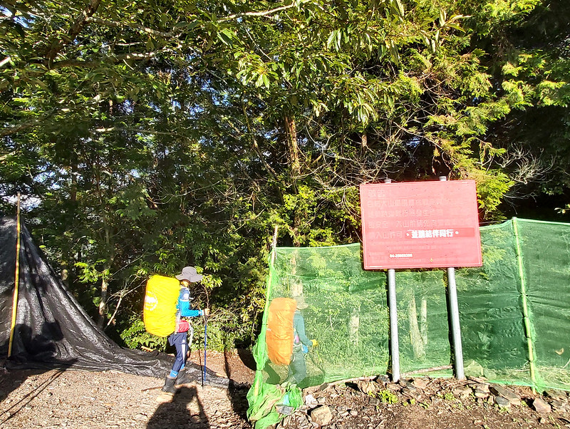
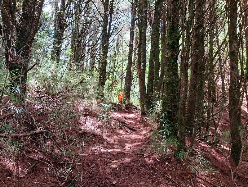
The first section of the trail was quite pleasant. There were many pine trees, and it was very comfortable to
walk on those pine needles.

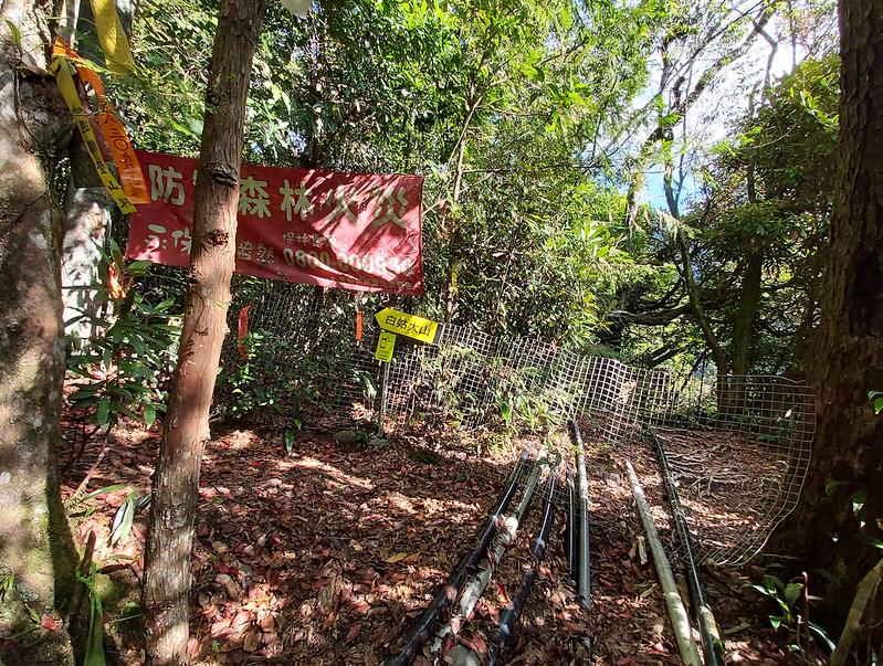
When we reached a metal mesh fence with water hoses going underneath, the fun part stared. Our guide told us
that Mr. Zhang, the victim of the tragic accident mentioned earlier, took a wrong turn here in 2011. After that,
they put up a metal mesh fence to warn hikers. I guess nobody will ever make a wrong turn again here.
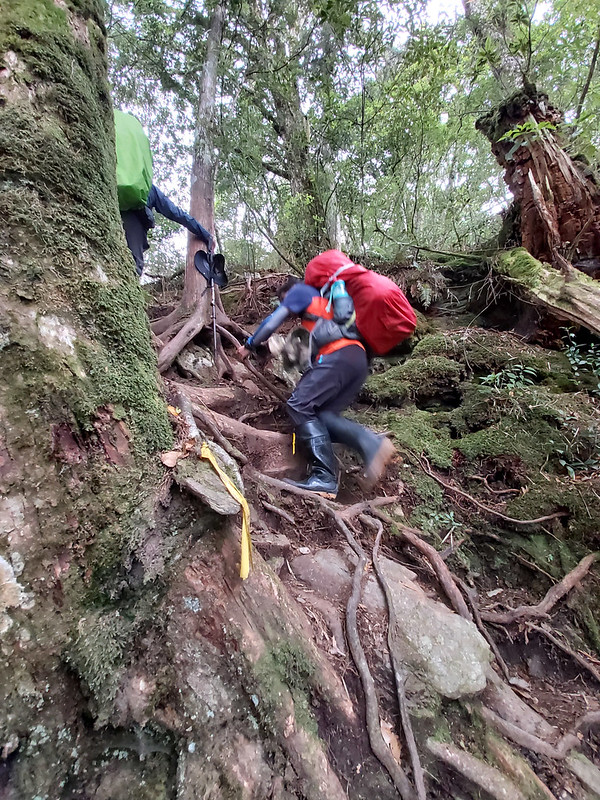
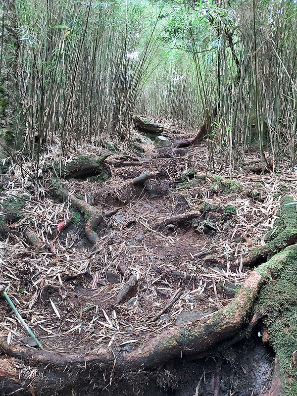
After taking the steep uphill, most of the terrains were covered by pine needles and intertwined with tree
roots. I was already out of breath after the climbing.
Around 10:00 am, we reached our first peak, Mt. Sanzhui 三錐山, 2,570 meters (8,432 feet). There wasn't view here.
We took a short break.

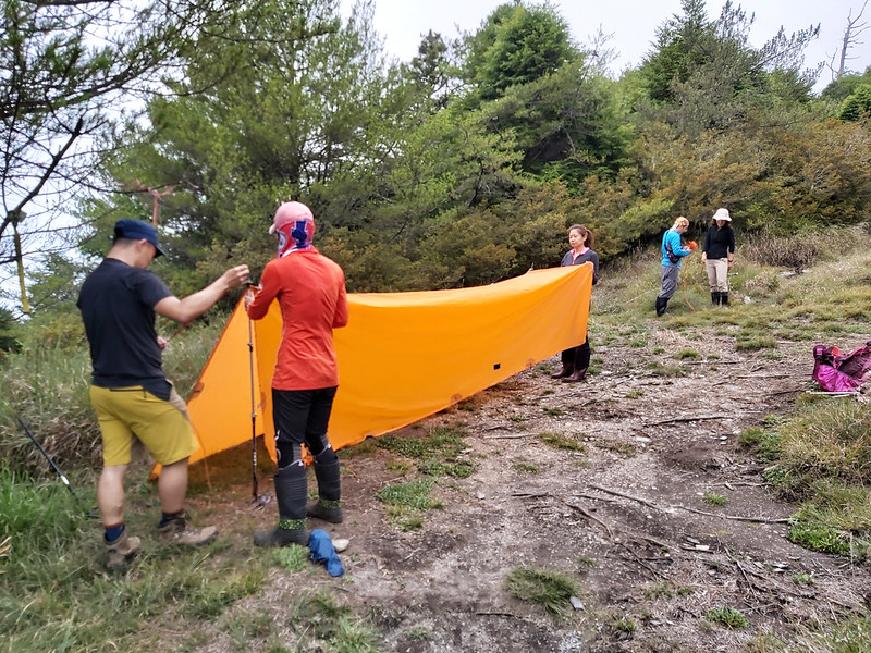
It was around noon when we reached a hunter's tarp, which looked like a permanent fixture here. Little did we
know that this humble looking tarp came back to disturb us the next evening, but it wasn't the tarp's fault
though.
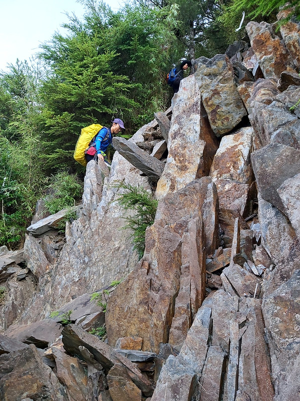
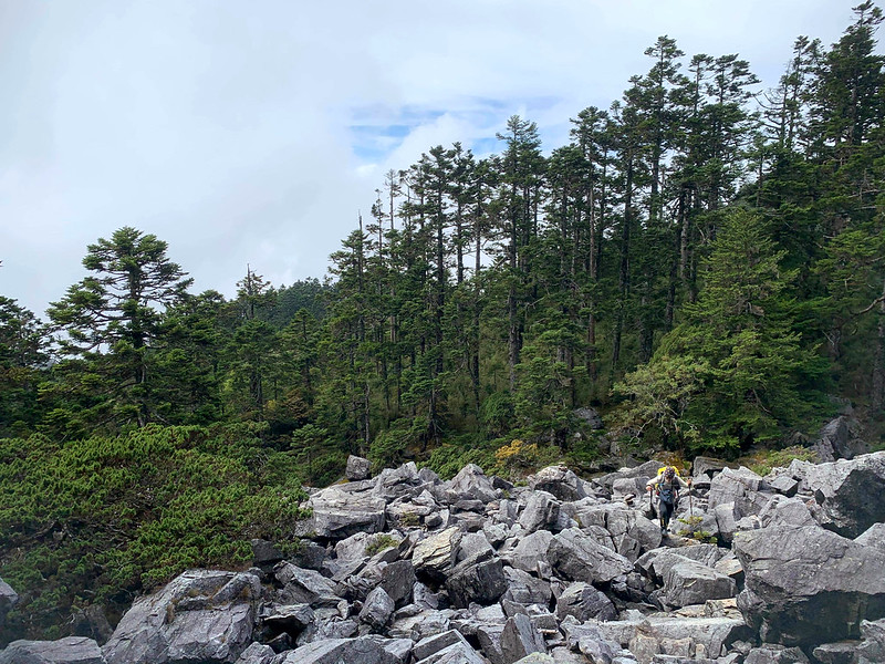
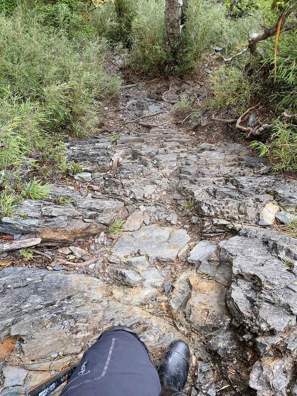
We continued to hike, and we reached the rocky, slippery slope within 10 minutes. If you think climbing up
slopes like this is hard, you should try descending from them, which was even more difficult and dangerous.

Luckily, we made it, and it took us another 20 minutes to our campsite. We didn't camp at Siyan Ponds campsite
司晏池, and we pitched our tents slightly lower instead. There were be other groups coming later, so our guides
decided to stay away from the campsite and we wouldn't be disturbed that much by others who came late. Smart.
The Unforgettable Water in Siyan Pond
After we settled down, our guides took us to Siyan Ponds to draw water. It took us around 10 minutes to get
there. I had been warned about the water quality before my trip, but seeing it in person was still a shock. I
would never think about drinking the water like this. But if you want to hike Mt. Baigu, you either carry extra
3 to 5 litters of water or you bring your own filter. I chose the latter one.

It took much longer than I thought to draw water from the pond. We had to skim the surface as much as we could
and use a cloth to sieve the dirt and debris before using the filter. I kneeled down there for at least 20
minutes to draw around 1 litter. Here was the result after using my filter, which looked much better.

After dinner, we called it a day and went to our tents to sleep. For me, it was a long night, because I always
slept bad on multi-day hikes. Luckily, I still could get some weak phone signals and go online.
Day 2: based on my hike on July 25, 2020
03:00
Got up for breakfast
04:00
Headed to Mt. Baigu
05:00
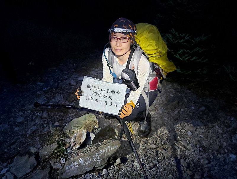
Arrived at Mt. Baigu Southeast Peak
05:49
Arrived at Jita Campsite
08:50
Reached the rock scrambles 石瀑/砂岩亂石區
09:23
Arrived at Mt. Baigu peak and stayed for 10 minutes
10:03
Took a 30-minute lunch break
12:53
Back to Jita Campsite
14:06
Reached to Mt. Baigu Southeast Peak again
15:09
Back to our campsite and called it a day
Total time:
9 hours 9 minutes, including long breaks
Distance: 9.5 km (5.9 miles)
Brief itinerary: Siyan Pond (Height 2,881 meters) ➔ Mt. Baigu Southeast Peak (Height 3,035 meters) ➔ Jita Campsite (Height 2,784 meters) ➔ Mt. Baigu (Height 3,341) ➔ Jita Campsite ➔ Mt. Baigu Southeast Peak ➔ Siyan Pond
Brief itinerary: Siyan Pond (Height 2,881 meters) ➔ Mt. Baigu Southeast Peak (Height 3,035 meters) ➔ Jita Campsite (Height 2,784 meters) ➔ Mt. Baigu (Height 3,341) ➔ Jita Campsite ➔ Mt. Baigu Southeast Peak ➔ Siyan Pond
We were supposed to get up at 4 am to get ready, but I got up at 3 to prepare my breakfast, taking my time. We
got ready and left at 5 am to our first peak, Mt. Baigu Southeast Peak 白姑東南 3,035 meters (9,957 feet).
It took us around one hour from our campsite to Mt. Baigu Southeast Peak, and most of this section was downhill.
Although Mt. Baigu Southeast Peak is over 3,000 meters, it's not listed as 100 Peaks. It was still dark when we
got there, but I could see the sky turning bright and red. It must be great to see the sunrise at Mt. Baigu, but
that means you have to get up really early to catch the first beam of sunlight.

From here, it was mostly downhill again, but I wasn't particularly excited about it, because I had to hike back
here later after I was exhausted. Around 30 minutes, we reached Jita Campsite 吉他營地. It means guitar in Chinese.
I have no idea why this is called a campsite, and this campsite could only accommodate one or two tents. A
yellow sign saying you could get phone signal here, but I didn't get many bars.

Jita Campsite was also the lowest point from our campsite to Mt. Baigu. From here, it was almost all the way up
to Mt. Baigu.

After taking a short break at Jita Campsite, we resumed the hike and what was waiting for us was more steep
climbing. Many fallen big trees lying on the trail, and we had to climb over them from time to time.
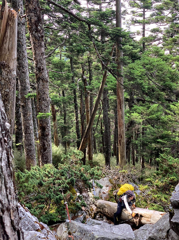
Other than the fallen trees, there were also many rock hills to climb and endless sidehills to pass.
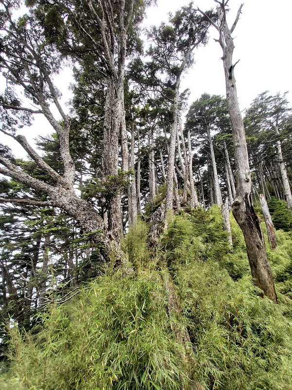
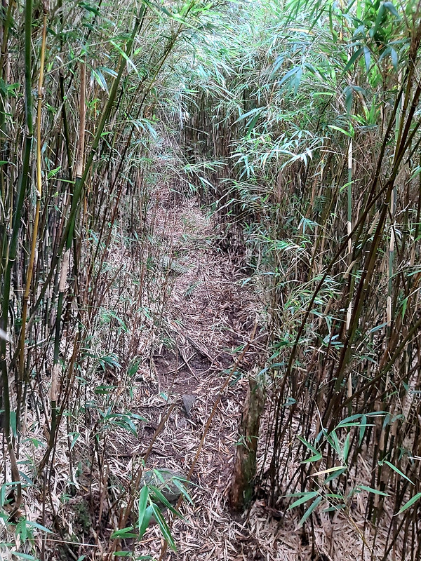
We even had to go through many bamboo woods. Luckily, those were not too difficult to go through.

One thing worth mentioning is there were many tall, magnificent Taiwan Red Pines and Taiwan Red Cypress shooting
into the sky among the bamboo woods. The mixed forest is a common scene on high altitudes in Taiwan.
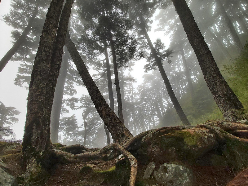
We also had to walk on the huge boulders scattered on the ridgelines flanked by tall pine trees.


The weather became cloudy and I could see mist flowing around the ridges and valleys near us. Although I was
tired and out of breath, I was still in awe when seeing the stunning views and landscape.

Some of the ridges were really scary. How I managed to get pass those ridges without panicking still baffles me.
While I was trying to catch my breath, I saw some bright purple flowers on the way up. Those were
Arisanensis Gentiana 阿里山龍膽. I was amazed
to see so many delicate flowers that could survive this kind of harsh and barren environment but still thrive,
while I was struggling a lot on the trail.

The Biggest Surprise Waiting for Me
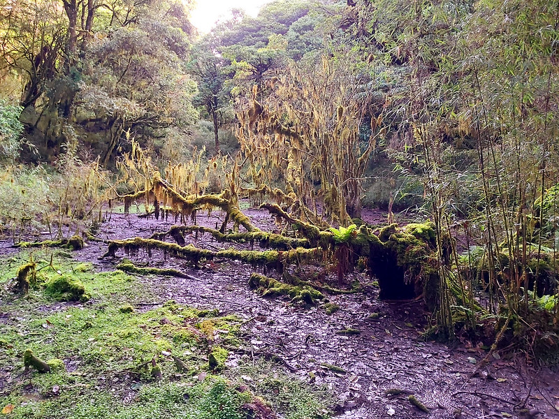
Then we reached Grass Ponds 青草池, another ponds relying on rainfall, and those ponds looked exactly like those
where we drew water from. Hanhan kept me company all the time, and he told me that Rock Waterfall (literally
from Chinese 石瀑區) or the rock scrambles 砂岩亂石區 wasn't far away. During the meeting before our hike, Hanhan had
shown us what this area looked like, but I didn't feel anything special till now.
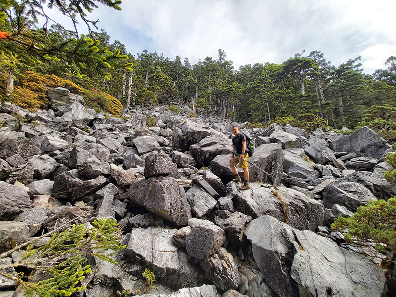
When we finally reached the rock scrambles, my jaw almost dropped. Seeing the slope covered by those gigantic
rocks was so dramatic and made me frightened. I was worried that some of those rocks would get loose and roll
over us. Hanhan assured me that it was safe to hike on them, but you still had to be careful.
After the feel-like-forever climbing, I finally passed this area and reached a small trail with more vegetation.
I could feel the heat from the sun because there was no shade at this section at all. Then, while passing
another section of bamboo woods, I could hear people talking in the near distance.
Mt. Baigu! Finally!
Before 1999 Jiji Earthquake (921集集大地震) struck Taiwan, the trailhead to Mt. Baigu was located in Qingshan on
Central Cross-island Highway 中橫青山, and the hike to Mt. Baigu could be done in one day, if you could manage 2,000
meters of acesending and descending. But the earthquakes destroyed the trail, and we now started at the
trailhead in Hongxiang Spring, Renai Nantou.


Although it was cloudy, I still could get a glimpse of the mountains surrounding us. I was not sure whether I
would come back here again, but I was grateful that at least it wasn't raining.
There was no shade on the summit, so we descended to the woods near the Boulder Rubble Area to have our lunch
break. It still took me longer than other hikers to descend. One of the reasons was my heavy backpack took me to
use extra strength. Another reason was my knees started hurting.

Descending Wasn't Easy, Either.
There is a saying in Chinese, 上山容易下山難, which means it's easy to climb up but it's difficult to descend. In this
case, it was true. When I resumed my hike after the lunch break, I was surprised to see how steep those ridges
we passed earlier. I was not good at dealing with the height, but I was coping with those scary ridges better
than I thought I would.
But I have to say, those rugged ridges looked so amazing, especially with the mist and fog spilling over them.
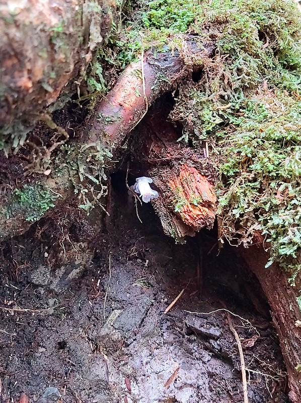
While I was struggling with the climbing over the steep slopes, I saw something tiny and white hiding underneath
tree roots. I stopped and kneeld down to check what that was, and it turned out to be Falseindianpipe 阿里山水晶蘭.
Day 3: based on my hike on July 26, 2020
05:00
Got up and prepared to leave
06:00
Left the campsite
06:24
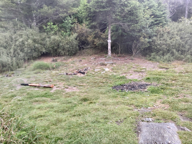
Reached Pine Needle Campsite
06:31
Reached Hunter Campsite
07:26
Reached Mt. Sanzhui
09:40
Arrived at the trailhead
Total time:
3 hours 40 minutes, including long breaks
Distance: 5.6 km (3.5 miles)
Brief itinerary: Siyan Pond (Height 2,881 meters) ➔ Mt. Sanzhui (Height 2,570 meters) ➔ Last Farmhouse (Height 1,970 meters)
Brief itinerary: Siyan Pond (Height 2,881 meters) ➔ Mt. Sanzhui (Height 2,570 meters) ➔ Last Farmhouse (Height 1,970 meters)
An Ill-prepared and Selfish Couple
We were woken up by lights and people's panic voice. I heard some frantic talks and annoying headlamp shooting
inside my tent. I had no idea what was going on, but then I heard the voice of one of our guides. After this
disturbance, it took me a while to fall asleep again.
Later I was told that there was a couple who couldn't find their tent, and the wife got panic and eventually
raised her voice. One of our guides, Wadan 瓦旦, decided to ask what happened. The couple told Wadan that they
pitched up their tent at Pine Needle Campsite 松針營地, which wasn't too far away from ours. Wadan was very kind to
offer his companying them to their tent.

But guess what? When they reached Pine Needle Campsite, this ill-prepared couple still couldn't find their tent,
again. It turned out they pitched their tent at Hunter Campsite, which was the first tarp I mentioned earlier
and it was at least one hour away from ours.
They told Wadan that they were from Hualien and arrived at the trailhead around noon. For some unknown reasons,
they still wanted to hike to the peak. I remember seeing this couple on the way back to our tents around 1 pm.
One of our guides suggest them to turn back because it was too late, but they just ignored the warning.

The Sun Decided to Show up When It was Time to Go Home
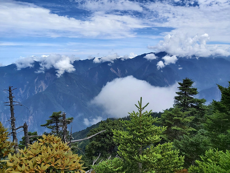
After a restless night, it was time to go home. The weather was much better than the previous day, and I saw
this amazing view from our campsite.

This happens a lot on the trail: when you were trying to get to the peaks hoping to see the amazing views from
the top, the weather turned cloudy. By the time you were ready to leave, the sun decided to show up. It was no
exception this time, like my Mt. Dabajian hike.

Even though I didn't get to see the stunning views from the Class 1 Triangulation peak of Mt. Baigu, it was
still wonderful to hike on the trail that was paved by soft pine needles. The beams of sun made the hiking back
to the trailhead even more pleasant.

Those beautiful trees were so tall and amazing.

By the time we were close to the trailhead, there were many new tents being set up there. Hanhan said many
hikers who chose to hike to Mt. Baigu in one day would pitch their tents here and get up around 2 am to hike. I
forgot to take photos of them.
When we exited the trail and got back to our cars, the stunning mountains were waiting for us, so were those
endless flies.

About Mt. Baigu and the Famous (or Notorious) Deadly Accident
Mt. Baigu is located between Renai Township in Nantou County 南投縣仁愛鄉 and Heping District in Taichung City 台中市和平區,
central Taiwan, and is very close Central Cross-island Highway 中部橫貫公路 or 中橫 in short. The majority of indigenous
people live in Renai are Atayal people.
One of Atayal's clans, Xalut 福骨群, has been living around Mt. Baigu for generations. Xalut means people who live
in remote mountains. During Japanese Occupation, Xalut turned into Hakku in Japanese, and it was translated into
Baigu, which also sounds like white dog in Chinese. That's how the name came from.
100 Peaks or baiyue 百岳 in Chinese is a very famous list (achievement to be exact) among hikers in Taiwan. Mt.
Baigu is listed No. 44. Under this list, there are also many sub-lists. Among those 100 peaks, the trailheads of
4 peaks are located on Central Cross-island Highway.
Those 4 mountains happen to be difficult to hike. Therefore, those are also nicknamed as 中橫四辣. In Chinese, 辣 means spicy, and it also means it's difficult to handle. I
can't find the official English name for 中橫四辣, so please bear with me and let's call it Central Highway 4 Spicy
Hikes. The mountains listed on Central Highway 4 Spicy Hikes are Mt. Yangtou 羊頭山, Mt.
Bilu 畢祿山, Mt. Baigu 白姑大山 and Mt. Pingfeng 屏風山, ranging from relatively easy to the most challenging
one on this list. But some hikers say Mt. Pingfeng is easier than Mt. Baigu after the new trail has been
discovered.
In 2011, a hiker, Mr. Zhang, went missing when he tried to
do a solo hike on Mt. Baigu. It took the rescue team 51 days trying to find him without any luck. This is a long
story, but this tragedy ignited the debates about mountaineering/hiking safety and education in hiking
communities in Taiwan.
Get Free Guides on Public Transport and Applying for Permits. Or Hire Me!
Free Bus Guides to Hike Popular Mountains in Taiwan
Taking buses to hike in Taiwan can be tricky if you don't read Chinese. Therefore, I've made several public transport guides to help you get to the trailheads. Or click the
image below to see more details.