Mt. Meilu, Mt. Gaoyao and Mt. Badaoer: A Hike with Great Views and Wild Orchids in Wulai
Speaking of Wulai, the first thing comes to people's mind is hot spring. Yet, there are many wonderful hiking
trails near Wulai, and Mt. Badaoer is one of them. This hike will take you to see the exotic orchids and
amazing views on the peak.


Table of Contents:
- About Mt. Meilu, Mt. Gaoyao, and Mt. Badaoer and Chatianshan Mountain System
- How to Get There
- Peaks and Places to Reach
- A Remote Trail with Hidden Surprises and Wonderful Peak Views to See Wulai and Yilan
- Thoughts about this Hike and Other Routes
- Map and Itinerary
- Recommended Blogs and Resources
- Related Posts on Taiwan Hikes
About Mt. Meilu, Mt. Gaoyao, and Mt. Badaoer and Chatianshan Mountain System
Mt. Badaoer, Mt. Meilu and Mt. Gaoyao are called Wulai Three Mountains 烏來三山, and belong to Chatian Mountain System. Therefore, let's talk about Chatian
Mountain System first.
About Chatian Mountain System and Mt. Beichatian
Chatianshan Mountain System belongs to the north section of Mt. Xue Range (aka Xueshan, Mount Sylvia,
Snow Mountain, etc.) 雪山山脈, and is famous for its biodiversity and Fagus hayatae, aka Taiwanese Beech 台灣山毛欅.

To preserve Chatian Mountain's unique nature, the Council on Agriculture officiated the Chatianshan Nature Reserve 插天山自然保留區 in March, 1992 and the total area is
around 7,759 hectares (19,173 acres). Chatianshan Nature Reserve is located in between Wulai Village and
Sansia Township of Taipei County and Fusing Village of Taoyuan County.

There's a very famous Mid-elevation Mountain Trail 中級山 called Mt. Beichatian or Beichatianshan 北插天山 with the height of 1,727 meters (5,666
feet). Bei means “north” and Shan means “mountains” in Chinese. One of the meanings of Cha is poking or
stabbing, and Tian in Chinese means sky. Chatian means the mountains are so tall that they are like poking
into the sky. As you might have guessed, hiking to this mountain isn't a piece of cake.

Since it's located in Chatianshan Nature Reserve, you need to apply for permits to hike Mt. Beichatian. I haven't done this one yet, because it's too
popular to get the permits.
Atayal people 泰雅族 call Mt. Beichatian “Babo Takai”. In Atayal language, Babo means mountains and Takai means
the mountains are very high. Therefore, Mt. Beichatian is also called Mt. Takai 塔開山. There are also many giant
old trees in Mt. Beichatian, ranging from 800 years old to 1,500. 18 of them have been numbered.

If there's a north Chatian mountain, there must be a “south” one. Yes, there's a Mt. Nanchatian with a height of 1,907 meters (6,257 feet). Mt. Nanchatian is
more challenging to hike and less popular compared to its north counterpart.
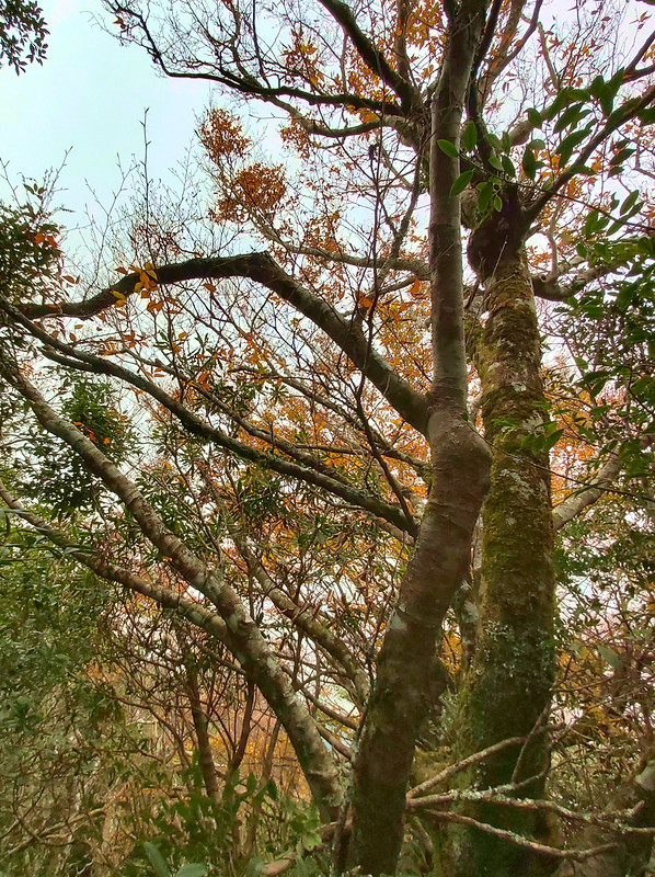
The leaves of Taiwanese Beech will turn yellow and then red in autumn and make the mountains so colorful. This
phenomenon attracts many hikers to witness the beauty of this area.
About Mt. Meilu, Mt. Gaoyao, and Mt. Badaoer
The name of Mt. Badaoer came from Atayal's Batul, an earring wore by Atayal people. The shape of Mt. Badaoer
looking from Xinwu Road in Wulai looked like Batual, and the pronunciation of Batual in Mandarin is Badaoer.
That's how the name of Mt. Badaoer came from.
Many years ago, the trail to Mt. Badaoer was from Honghegu 紅河谷, meaning Red River Valley in Chinese. The old
name of Honghegu is Jiajiuliao 加九寮, located between Jiajiuliao Creek and Nanshi River 南勢溪. After new roads
were built, many hikers take the trailhead next to Baoqing Temple to Mt. Badaoer.
Hikers can still take the trailhead in Honghegu, but it's more difficult and not for every hiker. I did a hike
to Mt. Jiajiuling in October 2019, and the trees and the valleies were beautiful.

I don't find much information about Mt. Gaoyao. As to Mt. Meilu, Mei means beautiful, and Lu means deer or
Sambar. It is said that there were many beautiful and fat deer or sambars running around at Mt. Meilu. That's
how the name of Meilu came from.
How to Get There
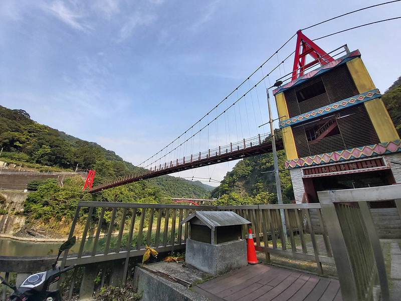
There is no public transport to or near Baoqing Temple, unless you are willing to walk from Wulai Terminal,
the last bus stop of Bus 849 to the temple, which is a
6.2km walk, single trip, and you have to walk back to the bus stop if you can't get a ride. Otherwise, you'll
need to drive or ride a scooter to get there.
Peaks and Places to Reach
Baoqing Temple: 保慶宮, height 900 meters (2,953 feet). The distance from the
nearest bus stop in Wulai, Wulai Terminal, to this temple is 6.2 km (3.85 miles).
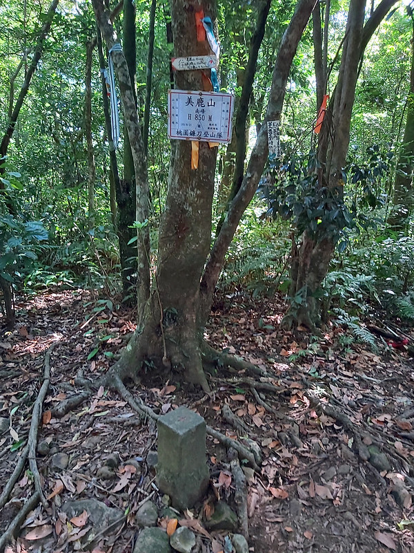
Mt. Meilu South Peak: 美鹿山南峰, height 850 meters (2,789 feet). No views.
Mt. Meilu: 美鹿山, height 870 meters (2,854 feet). No views.
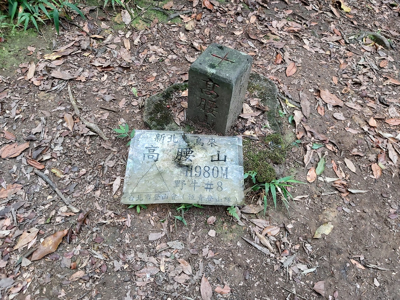
Mt. Gaoyao: 高腰山, height 980 meters (3,215 feet). No views.
Mt. Badaoer: 拔刀爾山, height 1,117 meters (3,665 feet). There is a Class 3 Triangulation Stone on the peak and the views are great.
Mt. Meilu South Peak: 美鹿山南峰, height 850 meters (2,789 feet). No views.
Mt. Meilu: 美鹿山, height 870 meters (2,854 feet). No views.
Mt. Gaoyao: 高腰山, height 980 meters (3,215 feet). No views.
Mt. Badaoer: 拔刀爾山, height 1,117 meters (3,665 feet). There is a Class 3 Triangulation Stone on the peak and the views are great.
A Remote Trail with Hidden Surprises and Wonderful Peak Views to See Wulai and Yilan
Distance: 8.5 km (5.3 miles)
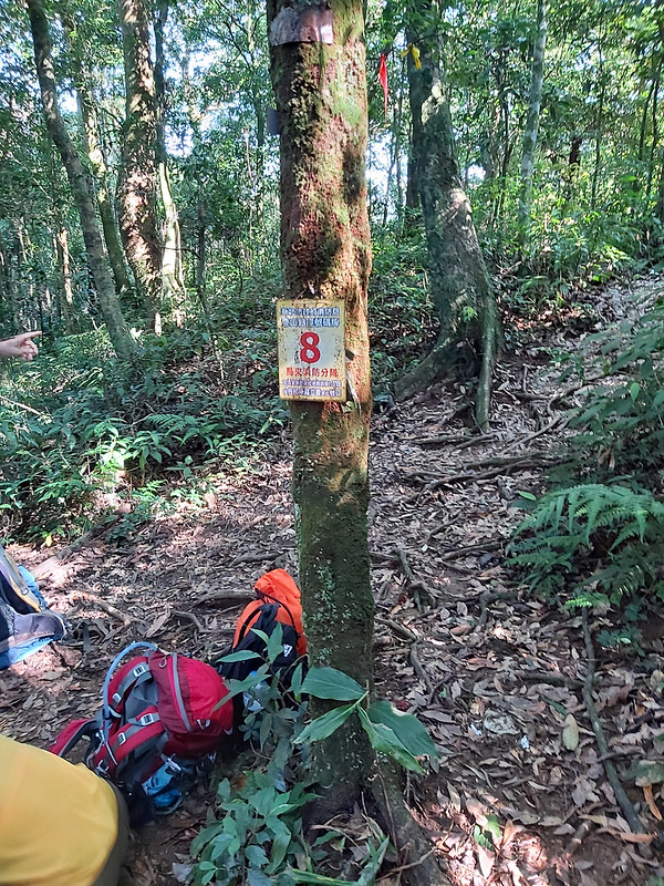
Brief itinerary: Baoqing Temple (Height 900 meters) ➔ Mt. Meilu South Peak (Height 850 meters) ➔ Junction with No. 8 sign ➔ Mt. Gaoyao (Height 980 meters) ➔ Mt. Badaoer (Height 1,117 meters) ➔ Junction with No. 8 sign ➔ Baoqing Temple
GPS coordinates of the trailhead: 24.8517389,121.5372427
Brief itinerary: Baoqing Temple (Height 900 meters) ➔ Mt. Meilu South Peak (Height 850 meters) ➔ Junction with No. 8 sign ➔ Mt. Gaoyao (Height 980 meters) ➔ Mt. Badaoer (Height 1,117 meters) ➔ Junction with No. 8 sign ➔ Baoqing Temple
GPS coordinates of the trailhead: 24.8517389,121.5372427
This is one of the trails I always wanted to do, but the problem is there is no public transport to the
trailhead. Unless I'm willing to walk extra 6.2 km from the bus stop in Wulai or get a ride from other hikers,
there is no way to do this hike. Luckily, Fion, my friend who is also a hiking guide, told me that a hiking
group had this hike and arranged pickups for us, and my wish was finally fulfilled.

We met up at Taipei Train Station at 6:30 am and by the time we got to Baoqing Temple 保慶宮, it was already
7:45. Remember to prepare enough commuting time if you do this hike.
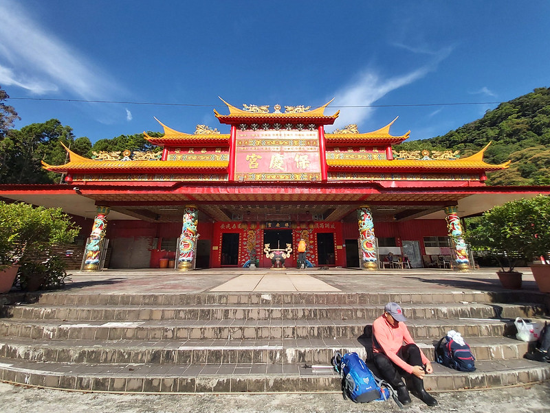
Not just popular among hikers, this place is also cyclists' favorite meetup location. The trailhead is right
next to the temple.

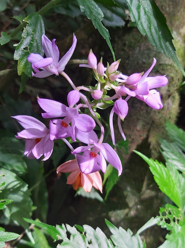
Spotted the Beautiful Wild Orchid before Mt. Meilu
The first peak we reached was Mt. Meilu South Peak. There wasn't much view, so we quickly left. Not long after
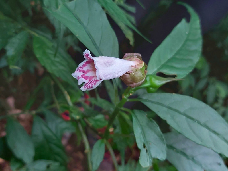
we left the peak, I spotted something bright out of the corner of my eye. They were purple orchids, called
Calanthe sylvatica (Thouars) Lindl 長距根節蘭. I also found them on my hike to Mt. Liwu. Here are other beautiful wildflowers I've found on the trails.

I've done several hikes in Wulai and this place is famous for stunning wild orchids and other wildflowers, but
I didn't expect to see them again. Therefore, I was so thrilled.

Wulai is truly the home for many wild orchids. If you are also interested in wild orchids, you can visit Max Kuo's YouTube channel. He's dedicated to find many amazing
wild orchids on the trails.
Soon, we reached Mt. Meilu South Peak. There was no view here, so we continued our hike.
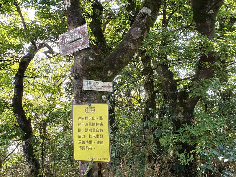
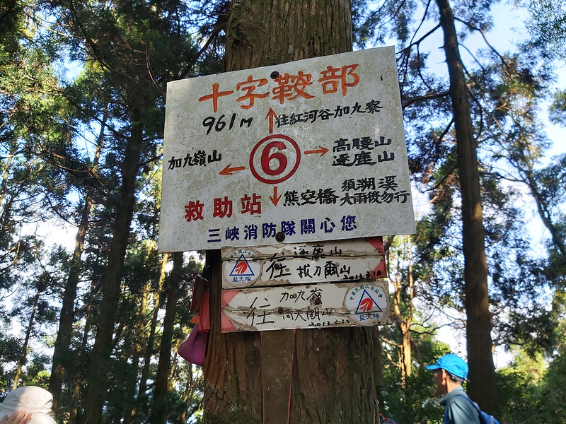
We reached a three-way junction with a marked sign, No. 8. and another sign pointing to the direction of Mt.
Gaoyao.
Within 20 minutes, we reached Mt. Meilu. Nothing much on this peak, either. So, we turned back to the junction
with No. 8 and continued our hike.

Another Junction to Mt. Gaoyao
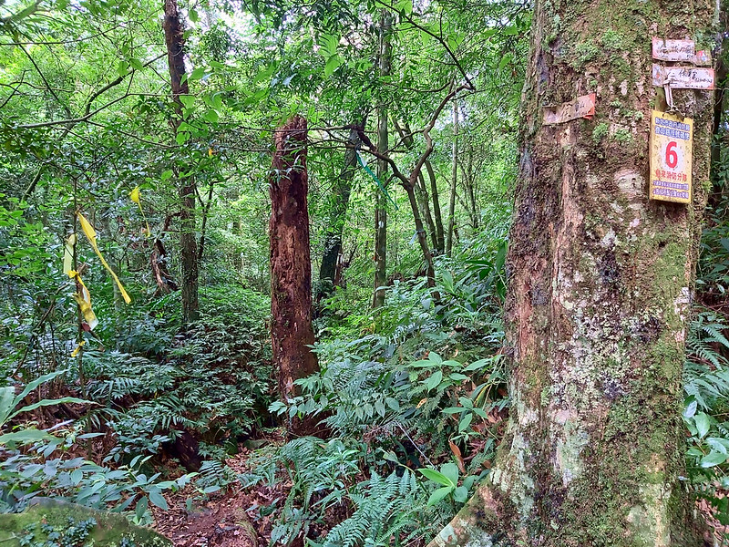
There are several junctions on this trail. We reached another sign with No. 7. There were so many tags, signs,
and ribbons on this poor tree. We followed the direction to Mt. Gaoyao.

Within 20 minutes, we reached Mt. Gaoyao. There was still no view here, so we turned back and headed to Mt.
Badaoer.
More Wild Orchids and Stunning Views on Mt. Badaoerand
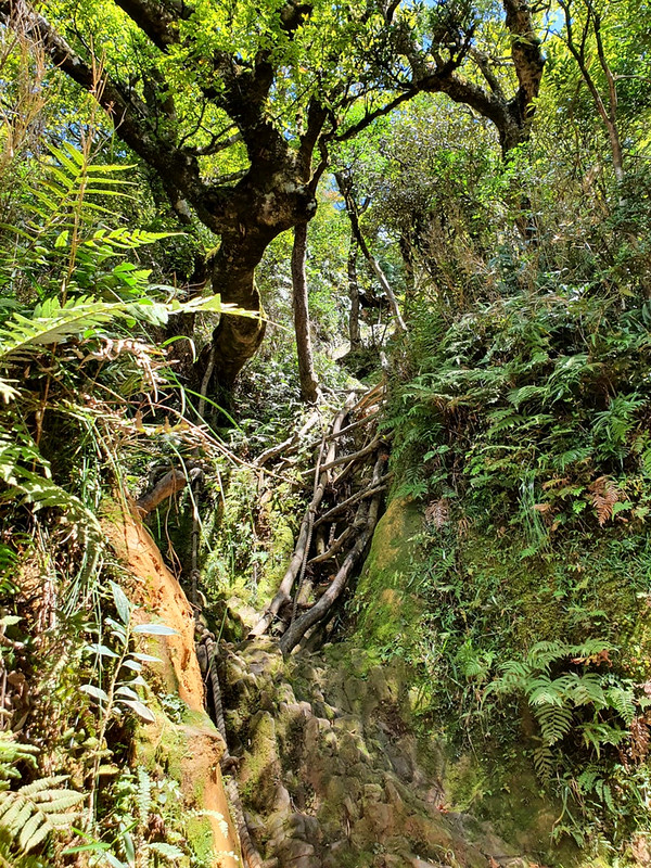
The vegetation here was different from those Japanese Cedars we saw earlier. It was more like a jungle, and
often time we hiked on small valleys among the hills.


To my delight, I saw those beautiful orchids again.
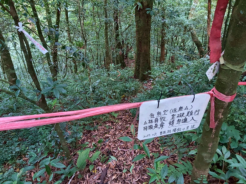
Then we turned to the sidehill, and we saw a junction with a rope haning above the trail. There was a
handwritten sign tying on the rope saying this junction would take you to Honghegu 紅河谷, and it was signed by a
person who claimed he got lost here. Reading this, you get the idea about what had happened.

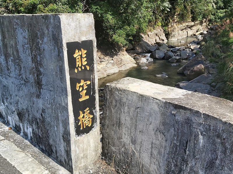
While walking on the sidehill, we saw another hand-written sign hanging on the rope that blocked the trail
again. It said this junction would take you to Xiongkong (Mt. Zhulu) 熊空 (逐鹿山) with the similar warning on the
previous one. I always wanted to hike Mt. Zhulu and now those signs made me even more intrigued.
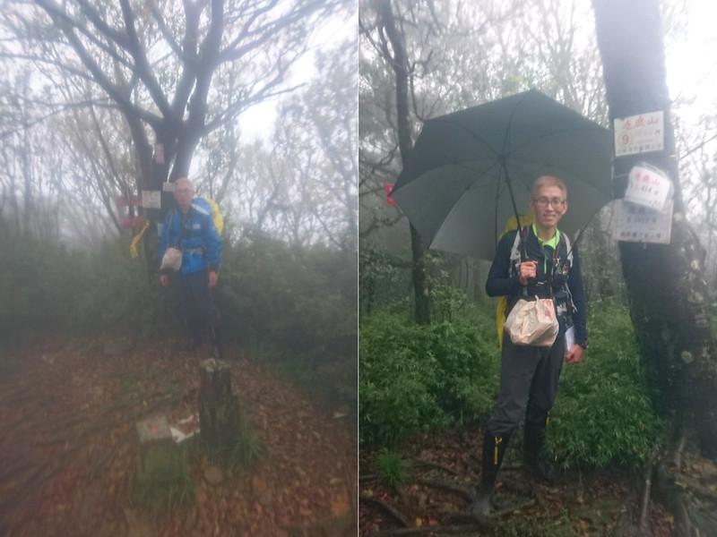
Stunning Views on Mt. Badaoer
After passing this junction, we arrived at Mt. Badaoer within 10 minutes. The view on Mt. Badaoer was great. I
was told we could see as far as Mt. Hongludi, but it was pity that I
didn't have the PeakFinder app at that time to know what those peaks were.

But I got to see Mt. Zhulu and Mt. Kabao. I always wanted to hike to those two mountains, but there was no
public transport to the trailhead and this hike was quite challenging. At least, I could see those peaks from
the distance for now.

It was around noon, and we found a big flat place in the woods to have lunch. The trees in this area were
mixed with tall trees and small bushes, and it was quite humid. I found many cute mushrooms there.

After lunch break, we resumed our hike and passed the junction with the No. 6 sign, and back to No. 8 within
30 minutes.
While getting back to Baoqing Temple, I saw those wonderful orchids again and even found another wildflower,
Taiwan Bicornuta 角桐草, which is an endemic species in Taiwan. I saw this one in Miaoli, too.
Before 2 o'clock, we were already back to the temple and finished this hike.

Thoughts about this Hike and Other Routes
As you can see, this is a very short hike with amazing views on Mt. Badaoer and beautiful wildflowers. This is
a hike that I will do it again.
Do A Big Loop Hike Starting from Honghegu
If I get a chance to hike here again, I will take the one from Honghegu. I can take Bus 849 from MRT Xingdian Station and get off at Chenggong
Stop 成功站. The trailhead is very close to Chenggong Stop. The distance of this route is around 16 km (10 miles)
and it's more challenging. The elevation gain and loss are 1,200 meters.
Hike to Mt. Zhulu and Mt. Kabao
The followings are the trails I want to do or do it again: Mt. Jiajiuling, Mt. Zhulu and Mt. Kabao 卡保. Many
hikers prefer to hike here in autumn so they can see Taiwanese Beech. It will be great to see those amazing
trees, but I'm also fine without seeing them if I can avoid the crowd.
Be Aware of Leeches and Snakes
Many hikers report seeing snakes and getting bitten by leeches on the trail. There are also bees in certain
areas here. I didn't meet any of them, especially the leeches. But I guess it was because I wore rainboots. If
you don't like those tiny suckers, please be aware of them. If you don't know how to get rid of leeches that
are already sucking your blood, put a pinch of salt on them and they will fall off right away. I tried this
several times and it works like a charm.
Have you visited Wulai before? What do you think about those mountains? Let me know in the comment box below.
Also, subscribe Taiwan Hikes newsletter for the wonderful trails in Taiwan.
Map and Itinerary
Group Hike or Solo Hike: Group hike
Date of Hike: August 16, 2021
Date of Hike: August 16, 2021
Click Menu in the map to download, print or share the map.
Click to change the speed to meet
your condition.
to change the speed to meet
your condition.
Note:
My GPS track may not be totally accurate and is for reference only.
Click
to change the speed to meet
your condition.Note:
My GPS track may not be totally accurate and is for reference only.
Based on my hike on August 16, 2020
07:45
Arrived at Baoqing Temple
08:00
Started the hike
08:34
Reached Mt. Meilu South Peak
08:39
Reached the junction with No. 8 sign
08:55
Reached Mt. Meilu, no views
09:11
Back to the junction with No. 8 sign
09:27
Reached the junction to Mt. Gaoyao and No. 7 sign
10:15
Arrived at Mt. Gaoyao
11:20
Passed the hand-written sign of warning to Honghegu
11:24
Reached the junction and the sign to Xiongkong (Mt. Zhulu)
11:30
Reached Mt. Badaoer and took a break
12:00
Lunch break at a saddle
12:32
Saw No. 6 sign
12:59
Back to the junction with No. 8 sign
13:36
Back to the temple and finished the hike
Total time:
5 hours 36 minutes, including long breaks