South Section 2 南二段: A 7-Day Thru-Hike in Taiwan's Central Mountain Range
South Section 2 of Taiwan's Central Mountain Range, known locally as Nan Er Duan (南二段), is a remote 7-day high-mountain traverse from Xiangyang to Dongpu. The approximately 89-kilometer route passes Jiaming Lake, crosses nine of Taiwan's 100 Peaks, and eventually joins part of the Japanese-era Batongguan Traversing Trail.

Unlike many long mountain traverses in Taiwan, cabins are available along the route, so hikers who successfully obtain all the required cabin reservations may not need to carry a tent. However, long days, limited water, changing weather, and several remote sections make this a route for experienced and well-prepared hikers.

I completed this challenging trek in November 2025 and was amazed by its spectacular landscapes, diverse vegetation, and constantly changing terrain. However, I also had a close call during the journey, and I hope you can learn from my mistakes.
If you can only choose one long-distance backpacking hike in Taiwan, choose South Section 2.
Disclaimer:
All content is for inspiration only. Use Taiwan Hikes' suggestions at your own risk. We are not responsible for any losses, injuries, or damages.
All content is for inspiration only. Use Taiwan Hikes' suggestions at your own risk. We are not responsible for any losses, injuries, or damages.
Table of Contents:
- Trail Information: South Section 2 at a Glance and Cabins
- Is This Hike Suitable for You?
- South Section 2: Seven-Day Itinerary
- My Close Call: What Happened and What Hikers Can Learn
- How to Apply for Permits to Hike South Section 2: A Little Bit Complicated
- Map, Transportation, and Weather
- Shorter Hiking Option: BaDaXiu (八大秀)
- Related Posts
Trail Information: South Section 2 at a Glance and Cabins
Trail Name: South Section 2 of the Central Mountain Range, Nan Er Duan 南二段
Distance: 89.3 km (55.5 miles)
Route type: Point-to-point
Ascent/Descent: 6,547m/7,593m
Permits: You need permits from Jiaming Lake, Yushan National Park, and the police agency.
Difficulty Level:
Distance: 89.3 km (55.5 miles)
Route type: Point-to-point
Ascent/Descent: 6,547m/7,593m
Permits: You need permits from Jiaming Lake, Yushan National Park, and the police agency.
Difficulty Level:
Peaks Along the Route (10 are listed among Taiwan's 100 Peaks.)
- Mt. Siangyang 向陽山, 3,602 meters, Class 3 Triangulation Stone
- Mt. Sancha 三叉山, 3,496 meters, Class 1 Triangulation Stone
- Jiaming Lake 嘉明湖: 3,310 meters, a popular hiking destination in Taiwan that is worth visiting.
- Mt. Nanshuangtou (South Shuangtou Mountain) 南雙頭山, 3,356 meters, not listed in the 100 Peaks.
- Yunfeng (Yun Peak or Yunfong) 雲峰, 3,564 meters, Class 2 Triangulation Stone
- Mt. Lulu 轆轆山, 3,279 meters, Class 3 Triangulation Stone
- Mt. Tafen 塔芬山, 3,090 meters, Class 2 Triangulation Stone
- Mt. Dafenjian 達芬尖山, 3,208 meters
- Mt. Nandashuiku (South Dashuiku Mountain) 南大水窟山, 3,381 meters, not listed in the 100 Peaks.
- Mt. Dashuiku 大水窟山, 3,642 meters
- Mt. Xiuguluan 秀姑巒山, 3,825 meters. Mt. Xiuguluan is actually not in the South Section 2, and is listed in the Mabolasih (or Mabolasi) Crossing Trail (Mabolasih Traversing Trail) 馬博橫斷. We included this in our South Section 2 hike.
- Mt. Batongguan 八通關山, 3,335 meters

Cabins to Stay
- Siangyang Cabin 向陽山屋: elevation: 2,850 meters, capacity: 70 people. When doing the South Section 2 hike, hikers usually don't stay at the Jiaming Lake Cabin 嘉明湖山屋. Phone signals are good at both cabins.
- Lakuyin River Cabin 拉庫音溪底山屋: elevation: 2,690 meters, capacity: 20 people. Phone signal is patchy.
- Lulu Valley Cabin (Lulugu Cabin) 轆轆谷山屋: elevation: 2,991 meters, capacity: 20 people. No phone signal inside the cabin, and it is patchy at the front door. There is a river by the cabin.
- Tafen Valley Cabin (Tafengu Cabin) 塔芬谷山屋: elevation: 2,605 meters, capacity: 20 people. No phone signal inside the cabin, and it is patchy at the front door. Water tanks are available at the cabin, but the water might be low during droughts.
- Dashuiku Cabin 大水窟山屋: elevation: 3,227 meters, capacity: 20 people. No phone signals inside or outside of the cabin. Water tanks are available at the cabin, but the water might be low during droughts.
- Baiyang Mine Cabin (Baiyangjinkuang Cabin) 白洋金礦山屋: elevation: 2,575 meters, capacity: 20 people. There's a campground here, too. No phone signal inside the cabin, and it is patchy at the front door. Water tanks are available at the cabin, but the water might be low during droughts.
- Jhongyang Mine Cabin (Jhongyangjinkuang Cabin) 中央金礦山屋: elevation: 2,823 meters, capacity: 20 people. No phone signal inside the cabin, and it is patchy at the front door.
- Guangao Cabin 觀高山屋: elevation: 2,575 meters, capacity: 42 people. Phone signal is patchy inside the cabin. It's much better at the junction.
- Lele Cabin 樂樂山屋: elevation: 1,670 meters, capacity: 12 people. Phone signal is patchy. There are water tanks at the cabin, but you can find water sources heading to the Dongpu side.
Additional Information:
- The trail to the famous Batongguan Grassland 八通關大草原 has become inaccessible due to numerous typhoons, earthquakes, and landslides. As a result, many hikers, including us, bypassed the old route and took a detour.
- We didn't stay in all the cabins mentioned above. Some hikers completed this hike in eight days or started from the Dongpu trailhead. We took the southern route, which is easier than the Dongpu side.

Is This Hike Suitable for You?
Without a doubt, this hike is amazing and definitely worth undertaking. But the question remains: are you prepared for this adventure? Here's what you need to know.
- Although you may not need to carry a tent or hire a porter to lighten your load, you still need to be fit enough to handle rough terrain, including climbing and descending.
- Navigation skills are very important. You need to be able to read the map and navigate the trail paths. We took several wrong turns, even with a professional, seasoned hiking guide. This is because the trail terrain changes after typhoons or heavy rains.
- The ability and courage to call off the hike when the weather is not promising. Taiwan is prone to torrential rains and typhoons in summer. Hikers have died during this long-distance hike. Carrying a satellite phone or inReach is essential, too.
- Again, trail distance in Taiwan is just a number. The short distance doesn't mean it will be faster to finish. Please do thorough research before you do this hike.
Not Ready for a Seven-Day High-Mountain Traverse?
My Permit-Free Hiking Trails Guide includes 41 trails across Taiwan that you can reach by public transport—without dealing with high-mountain permits or carrying seven days of supplies.
Get all 41 trails + maps →South Section 2: Seven-Day Itinerary
South Section 2 is a point-to-point hike, with most hikers starting at the south entrance of Siangyang National Recreation Area. This location also serves as the trailhead for the famous Jiaming Lake hike (my post).
Day 1: Siangyang National Recreation Area to check in ➔ Siangyang Cabin
Distance: 7 km (4.35 miles). The distance from the checkpoint to the Jiaming Lake trailhead is 2.7 km, and the trailhead to Siangyang Cabin is 4.3 km.
Estimated time: 2-3 hours
Estimated time: 2-3 hours
We took a train from Taipei to Chishang and met up with our pickup drivers upon arrival. The drive from Chishang Train Station to Siangyang National Recreation Area took approximately 2 hours. Once we arrived, our guide submitted our documents to the nearby police station.

A staff member from the Forestry and Nature Conservation Agency provided us with a briefing about the Formosan Black Bear, the Alishan Salamander, and other important information we needed to know.
While sightings of the Formosan Black Bear are rare, they have been reported in the area. We were reminded to practice Leave No Trace principles and to avoid feeding any wild animals.

The hike to Siangyang Cabin, located at the 4.3 km mark, took us about 2 hours. The cabin offers bio-toilets, water, and kitchen facilities.

The kitchen is divided into two sections: one for catering companies and another for hikers who prefer to cook their own meals. This new setup represents an improvement for visitors. For more details about the cabin, please refer to my Jiaming Lake post.

Spending our first night at Siangyang Cabin, situated at an elevation of 2,850 meters above sea level, helps with acclimatization to the higher altitude. However, it is advisable to consult your doctor beforehand, as this is a long-distance hike.

Day 2: Siangyang Cabin ➔ Junction to Mt. Siangyang at the 7.4 km mark ➔ Jiaming Lake Cabin ➔ Junction to Mt. Sancha ➔ Junction to Jiaming Lake ➔ Jiaming Lake ➔ back to the junction ➔ Lakuyin River Cabin (Lakuyin Cabin)
Distance: 14.2 km (8.8 miles)
Estimated time: 10 hours
Estimated time: 10 hours
We started the hike around 3:30 am. When we started the second day's hike, it was drizzling. This was not my first time visiting Jiaming Lake; I was still hoping for better weather by the lake.
Yet, the clouds and mountain ridges still gave us a spectacular view.

We passed the junction to Mt. Siangyang, but none of us wanted to go. Most of us had hiked to this mountain before, and it was still drizzling without a promise of a good view anyway.
We arrived at the Jiaming Lake Cabin near 8:00 am, and we took a long break.

At this moment, the sky was still overcast with a few patches of blue appearing.

As we approached Jiaming Lake, more patches of blue sky began to appear.
When we reached the junction to Mt. Sancha, I skipped going to Mt. Sancha again. We dropped our big backpacks at the junction at the 12.7 km mileage.

By 11:09 am, the Jiaming Lake presented herself with a nearly full water body. There was a typhoon before we did this hike. This was my first time seeing Jiaming Lake this full, and I was thrilled. What made us even more excited was that the weather improved with a blue sky. This was also my third visit to Jiaming Lake.

Well, this was not our destination, and we still had 6km ahead of us before reaching Lakuyin River Cabin.

The junction to the Lakuyin River Cabin was an unassuming wooden post, and we entered the Yushan National Park's territory from here. You must have an offline trail map on your phone if you do this hike because there are not many trail markers here.


After we reached the highest point, we descended to a huge slope and saw the red roof of our temporary home for tonight around 1:17 pm.

The following descent may fool hikers into thinking it would be easy. In fact, it was a 448-meter descent and took me nearly one hour to arrive at Lakuyin River Cabin.

Lakuyin River Cabin is a relatively new cabin with a lighted toilet flashing at night. This is very important, and I will share my story later.


You can find water tanks next to the cabin, but we went to the nearby creeks to draw water.

This is a two-story cabin, and the interior is simple. There's a big table inside for hikers to cook. Please don't cook on the mattress to prevent the floor from being burnt.


Day 3: Lakuyin River Cabin ➔ Mt. Nanshuangtou ➔ Junction to Yunfeng ➔ Yunfeng ➔ Junction to Yunfeng ➔ Lulu Valley Cabin
Distance: 15.8 km
Estimated time: 9 hours
Estimated time: 9 hours
When doing a long-distance hike in Taiwan, it is common to start around 2:00 or 3:00 in the early morning. We left Lakuyin River Cabin at about 3:00 and followed our guides as we hiked in the dark.
We reached Mt. Nanshuangtou around 5:30, just as some light was beginning to break through the dark sky. Since we did this hike in mid-November, the sunrise was fairly late.

As we descended again, I found myself lagging behind the group due to the steep slope. However, this turned out to be a blessing, as my position allowed me to see the sun casting a crimson hue on Yushan (Jade Mountain).


At 8:52, we arrived at the junction leading to Yunfeng and took a short break. We left our backpacks behind and carried only the essentials to Yunfeng.

The name Yunfeng literally means "cloud peak" in Chinese, but the hike to the summit was far from romantic. After reaching the small peak, we had to climb over a steep slope to get to the other side, followed by another descent.

In general, the trail to Yunfeng is a constant series of ups and downs, with numerous false peaks that momentarily lift your spirits before breaking your will again.

After two hours of grinding and cursing, we finally arrived at Yunfeng. Fortunately, our hard work paid off, and we were rewarded with amazing views from the summit.

We took a break at the top before heading back to our backpacks. The weather was becoming cloudy, and I noticed some unusual rain.
The raindrops were larger and fell more slowly than usual. Later, I learned that Yushan had reported its first winter snow of 2025, and I realized that what we encountered was indeed that first snowfall.

We returned to the junction at 12:54 and started our hike to our destination for Day 3: Lulu Valley Cabin.

The next segment of the hike was typical, with us climbing over various hills and valleys.

Along the way, I observed many trees showing signs of damage from sambar deer, either from rubbing their antlers or grazing on the bark.

When we finally spotted our cabin, it was already 16:09. However, it still seemed far away. Regardless, seeing the cabin gave me a boost of energy, and I quickened my pace. It took me nearly 20 minutes to reach the cabin, arriving at 16:26.

The interior of Lulu Valley Cabin is quite similar to that of Lakuyin River Cabin; they are basically the same except for the newer models.

There is no water source nearby, but water tanks are located beside the cabin.
The bio-toilets are not far off, and the lights turn off at night. After settling in, we prepared to cook our dinner and call it a night.

Day 4: Lulu Valley Cabin ➔ Junction to Mt. Lulu ➔ Mt. Lulu ➔ Junction to Mt. Lulu ➔ Tafen Pond ➔ Mt. Tafen ➔ Tafen Valley Cabin
Distance: 8.8 km
Estimated time: 9 hours
Estimated time: 9 hours
We started the hike slightly later than usual since Day 4's hike was shorter, and we didn't aim to catch the sunrise. The sky was overcast with clouds, leaving us unsure if we would even see the sunrise.

The distance from the junction to Mt. Lulu wasn't long, but it was steep enough to leave us huffing and puffing. Fortunately, we were rewarded with breathtaking views from the summit.

We often hope for clear blue skies at the summits, but sometimes the clouds and mist can create a spellbinding atmosphere that makes the landscape even more spectacular.

I often hurried to set up my camera to film time-lapse videos, but when I was at Mt. Lulu, I simply wanted to sit quietly and savor the surroundings in that moment. I'm not sure if I will hike this trail again, but I want to capture the essence of that experience.
Soon it was time to reunite with our backpacks. There were still more ups and downs ahead of us.

We arrived at an open area featuring a small pond in the middle of a grassland. This was Tafen Pond, and it was incredibly photogenic. My hiking companions took photos with their reflections shimmering in the water.

After nearly an hour of enjoying this spot, we strapped on our heavy backpacks again and headed toward Mt. Tafen.
The clouds seemed thicker now, but fortunately, there was no threat of rain.

Upon reaching Mt. Tafen, the clouds were still dense. After taking some photos, we prepared to head to Tafen Valley Cabin.

The hike took us about an hour and ten minutes to complete. At the cabin, we found water tanks and toilets available, along with a freshwater source not far away.


Day 5: Tafen Valley Cabin ➔ Junction to Mt. Dafenjian ➔ Mt. Dafenjian ➔ Junction to Mt. Dafenjian ➔ Mt. Nandashuiku ➔ Dashuiku Cabin
Distance: 9.4 km
Estimated time: 8-9 hours
Estimated time: 8-9 hours
We left Tafen Valley Cabin around 6:00, and the weather seemed to be brighter. We hiked in the forest, seeing mist and clouds floating from the deep valleys.


Some sections are rugged. But compared to those on the way to Yunfeng, those had become nothing to us.

We reached the junction to Mt. Dafenjian around 8:30, and took a short break. The mileage post said the distance from here to the summit was 200 meters.

Yet, don't be fooled by the distance. What awaited us was steep slopes as usual.

Then, we finally claimed our 5th 100 Peaks from this hike, Mt. Dafenjian.

Those peaks we visited on the previous days were also there to be seen and reminded us of the challenging terrain.


However, the endless hills still diminished my will a little bit.

Then, after one more push to climb over, we finally reached Mt. Nandashuiku. Although this one is not included in the 100 Peaks, the stunning and spectacular views still put me in awe.

We couldn't see Dashuiku Cabin from there, but we could see the following summits like Mt. Dashuiku, Mt. Xiuguluan, and Mt. Batongguan.
Our guide, Xiao Tsai, also pointed out the famous Japanese Historic Trail to us, although I had a hard time recognizing it.
We took a long break here, waiting for our hiking mates to catch up, and enjoyed the splendid show that the mountains and clouds presented.
From Mt. Nandashuiku, the trail to Dashuiku Cabin was mostly downhill. There were still clouds ahead of us, and Xiao Tsai was praying for the clouds to float away.

We waited for a while, and then the Dashuiku (literally meaning "big water pond" in Chinese) and the cabin finally appeared!
Gradually, the famous/notorious toilet appeared, too. Xiao Tsai was joking that if you were in a hurry, you may not be able to reach the toilet in time. And something happened to me when I was trying to go to the toilet later.

From this hill, the landscape was stunning, and we stopped to take as many photos as we could.
Then, we finally arrived at the cabin around 14:30.
There was no flowing water near Dashuiku Cabin, but you can find water tanks by the cabin. If the water is low during the drought, you can go to the pond behind the cabin to draw water.

Then, we headed to the big pond to have a look. This pond was bigger than I anticipated. With the strong winds and clouds, I shot my first time-lapse video on this trip.


While staying at Dashuiku Cabin, I had a close call. Make sure you read this section: My Close Call: What Happened and What Hikers Can Learn.
Day 6: Dashuiku Cabin ➔ Mt. Dashuiku ➔ Xiuguping ➔ Junction to Mabolasih Trail ➔ Mt. Xiuguluan ➔ Junction to Mabolasih Trail ➔ Xiuguping ➔ Baiyang Mine Cabin ➔ Jhongyang Mine Cabin
Distance: 9 km
Estimated time: 11 hours
Estimated time: 11 hours
We departed the cabin at 5:00 a.m. while it was still dark, passing the junction to the Batongguan Historic Trail, a path I had attempted to find my way back to the cabin the previous night. But, I forgot to take the photo.
As we ascended Mt. Dashuiku, the sun emerged, casting beautiful hues across the sky and radiating the layers of mountains before us.
We paused to admire the scenery and spotted two ponds nestled within the peaks: the distant Dashuiku (Dashui Pond), with the cabin appearing small from our vantage point.

We reached the summit of Mt. Dashuiku around 7:00 a.m. and enjoyed 360-degree views as the weather improved.

We arrived at Xiuguping at 8:55 a.m. and took a break. Unlike the standard South Section 2 hike, which omits Mt. Xiuguluan, our guides included it in our itinerary—a decision I appreciated, especially since I have no plans to tackle the infamous Mabolasih Trail, which includes Mt. Xiuguluan.

Trail sign indicated 1.7 km to Mt. Xiuguluan, 2.6 km back to Mt. Dashuiku, and 10.5 km to Batongguan. Despite appearing manageable, trail distances in Taiwan can be deceptive.

We left our backpacks at Xiuguping and set out for Mt. Xiuguluan at 9:38 a.m. The trek was challenging, similar to Yunfeng, featuring numerous false peaks and unstable scree-covered slopes.

Climbing Mt. Xiuguluan proved to be both a physical and mental challenge. At 10:17 a.m., we paused at the junction to the Mabolasih Trail before facing the steep ascent.


I reached the peak by 11:00 a.m., rating Yunfeng and Mt. Xiuguluan as the toughest climbs on the South Section 2 trail, with incredibly rewarding views.


After taking in the summit, it was time to descend. While the return was still demanding, it felt less strenuous than the climb.


Reuniting with our backpacks at Xiuguping, we continued toward Jhongyang Mine Cabin, passing Baiyang Mine Cabin around 1:30 p.m.

On a cautionary note, maintaining awareness of the GPX map is crucial. I inadvertently took a wrong turn, finding myself precariously perched on a slope. I stayed calm and called our guides for help. Fortunately, I had a phone signal, so I called our guides, and they came to assist me.

By the time I arrived at Jhongyang Mine Cabin at 4:30 p.m., I was 30 minutes behind my hiking mates. I was tired but grateful to be safe.

Day 7: Jhongyang Mine Cabin ➔ Junction to Mt. Batongguan ➔ Mt. Batongguan ➔ Junction to Mt. Batongguan ➔ Junction to Guangao Cabin ➔ Yinyu (or Yiniu) Waterfall ➔ Lele Cabin (Lele Police Substation) ➔ Yunlong Waterfall ➔ Fuzih Cliff ➔ Batongguan Historic Trailhead ➔ Dongpu Service Center
Distance: 25.1 km
Estimated time: 8-9 hours
Estimated time: 8-9 hours
The final day of our hike began early as we left the cabin around 3:30 am. By 4:00, we passed Banaiyike Campground, where not many hikers stayed.

Reaching the junction to Mt. Batongguan at 4:30, we took a brief break before tackling the last steep ascent of about 500 meters. To lighten our load, we left our larger backpacks here.


As we climbed to an open area, the sun began to rise. Although we hadn't planned to catch the sunrise from Mt. Batongguan's summit, the unexpected view was exhilarating. Eager for what lay ahead, we pressed on.


After navigating a final rocky slope, we reached Mt. Batongguan, at 3,335 meters, by 6:30. I have seen Mt. Batongguan from various trails before, but completing the ascent made me feel incredible.

The return journey was challenging, and some of us took a wrong turn. Xiao Tsai quickly noticed, came back to find us, and led us onto the correct trail.
We returned to our backpacks around 7:15 and continued on a rugged trail, encountering a mix of ups and downs.

After returning to the junction to retrieve our backpacks, we continued our journey. Signs indicated we were 2.7 km from Batongguan Grassland, but we chose not to visit because the trail was fragile after the April 2024 earthquakes and several typhoons. Yushan National Park has since closed this section, so we took a bypass instead.

At Guangaoping junction, we were only 160 meters from the latest Guangao Cabin. I first visited this area in 2022 on my hike from Dongpu, via Batongguan, and to Yushan, but the route has since become increasingly treacherous, making it unadvisable for hikers.


A Short Visit to Guangao Cabin
Note: When I did this hike, Guangao Cabin was the latest (most luxurious) cabin ever built in Taiwan and began operating on April 1, 2025. Qilai Cabin 奇萊山屋, the newest cabin built by Taroko National Park, started serving hikers on August 21, 2026. I hadn't stayed in either cabin when I wrote this post, but I was lucky enough to get a close look at both.
Guangao Cabin, 2,575 meters above sea level, is located at 14.6 km on the western section of the Batongguan Historic Trail. It is an important overnight stop for several long-distance routes, including South Section 2, the Mabolasih Traverse, the Batongguan Traversing Trail, and Badashiu. For many hikers, it is either the first or final overnight stop of their thru-hike.

The former Guangao Station, managed by the Forestry and Nature Conservation Agency, once stood nearby. However, its foundations subsided after Typhoon Morakot in 2009. The agency's Nantou Branch officially closed the building and prohibited its use in 2010. I stayed at this station while hiking from Dongpu, via Batongguan, to Yushan.
Amenities:
- Indoor and outdoor slippers
- 3 dormitory rooms with bunk beds, each accommodating 14 people
- A common room
- A basic cooking area
- A room for hanging wet clothes and gear
- A management office
- USB and Type-C charging ports in the common room
- Emergency equipment, including a portable altitude chamber (PAC) and first-aid kits
- An outdoor ecological toilet that requires manual waste handling and maintenance
- Camping is not allowed here.
Fees:
- NT$800 on weekdays
- NT$1,200 on weekends
- Check-in time: after 15:00. Present your permit and ID when checking in.
- Check-out time: before 10:00

Practice Leave No Trace principles, and please do not take the slippers home. They are often stolen.


2026 Yushan Permit Application Guide
If Yushan is also on your list, my 2026 Yushan permit application guide covers the permit application, transportation, lodges, gear, weather, and complete planning process for independent hikers.
US$34 for a complete Yushan permit and hiking guide, including a personally tested permit strategy that worked.
My Close Call: What Happened and What Hikers Can Learn
After dinner at Dashuiku Cabin, we went to bed as usual. Beforehand, Xiao Tsai had left a trowel on the table in case anyone needed to answer nature's call during the night.
The First Mistake: Not Bringing My Phone
I had brought only a limited number of power banks, so I turned off my phone before going to sleep. Since it was already off, I decided to leave it behind.

Before heading out, I considered taking the trowel but chose to walk to the toilet instead. It was around 19:22.
When I opened the cabin door, many sambar deer were staring at me. I would have taken a photo, but my phone was inside the cabin.
The Second Mistake: Nobody Knew I Had Gone Out
I thought everyone was asleep and did not want to wake my hiking companion, so I left without telling anyone.
The Third Mistake: Not Bringing a Whistle
In fact, I had forgotten to bring a whistle on the hike at all. Wearing only slippers, I headed toward the toilet beneath a sky filled with stars, including Orion.
In daylight, the footpath was easy to follow. In the dark, however, I saw several paths, most of which had been made by sambar deer. Unsurprisingly, I followed the wrong one.
After finishing what I had gone outside to do, I took another wrong path and began wandering around. At first, I remained calm and assumed I would find the cabin. Then panic set in. I called out our guide's name, but I was too far away for anyone to hear me.
As I clutched the rubbish bag in my hand, I even imagined how ridiculous it would look if they found my frozen body still holding it.
The Thing I Did Right to Save My Life: Do Not Go Downhill
When I realized I was wandering downhill, I turned back toward higher ground and tried to retrace my steps. I even reached the junction with the Batongguan Traversing Trail. A sign indicated Dashuiku Cabin was just 300 meters away, but I still couldn't find it.
Without moonlight, I couldn't spot the nearby pond that could have reflected the moonlight and served as a landmark.

Although I tried to use Orion for navigation, I had no knowledge of star navigation. My only option was to return to higher ground and wait for assistance.

After climbing back up, I finally saw a headtorch, thinking it was one of my hiking mates.
When I rushed toward the life-saving light, it belonged to a woman at the cabin. I burst into tears from relief, startling her, but she comforted me and guided me back.

Reflecting on it, I realized descending further could have led to dire consequences, as our guides had warned against getting lost in Taiwan's steep, forested mountains. Descending can lead to treacherous terrain or make it impossible to climb back up, making rescues much harder.
The one right decision I made was returning to higher ground. However, I had made several mistakes: I left without notifying anyone, wore only slippers, and didn't carry my phone or a whistle. A phone could have provided offline maps to help me find my way.
Learn from my mistakes: always inform someone before leaving, carry your phone, whistle, headtorch, and offline map, even for short distances. Also, read up on what to do if you get lost on a trail in Taiwan.
How to Apply for Permits to Hike South Section 2: A Little Bit Complicated
The permit application is a little complicated because this route involves two government agencies in Taiwan: the Forestry and Nature Conservation Agency and Yushan National Park.
Permit for the Siangyang Cabin
First, decide your route: whether you start from the Siangyang side or the Dongpu side. Starting from the Siangyang side is relatively easier than from the Dongpu side.

To acclimatize to the altitude, you can apply to stay at the Siangyang Cabin on Day 1. First, go to Jiaming Lake's official website to apply.
You can also apply for the permit on the Hike Smart Taiwan Service website, but I have never tried that. Therefore, I still stick to the old website. You can read this section about Jiaming Lake's application.


When you apply for the Siangyang Cabin, please select your South Section 2 route. The agency will reserve beds for hikers who plan to hike the South Section 2.
Police Permit for the Hike from the Siangyang Side
The hike between the Siangyang Forest Recreation Area and the Yushan National Park border requires a police permit. You must apply for this yourself. The Jiaming Lake website doesn't handle the police permit application. You can read the post above for the application process.
The good news is that you can apply for the police permit on the Hike Smart Taiwan Service website, and it's much easier than the old police permit application website.


Alternative Route If You Don't Plan to Stay in Siangyang Cabin.
If you are super fit, you can start your hike early and hike all the way to Lakuyin River Cabin. With this route, you can submit your park and police permit applications on the Hike Smart Taiwan Service website in one go. The distance from the trailhead to Lakuyin River Cabin is around 17.6 km / 11 miles.
Permit from the Yushan National Park
To apply for permits inside Yushan National Park, here is the route for your reference. You apply on the Hike Smart Taiwan Service website.
Note: The following route and spelling are based on the names on the Hike Smart Taiwan Service. I use the same names on this website to reduce confusion (though I'm not sure it helps).
- Day 1: Lake Jiaming National Trail (outside the park) ➔ Lakuyin River Cabin
- Day 2: Lakuyin River Cabin ➔ Nanshuangtou Mountain ➔ Yun Peak (Yunfeng) ➔ Yunfong Sancha Campground ➔ Lulu Valley Cabin
- Day 3: Lulu Valley Cabin ➔ Lulu Mountain ➔ Tafen Mountain ➔ Tafen Valley Cabin
- Day 4: Tafen Valley Cabin ➔ Dafenjian Mountain ➔ Nandashuiku Mountain ➔ Dashuiku Cabin
- Day 5: Dashuiku Cabin ➔ Dashuiku Mountain ➔ Siouguluan Mountain ➔ Baiyang Mine Cabin ➔ Jhongyang Mine Cabin
- Day 6: Jhongyang Mine Cabin ➔ Banaiyike Campground ➔ Batongguan Mountain ➔ Guangao Cabin ➔ Lele Cabin (Lele Police Substation) ➔ Dongpu Trailhead ➔ Dongpu Service Center


One tip to make your application easier is to save it as a draft first. That way, you can come back and edit it before sending the application. The application window is from 7:00 to 23:00 (GMT+8 Taipei time).
Check-in at the Dongpu Multifunctional Service Center
If you start your hike from the Dongpu side, bring your passport to check in at the Dongpu Service Center between 8:00 and 17:00.

The scanner at the window only works for Taiwanese ID, ARC, or APRC cards. If you plan to start the hike before 8:00 am, take a selfie with the date and time code if possible and upload the photo to Yushan Headquarters' mailbox.

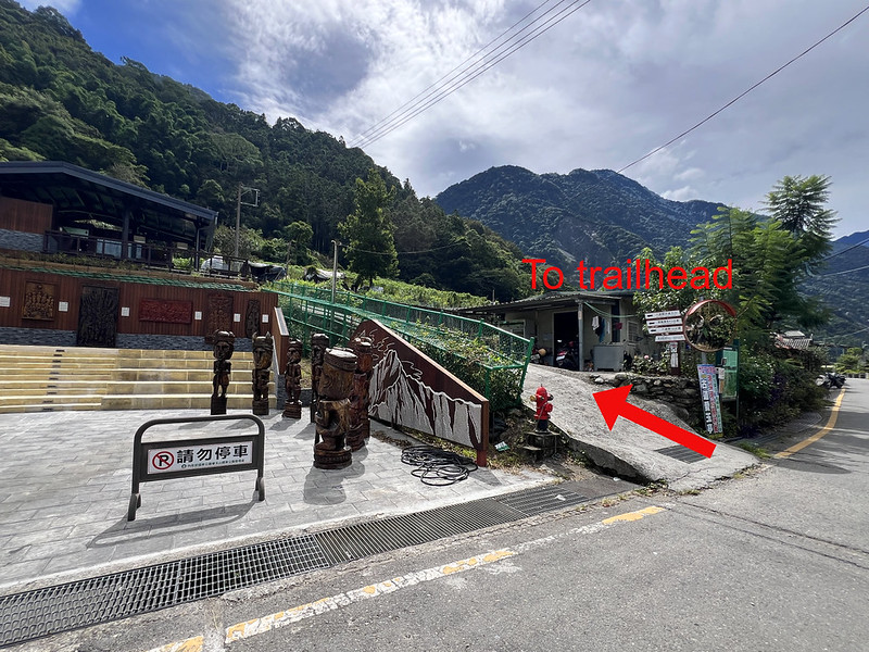
After you finish the hike, Yushan National Park will email you to complete the online checkout (National Park Leaving Park Report Back).
Map, Transportation, and Weather
Map
I didn't record my GPX when doing this hike. This GPX was contributed by a hiker on the Hiking Note website.
I added Mt. Siangyang and Mt. Sancha if you want to bag more of Taiwan's 100 Peaks. I also marked where I took the wrong turn. Please note that the route may change due to landslides and rain. Always proceed with caution and learn how to navigate in Taiwan's mountains.
Route map for South Section 2 by Anusha Lee on plotaroute.com
Public Transportation to the Siangyang Forest Recreation Area: None
If you start from the Siangyang side, you need to hire a private pickup to the trailhead. You can contact Jiaming Lake B&B in Chishang or Xiao Fong in Guanshan to hire the service and hostel stay (both are not affiliated).
Public Transportation from the Dongpu Side
Your location ➔ Taiwan High-Speed Rail - Taichung Station ➔ Shuili Bus Station (close to the train station) ➔ Dongpu
Taiwan has two train systems: Taiwan High-Speed Rail and Taiwan Railway, and their stations are in different areas. Pay attention to the correct train stations so you don't end up in the wrong place.
- Bus from Taiwan High-Speed Rail - Taichung Station: Take the 6333D at Platform 4, Exit 5; check the timetable on the iBus website.
- You can also take other 6333 series buses from Taichung Train Station (the Taiwan Railway one).
- Buses from Shuili Train Station to Dongpu: 6732 and 6734
- After you get off the bus (the last stop), walk to Dongpu Multifunctional Service Center 東埔多功能服務中心 (map) to check in.
- Then, walk to the trailhead and start your hike.


Weather
This long-distance hike lasts at least 6 or 7 days, so it is essential for hikers to monitor how the weather may change as the hike approaches.
If you plan to do this hike during the summer, which coincides with typhoon season, be aware that the weather forecast can change daily. It is crucial to bring a satellite phone or an inReach device to stay updated; your emergency coordinator can provide you with the latest weather information.
If a tropical depression is approaching Taiwan, I recommend canceling the hike. The South Section 2 is not enjoyable in heavy rain and can pose serious dangers.
All national parks in Taiwan will revoke the park permits when the weather bureau issues a typhoon sea warning. National parks will take a few days to reopen trails after the sea or land warnings are lifted.
Shorter Hiking Option: BaDaXiu (八大秀)
BaDaXiu is an out-and-back hike from the South Section 2 route, covering only Mt. Batongguan (3,335 meters), Mt. Dashuiku (3,642 meters), and Mt. Xiuguluan (3,825 meters) from the Dongpu trailhead.
This hike takes 3 or 4 days. If you want to do it in 3 days, you need to stay at an accommodation in Dongpu before the hike. There are no hostels in Dongpu, and there aren't many grocery stores around either. Thus, I would do BaDaXiu in 4 days instead.
BaDaXiu Brief Itinerary:
- Day 1: Your location ➔ Dongpu Multifunctional Service Center to check in ➔ Yunlong Waterfall ➔ Yinyu Waterfall ➔ Lele Cabin ➔ Guangao Cabin. Distance: 16.6 km / 10.3 miles, including the 2 km from the Dongpu bus stop, Dongpu Multifunctional Service Center, and to the Dongpu Trailhead, around 8-9 hours.
- Day 2: Guangao Cabin ➔ Junction to Mt. Batongguan ➔ Mt. Batongguan ➔ Back to the junction ➔ Jhongyang Mine Cabin. Distance: 17.6 km / 11 miles, around 6-8 hours. The trail to Batongguan Grassland is too treacherous to hike. Therefore, I don't recommend hiking it.
- Day 3: Jhongyang Mine Cabin ➔ Baiyang Mine Cabin ➔ Xiuguping ➔ Mt. Xiuguluan ➔ Back to Xiuguping ➔ Mt. Dashuiku ➔ Back to Xiuguping ➔ Baiyang Mine Cabin ➔ Jhongyang Mine Cabin. Distance: 18.4 km / 11.4 miles, around 15-16 hours. On Day 3, you can carry only essential items.
- Day 4: Jhongyang Mine Cabin ➔ Guangao ➔ Yunlong Waterfall ➔ Lele Cabin ➔ Trailhead, Distance: 21.4 km / 13.3 miles, around 12-13 hours.
This trail is shorter, but it remains a challenging hike. Although the hike remains challenging, its permit application and transportation arrangements are simpler than those for the complete South Section 2 traverse.