A Trail Between Shifen and Shuangxi to Mt. Neipinglin with Wonderful Views
This trail is between the famous Shifen Waterfalls and Shuangxi. You can start from either side and hike to
the highest peak, Mt. Neipinglin. When you reach Mt. Neipinglin, you can see the highest peak in Taipei City,
Mt. Qixing, and the beautiful northeast coast of Taiwan.


Table of Contents:
- About Pinghu Recreation Area, Mt. Neipinglin, Shuangxi and Pingxi
- How to Get There
- Peaks and Places to Reach
- You Can't Miss Trails in Pingxi and Shuangxi, Especially When They Were Just Cleared Up
- Wonderful Views on Mt. Neipinglin and You Even Can See Mt. Qixing
- More Rugged Terrain to Mt. Dapinglin
- Trying to Find Mt. Dazhulin But Failed
- Thoughts about this Hike
- Map and Itinerary
- Recommended Blogs and Resources
- Related Posts on Taiwan Hikes
About Pinghu Recreation Area, Mt. Neipinglin, Shuangxi and Pingxi
Pingxi and Shuangxi are two districts in New Taipei City and next to each other. Both are also in the south of
Ruifang. There are also many wonderful hiking trails in both districts and one of my favorite places to hike.

Pinghu Recreation Area 平湖森林遊樂區
Pinghu Recreation Area 平湖森林遊樂區 was built by Pingxi Township (now Pingxi District) in the last century, and it
was meant to be a forest theme park to attract tourists. However, the business didn't go as expected, and this
area was devastated by several typhoons. Pingxi Township gradually gave it up and let it be free for the
public to access.
The name of the location of Pinghu Recreation Area is called Fanzikeng 番子坑. Keng in Chinese means valley. It
is said that Taiwanese plains aborigines 平埔族 had lived in Fanzikeng during Jiaqing Emperor of Qing Dynasty.
Therefore, the Han people who first immigrated here called this area Fanzikeng. Please note that Fanzi was
used to refer to indigenous people and it is not a very friendly name. But, unfortunately we still can hear
this nowadays.
Those sections left from the theme park are Huangshan Road 環山道路, the East Trail (footpath) and the West Trail
(the natural terrain). The East Trail is more friendly for people who don't hike regularly.
As to the west one, you'll need to do homework and get the map or GPX ready before your hike. My hike was on
the west one. The West Trail is also part of middle section of Tamsui-Kavalan Historic
Trail. Taiwan Trails and Tales has done an
incredible job and finished all the sections of Tamsui-Kavalan Historic Trail.
Pingxi: A Place More Than Just Sky Lanterns
Pingxi used to be a coal town, and there is a famous Pingxi Railway Line with all kinds of tourist attractions
to explore. Other than the culture and beautiful old buildings left from that era, Pingxi's hilly terrain also
has unique geological formations like potholes 壺穴 (the erosion caused by rivers or waterfalls) and waterfalls
worth visiting.
There are 36 waterfalls in Pingxi. You can visit Foreigners in Taiwan's website for
more details.
Other wonderful trails in Pingxi include Mt. Xiaozhi 孝子山 and Cimu Peak 慈母峰. But if you are not
comfortable with height, those might be a little bit scary for you.

Shuangxi: A Hidden Gem
Shuang means double, two or a pair in Chinese and Xi here means rivers or creeks. As you can guess it, there
are two rivers in Shuangxi, Pinglin River 平林溪 and Mudan River 牡丹溪. Those two rivers merge in Shuangxi and you
can see them when you visit the downtown.
One thing worth mentioning is that Beishi River originates in Mt. Sanfangxiang of Taipin Village in Shuangxi,
and it is the catchment area of Feitsui Reservior 翡翠水庫, the main water source for Taipei City and New Taipei
City serving at least 6 million people, a quarter of Taiwan's population.
From hikers' point of view, Shuangxi is a heaven. There are so many wonderful trails here, not to mention that
many of them are also part of the famous middle section of Tamsui-Kavalan Historic
Trail system, like Bengshankeng Historic Trail 崩山坑古道, Hubaotan (Hubao Lake) 虎豹潭, Wantan Historic Trail 灣潭古道, Diaoshan
Old Trail 貂山古道, etc.
I'd love to do more trails in Shuangxi, but the only problem is the transport. There aren't many public
transports coming here, and some of the trails are very remote.

Other than hiking, there are many great things to see in this quiet town. There's a 200+ year-old temple, a
100-year-old iron shop, and other old houses in the downtown Shuangxi. You can check out here for the details in English.

Mountain Names with Pinglin 平林
You might have noticed that many mountains here ended with Pinglin. Actually, there are 6 mountains that has
Pinglin in their names, and they are Mt. Pinglin 平林山 (height: 210 meters), Mt. Dapinglin 大平林山 (height: 420
meters), Mt. Neipinglin 內平林山 (height: 502 meters), Mt. Xianeipinglin 下內平林山 (height: 504 meters), Mt.
Shangpneipinglin 上內平林山 (height: 532 meters), and Mt. Dongneipinglin 東內平林山 (height: 122 meters).

Some hikers connect Mt. Dongneipinglin, Mt. Pinglin, Mt. Neipinglin, and Mt. Dapinglin and develop a Four Lin
Distance, and the route is around 10 km (6.2 miles).
How to Get There
No matter which trailhead you want to start, you can take Local Train and get off at Shuangxi or Shifen Train Station. It's better to
have a GPX with you so you can follow the track to get to the trailhead.
Peaks and Places to Reach
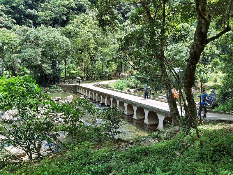
Shifen Train Station: 十分火車站, a famous tourist attraction packed with tons of
people and identical shops. I usually try to avoid taking the train here, because it will be like a battle to
get on the carriage.
Qianjieling or Qianjie Peak: 千階嶺 meaning thousands of steps in Chinese, height 330 meters (1,083 feet). The view is great.
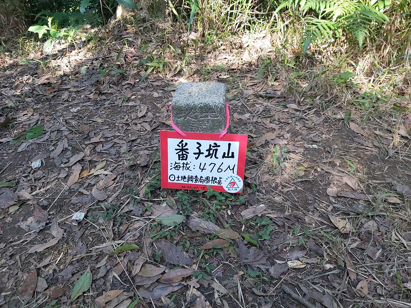
Mt. Fanzikeng: 番子坑山, height 476 meters (1,562 feet). I honestly think you can skip this one, but the round trip to this small peak is only 20 minutes.
Mt. Neipinglin: 內平林山, height 502 meters (1,647 feet). The highlight of this hike. You definitely have to visit this peak. There is a Class 3 Triangulation Stone on the peak.
Mt. Dapinglin: 大平林山, height 420 meters (1,378 feet). Not much to see here.
Mt. Xinluwei: 新路尾山, height 315 meters (1,033 feet). You can get some decent views here.
Mt. Dazhulin: 大竹林山, height 304 meters (997 feet). I missed this one, but it seems not much to see on the peak according to other hikers.
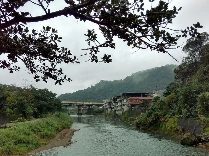
Shuangxi Train Station: 雙溪火車站. A quiet small time but much to my liking. This place is worth paying a visit even not for hiking.
Qianjieling or Qianjie Peak: 千階嶺 meaning thousands of steps in Chinese, height 330 meters (1,083 feet). The view is great.
Mt. Fanzikeng: 番子坑山, height 476 meters (1,562 feet). I honestly think you can skip this one, but the round trip to this small peak is only 20 minutes.
Mt. Neipinglin: 內平林山, height 502 meters (1,647 feet). The highlight of this hike. You definitely have to visit this peak. There is a Class 3 Triangulation Stone on the peak.
Mt. Dapinglin: 大平林山, height 420 meters (1,378 feet). Not much to see here.
Mt. Xinluwei: 新路尾山, height 315 meters (1,033 feet). You can get some decent views here.
Mt. Dazhulin: 大竹林山, height 304 meters (997 feet). I missed this one, but it seems not much to see on the peak according to other hikers.
Shuangxi Train Station: 雙溪火車站. A quiet small time but much to my liking. This place is worth paying a visit even not for hiking.
You Can't Miss Trails in Pingxi and Shuangxi, Especially When They Were Just Cleared Up
Distance: 14 km (8.7 miles)
Brief itinerary: Shifen Train Station (Height 213 meters) ➔ Qianjieling (Height 330 meters) ➔ Mt. Fanzikeng (Height 476 meters) ➔ Mt. Neipinglin (Height 502 meters) ➔ Mt. Dapinglin (Height 420 meters) ➔ Mt. Xinluwei (Height 315 meters) ➔ Shuangxi Train Station (Height 36 meters) (I missed Mt. Dazhulin)
GPS coordinates of Qianjieling entrance: 25.043782, 121.782943
Update: I did this hike twice again from Shuangxi and Mudan to Shifen, and I finally got to visit Mt.
Dazhulin. I can tell you that you can totally skip this peak because the trail to the peak is muddy, and
you'll have to cross small streams several times. The most important thing of all is, there is nothing much
to see on Mt. Dazhulin. It's in the woods.
If you want to skip Mt. Dazhulin, I'll suggest you start from Mudan Train Station to save some time.
I've been following several hikers'
blogs to see the latest news about the trails. Many of them had posted that they just did Shuan-Shih
(meaning from Shuangxi to Shihfen) Long Distance Hike, and the trail condition was extremely good, thanks to
the efforts of a group of volunteer hikers 聯合探勘隊 and Blue Sky Team 藍天隊 to clean up the grass and tree
branches. This is usually a cue for me to do my solo hike.
This is a point-to-point hike, and most hikers start from Shuangxi Train Station and end at Shifen Train
Station. Both are wonderful places, but I didn't want to get caught up with the tourists when I finished the
hike. So, I decided to start my hike from Shifen Train Station, the opposite direction.
I was lucky to have a gorgeous Sunday to do this hike. I took an early train and got off at Shifen Train
Station. Shifen is famous for sky lanterns, but I DO NOT suggest people to release sky lanterns.

You need to take the roads from Shifen Train Station to the trailhead, and there are many junctions that might
be confusing. Having a GPX track in your smartphone is necessary.
Unusually Quiet Shifen Train Station and A Little Bit Confusing Start
It was still early when I arrived at Shifen Train Station. Usually, this place was packed with local and
international tourists, but not this early. I was the only person walking along the railway track and I
enjoyed the quiet morning.

There was a distance from the train station to the trailhead, and I needed to rely on GPX track to get there.
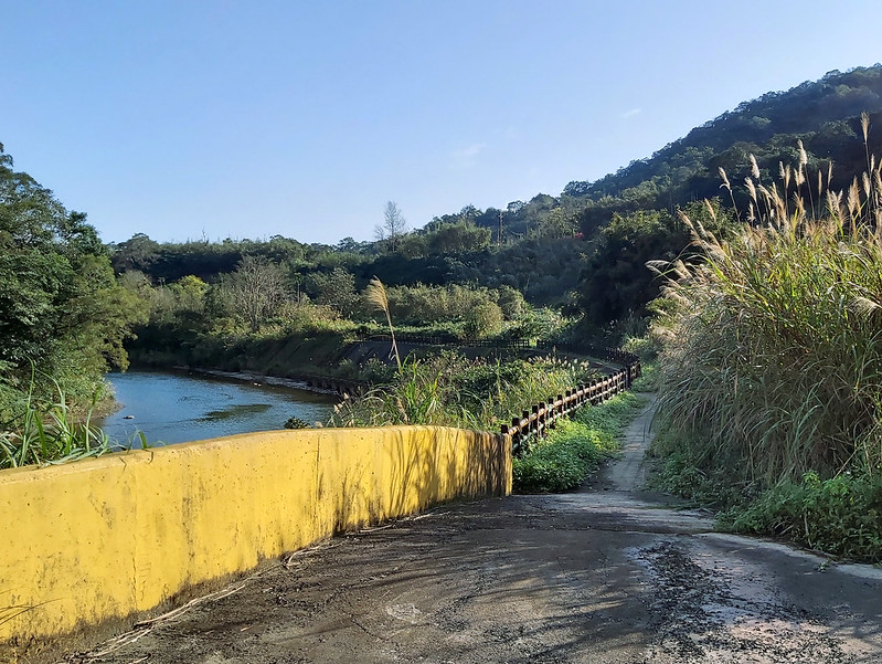
After seeing the sign of Nanshanping 南山坪, I crossed Nanshan Bridge 南山橋.

I saw the sign of Tamsui-Kavalan Historical Trails high on the wall.

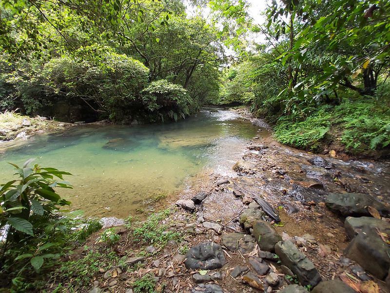
I walked along Keelung River 基隆河 and reached the end of the road, but there was a small path, so I continued.
I didn't see any sign and I started questioning myself whether I made a wrong turn.
Within a few meters, I saw a dirt path, and instinctively took this one, not knowing where it would lead me,
even though my GPX told me that I was on the right direction.

A Lovely 100-year-old Earth God Temple before Reaching Qianjieling
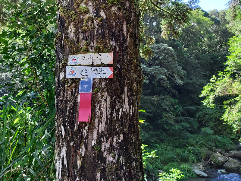
Then, I saw something that I didn't expect to see, a small Earth God temple. The trail went up from there, and
I finally saw a hand-written sign made by the volunteer hikers when I reached the road. The sign said the
temple was more than 100 years old.

I followed the road and I finally saw a big map of Tamsui-Kavalan Trails. The one I was heading to was
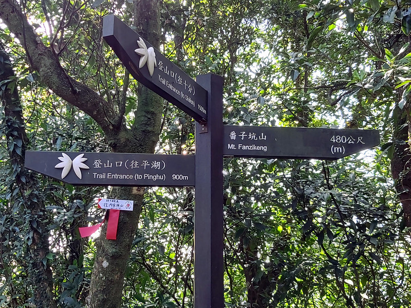
Fanzikeng Trail 番子坑步道.
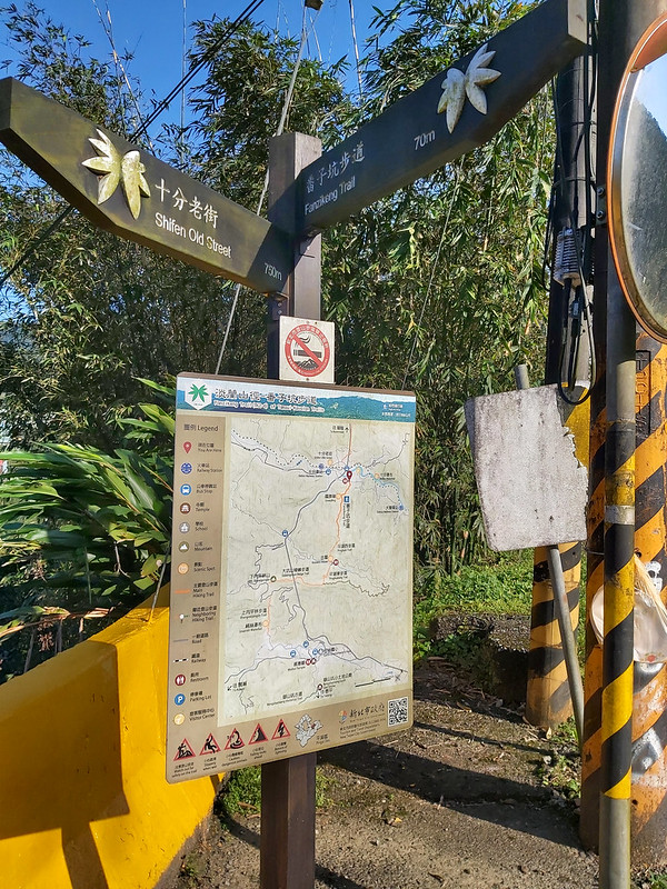
I turned to the pointed direction, and I saw a basketball court, and I finally found the trailhead of
Qianjieling (Thousand Steps Peak) 千階嶺.

Great View on Qianjieling aka Flag Peak 千階嶺 (國旗嶺)
Qianjie mean thousand steps in Chinese, I didn't count how many steps I took, but lucky for me it didn't take
long for the steps to finish.

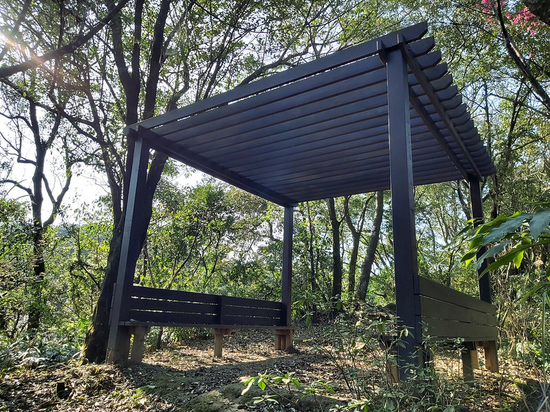
I reached a pavilion like structure within 20 minutes, and the trail became a natural dirt path again, which
was good.
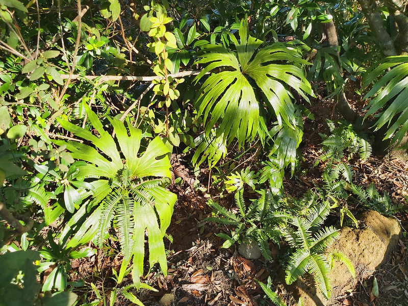
There were many Coupled Dipteris 雙扇蕨 here, and the sign of Tamsui-Kavalan
Historic Trail was inspired by this fern.
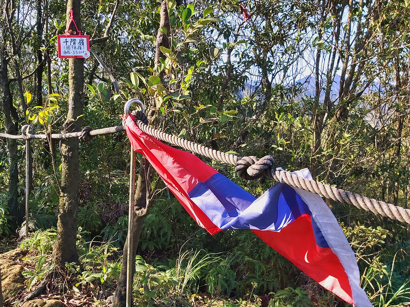
It took me five minutes from the pavilion to Qianjieling, and there was a Taiwan's national flag tied on the
rope.
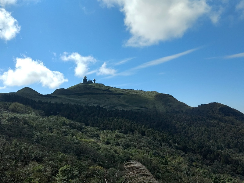
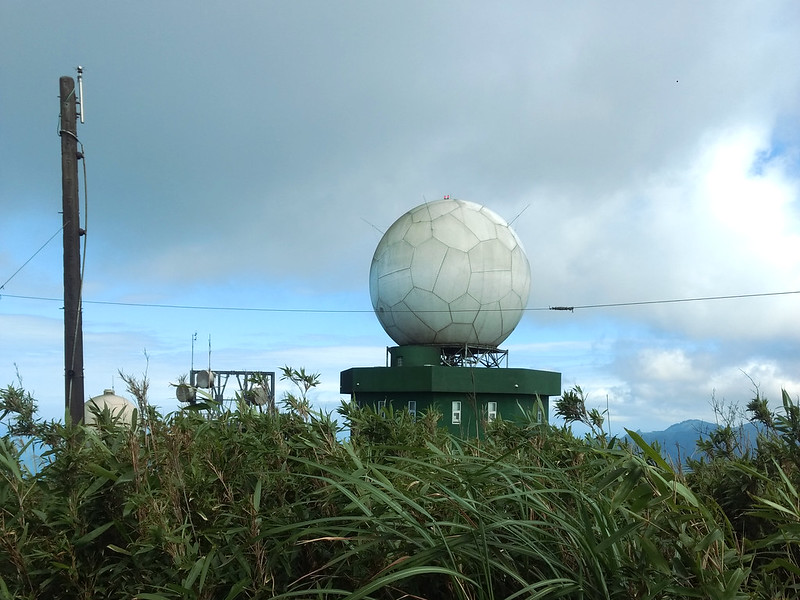
The view up there was great. I could see Wufenshan (Mt. Wufen) Weather Radar
Station 五分山氣象雷達站, which was built in 1980, Provincial Highway 2C 台二丙線 and other mountains.

There is a step trail going up to the radar station, and I hiked there twice before. But, it was an endless
winding road all the way up the the trail entrance.
I continued my hike and reached a 3-way fork, one to Provincial Highway 2C, and the other one to Pinghuxi
Trail 平湖西步道. I think this should be Pinghu West Trail. Xi in Chinese means west. I took the latter one with
wooden steps all the way up again.

Wufenshan Weather Radar Station still could be seen in between the trees, and the trail became flat. This is
one of my favorite moments about doing a solo hike. It was quiet and relaxing with beams of sunlight seeping
into the trees, and the temperature was perfect!

Then, I saw a tree placed flat on the trail and a yellow sign. The sign was made by Pingxi District saying the
trail ahead was dangerous, so on and so forth. I continued my hike.
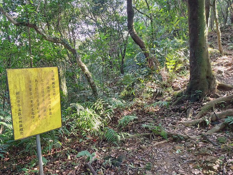
The trail went from dirt path to steps again, really small steps, or I must have a pair of gigantic feet.

Mt. Fanzikeng Was A Disappointment
Then I reached another 3-way fork, and I took the one to Mt. Fanzikeng. The sign said the peak was only 480
meters (525 yards) away, so why not?
From there, it went downhill, not to my liking, because I would have to climb up again later. Soon, I reached
Mt. Fanzikeng, and it was a disappointment. I couldn't tell it was a mountain except for the stone (not a
triangulation stone) and the sign, and there wasn't much to see here, either. So, I left quick and took the
uphill again.

It took me about 20 minutes for the round trip to Mt. Fanzikeng to the 3-way fork. If you ask me, I'd suggest
you skip this one and you can save 20 minutes.
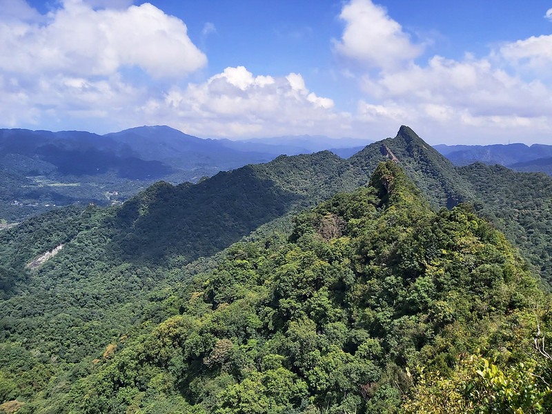
Wonderful Views on Mt. Neipinglin and You Even Can See Mt. Qixing
While getting back to my next peak, I could see the mountains along the trail. Then, I saw something familiar,
and I checked with my PeakFinder app. It was Mt. Keelung. Mt. Keelung looked like a triangular shape from here.

It seem there were so many trails connecting to this one from Pinghu Recreation Area, because I saw several
signs pointing to that direction. I'll have to explore this area again.

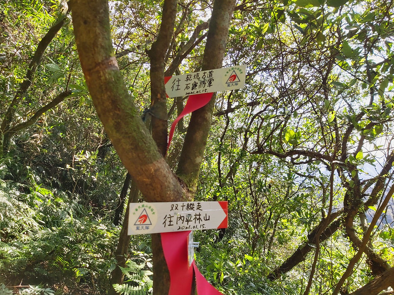
I reached another fork and one of the signs pointing to Qiankeng Old Trail (Shihquei General or Stone Turtle
General) 乾坑古道 (石龜將軍), and Qiankeng Old Trail looked interesting. I continued to my hike Mt. Neipinglin.
Qiankeng Old Traill will be on my list.
Found An Interesting Plant
Then, suddenly something on the path caught my attention. The color was too bright red to ignore it, so I
stopped to take a closer look.
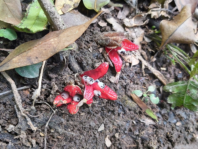
It turned out those were Zingiber kawagoii Hayata 三奈 (but some say
it's 台灣山薑). Those were actually the fruit, not the flowers. After Googling, Zingiber kawagoii Hayata's
flowers are so gorgeous, but it's not easy to find them.
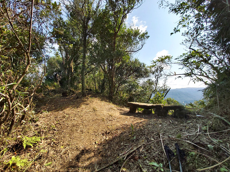
There were several stone chairs on the trail, and they looked so tempting. I didn't want to take too many
breaks, so I made myself continue.
Around 11:41, I reached a fork again with a big area and several chairs. I decided to give in and had a lunch
break. While finishing my lunch and trying to find a safe place to do my business, two male hikers came up to
the fork and we had a brief conversation. What a close call…
After everything was finished, I resumed my hike around 12:15 and passed a huge rock wall. From here, the
mountains from Ruifang were blocked, and I started seeing more mountains from Pinglin 坪林 side. The Pinglin
here is different from the names in the mountains. It's a district in New Taipei City and close to Jiaoxi
Yilan.
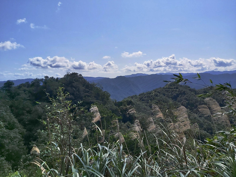
Amazing Views on Mt. Neipinglin and Another Wildflower
Then, I reached Mt. Neipinglin. It only took me 10 minutes from my lunch location to here. In hindsight, it
would be great to have my lunch at Mt. Neipinglin with stunning views on the peak. The only downside to have
lunch here was there was no shade, and it was a little bit hot to sit under the sun.

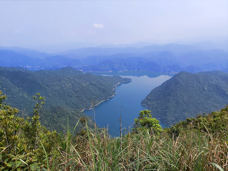
I was really amazed by how far I could see from Mt. Neipinglin. I used PeakFind to check and I could see Mt.
Qixing Main Peak, 1,118 meters (3,668 feet), the highest peak in Taipei City and almost 30 Km away from where
I was. Also, thanks to the great weather.

Here's the video I took on the peak.
While enjoying how far I could see from the peak, I also noticed something near the small trees. It was Taipei
Climbing Violet 台北堇菜. Later I saw a lot of Taipei Climbing Violets on Yangmingshan. It's pity that I couldn't
get better focused photos.
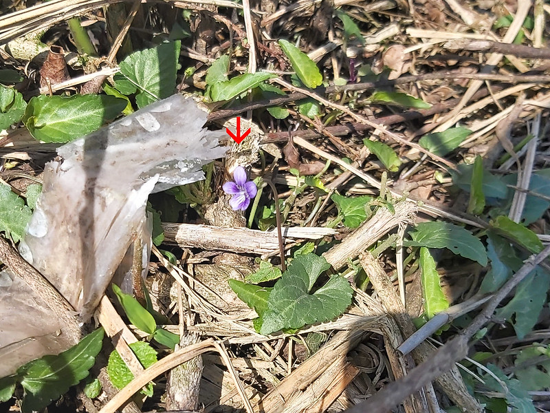
You can check out my Wildflowers' page to see more details about Taipei Climbing Violet.
More Rugged Terrain to Mt. Dapinglin
After I was satisfied with my time admiring the views, I resumed the hike. The first thing to overcome was the
steep slope.
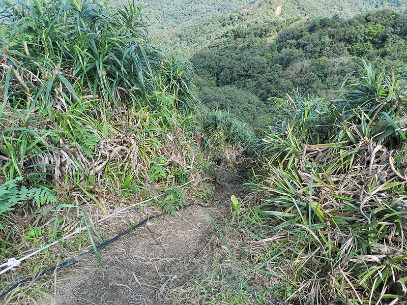
There were ropes almost all the way to down or up to the next peak. Now, I realized why most hikers started
from Shuangxi side to do this hike.
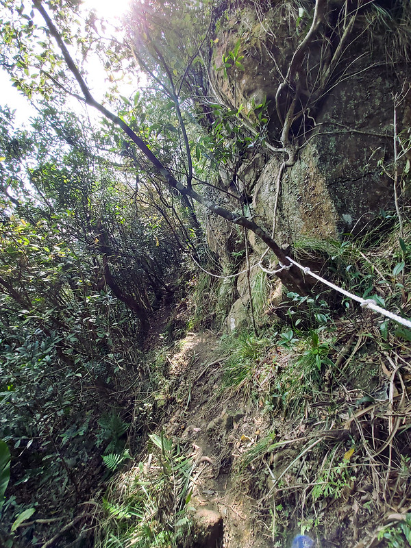
Although it was steeper after Mt. Neipinglin, the trail was well-marked with new hand-written signs and
cleared up when I was there. There were some forks here, too. I passed a sign pointing to Youkeng 幼坑, which
was also a great place to hike.

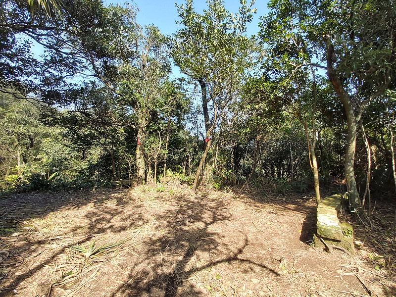
Then, within a few minutes, I reached Mt. Dapinglin. There wasn't much to see around here but with way too
many tiny bugs. So, I quickly left.

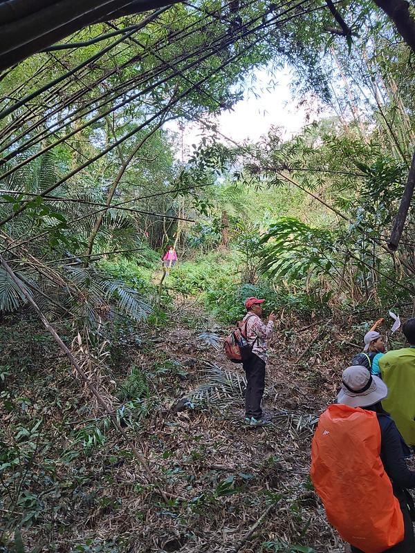
Mt. Xinluwei with Great Views and Other Late Hikers
The trail after Mt. Dapinglin was less steeper, and it took me around 1 hour to reach Mt. Xinluwei. The view
on Mt. Xinluwei was great, too.

When I decided to take a longer break, even thinking about brewing a cup of coffee for myself, I saw a hiker
coming from the direction I was going to take. Then, more and more followed, a huge group to be exact. It was
already 14:29 and I was surprised to see those hikers coming this late. To my dismay, I quickly gathered my
stuff and continued my hike.

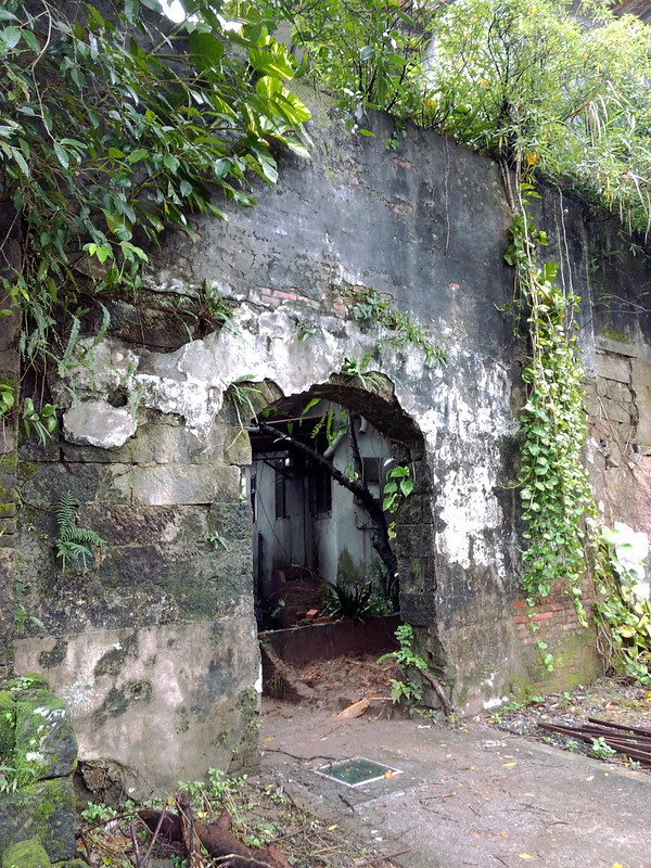
Then I reached a fork and there was an old house standing there. The roof and most of the wall of the house
were already collapsed, but we still could find relics like this on the old trails in Taiwan.

There were still many hikers from the big group, and it was difficult to find a quiet place to take decent
photos of the old house. I got distracted and disturbed and ended up taking the wrong turn. While taking the
wrong turn, more and more hikers coming toward me kept asking me questions like why you went there. Most
Taiwanese hikers aren't used to solo hikers. This group was no exception. They thought I was one of them, but
I really didn't want to explain to them.
Unfortunately, I wasted precious 10 minutes before getting back to my right direction. The funny thing is the
more I tried to avoid the crowd, the more I got stuck with them. While I made my way to my direction, I heard
their guide yelling at me, don't go alone. I didn't reply. I heard somebody explaining to him instead.

Trying to Find Mt. Dazhulin But Failed
Soon I found myself walking on some concrete path.

When I looked up, I saw a mountain and my PeakFinder told me it was Mt. Canquanliao 燦光寮山, one of my favorite mountains in Ruifang.

Then, the concrete path became wider, so wide that I became to suspect myself taking a wrong turn again.
However, I still could see the sign telling me the direction to Mt. Dazhulin.
Shortly, I saw a lamppost with two signs telling me one direction would take me to Mt. Dazhulin, and Mudan
Train Station, and the other would take me to Mt. Xinluwei and Xinluwei Old Trail. So, I took the one to Mt.
Dazhulin. This should be right, right?

However, I still couldn't find my way to Mt. Dazhulin even though I saw the hand-written signs agian. I was a
little bit tired. I checked my phone, and I could get the internet access here. I decided to ditch Mt.
Dazhulin and get myself back to Shuangxi Train Station.
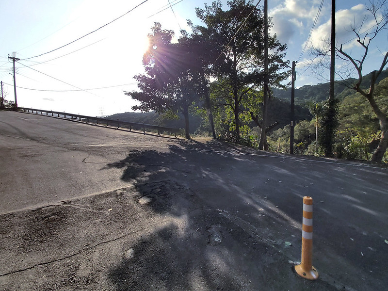
It wasn't difficult to find Shuanggan Road 雙柑路, but it was a little bit boring to walk on the road with my
heavy rainboots. Fortunately, there were interesting things to give me distraction, like this narrow gutter
above a small creek. I've been wondering what the gutter was for. It seems too narrow for people to walk on
it.

While on Shuanggan Road, there was a map telling you those interesting places to visit in this area.

Then I saw a post saying Donghe Trail 東和步道. Donghe Trail seemed like a short and sweet trail to try, but I was
too tired to explore it, especially after seeing I still had to take 2.3 km from this post to Shuangxi Train
Station.

It took me 50 minutes to get myself back to Shuangxi Train Station, and it was 16:45. Finally, I could call it
a day. Later I realized that Mudan Train Station was much closer to the sign pointing to Mt. Dazhulin. Lesson
learned.

Thoughts about This Hike and Other Routes
This is a wonderful hike that I'll do it again, and this is how I will do it.
Start the Hike from Shuangxi Side
After doing this hike from the Shifen side, I understand why most hikers did it from the Shuangxi side,
because you will start climbing the steeper slopes first. After the hard work, you will see the amazing views
on Mt. Neipinglin and end the trails with the much easier log steps.
Moreover, there are more restaurants that are still open in Shifen after you finish your hike. When I finished
my hike in Shuangxi, I was trying to find a restaurant, but all of them were closed. I was so hungry, and we
weren't allowed to eat on the trail due to the pandemic.
The only drawback is you will have to squeeze yourself into the carriage of Pingxi Line with other tourists,
and you have to transfer your train at Ruifang Station. The other option is to take Bus 795, and Bus 795 will take you to MRT Muzha Station via Shenkeng Old
Street. It can be very crowded in the bus, too.
The Other Route with An Interesting Folk Story: Qiankeng Old Trail and General Turtle
According to Mountain Shade Fox Trace 山影狐蹤, Qiankeng Old Trail was a trail
that connected between Dahua 大華 and Shihfenliao 十分寮, but the residents moved out of here after Pingxi Line and
other roads were available.
According to the legends, Xuantian Shandi or Emperor of Mysterious Heaven 玄天上帝, conquered a turtle and a snake
and appointed them as generals in his court. However, General Snake wanted to take a break, so he sneaked into
the human world and caused many troubles. Therefore, Xuantian Shandi sent General Turtle to stop him. However,
the battles with General Snake were so intense that General Turtle was too exhausted to return to Xuantian
Shandi's court, and he was forced to rest by Qiankeng River.
While he was waiting for his end to come, the Earth God showed up and negotiated a deal with General Turtle,
which was the Earth God would help General Turtle's spirit back to Xuantian Shandi's court, but his body would
have to stay in Qiankeng to protect the local people. After the deal was struck, General Turtle's spirit
finally returned and his body turned into a stone statue staying there forever. That's why it's called Stone
Turtle. Shih means stone and Gui means turtle in Chinese.
Mountain Shade Fox Trace did a hike to see the Earth God's temple and the statue of General Turtle on Qiankeng
Old Trail. The trailhead is close to Dahua Train Station, and you can also hike to Mt. Neipinglin from there.
Take Youkeng Old Trail to Mt. Neipinglin
There are many ways to do Youkeng Old Trail, and one of them is to do a loop hike starting from Sandiaolin
Train Station 三貂嶺火車站 to Mt. Youkeng, Mt. Neipinglin, Mt. Dapinglin, Mt. Dazhulin and back to Sandiaolin Train
Station.
I've been to Youkeng Old Trail before, and I always wanted to do it again. Doing Youkeng Old Trail and Mt.
Neipinglin together is definitely a great idea.

There are too many routes in Pingxi and Shuangxi to introduce them all on this post. But no matter which one
you take it, please put Mt. Neipinglin in your itinerary. I guarantee you that you won't regret it.
Have you been to Shifen Waterfalls? Did you also get a chance to hike the trails nearby? Please leave comments
below. Don't forget to subscribe to newsletters to know more about the exciting trails in Taiwan.
Map and Itinerary
Group Hike or Solo Hike: Solo hike
Date of Hike: January 31, 2021
Date of Hike: January 31, 2021
Click Menu in the map to download, print or share the map.
Click to change the speed to meet
your condition.
to change the speed to meet
your condition.
Note:
My GPS track may not be totally accurate and is for reference only.
Click
to change the speed to meet
your condition.Note:
My GPS track may not be totally accurate and is for reference only.
Based on my hike on January 31, 2021
08:40
Arrived at Shifen Train Station
08:48
Reached the footpath by the river
08:50
Saw a fork and turned right to the dirt path
08:54
Passed the 100+ Year-old Earth God Temple
08:56
Saw sign of Fanzikeng Trail (TK2-6) and a basketball court
09:00
Went through the basketball court and a toilet, and arrived at
the entrance of Qianjieling
09:18
Reached a pavilion and hiked on the ridge
09:23
Reached Qianjieling (aka Quoqi Peak, meaning Flag Peak)
09:32
Arrived at a 3-way fork and took the Pinghuxi Trail
09:54
Reached the yellow sign with a warning
10:09
Reached a 3-way fork and took the Fanzikeng Trail one
10:24
Arrived at Mt. Fanzikeng, no view
10:35
Back to 3-way fork and headed to Mt. Neipinglin
10:41
Passed the sign of Pinghu Recreation Park parking lot
10:55
Reached the fork to Mt. Neipinglin and Qiankeng Old Trail
(General Stone Turtle)
11:00
Reached a wide area with stone benches
11:41
Reached another big area with stone benches. Took a lunch
break.
12:15
Resumed the hike
12:22
Saw the sign saying To Huangshan Road at the East Trail of Pinghu
Recreation Area. Then reached Mt. Neipinglin.
13:16
Saw the sign of Qiankeng Old Trail, Mt. Dapinglin, Mt.
Neipinglin
13:23
Saw the sign to Youkeng Old Trail and bamboo woods
13:26
Reached Mt. Dapinglin. No views.
13:35
Reached a fork with signs of Mt. Xinluwei, Xiangong Temple, Mt.
Neipinglin
14:26
Reached the fork with sign of Mt. Dapinglin, Shihfanzikeng No. 1,
and 2 minutes to Mt. Xinluwei
14:28
Arrived at Mt. Xinluwei. Met a huge group of hikers and I quickly
left.
14:46
Reached a fork with a relic in the bamboo woods, met those hikers
again, and took the wrong turn
14:55
Finally found the right path
15:04
Reached the flat concrete road
15:17
Reached the road, saw a lamppost with signs of to Mudan Train
Station + Mt. Dazhulin, but I still couldn't find the entrance to Mt. Dazhulin. So, I gave up and
continued the industrial road.
15:54
Reached Shuanggan Road
15:57
Passed the sign of Donghe Trail and 2.3 km to Shuangxi Train
Station
16:45
Finally reached Shuangxi Train Station
Total time:
8 hours 5 minutes, including long breaks
Recommended Blogs and Resources:
Chinese only:
Hiking Biji: Pinghu Forest Trail, the West One 平湖森林步道(西段)
Hiking Biji: Pinghu Forest Trail, the East One 平湖森林步道(東段)
Frank: Shuangxi to Shifen Hike 新北市雙溪區-平溪區 雙十縱走
Wayfarer: Mudan to Shuangxi Hike 雙牡縱走
Mountain Shade Fox Trace 山影狐蹤: Qiankeng Old and General Shihgui (Stone Turtle) 乾坑古道、石龜將軍(平溪鄉野傳奇)
Hiking Biji: Pinghu Forest Trail, the West One 平湖森林步道(西段)
Hiking Biji: Pinghu Forest Trail, the East One 平湖森林步道(東段)
Frank: Shuangxi to Shifen Hike 新北市雙溪區-平溪區 雙十縱走
Wayfarer: Mudan to Shuangxi Hike 雙牡縱走
Mountain Shade Fox Trace 山影狐蹤: Qiankeng Old and General Shihgui (Stone Turtle) 乾坑古道、石龜將軍(平溪鄉野傳奇)