Jialuo Lake Hike: A Two-day Camping to Explore the Enchanted Forests
A charming tale surrounds the Jialuo Lake region. A fairy from the heavens accidentally broke her pearl
necklace, causing the pearls to fall into the mortal realm and become large and small lakes. This is the
folklore behind Jialuo Lake.
To discover these earthly gems, let's launch the Taipingshan and Jialuo Lake Thru Hike, aka Tai-Jia Hike 太加縱走.
This trail is very special to me. When I first did this hike in March 2019, I told one of my hiking mates I
wanted to build a website about hiking in Taiwan. He was very supportive and told me to do it. I never got to
see this hiker again, so I want to thank him and tell him: I did it.
Disclaimer:
All content is for inspiration only. Use Taiwan Hikes' suggestions at your own risk. We are not responsible for any losses, injuries, or damages.
All content is for inspiration only. Use Taiwan Hikes' suggestions at your own risk. We are not responsible for any losses, injuries, or damages.
Table of Contents:
Trail Information
Trail Name: Taipingshan and Jialuo Lake Trail, or Tai Jia Thru Hike 太加縱走 or
Jia Tai Thru Hike 加太縱走
Distance: 18.9 km (11.5 miles)
Route type: Point-to-point
Days/Hours Needed: 2 days
Total Ascent/Descent: 955m/1,850m
Best Time to Go: Spring, Summer, and Fall. It can be icy in winter.
Permits: Police Mountain Entry Permit
Difficulty Level:
Distance: 18.9 km (11.5 miles)
Route type: Point-to-point
Days/Hours Needed: 2 days
Total Ascent/Descent: 955m/1,850m
Best Time to Go: Spring, Summer, and Fall. It can be icy in winter.
Permits: Police Mountain Entry Permit
Difficulty Level:
Peaks or Places to Reach
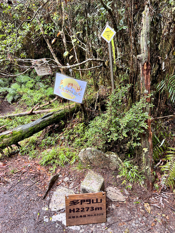
- Mt. Duomen 多門山, 2,273 meters (7,457 feet) above sea level. There is a Class 3 Triangulation on the summit, but there is no view.
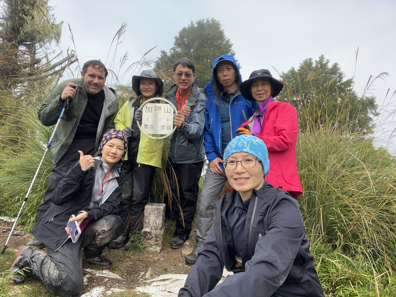
- Mt. Jialuo, 加羅山, 2,320 meters (7,611 feet) above sea level. There is a Class 3 Triangulation on the summit. The views are great.
Additional Information:
- When you check the government's website, it says Tai Jia Trail is 10.7 km. But the actual distance is more than that. The starting point is from Taipingshan Villa Information Center, including Maosing Reminiscent Trail (0.9 km), Cypress Forest Trail (1.3 km), Tai Jia Trail (10.7 km), and Siji Forest Road 四季林道 (6 km, from the Gigantic Tree Trailhead to the gate). The distance is around 18.9 km, plus the round trip from the junction to Mt. Jialuo, 1.4 km.
- You can start this hike either from Taipingshan or Siji or do an out-and-back hike from Siji if you drive a car. But staring from the Taipingshan side was better.
- While most hikers camp by Jialuo Lake, there are other alternatives to consider: Kuai Mu Campsite 檜木營地 or Taichi Pond 太極池, aka Lightening Pond 閃電池.
- If you take public transport to Taipingshan, try to book a stay there. Alternatively, you can hike to Kuai Mu Campsite and camp there on Day 1.
- Some hikers camp at Taichi Pond/Lightening Pond, which is only one hour away from Jialuo Lake.
- Please don't wash your boots or utensils at Jialuo Lake or any ponds here.
- This is a popular trail. Please don't leave your expensive gear or electronic devices unattended.
- Expect muddy terrain and dirty boots.
"Jialuo Lake Trail."
"Say no more."
Transport to the Trailhead at and Map/GPX Data
If you prefer to take public transport to go hiking in Taiwan, this iBus website is a must-have for your phone. You can check the buses and their
real-time schedule. It has an English option, too. Type the bus number and you will get the timetable, fare,
and route map.
Download the Android app.
Download the iOS app.
Download the Android app.
Download the iOS app.
To reach either trailhead, you must go to Yilan Transfer Station or Luodong Transfer Station from your current location.
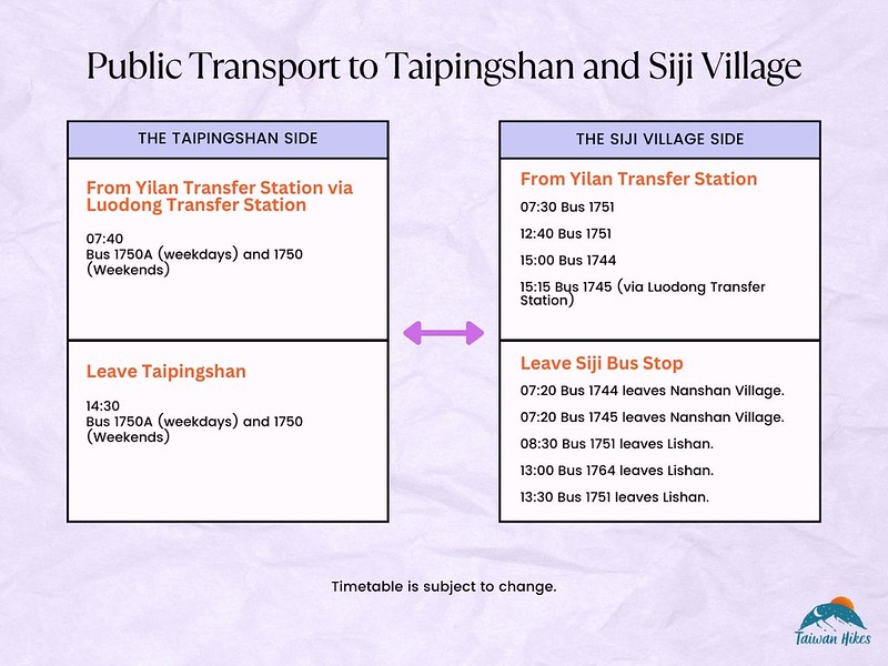
Bus Links
Google Maps shows several hotels in Siji Village. If you don't want to rush to catch the bus, staying
overnight there is a good option.
GPX Track
Route map for Taipingshan-Jialuo Lake Thru HIke by Anusha Lee on plotaroute.com
Click Menu in the map to download, print, or share the map.
You can see more options after clicking the Play button.
Click to change the speed to meet your condition.
You can see more options after clicking the Play button.
Click
to change the speed to meet your condition.
Details about the Jialuo Lake Hike
Brief itinerary: Taipingshan Villa Information Center (1,869 m) ➔ Scenery Platform/107/107
Entrance (2,180 m) ➔ Mt. Duomen, 88/107 (2,273 m) ➔ Taiping Pond, 63/107 (2,150 m) ➔ Taichi
Pond, 39/107 ➔ Jialuo Lake, 29/107 (2,243 m) and camping ➔ Weidan Pond 26/107 ➔ Junction to
Haomai Pond and Mt. Jialuo ➔ Mt. Jialuo (2,320 m) ➔ Back to junction ➔ Junction to Kuimu
Pond, 19/107 (2,235 m) ➔ Gigantic Tree Trailhead, 0/107 (1,695 m) ➔ The first gate (1,270 m)
➔ The second gate (973 m)
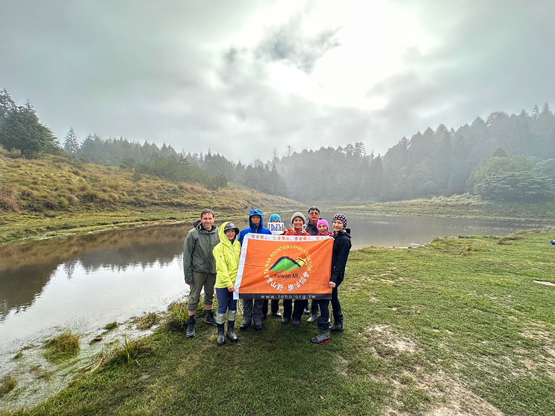
I've done Jialuo Lake camping twice, and the trail is much better maintained and well-marked now.
Before our hike, we stayed at a hotel in Songluo Village of Datong County in Yilan and headed to the trailhead
at 6:15 a.m. It took us around 1 hour to arrive at Taipingshan. We did his hike in late October, and it was
12°C and drizzling.
Jialuo Lake Trail is famous/notorious for its muddy terrain. I didn't know what was waiting for us.
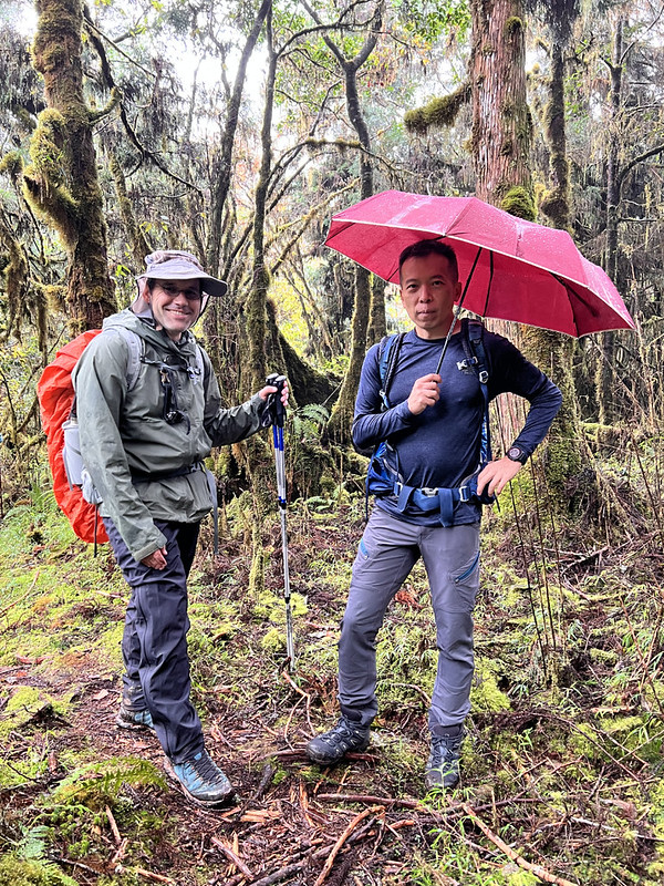
A Delight Walk in Taipingshan
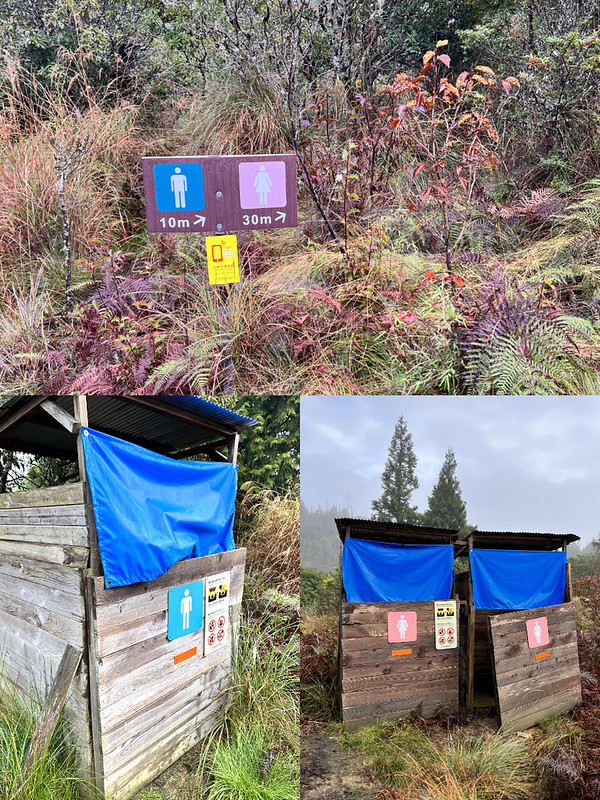
07:19 After going to the toilet and taking group photos, we took the Central
Steps 中央階梯 of Maosing Reminiscent Trail 茂興懷舊步道.
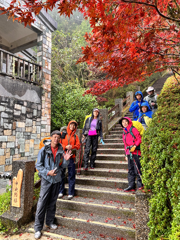
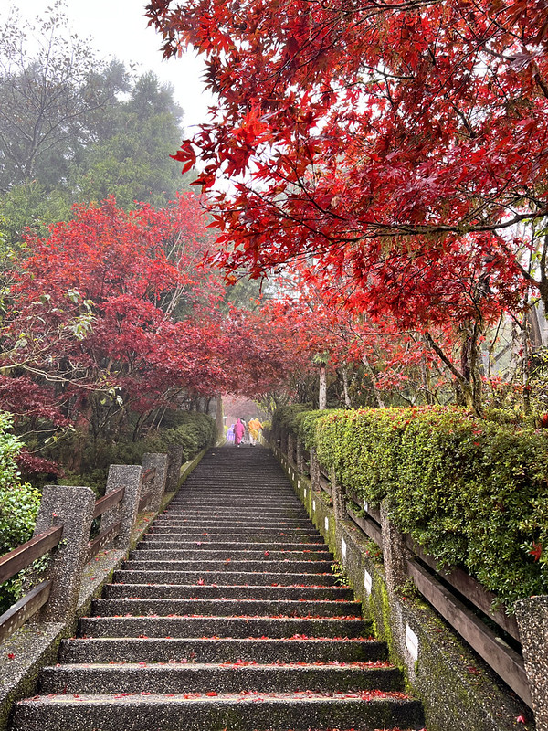
Taipingshan is famous for its fall foliage, and we were flanked by the beautiful red leaves. The overcast
weather didn't diminish the beauty of Taipingshan. In contrast, it brought out the nostalgia of this place,
which was known for being one of the primary logging stations a century ago.
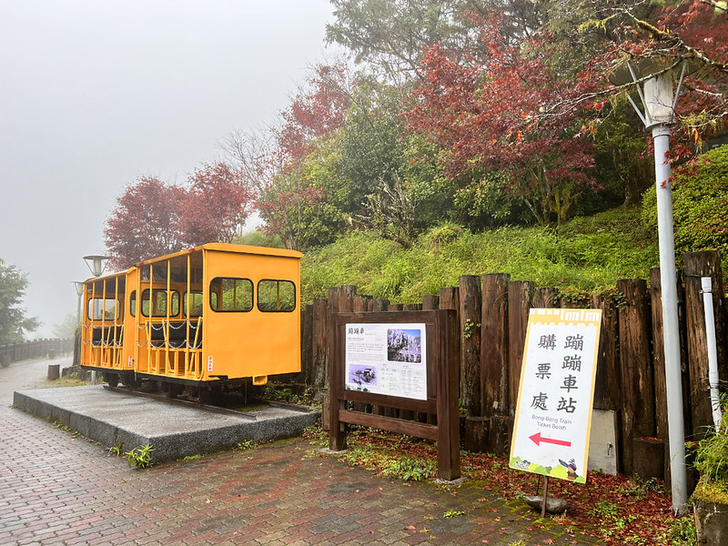
We passed the Pong-Pong Train Station, the old logging railway turned tourist attraction. I took this train many
years ago, and it was a beautiful train ride.
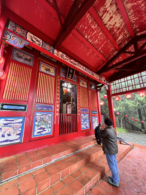
07:56 We finally reached Jhenan Temple 鎮安宮, the end of the Maosing Reminiscent
Trail.
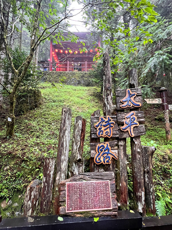
Maosing Reminiscent Trail was a short trail, only 0.9 km long, but it took us longer than expected to finish.
The beautiful trees and the old buildings were difficult to ignore.
Jhenan Temple used to be a Shino Shrine during the Japanese Era. Later, it was rebuilt and worshiped the Chinese
deities Zheng Cheng-gong (Koxinga), Guanyin, and the Earth God. Jhenan Temple is also the highest temple in
Yilan and the highest for worshipping Koxinga.
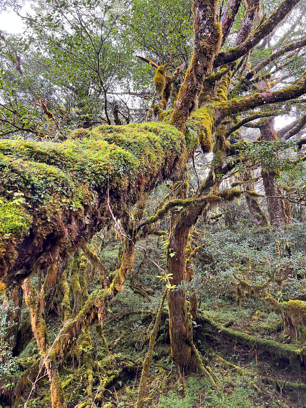
After passing Jhenan Temple, we entered Cypress Forest Trail 檜木原始林步道. The vegetation went from maple trees to
tall Cypress trees covered with moss. I did this section when I hike from Jancing Historic Trail.
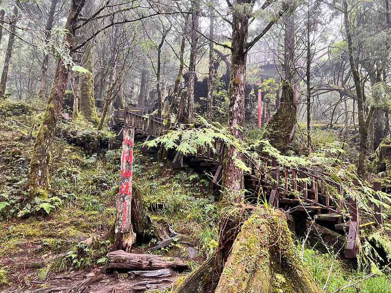
Cypress Forest Trail is 1.3 km long with plank steps. I must give credit to Taipingshan National Forest
Recreation Area. They put many anti-slip strips to increase the grip on those plank steps. Otherwise, this would
be a terrible trail to walk when they get moist.
When I did Jiancing Old Trail, I saw a Golden Weasel on the trail.
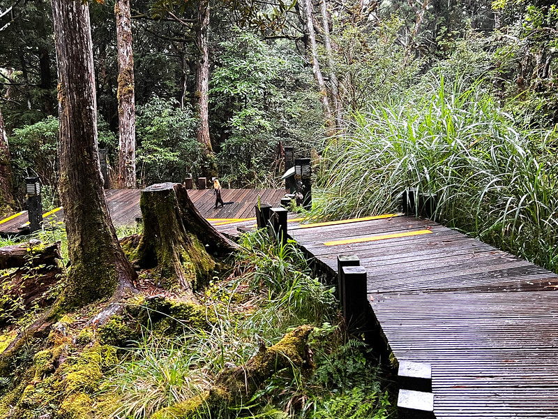
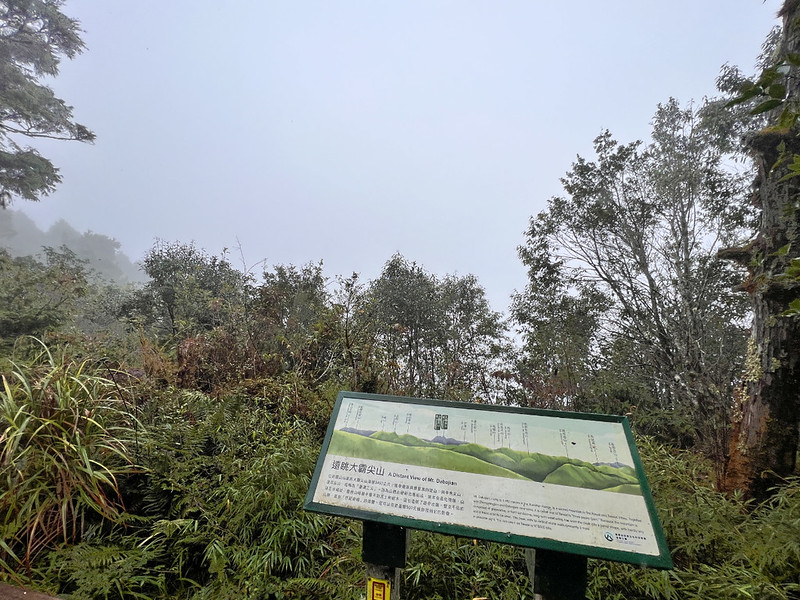
08:53 There is a scenery platform at the end of Cypress Forest Trail. It is said
that we could see Mt. Dabajian, Wuling Quadruple Mountains, and Xueshan/Snow Mountain from here, but whenever I
came here, it was either cloudy or rainy.
Enter the Trail with Rewards of Stunning Ponds
For most tourists, this is the end of their hike. For us, the actual hike just got started. We studied the
signage and checked out the details of this trail.
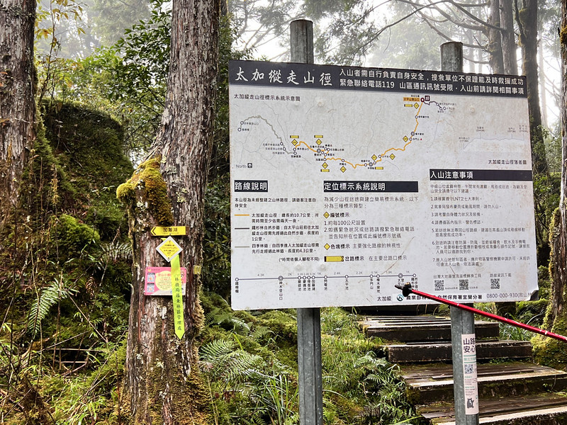
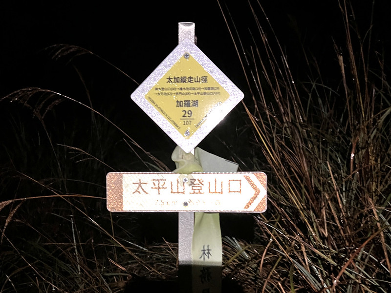
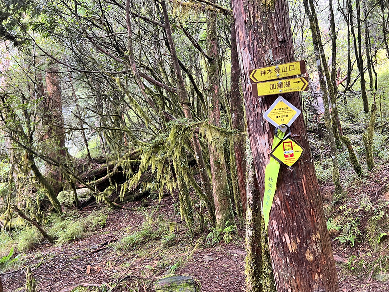
The Forestry Bureau put new, yellow, and reflective signages on the tree next to the big map. One of the numbers
says 107/107, which means it's 10.7 km from here to the Gigantic Tree Trailhead. Jialuo Lake's signage is
29/107, and the campingground is 28/107.
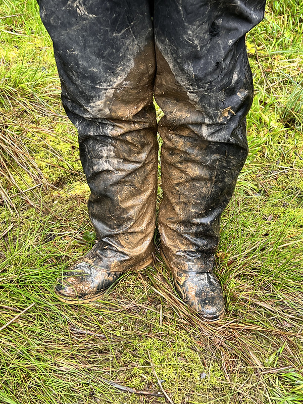
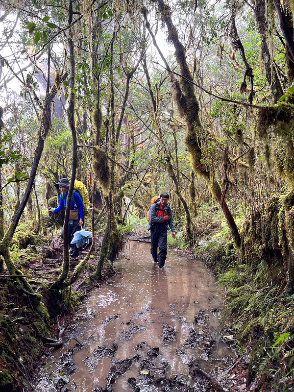
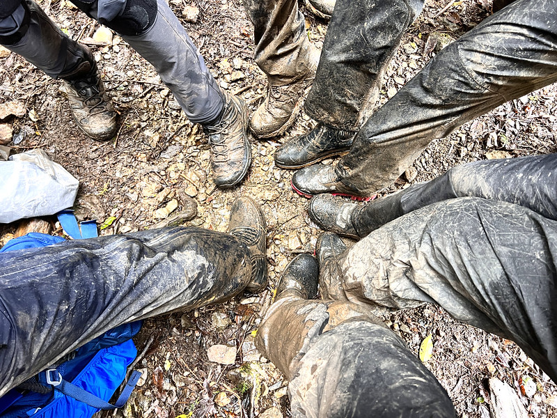
On the Jialuo Lake Trail, most of us opted for rain boots, but two of our hiking mates chose hiking boots. We
snapped a photo comparing the boots before and after the hike to capture the difference. Remember to read till
the end to see the result.
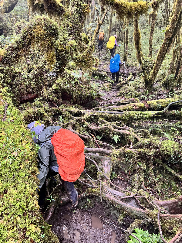
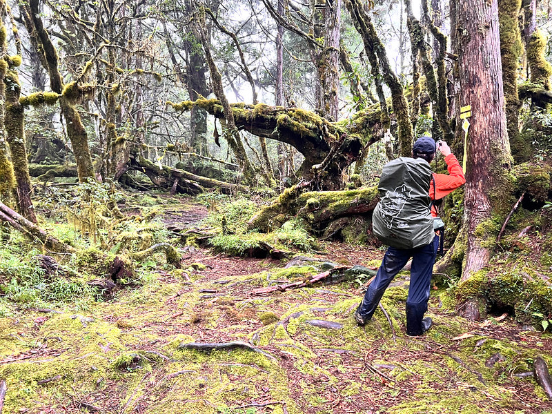
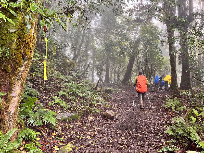
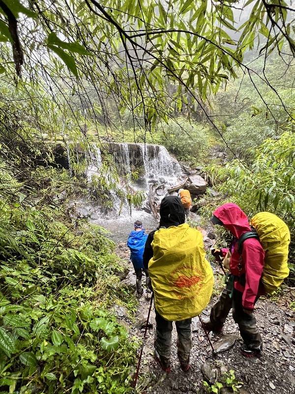
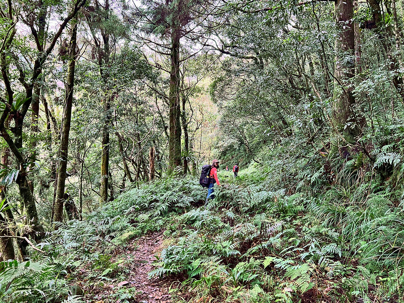
Without a surprise, the trail was muddy, and we had to walk in many water/mud puddles.
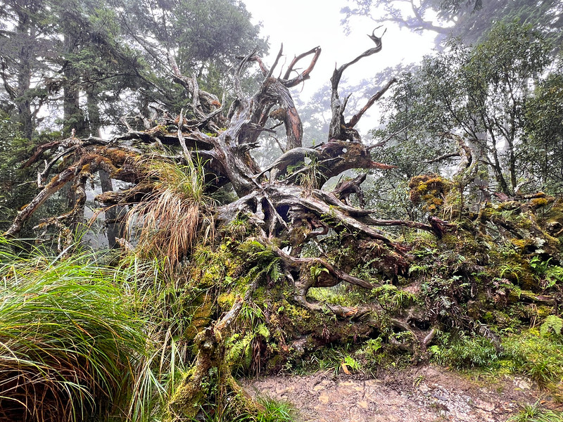
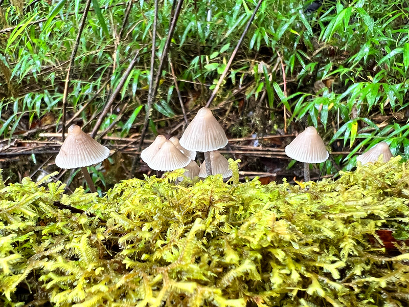
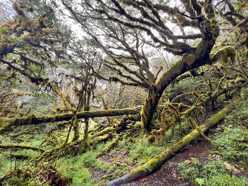
The forests were breathtaking, with a diverse array of trees in various shapes and sizes. Interestingly, this
particular formation is actually made up of tree roots.
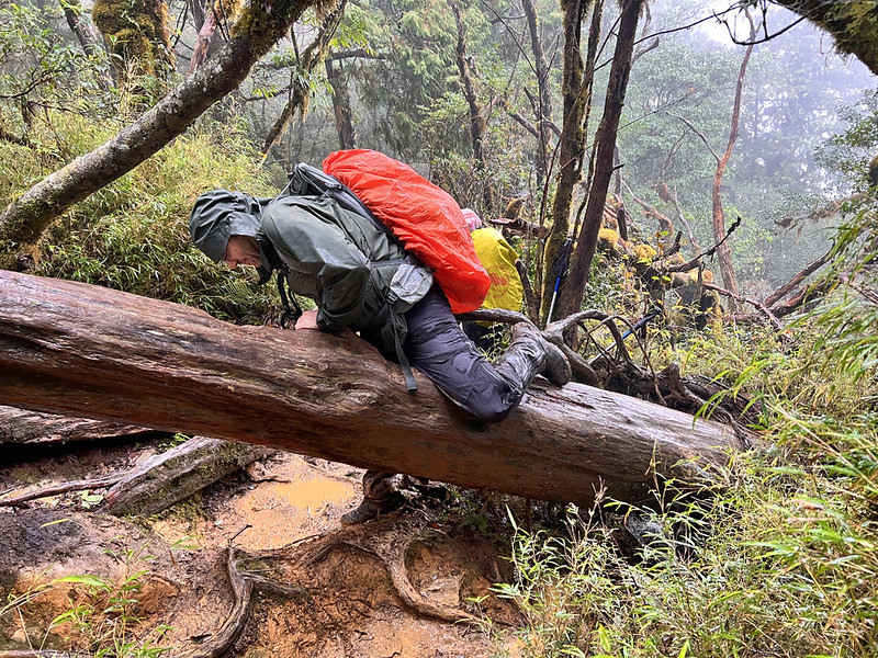
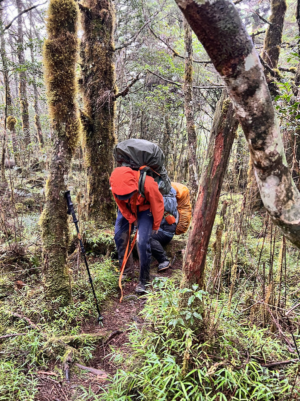
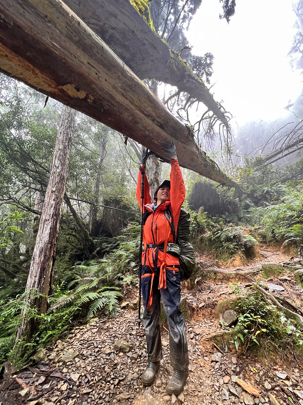
Crawling under or climbing over the fallen trees is a norm for this hike. From time to time, swear words slipped
out of my lips because I accidentally hit my shinbones so many times, which almost made me tear up.
Yet, the forests instantly relieved my pain, almost. They felt like an enchanting world, and time seemed to
stand still—at least for me.
10:54 We reached the Kuimu Campsite at 88/107. This site is big enough for two
or three tents.
11:31 We reached Mt. Duomen, 2,273 meters, at 75/107. I passed here when I did
my Jancing Old Trail hike. There is no view to see here.
13:55 While we continued, our guide, one of Eva's backpack straps, snapped from
the bottom. We had yet to reach halfway. Luckily, she came up with a brilliant idea by using her sling to secure
her backpack and managed to continue.
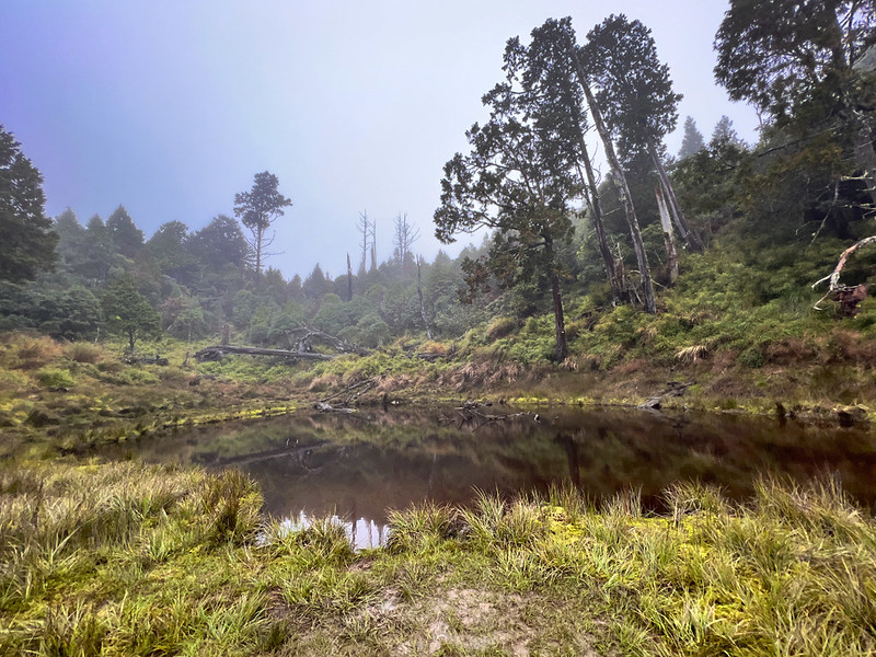
14:20 Arriving at Taiping Pond, our first stop, the overcast sky only enhanced
its charisma, creating a mystical forest ambiance.
The layers of reflections on the water were so clear that I felt as if I were in an upside-down world. This
place was also a perfect spot to stay overnight.
Duowang Pond 多望池 isn't far away, and we made a quick visit.
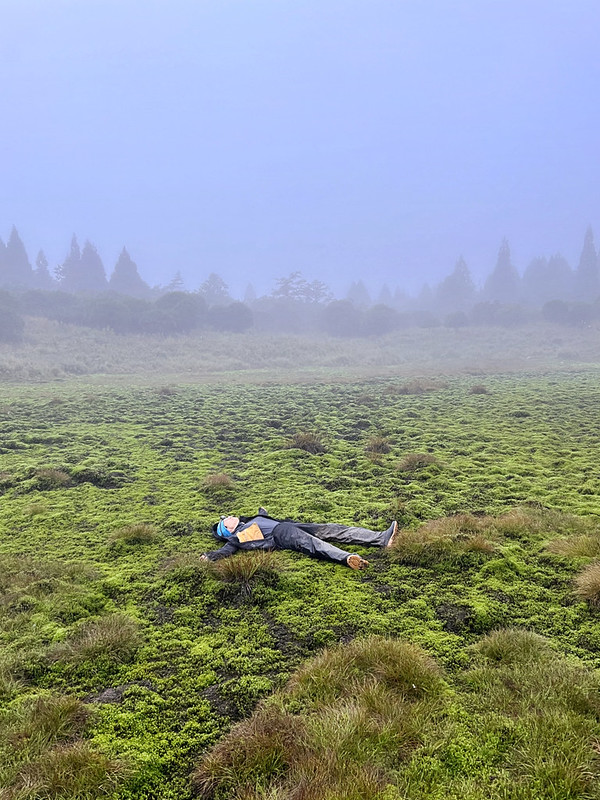
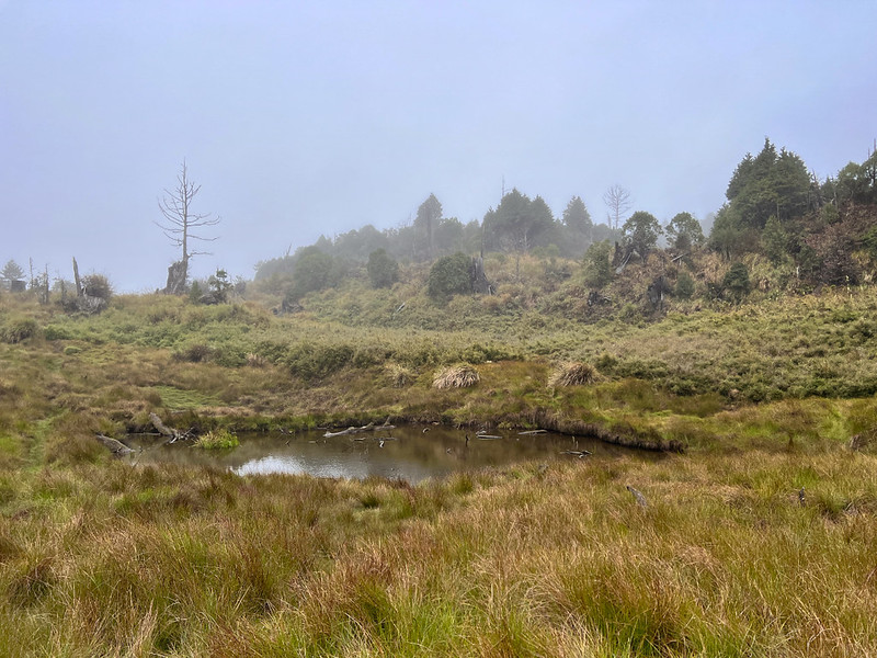
17:11 We reached Taichi Pond 太極池 at marker 39/107. On my first hike here in
2019, it was known as Shandian Pond 閃電池, which translates to Lightning Pond. This spot holds a special place in
my heart.
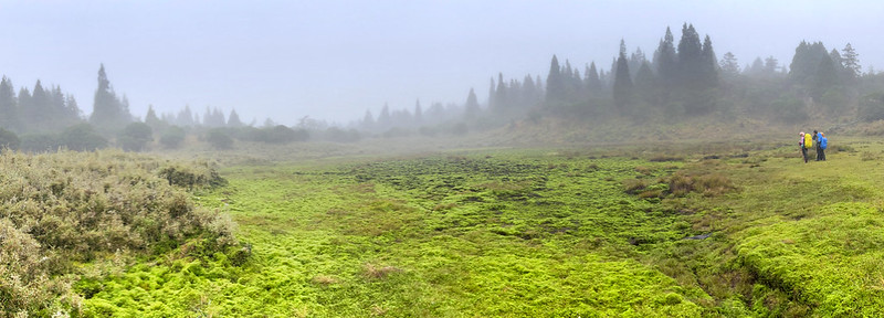
The soft, mossy terrain added a playful touch to the experience. Naturally, I couldn't resist the urge to lie
down and soak in the moment on the cushy moss-covered ground.
It was getting late. The extra muddy terrain made our hike slower than it should have been, so we took out our
headlamps and hiked in the dark.
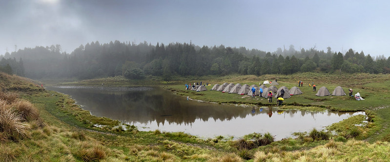
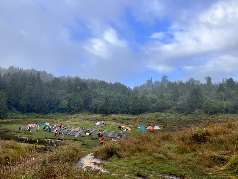
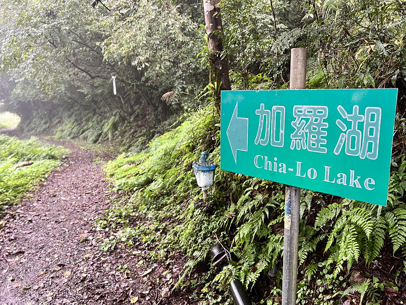
18:10 We finally saw the 29th of signage, Jialuo Lake, and arrived at the
campsite at 28/107.
Our Temporary Home: Jialuo Lake and Other Ponds
When we finished dinner, it was still drizzling. I shared the tarp with our two guides, Eva and Kevin. To my
surprise, the phone signals were exceptionally good.
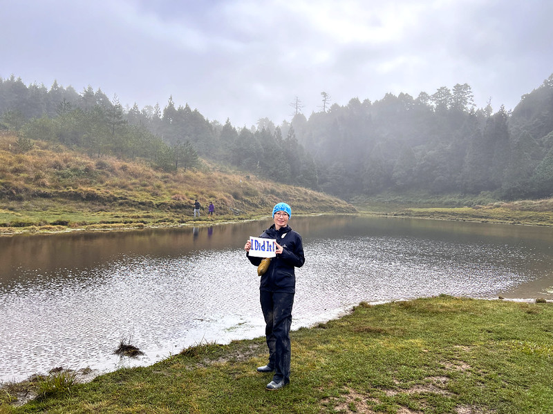
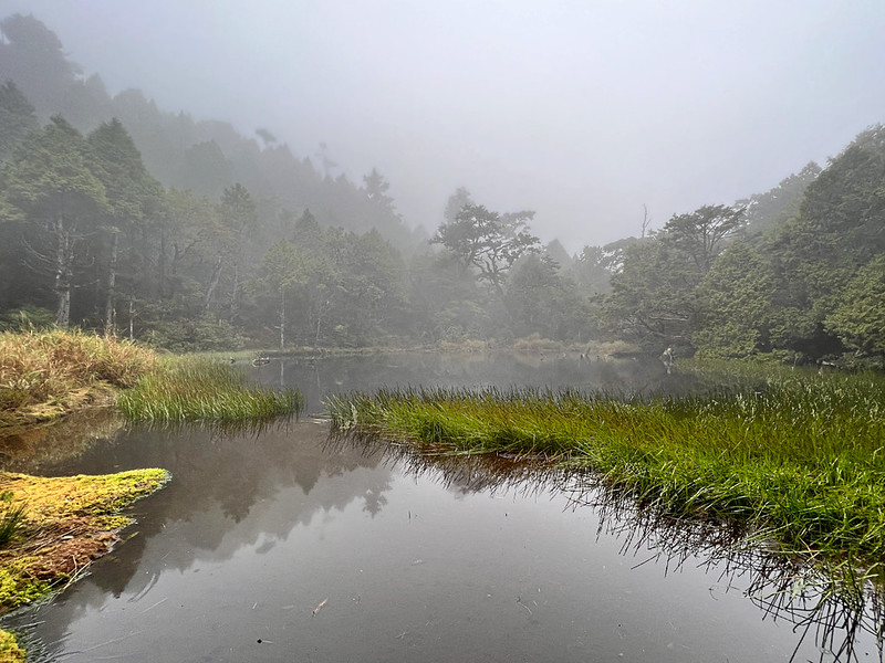
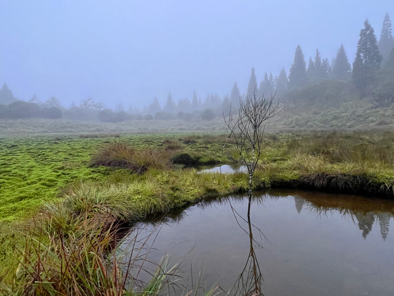
Waking up refreshed, I set out to explore Jialuo Lake. The weather was strikingly similar to my first visit in
2019, except for the mist and reflections performing a delicate dance over the tranquil Jialuo Lake.
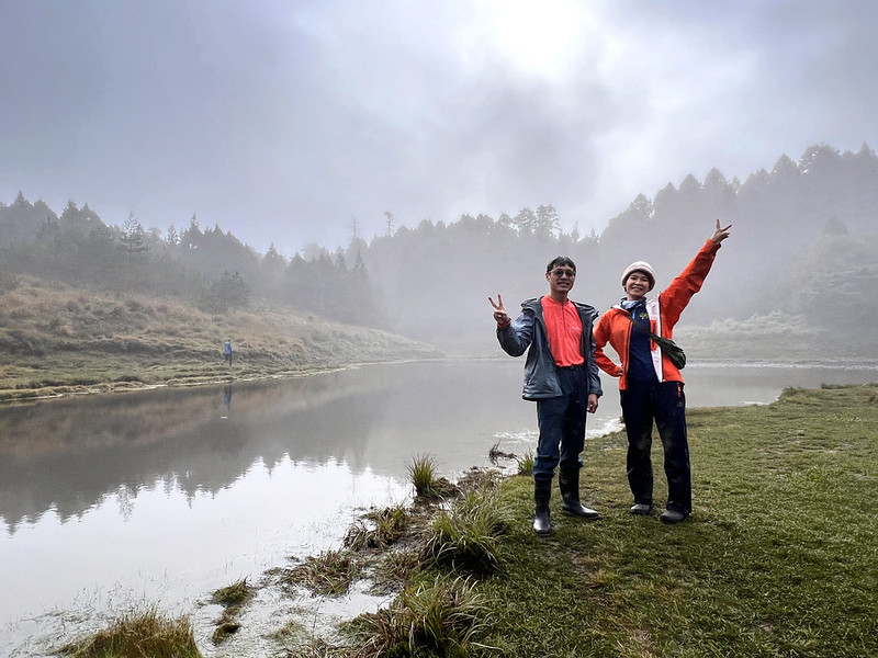
The reflections remained undisturbed, a testament to the lake's stillness.
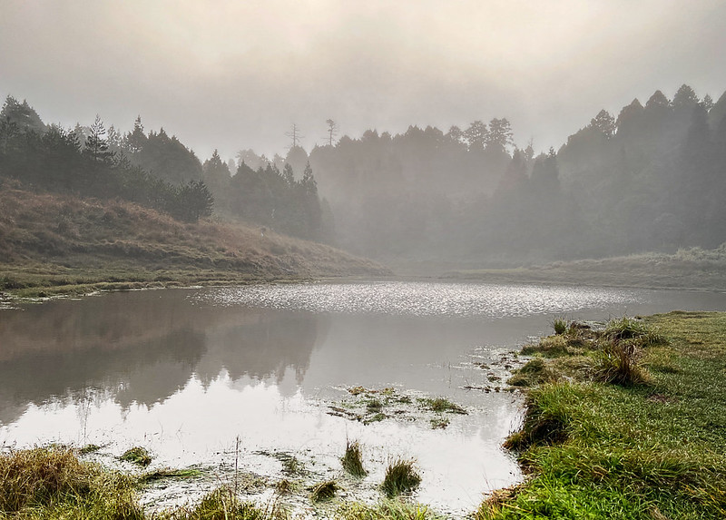
As if by magic, the fog and mist shifted, unveiling patches of blue sky.
This breathtaking location is comparable to the famous Songluo Lake Trail. If time allows, I'd love to linger by
the lake and savor the peacefulness.
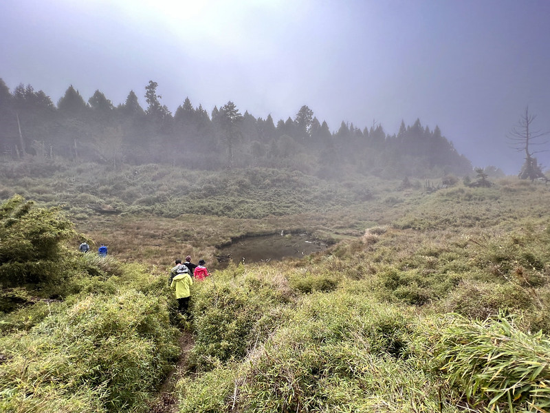
More Ponds to Explore and Mt. Jialuo
08:45 We were ready to explore other ponds. Our guide, Kevin, said he and his
wife planned to bag all the ponds here. This idea was so tempting.
We passed the toilets at the 27/107 signage, and you will find toilets near here.
08:49 We arrived at Weidan Pond 偉蛋池. Though smaller than Jialuo Lake, its beauty
remains captivating.
09:07 We anchored at the junction of Mt. Jialuo and Haomai Pond 豪邁池. Eva decided
to stay and look after our backpacks, which turned out to be a great idea, and I'll explain more later.

Haomai Pond is right next to the junction.
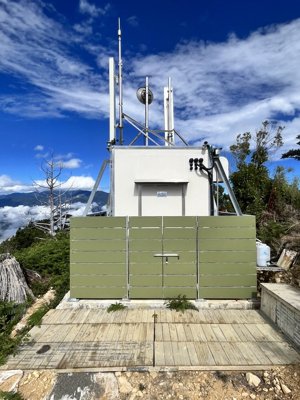
We did a little climbing in the woods before reaching Mt. Jialuo, 2,320 meters. A transmission tower is next to
the summit of Mt. Jialuo, which explains the exceptionally good phone signals.
09:21 When we arrived at Mt. Jialuo, it was still murky. Kevin shared those
photos with me when the weather was good. From here, Mt. Dabajian, Xueshan/Snow Mountain, and the Holy Ridge
could be seen.

When we returned to the junction, Eva told us that a hiker was trying to take away one of the backpacks in our
pile. She stopped him, but the hiker insisted twice. Eventually, he gave up. The backpack he intended to take
belonged to our French hiking mate, and he put his DSLR camera in it.
By the way, please check out Laurent's amazing photo albums on Flicker.
PSA
I am still determining what the hiker wanted, but I have to warn you that thefts are
common on the popular trails in Taiwan. The most notorious one is Paiyun Lodge, the one for the
Yushan/Jade Mountain hike.
We have heard of hikers sharing their items missing at Paiyun Lodge, including
Arc'teryx down jackets, Lekki trekking poles, electronic devices, etc. Those reports are embarrassing and
could put hikers' lives in danger.
Therefore, please always keep the essential and expensive (big brand) items with you.
Continue Our Hike
As we continued our hike, we encountered numerous dead, white, and withered trees along the path. Our curiosity
was soon satisfied when we came across a large sign that provided an explanation.
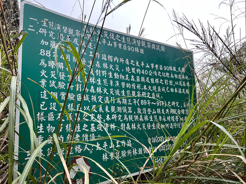
In April 1999, a forest fire ravaged this area, destroying 40 hectares of forest land, equivalent to
approximately 75 American football fields.
Following this disaster, the Taiwan Forestry Research Institute initiated a research project to observe and
track the recovery and progress of the affected region.
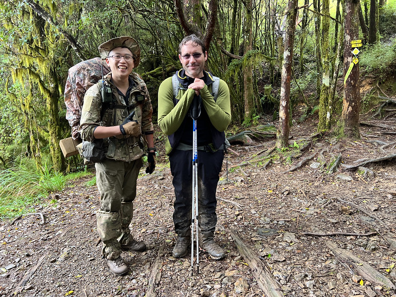
10:10 At the junction leading to Kuaimu Pond 檜木池, we decided not to venture
there. Instead, we took an extended break and enjoyed meeting a multilingual Taiwanese hiker, Fritz, fluent in
English, French, and German. He engaged in a conversation in French with our French hiking mate.
11:00 We encountered a massive fallen tree trunk, a familiar sight from my
previous visit. It was a joy to see it again. Eva took the opportunity to demonstrate how to lift a gigantic
tree.
11:08 We arrived at a spacious, flat area with a sign indicating "8/107,"
designating it as a campsite. If you're prepared to carry water from Jiafuna Creek near the Gigantic Tree
Trailhead, this spot is suitable for camping.
11:58 I saw the signage 1/107.
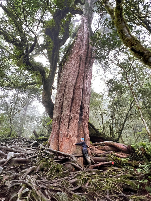
Hike to the Gigantic Tree at the Trailhead, plus 6 km on Siji Forest Road
12:06 I finally reached the renowned Gigantic Tree Trailhead. The beauty of this
tree was so overwhelming that I couldn't resist hugging it.
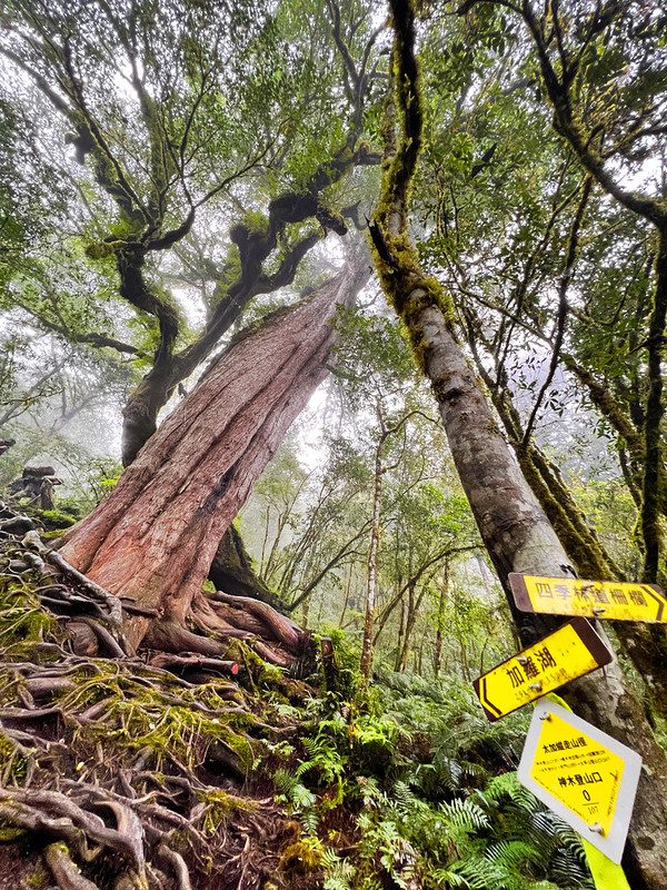
When you approach the Gigantic Tree Trailhead, descending the intertwined tree roots can be dangerous if your
feet get caught up with them. Caution is advised when you hike here.
We took an extended break here, awaiting the arrival of our hiking mates. During our wait, an older female hiker
approached us, seeking advice on capturing a photo that included the entirety of the tree and their faces
visible, a common dilemma for many auntie hikers in Taiwan.
Think our adventure ends here? Not quite! This spot marks the exit (or entrance) to the Taipingshan and Jialuo
Lake Trail. We still had about 6 km or a 2-hour trek ahead to reach the gate (the second one, to be exact) and
reunite with our hired van.
It was then time for the grand reveal: a before-and-after comparison of our hiking boots and rain boots.
Along the way, we passed through Jianafu Creek 加納富溪, an ideal spot for washing our muddy rain boots. For those
starting from the Siji side, this creek is also convenient for refilling water supplies.
14:02 We reached the first gate, but the gate we were supposed to finish at was
still 1.6 km (one mile) away. At least, this was the end of the muddy trail.
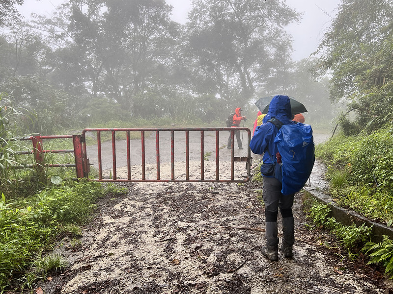
14:24 We arrived at the second gate, marking the official end of our remarkable
hike!

About Jialuo Lake and Police Permit
The Jialuo Lake group, nestled between Geli Lolo Mountain 給里洛山 (2,792m) and Taipingshan, is a collection of over
ten picturesque ponds, including Jialuo Lake 加羅湖, Weidan Pond 偉蛋池, Haomai Pond 豪邁池, and Chetui Pond 撤退池,
scattered around Mt. Jialuo (2,320m).
Discovered potentially during Taipingshan's logging or security road construction, the area was known by 1932,
with botanist Sigeyosi Suzuki 鈴木重良 documenting it between 1925 and 1931. Teiso Esaki 江崎悌三 also noted three
lakes, including Jialuo Lake and Ya Pond (Duck Pond).
After the Old Taipingshan Logging Station closed, Jialuo Lake was forgotten until the National Taiwan University
(NTU) Mountaineering Club's 1987 rediscovery. Some lake names, like Haomai Pond and Weidan Pond, are linked to
this exploration, named for the challenges faced and the explorers' names, respectively.
Traveling from the Taipingshan Forest Recreation Area to the Siji Forest Road, visitors encounter unique ponds
and an adventurous landscape of robust whitewood forests, dense dwarf bamboo, and moss-covered primitive
forests.
As to the logging history in Taipingshan and Mt. Dayuan, please see my post: Kulu Forest Road, Mt. Dayuan and Dayuan Elementary School: The Less Known Logging
History near Taipingshan.
Apply for Police Permit
You can apply for the permit in person before your hike by going to Taipingshan Police Station 太平山派出所 (map). This police station is very close to
Taipingshan Villa. It's open 24/7.
Or apply online by going to Mountain Entry Application System.
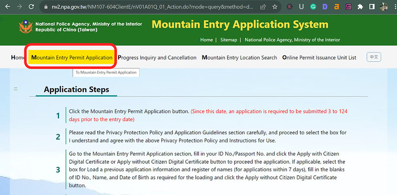


The most important part is to put this spelling "Chialo" in the destination database and select this one. It's
also case sensitive.

Here's a reference for you to put in the hiking plan. You can copy and paste in the form.
Day 1: Taipingshan Villa Information Center ➔ Scenery Platform Entrance ➔ Mt. Duomen ➔ Jialuo Lake and camping
Day 2: Jialuo Lake ➔ Junction to Haomai Pond and Mt. Jialuo ➔ Mt. Jialuo ➔ Back to junction ➔ Junction to Kuimu Pond ➔ Gigantic Tree Trailhead ➔ The first gate ➔ The second gate ➔ Exit the trail